


Search for another town





Free U.S. delivery 7 to 10 days after you order
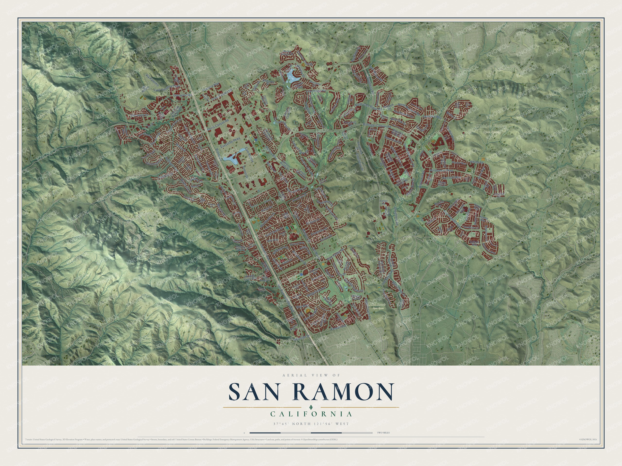
San Ramon, California Map Art
Building by building, with labeled streets and shaded relief.
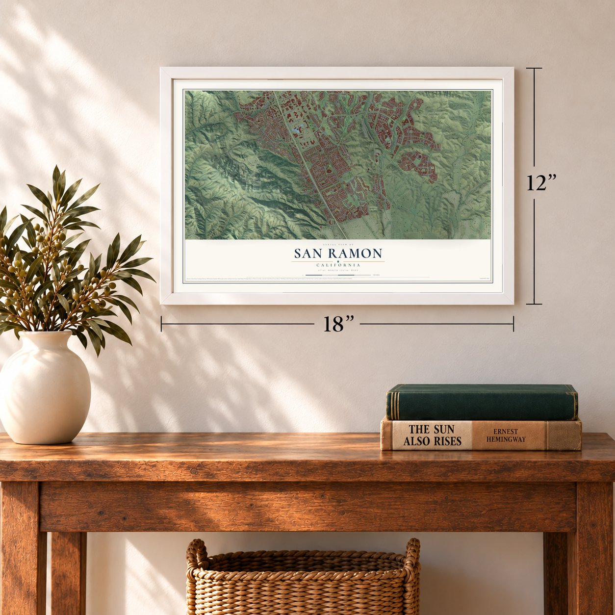
12" x 18" Archival Matte Print
A Map of Home. A Work of Art.
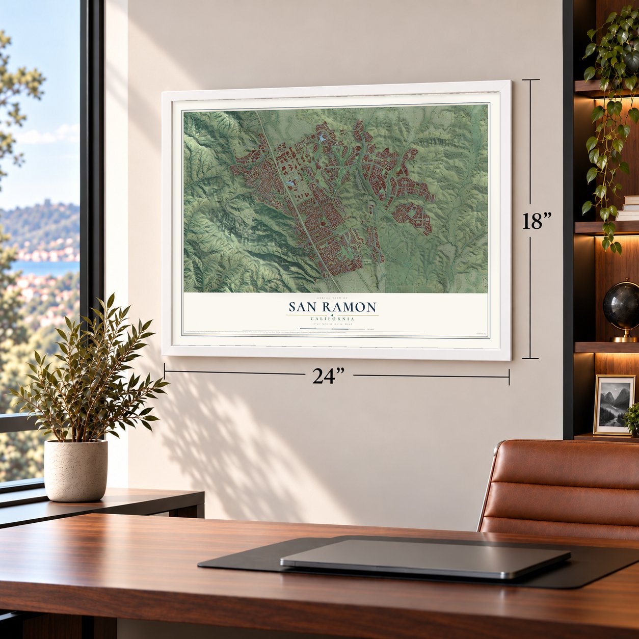
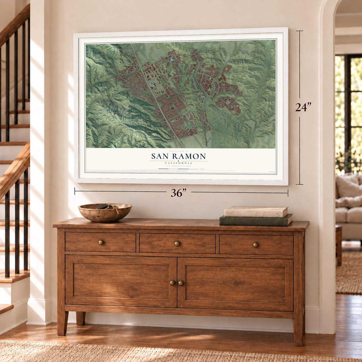
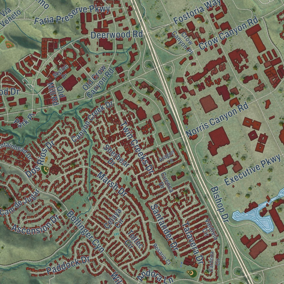
Explore San Ramon, California from a whole new perspective. Created using aerial imagery and detailed geographic data, this map captures San Ramon building by building, with labeled streets, familiar landmarks, and shaded topographical relief that highlights the natural contours of the landscape.
Combining modern data with the timeless character of a vintage atlas, this map is just as interesting up close as it is beautiful on the wall. Whether you grew up in San Ramon, spent memorable years there, or call it home today, this unique map is a great way to celebrate a place that means something to you. Zoom in on the preview to look for your street, and then order a print to put your memories on the wall.
Three ways to hang it
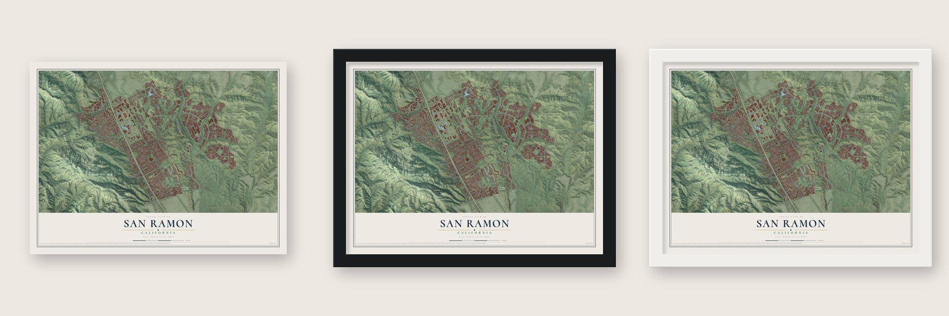
Unframed archival matte, a black wood frame or a white wood frame.
Up close
Geography Worth Displaying
This map was created using accurate cartographic data and authoritative geographic sources, including the U.S. Geological Survey and the Census Bureau. The map brings together terrain, waterways, roads, and building detail. The majority of the streets are labeled, houses are accurately depicted, and the topography is derived from government sources. Combining local data with carefully composed color and shading leads to this beautifully detailed San Ramon artwork for your wall.
Rather than simply showing street outlines, we’ve included as many of the street names as we could reasonably fit on the map while keeping their names legible. Zoom in on the high resolution preview to see exactly what’s on the map. We truly set out to create a statement piece for anyone who loves San Ramon. So whether it’s for you, or a gift for someone you love, we hope this map of San Ramon brings back fond memories.
Read the story behind this map of San Ramon, California from 2026.

Find your street
Names on the San Ramon map
Every name below is printed on this map. Look for your street, your school, the park where you played, or the pond down the road.
Places and landmarks2
- Hidden Valley Open Space
- Old Ranch Open Space
Streets and roads242
- Corey Place
- Lakeview Drive
- Bollinger Canyon Road
- Dougherty Road
- Crow Canyon Road
- Alcosta Boulevard
- San Ramon Valley Boulevard
- Broadmoor Drive
- Bollinger Cyn
- Windemere Parkway
- Davona Drive
- Norris Canyon Road
- Westside Drive
- Cam Ramon
- Albion Road
- Lilac Ridge Road
- Pine Valley Road
- Montevideo Drive
- Tareyton Avenue
- Morgan Drive
- East Branch Parkway
- Faria Preserve Parkway
- Bishop Drive
- Marsh Drive
- Ascot Drive
- North Monarch Road
- Harcourt Way
- North Gale Ridge Road
- Derby Drive
- Santander Drive
Show all 242 streets
- Canyon Crest Drive
- Old Ranch Road
- Canyon Lakes Drive
- Dos Rios Drive
- Deerwood Road
- Canyon View Circle
- Watermill Road
- South Monarch Road
- Red Willow Road
- Bent Creek Drive
- Sedgefield Avenue
- Canyon Hills Road
- Bridle Court
- Ivy Hill Way
- Mangos Drive
- Enfield Street
- Deerwood Drive
- Thunderbird Drive
- Velvetleaf Circle
- Emerson Lane
- Twin Creeks Drive
- Feathermint Drive
- Talavera Drive
- Kittery Avenue
- Reedland Circle
- Greenwich Drive
- Bayberry View Lane
- Fostoria Way
- Wells Lane
- Wildhorse Drive
- Japonica Way
- Rosincress Drive
- Elderberry Drive
- Briar Oak Drive
- Tahiti Drive
- Olympia Fields Drive
- Ascension Drive
- Veracruz Drive
- Paddock Drive
- Fircrest Lane
- Executive Parkway
- Ensenada Drive
- Doughtery Road
- Terra Alta Drive
- Nantucket Drive
- El Suyo Drive
- Stage Coach Road
- Biddleford Drive
- Market Place
- Estero Drive
- Alpine Blue Drive
- Keats Lane
- Saint Denis Drive
- Campion Drive
- Lucy Lane
- Basswood Drive
- Hoskins Lane
- Silva Way
- Fuchsia Lane
- Blue Fox Way
- Del Mar Drive
- Kimball Avenue
- York Lane
- Via Palermo
- Sunset Drive
- May Way
- Andora Lane
- Lakemont Drive
- Century Oaks Court
- Sherwood Way
- Rosamund Drive
- Balmoral Way
- Sombrero Circle
- Longleaf Circle
- Summerwood Loop
- Stoneleaf Road
- Elmwood Drive
- Trumpet Vine Lane
- Asterbell Drive
- Fallen Leaf Circle
- Old Ranch Estates Drive
- Shoreline Circle
- Pradera Way
- Pebble Place
- Briza Loop
- Belle Meade Drive
- Holborn Way
- Old Crow Canyon Road
- Celaya Circle
- Calais Drive
- Summit View Drive
- Canyon Woods Place
- Sweetgate Drive
- Magnolia Bridge Drive
- Woodview Terrace Drive
- Victory Circle
- Satinleaf Way
- Monarch Road
- Omega Road
- Mornington Lane
- Sorrelwood Drive
- Vista Monte Drive
- Via Veneto
- Interlachen Avenue
- Kearny Way
- Winding Creek Way
- Toluca Drive
- Canyon Creek Drive
- Barbados Drive
- Toltec Circle
- Canyon Side Avenue
- Paige Way
- Riviera Way
- Chanterella Drive
- Copperset Road
- Donner Way
- Bethany Road
- Watson Canyon Court
- Ivy Leaf Springs Road
- Hawkins Drive
- Canyon Woods Drive
- Cam de Jugar
- Arrowfield Way
- Springfield Drive
- Torreon Avenue
- Crestfield Drive
- Bandol Way
- Terraced Hills Way
- Marble Canyon Place
- Burning Tree Drive
- Park Place
- Pine Valley Place
- Ashby Way
- Harness Drive
- Foster Drive
- Canyon Lakes Place
- Sage Circle
- Cattleya Drive
- Byron Lane
- Malayan Street
- Sherbear Drive
- Kent Place
- Milo Way
- Butte Avenue
- Nutmeg Park Street
- Trefoil Road
- Wycliffe Lane
- Joree Lane
- Mare Lane
- Cabrillo Avenue
- Echo Place
- Winged Foot Place
- Jasper Hill Drive
- Todd Way
- Lanai Drive
- Brewin Lane
- Old Mill Road
- Jamie Place
- Brookcliff Circle
- Stoney Creek Drive
- Fountainhead Drive
- Valdivia Circle
- Hollyview Drive
- Mohawk Circle
- Fioli Loop
- Thunderbird Place
- Goldenrod Lane
- Ironwood Drive
- Crow Canyon Place
- Lomond Circle
- Cameron Circle
- Corrinne Street
- Camassia Way
- Laramie Avenue
- Avalon Way
- Winthrop Avenue
- Java Drive
- Lawton Way
- Karina Court
- Cuenca Drive
- Bailey Way
- Kyler Lane
- Lakemont Place
- Goldenbay Avenue
- North Westside Drive
- South Gale Ridge Road
- Cardona Circle
- Arapaho Circle
- Aragon Lane
- Blue Mound Drive
- Cobblestone Lane
- Saturn Park Drive
- Paddington Way
- Mediar Drive
- Kennard Lane
- Sand Point Drive
- Allanmere Drive
- Cypress Hawk Court
- Barons Lane
- Aptos Drive
- Rosario Court
- Sonsilla Lane
- Majestic Oak Court
- Newport Avenue
- Canyon Green Place
- Dewberry Drive
- Teracina Drive
- Skyline Drive
- Dolores Drive
- Casella Court
- Silk Hill Court
- Acorn Court
Names are listed as they appear on the printed map. Zoom into the product photos to find them.
About San Ramon, California
San Ramon is a city of 84,605 people in Contra Costa County, set in the San Ramon Valley with Mount Diablo rising to the northeast. The Seunen people, an Ohlone group, made their homes beside the creeks here until Mission San José took the land for grazing around 1797. In 1834 it became part of Rancho San Ramon, a land grant to José María Amador. He named it for a Native American vaquero who herded the mission's sheep.
Leo and Mary Jane Norris, the first American settlers to stay for good, bought the rancho's northwest corner in 1850. Their land lay near where Bollinger Canyon Road and Crow Canyon Road now meet. The settlement went by Brevensville, Lynchville and Limerick for a time. A permanent post office made San Ramon its official name in 1873.
- The first school in 1854The valley's first school opened in 1854 in a small house close to the cemetery, on ground that later belonged to the Kendall family.
- From rail line to trailThe Southern Pacific finished its San Ramon Branch Line in 1891. The line ran north to Avon, east of Martinez, where it joined the Oakland and Stockton line. On February 7, 1909, it was extended south to Radum, near Pleasanton. Passenger trains stopped in 1934. By 1986 the county owned the old route, and it became the Iron Horse Regional Trail.
- Bishop RanchThese 585 acres were farmland before Western Electric owned them. Major building on the Bishop Ranch office park began in the early 1980s. Pacific Bell moved its headquarters here from downtown San Francisco around 1983, and Chevron came in 2001. In December 2016 the park became home to North America's first self-driving passenger shuttle route.
- Memorial ParkThe park was to be called Alta Mesa Park. While it was being built, the City Council gave it a new name in memory of Tom Burnett, who lived in San Ramon, and of everyone else killed on Flight 93 on September 11, 2001. The 16-acre park was dedicated on September 11, 2002.
Keep exploring California
San Ramon is one of 1,990 California towns we've mapped. Every dot on the map is a print of its own.
The search covers every state, California first.
Near San Ramon
Order 2 or more town maps and save 10%. Shown in the size and finish you picked above, so they hang as a set.
- Camino Tassajara 12" x 18" / Archival Matte Print $39.99
- Blackhawk 12" x 18" / Archival Matte Print $39.99
- Norris Canyon 12" x 18" / Archival Matte Print $39.99


More maps nearby: Danville, Dublin, Tassajara, Diablo and Pleasanton.
The art of mapping a place
How This Map Was Made
Real places. Remarkable detail. Discover the layers that turn geographic data into a map of home.

The view from above
Aerial imagery reveals the character of the land: woodland, open fields, and the patterns of a place.

The shape of the land
Elevation data brings hills, valleys, and subtle changes in the landscape into view.

The details of home
Roads, waterways, and building footprints come together to make the map feel unmistakably local.

Geography becomes art
Considered color, shading, and typography bring the layers together in a map made for your wall.


Process illustrated with Mendon, Massachusetts. Aerial imagery: USDA NAIP. Terrain: USGS 3D Elevation Program. Map details and finished artwork: KNOWOL.
The Details
About This Print
Choose an archival matte print, or a black or white Ayous wood frame. The archival matte print is unframed.
Select your size and finish above to see the matching product image and price.
Materials & Craftsmanship
A contemporary map with the character of a classic atlas, printed on archival matte paper. Optional frames are made from Ayous wood.
Your printed map does not include the watermark shown in the full-map preview.
Shipping & Delivery
Free shipping within the United States. Every print is made to order in the USA.
Buying a gift? Add a note in your cart and we'll include it. We never put prices in the package.
Prints ship within 2 to 3 business days. Allow 7 to 10 days total from ordering for delivery. Timing may vary during holidays or periods of high order volume.
Read our shipping policy.
Returns and damaged prints
Each print is made to order. Change-of-mind refunds are not available after production.
If your print arrives damaged, misprinted or incorrect, contact support@knowol.com within 30 days of receiving it. Include your order number, photos and a description of the issue.
Read our full refund and replacement policy. For questions about your order, email support@knowol.com.