


Search for another town





Free U.S. delivery 7 to 10 days after you order
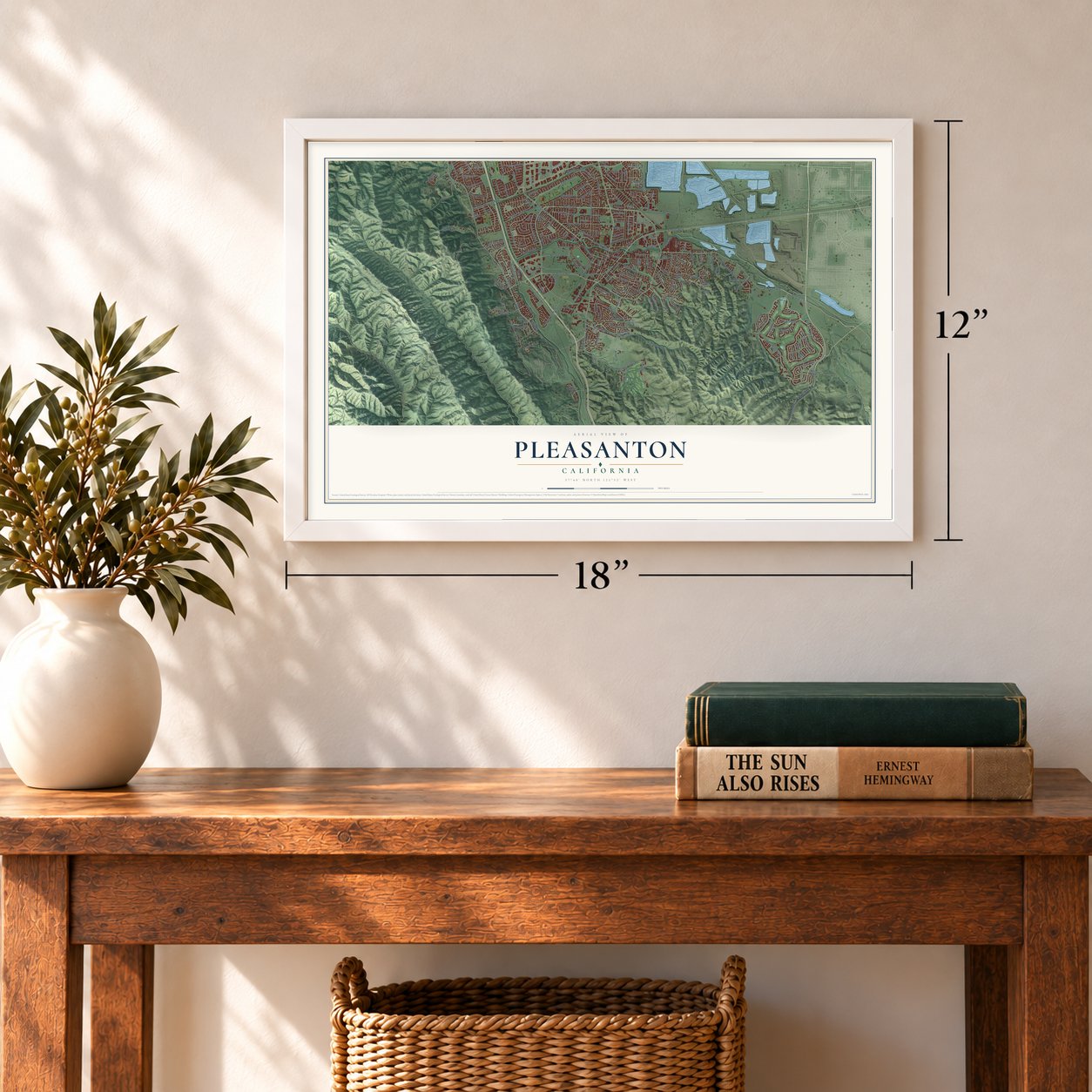
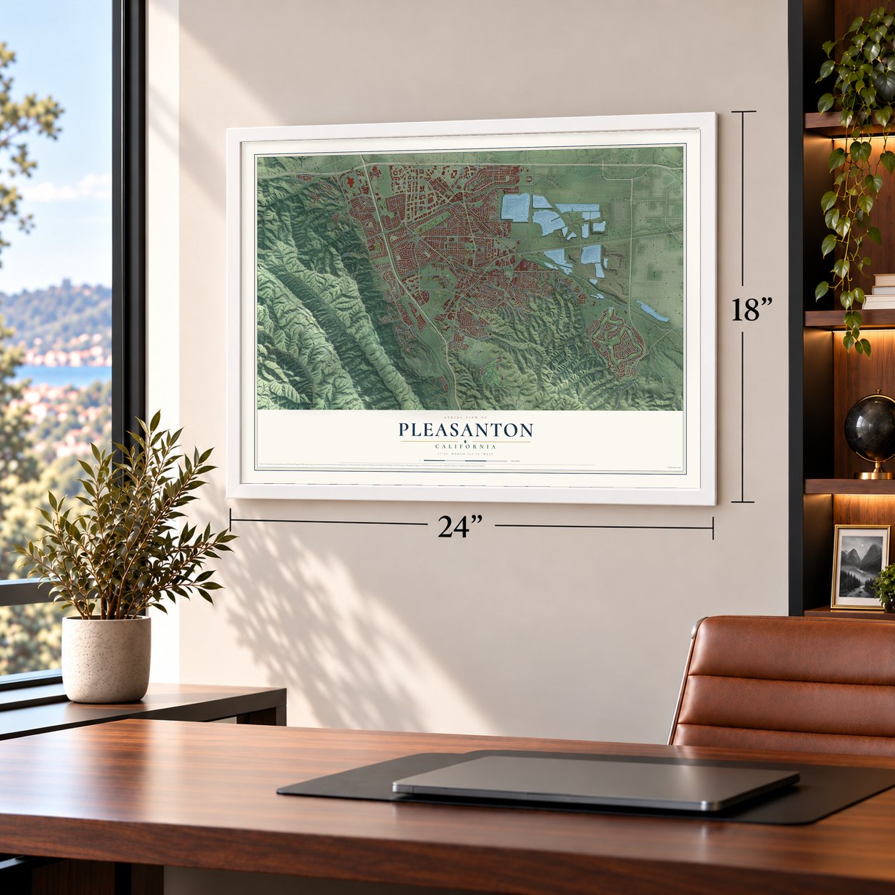
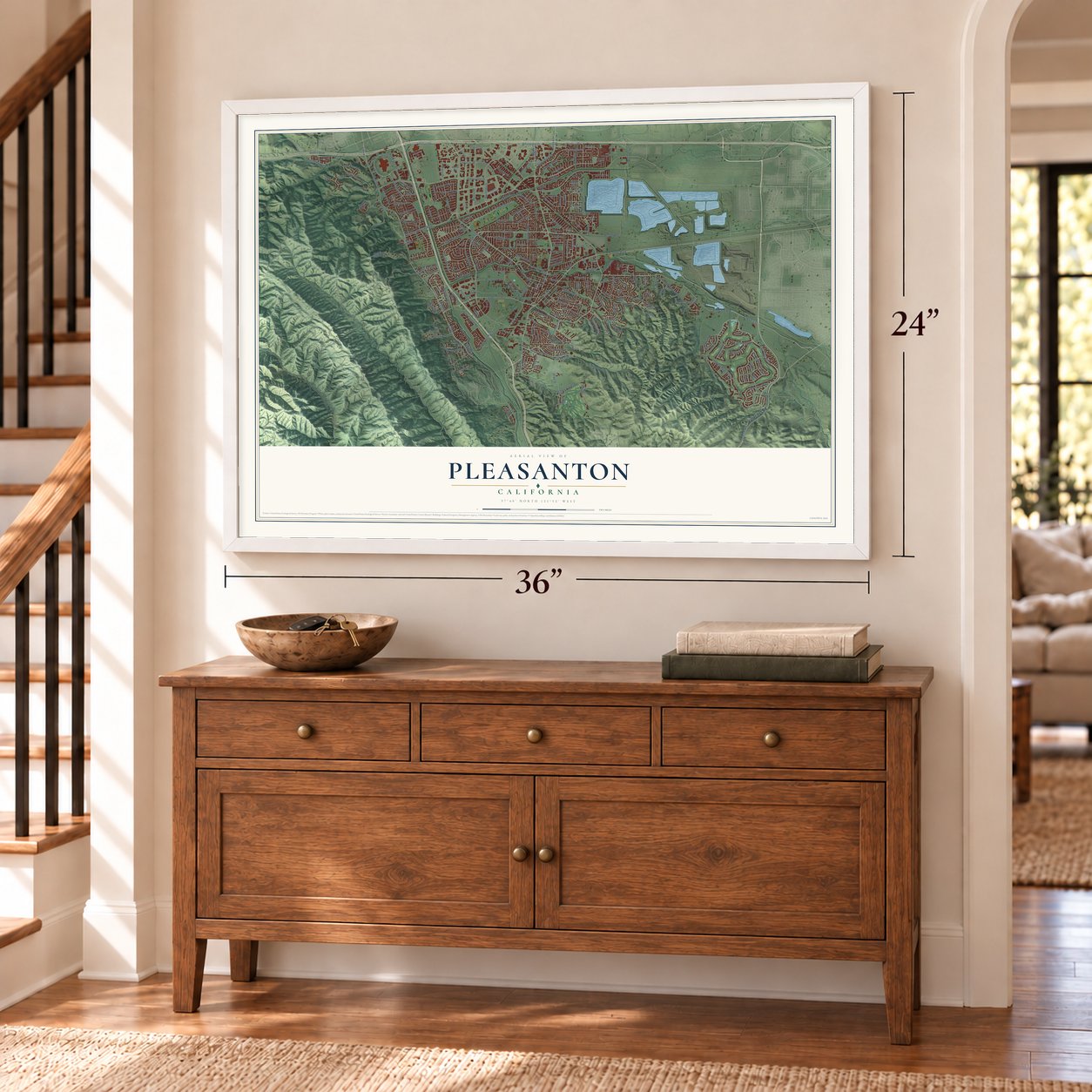
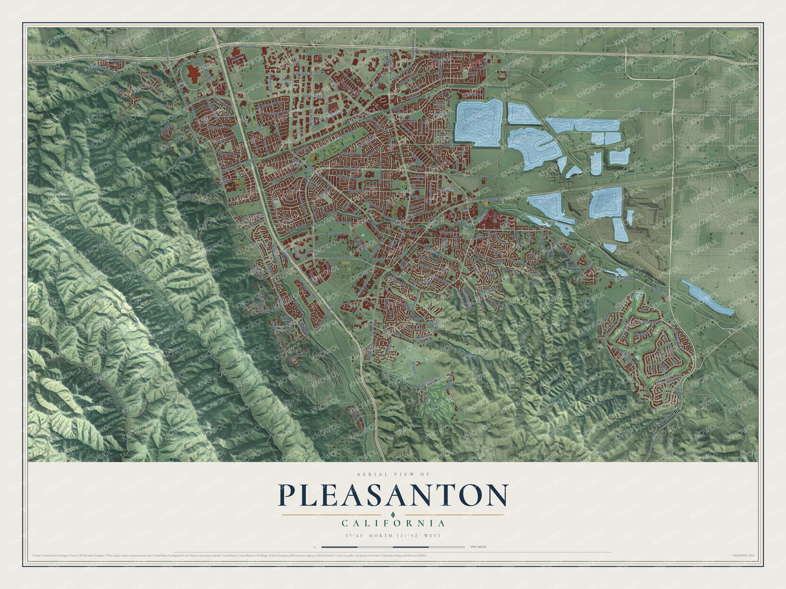
Pleasanton, California Map Art
Building by building, with labeled streets and shaded relief.
12" x 18" Archival Matte Print
A Map of Home. A Work of Art.
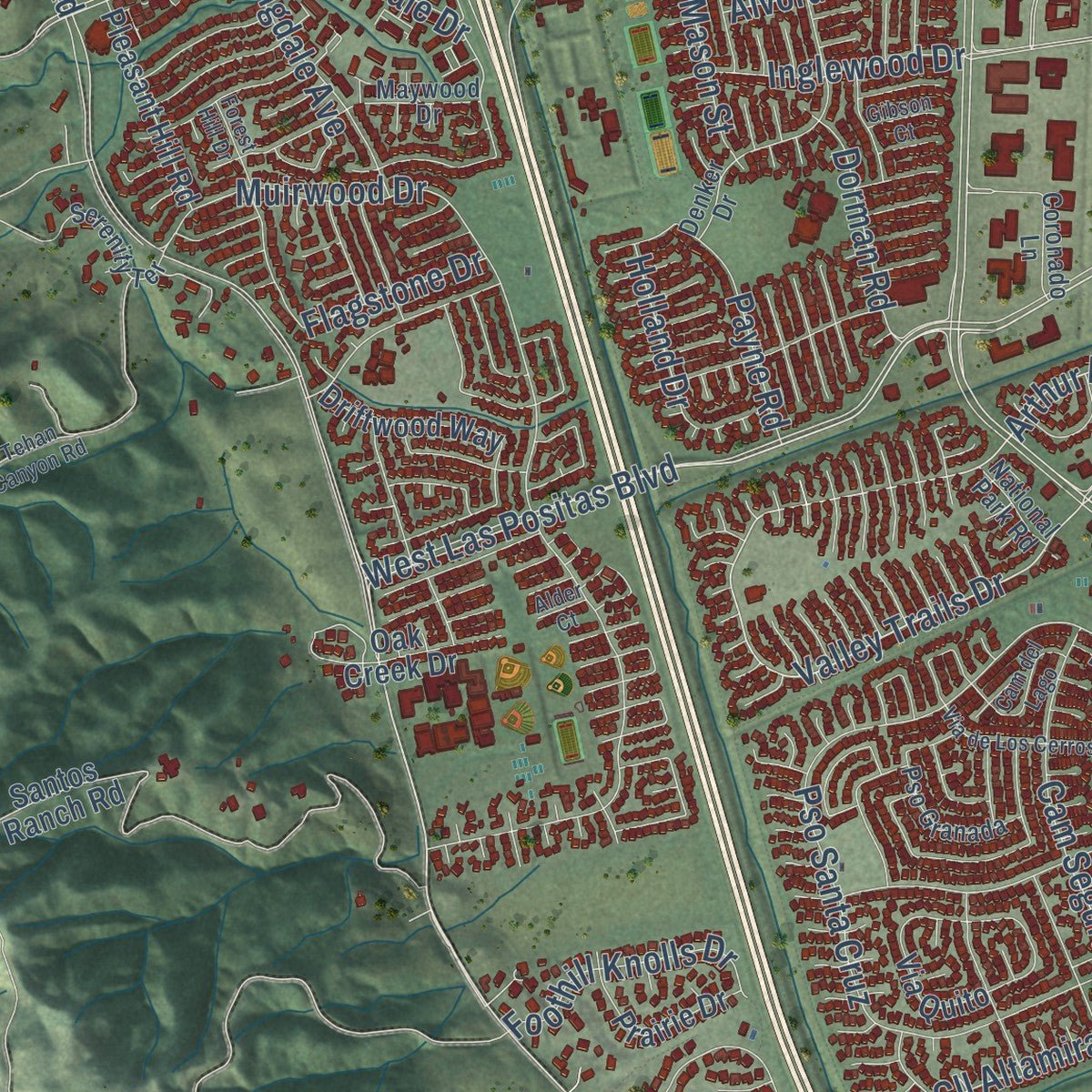
Explore Pleasanton, California from a whole new perspective. Created using aerial imagery and detailed geographic data, this map captures Pleasanton building by building, with labeled streets, familiar landmarks, and shaded topographical relief that highlights the natural contours of the landscape.
Combining modern data with the timeless character of a vintage atlas, this map is just as interesting up close as it is beautiful on the wall. Whether you grew up in Pleasanton, spent memorable years there, or call it home today, this unique map is a great way to celebrate a place that means something to you. Zoom in on the preview to look for your street, and then order a print to put your memories on the wall.
Three ways to hang it
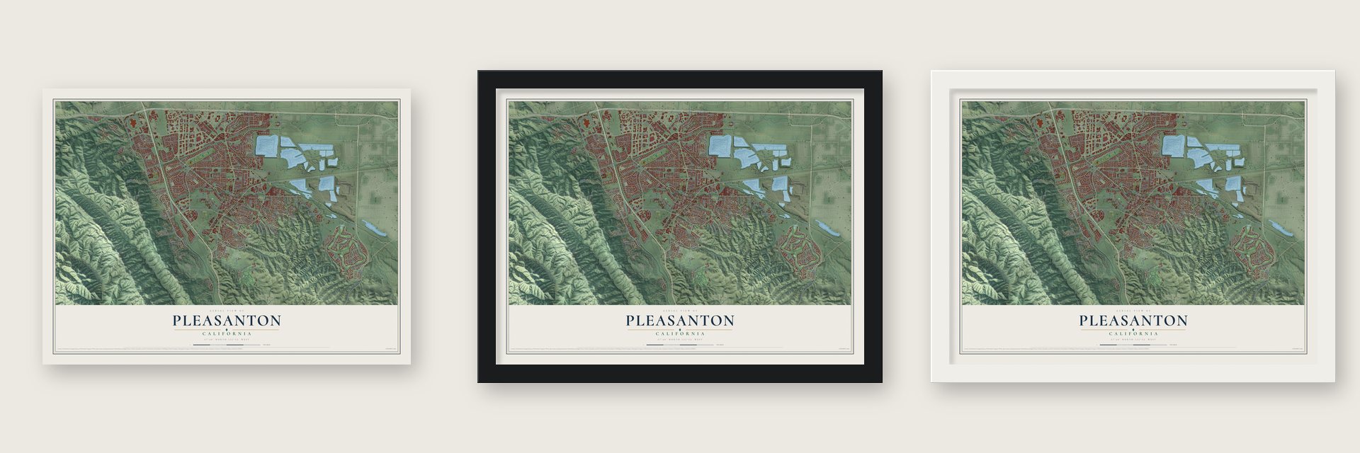
Unframed archival matte, a black wood frame or a white wood frame.
Up close
Geography Worth Displaying
This map was created using accurate cartographic data and authoritative geographic sources, including the U.S. Geological Survey and the Census Bureau. The map brings together terrain, waterways, roads, and building detail. The majority of the streets are labeled, houses are accurately depicted, and the topography is derived from government sources. Combining local data with carefully composed color and shading leads to this beautifully detailed Pleasanton artwork for your wall.
Rather than simply showing street outlines, we’ve included as many of the street names as we could reasonably fit on the map while keeping their names legible. Zoom in on the high resolution preview to see exactly what’s on the map. We truly set out to create a statement piece for anyone who loves Pleasanton. So whether it’s for you, or a gift for someone you love, we hope this map of Pleasanton brings back fond memories.
Read the story behind this map of Pleasanton, California from 2026.

Find your street
Names on the Pleasanton map
Every name below is printed on this map. Look for your street, your school, the park where you played, or the pond down the road.
Streets and roads250
- Vallecitos Road
- Bernal Avenue
- Valley Avenue
- Vineyard Avenue
- Stanley Boulevard
- First Street
- Roadway 13
- Verde Drive
- East Ruby Hill Drive
- Stoneridge Drive
- West Las Positas Boulevard
- West Ruby Hill Drive
- Foothill Road
- Main Street
- Valley Trails Drive
- Arthur Drive
- Hopyard Road
- Vineyard Drive
- Laurel Creek Drive
- Amber Lane
- Parkside Drive
- Zenato Place
- Santa Rita Road
- Sunol Boulevard
- Arbor Drive
- Valley Oak Road
- Division Street
- Cll Altamira
- Appian Street
- Owens Drive
Show all 250 streets
- Stoneridge Mall Road
- Hacienda Drive
- Gibraltar Drive
- Willow Road
- Johnson Drive
- Rosewood Drive
- Fairlands Drive
- Muirwood Drive
- Dublin Canyon Road
- Via Di Salerno
- Mohr Avenue
- Koll Center Parkway
- Black Avenue
- Pso Santa Cruz
- Laguna Creek Lane
- Inglewood Drive
- Rose Avenue
- Regency Drive
- Neal Street
- Del Valle Parkway
- Happy Valley Road
- Kolln Street
- Kottinger Drive
- Minnie Street
- Greenwood Road
- Hansen Drive
- West Lagoon Road
- Springdale Avenue
- Villa Loop
- Pimlico Drive
- Kamp Drive
- Hearst Drive
- Pleasanton Avenue
- Busch Road
- East Angela Street
- Sycamore Road
- Old Vineyard Avenue
- Junipero Street
- Touriga Drive
- Abbie Street
- Crellin Road
- Martin Avenue
- Harvest Road
- Piemonte Drive
- Andrews Drive
- Dennis Drive
- Northway Road
- Germano Way
- Stonedale Drive
- Sutter Gate Avenue
- Franklin Drive
- Churchill Drive
- Longview Drive
- Rheem Drive
- Blackbird Drive
- Cam Segura
- Olson Court
- Serpentine Lane
- El Charro Road
- Case Avenue
- Raven Road
- Payne Road
- Monaco Drive
- Hopkins Way
- Dublin Boulevard
- Remillard Court
- Foothill Knolls Drive
- Holland Drive
- Quarry Lane
- Mavis Drive
- Deer Oaks Drive
- Dorman Road
- Belleza Drive
- Kolb Ranch Drive
- Alvord Way
- Del Sol Avenue
- Pineto Place
- Clover Court
- Flagstone Drive
- Eilene Drive
- Riddell Street
- Grant Court
- Trenery Drive
- Nevada Street
- Mason Street
- Alisal Street
- Vine Street
- Jensen Street
- Lupine Court
- Ray Street
- Silver Street
- Huff Drive
- Nevis Street
- Cid Way
- Newton Way
- Golden Eagle Way
- Redflat Court
- Old Santa Rita Road
- Palomino Drive
- Chabot Drive
- Santos Ranch Road
- Gibraltar Drive North
- Moller Ranch Drive
- Peters Avenue
- Sycamore Creek Way
- Streamside Circle
- Concord Street
- Silver Oaks Court
- Clubhouse Drive
- Brookline Loop
- Mission Drive
- Tassajara Road
- Tawny Drive
- Paragon Circle
- Ruby Hill Drive
- Golden Road
- Via de Los Milagros
- Montevino Drive
- Fairgrounds Road
- Sylvaner Drive
- Sonoma Drive
- Woodthrush Road
- Pleasant Hill Road
- Oak Vista Way
- Spumante Place
- Canyon Way
- Pomino Way
- Sunset Creek Lane
- Bordeaux Street
- Via Quito
- Cam Brazos
- Pietronave Lane
- Prairie Drive
- Boulder Street
- Tapestry Way
- Tanager Drive
- Crosby Drive
- Driftwood Way
- Vintner Way
- Via Espada
- Smallwood Court
- Suffolk Way
- Gulfstream Street
- Clara Lane
- Adams Way
- Oak Creek Drive
- Francisco Street
- Frog Hill Lane
- Grey Eagle Court
- Orloff Drive
- Diavila Avenue
- Dublin Road
- War Glory Place
- Ironwood Drive
- Safreno Way
- Cascara Court
- Nicole Avenue
- Krause Street
- Third Street
- Foot Hill Road
- Villero Court
- Morse Drive
- Vierra Court
- Park Place
- Utah Street
- Old Bernal Avenue
- Denker Drive
- Blessing Drive
- Bonita Avenue
- Independence Drive
- Pso del Cajon
- Maywood Drive
- San Juan Way
- Paladin Way
- Serenity Terrace
- Coronado Lane
- Rockingham Drive
- Bradford Way
- Arlington Drive
- Pso Granada
- Madeira Drive
- Deodar Way
- Windmill Lane
- Kirkcaldy Street
- Wingate Drive
- Varese Court
- National Park Road
- Vis Diablo
- Baker Drive
- Grapevine Drive
- Gibraltar Drive South
- Sterling Greens Circle
- Canyon Meadow Circle
- Commerce Circle
- 12 Oaks Drive
- Gray Fox Circle
- Casterson Court
- Forest Hill Drive
- Second Street
- Gatetree Circle
- San Ramon Road
- Orchard Way
- Lund Ranch Road
- Inspiration Terrace
- Trimingham Drive
- Via de Los Cerros
- Cam del Lago
- Promenade Way
- California Avenue
- Manoir Lane
- Tehan Canyon Road
- Tuscany Place
- Walnut Drive
- Mataro Court
- Maple Leaf Drive
- Raboli Street
- Gibson Court
- Fair Street
- Briggs Court
- Alder Court
Names are listed as they appear on the printed map. Zoom into the product photos to find them.
About Pleasanton, California
Pleasanton is a city of 79,871 people in Alameda County, in the Amador Valley of the East Bay. In the 1770s seven Ohlone tribes lived in this valley, in villages of 60 to 90 people. The first Spanish expedition came in 1772. After Mission San Jose opened in 1797, large groups of valley people joined it.
Mexico won independence from Spain in 1821, and the mission lands were split into ranchos. Pleasanton sits on two of them, the Rancho Santa Rita and the Rancho Valle de San José. During the Gold Rush the Bernal family left San José to guard their ranch from squatters. John Kottinger, an Austrian-born lawyer who had married into the family, came with them. In the 1860s he named the town for his friend, Union Major General Alfred Pleasonton. A clerk's typo in Washington gave it the spelling it still carries.
- The Most Desperate TownBefore Pleasanton there was Alisal. It grew up on Rancho Santa Rita around El Alisal, an adobe Francisco Solano Alviso built in 1844. After the Gold Rush began, outlaws used the trail through town, and Alisal was called "The Most Desperate Town in the West." Claudio Feliz and Joaquin Murrieta robbed miners coming home from the gold fields, then hid there. The adobe still stands in Alviso Adobe Community Park.
- A racetrack since 1858The track at the fairgrounds was built in 1858. It is the oldest one-mile horse racing track in the United States. The Alameda County Fair has been held on the 270-acre grounds since 1912, from late June into early July. A nine-hole golf course fills the infield of the track.
- Hardware on Main StreetThe building at 600 Main Street, with its five-sided corner tower, went up in 1890. It sold hardware for more than 100 years, first under the Lewis Brothers, then Cruikshank and Kolln. It carried the Kolln name from 1933 until the store closed in 2004. Developer Bud Cornett bought the landmark, restored it and braced it against earthquakes, and Comerica Bank moved in.
- Mary Pickford in 1917Pleasanton was the setting for the 1917 film Rebecca of Sunnybrook Farm, starring Mary Pickford. Phoebe Apperson Hearst also lived here. Her mansion had 50 rooms and stood on an estate of 2,000 acres. The land is now Castlewood Country Club.
Keep exploring California
Pleasanton is one of 1,990 California towns we've mapped. Every dot on the map is a print of its own.
The search covers every state, California first.
Near Pleasanton
Order 2 or more town maps and save 10%. Shown in the size and finish you picked above, so they hang as a set.
- Dublin 12" x 18" / Archival Matte Print $39.99
- Sunol 12" x 18" / Archival Matte Print $39.99
- Livermore 12" x 18" / Archival Matte Print $39.99


More maps nearby: San Ramon, Norris Canyon, Camino Tassajara, Union City and Tassajara.
The art of mapping a place
How This Map Was Made
Real places. Remarkable detail. Discover the layers that turn geographic data into a map of home.

The view from above
Aerial imagery reveals the character of the land: woodland, open fields, and the patterns of a place.

The shape of the land
Elevation data brings hills, valleys, and subtle changes in the landscape into view.

The details of home
Roads, waterways, and building footprints come together to make the map feel unmistakably local.

Geography becomes art
Considered color, shading, and typography bring the layers together in a map made for your wall.


Process illustrated with Mendon, Massachusetts. Aerial imagery: USDA NAIP. Terrain: USGS 3D Elevation Program. Map details and finished artwork: KNOWOL.
The Details
About This Print
Choose an archival matte print, or a black or white Ayous wood frame. The archival matte print is unframed.
Select your size and finish above to see the matching product image and price.
Materials & Craftsmanship
A contemporary map with the character of a classic atlas, printed on archival matte paper. Optional frames are made from Ayous wood.
Your printed map does not include the watermark shown in the full-map preview.
Shipping & Delivery
Free shipping within the United States. Every print is made to order in the USA.
Buying a gift? Add a note in your cart and we'll include it. We never put prices in the package.
Prints ship within 2 to 3 business days. Allow 7 to 10 days total from ordering for delivery. Timing may vary during holidays or periods of high order volume.
Read our shipping policy.
Returns and damaged prints
Each print is made to order. Change-of-mind refunds are not available after production.
If your print arrives damaged, misprinted or incorrect, contact support@knowol.com within 30 days of receiving it. Include your order number, photos and a description of the issue.
Read our full refund and replacement policy. For questions about your order, email support@knowol.com.