
Search for another town


Free U.S. delivery 7 to 10 days after you order
Davis, California Map Art
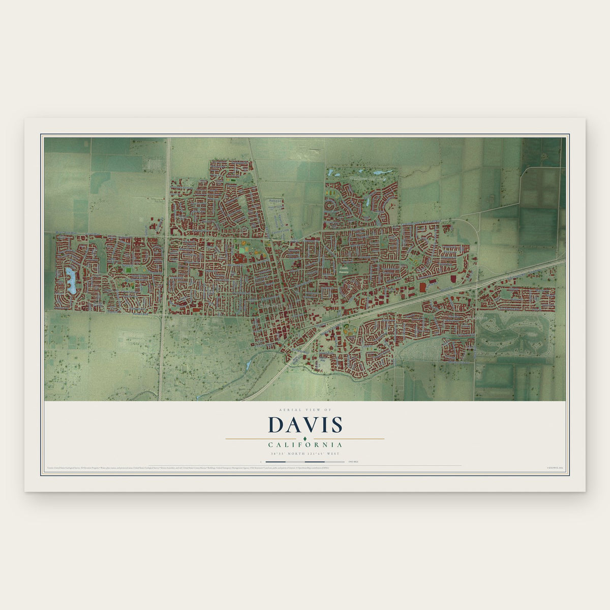
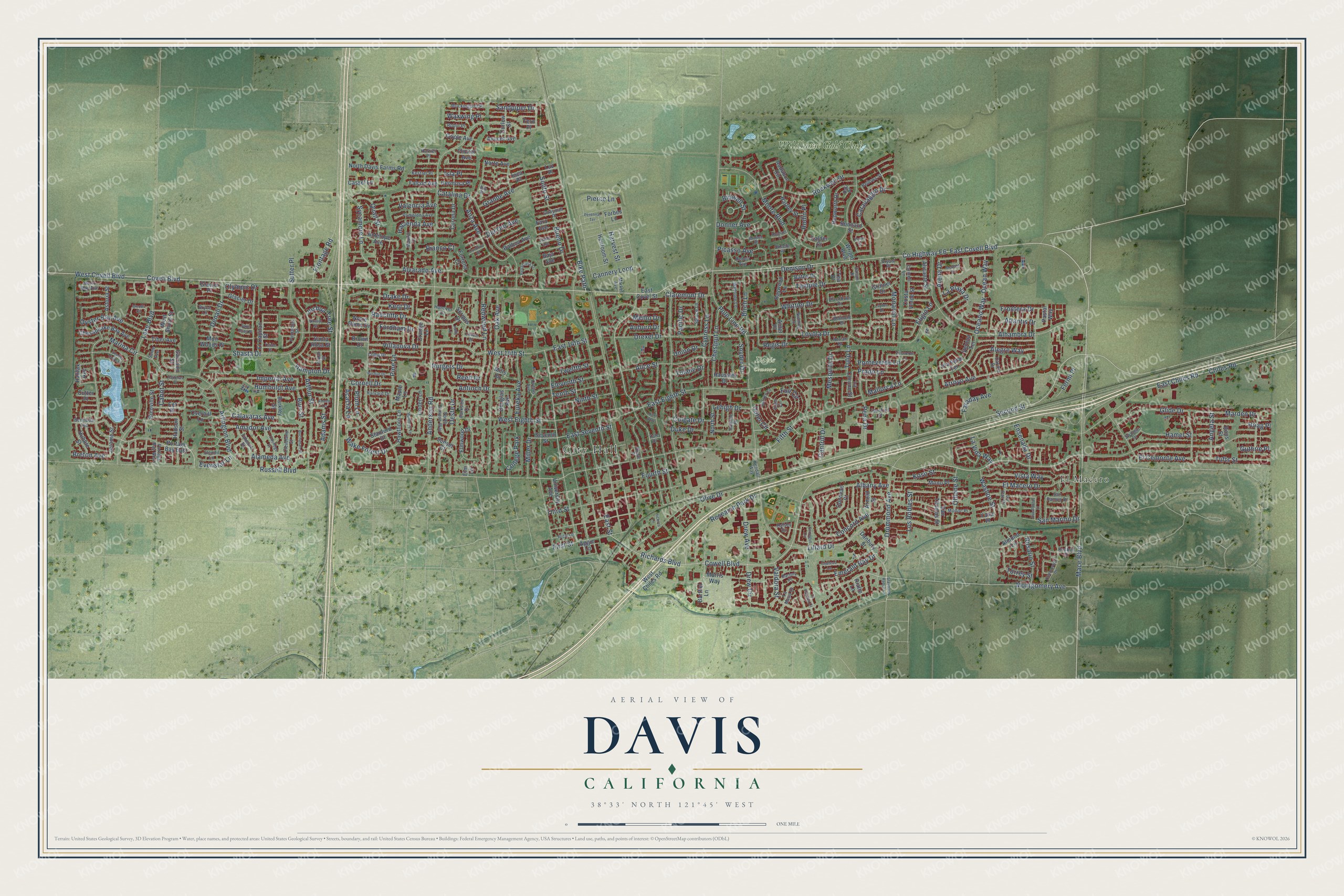
A new map of Davis, California, made in 2026 and printed to order on thick archival matte paper.
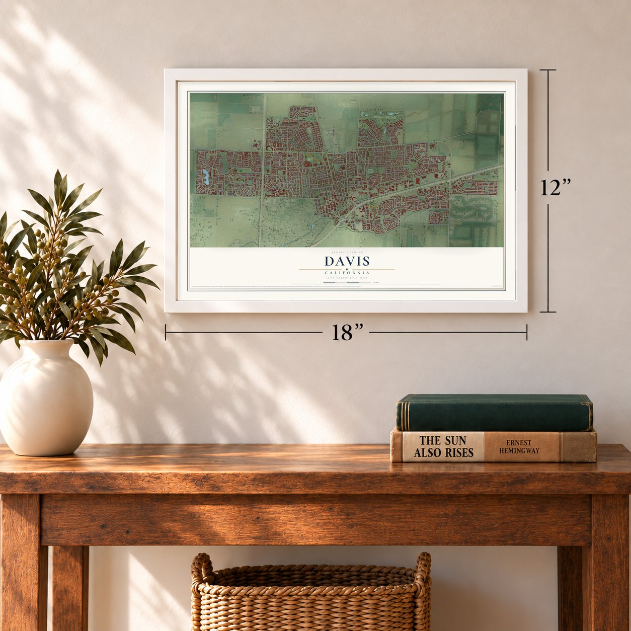
12" x 18" Archival Matte Print
A Map of Home. A Work of Art.
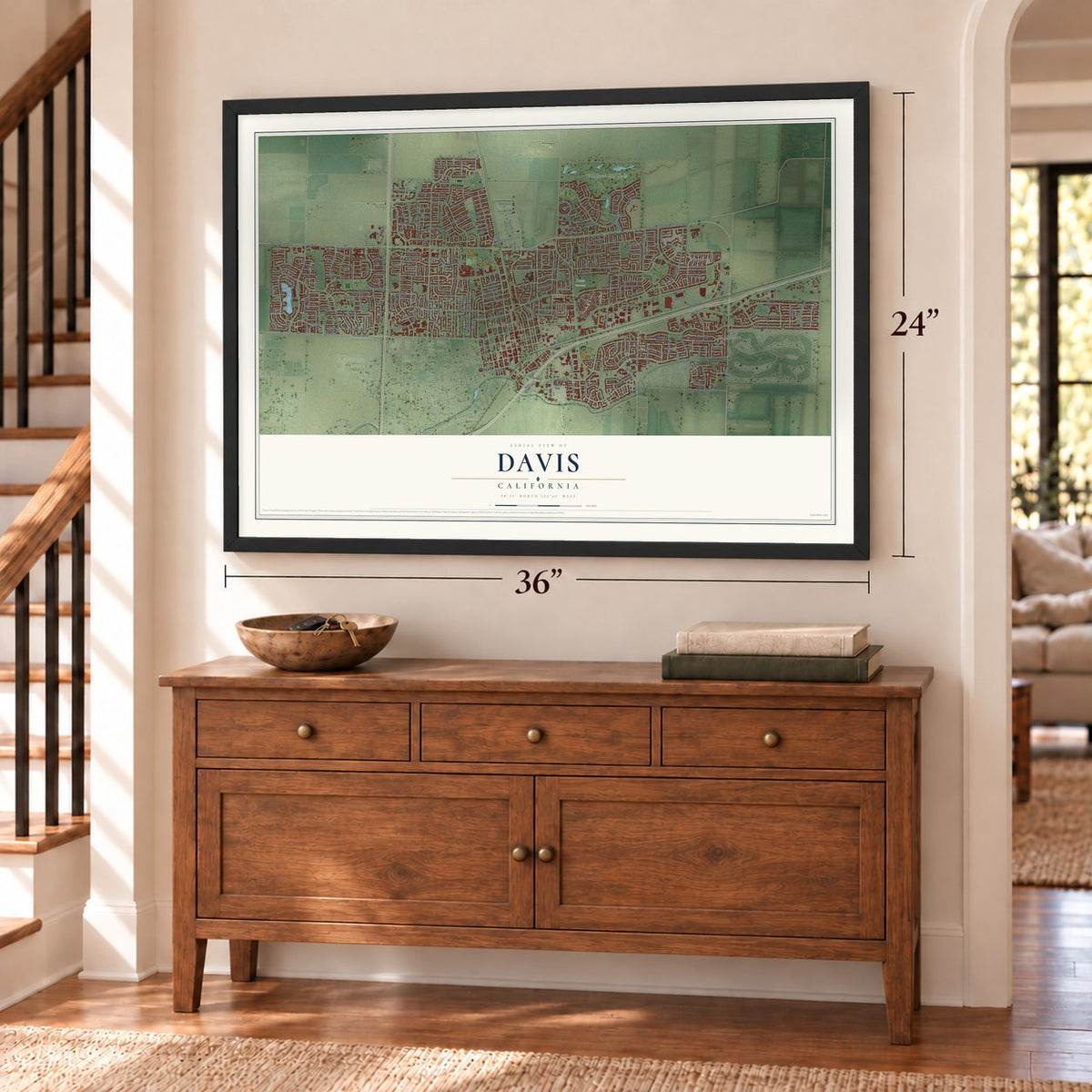
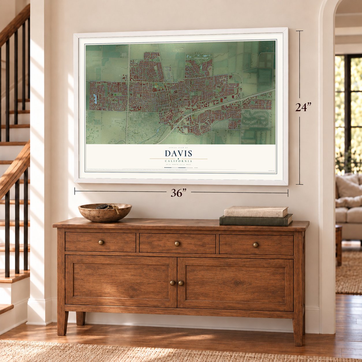
Explore Davis, California from a whole new perspective. Created using aerial imagery and detailed geographic data, this map captures Davis building by building, with labeled streets, familiar landmarks, and shaded topographical relief that highlights the natural contours of the landscape.
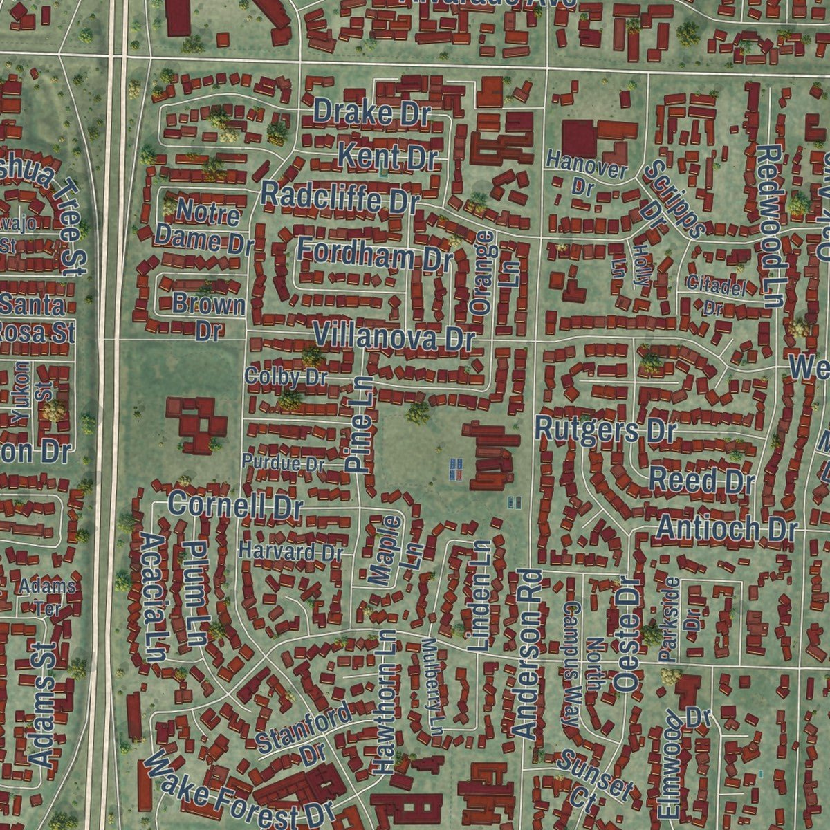
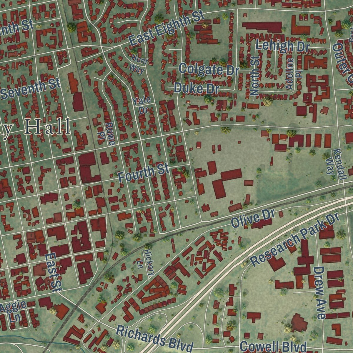
Combining modern data with the timeless character of a vintage atlas, this map is just as interesting up close as it is beautiful on the wall. Whether you grew up in Davis, spent memorable years there, or call it home today, this unique map is a great way to celebrate a place that means something to you. Zoom in on the preview to look for your street, and then order a print to put your memories on the wall.
Three ways to hang it
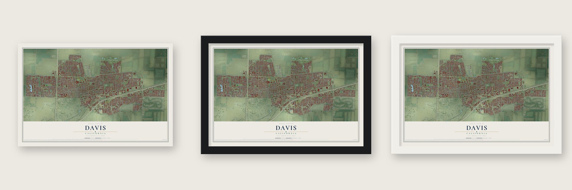
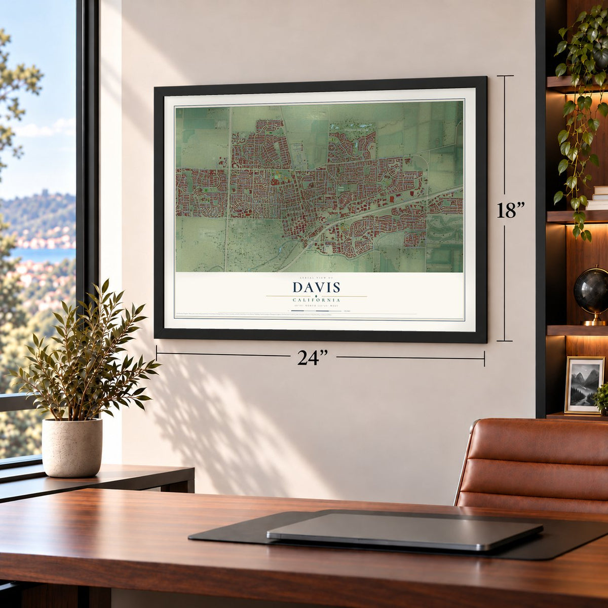
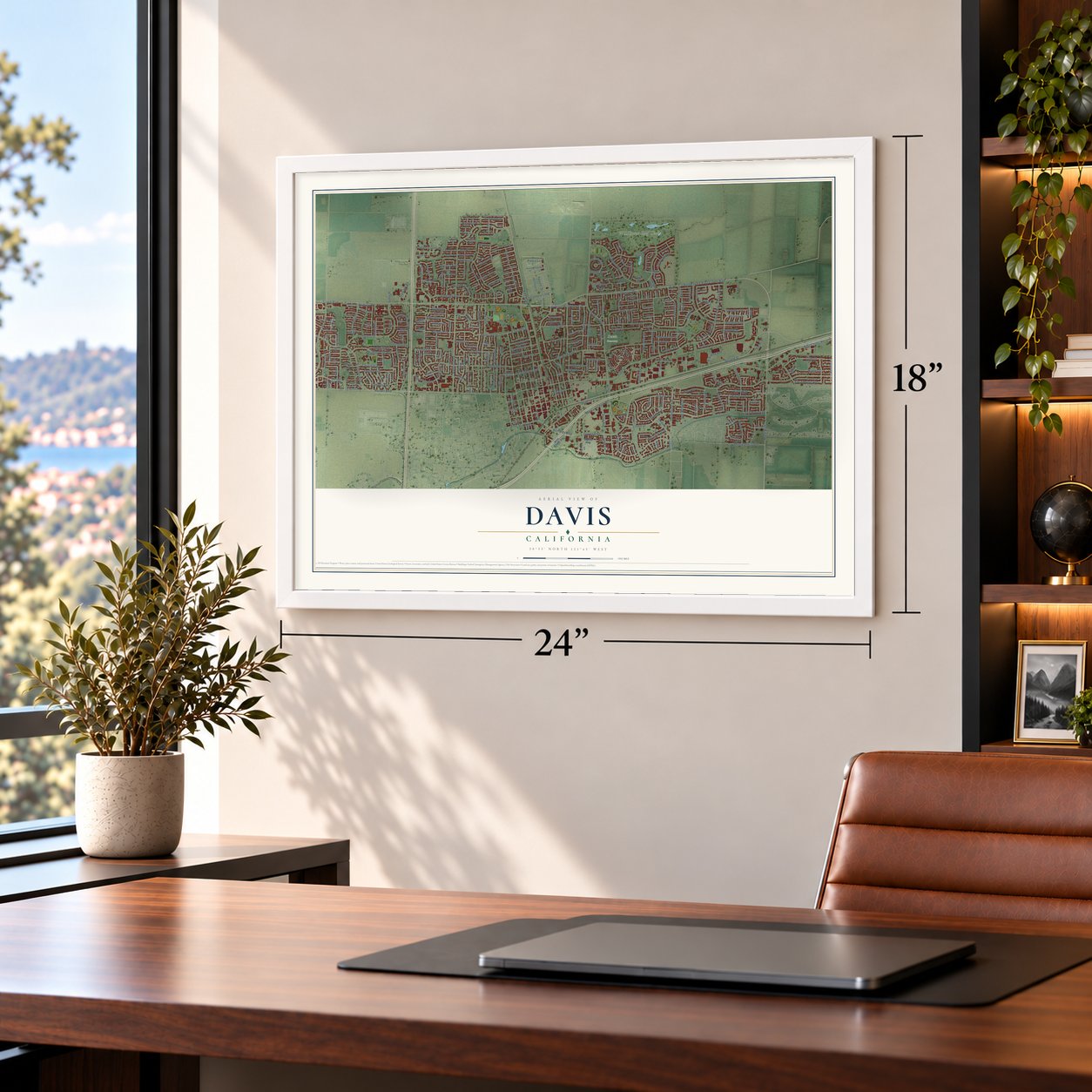
Unframed archival matte, a black wood frame or a white wood frame.
Up close
Geography Worth Displaying
This map was created using accurate cartographic data and authoritative geographic sources, including the U.S. Geological Survey and the Census Bureau. The map brings together terrain, waterways, roads, and building detail. The majority of the streets are labeled, houses are accurately depicted, and the topography is derived from government sources. Combining local data with carefully composed color and shading leads to this beautifully detailed Davis artwork for your wall.
Rather than simply showing street outlines, we’ve included as many of the street names as we could reasonably fit on the map while keeping their names legible. Zoom in on the high resolution preview to see exactly what’s on the map. We truly set out to create a statement piece for anyone who loves Davis. So whether it’s for you, or a gift for someone you love, we hope this map of Davis brings back fond memories.
Read the story behind this map of Davis, California from 2026.
About Davis, California
Davis is a city of 66,850 people in Yolo County, in the Sacramento Valley 11 miles west of Sacramento. The Patwin people lived here before American and Mexican rule pushed them out in the 1830s, and their burial grounds have turned up across the city. The town's land later came out of the rancho Laguna de Santos Callé, where the farmer Jerome C. Davis was one of the early claimants and pressed Congress to let him keep his ground.
When the Southern Pacific Railroad put a depot here in 1868, the stop was named Davisville in his honor. Early in 1869 a branch line was built from Davis to Woodland. The post office cut the name down to Davis in 1907, and the city was incorporated on March 28, 1917.
- Chosen over 50 other sitesAfter the state legislature passed the University Farm Bill in 1905, Governor George Pardee picked Davis from among 50 other sites for the University of California's farm. Students arrived in 1908. In 1922 the farm took a new title as the College of Agriculture's Northern Branch, and in 1959 it became the University of California, Davis, the seventh general campus in the system.
- A city built for bikesBike lanes became a political fight in the 1960s, and in 1966 voters elected a City Council majority that backed bicycles. Helped by flat ground and mild weather, Davis was building cycling facilities ahead of most of the country by the early 1970s. The United States Bicycling Hall of Fame moved to Davis in 2010.
- A tunnel for toadsWhen a new overpass was planned, residents worried that cars would kill the toads that crossed a dirt lot to reach a reservoir. After a long argument, the city built a tunnel for them in 1995 beneath the Pole Line Road overpass over Interstate 80. It cost $14,000 and is 21 inches wide and 18 inches high, and it later earned a mention on The Daily Show.
- A $100,000 prize in 1981After the energy crisis of 1973, Davis adopted a building code that pushed for energy efficiency, and power use in its buildings dropped sharply. In 1981 residents won a $100,000 prize from PG&E for cutting electricity use at the summer peak. The City Council went on to declare Davis a nuclear-free zone on November 14, 1984.
Find your street
Names on the Davis map
Every name below is printed on this map. Look for your street, your school, the park where you played, or the pond down the road.
Places and landmarks5
- City Hall
- Davis Cemetery
- El Macero
- Wildhorse Golf Club
- College Park
Streets and roads339
- Cowell Boulevard
- West Covell Boulevard
- East Covell Boulevard
- Mace Boulevard
- Richards Boulevard
- County Highway E6
- Russell Boulevard
- Second Street
- Montgomery Avenue
- Bike Path
- Covell Boulevard
- West Eighth Street
- Pole Line Road
- Fifth Street
- West 14th Street
- Wake Forest Drive
- East Eighth Street
- Loyola Drive
- Marina Circle
- First Street
- Cornell Drive
- Calavaras Avenue
- Snyder Drive
- Mesquite Drive
- Anderson Road
- Chiles Road
- Sycamore Lane
- Moore Boulevard
- Alhambra Drive
- Cannery Loop
Show all 339 streets
- Research Park Drive
- Lake Boulevard
- Oak Avenue
- Lillard Drive
- Arlington Boulevard
- Shasta Drive
- Alvarado Avenue
- Anza Avenue
- Olive Drive
- Catalina Drive
- East Chiles Road
- Fourth Street
- Third Street
- Olympic Drive
- Drexel Drive
- Rockwell Drive
- Drummond Avenue
- Arroyo Avenue
- Arena Drive
- Oeste Drive
- Villanova Drive
- Oyster Bay Avenue
- Denison Drive
- East Street
- El Cemonte Avenue
- Drake Drive
- Miller Drive
- Temple Drive
- Arthur Street
- Humboldt Avenue
- El Macero Drive
- Albany Avenue
- Redwood Lane
- Frontage Road
- Tulip Lane
- Alice Street
- Whittier Drive
- Radcliffe Drive
- Full Circle
- Monarch Lane
- Grande Avenue
- East Seventh Street
- Chestnut Lane
- Cypress Lane
- Eureka Avenue
- Caravaggio Drive
- Ocean Way
- Oceano Way
- Vista Way
- Ponteverde Lane
- Alameda Avenue
- Valdora Street
- Glide Drive
- Denali Drive
- Concord Avenue
- Alegre Way
- Amador Avenue
- Prado Lane
- Drew Avenue
- Tufts Street
- Fordham Drive
- Mallorca Lane
- Antioch Drive
- Emerald Bay Drive
- Sandpiper Drive
- Pine Lane
- Ensenada Drive
- Bueno Drive
- Marden Drive
- Picasso Avenue
- Imperial Avenue
- Adams Street
- Atlantis Drive
- Ninth Street
- Tenth Street
- Eleventh Street
- Ohlone Street
- Koso Street
- Quail Street
- La Playa Drive
- Birch Lane
- Pierce Lane
- Reed Drive
- Faraday Avenue
- Hamel Street
- Rutgers Drive
- Rosario Street
- Plum Lane
- Torrey Street
- Eligio Lane
- Outer Circle
- Washoe Street
- Hampton Drive
- Regis Drive
- Cantrill Drive
- Claremont Drive
- Pena Drive
- Los Robles Street
- Pacific Drive
- Frontera Drive
- Angela Street
- Del Oro Avenue
- Bidwell Street
- Acacia Lane
- San Marino Drive
- Harvest Street
- Colgate Drive
- Joshua Tree Street
- Twelfth Street
- Donner Avenue
- East 14th Street
- Fermi Place
- Auburn Drive
- Solito Street
- Hacienda Avenue
- Valencia Avenue
- Burr Street
- Rodin Place
- Lehigh Drive
- Breton Avenue
- La Vida Way
- Bianco Court
- Waxwing Place
- Cabot Street
- Evenstar Lane
- Duke Drive
- Kent Drive
- Tulane Drive
- Isla Place
- Union Drive
- Guthrie Place
- Menlo Drive
- Hoag Place
- Drew Circle
- Sutter Place
- Elmwood Drive
- Bienville Street
- Seventh Street
- West Chiles Road
- Corona Drive
- Audubon Circle
- Portage Bay East
- Glacier Place
- Verona Terrace
- Baywood Lane
- North Davis Farms Road
- Chesapeake Bay Avenue
- Hepworth Drive
- Jerome Street
- Linden Lane
- Scripps Drive
- Notre Dame Drive
- University Avenue
- Mono Place
- Grinnel Drive
- Antelope Avenue
- Brown Drive
- Danbury Street
- El Capitan Street
- Santa Rosa Street
- Alicante Street
- Almond Lane
- Heirloom Street
- Rialto Lane
- Avocet Avenue
- Faro Avenue
- Hawthorn Lane
- Barkley Street
- Hartley Street
- Arnold Street
- Orange Lane
- Hubble Street
- San Thomas Street
- Tiber Avenue
- Bates Drive
- Glacier Drive
- Balboa Avenue
- Halifax Avenue
- Bonnard Street
- Pastal Way
- Curlew Street
- Astoria Street
- Muir Woods Place
- Hermosa Place
- Douglas Avenue
- Mills Drive
- North Street
- Stanford Drive
- West Shore Street
- Haussler Drive
- Luz Place
- East Covel Street
- Falcon Avenue
- Hudson Street
- Costa Verde Street
- Via Verdi Terrace
- Donovan Court
- Oriole Avenue
- La Coruno Street
- Norte Avenue
- Cassel Lane
- Barthel Lane
- Garrison Street
- Overhill Lane
- Baja Avenue
- Morris Way
- Sunset Court
- Maple Lane
- Flicker Avenue
- Wright Boulevard
- Fortuna Court
- Calder Court
- Cutter Place
- Eel Place
- Aggie Lane
- Forbes Lane
- Roos Street
- Yana Place
- Inca Place
- Alder Place
- Tern Place
- Tea Place
- Elm Lane
- Portage Bay West
- Halsey Circle
- Renoir Avenue
- Colby Drive
- Blackburn Drive
- Belmont Drive
- Inner Circle
- Parkside Drive
- Spruce Lane
- Madrone Lane
- Hanover Drive
- Spafford Street
- North Campus Way
- Caricia Drive
- Carmelo Lane
- Bryce Lane
- Pamplona Avenue
- Pinnacles Street
- Bellows Street
- Morro Bay Avenue
- Mockingbird Place
- Fillmore Street
- Seine Avenue
- Nutmeg Lane
- Cleveland Street
- Elendil Lane
- Adrian Drive
- Harvard Drive
- Barony Place
- Guaymas Place
- Bermuda Avenue
- Rice Lane
- Adeline Place
- Kestrel Place
- La Paz Drive
- La Mesa Court
- San Ramon Drive
- Market Avenue
- Modoc Place
- Redbud Drive
- Swingle Drive
- Yukon Street
- Kendall Way
- Robin Place
- Harrier Place
- Ovejas Avenue
- Okeefe Place
- Bryant Place
- Madrid Court
- Manet Place
- Dali Place
- Rowe Place
- Yale Drive
- Iris Place
- Slayback Ranch Lane
- Eucalyptus Street
- Farragut Circle
- Broken Circle
- Woods Circle
- Layton Drive
- Mulberry Lane
- Villaverde Lane
- Coolidge Street
- Cottonwood Drive
- Bella Casa Street
- Merced Drive
- Chateau Lane
- Purdue Drive
- Diablo Avenue
- Adams Terrace
- Buchanan Street
- Citadel Drive
- Hatteras Place
- Navajo Street
- Perennal Terrace
- La Paloma Court
- Hunt Way
- Cordova Place
- Raphael Place
- Shelter Cove Place
- Hickory Lane
- Tahoe Place
- Saint Elias Place
- Balsam Place
- Holly Lane
- Henri Court
Names are listed as they appear on the printed map. Zoom into the product photos to find them.
The art of mapping a place
How This Map Was Made
Real places. Remarkable detail. Discover the layers that turn geographic data into a map of home.

The view from above
Aerial imagery reveals the character of the land: woodland, open fields, and the patterns of a place.

The shape of the land
Elevation data brings hills, valleys, and subtle changes in the landscape into view.

The details of home
Roads, waterways, and building footprints come together to make the map feel unmistakably local.

Geography becomes art
Considered color, shading, and typography bring the layers together in a map made for your wall.


Process illustrated with Mendon, Massachusetts. Aerial imagery: USDA NAIP. Terrain: USGS 3D Elevation Program. Map details and finished artwork: KNOWOL.
The Details
About This Print
Choose an archival matte print, or a black or white Ayous wood frame. The archival matte print is unframed.
Select your size and finish above to see the matching product image and price.
Materials & Craftsmanship
A contemporary map with the character of a classic atlas, printed on archival matte paper. Optional frames are made from Ayous wood.
Your printed map does not include the watermark shown in the full-map preview.
Shipping & Delivery
Free shipping within the United States. Every print is made to order in the USA.
Buying a gift? Add a note in your cart and we'll include it. We never put prices in the package.
Prints ship within 2 to 3 business days. Allow 7 to 10 days total from ordering for delivery. Timing may vary during holidays or periods of high order volume.
Read our shipping policy.
Returns and damaged prints
Each print is made to order. Change-of-mind refunds are not available after production.
If your print arrives damaged, misprinted or incorrect, contact support@knowol.com within 30 days of receiving it. Include your order number, photos and a description of the issue.
Read our full refund and replacement policy. For questions about your order, email support@knowol.com.
Find your town
Looking for another city?
Find a map of home in our California collection, or any town in the country.
Nearby
Maps of towns near Davis
Know someone from one of these towns? Their map makes a great gift.
 University of California-Davis
, California
From $39.99See the map
 El Macero
, California
From $39.99See the map
 Woodland
, California
From $39.99See the map
More maps nearby: Dixon, West Sacramento, Monument Hills, Winters and Yolo.