
Search for another town





Free U.S. delivery 7 to 10 days after you order
Deer Park, Texas Map Art
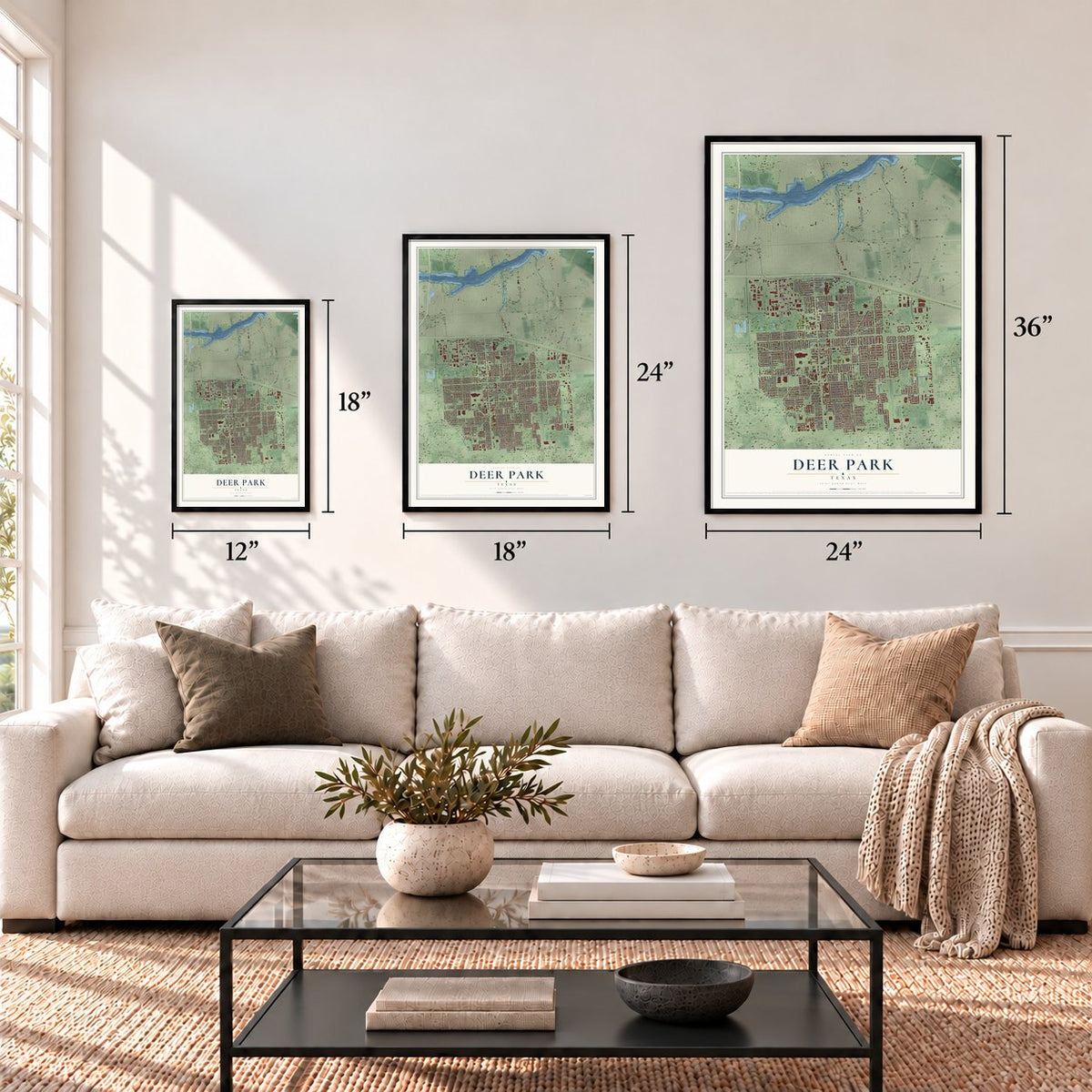
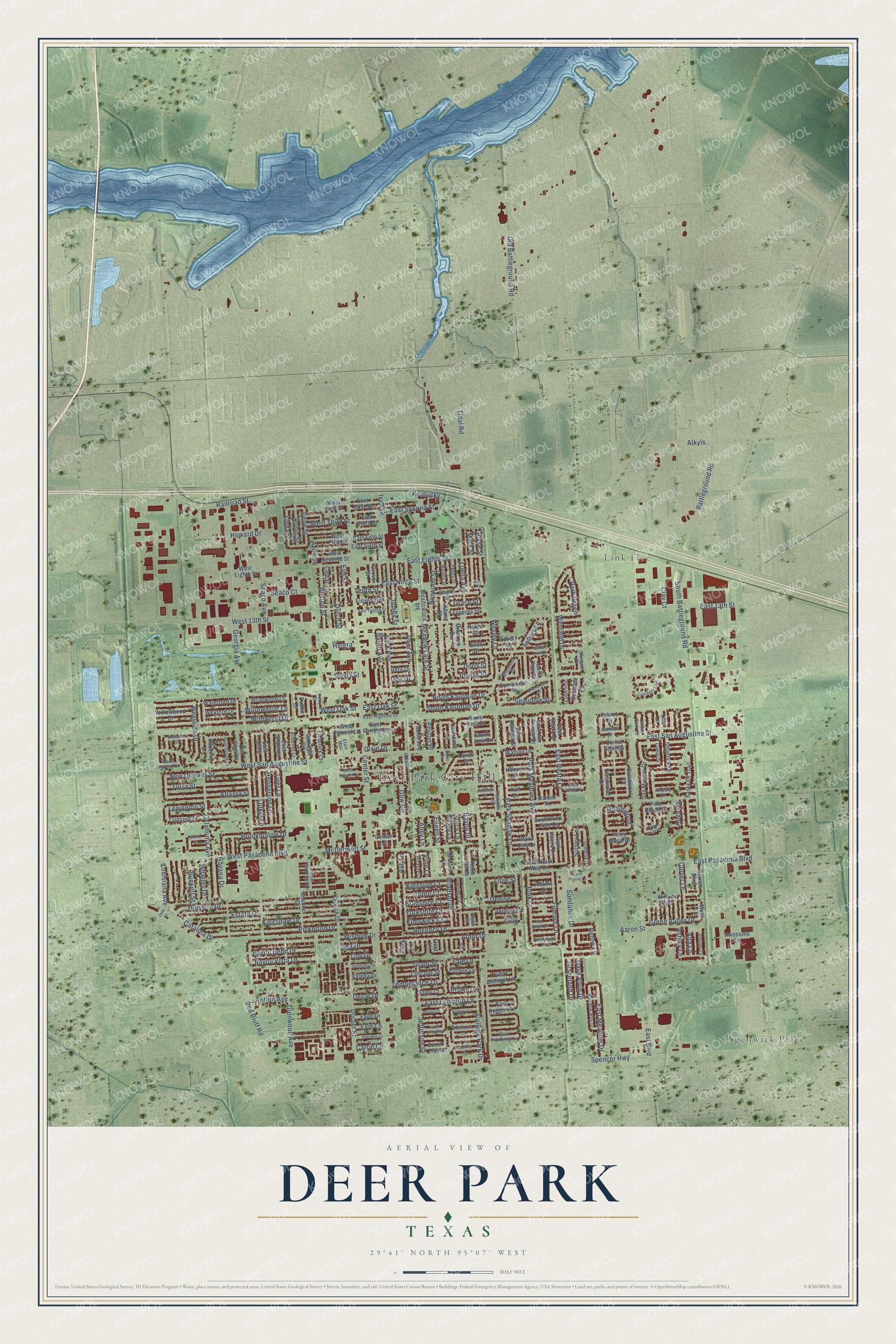
A new map of Deer Park, Texas, made in 2026 and printed to order on thick archival matte paper.
12" x 18" Archival Matte Print
A Map of Home. A Work of Art.
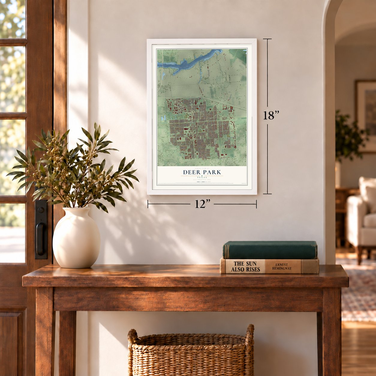
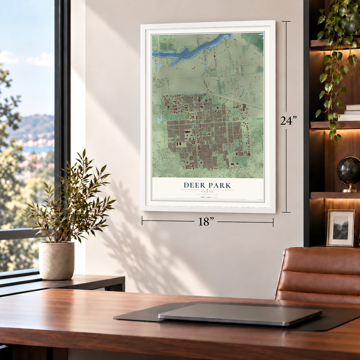
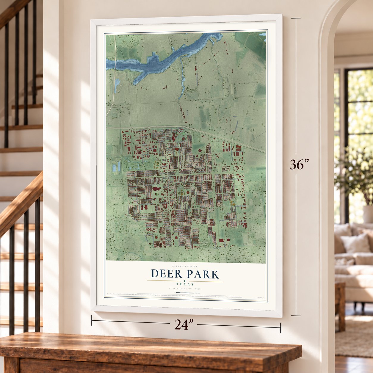
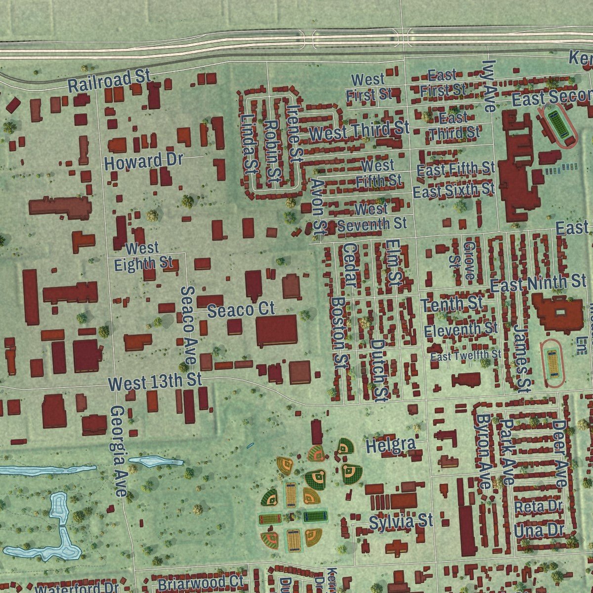
This beautifully detailed map of Deer Park, Texas was created in 2026 using aerial imagery combined with modern topographical, census, street and landmark data. It's a modern aerial view of Deer Park in Harris County, Texas, that combines modern data with a vintage aesthetic. Zoom in on the preview and look for your block.
Three ways to hang it
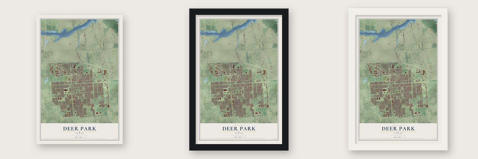
Unframed archival matte, a black wood frame or a white wood frame.
Up close
Real geography. Art worth displaying.
This map was created using accurate cartographic data and authoritative geographic sources, including the U.S. Geological Survey and the Census Bureau. The map brings together terrain, waterways, roads, and building detail. The majority of the streets are labeled, houses are accurately depicted, and the topography is derived from government sources. Combining local data with carefully composed color and shading leads to this beautifully detailed Deer Park artwork for your wall.
Rather than simply showing street outlines, we’ve included as many of the street names as we could reasonably fit on the map while keeping their names legible. Zoom in on the high resolution preview to see exactly what’s on the map. We truly set out to create a statement piece for anyone who loves Deer Park. So whether it’s for you, or a gift for someone you love, we hope this map of Deer Park brings back fond memories.
Read the story behind this map of Deer Park, Texas from 2026.
About Deer Park, Texas
Deer Park is a city in southeast Harris County, shaped by rail connections and later industrial growth. Its name recalls a private deer park that once occupied the area. Established as a subdivision in 1893, the community expanded after refineries and wartime chemical production arrived, and the 2020 census recorded 34,495 residents.
- Early ConnectionsA post office opened in 1893, and a Galveston, Harrisburg and San Antonio Railway station served the settlement by about 1894.
- City GovernmentDeer Park incorporated in 1948 and operates under a council-manager system.
- Industrial ExpansionRefineries and toluol plants spurred growth after 1946, with the local Shell facility producing ten million gallons of toluol each year.
- Rapid Population GrowthThe population rose from 736 in 1950 to 4,865 in 1960, a sixfold increase.
Find your street
Names on the Deer Park map
Every name below is printed on this map. Look for your street, your school, the park where you played, or the pond down the road.
Places and landmarks5
- Deer Park City Hall
- Spenwick Place
- Link Five
- Dow Park
- Grand View Cemetery
Streets and roads272
- East Lambuth Lane
- Westside Drive
- Seminole Street
- Grant Street
- Temperance Lane
- Center Street
- Luella Avenue
- East Boulevard
- Battleground Road
- East Pasadena Boulevard
- East 13th Street
- East San Augustine Street
- Georgia Avenue
- Spencer Highway
- Old Battleground Road
- Railroad Street
- West Pasadena Boulevard
- West 13th Street
- West San Augustine Street
- South Battleground Road
- Louisiana Avenue
- Hillshire Drive
- Red Bluff Road
- Estate Drive
- Kingsdale Drive
- Tidal Road
- Pickerton Drive
- Ivy Avenue
- Wisdom Drive
- Wildwood Drive
Show all 272 streets
- East Eighth Street
- Regency Drive
- Glenwood Avenue
- Park Meadows Avenue
- Norwood Street
- Arbor Drive
- College Park Drive
- Park Shadow Lane
- Durant Street
- Wynfield Drive
- New Orleans Street
- Atlanta Street
- Aaron Street
- Oklahoma Avenue
- East Second Street
- Bayou Bend Drive
- Sundance Drive
- Jefferson Street
- Tulsa Street
- Havana Drive
- Brookhollow Drive
- East Meadow Drive
- Bayou Vista Drive
- Elm Street
- Asbury Lane
- Catalina Drive
- Filmore Lane
- Polk Lane
- North Kaufman Drive
- East Ninth Street
- East Reata Lane
- Dutch Street
- Lufkin Lane
- Boston Street
- McDermott Street
- Meadow Lark Street
- Kentucky
- Tyler Lane
- Cedar
- James Street
- Henderson Lane
- Clover Lane
- Park Avenue
- Phyllis Street
- Dow Circle
- South Kaufman Drive
- Dave Alvin Drive
- Green Valley Drive
- Deer Avenue
- Irene Street
- Linda Street
- Mark Street
- Alyse Street
- Windsor Drive
- Robin Street
- Seaco Avenue
- Sylvia Street
- Carrie Lane
- Tudor Court
- Kimswick Court
- Lincoln Street
- Bradshire Court
- Kingston Court
- Yorkshire Court
- Plunkett Street
- West Third Street
- Yale Lane
- Whatley Drive
- Willowbriar Lane
- Park Green
- West Oak Street
- Lexington Street
- Surrey Lane
- Graceland Drive
- Holton Avenue
- Kitty
- Howard Drive
- Clay Court
- Bayou Street
- Spa Drive
- Coy Drive
- East Oak Street
- Robinwood
- Alkyls
- Augusta
- Seaco Court
- Wesley Lane
- Eileen Street
- Byron Avenue
- Pine Lane
- Doris Street
- Abby Lane
- Tenth Street
- Ashley Lane
- Alta Lane
- Peyton Place
- Ash Lane
- Brown Lane
- Penny Lane
- Evie Lane
- Oscar Drive
- Stacy Lane
- Grace Street
- Denise
- Avon Street
- Helgra
- Dixie Drive
- Lillie Street
- Una Drive
- Cork
- West Fifth Street
- Comanche Street
- East Reata Drive
- Piney Wood Drive
- West Eighth Street
- East First Street
- Concord Street
- Kalwick Drive
- West Forrest Lane
- Meadowlark Lane
- North Amy Drive
- Helen Drive
- Pine Brook Drive
- Garrett Boulevard
- Beecher Drive
- South Park Way Drive
- Lanell Street
- Santa Fe Trail
- San Marcos Drive
- Willowbend Drive
- Knob Hill Street
- Briarwood Court
- Ellen Drive
- East Lawther Street
- Minchen Drive
- Shiprock Drive
- West Seventh Street
- Velma Street
- East Clare
- East Shannon
- Erin Glen Court
- Sharie Street
- East Amherst Lane
- Waterford Drive
- East Fifth Street
- Wexford Drive
- Donegal Court
- East Third Street
- Park Haven Lane
- East Sixth Street
- Awesome Lane
- Limerick Court
- Lawrence Lane
- South Park Side Drive
- East Rutgers Lane
- East Van Trease Drive
- Grove Street
- Eleventh Street
- Ranier Drive
- Crestwood Drive
- Crestmont Drive
- Kilkenny Lane
- Faith Drive
- Frances Street
- Watson Drive
- Valeda Drive
- Village Lane
- Purdue Lane
- Kenny Street
- Deertrail Street
- East Forrest Lane
- South Amy Drive
- Park Link Drive
- Hoover Drive
- Taft Drive
- South Travis
- Adams Drive
- West First Street
- Center Court
- Strey Court
- Lovely Lane
- Comal Springs
- Lisa Lane
- Sabine Drive
- Reta Drive
- Fleet Lane
- Willow Trail
- Dublin Drive
- Moss Lane
- Juniper Lane
- Wyngate Drive
- Cleveland Drive
- Elain Mac
- Somerset Lane
- Meadow Way Drive
- West Parktown Drive
- East Highline Drive
- Cherokee Street
- Killarney Lane
- Downing Circle
- Wake Forest Drive
- Dalmation Lane
- East Princeton Lane
- Parkglen Street
- Peggy Street
- Martha Street
- Hickory Lane
- Canterbury Court
- Shoshoni Drive
- Kerry Drive
- Camdon Drive
- Trinity Park Court
- Comal Drive
- Janell Rene Circle
- Jeffery Street
- Artesia Drive
- Iris
- Dover Street
- Dunn Circle
- Garden Park Drive
- Academy Lane
- Piney Point Drive
- Woodcrest Drive
- Southern Trail
- Dartmouth Lane
- Maxwell Lane
- East Twelfth Street
- Saint Patrick Lane
- Rutgers Lane
- Elbridge Lane
- Stephanie Drive
- West Vaughn Lane
- South Crockett
- Deervalley Street
- Van Buren Drive
- North Prairie Lane
- Salem Drive
- Boone Court
- Mesa Verde Drive
- Dahlia Lane
- Jana Lane
- Alan Street
Names are listed as they appear on the printed map. Zoom into the product photos to find them.
The art of mapping a place
How This Map Was Made
Real places. Remarkable detail. Discover the layers that turn geographic data into a map of home.

The view from above
Aerial imagery reveals the character of the land: woodland, open fields, and the patterns of a place.

The shape of the land
Elevation data brings hills, valleys, and subtle changes in the landscape into view.

The details of home
Roads, waterways, and building footprints come together to make the map feel unmistakably local.

Geography becomes art
Considered color, shading, and typography bring the layers together in a map made for your wall.


Process illustrated with Mendon, Massachusetts. Aerial imagery: USDA NAIP. Terrain: USGS 3D Elevation Program. Map details and finished artwork: KNOWOL.
The Details
About This Print
Choose an archival matte print, or a black or white Ayous wood frame. The archival matte print is unframed.
Select your size and finish above to see the matching product image and price.
Materials & Craftsmanship
A contemporary map with the character of a classic atlas, printed on archival matte paper. Optional frames are made from Ayous wood.
Your printed map does not include the watermark shown in the full-map preview.
Shipping & Delivery
Free shipping within the United States. Every print is made to order in the USA.
Buying a gift? Add a note in your cart and we'll include it. We never put prices in the package.
Prints ship within 2 to 3 business days. Allow 7 to 10 days total from ordering for delivery. Timing may vary during holidays or periods of high order volume.
Read our shipping policy.
Returns and damaged prints
Each print is made to order. Change-of-mind refunds are not available after production.
If your print arrives damaged, misprinted or incorrect, contact support@knowol.com within 30 days of receiving it. Include your order number, photos and a description of the issue.
Read our full refund and replacement policy. For questions about your order, email support@knowol.com.
Find your town
Looking for another city?
Find a map of home in our Texas collection.
Nearby
Maps of towns near Deer Park
Know someone from one of these towns? Their map makes a great gift.
 Pasadena
, Texas
From $39.99See the map
 La Porte
, Texas
From $39.99See the map
 Channelview
, Texas
From $39.99See the map
More maps nearby: South Houston, Morgan's Point, Cloverleaf, Shoreacres and Galena Park.