
Search for another town





Free U.S. delivery 7 to 10 days after you order
Delaware, Ohio Map Art
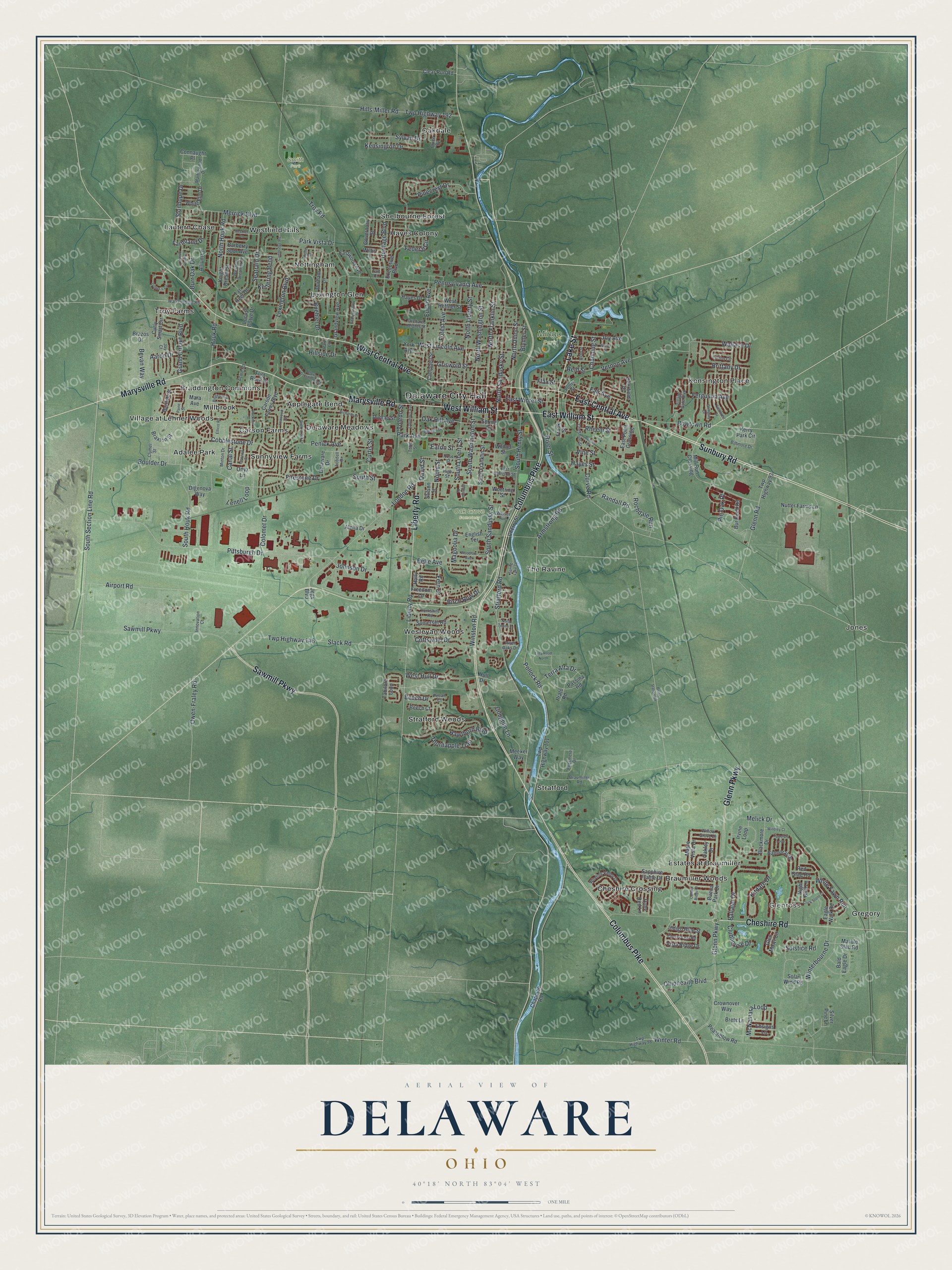
A new map of Delaware, Ohio, made in 2026 and printed to order on thick archival matte paper.
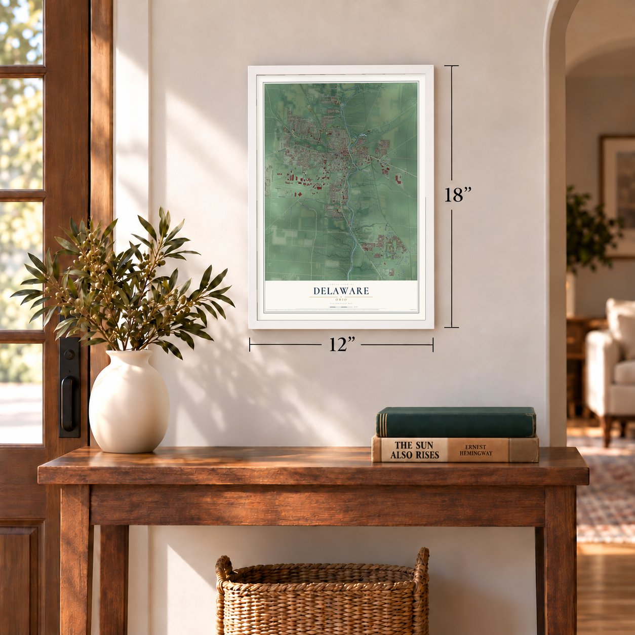
12" x 18" Archival Matte Print
A Map of Home. A Work of Art.
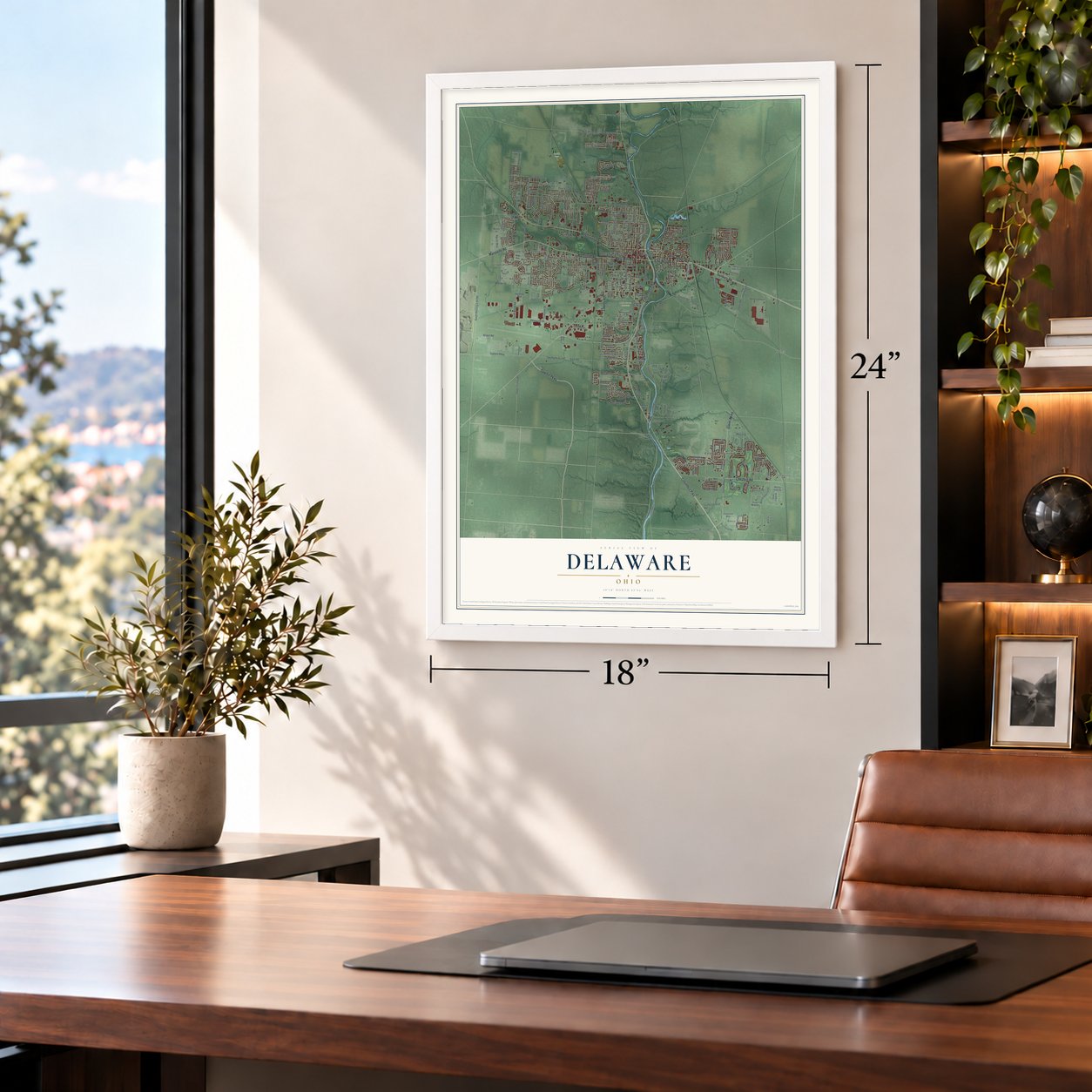
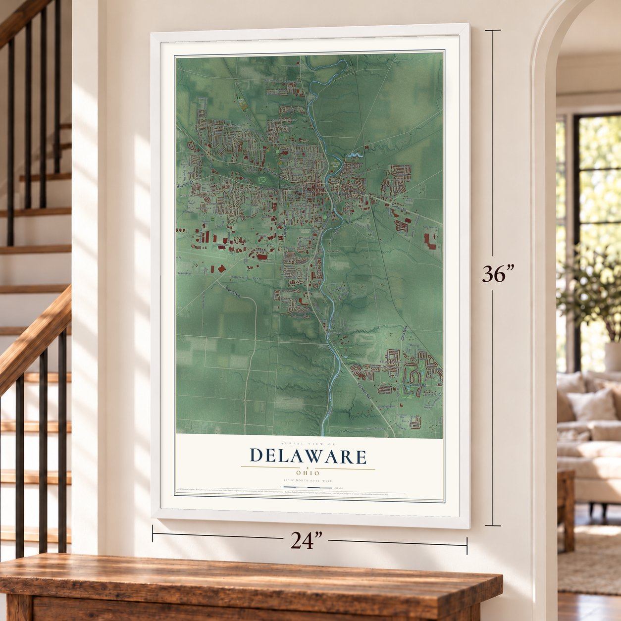
Explore Delaware, Ohio from a whole new perspective. Created using aerial imagery and detailed geographic data, this map captures Delaware building by building, with labeled streets, familiar landmarks, and shaded topographical relief that highlights the natural contours of the landscape.
Combining modern data with the timeless character of a vintage atlas, this map is just as interesting up close as it is beautiful on the wall. Whether you grew up in Delaware, spent memorable years there, or call it home today, this unique map is a great way to celebrate a place that means something to you. Zoom in on the preview to look for your street, and then order a print to put your memories on the wall.
Three ways to hang it
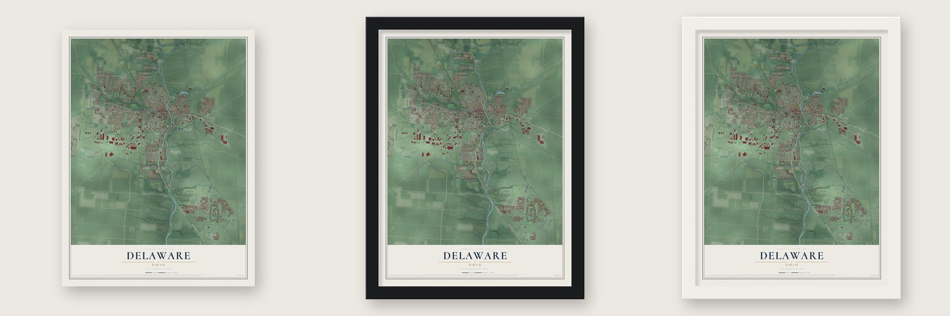
Unframed archival matte, a black wood frame or a white wood frame.
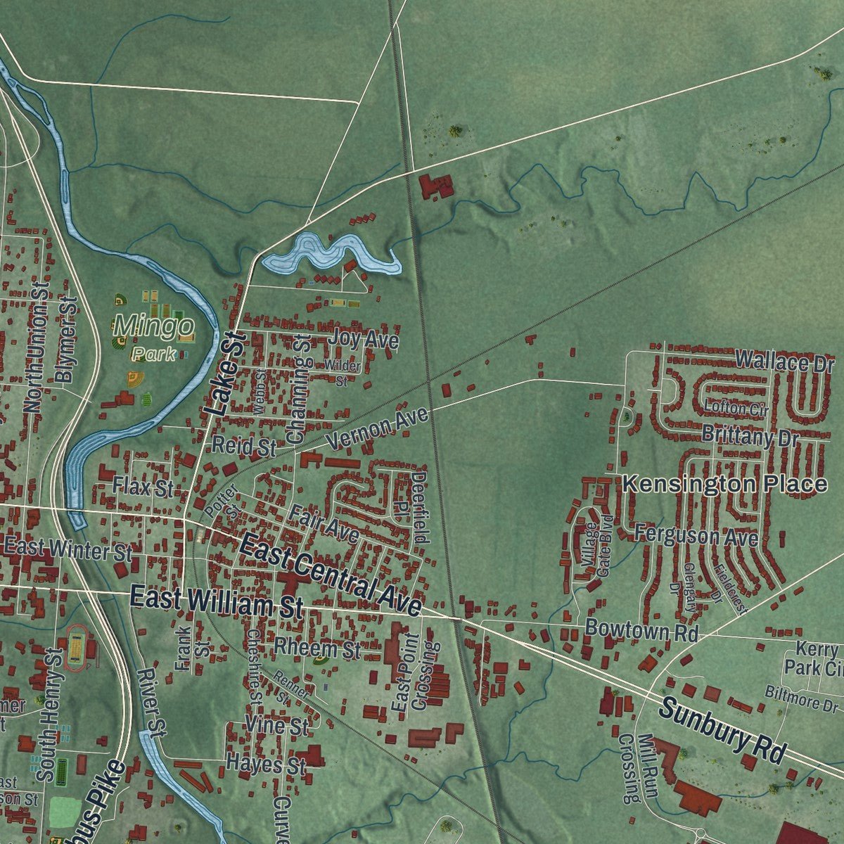
Up close
Geography Worth Displaying
This map was created using accurate cartographic data and authoritative geographic sources, including the U.S. Geological Survey and the Census Bureau. The map brings together terrain, waterways, roads, and building detail. The majority of the streets are labeled, houses are accurately depicted, and the topography is derived from government sources. Combining local data with carefully composed color and shading leads to this beautifully detailed Delaware artwork for your wall.
Rather than simply showing street outlines, we’ve included as many of the street names as we could reasonably fit on the map while keeping their names legible. Zoom in on the high resolution preview to see exactly what’s on the map. We truly set out to create a statement piece for anyone who loves Delaware. So whether it’s for you, or a gift for someone you love, we hope this map of Delaware brings back fond memories.

About Delaware, Ohio
Delaware is a city in Delaware County, Ohio. The 2020 census recorded 41,302 residents. Delaware was founded in 1808.
- 41,302 peopleThe Census Bureau recorded this population in 2020.
- Delaware CountyDelaware is a city in this Ohio county.
- Founded in 1808Delaware was founded in 1808.
- 19.07 square milesThe Census Bureau reports this total area for the community.
Find your street
Names on the Delaware map
Every name below is printed on this map. Look for your street, your school, the park where you played, or the pond down the road.
Places and landmarks31
- Delaware City Hall
- Glenross
- Mingo Park
- Oak Grove Cemetery
- Smith Park
- Adalee Park
- Applegate Bend
- Braddington Commons
- Braumiller Woods
- Carson Farms
- Cheshire Crossing
- Delaware Meadows
Show all 31 places
- Estates at Braumiller
- Gregory
- Hayes Colony
- Jones
- Kensington Place
- Lantern Chase
- Lexington Glen
- Millbrook
- Nottingham
- Oakdale
- Shelbourne Forest
- Stratford
- Stratford Woods
- Sunnyview Farms
- The Ravine
- Troy Farms
- Village at Lehner Woods
- Wesleyan Woods
- Westfield Hills
Streets and roads262
- Columbus Pike
- Marysville Road
- West Central Avenue
- West William Street
- Sawmill Parkway
- Sunbury Road
- East Central Avenue
- East William Street
- Cheshire Road
- Liberty Road
- Lake Street
- Glenn Parkway
- South Section Line Road
- Pittsburgh Drive
- Grand Circuit Boulevard
- Bowtown Road
- Cobblestone Drive
- Stratford Road
- Hawthorn Boulevard
- Winter Road
- Pinecrest Drive
- Curve Road
- Vine Street
- London Road
- Troy Road
- South Houk Road
- South Sandusky Street
- Boulder Drive
- Pennsylvania Avenue
- Slack Road
Show all 262 streets
- Twp Highway 146
- North Liberty Street
- Airport Road
- Pollock Road
- Ohiohealth Boulevard
- Hills-Miller Road
- Twp Highway 192
- Rochdale Run
- South Henry Street
- Park Avenue
- North Sandusky Street
- North Franklin Street
- North Washington Street
- Firestone Drive
- McNamara Loop
- East Winter Street
- North Union Street
- North Houk Road
- Ballater Drive
- West Lincoln Avenue
- Winterbourne Drive
- Buehler Drive
- Wallace Drive
- Euclid Avenue
- Merrick Boulevard
- Melick Drive
- White Fawn Run
- Lexington Boulevard
- Seatrain Drive
- Penick Avenue
- Channing Street
- Cottswold Drive
- Glenn Road
- South Washington Street
- South Liberty Street
- Curtis Street
- Brittany Drive
- Belle Avenue
- West Hull Drive
- Kitdare Drive
- Pin Oak Place
- Armstrong Road
- Canal Street
- Griswold Street
- Hayes Street
- Stonhope Drive
- Heritage Boulevard
- Ferguson Avenue
- Oak Hill Avenue
- Farmland Drive
- Kensington Drive
- Beech Drive
- Bevan Way
- Vernon Avenue
- Hillside Drive
- Thornapple Trail
- Federal Circle
- Owen-Fraley Road
- Terra Alta Drive
- Fair Avenue
- Sylvan Drive
- Lenell Loop
- Coughlin Lane
- Houk Road
- Park Vista Drive
- Solstice Road
- River Street
- Joy Avenue
- Fern Drive
- Noble Street
- Toledo Street
- Burr Oak Drive
- Kettering Bend
- Birch Row Drive
- Aaron Drive
- Forest Avenue
- Winston Road
- Clubhouse Drive
- Randall Road
- Colomet Drive
- Rheem Street
- Johnson Drive
- Magnolia Drive
- Eaton Street
- Blymer Street
- Flax Street
- Reid Street
- David Street
- South Street
- Mill Run Crossing
- Carson Farms Boulevard
- Maple Vista Drive
- Allium Lane
- Brazos Drive
- Executive Boulevard
- Twp Highway 101
- Balmoral Drive
- West Heffner Street
- Twp Highway 93
- Cherry Street
- Eagle Walk Road
- Tabilore Loop
- Somerset Road
- Tar Heel Drive
- Crownover Way
- Bur Reed Road
- Curly Smart Circle
- Grandview Avenue
- White Elm Drive
- Kerry Park Circle
- South Franklin Street
- Delaware Drive
- Blackmore Drive
- Glen Mawr Circle
- Durham Lane
- Irvine Loop
- Flint Rock Drive
- Knight Dream Street
- Buena Park Drive
- Brets Lane
- Digenova Way
- Oakley Drive
- Nutter Farms Lane
- Vista Ridge Drive
- Eastwood Avenue
- Sapphire Flame Drive
- Locust Curve Drive
- Peachblow Road
- Spring Street
- Braxton Street
- Deerfield Place
- English Terrace
- Campbell Street
- Clear Run Road
- Indigo Blue Street
- Marble Slab Road
- Barberry Spur Avenue
- East Point Crossing
- Bartlett Street
- Hayes Drive
- Bald Eagle Drive
- Onyx Lane
- Ruby Red Lane
- Ensigns Lane
- Red Stag Road
- Connaught Place
- Freedom Lane
- Governors Street
- Holly Road
- Chapman Road
- Willis Lane
- Solar Wind Road
- Wilmer Street
- Passina Road
- Wootring Street
- Beech Court
- Dunlap Street
- Prato Road
- Frank Street
- Night Bird Lane
- Alpha Drive
- Silver Pine Lane
- Mara Avenue
- Meeker Way
- Stilson Street
- York Avenue
- Jegs Boulevard
- Hull Drive
- Warrensburg Road
- Braumiller Road
- Village Gate Boulevard
- Twp Highway 98
- Winding Valley Drive
- Cheshire Street
- Lofton Circle
- Western Dreamer Drive
- Potter Street
- Biltmore Drive
- Ross Street
- Cherry Leaf Road
- Yorkshire Road
- Acme Road
- Bruce Road
- Minton Drive
- Orchard Heights Street
- Ellesmere Drive
- Marblewood Drive
- River Oaks Drive
- Clymer Street
- Willow Grove Drive
- East Harrison Street
- Innovation Court
- Todd Street
- High Street
- Weiser Avenue
- Lobdell Drive
- Park Lane
- Pecan Court
- Jay Court
- Taft Court
- Rockmill Street
- Cambridge Road
- Rock Creek Drive
- Richards Drive
- Fieldcrest Drive
- Glengary Drive
- Trotter's Circle
- Columbus Avenue
- Tipperary Loop
- Spring Lake Court
- Talla Road North
- Leawood Drive
- Lantern Chase Drive
- Berlin Station Road
- Wilder Street
- Delaware Crossing East
- Colony Ridge Drive
- Linwood Street
- Crick Stone Drive
- Williams Drive
- Thistle Drive
- Georgetowne Drive
- Beckler Lane
- Renner Street
- Bingham Circle
- Woodrow Avenue
- Ellicot Road
- Windley Court
- North Towne Lane
- Webb Street
- Chelsea Street
- Paine Street
Names are listed as they appear on the printed map. Zoom into the product photos to find them.
The art of mapping a place
How This Map Was Made
Real places. Remarkable detail. Discover the layers that turn geographic data into a map of home.

The view from above
Aerial imagery reveals the character of the land: woodland, open fields, and the patterns of a place.

The shape of the land
Elevation data brings hills, valleys, and subtle changes in the landscape into view.

The details of home
Roads, waterways, and building footprints come together to make the map feel unmistakably local.

Geography becomes art
Considered color, shading, and typography bring the layers together in a map made for your wall.


Process illustrated with Mendon, Massachusetts. Aerial imagery: USDA NAIP. Terrain: USGS 3D Elevation Program. Map details and finished artwork: KNOWOL.
The Details
About This Print
Choose an archival matte print, or a black or white Ayous wood frame. The archival matte print is unframed.
Select your size and finish above to see the matching product image and price.
Materials & Craftsmanship
A contemporary map with the character of a classic atlas, printed on archival matte paper. Optional frames are made from Ayous wood.
Your printed map does not include the watermark shown in the full-map preview.
Shipping & Delivery
Free shipping within the United States. Every print is made to order in the USA.
Buying a gift? Add a note in your cart and we'll include it. We never put prices in the package.
Prints ship within 2 to 3 business days. Allow 7 to 10 days total from ordering for delivery. Timing may vary during holidays or periods of high order volume.
Read our shipping policy.
Returns and damaged prints
Each print is made to order. Change-of-mind refunds are not available after production.
If your print arrives damaged, misprinted or incorrect, contact support@knowol.com within 30 days of receiving it. Include your order number, photos and a description of the issue.
Read our full refund and replacement policy. For questions about your order, email support@knowol.com.
Find your town
Looking for another city?
Find a map of home in our Ohio collection, or any town in the country.
Nearby
Maps of towns near Delaware
Know someone from one of these towns? Their map makes a great gift.
 Kilbourne
, Ohio
From $39.99See the map
 Ostrander
, Ohio
From $39.99See the map
 Radnor
, Ohio
From $39.99See the map
More maps nearby: Powell, Shawnee Hills, Ashley, Magnetic Springs and Sunbury.