
Search for another town



Free U.S. delivery 7 to 10 days after you order
Delray Beach, Florida Map Art
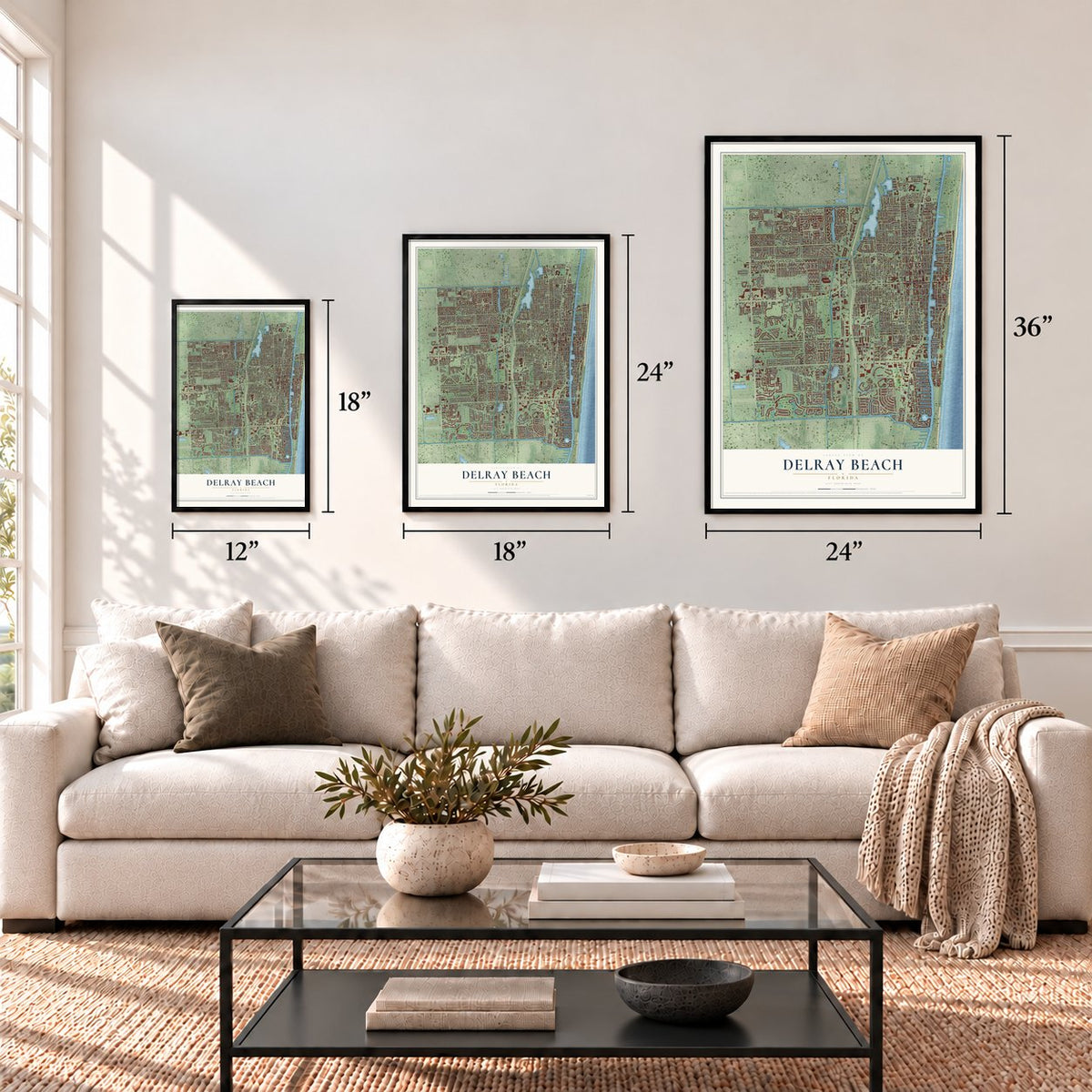
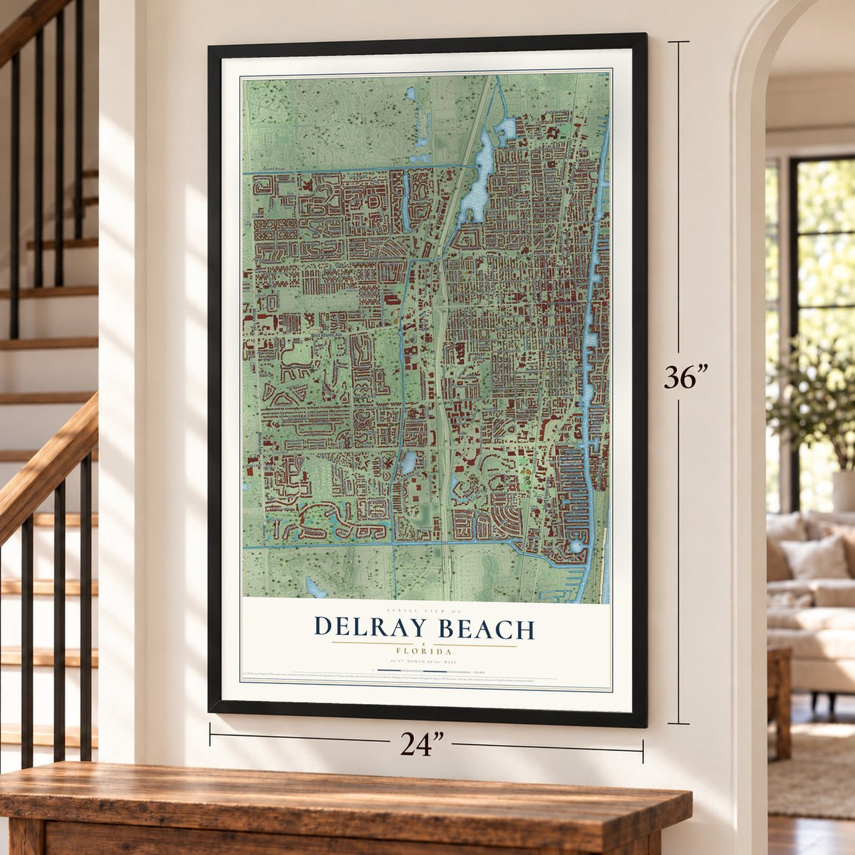
A new map of Delray Beach, Florida, made in 2026 and printed to order on thick archival matte paper.
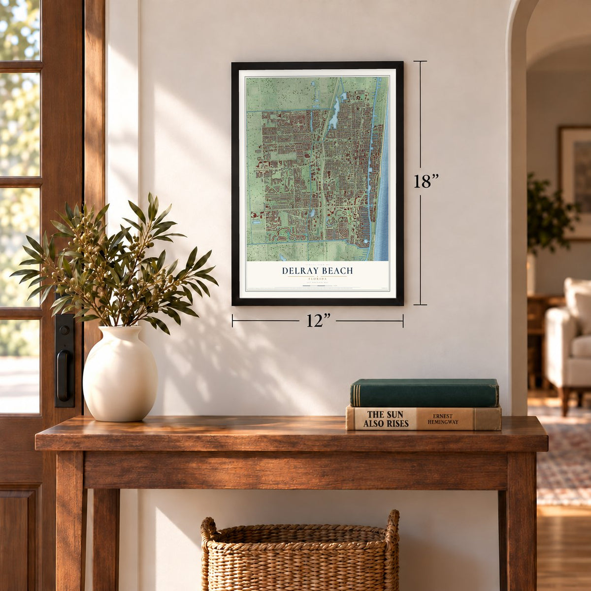
12" x 18" Archival Matte Print
A Map of Home. A Work of Art.
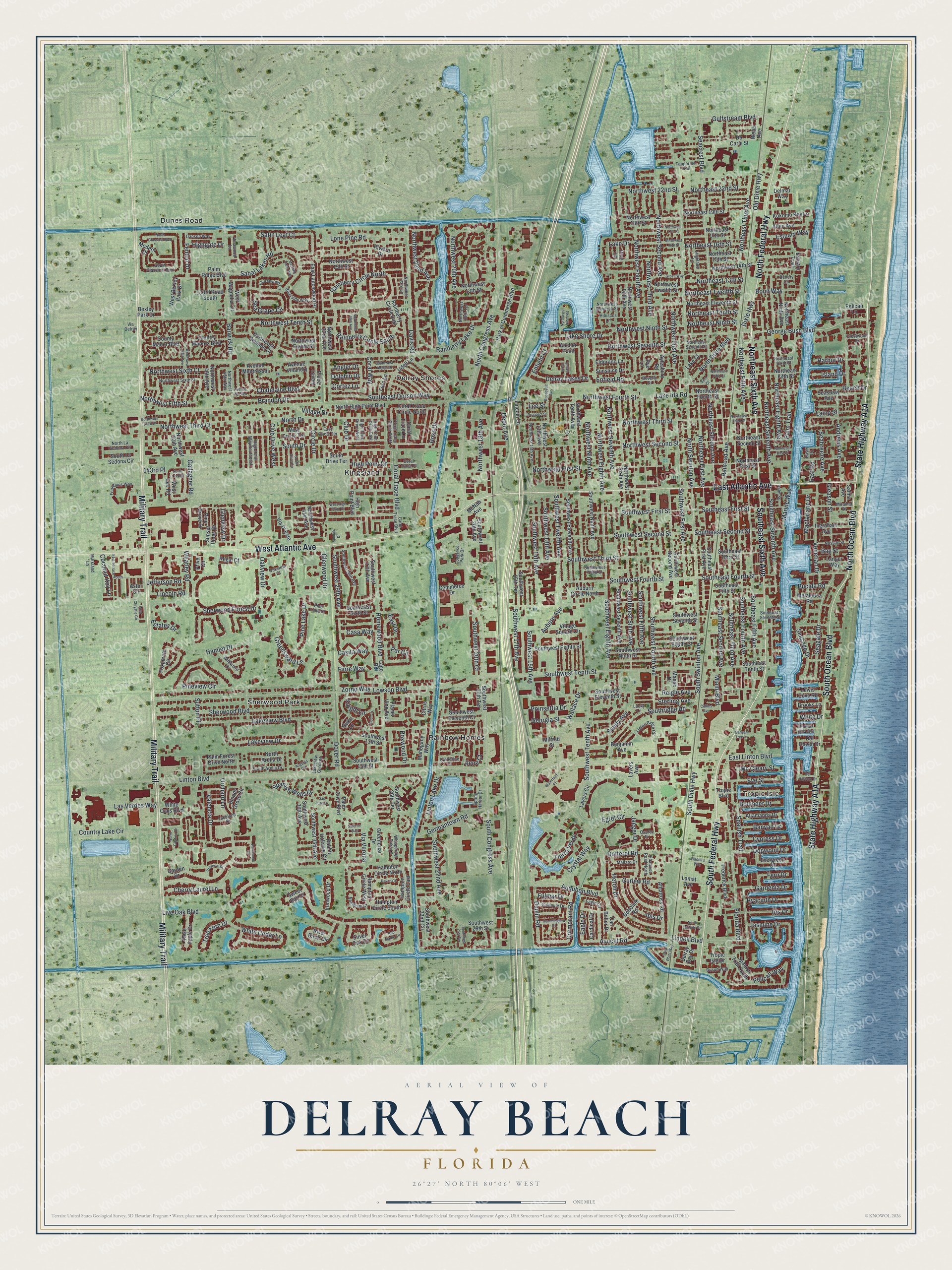
Explore Delray Beach, Florida from a whole new perspective. Created using aerial imagery and detailed geographic data, this map captures Delray Beach building by building, with labeled streets, familiar landmarks, and shaded topographical relief that highlights the natural contours of the landscape.
Combining modern data with the timeless character of a vintage atlas, this map is just as interesting up close as it is beautiful on the wall. Whether you grew up in Delray Beach, spent memorable years there, or call it home today, this unique map is a great way to celebrate a place that means something to you. Zoom in on the preview to look for your street, and then order a print to put your memories on the wall.
Three ways to hang it
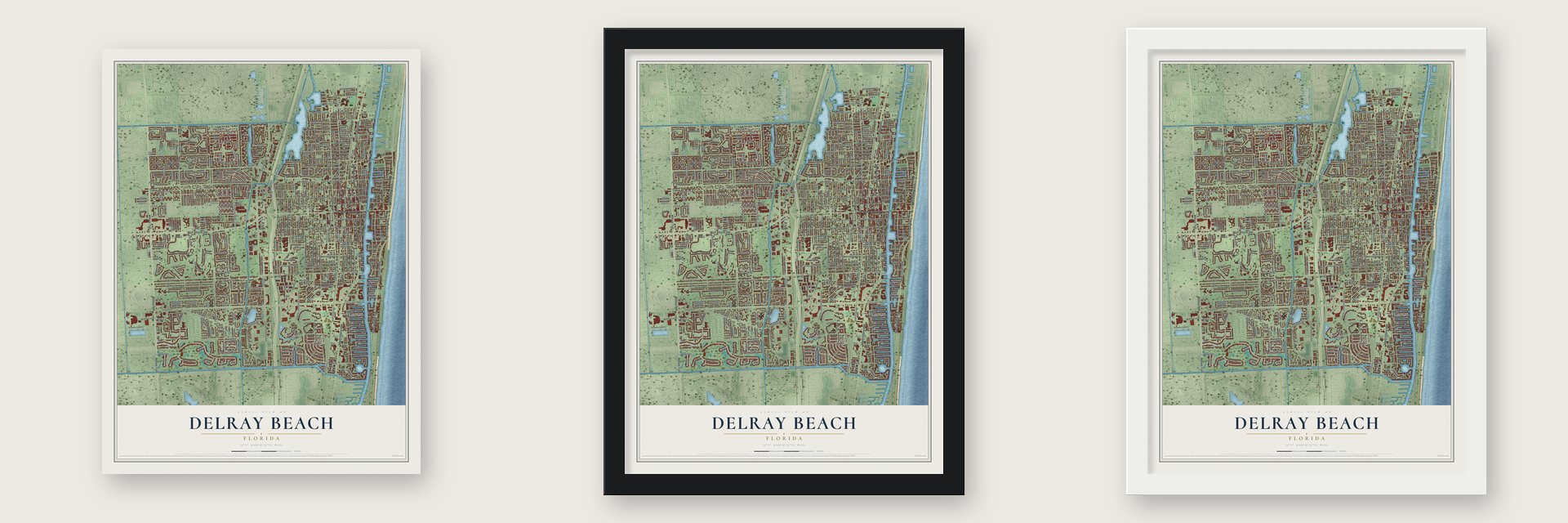
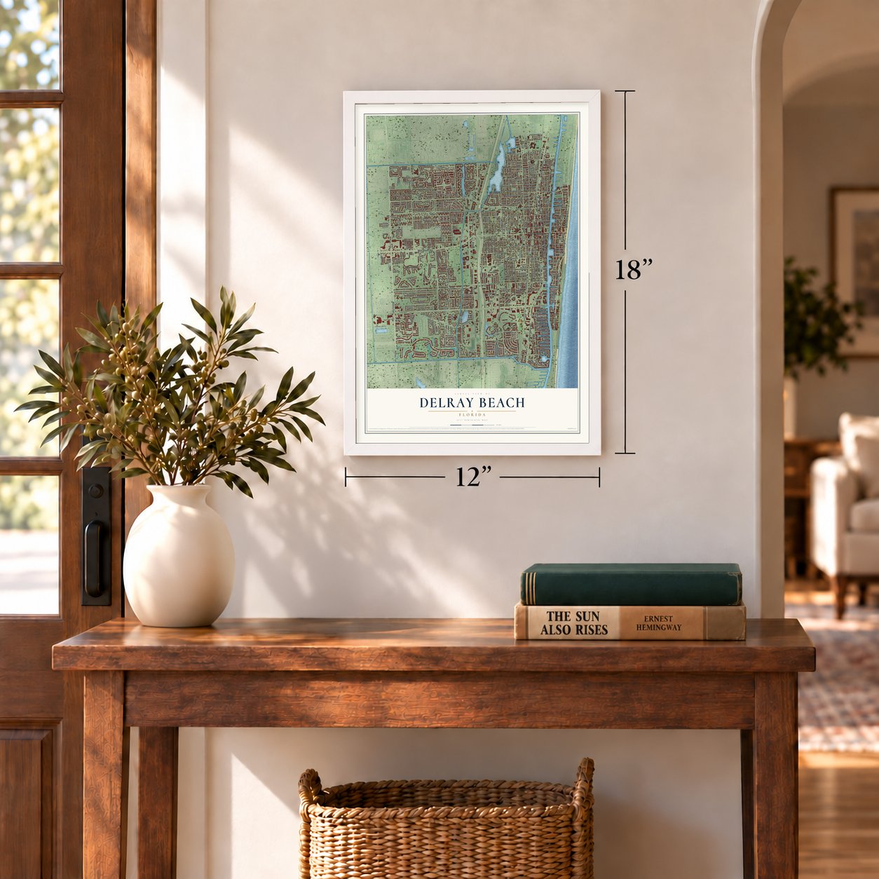
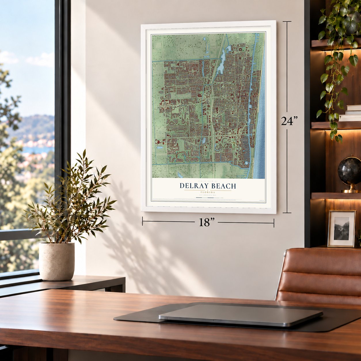
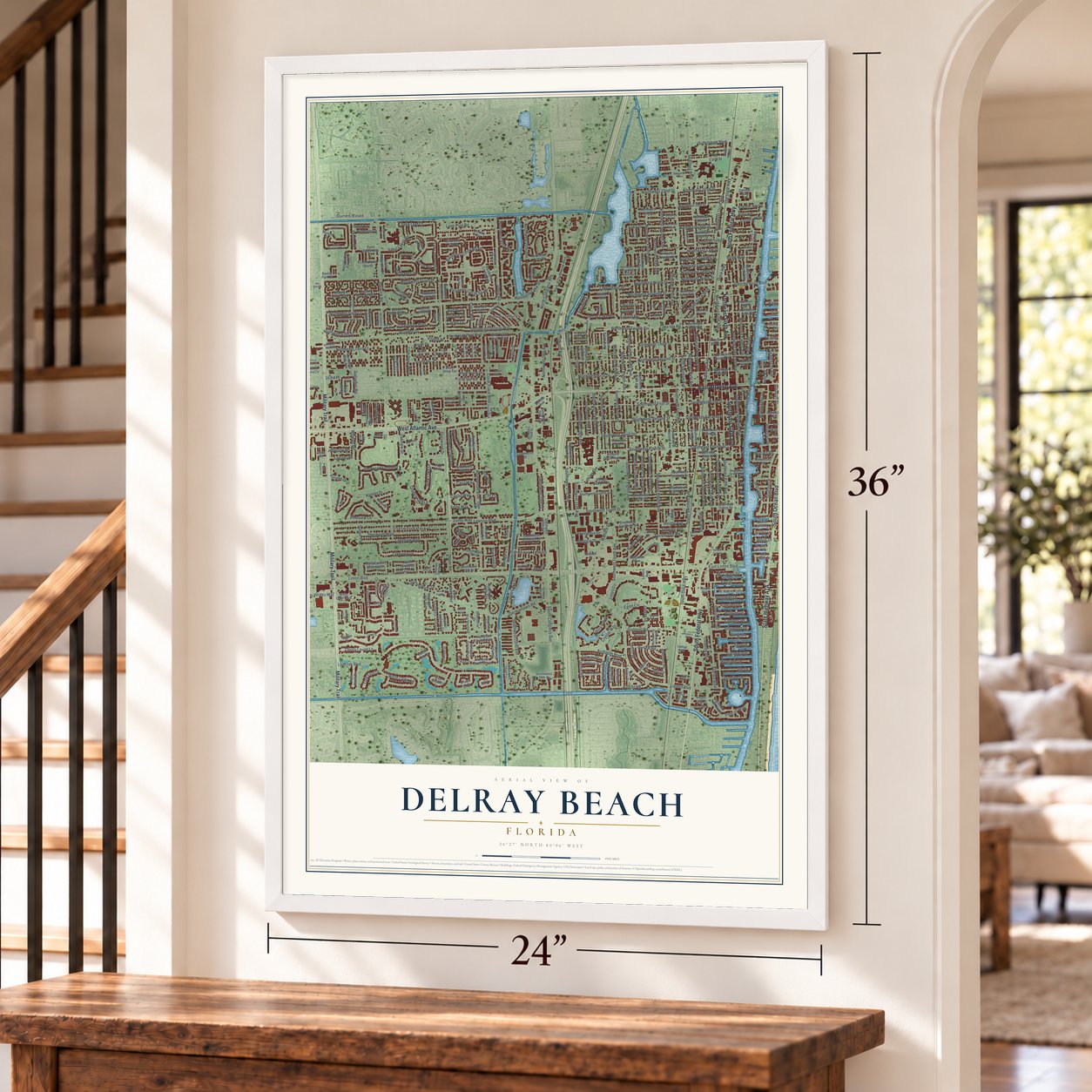
Unframed archival matte, a black wood frame or a white wood frame.
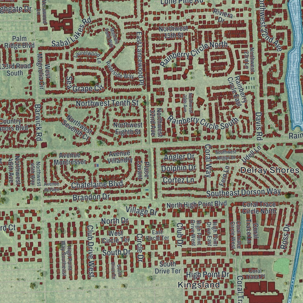
Up close
Geography Worth Displaying
This map was created using accurate cartographic data and authoritative geographic sources, including the U.S. Geological Survey (USGS) and FEMA. The map brings together terrain, waterways, roads, and building detail. The majority of the streets are labeled, houses are accurately depicted, and the topography is derived from government sources. Combining local data with carefully composed color and shading leads to this beautifully detailed Delray Beach artwork for your wall.
Rather than simply showing street outlines, we’ve included as many of the street names as we could reasonably fit on the map while keeping their names legible. Zoom in on the high resolution preview to see exactly what’s on the map. We truly set out to create a statement piece for anyone who loves Delray Beach. So whether it’s for you, or a gift for someone you love, we hope this map of Delray Beach brings back fond memories.
Explore the full map of Delray Beach, Florida and read about the local places it shows.

About Delray Beach, Florida
The 2020 census counted 66,846 people in Delray Beach, a city in Palm Beach County.
- 66,846 peopleRecorded for Delray Beach in the 2020 census.
- Palm Beach CountyDelray Beach belongs to Palm Beach County in Florida.
- Incorporated in 1911Delray Beach was incorporated in 1911.
Find your street
Names on the Delray Beach map
Every name below is printed on this map. Look for your street, your school, the park where you played, or the pond down the road.
Places and landmarks7
- Tropic Isle
- Pompey Park
- Delray Shores
- Dunes Road
- Kingsland
- Rainbow Homes
- Sherwood Park
Streets and roads465
- East Atlantic Avenue
- Northeast Sixth Avenue
- South Ocean Boulevard
- North Ocean Boulevard
- South Federal Highway
- Military Trail
- West Atlantic Avenue
- North Federal Highway
- Southeast Sixth Avenue
- Northeast Second Avenue
- Northwest Second Street
- South Swinton Avenue
- Southeast Second Avenue
- Southwest Twelfth Avenue
- Auburn Avenue
- Seacrest Boulevard
- Chatelaine Boulevard
- Gallagher Road
- Southwest Fourth Street
- Spanish Trail
- Southridge Road
- Northeast Fifth Avenue
- Linton Lake Drive
- Gulfstream Boulevard
- Coral Trace Boulevard
- Dixie Highway
- Homewood Boulevard
- Northwest Fourth Avenue
- Old Dixie Highway
- George Bush Boulevard
Show all 465 streets
- Seagate Drive
- Southeast Second Street
- Northwest Sixth Court
- Bucida Road
- Eagle Drive
- Linton Boulevard
- Lake Ida Road
- South Congress Avenue
- North Swinton Avenue
- Lowson Boulevard
- Southwest Fourth Avenue
- South Dixie Highway
- Davis Road
- North Congress Avenue
- Barwick Road
- Northeast Third Avenue
- Live Oak Boulevard
- Germantown Road
- Southwest Tenth Avenue
- Southwest Eighth Avenue
- Northwest Third Street
- Northwest Second Avenue
- Southeast Fifth Avenue
- Southwest Second Street
- Sherwood Forest Drive
- Lindell Boulevard
- Southwest Tenth Street
- Southwest Sixth Avenue
- Southwest Third Street
- Hamlet Drive
- Northwest Third Avenue
- Sherwood Boulevard
- Palm Trail
- Southeast Third Avenue
- Southeast Fourth Avenue
- Sabal Lakes Road
- Orchard Lane
- Northwest 18th Avenue
- Andrews Avenue
- Northeast Seventh Avenue
- Northwest First Street
- Southwest 22nd Avenue
- Southwest First Street
- Northeast Eighth Avenue
- Northwest First Avenue
- Southeast Seventh Avenue
- Northwest Tenth Street
- Northwest Ninth Street
- Depot Avenue
- Southwest Fifth Avenue
- Southwest 15th Avenue
- Northwest Eighth Avenue
- Greensward Lane
- Rainberry Circle North
- Northwest 22nd Avenue
- Southwest 14th Avenue
- Florida Boulevard
- Northwest Fourth Street
- Crystal Way
- East Linton Boulevard
- White Cedar Lane
- Lake Drive
- South Drive
- Southeast Dorson Way
- Seasage Drive
- Dotterel Road
- Lakeview Boulevard
- Pineview Circle
- Jaeger Drive
- North Drive
- Heron Drive
- Lakeview Drive
- Village Drive
- Venetian Drive
- Southwest 13th Avenue
- Northeast First Avenue
- Northwest Seventh Avenue
- Northwest Seventh Street
- Pelican Way
- Gleason Street
- Southeast First Street
- Southwest First Avenue
- Wallace Drive
- Cherry Laurel Lane
- High Point Drive
- Satin Leaf Court
- Dover Road
- Northwest 20th Avenue
- Estates Drive
- Northwest Third Court
- Cormorant Road
- Lone Pine Road
- Tierra Verde
- Audubon Boulevard
- Brandon Drive
- Northwest Ninth Avenue
- Las Verdes Way
- Glenwood Drive
- Southeast Fourth Street
- Sea Grape Circle
- Enfield Road
- Valencia Drive
- Egret Circle
- North Dixie Boulevard
- Par Circle
- Northeast 22nd Street
- Southwest 17th Avenue
- Southwest 20th Court
- Pine Lake Drive
- Rainberry Circle South
- Lake Shore Drive
- Delray Lakes Drive
- Jasmine Drive
- Cortez Lane
- Ibis Drive
- Eve Street
- Ilene Court
- Avocet Road
- Northwest 22nd Street
- Northeast 13th Street
- Spanish Wells Drive
- Northeast 16th Street
- Southwest 29th Avenue
- Northeast Twelfth Street
- Dunlin Road
- Curlew Road
- Country Lake Circle
- Rainberry Lake Drive
- Northeast Tenth Street
- Beach Drive
- Dogwood Drive
- Coconut Key Lane
- Northwest Fifth Street
- Oakview Drive
- Northeast Ninth Street
- Seabreeze Avenue
- Iris Drive
- Poinsettia Drive
- Estuary Way
- Lincoln Road
- Laing Street
- Whatley Road
- Club Drive West
- Railroad Avenue
- Bond Way
- Fiore Way
- Harbor Drive
- Macfarlane Drive
- Georgia Street
- Gardenia Drive
- Fenton Drive
- Sundy Avenue
- Cypress Drive
- Hyacinth Drive
- Reigle Avenue
- Casita Way
- Banyan Drive
- Marine Way
- Via Verona
- Jefferson Road
- Zorno Way
- Coral Way
- Sterling Avenue
- Bolender Drive
- Miami Boulevard
- Circle Drive
- Mc Cleary Street
- Highgate Drive
- Ross Drive
- Tree Fern Drive
- Fulmar Drive
- Casa Way
- Island Drive
- Bay Street
- Glenview Drive
- Enfield Court
- Boxwood Drive
- Dolphin Drive
- Angler Drive
- Knight Lane
- Fern Drive
- East Drive
- Sutton Place
- 143rd Place
- East Road
- White Drive
- Club Drive
- Lee Street
- Riviera Drive
- Hampton Circle East
- Estuary Trail
- Hampton Circle South
- High Point Boulevard
- Hampton Circle West
- Webb Avenue
- North High Point Boulevard
- Southwest Sixth Street
- Southeast Third Street
- Southwest 27th Avenue
- Spanish Trail South
- McNab Avenue
- Citrus Way
- Southwest Seventh Avenue
- Northwest Sixth Avenue
- Northwest Fifth Avenue
- Lavers Circle
- Northwest Twelfth Street
- Southeast First Avenue
- Southwest Second Avenue
- Northwest 18th Street
- Northwest 13th Street
- Commerce Drive
- Northwest 15th Street
- Southwest Eleventh Avenue
- Southwest 22nd Circle
- Northeast Fourth Street
- Southwest Seventh Street
- Northwest Tenth Avenue
- Northeast Second Street
- Northwest Seventh Court
- Northeast First Street
- Northeast Fifth Street
- Park of Commerce Boulevard
- Southwest Eighth Street
- Rabbit Hollowe Circle
- Southwest Ninth Street
- Southwest 20th Terrace
- Village Square Circle
- Southwest 26th Terrace
- West Bexley Park Drive
- Southeast Tenth Street
- Delmar Way
- Northwest 13th Avenue
- Southwest 13th Street
- Foxpointe Circle
- Tropic Isle Drive
- Bloods Grove Circle
- Southwest Eighth Court
- Northwest 50th Avenue
- River Birch Circle
- Tropic Boulevard
- Northeast 17th Street
- Astor Circle
- Anchor Point
- Northwest 46th Avenue
- Pine Grove Drive
- Palm Cove Boulevard
- Northeast Eleventh Street
- Albatross Road
- Silver Oak Circle
- Lamat Avenue
- Northeast 14th Street
- Northeast Ninth Avenue
- Frederick Boulevard
- Northwest Eighth Street
- Southwest Ninth Avenue
- Udell Lane
- Southeast Fifth Street
- Southwest 35th Avenue
- Seaspray Avenue
- Modern Drive
- Kokomo Key Lane
- Country Manors Boulevard
- Ingraham Avenue
- East Lancewood Place
- Regal Court
- Northeast 19th Street
- Southwest Eleventh Street
- Via D' Este
- Northwest 32nd Avenue
- Allen Avenue
- North Arelia Drive
- Palm Forest Drive North
- Northwest 41st Avenue
- Lago Road
- Allamanda Drive
- Prive Circle
- Sunset Pines Drive
- Southwest 36th Avenue
- South Drive Terrace
- Southwest Eleventh Court
- Hampton Circle North
- South La Sedona Circle
- Southwest 20th Avenue
- Auburn Circle North
- Ironwood Drive
- Bexley Park Drive
- Southwest 15th Terrace
- Southwest 15th Street
- Coral Trace Circle North
- Coral Trace Lane
- Mahogany Way
- County Manor Boulevard
- Carl Bolter Drive
- Palm Ridge Boulevard
- Rose Apple Drive
- Duke Lane
- Langer Way
- Rainberry Circle East
- Northeast 15th Street
- 133rd Road South
- Del Haven Drive
- Avenue Montressor
- West Circle Terrace
- Eldorado Lane
- Sunshine Drive
- West Magnolia Circle
- Cardinal Drive
- Flame Vine Avenue
- Avenue Villandry
- Greenbriar Drive
- Evergreen Drive
- Melaleuca Road
- Lewis Cove Road
- De Carie Street
- Southwest 29th Street
- Brooks Lane
- White Oaks Boulevard
- Bobolink Road
- Delray Bay Drive
- Aylesbury Road
- Lincoln Lane
- West Lee Road
- Fern Lane
- Benjamin Avenue
- Pelican Lane
- Mango Drive
- Place Tavant
- Sweet Bay Drive
- Lavers Avenue
- Salina Avenue
- Garden Drive
- Milfred Street
- Lake Court
- Pine Lane
- Rye Lane
- Catherine Drive
- Congress Park Drive
- Northwest Sixth Street
- High Point Way Southeast
- South Classical Boulevard
- Fountains Way
- Spring Harbor Drive
- Northwest Eleventh Street
- Northwest 19th Terrace
- Northeast Sixth Street
- Southeast Seventh Street
- Northwest 23rd Lane
- Southwest 28th Avenue
- Northwest 14th Avenue
- Linton Ridge Circle
- Northeast Seventh Street
- Miramar Drive
- South Arelia Drive
- Laurelwood Lane
- Highland Lane
- Danson Way
- Nassau Street
- Coral Trace Circle West
- Riverside Way
- Gallinule Drive
- Southwest Third Court
- Mallard Drive
- Wildwood Drive
- North La Sedona Circle
- Albatross Road North
- Needham Court
- Lakeland Drive
- Tangerine Trail
- Whispering Oaks Lane
- Carol Trace Boulevard
- Oakview Court
- Basin Drive
- Rhodes Villa Avenue
- East Circle Terrace
- Verawood Lane
- Eagle Circle
- Crestwood Drive
- Northwest 45th Way
- Palm Square
- High Point Drive West
- Pine Lake Court
- High Point Drive East
- Bosun Way
- Lakeview Gardens
- Coral Trace Place
- Osprey Drive
- Markland Lane
- Beverly Drive
- Lucky Lane
- Hibiscus Lane
- Denery Lane
- Via Delray
- Avenue de Gien
- North Citation Drive
- North Lee Road
- Northeast Third Street
- Northwest 17th Street
- Hammock Circle
- Northwest 29th Avenue
- Northwest 16th Street
- South Drive Circle
- Red Maple Circle
- Roosevelt Avenue
- Grove Way
- Majestic Palm Way
- Northwest 49th Avenue
- Canoe Point
- 51st Terrace South
- Southwest Angler Drive
- Southwest 21st Terrace
- North Classical Boulevard
- Hummingbird Drive
- Del Harbour Drive
- Northwest Ninth Road
- Devon Court
- Waterford Place
- Preserve Drive
- West High Point Court
- Northwest Third Drive
- Peer Lane
- Augusta Circle
- North Latitude Circle
- Canal Point Way
- Prospect Street
- Northeast First Court
- West Chrystie Circle
- Salerno Way
- San Juan Drive
- Fladell's Way
- Northeast Fifth Court
- Collins Avenue
- Spodak Drive
- Banyan Tree Lane
- Fern Court
Names are listed as they appear on the printed map. Zoom into the product photos to find them.
The art of mapping a place
How This Map Was Made
Real places. Remarkable detail. Discover the layers that turn geographic data into a map of home.

The view from above
Aerial imagery reveals the character of the land: woodland, open fields, and the patterns of a place.

The shape of the land
Elevation data brings hills, valleys, and subtle changes in the landscape into view.

The details of home
Roads, waterways, and building footprints come together to make the map feel unmistakably local.

Geography becomes art
Considered color, shading, and typography bring the layers together in a map made for your wall.


Process illustrated with Mendon, Massachusetts. Aerial imagery: USDA NAIP. Terrain: USGS 3D Elevation Program. Map details and finished artwork: KNOWOL.
The Details
About This Print
Choose an archival matte print, or a black or white Ayous wood frame. The archival matte print is unframed.
Select your size and finish above to see the matching product image and price.
Materials & Craftsmanship
A contemporary map with the character of a classic atlas, printed on archival matte paper. Optional frames are made from Ayous wood.
Your printed map does not include the watermark shown in the full-map preview.
Shipping & Delivery
Free shipping within the United States. Every print is made to order in the USA.
Buying a gift? Add a note in your cart and we'll include it. We never put prices in the package.
Prints ship within 2 to 3 business days. Allow 7 to 10 days total from ordering for delivery. Timing may vary during holidays or periods of high order volume.
Read our shipping policy.
Returns and damaged prints
Each print is made to order. Change-of-mind refunds are not available after production.
If your print arrives damaged, misprinted or incorrect, contact support@knowol.com within 30 days of receiving it. Include your order number, photos and a description of the issue.
Read our full refund and replacement policy. For questions about your order, email support@knowol.com.
Find your town
Looking for another city?
Find a map of home in our Florida collection, or any town in the country.
Nearby
Maps of towns near Delray Beach
Know someone from one of these towns? Their map makes a great gift.
 Gulf Stream
, Florida
From $39.99See the map
 Golf
Golf, Florida
From $39.99See the map
 Highland Beach
, Florida
From $39.99See the map
More maps nearby: Briny Breezes, Boynton Beach, Boca Raton, Ocean Ridge and San Castle.