
Search for another town


Free U.S. delivery 7 to 10 days after you order
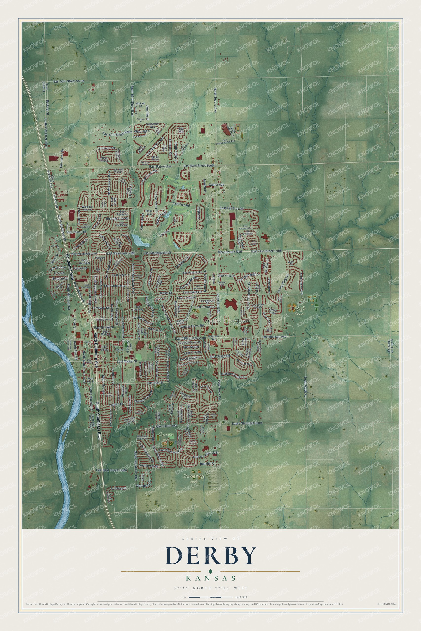
Derby, Kansas Map Art
Building by building, with labeled streets and shaded relief.
12" x 18" Archival Matte Print
A Map of Home. A Work of Art.
Explore Derby, Kansas from a whole new perspective. Created using aerial imagery and detailed geographic data, this map captures Derby building by building, with labeled streets, familiar landmarks, and shaded topographical relief that highlights the natural contours of the landscape.
Combining modern data with the timeless character of a vintage atlas, this map is just as interesting up close as it is beautiful on the wall. Whether you grew up in Derby, spent memorable years there, or call it home today, this unique map is a great way to celebrate a place that means something to you. Zoom in on the preview to look for your street, and then order a print to put your memories on the wall.
Three ways to hang it

Unframed archival matte, a black wood frame or a white wood frame.
Up close
Geography Worth Displaying
This map was created using accurate cartographic data and authoritative geographic sources, including the U.S. Geological Survey and the Census Bureau. The map brings together terrain, waterways, roads, and building detail. The majority of the streets are labeled, houses are accurately depicted, and the topography is derived from government sources. Combining local data with carefully composed color and shading leads to this beautifully detailed Derby artwork for your wall.
Rather than simply showing street outlines, we’ve included as many of the street names as we could reasonably fit on the map while keeping their names legible. Zoom in on the high resolution preview to see exactly what’s on the map. We truly set out to create a statement piece for anyone who loves Derby. So whether it’s for you, or a gift for someone you love, we hope this map of Derby brings back fond memories.

Find your street
Names on the Derby map
Every name below is printed on this map. Look for your street, your school, the park where you played, or the pond down the road.
Places and landmarks7
- Derby City Hall
- Deskarsky Park
- Garrett Park
- High Park
- North Forest Park
- Clear Lake
- College Park
Streets and roads233
- Southeast Boulevard
- North Baltimore Avenue
- South Southeast Boulevard
- East 71st Street South
- East Meadowlark Road
- East Meadowlark Street
- Meadowlark Boulevard
- East Market Street
- East 91st Street South
- East Patroit Avenue
- South 63rd Street East
- East Osage Road
- North Nelson Drive
- East Carolyn Street
- North River Street
- South Woodlawn Boulevard
- North Rock Road
- East Tall Tree Road
- English Street
- South Rock Road
- North Second Avenue
- Buckner Street
- Tall Tree Road
- East 79th Street South
- East Madison Avenue
- North Woodlawn Boulevard
- North Buckner Street
- East James Street
- Nelson Drive
- Triple Creek Drive
Show all 233 streets
- East 55th Street South
- East Kay Street
- East 87th Street South
- North Westview Drive
- North Georgie
- James Street
- North Derby
- South Southeast Drive
- North Kokomo
- South McIntosh Road
- Newberry
- North El Paso Drive
- North Timberleaf Drive
- South Buckner Street
- North Brook Forest Road
- East 63rd Street South
- South 47th Street East
- North Lakeview Drive
- East Rough Creek
- Rough Creek Road
- East 60th Street South
- East Lincoln
- Hilltop Road
- South Hilltop Road
- Spring Ridge Drive
- Marguerite Parkway
- East Woodbrook Street
- Dry Creek Drive
- North Sunset Drive
- Beau Jardin
- East Cresthill
- East Pinion Road
- Chet Smith Avenue
- Walnut Grove Road
- South Georgie
- Waters Edge
- Derby Hills Drive
- East Greenway
- South Derby
- East Glen Hills Drive
- Madapalla Court
- South Webb Road
- East Countryview Drive
- Burning Tree Road
- Riverview Street
- Wedgewood Drive
- Duckcreek Lane
- East Warren Avenue
- Winding Lane
- River Street
- Bodine Drive
- Commerce Drive
- Overlook Drive
- South Gasaway Drive
- East Rushwood Drive
- Stone Creek
- Spring Creek Drive
- Cambridge
- East Britain Street
- Lookout
- Cross Creek
- North Water
- Southcrest Drive
- Crestway Street
- Red Powell Drive
- South Nancy Lane
- Emerson Circle
- Longhorn Drive
- Lincoln
- East Virginia
- Conyers Avenue
- Rockhill Court
- La Mesa Street
- Fernell Street
- Glen Hills Drive
- Pepper Corn
- East Maple
- Nixon Street
- Songbird Street
- Laughlin Street
- Woodard
- North Hamilton Drive
- West Meadowlark Road
- Stone Path Street
- East Alise
- Bel Arbor Street
- North High Park Drive
- North Briarwood Road
- Madison Avenue
- South Oliver Street
- South Kokomo
- South Circle Drive
- South Westview
- East Windmill Road
- North Willow Drive
- East Park Lane Street
- South Park Hill Street
- North Farmington Drive
- North Tamarisk Street
- East Crestway
- Tiara Pines Drive
- South Honeybrook Lane
- South 55th Street East
- Mary Etta Street
- East Walnut
- Armstrong Avenue
- South Lauber Lane
- South Sharon Drive
- South Hila Street
- Brookstone Street
- East Oak Forest Road
- Walnut Creek Drive
- South Sontag Street
- North Amber Ridge Street
- South Brookwood
- South Willow Drive
- South 111th Street East
- South Mockingbird Lane
- West Harral Street
- North Osage Road
- Splitwood Way
- North Liberty Lane
- Trail Ridge Drive
- North Ridge Road
- South Water
- Rainbow Drive
- Pheasant Run
- Timber Creek
- West Kay Street
- North Bulldog Drive
- Zachary Drive
- Moss Wood
- West Tall Tree Road
- Rock Bridge
- East Pecan Lane
- White Oak Road
- Willow Creek
- East Emma
- Krista Lane
- Timber Ridge Circle
- Hickam Street
- Sharon Court
- Louisa Street
- Lost Hill
- Lost Hills Court
- Keys Court
- Bel Rue
- North Linden Lane
- East Timber Creek Street
- South Chaparral Street
- East Wild Plum Drive
- North Button Bush Street
- North Ridgecrest Road
- Brendonwood Road
- North Valley Stream Drive
- South Lakeview Drive
- East Blue Spruce Road
- North Pleasantview Drive
- East Independence Avenue
- North Brookwood
- Whitetail Street
- Ramblewood
- Hickory Branch
- Woodlawn Heights Road
- Arrowhead Drive
- East Bryant Street
- East Twisted Oak
- Oakwood Court
- Rockford Street
- North Klein Circle
- South Pointer Lane
- Sumac Road
- Maryland Street
- Lookout Circle
- Fallen Tree Court
- Ohio Street
- West Market
- East Birchwood Road
- Broadmoor Street
- South Milton Drive
- East Stone Path Street
- East Wedgewood Drive
- East Belmont
- South Arbor Meadows Street
- East English Court
- West Greenway Street
- East Deer Trail Road
- South Jackson Boulevard
- Sunrise Court
- Freedom Street
- North Zachary Drive
- Tyndall Street
- East Wahoo Street
- East Horizon Drive
- Oxford Circle
- West Mallard Drive
- South 51st Street East
- Beau Jordin Circle
- Wild Turkey Court
- Johnson Drive
- East Curtis Court
- East Ivy Hill Court
- Cherry
Names are listed as they appear on the printed map. Zoom into the product photos to find them.
About Derby, Kansas
Derby is a city of 25,625 people in Sedgwick County, just south of Wichita. In 1869 this land was Osage Trust Land, counted as Indian Territory, and traders and trappers passed through without staying. Alexander and Margaret (Dickson) Garrett were the first to settle for good. The first houses, blacksmith shops and general stores went up in 1870, the work of John Haufbauer and J.H. Minich. In 1871 the town was laid out on a plat and given the name El Paso, borrowed from the town in Illinois.
The station got a new name in 1880, when the Atchison, Topeka and Santa Fe Railway chose Derby to honor railroad official C.F. Derby and to avoid confusion with El Paso, Texas. The town still incorporated as El Paso in 1903 and stayed mostly rural until after World War II. Then the Wichita aircraft plants, with Boeing a few miles north, drew workers, and in 1952 the Air Force opened McConnell Air Force Base between Wichita and Derby. The population climbed from 432 in 1950 to about 5000 in 1956, and that year the city officially took the name Derby.
- A doctor who swam the riverDr. Henry Clay Tucker came from Ohio in 1871 and began practicing medicine here. No bridge yet crossed the Arkansas River, so when patients on the west side needed him, he often swam over to reach them.
- A museum in a 1923 schoolThe Derby Historical Museum fills a school building from 1923. Inside are an 1870 log cabin, a schoolroom, a general store stocked with antique pharmacy goods, one of the biggest arrowhead collections on display in Kansas, and a two-horse covered wagon that came all the way from North Carolina to this part of Kansas in the 1860s.
- Athletes and a cartoonistDerby's notable people include pro golfer Woody Austin, football safety George Teague, football coach Sherrone Moore, mixed martial artist David Rickels and cartoonist Grant Snider.
Keep exploring Kansas
Derby is one of 764 Kansas towns we've mapped. Every dot on the map is a print of its own.
The search covers every state, Kansas first.
Near Derby
Order 2 or more town maps and save 10%. Shown in the size and finish you picked above, so they hang as a set.
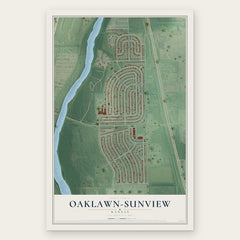
- Oaklawn-Sunview 12" x 18" / Archival Matte Print $39.99
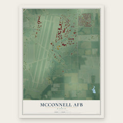
- McConnell AFB 12" x 18" / Archival Matte Print $39.99
- Haysville 12" x 18" / Archival Matte Print $39.99

More maps nearby: Mulvane, Rose Hill, Peck, Eastborough and Cessna.
The art of mapping a place
How This Map Was Made
Real places. Remarkable detail. Discover the layers that turn geographic data into a map of home.

The view from above
Aerial imagery reveals the character of the land: woodland, open fields, and the patterns of a place.

The shape of the land
Elevation data brings hills, valleys, and subtle changes in the landscape into view.

The details of home
Roads, waterways, and building footprints come together to make the map feel unmistakably local.

Geography becomes art
Considered color, shading, and typography bring the layers together in a map made for your wall.


Process illustrated with Mendon, Massachusetts. Aerial imagery: USDA NAIP. Terrain: USGS 3D Elevation Program. Map details and finished artwork: KNOWOL.
The Details
About This Print
Choose an archival matte print, or a black or white Ayous wood frame. The archival matte print is unframed.
Select your size and finish above to see the matching product image and price.
Materials & Craftsmanship
A contemporary map with the character of a classic atlas, printed on archival matte paper. Optional frames are made from Ayous wood.
Your printed map does not include the watermark shown in the full-map preview.
Shipping & Delivery
Free shipping within the United States. Every print is made to order in the USA.
Buying a gift? Add a note in your cart and we'll include it. We never put prices in the package.
Prints ship within 2 to 3 business days. Allow 7 to 10 days total from ordering for delivery. Timing may vary during holidays or periods of high order volume.
Read our shipping policy.
Returns and damaged prints
Each print is made to order. Change-of-mind refunds are not available after production.
If your print arrives damaged, misprinted or incorrect, contact support@knowol.com within 30 days of receiving it. Include your order number, photos and a description of the issue.
Read our full refund and replacement policy. For questions about your order, email support@knowol.com.