
Search for another town


Free U.S. delivery 7 to 10 days after you order
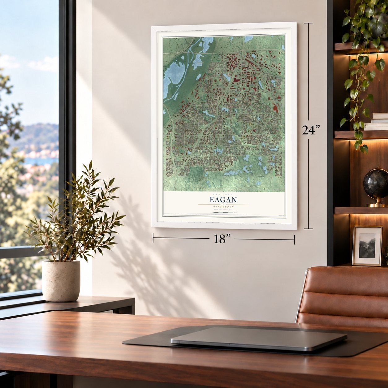
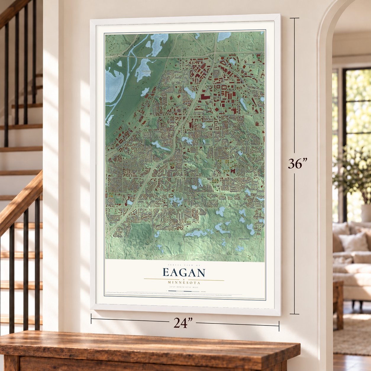
Eagan, Minnesota Map Art
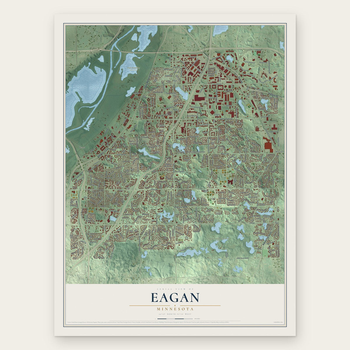
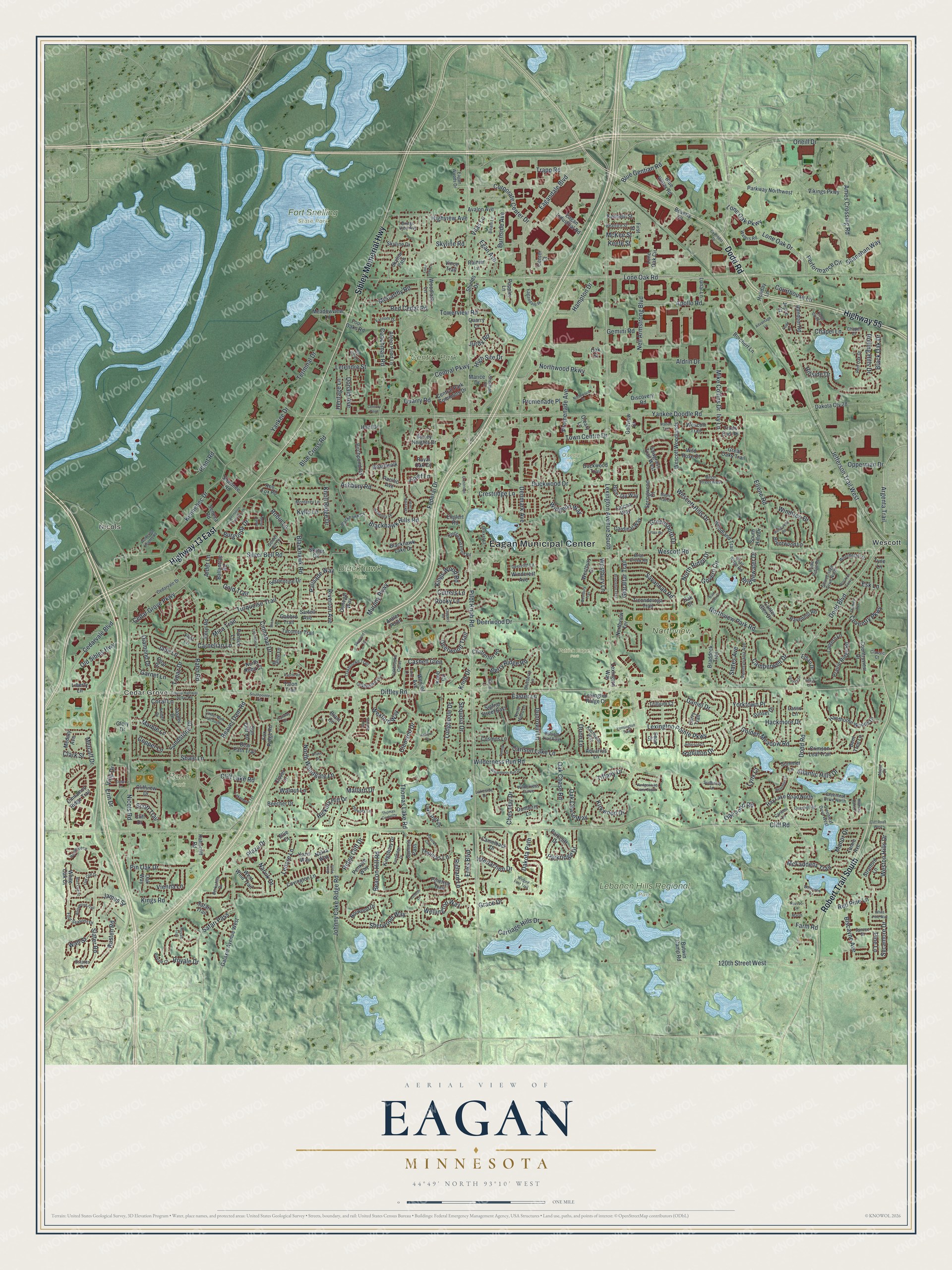
A new map of Eagan, Minnesota, made in 2026 and printed to order on thick archival matte paper.
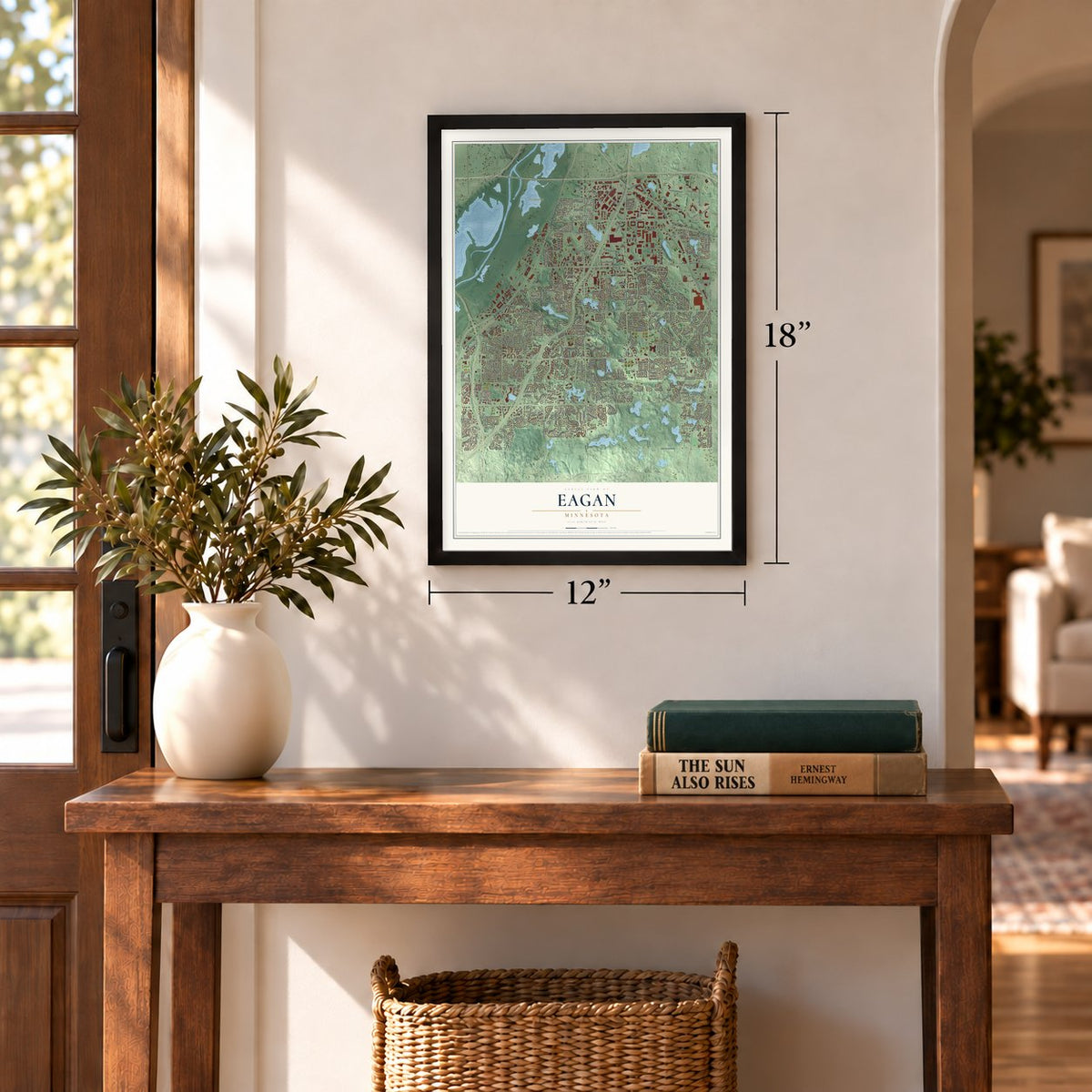
12" x 18" Archival Matte Print
A Map of Home. A Work of Art.
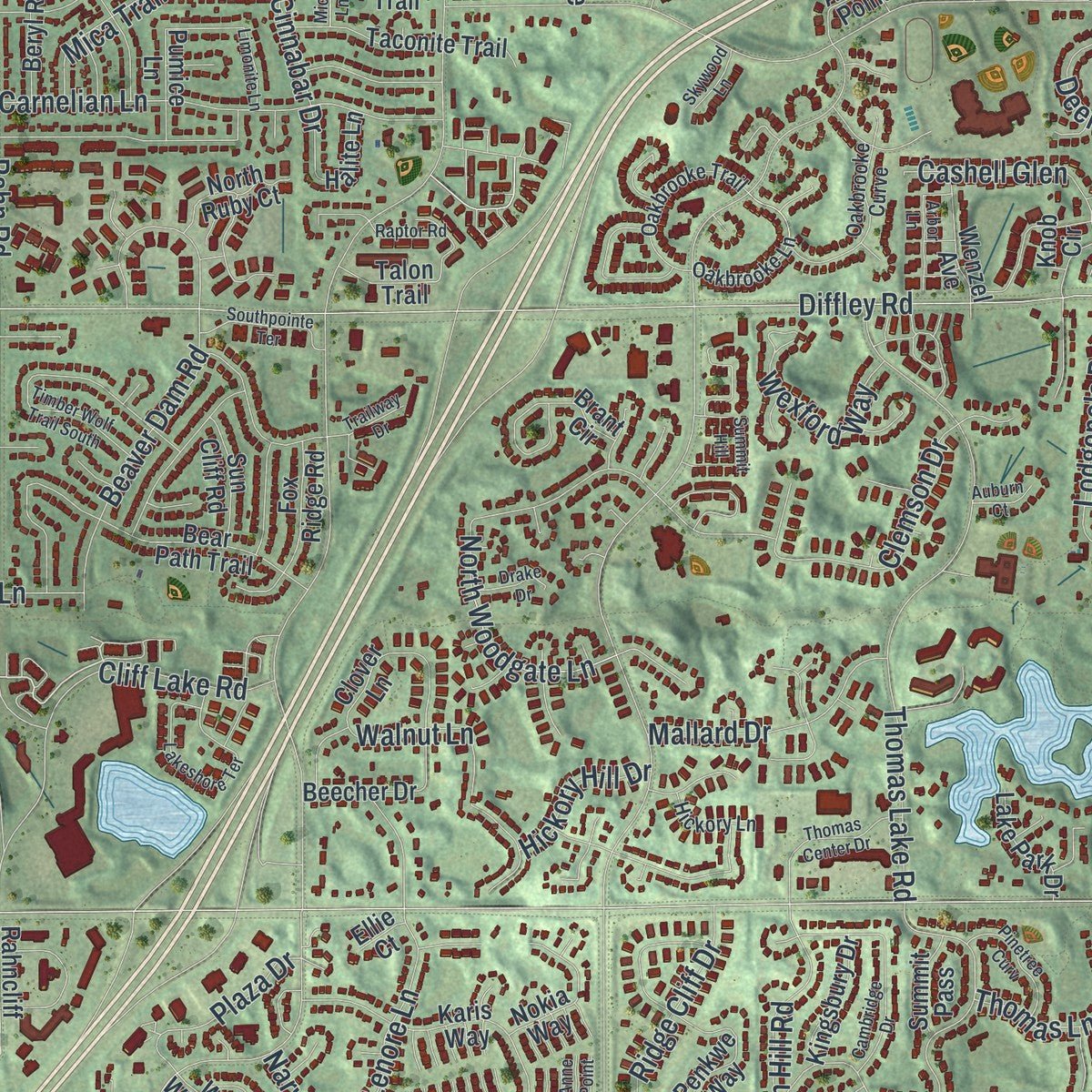
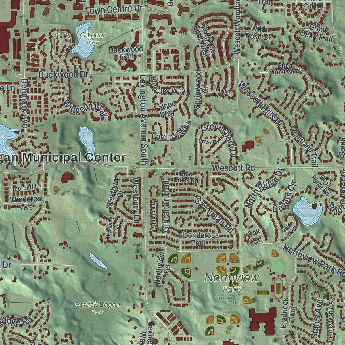
Explore Eagan, Minnesota from a whole new perspective. Created using aerial imagery and detailed geographic data, this map captures Eagan building by building, with labeled streets, familiar landmarks, and shaded topographical relief that highlights the natural contours of the landscape.
Combining modern data with the timeless character of a vintage atlas, this map is just as interesting up close as it is beautiful on the wall. Whether you grew up in Eagan, spent memorable years there, or call it home today, this unique map is a great way to celebrate a place that means something to you. Zoom in on the preview to look for your street, and then order a print to put your memories on the wall.
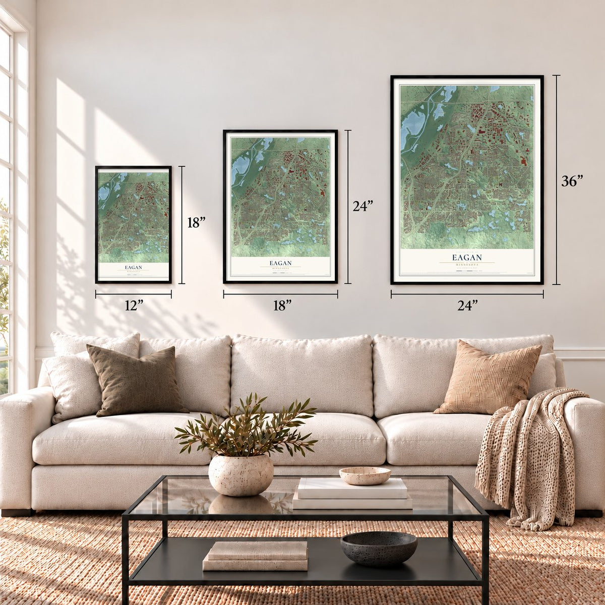
Three ways to hang it
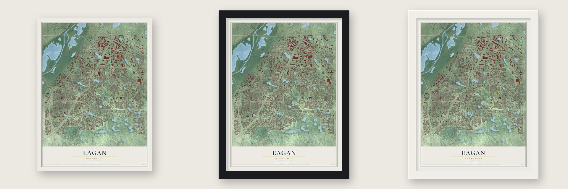
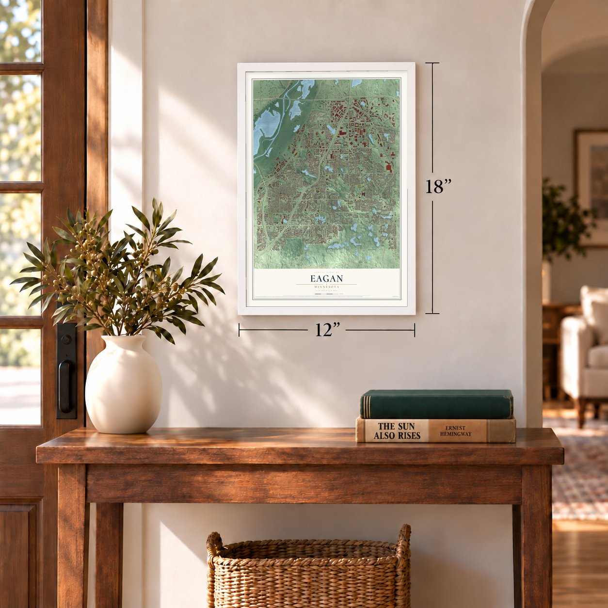
Unframed archival matte, a black wood frame or a white wood frame.
Up close
Geography Worth Displaying
This map was created using accurate cartographic data and authoritative geographic sources, including the U.S. Geological Survey and the Census Bureau. The map brings together terrain, waterways, roads, and building detail. The majority of the streets are labeled, houses are accurately depicted, and the topography is derived from government sources. Combining local data with carefully composed color and shading leads to this beautifully detailed Eagan artwork for your wall.
Rather than simply showing street outlines, we’ve included as many of the street names as we could reasonably fit on the map while keeping their names legible. Zoom in on the high resolution preview to see exactly what’s on the map. We truly set out to create a statement piece for anyone who loves Eagan. So whether it’s for you, or a gift for someone you love, we hope this map of Eagan brings back fond memories.
Read the story behind this map of Eagan, Minnesota from 2026.

About Eagan, Minnesota
Eagan is a city of 68,855 people in Dakota County, south of Saint Paul on the south bank of the Minnesota River. It is named for Patrick Eagan, who was born in 1811. He and his wife, Margaret Twohy, left County Tipperary in Ireland for Troy, New York, and married there in 1843. Around 1853 they reached Mendota. They then settled in this area on a 220-acre farm near where the town hall stands today, and Patrick was the first man to chair the town's board of supervisors.
Other Irish families farmed here too, and the township became known as the Onion Capital of the United States. Its farmers raised crops and livestock and shipped them to market by rail and over the river bridge. The town grew fastest after 1980, when Highway 77 was moved and widened and a six-lane bridge was built across the Minnesota River. Growth kept coming once the last southbound section of Interstate 35E through Eagan was finished in the mid-1980s.
- Vikings headquarters since 2018The Minnesota Vikings moved their headquarters from Eden Prairie to Eagan, onto the grounds where Northwest Airlines once had its own offices. Their training center opened in 2018 with a stadium and six practice fields, and its outdoor field seats 6,500 fans. Minnesota Aurora FC began playing its home matches at the stadium in 2022.
- A governor and a state auditorTim Pawlenty sat on the Eagan city council and represented the city in the Minnesota House before he became the state's 39th governor. Patricia Anderson, a former mayor of Eagan, served as the 17th Minnesota State Auditor from 2003 to 2007.
Find your street
Names on the Eagan map
Every name below is printed on this map. Look for your street, your school, the park where you played, or the pond down the road.
Places and landmarks12
- Eagan Municipal Center
- Nicols
- Cedar Grove
- Blackhawk Park
- Central Park
- Fort Snelling State Park
- Lebanon Hills Regional Park
- Northview Park
- O'Leary Park
- Patrick Eagan Park
- Rahn Park
- Wescott
Streets and roads444
- Dodd Road
- Sibley Memorial Highway
- Highway 13 East
- Highway 55
- Robert Trail South
- Yankee Doodle Road
- Federal Drive
- Dodd Boulevard
- Central Parkway
- Argenta Trail
- Blackhawk Hills Road
- Lexington Avenue South
- Eagandale Boulevard
- High Site Drive
- Slater Road
- Camberwell Drive
- Lone Oak Road
- Nicols Road
- Denmark Avenue
- Oneill Drive
- Cedarvale Boulevard
- Pilot Knob Road
- Diffley Road
- Cliff Road
- Blackhawk Road
- Wescott Road
- Johnny Cake Ridge Road
- Wilderness Run Road
- Rahn Road
- Deerwood Drive
Show all 444 streets
- Elrene Road
- Duckwood Drive
- Lone Oak Parkway
- Silver Bell Road
- Northview Park Road
- 120th Street West
- Carnelian Lane
- Jefferson Trail West
- Towerview Road
- Performance Circle
- Coachman Road
- Town Centre Drive
- Lone Oak Drive
- Rolling Hills Drive
- Hackmore Drive
- Thomas Lake Road
- Blue Gentian Road
- Mike Collins Drive
- Wescott Hills Drive
- Ames Crossing Road
- Kennebec Drive
- Walnut Lane
- Ashbury Road
- Beaver Dam Road
- Diamond Drive
- Interlachen Drive
- Widgeon Way
- Neil Armstrong Boulevard
- Northwood Parkway
- Carlson Lake Lane
- Turquoise Trail
- Sherwood Way
- Jade Lane
- North Woodgate Lane
- Beacon Hill Road
- Cliff Lake Road
- Promenade Avenue
- Cedar Grove Parkway
- Rocky Lane
- Clemson Drive
- Weston Hills Drive
- Lexington Pointe Parkway
- Chapel Lane
- Red Pine Lane
- Crestridge Lane
- Riverton Avenue
- Terminal Drive
- Shale Lane
- Murphy Parkway
- Savannah Road
- Lenore Lane
- Highview Avenue
- Windtree Drive
- Aldrin Drive
- Burgundy Drive
- Sandstone Drive
- Apollo Road
- Gold Trail
- Blue Cross Road
- Corporate Center Drive
- Robin Lane
- Royale Drive
- Cinnabar Drive
- McFaddens Trail
- Deerwood Trail
- Trapp Road
- Berry Ridge Road
- Burnside Avenue
- Greensboro Drive
- Safari Pass
- Easter Lane
- Hickory Hill Drive
- Coventry Parkway
- Wellington Way
- Parkridge Drive
- Carriage Hills Drive
- Cashell Glen
- Daniel Drive
- Opperman Drive
- Hamilton Drive
- Kings Wood Road
- Metcalf Drive
- Oak Chase Road
- Kings Road
- Farm Road
- Mica Trail
- North Ridge Drive
- Tiffany Drive
- Wexford Way
- Golden Meadow Road
- McCarthy Road
- Oak Chase Way
- Letendre Street
- Erin Drive
- Mallard Drive
- Govern Circle
- Lodgepole Drive
- James Street
- Oak Pond Road
- Skyline Road
- Palisade Way
- Manor Drive
- Donald Avenue
- Thomas Lane
- Atlantic Hills Drive
- Biscayne Avenue
- Vienna Lane
- Heritage Lane
- Dunrovin Lane
- Red Cedar Road
- Scott Trail
- Yankee Drive
- Ivy Lane
- Jurdy Road
- Courthouse Lane
- Marble Lane
- Sequoia Drive
- Old Sibley Highway
- Villa Drive
- Kirkwood Drive
- Egan Avenue
- Dakota Path
- Ridge Cliff Drive
- Bridgewater Drive
- Yorktown Place
- Sycamore Drive
- States Avenue
- Plaza Drive
- Quarry Road
- Promenade Place
- Westbury Lane
- Pin Oak Drive
- Rusten Road
- Ches Mar Drive
- Shanahan Way
- Knoll Ridge Drive
- Gibraltar Trail
- Hampton Drive
- Eriks Boulevard
- Vilas Lane
- Copper Lane
- Coral Lane
- Topaz Drive
- Black Oak Drive
- Wall Street
- Richard Lane
- Garnet Lane
- Violet Lane
- Gemini Road
- Narvik Drive
- Hillside Drive
- Esk Lane
- Orion Lane
- Pine Lane
- Plant Road
- McKee Street
- Kyllo Lane
- Grace Drive
- Cutters Lane
- Clark Street
- Knob Drive
- Keefe Street
- Lynx Court
- Alder Lane
- Wescott Woodlands
- Surrey Heights Drive
- Cinnamon Ridge Trail
- Cosmos Lane
- Dakota Cty 28
- Kenneth Street
- First Street
- Covington Lane
- Braddock Trail
- Galaxie Avenue West
- Blackhawk Lake Drive
- Camelback Drive
- Birchpond Road
- Woodland Trail
- Vikings Parkway
- Eagan Industrial Road
- Bear Path Trail
- Blue Jay Way
- Hawthorne Woods Drive
- Hay Lake Road North
- Taconite Trail
- Northview Terrace
- Duckwood Trail
- Penkwe Way
- Parkway Northwest
- Falcon Way
- Prairie Ridge Road
- Karis Way
- Butwin Camp Road
- Curry Trail
- Clover Lane
- Ticonderoga Trail
- Dunberry Lane
- Westbury Drive
- Norwood Drive
- Safari Trail
- Beryl Road
- Royal Oak Circle
- Nokia Way
- Brant Circle
- Cliffview Drive
- Four Oaks Road
- Countryview Drive
- Jasper Drive
- Serpentine Drive
- Trails End Road
- Cardinal Way
- Avalon Avenue
- Skyline Drive
- Sawgrass Trail West
- Great Oaks Trail
- Blue Water Road
- Golfview Drive
- Stratford Lane
- Boardwalk
- Central Park Commons Drive
- Lantern Lane
- Canter Glen Drive
- Pumice Lane
- Alden Pond Lane
- Pinetree Trail
- Chatterton Road
- Shields Drive
- Meadowview Lane
- Donegal Way
- Marice Drive
- South Hills Drive
- Parkcliff Drive
- Wescott Trail
- Crimson Leaf Trail
- Discovery Road
- Sunset Drive
- Lexington Ridge Court
- Borchert Lane
- Holiday Lane
- Lone Oak Circle
- Brentwood Lane
- Havenhill Road
- Ethan Drive
- West Wind Trail
- Sigfrid Street East
- Kingsbury Drive
- North Ruby Court
- Seneca Road
- Random Road
- Lake Park Drive
- Springwood Court
- Fox Ridge Road
- Ballantrae Road
- Wenzel Avenue
- Sun Cliff Road
- White Oak Court
- Sartell Avenue
- Lexington Way
- Woodlark Lane
- Windcrest Avenue
- Opal Drive
- Wild Rose Court
- Beecher Drive
- Shawnee Road
- Flint Lane
- Quarry Lane
- Pacific Avenue
- Cliff Drive
- Vince Trail
- Summer Lane
- Tamie Avenue
- Bent Tree Lane
- Lunar Lane
- Skater Circle
- Beverly Drive
- Skyline Path
- Gabbro Trail
- Rahncliff Road
- Trillium Court
- Oleary Lane
- Medary Avenue
- Aquarius Lane
- Talon Trail
- Englert Road
- Summit Pass
- Antler Point
- Knob Circle
- Red Fox Road
- Oak Way
- Halite Lane
- Poppler Lane
- Hunt Drive
- Liberty Lane
- Joyce Court
- Rainier Lane
- Lasso Lane
- Center Court
- Oak Street
- Tyne Lane
- Glory Drive
- Sean Court
- Ellie Court
- Oak Court
- Greenleaf Drive West
- Bridle Ridge Road
- Greenleaf Drive North
- Pennsylvania Avenue
- Cedarvale Drive
- Stonebridge Drive North
- Eagandale Place
- Kingswood Pond Road
- Balsam Trail East
- Worchester Drive
- Ashbury Place
- Four Seasons Drive
- Oakbrooke Lane
- Oakbrooke Trail
- Amber Drive
- Red Oak Drive
- Blueberry Lane
- Wilderness Curve
- Oakbrooke Curve
- Kaufmanis Way
- Waters Road
- Birch Street West
- Spruce Street
- Quail Ridge Road
- Sudberry Lane
- Farnum Drive
- Berkshire Drive
- Monterey Lane
- Briar Creek Road
- Golden Hill Terrace
- Blackhawk Cv
- Beatrice Street
- Chapel Court
- Eagan Woods Drive
- Drexel Court
- Caribou Lane
- Beam Lane
- North Nybro Lane
- Hickory Lane
- Overhill Road
- Deercliff Lane
- Royale Court
- Sherman Court
- Bridge View Avenue
- Lakeside Drive
- Classic Court
- Estates Drive
- Alicia Drive
- Northwood Drive
- Lakeshore Terrace
- Thames Avenue
- Commers Drive
- County Highway 30 Svc Road
- Wilderness Run Drive
- Lakeview Curve
- Thomas Center Drive
- White Pine Way
- Merlot Curve
- Whispering Trail
- Southpointe Terrace
- Summit Hill
- Jefferson Lane
- Stonewood Road
- Crane Creek Lane
- Trailway Drive
- Timber Wolf Trail South
- Pinetree Curv
- Clippers Road
- Wedgewood Lane South
- Dodd Lane
- Brockton Curve
- City View Drive
- Arbor Lane
- Wuthering Heights Road
- Oak Cliff Drive
- Limonite Lane
- Westwood Lane
- Princeton Trail
- Cambridge Drive
- Vermilion Court South
- Lone Oak Lane
- Hilltop Lane
- Reindeer Lane
- Winged Foot Trail
- Kensington Trail
- Burr Oak Street
- Waterview Cv
- Maple Trail Court
- Bald Lake Court
- Westbury Trail
- Svensk Lane
- Drake Drive
- Raptor Road
- Cedar Lane
- Advantage Lane
- Granite Drive
- Cliff Road West
- Crestridge Drive
- Station Trail
- Cross Road
- Skywood Lane
- Majestic Oaks Place
- Lexie Court
- Auburn Court
- Mica Lane
- Nauvoo Lane
- Royale Trail
- London Lane
- Century Point
- Marsh
- Anne Point
Names are listed as they appear on the printed map. Zoom into the product photos to find them.
The art of mapping a place
How This Map Was Made
Real places. Remarkable detail. Discover the layers that turn geographic data into a map of home.

The view from above
Aerial imagery reveals the character of the land: woodland, open fields, and the patterns of a place.

The shape of the land
Elevation data brings hills, valleys, and subtle changes in the landscape into view.

The details of home
Roads, waterways, and building footprints come together to make the map feel unmistakably local.

Geography becomes art
Considered color, shading, and typography bring the layers together in a map made for your wall.


Process illustrated with Mendon, Massachusetts. Aerial imagery: USDA NAIP. Terrain: USGS 3D Elevation Program. Map details and finished artwork: KNOWOL.
The Details
About This Print
Choose an archival matte print, or a black or white Ayous wood frame. The archival matte print is unframed.
Select your size and finish above to see the matching product image and price.
Materials & Craftsmanship
A contemporary map with the character of a classic atlas, printed on archival matte paper. Optional frames are made from Ayous wood.
Your printed map does not include the watermark shown in the full-map preview.
Shipping & Delivery
Free shipping within the United States. Every print is made to order in the USA.
Buying a gift? Add a note in your cart and we'll include it. We never put prices in the package.
Prints ship within 2 to 3 business days. Allow 7 to 10 days total from ordering for delivery. Timing may vary during holidays or periods of high order volume.
Read our shipping policy.
Returns and damaged prints
Each print is made to order. Change-of-mind refunds are not available after production.
If your print arrives damaged, misprinted or incorrect, contact support@knowol.com within 30 days of receiving it. Include your order number, photos and a description of the issue.
Read our full refund and replacement policy. For questions about your order, email support@knowol.com.
Find your town
Looking for another city?
Find a map of home in our Minnesota collection, or any town in the country.
Nearby
Maps of towns near Eagan
Know someone from one of these towns? Their map makes a great gift.
 Mendota Heights
, Minnesota
From $39.99See the map
 Mendota
, Minnesota
From $39.99See the map
 Inver Grove Heights
, Minnesota
From $39.99See the map
More maps nearby: Apple Valley, Sunfish Lake, Morris Park, Rosemount and Lilydale.