
Search for another town



Free U.S. delivery 7 to 10 days after you order
Apple Valley, Minnesota Map Art
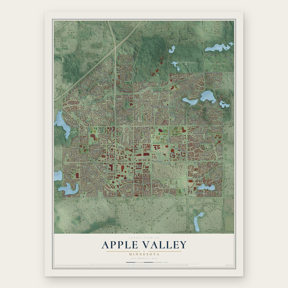
A new map of Apple Valley, Minnesota, made in 2026 and printed to order on thick archival matte paper.
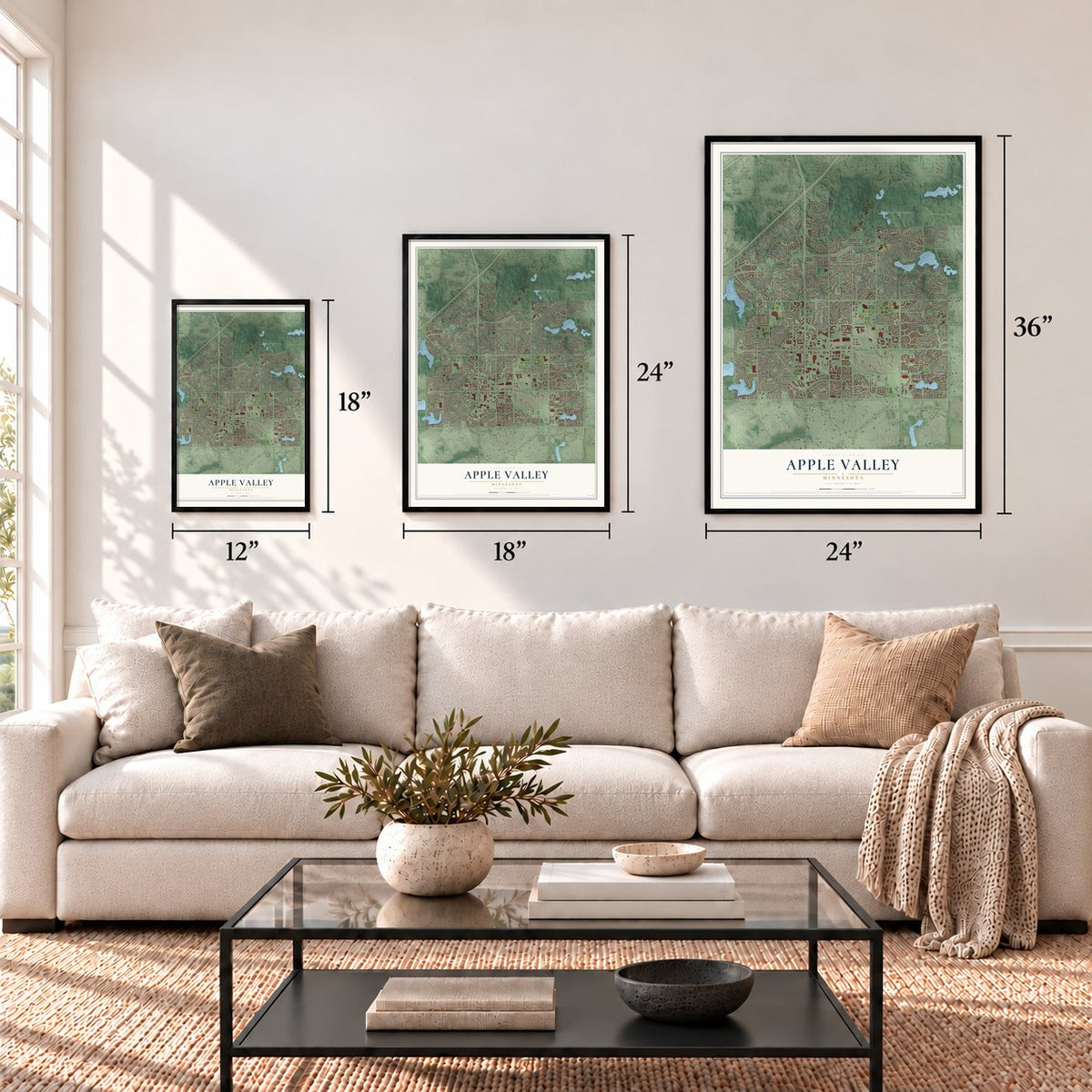
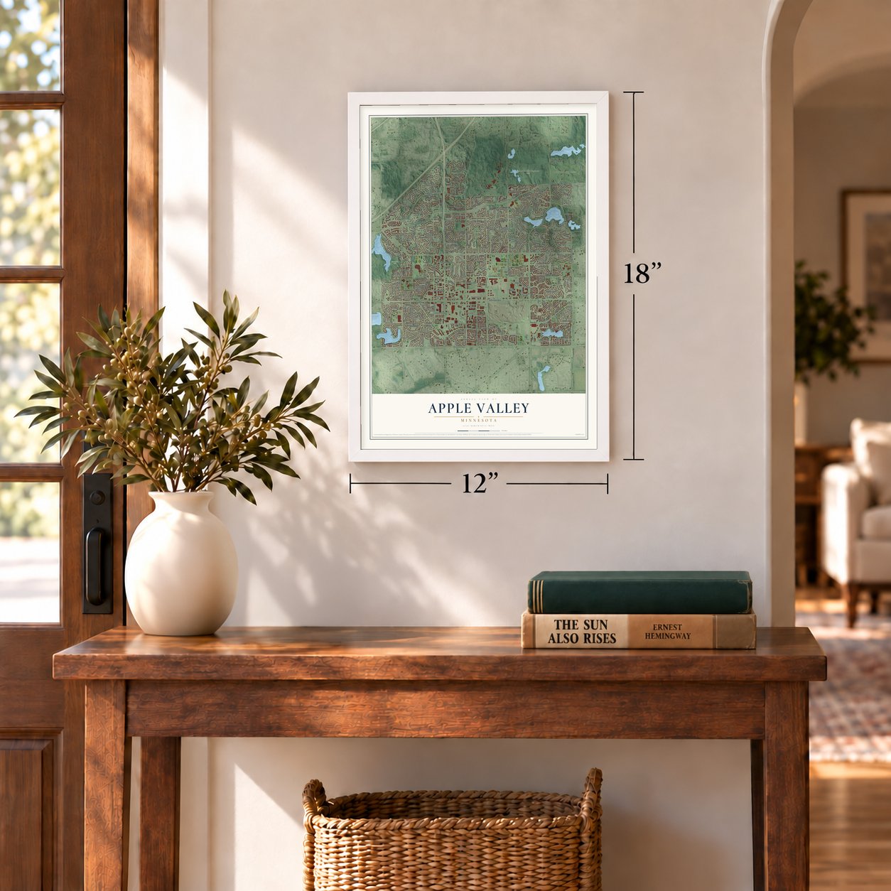
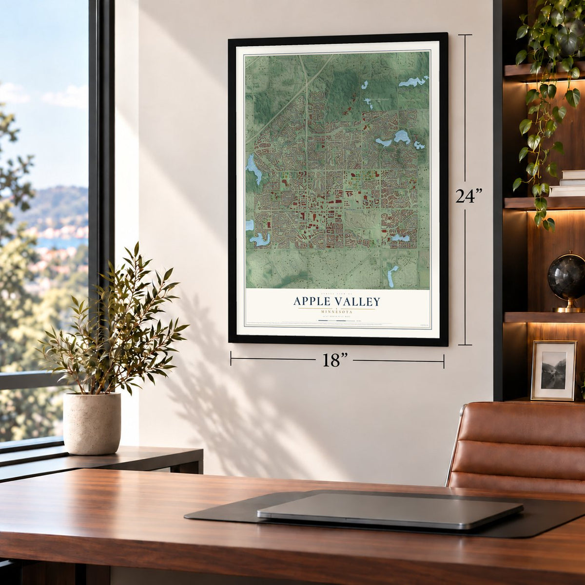
12" x 18" Archival Matte Print
A Map of Home. A Work of Art.
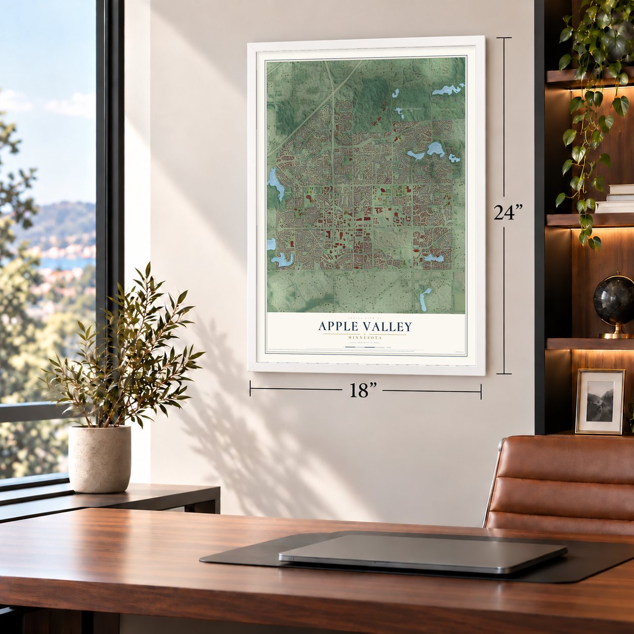
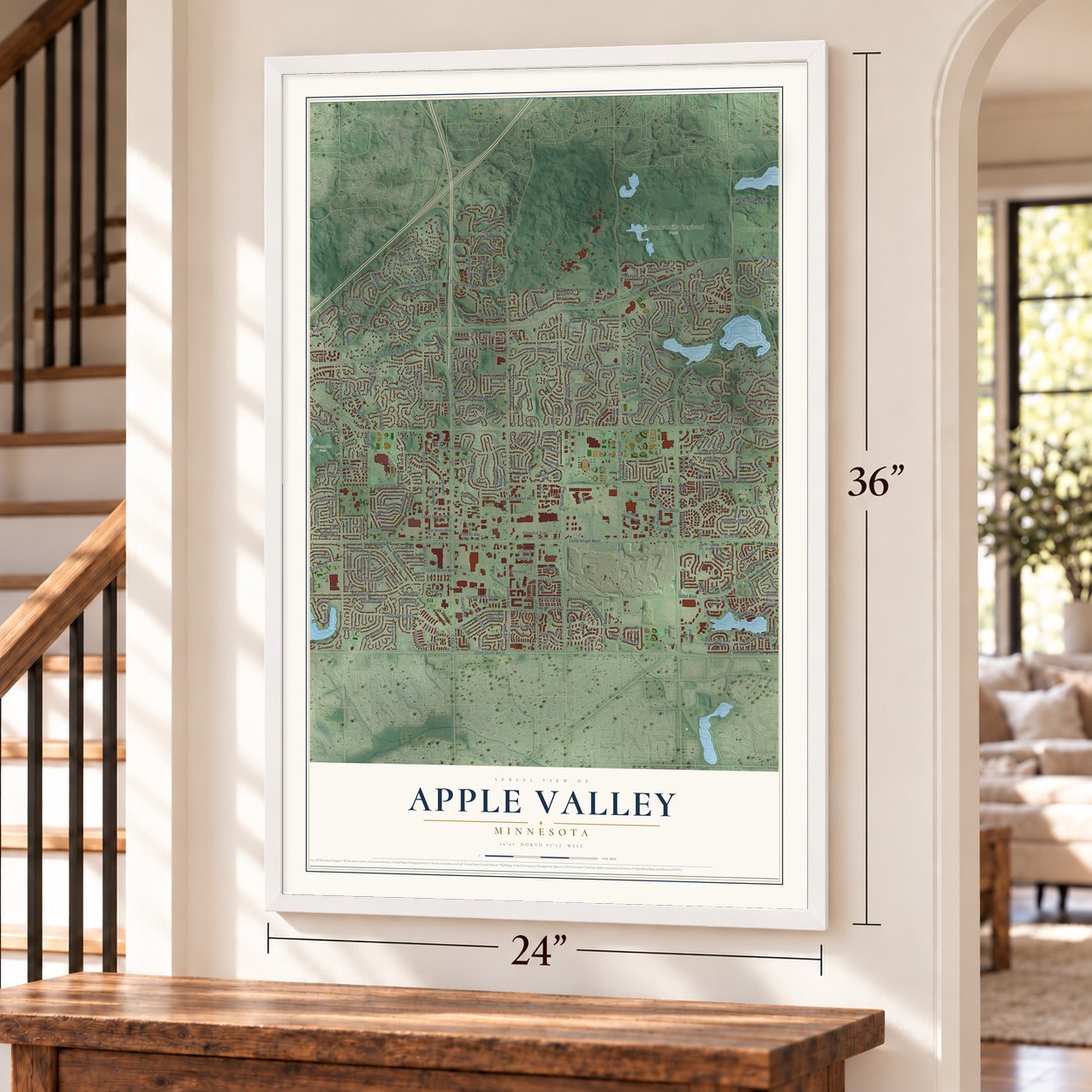
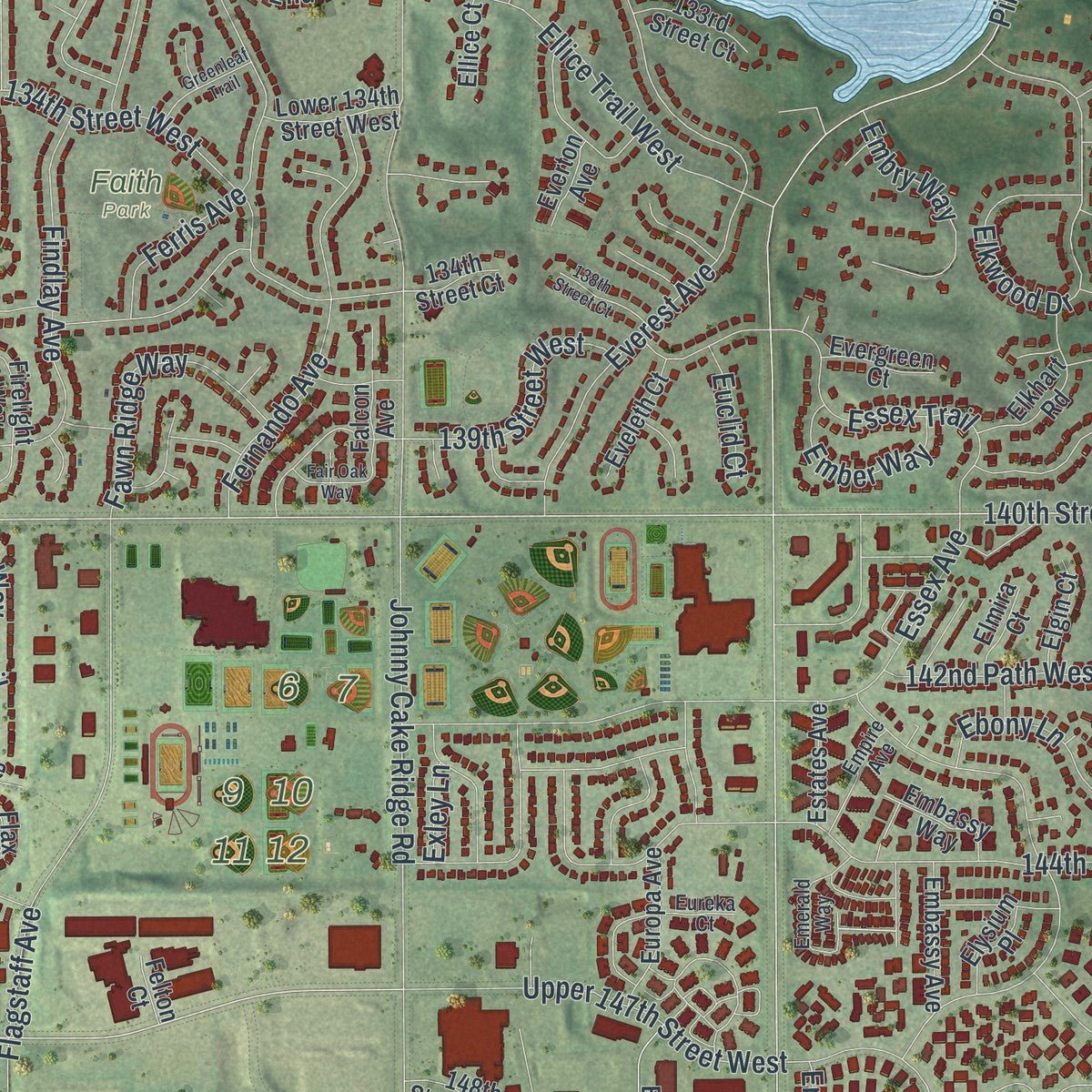
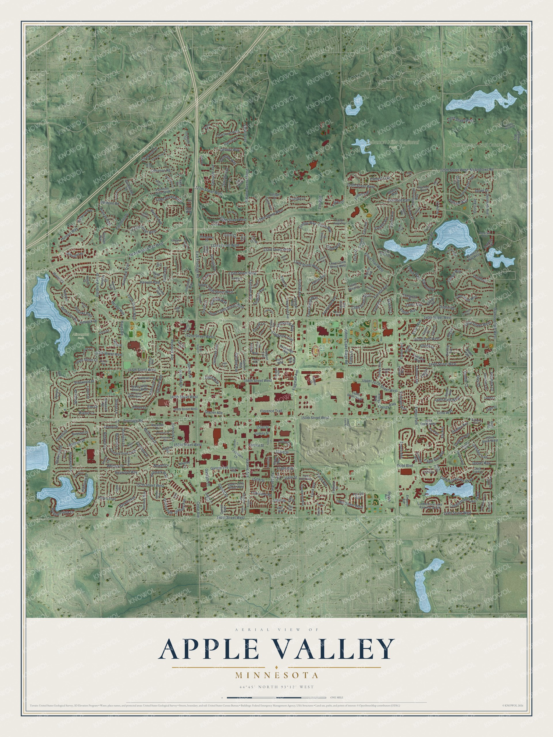
Explore Apple Valley, Minnesota from a whole new perspective. Created using aerial imagery and detailed geographic data, this map captures Apple Valley building by building, with labeled streets, familiar landmarks, and shaded topographical relief that highlights the natural contours of the landscape.
Combining modern data with the timeless character of a vintage atlas, this map is just as interesting up close as it is beautiful on the wall. Whether you grew up in Apple Valley, spent memorable years there, or call it home today, this unique map is a great way to celebrate a place that means something to you. Zoom in on the preview to look for your street, and then order a print to put your memories on the wall.
Three ways to hang it
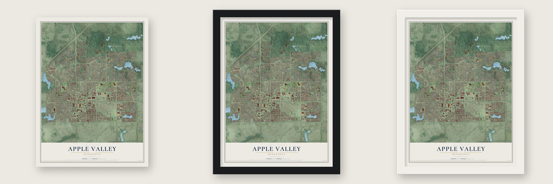
Unframed archival matte, a black wood frame or a white wood frame.
Up close
Geography Worth Displaying
This map was created using accurate cartographic data and authoritative geographic sources, including the U.S. Geological Survey and the Census Bureau. The map brings together terrain, waterways, roads, and building detail. The majority of the streets are labeled, houses are accurately depicted, and the topography is derived from government sources. Combining local data with carefully composed color and shading leads to this beautifully detailed Apple Valley artwork for your wall.
Rather than simply showing street outlines, we’ve included as many of the street names as we could reasonably fit on the map while keeping their names legible. Zoom in on the high resolution preview to see exactly what’s on the map. We truly set out to create a statement piece for anyone who loves Apple Valley. So whether it’s for you, or a gift for someone you love, we hope this map of Apple Valley brings back fond memories.
Read the story behind this map of Apple Valley, Minnesota from 2026.

About Apple Valley, Minnesota
Apple Valley is a city in Dakota County, Minnesota, with 56,374 residents recorded in the 2020 census. The area that became Apple Valley was first established in 1859 as Lebanon Township, and remained a farming community for nearly a century.
- 56,374 residentsThe 2020 census recorded this population in Apple Valley.
- Dakota CountyApple Valley is a city in this Minnesota county.
- A chapter from the pastThe area that became Apple Valley was first established in 1859 as Lebanon Township, and remained a farming community for nearly a century.
Find your street
Names on the Apple Valley map
Every name below is printed on this map. Look for your street, your school, the park where you played, or the pond down the road.
Places and landmarks6
- Alimagnet Park
- Delaney Park
- Faith Park
- Lebanon Hills Regional Park
- Valleywood Golf Course
- Energy Park
Streets and roads369
- Diamond Path
- 158th Street West
- Diamond Path West
- Guthrie Avenue
- 158th Street
- 134th Street West
- 140th Street West
- 147th Street West
- McAndrews Road
- Dodd Boulevard
- 150th Street West
- 160th Street West
- Pilot Knob Road
- Pennock Avenue
- Cedar Avenue
- Johnny Cake Ridge Road
- Flagstaff Avenue
- Galaxie Avenue West
- Garden View Drive
- 132nd Street West
- 157th Street West
- Foliage Avenue
- 125th Street West
- Garrett Avenue
- 142nd Street West
- 144th Street West
- Palomino Drive
- 145th Street West
- Embry Path
- Everest Avenue
Show all 369 streets
- Whitney Drive
- 137th Street West
- 135th Street West
- 133rd Street West
- Frontage Road
- 153rd Street West
- Walnut Lane
- 159th Street West
- 131st Street West
- Hayes Road
- Galaxie Avenue
- Findlay Avenue
- Cimarron Road
- Granada Avenue
- Gantry Lane
- Duluth Drive
- Cobblestone Lake Parkway
- Redwood Drive
- 143rd Street West
- Chaparral Drive
- Dundee Avenue
- Glazier Avenue
- Garland Avenue
- 129th Street West
- Echo Way
- Highview Drive
- Upper 147th Street West
- Eagle Bay Way
- 127th Street West
- Elkwood Drive
- 128th Street West
- Fernando Avenue
- Geneva Way
- Guild Avenue
- Germane Avenue
- Oriole Drive
- Glenda Drive
- Hunters Way
- Finch Avenue
- 141st Street West
- 146th Street West
- Dover Drive
- Flagstone Trail
- Euclid Avenue
- Strese Lane
- Genesee Avenue
- Cortland Drive
- Ellice Trail West
- Fordham Avenue
- Georgia Drive
- Emmer Place
- Ferris Avenue
- 142nd Path West
- Hayes Trail
- 130th Street West
- Florence Trail
- Heywood Way
- 126th Street West
- 157th Street
- Findlay Way
- Upper 136th Street West
- Harwell Path
- Upper 139th Street West
- Essex Avenue
- McAndrews Road West
- Essex Trail
- Dorchester Trail
- Garrett Drive
- East Frontage Road
- Drexel Way
- Havelock Trail
- Elm Drive
- Dresden Trail
- Pennock Lane
- Lowell Drive
- 153rd Street
- Hallmark Drive
- Redwell Lane
- Eveleth Avenue
- McIntosh Drive
- Harwell Avenue
- Baldwin Drive
- Dublin Road
- Fairlawn Avenue
- 151st Street
- Fjord Avenue
- Fawn Ridge Way
- Hopewell Lane
- Dunbar Court
- Ebony Lane
- Cobblstone Lake Parkway
- Dunbar Way
- Hamlet Avenue
- Hallmark Way
- 148th Path West
- Flintwood Way
- 139th Street West
- Embry Way
- Holyoke Path
- Echo Lane
- Falcon Drive
- Griffon Path
- Pinewood Drive
- Reflection Road
- Everest Trail
- Herald Way
- Hialeah Path
- Haven Drive
- Hyland Pointe Court
- 120th Street West
- Endicott Way
- Durham Way
- 144th Street Court
- Newell Drive
- Safari Pass
- Spruce Drive
- Belmont Road
- Dupont Path
- Finch Way
- Ember Way
- Gladiola Way
- Duchess Lane
- Ely Avenue
- Dory Avenue
- Folkstone Road
- Fortino Street
- Genesee Way
- Florida Lane
- Denmark Avenue
- 131st Circle
- Foxtail Lane
- Gavotte Avenue
- Gaslight Lane
- Dory Court
- Denmark Court
- Beacon Lane
- 146th Way
- 132nd Way
- Rimrock Drive
- Flight Way
- Zoo Boulevard
- Euclid Court
- Emory Avenue
- Granada Drive
- Huron Court
- 156th Street
- Flint Lane
- Exley Lane
- Flora Way
- 134th Street Court
- 152nd Street West
- Flackwood Way
- 138th Street West
- Harmony Way
- Upper 146th Street West
- Dominica Way West
- 149th Street West
- 148th Street West
- Cobblestone Lake Parkway South
- 151st Street West
- Founders Lane
- Highwood Way
- 133rd Street Court
- Energy Way
- Upper 157th Street West
- Europa Avenue
- Driftwood Lane
- Cortland Drive South
- Huntington Drive
- Easter Avenue
- Freeport Trail
- Gossamer Way
- Fleetwood Avenue
- Flower Way
- Holyoke Lane
- Eveleth Path
- 121st Street West
- Sweetwater Drive
- Florist Circle
- Footbridge Way
- Flite Way
- Haralson Drive
- 149th Court
- Hanover Lane
- Embassy Way
- Ramsdell Drive
- Palomino Drive South
- Edinborough Way
- Elkhart Road
- Heritage Way
- Fridley Way
- Duck Trail Lane
- Hershey Court
- Downey Trail
- Ely Path
- Flax Way
- Everton Avenue
- Gannon Way
- Garrett Path
- Gemstone Court
- Glen Way
- 148th Court
- Embassy Avenue
- Fair Hill Way
- Dominica Court
- Elmira Court
- Durning Avenue
- Lower 134th Street West
- Firelight Way
- Dove Trail
- Dunbar Avenue
- Linden Drive
- 132nd Court
- Eveleth Court
- Danbury Way
- Drake Path
- Floral Avenue
- Ethelton Way
- Exley Avenue
- Drexel Court
- Falcon Avenue
- Estates Avenue
- Gabella Street
- Elgin Court
- Juniper Lane
- Evergreen Court
- Emperor Avenue
- Emblem Way
- Oakwood Road
- Gurney Path
- Elysium Place
- Henna Avenue
- Whitney Court
- Guild Court
- Foliage Court
- Glazier Court
- Fairfield Drive
- Ellice Court
- English Avenue
- 141st Court
- Regent Drive
- Europa Court
- 142nd Street
- Finch Lane
- Frost Lane
- Ferris Court
- Porter Lane
- Hollins Court
- Felton Court
- Sabra Court
- Flan Court
- Emerald Way
- Guthrie Way
- Garnet Way
- Grandview Terrace
- Essex Way
- Holland Avenue
- Fireside Drive
- Dunwood Trail
- Eagle Bay Drive
- Duck Pond Way
- Frisian Lane
- Dunbar Boulevard
- Lower 147th Street West
- Jonathan Drive
- Germane Trail
- Falcon Ridge Trail
- Fleet Trail
- Glasgow Lane
- Dry Meadow Lane
- Dominica Way
- 137th Court
- 156th Street West
- Granite Avenue
- Evermoor Parkway
- 139th Court
- Empire Avenue
- Beaumont Court
- Garner Lane
- Shasta Court
- Fountain Avenue
- Edgemont Curve
- Gladstone Path
- Lane 6
- Golding Lane
- Galveston Avenue
- Gibralter Terrace
- Florissant Path
- Fresno Avenue
- Gardenia Court
- Henna Court
- Gantry Court
- Eureka Court
- Grand Oak Court
- Park Lane
- Gull Court
- Hidden Meadow Road
- Hallmark Path
- Garvin Brook Lane
- Eddy Creek Way
- 138th Street Court
- Shoshoni Trail
- Garner Way
- Gamma Way
- Minjon Drive
- Hickory Way
- Drawstone Trail
- Fountain Court
- Freesia Way
- Highview Lane
- Greenleaf Trail
- Drommond Trail
- Friday Lane
- Glenhaven Avenue
- Holyoke Court
- Foghorn Lane
- Elderberry Court
- Danbury Way West
- Gallivant Lane
- Fontana Lane
- Fair Oak Way
- Ensley Avenue
- Eastview Court
- 126th Street Court
- Butte Avenue
- Johnny Cake Road
- Firtree Lane
- Gallant Court
- Upper 129th Court
- Rome Court
- Glendale Court
- Glencove Trail
- 143rd Street Court
- Eland Court
- Kent Lane
- 144th Court
- 134th Court
- Eden Court
- Glen Court
Names are listed as they appear on the printed map. Zoom into the product photos to find them.
The art of mapping a place
How This Map Was Made
Real places. Remarkable detail. Discover the layers that turn geographic data into a map of home.

The view from above
Aerial imagery reveals the character of the land: woodland, open fields, and the patterns of a place.

The shape of the land
Elevation data brings hills, valleys, and subtle changes in the landscape into view.

The details of home
Roads, waterways, and building footprints come together to make the map feel unmistakably local.

Geography becomes art
Considered color, shading, and typography bring the layers together in a map made for your wall.


Process illustrated with Mendon, Massachusetts. Aerial imagery: USDA NAIP. Terrain: USGS 3D Elevation Program. Map details and finished artwork: KNOWOL.
The Details
About This Print
Choose an archival matte print, or a black or white Ayous wood frame. The archival matte print is unframed.
Select your size and finish above to see the matching product image and price.
Materials & Craftsmanship
A contemporary map with the character of a classic atlas, printed on archival matte paper. Optional frames are made from Ayous wood.
Your printed map does not include the watermark shown in the full-map preview.
Shipping & Delivery
Free shipping within the United States. Every print is made to order in the USA.
Buying a gift? Add a note in your cart and we'll include it. We never put prices in the package.
Prints ship within 2 to 3 business days. Allow 7 to 10 days total from ordering for delivery. Timing may vary during holidays or periods of high order volume.
Read our shipping policy.
Returns and damaged prints
Each print is made to order. Change-of-mind refunds are not available after production.
If your print arrives damaged, misprinted or incorrect, contact support@knowol.com within 30 days of receiving it. Include your order number, photos and a description of the issue.
Read our full refund and replacement policy. For questions about your order, email support@knowol.com.
Find your town
Looking for another city?
Find a map of home in our Minnesota collection, or any town in the country.
Nearby
Maps of towns near Apple Valley
Know someone from one of these towns? Their map makes a great gift.
 Burnsville
, Minnesota
From $39.99See the map
 Eagan
Eagan, Minnesota
From $39.99See the map
 Lakeville
, Minnesota
From $39.99See the map
More maps nearby: Farmington, Rosemount, Empire, Bloomington and Savage.