
Search for another town





Free U.S. delivery 7 to 10 days after you order
Burnsville, Minnesota Map Art
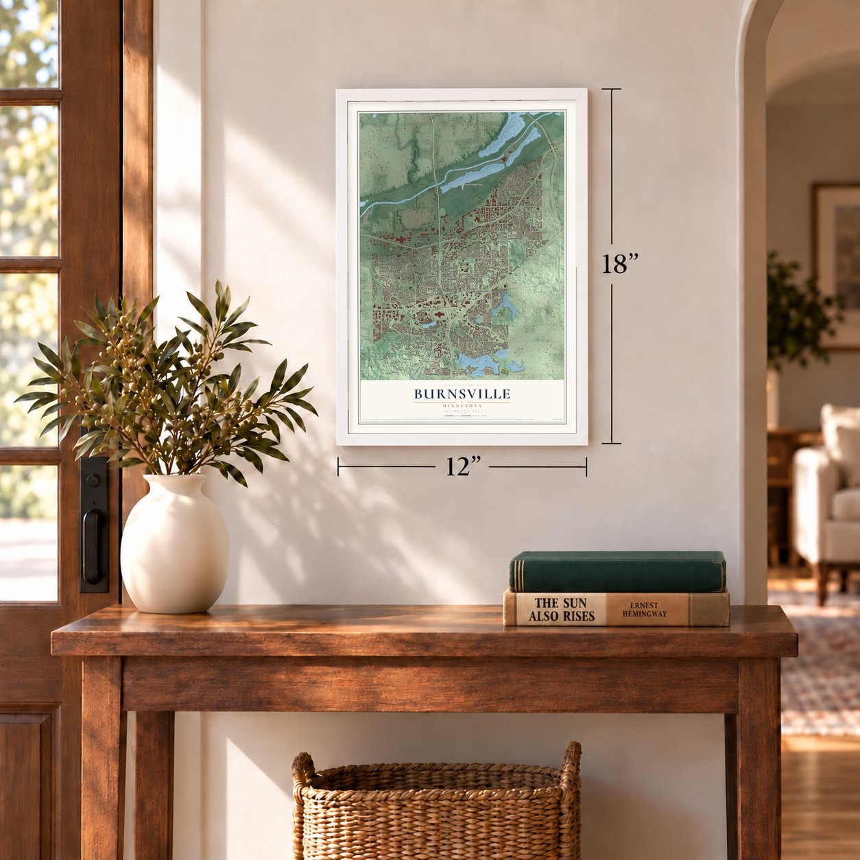
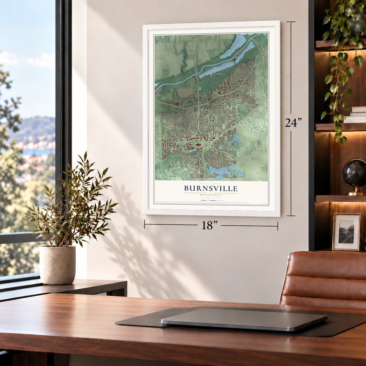
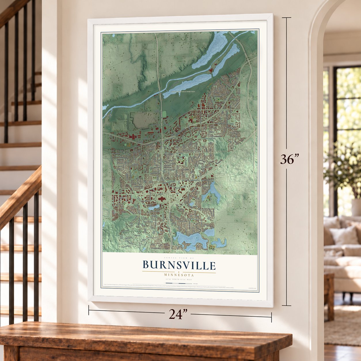
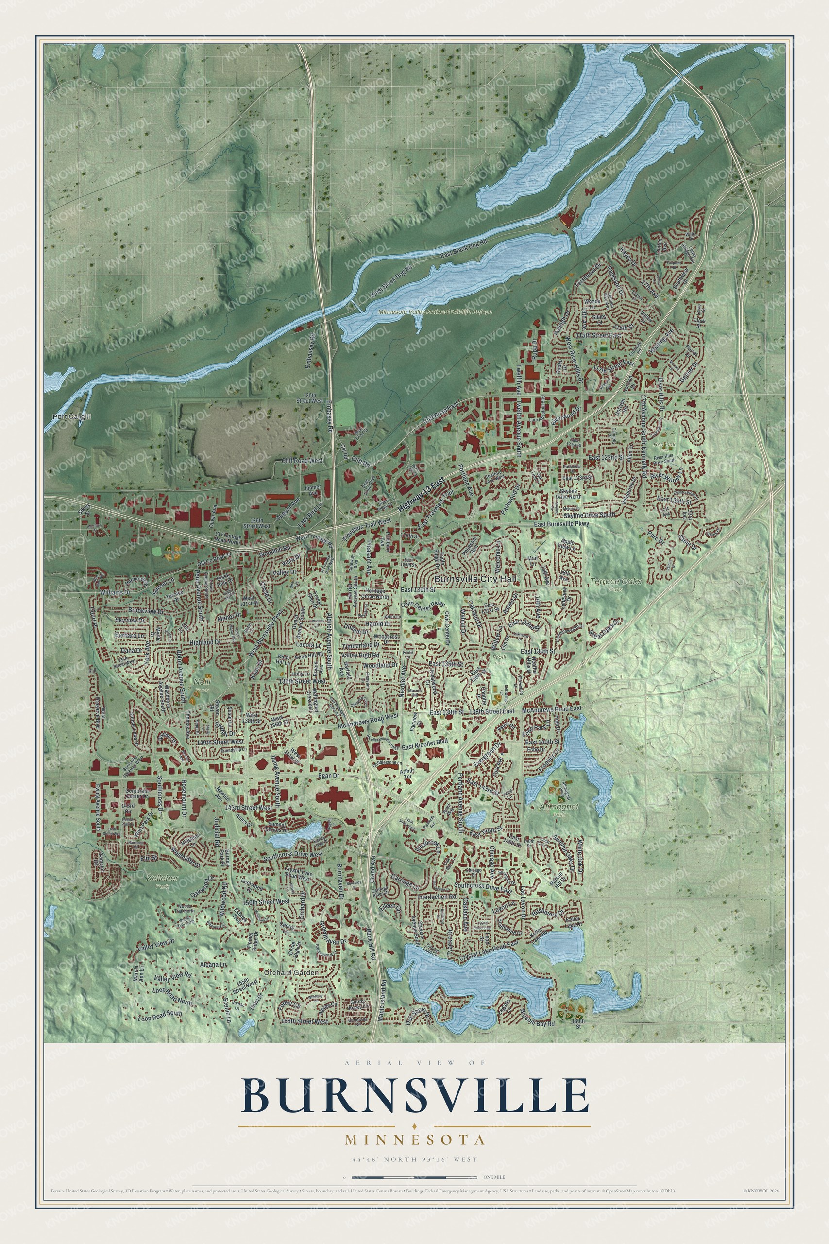
A new map of Burnsville, Minnesota, made in 2026 and printed to order on thick archival matte paper.
12" x 18" Archival Matte Print
A Map of Home. A Work of Art.
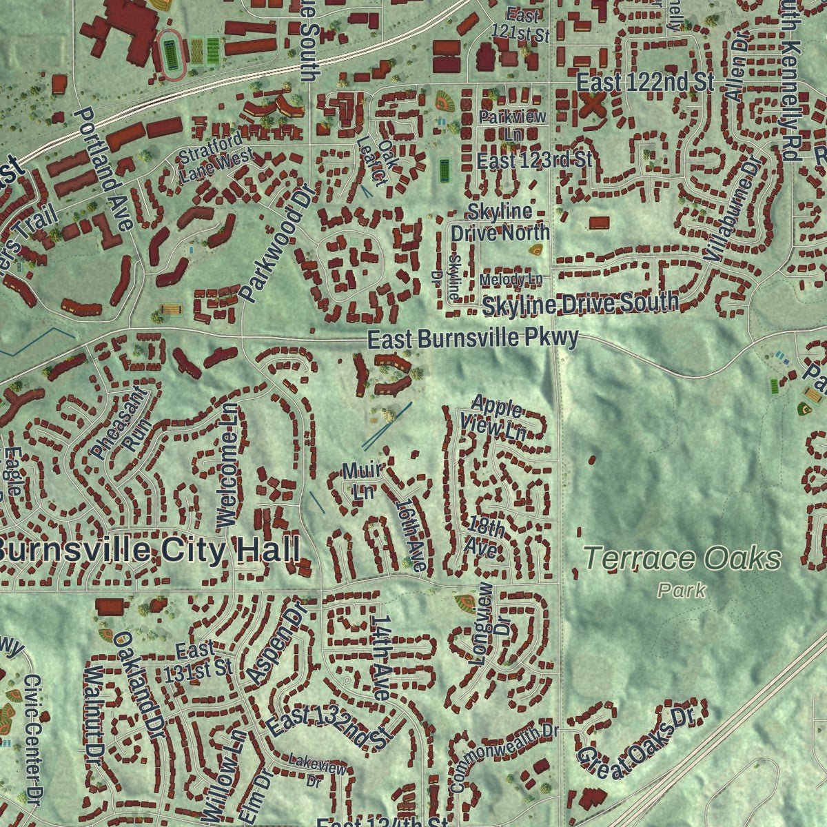
Explore Burnsville, Minnesota from a whole new perspective. Created using aerial imagery and detailed geographic data, this map captures Burnsville building by building, with labeled streets, familiar landmarks, and shaded topographical relief that highlights the natural contours of the landscape.
Combining modern data with the timeless character of a vintage atlas, this map is just as interesting up close as it is beautiful on the wall. Whether you grew up in Burnsville, spent memorable years there, or call it home today, this unique map is a great way to celebrate a place that means something to you. Zoom in on the preview to look for your street, and then order a print to put your memories on the wall.
Three ways to hang it
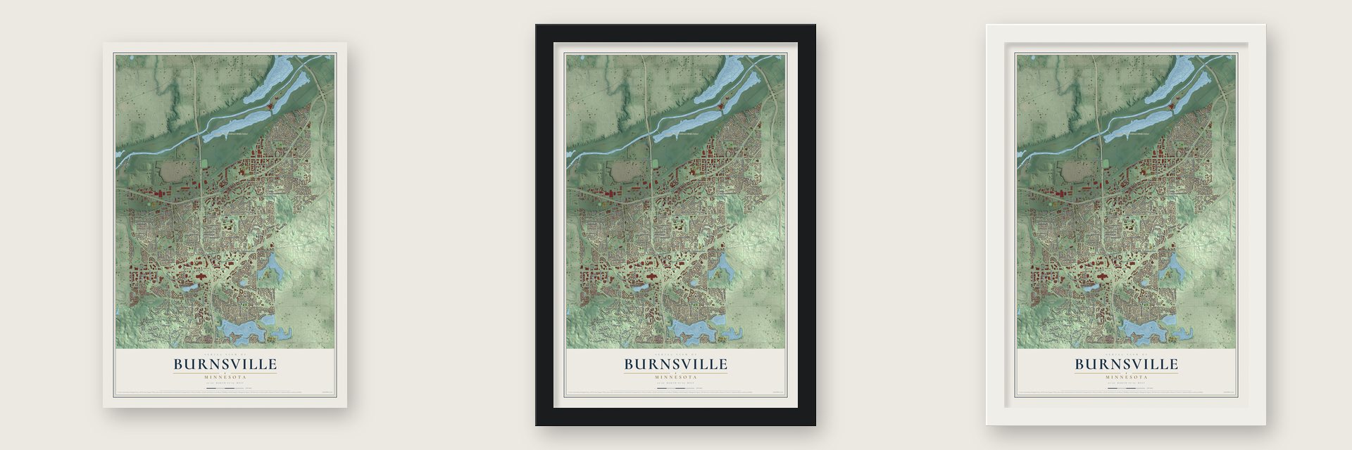
Unframed archival matte, a black wood frame or a white wood frame.
Up close
Geography Worth Displaying
This map was created using accurate cartographic data and authoritative geographic sources, including the U.S. Geological Survey and the Census Bureau. The map brings together terrain, waterways, roads, and building detail. The majority of the streets are labeled, houses are accurately depicted, and the topography is derived from government sources. Combining local data with carefully composed color and shading leads to this beautifully detailed Burnsville artwork for your wall.
Rather than simply showing street outlines, we’ve included as many of the street names as we could reasonably fit on the map while keeping their names legible. Zoom in on the high resolution preview to see exactly what’s on the map. We truly set out to create a statement piece for anyone who loves Burnsville. So whether it’s for you, or a gift for someone you love, we hope this map of Burnsville brings back fond memories.
Read the story behind this map of Burnsville, Minnesota from 2026.

About Burnsville, Minnesota
Burnsville is a city of 64,317 people in Dakota County, on a bluff above the south bank of the Minnesota River. Around 1750 Chief Black Dog moved his band of Mdewakanton Dakota down from the Mille Lacs Lake area and set up a permanent village between the river and the lake that now carries his name, and early settlers counted more than 250 people living there. The Dakota gave up the land in 1851, and many moved to Chief Shakopee's village at Prior Lake.
Irish farmers came next: William Byrne and settlers named Nixon, Woodruff, McCoy and Martin arrived in 1852. On May 11, 1858, the area became a township, among the first 17 that Dakota County formed, spelled Byrnesville, though the town clerk wrote the name both as Burns and as Byrne. It was still a quiet farm township of 583 people in 1950, with eight grades taught in one room. Interstate 35W arrived in 1960, and in 1964 the township defeated an annexation attempt by Bloomington and incorporated as a city, with Burnsville as the winning spelling.
- Named for William ByrneWilliam Byrne left County Kilkenny, Ireland, in 1840 for Hamilton, Ontario, before coming here to farm. He donated ground for a church, a school and a burial ground, and he led the town as its chairman. His name went into the records as Burns and was never fixed. In the 1960s a relative who dedicated William Byrne Elementary thought about asking for the spelling to be corrected, but most of the family had moved away decades before.
- How Buck Hill got its nameCrystal Lake, at the south end of Burnsville, was a Dakota place for fishing, leisure and burial. From the hilltop above it, people watched deer come down to drink, and early settlers who saw the bucks there named it Buck Hill. Today it is a ski peak with a 310-foot vertical drop.
- A lake resort after 1864Rail service reached Burnsville in 1864, and the town turned into a summer resort, with vacation cottages lining the shore of Crystal Lake. The Bloomington Ferry carried travelers across the Minnesota River until the first Bloomington Ferry Bridge was built in 1889. By 1920 the Lyndale Avenue Drawbridge beside Black Dog Lake carried Minneapolis's first north-south highway on to the farm towns of southern Minnesota.
- The longest fire truck paradeThe Burnsville Fire Muster began in the 1970s as a short parade showing off a local collector's fire equipment, and it became a yearly event in 1980. Borrowing the New England fire muster tradition, it now brings a big parade, concerts and fireworks every August or September. In 2004 the Guinness Book of World Records named its fire truck parade the longest of its kind in the world.
Find your street
Names on the Burnsville map
Every name below is printed on this map. Look for your street, your school, the park where you played, or the pond down the road.
Places and landmarks10
- Burnsville City Hall
- Orchard Garden
- Alimagnet Park
- Kelleher Park
- Minnesota Valley National Wildlife Refuge
- Neill Park
- Red Oak Park
- Terrace Oaks Park
- Wolk Park
- Port Cargill
Streets and roads329
- Highway 13 East
- Judicial Road
- West Burnsville Parkway
- Southcross Drive West
- East Burnsville Parkway
- Cliff Road East
- Nicollet Avenue
- Southcross Drive
- McAndrews Road West
- 140th Street West
- East 138th Street
- McAndrews Road East
- Cliff Road West
- 138th Street East
- Cliff Road
- Southcross Drive East
- Carriage Lane
- Rosemount Drive
- 158th Street West
- Summit Oaks Drive
- Egan Drive
- Parkwood Drive
- Maple Island Road
- Grand Avenue
- Eileen Circle
- Crystal Lake Road East
- Evergreen Drive
- Loop Road North
- Elm Street
- Portland Avenue
Show all 329 streets
- Riverwood Drive
- Woodhill Road
- Civic Center Parkway
- East Black Dog Road
- River Hills Drive
- Buck Hill Road
- Portland Avenue South
- Burnhaven Drive
- East 134th Street
- Lac Lavon Drive
- East 130th Street
- 136th Street West
- Irving Avenue South
- Aldrich Avenue South
- Williams Drive
- Oakland Drive
- Upton Avenue South
- West Black Dog Road
- East Travelers Trail
- Highland Drive
- East 122nd Street
- Kennelly Road
- Rushmore Drive
- East 125th Street
- Galtier Drive
- 150th Street West
- Travelers Trail West
- Chicago Avenue
- Hayes Drive
- Loop Road South
- Brookview Drive
- Penn Avenue South
- Dupont Avenue
- Embassy Road
- York Avenue
- Lacota Lane
- Twelfth Avenue South
- East Nicollet Boulevard
- Greenhaven Drive
- Frontier Lane
- East 132nd Street
- Shirley Drive
- West River Hills Drive
- Westcliffe Drive
- Dana Drive
- 143rd Street West
- Lady Bird Lane
- Bluebill Bay Road
- Court Place
- Circle Drive
- 117th Street East
- Valley View Drive
- Orchard Drive
- Valley Drive
- Skyline Drive South
- Parc Drive
- Radisson Drive
- White Oak Drive
- 115th Street East
- Wildwood Road
- Aspen Drive
- Welcome Lane
- Raleigh Drive
- East 143rd Street
- Knox Drive
- East 145th Street
- 27th Avenue
- Timberland Drive
- Pleasant Avenue
- Valley High Road
- Tyacke Drive
- River Woods Lane
- Harold Drive
- East 135th Street
- Woodland Drive
- Territorial Drive
- Oakwood Drive
- Walnut Drive
- 27th Avenue South
- Innsbrook Lane
- Interlachen Road
- Valley View Road
- Great Oaks Drive
- Skyview Drive
- Embassey Road
- Oak Shore Drive
- Echo Park Lane
- Sunset Lane
- Oakland Avenue
- 19th Avenue
- Sable Drive
- East 140th Street
- Manor Drive
- Forest Circle
- Rupp Drive
- Scenic Lane
- Keating Avenue
- Lavon Lane
- Barbara Lane
- Unique Drive
- Twelfth Avenue
- Willow Lane
- Alcana Lane
- 114th Street
- 14th Avenue
- Vista Drive
- Camelot Road
- Clif Road
- Park Avenue
- Terrace Drive
- Horizon Drive
- Krestwood Drive
- Crystal Lake Road West
- 155th Street West
- West Preserve Boulevard
- Oliver Avenue
- Corporate Center Drive
- Sunset Lake Drive
- Washburn Avenue South
- Civic Center Drive
- Allen Drive
- 13 Frontage Road North
- Circle High Drive
- West Frontage Road
- Apple View Lane
- Eagle Ridge Drive
- West 139th Street
- East 131st Street
- West Park Drive
- East 123rd Street
- Thomas Avenue
- Knob Hill Road
- Girard Avenue South
- Summit Shores Drive
- Fairview Drive
- Pheasant Run
- Ewing Avenue South
- Crest Drive
- Horizon Road
- Harriet Avenue South
- Stevens Avenue South
- Aston Circle
- Wellington Crescent
- Cherry Lane
- Heritage Circle North
- Steven Road
- Villaburne Drive
- Southwind Drive
- Old County Road 34
- 16th Avenue
- Keller Lake Drive
- Heather Hills Drive
- Deerwood Drive
- Newton Avenue
- 126th Street West
- Boulder Drive
- Pillsbury Avenue
- West 141st Street
- Black Hills Drive
- Burnell Park Drive
- Keller Lake Road
- Longview Drive
- 120th Street West
- Sunny Acres Lane
- Hillshire Lane
- Perrot Lane
- Country Place
- Harmony Circle
- East 146th Street
- Alpine Circle
- 18th Avenue
- Estates Trail
- Southview Drive
- Forest Glen Drive
- Woodcrest Drive
- Garfield Avenue
- Logarto Lane
- Susan Lane
- East 136th Street
- Bryant Avenue
- Skyline Drive North
- Echo Drive
- West 131st Street
- Woods Lane
- 125th Street
- High Drive
- West 138th Street
- Myrtle Drive
- Timber Ridge Drive
- Marcia Ann Lane
- Ames Drive
- Arthur Terrace
- Jimmer Avenue
- Holly Lane
- Parson Hill Drive
- Elm Lane
- Elm Drive
- Lead Street
- Muir Lane
- 143rd Circle
- 33rd Avenue
- Valley Court
- Clark Street
- Rodeo Drive
- Clifton Avenue
- Knob Hill Lane
- 160th Street
- Sibley Court
- Sibley Street
- Burnsville Parkway West
- 146th Street
- River Ridge Boulevard
- Friendship Lane
- Alimagnet Parkway
- Larc Industrial Boulevard
- Burnsville Circle
- Pleasant Lane
- Oliver Avenue South
- Carver Court
- Slater Lane
- Commonwealth Drive
- Arbor Lane
- 134th Street West
- Gateway Boulevard
- Marcin Hill
- Parkwood Lane
- Frontage Road
- River Hills Drive South
- Stratford Lane West
- Carriage Place Drive
- Springhill Drive
- Cobblestone Lane
- Zebulon Pike Avenue
- Crystal Lake Circle
- Earley Lake Place
- Leisure Lane
- River Ridge Lane
- Chicago Drive
- Oak Run Lane
- East 121st Street
- Cedar Bridge Avenue
- Wood Way
- Woods Trail North
- Tiffany Court
- East 129th Street
- Connelly Drive
- 31st Avenue
- Parkview Lane
- Sumac Lane
- West 121st Street
- Scott Street
- Oak Leaf Court
- 143rd Lane
- Willie Drive
- Lewis Court
- Knoll Lane
- Rambush Road
- Lakeview Drive
- 35 Frontage Road West
- Greenhaven Way
- Woods Trail South
- Viewcrest Lane
- East Wellington Crescent
- Butternut Lane
- McLeod Street
- Nicollet Boulevard West
- Oakwood Curve
- Hillside Lane
- 152nd Street East
- Country Wood Drive
- London Drive
- Interlachen Lane
- Plymouth Avenue
- 145th Street East
- Foxpoint Road
- Millpond Avenue
- Eagle Bluff Drive
- Summerset Lane
- Hollow Park Lane
- East Manor Boulevard
- 145th Street West
- Willoway Circle
- Wildwood Court
- Girard Avenue
- Rose Bluff Boulevard
- Forest Park Lane
- Boulder Way
- Skyline Drive
- Pleasant Place
- Burkards Drive
- Fellowship Lane
- Melody Lane
- Vivian Drive
- Hamilton Street
- Wood Lake Drive
- Regent Lane
- Rainier Court
- Shelly Lane
- Ivy Terrace
Names are listed as they appear on the printed map. Zoom into the product photos to find them.
The art of mapping a place
How This Map Was Made
Real places. Remarkable detail. Discover the layers that turn geographic data into a map of home.

The view from above
Aerial imagery reveals the character of the land: woodland, open fields, and the patterns of a place.

The shape of the land
Elevation data brings hills, valleys, and subtle changes in the landscape into view.

The details of home
Roads, waterways, and building footprints come together to make the map feel unmistakably local.

Geography becomes art
Considered color, shading, and typography bring the layers together in a map made for your wall.


Process illustrated with Mendon, Massachusetts. Aerial imagery: USDA NAIP. Terrain: USGS 3D Elevation Program. Map details and finished artwork: KNOWOL.
The Details
About This Print
Choose an archival matte print, or a black or white Ayous wood frame. The archival matte print is unframed.
Select your size and finish above to see the matching product image and price.
Materials & Craftsmanship
A contemporary map with the character of a classic atlas, printed on archival matte paper. Optional frames are made from Ayous wood.
Your printed map does not include the watermark shown in the full-map preview.
Shipping & Delivery
Free shipping within the United States. Every print is made to order in the USA.
Buying a gift? Add a note in your cart and we'll include it. We never put prices in the package.
Prints ship within 2 to 3 business days. Allow 7 to 10 days total from ordering for delivery. Timing may vary during holidays or periods of high order volume.
Read our shipping policy.
Returns and damaged prints
Each print is made to order. Change-of-mind refunds are not available after production.
If your print arrives damaged, misprinted or incorrect, contact support@knowol.com within 30 days of receiving it. Include your order number, photos and a description of the issue.
Read our full refund and replacement policy. For questions about your order, email support@knowol.com.
Find your town
Looking for another city?
Find a map of home in our Minnesota collection, or any town in the country.
Nearby
Maps of towns near Burnsville
Know someone from one of these towns? Their map makes a great gift.
 Apple Valley
, Minnesota
From $39.99See the map
 Savage
, Minnesota
From $39.99See the map
 Bloomington
, Minnesota
From $39.99See the map
More maps nearby: Lakeville, Eagan, Richfield, Credit River and Prior Lake.