
Search for another town





Free U.S. delivery 7 to 10 days after you order
Lakeville, Minnesota Map Art
A new map of Lakeville, Minnesota, made in 2026 and printed to order on thick archival matte paper.
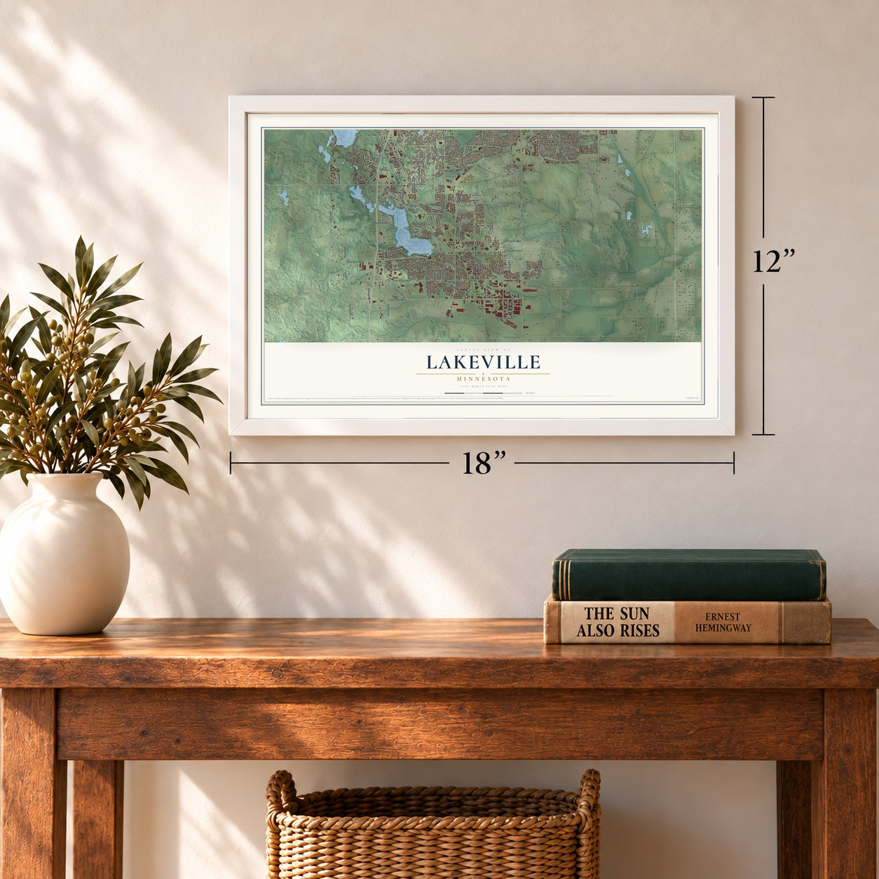
12" x 18" Archival Matte Print
A Map of Home. A Work of Art.
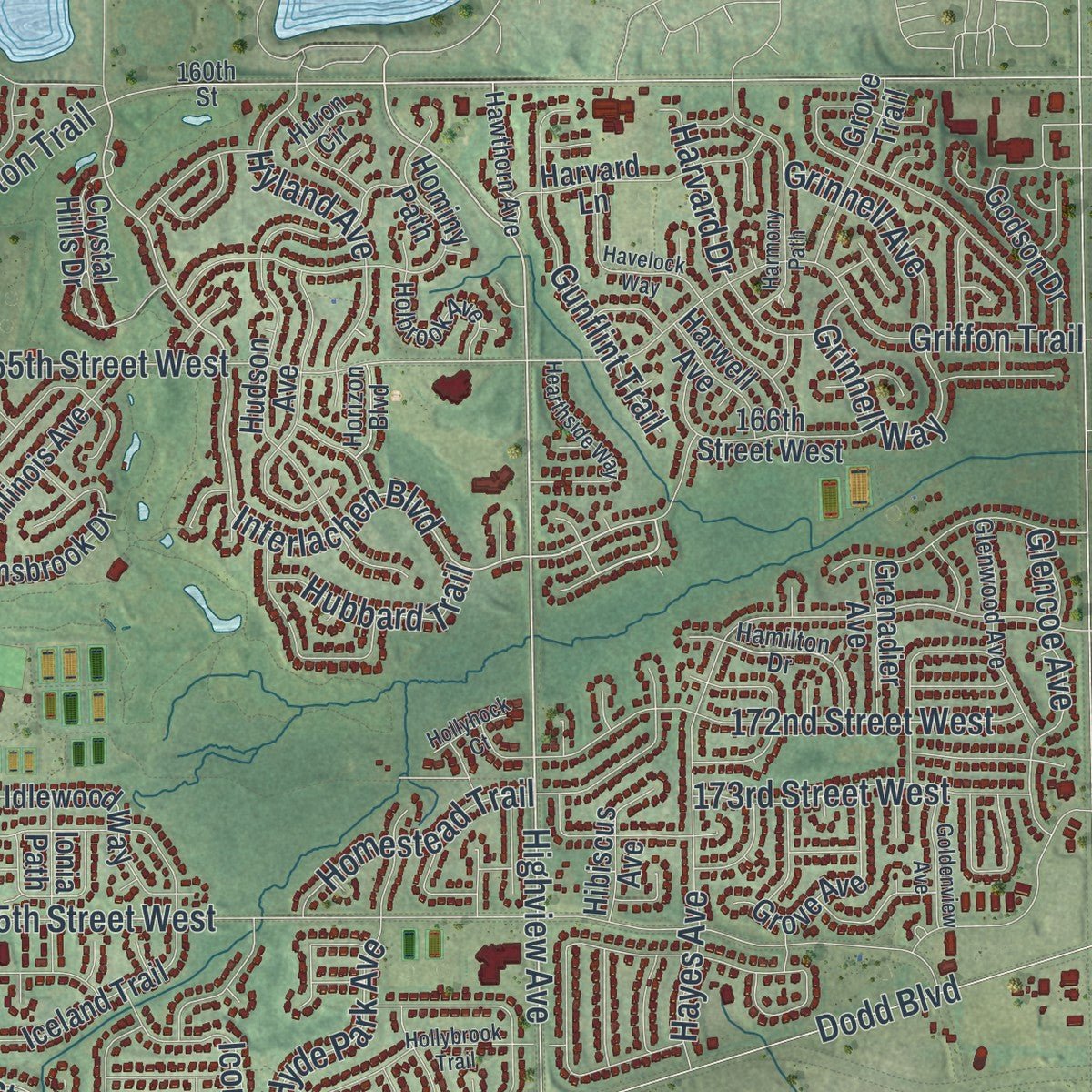
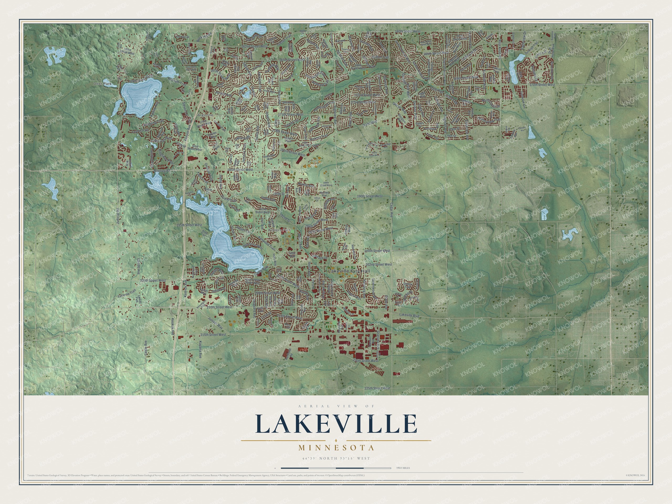
Explore Lakeville, Minnesota from a whole new perspective. Created using aerial imagery and detailed geographic data, this map captures Lakeville building by building, with labeled streets, familiar landmarks, and shaded topographical relief that highlights the natural contours of the landscape.
Combining modern data with the timeless character of a vintage atlas, this map is just as interesting up close as it is beautiful on the wall. Whether you grew up in Lakeville, spent memorable years there, or call it home today, this unique map is a great way to celebrate a place that means something to you. Zoom in on the preview to look for your street, and then order a print to put your memories on the wall.
Three ways to hang it
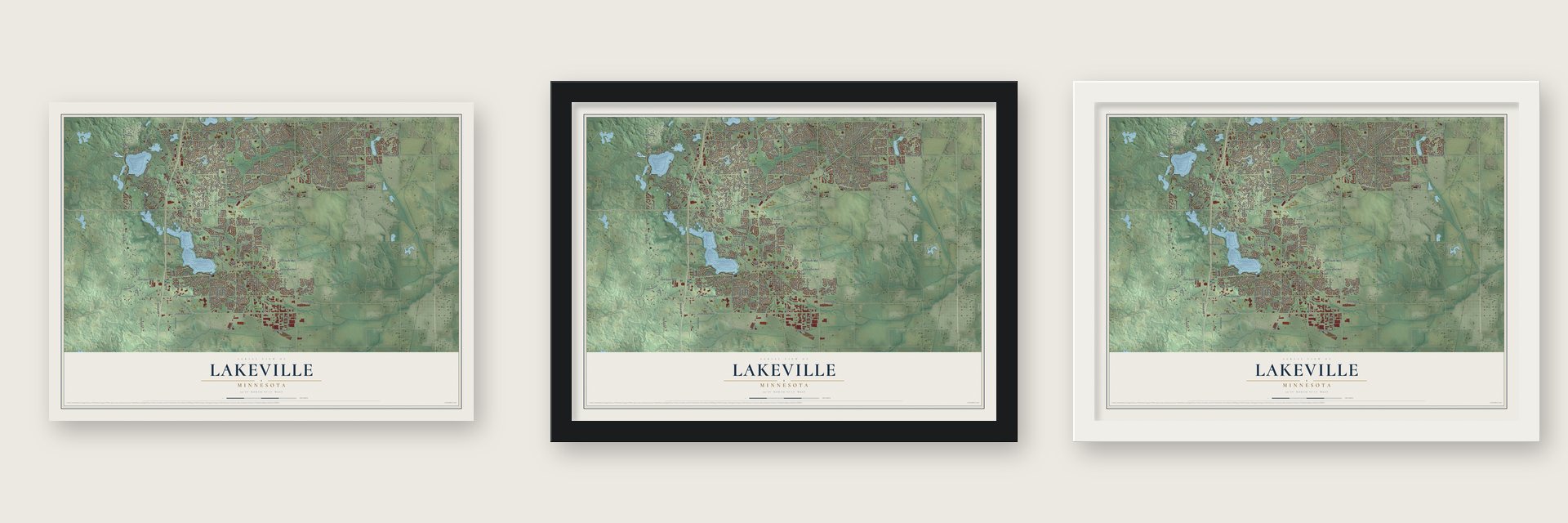
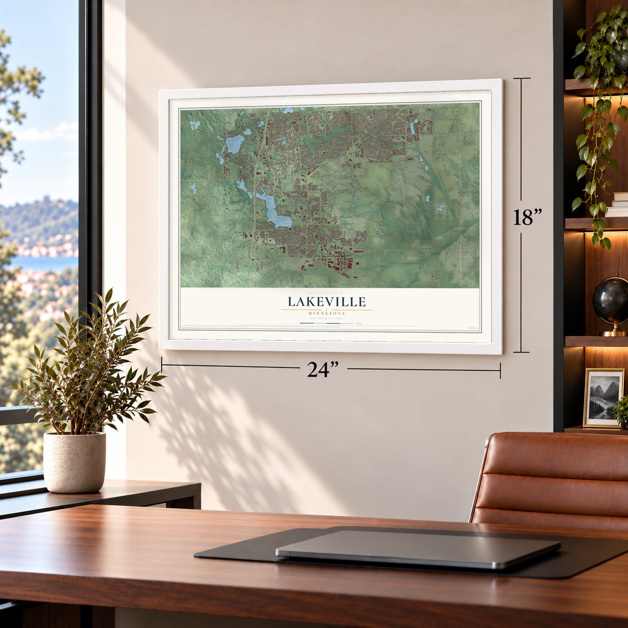
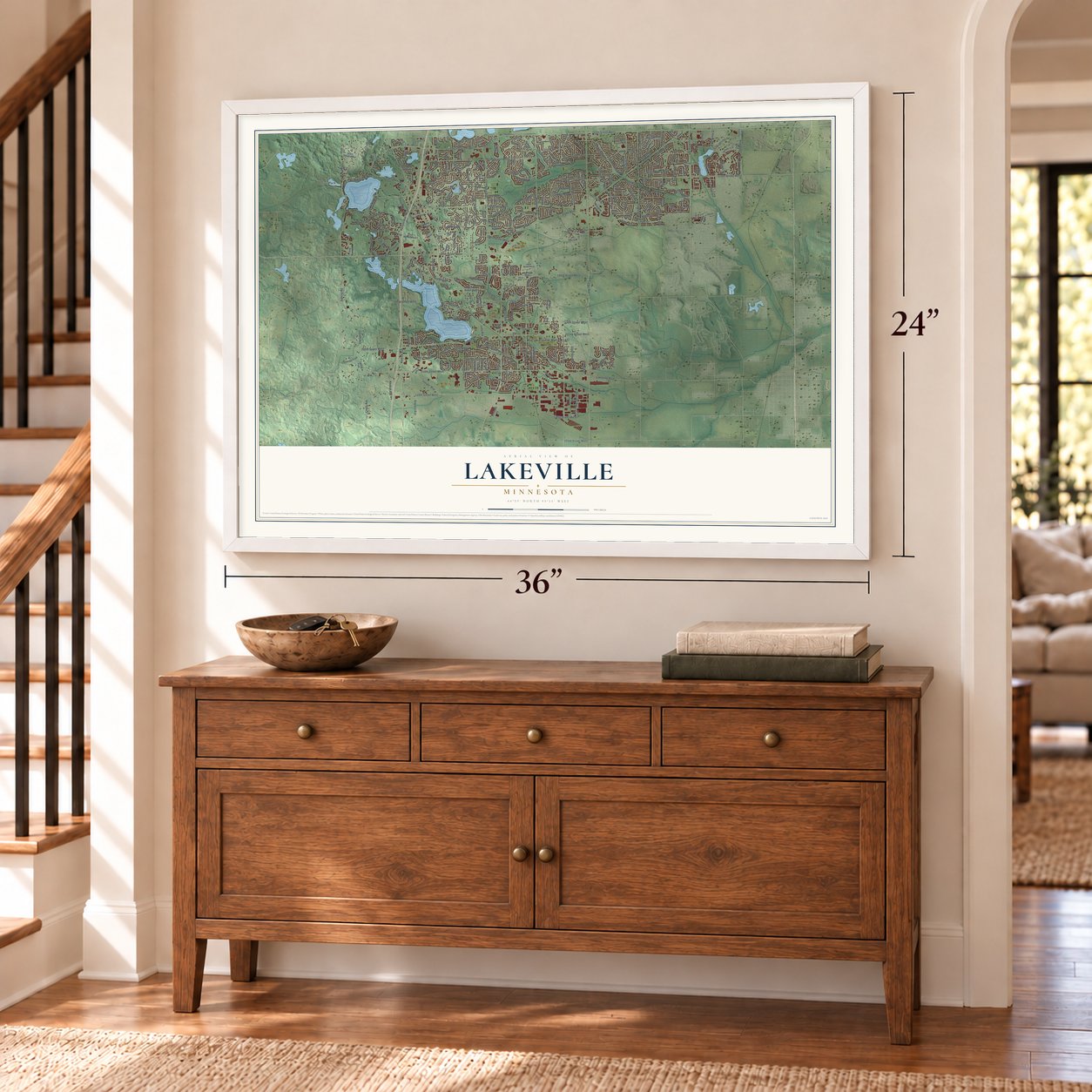
Unframed archival matte, a black wood frame or a white wood frame.
Up close
Geography Worth Displaying
This map was created using accurate cartographic data and authoritative geographic sources, including the U.S. Geological Survey and the Census Bureau. The map brings together terrain, waterways, roads, and building detail. The majority of the streets are labeled, houses are accurately depicted, and the topography is derived from government sources. Combining local data with carefully composed color and shading leads to this beautifully detailed Lakeville artwork for your wall.
Rather than simply showing street outlines, we’ve included as many of the street names as we could reasonably fit on the map while keeping their names legible. Zoom in on the high resolution preview to see exactly what’s on the map. We truly set out to create a statement piece for anyone who loves Lakeville. So whether it’s for you, or a gift for someone you love, we hope this map of Lakeville brings back fond memories.
Read the story behind this map of Lakeville, Minnesota from 2026.

About Lakeville, Minnesota
Lakeville is a city in Dakota County with 69,490 residents recorded in the 2020 census. Founded in 1855 and incorporated as a city in 1967, it developed from an agricultural settlement into an outer-ring Twin Cities suburb with an industrial presence.
- Railroad VillageAfter the Hastings and Dakota railroad arrived in 1869, residents selected a new village site initially known as Fairfield.
- Antlers and Dan PatchIn 1910, Marion Savage built a railroad line to serve Antlers Amusement Park, bringing wider attention to Lakeville.
- Parks and PreservesIn 2020, Lakeville had 3,021 acres devoted to parks, recreation, and preserves across 62 public properties.
- Airlake Industrial ParkThe 1,500-acre industrial park hosts as many as 200 companies and an estimated 4,500 employees.
- Vermillion RiverA branch of the Vermillion River crosses Lakeville, and Minnesota's Department of Natural Resources designates the river as a trout stream.
Find your street
Names on the Lakeville map
Every name below is printed on this map. Look for your street, your school, the park where you played, or the pond down the road.
Places and landmarks6
- Lakeville City Hall
- Deer Park
- Argonne
- Antlers Park
- King Park
- Ritter Farm Park
Streets and roads331
- Kenrick Avenue
- Judicial Road
- Ipava Avenue
- 205th Street West
- Kenyon Avenue
- 172nd Street West
- 169th Street West
- Jonquil Avenue
- Highview Avenue
- 173rd Street West
- 168th Street West
- Kodiak Avenue
- Dodd Boulevard
- 190th Street West
- Interlachen Boulevard
- Orchard Trail
- 164th Street West
- 220th Street West
- Oak Shore Drive
- 162nd Street West
- 165th Street West
- 195th Street West
- 212th Street West
- 190th Street
- Cedar Avenue
- 210th Street West
- 175th Street West
- Kenwood Trail
- 185th Street West
- 215th Street West
Show all 331 streets
- 160th Street West
- 170th Street West
- Minnreg Road
- 202nd Street West
- Holyoke Avenue
- Lakeville Boulevard
- Hamburg Avenue
- 167th Street West
- Pilot Knob Road
- 208th Street West
- Fieldcrest Avenue
- 207th Street West
- Keokuk Avenue
- Eagleview Drive
- Klamath Trail
- 200th Street West
- 178th Street West
- Jaguar Avenue
- Gerdine Path West
- Jaguar Path
- Italy Avenue
- Glacier Way
- Ixonia Avenue
- 179th Street
- Iteri Avenue
- Griffon Trail
- Jacquard Avenue
- 197th Street West
- Hayes Avenue
- Flagstaff Avenue
- 194th Street West
- Heritage Drive
- 183rd Street West
- Inndale Drive
- Joplin Avenue
- 225th Street West
- Kingsway Path
- Hyde Park Avenue
- Huxley Avenue
- Gage Avenue
- Eventide Way
- Laigle Avenue
- Dodd Lane
- 179th Trail West
- Juniper Way
- Gerdine Path
- Harvard Drive
- Kettering Trail
- Iberia Avenue
- Hyland Avenue
- Fallbrook Drive
- Jackpine Trail
- Hilldale Avenue
- Glencoe Avenue
- Layton Path
- Dynamic Drive
- Jordan Trail
- Idealic Avenue
- Isleton Avenue
- Lucerne Trail
- Jamaica Path
- Hickory Trail
- Countryview Trail
- Formosa Avenue
- Isleton Trail
- Grinnell Avenue
- Greenwood Avenue
- Homestead Trail
- Kaparia Avenue
- Gunflint Trail
- Icon Trail
- Jersey Avenue
- Harvest Drive
- North Creek Drive
- Foliage Avenue
- Irwindale Way
- Grinnell Way
- 178th Street
- Heron Lane
- Hubbard Trail
- Itea Avenue
- Lansford Path
- Laredo Avenue
- Irvine Lane
- 211th Street
- Indora Trail
- 192nd Street
- Jasper Terrace
- Steven Lane
- Granada Avenue
- Jupiter Way
- Finch Path
- Buck Hill Road
- Glade Avenue
- Hurley Avenue
- Romeo Drive
- Icalee Path
- Jutland Place
- Embers Avenue
- 181st Street West
- Finch Way West
- Jasper Trail
- Fairgreen Avenue
- Linch Path
- 161st Street West
- 166th Street West
- 163rd Street West
- 176th Street West
- Hudson Avenue
- Flagstaff Avenue West
- Hartford Way
- Draft Horse Boulevard
- Foliage Avenue West
- Upper 205th Street West
- Firestone Path
- Gannon Avenue West
- Idaho Avenue
- Javelin Avenue
- Gemini Trail
- Hytrail Circle
- Iceland Trail
- Ireland Way
- Falkirk Trail
- Justice Way
- Galena Avenue West
- Festal Avenue
- Holt Avenue
- Eastwood Avenue
- Iden Avenue
- Duluth Trail
- Ironstone Way
- Junelle Path
- East Lake Drive
- Diamonte Path
- Keystone Avenue
- Italy Path
- Juno Trail
- Inca Avenue
- 199th Street West
- Jasmine Path
- Hibiscus Avenue
- 192nd Street West
- Huntley Trail
- Illinois Avenue
- Idlewood Way
- Crystal Hills Drive
- Hyacinth Avenue
- Fieldfare Way
- Jasper Path
- Flagstaff Way West
- Grove Avenue
- Harvard Lane
- Ixonia Path
- Isle Avenue
- Fairhaven Avenue
- Frazer Path
- Impala Path
- Hollins Avenue West
- Hillcrest Avenue
- Logarto Lane
- Estate Lane
- Kendale Drive
- Laredo Path
- Innsbrook Drive
- Kaiser Way
- Kabera Trail
- Java Lane
- India Avenue
- Junco Trail
- Grove Trail
- Durango Trail
- Godson Drive
- Jubilee Way
- Jura Trail
- Fulda Trail
- Jackson Trail
- Kent Trail
- Ionia Path
- Island Avenue
- Hominy Path
- Ketchikan Trail
- Jewel Path
- Elmhurst Lane
- Hibbing Way
- Jersey Way
- Grenadier Avenue
- Indra Way
- Heywood Avenue
- Itami Trail
- Jurel Way
- Harwell Avenue
- Foxboro Lane
- Enfield Way
- Glasgow Avenue
- Irvine Way
- Humboldt Road
- Hanover Avenue
- Iran Avenue
- Jasper Way
- Helena Lane
- Faraday Lane
- Jury Court
- Frost Court
- Kindred Court
- Kensfield Trail
- Java Court
- Kenmore Drive
- Ideal Way
- Jay Court
- Ibara Trail
- Jamison Path
- Gage Way
- Hull Avenue
- Jade Terrace
- Kabot Cv
- Joplin Path
- 176th Circle
- Jasper Lane
- Galery Drive
- Fairfax Avenue
- Ireri Avenue
- Halo Avenue
- Jarl Court
- Joy Avenue
- Hamilton Drive
- 179th Street West
- 188th Street West
- Kensington Way
- 171st Street West
- Fishing Avenue West
- Gannon Way West
- Macbeth Circle
- Joplin Way
- Glenwood Avenue
- Glenbridge Avenue
- Linch Avenue
- Kensington Boulevard
- Holbrook Avenue
- Jackdaw Path
- Kenrick Loop
- Jonquil Trail
- Hawthorn Avenue
- Edinbug Way
- Excel Way
- Brutus Drive
- Europa Avenue
- Hydra Court
- Idalia Avenue
- Horizon Boulevard
- Diamond Path
- Klamath Terrace
- Ibex Avenue
- Irvona Avenue
- Hexham Way
- Kenreel Avenue
- Katrine Court
- Krafton Avenue
- Jalisco Lane
- Huron Circle
- Imbler Trail
- 160th Street
- 191st Court
- Ira Lane
- Lower 167th Street West
- Rollie Road
- Grenada Avenue
- Havelock Way
- Howland Avenue West
- Equestrian Trail
- Hollybrook Trail
- Harmony Path
- Hearthside Way
- Green Gables Trail
- Impala Avenue
- Islandview Circle
- Upper 162nd Street West
- Anthony Drive
- Kerryville Trail
- Kanabec Trail
- Hemlock Avenue
- Harappa Avenue
- 182nd Street West
- Knolls Path
- Goldenview Avenue
- Kerrick Court
- Five Oaks Drive
- Inspiration Path
- Jaeger Path
- Jade Lane
- English Path
- Kings Court
- Ixonia Lane
- Everest Path
- Element Avenue
- Jalisco Way
- Hollyhock Court
- Indio Path
- Lions Court
- English Avenue
- French Avenue
- Jewel Avenue
Names are listed as they appear on the printed map. Zoom into the product photos to find them.
The art of mapping a place
How This Map Was Made
Real places. Remarkable detail. Discover the layers that turn geographic data into a map of home.

The view from above
Aerial imagery reveals the character of the land: woodland, open fields, and the patterns of a place.

The shape of the land
Elevation data brings hills, valleys, and subtle changes in the landscape into view.

The details of home
Roads, waterways, and building footprints come together to make the map feel unmistakably local.

Geography becomes art
Considered color, shading, and typography bring the layers together in a map made for your wall.


Process illustrated with Mendon, Massachusetts. Aerial imagery: USDA NAIP. Terrain: USGS 3D Elevation Program. Map details and finished artwork: KNOWOL.
The Details
About This Print
Choose an archival matte print, or a black or white Ayous wood frame. The archival matte print is unframed.
Select your size and finish above to see the matching product image and price.
Materials & Craftsmanship
A contemporary map with the character of a classic atlas, printed on archival matte paper. Optional frames are made from Ayous wood.
Your printed map does not include the watermark shown in the full-map preview.
Shipping & Delivery
Free shipping within the United States. Every print is made to order in the USA.
Buying a gift? Add a note in your cart and we'll include it. We never put prices in the package.
Prints ship within 2 to 3 business days. Allow 7 to 10 days total from ordering for delivery. Timing may vary during holidays or periods of high order volume.
Read our shipping policy.
Returns and damaged prints
Each print is made to order. Change-of-mind refunds are not available after production.
If your print arrives damaged, misprinted or incorrect, contact support@knowol.com within 30 days of receiving it. Include your order number, photos and a description of the issue.
Read our full refund and replacement policy. For questions about your order, email support@knowol.com.
Find your town
Looking for another city?
Find a map of home in our Minnesota collection, or any town in the country.
Nearby
Maps of towns near Lakeville
Know someone from one of these towns? Their map makes a great gift.
 Farmington
, Minnesota
From $39.99See the map
 Credit River
, Minnesota
From $39.99See the map
 Apple Valley
, Minnesota
From $39.99See the map
More maps nearby: Burnsville, Empire, Savage, Elko New Market and Prior Lake.