
Search for another town





Free U.S. delivery 7 to 10 days after you order
Farmington, Minnesota Map Art
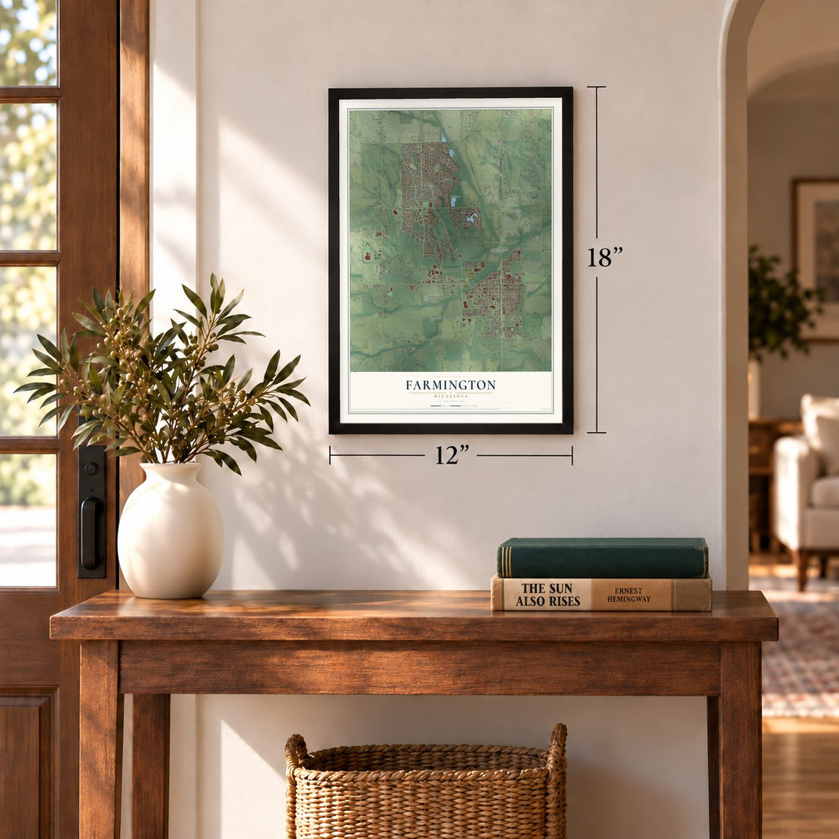
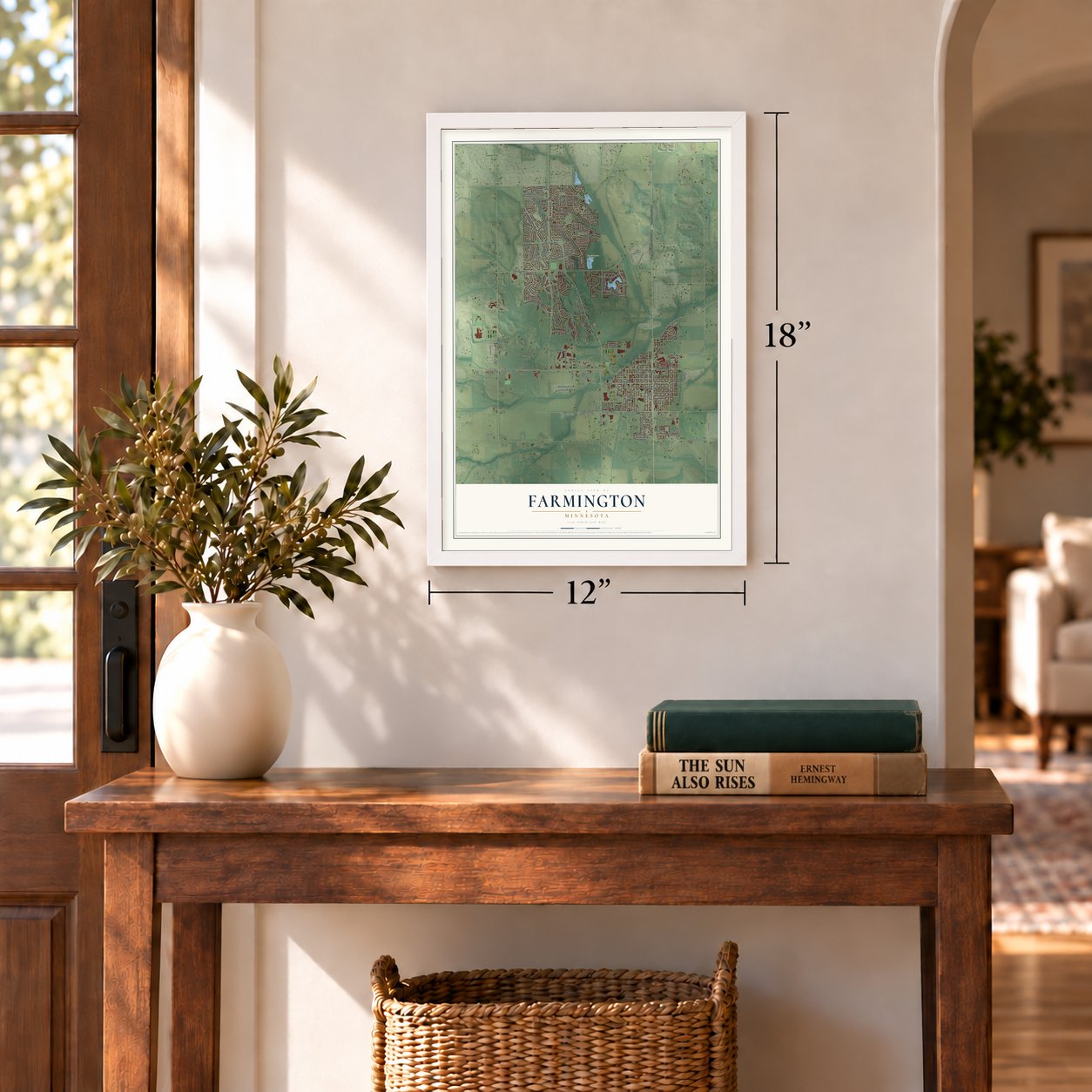
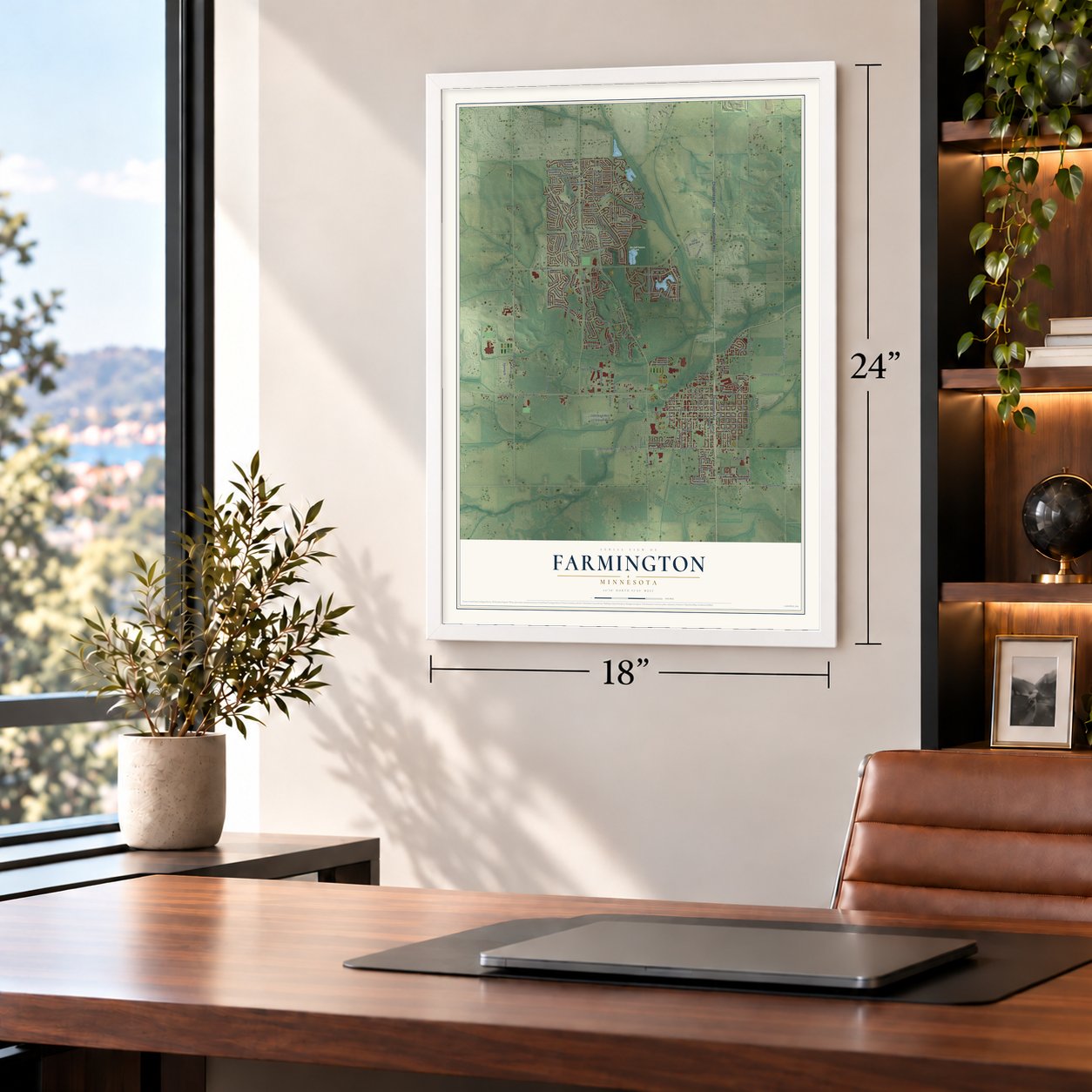
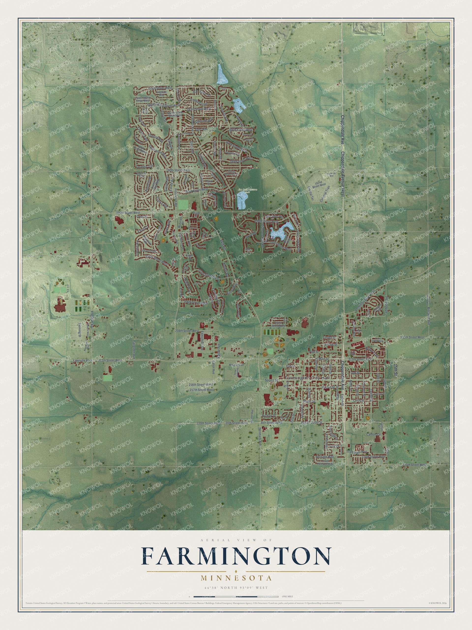
A new map of Farmington, Minnesota, made in 2026 and printed to order on thick archival matte paper.
12" x 18" Archival Matte Print
A Map of Home. A Work of Art.
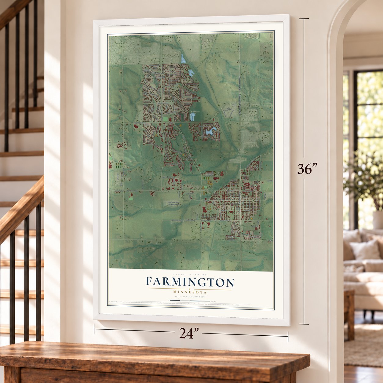
Explore Farmington, Minnesota from a whole new perspective. Created using aerial imagery and detailed geographic data, this map captures Farmington building by building, with labeled streets, familiar landmarks, and shaded topographical relief that highlights the natural contours of the landscape.
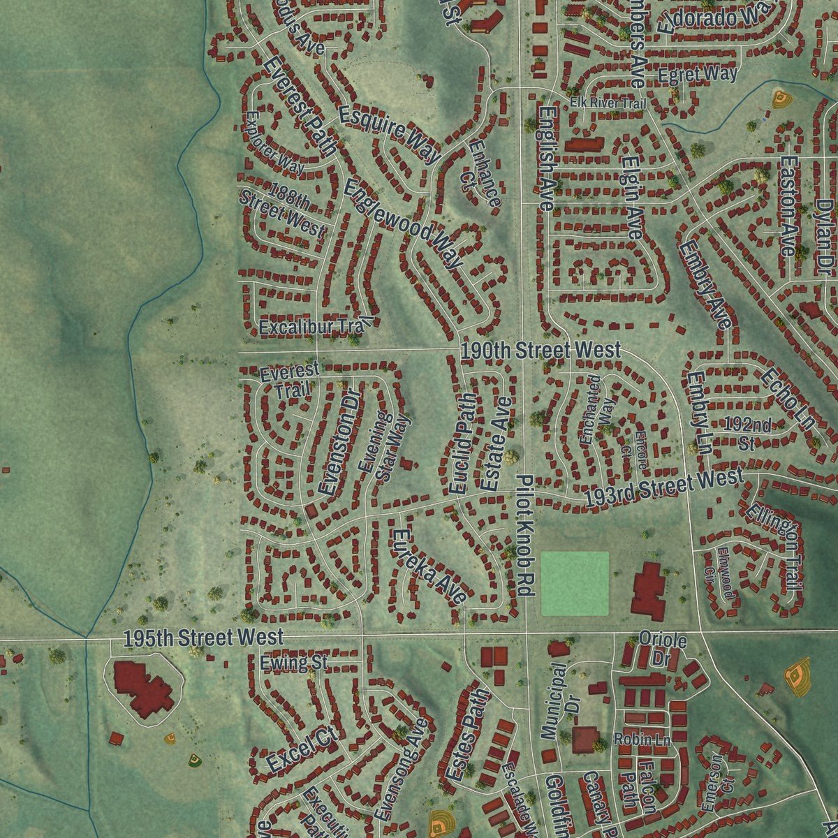
Combining modern data with the timeless character of a vintage atlas, this map is just as interesting up close as it is beautiful on the wall. Whether you grew up in Farmington, spent memorable years there, or call it home today, this unique map is a great way to celebrate a place that means something to you. Zoom in on the preview to look for your street, and then order a print to put your memories on the wall.
Three ways to hang it
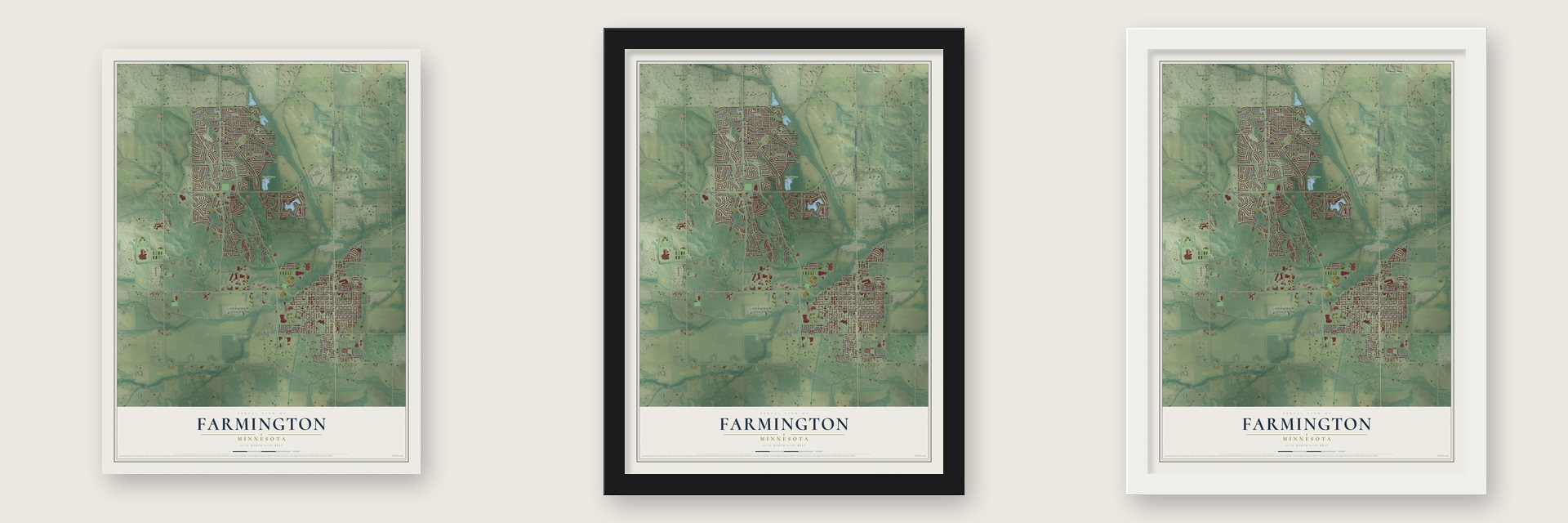
Unframed archival matte, a black wood frame or a white wood frame.
Up close
Geography Worth Displaying
This map was created using accurate cartographic data and authoritative geographic sources, including the U.S. Geological Survey and the Census Bureau. The map brings together terrain, waterways, roads, and building detail. The majority of the streets are labeled, houses are accurately depicted, and the topography is derived from government sources. Combining local data with carefully composed color and shading leads to this beautifully detailed Farmington artwork for your wall.
Rather than simply showing street outlines, we’ve included as many of the street names as we could reasonably fit on the map while keeping their names legible. Zoom in on the high resolution preview to see exactly what’s on the map. We truly set out to create a statement piece for anyone who loves Farmington. So whether it’s for you, or a gift for someone you love, we hope this map of Farmington brings back fond memories.
Read the story behind this map of Farmington, Minnesota from 2026.

About Farmington, Minnesota
Farmington is a city of 23,632 people in Dakota County, part of the Minneapolis-St. Paul area. Settlers came to Empire Township in the early 1850s, and a village called Dakota City grew where the Minnesota Central, Hastings and Dakota railroads met near the Vermillion River. Its depot was called Farmington Station, and outsiders kept using that name for the town, so the village changed its name to Farmington for good. The city's own history says the name honors Farmington, New York.
The village received its charter in 1872, which makes it the second-oldest community in Dakota County after Hastings, the county seat. On November 22, 1879, a cart of fireworks tipped over in a buggy accident. The fire that followed burned a hotel, a grain elevator, several stores and homes in what is now downtown. In 1880 a brick building rose at Third and Oak Streets in place of the wooden stores that had burned.
- The state's biggest county fairThe Dakota County Fair moved to Farmington in 1869. Its fairgrounds cover 360 acres, more than the 300 of the Minnesota State Fairgrounds, and the fair draws an average of 125,000 people a year, the largest county fair crowd in Minnesota.
- Mail to the farms in 1897In 1897 Farmington began rural free delivery of mail, among the earliest towns in the country to do so, bringing letters straight to the farms around it.
- First graduates in 1884Farmington High School sent off its first graduating class in 1884, twelve years after the village received its charter. The town marked its centennial in 1972.
Find your street
Names on the Farmington map
Every name below is printed on this map. Look for your street, your school, the park where you played, or the pond down the road.
Places and landmarks2
- Farmington City Hall
- Jim Bell Preseve Park
Streets and roads185
- Chippendale Avenue
- Chippendale Avenue West
- 15th Street
- Ash Street
- 20th Street West
- 220th Street
- Ash Street West
- 220th Street West
- 208th Street West
- Larch Street
- 14th Street
- Dunbury Avenue
- Seventh Street
- Ninth Street
- Twelfth Street
- Linden Street
- Flagstaff Avenue
- 212th Street West
- Pilot Knob Road
- 195th Street West
- Akin Road
- Spruce Street
- Embers Avenue
- 190th Street West
- English Avenue
- 200th Street West
- Eighth Street
- Everest Path
- Denmark Avenue
- 193rd Street West
Show all 185 streets
- 210th Street West
- Euclid Path
- Upper 182nd Street West
- 198th Street West
- Walnut Street
- Oak Street
- 187th Street West
- 213th Street West
- Sixth Street
- 180th Street West
- Fourth Street
- Elm Street
- Maple Street
- Pine Street
- Fifth Street
- Third Street
- Hickory Street
- Biscayne Avenue
- 189th Street West
- Vermillion River Trail
- Eaton Avenue
- First Street
- 225th Street West
- Cambodia Avenue
- Enright Way
- Second Street
- 206th Street West
- 203rd Street West
- Deerbrooke Path
- Tenth Street
- 13th Street
- Eleventh Street
- Duluth Street
- 186th Street West
- Emerald Trail
- Dover Drive
- Echo Drive
- Diamond Path Road
- Dylan Drive
- Everhill Avenue
- Eureka Avenue
- Eastview Avenue
- Colonial Trail
- 199th Street West
- Evenston Drive
- Englewood Way
- 183rd Street West
- Willow Trail
- Elgin Avenue
- Main Street
- 224th Street West
- 216th Street West
- 217th Street West
- Embry Avenue
- Cypress Drive
- Heritage Way
- Euclid Street
- Crystal Terrace
- Fairview Lane
- Knutsen Drive
- Willow Street
- Lakeville Boulevard
- Dunbar Avenue
- Eaves Way
- Estate Avenue
- Sunnyside Drive
- Edmonton Avenue
- Embry Lane
- Easton Avenue
- Easter Avenue
- Eldorado Way
- Fairgreen Avenue
- Fleming Street
- Esquire Way
- Echo Lane
- Estes Path
- Goldfinch Drive
- Echo Terrace
- Park Drive
- Canton Circle
- Erin Court
- Excel Court
- Catalina Way
- 191st Street West
- Upper 183rd Street West
- Evening Star Way
- Locust Street
- Evensong Avenue
- Excalibur Trail
- Erickson Path
- Lower 182nd Street West
- Camden Path
- 192nd Street West
- Egret Way
- Oriole Drive
- 188th Street West
- Division Street
- Empire Trail
- Dupont Way
- 196th Street West
- Exodus Avenue
- Denali Way
- 223rd Street West
- Elkridge Trail
- Everest Trail
- Ellington Trail
- Eventide Way
- Dyers Pass
- Municipal Drive
- Lower Heritage Way
- Devrie Path
- 207th Street West
- Dawson Lane
- Executive Path
- Canary Path
- 192nd Street
- Denton Avenue
- Ewing Street
- Export Trail
- Canton Court
- Enhance Court
- Exley Avenue
- Falcon Path
- Ely Avenue
- 211th Street West
- Dushane Parkway
- Escalade Way
- Explorer Way
- Enchanted Way
- East Oaks Drive
- Emperor Court
- Westview Drive
- Flagstone Way
- Flanders Way
- Dulaney Drive
- Emerson Court
- Langford Lane
- Dallas Avenue
- Pine Place
- Calhoun Court
- Dulcimer Court
- English Court
- Robin Lane
- Capri Street
- Dover Court
- Biscayne Avenue West
- Centennial Drive
- Tamarack Trail
- Cloverleaf Way
- Elk River Trail
- Enright Court
- Elmwood Circle
- Encore Court
- Duncan Court
- Akin Circle
Names are listed as they appear on the printed map. Zoom into the product photos to find them.
The art of mapping a place
How This Map Was Made
Real places. Remarkable detail. Discover the layers that turn geographic data into a map of home.

The view from above
Aerial imagery reveals the character of the land: woodland, open fields, and the patterns of a place.

The shape of the land
Elevation data brings hills, valleys, and subtle changes in the landscape into view.

The details of home
Roads, waterways, and building footprints come together to make the map feel unmistakably local.

Geography becomes art
Considered color, shading, and typography bring the layers together in a map made for your wall.


Process illustrated with Mendon, Massachusetts. Aerial imagery: USDA NAIP. Terrain: USGS 3D Elevation Program. Map details and finished artwork: KNOWOL.
The Details
About This Print
Choose an archival matte print, or a black or white Ayous wood frame. The archival matte print is unframed.
Select your size and finish above to see the matching product image and price.
Materials & Craftsmanship
A contemporary map with the character of a classic atlas, printed on archival matte paper. Optional frames are made from Ayous wood.
Your printed map does not include the watermark shown in the full-map preview.
Shipping & Delivery
Free shipping within the United States. Every print is made to order in the USA.
Buying a gift? Add a note in your cart and we'll include it. We never put prices in the package.
Prints ship within 2 to 3 business days. Allow 7 to 10 days total from ordering for delivery. Timing may vary during holidays or periods of high order volume.
Read our shipping policy.
Returns and damaged prints
Each print is made to order. Change-of-mind refunds are not available after production.
If your print arrives damaged, misprinted or incorrect, contact support@knowol.com within 30 days of receiving it. Include your order number, photos and a description of the issue.
Read our full refund and replacement policy. For questions about your order, email support@knowol.com.
Find your town
Looking for another city?
Find a map of home in our Minnesota collection, or any town in the country.
Nearby
Maps of towns near Farmington
Know someone from one of these towns? Their map makes a great gift.
 Empire
, Minnesota
From $39.99See the map
 Lakeville
, Minnesota
From $39.99See the map
 Apple Valley
, Minnesota
From $39.99See the map
More maps nearby: Rosemount, Coates, Hampton, Burnsville and Credit River.