
Search for another town





Free U.S. delivery 7 to 10 days after you order
Easley, South Carolina Map Art
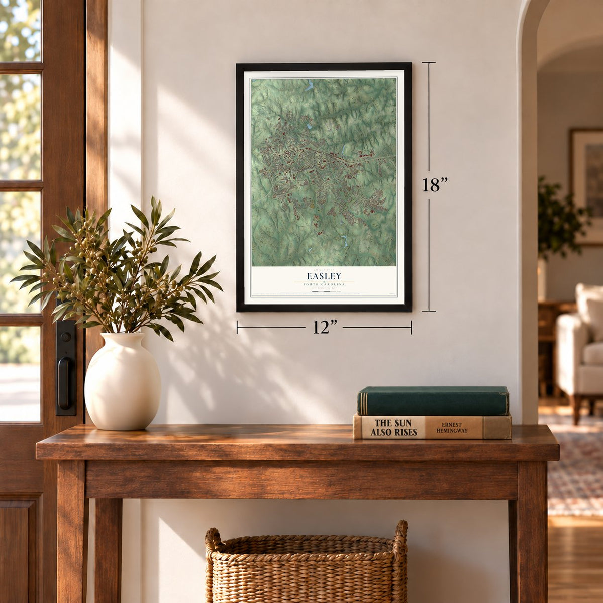
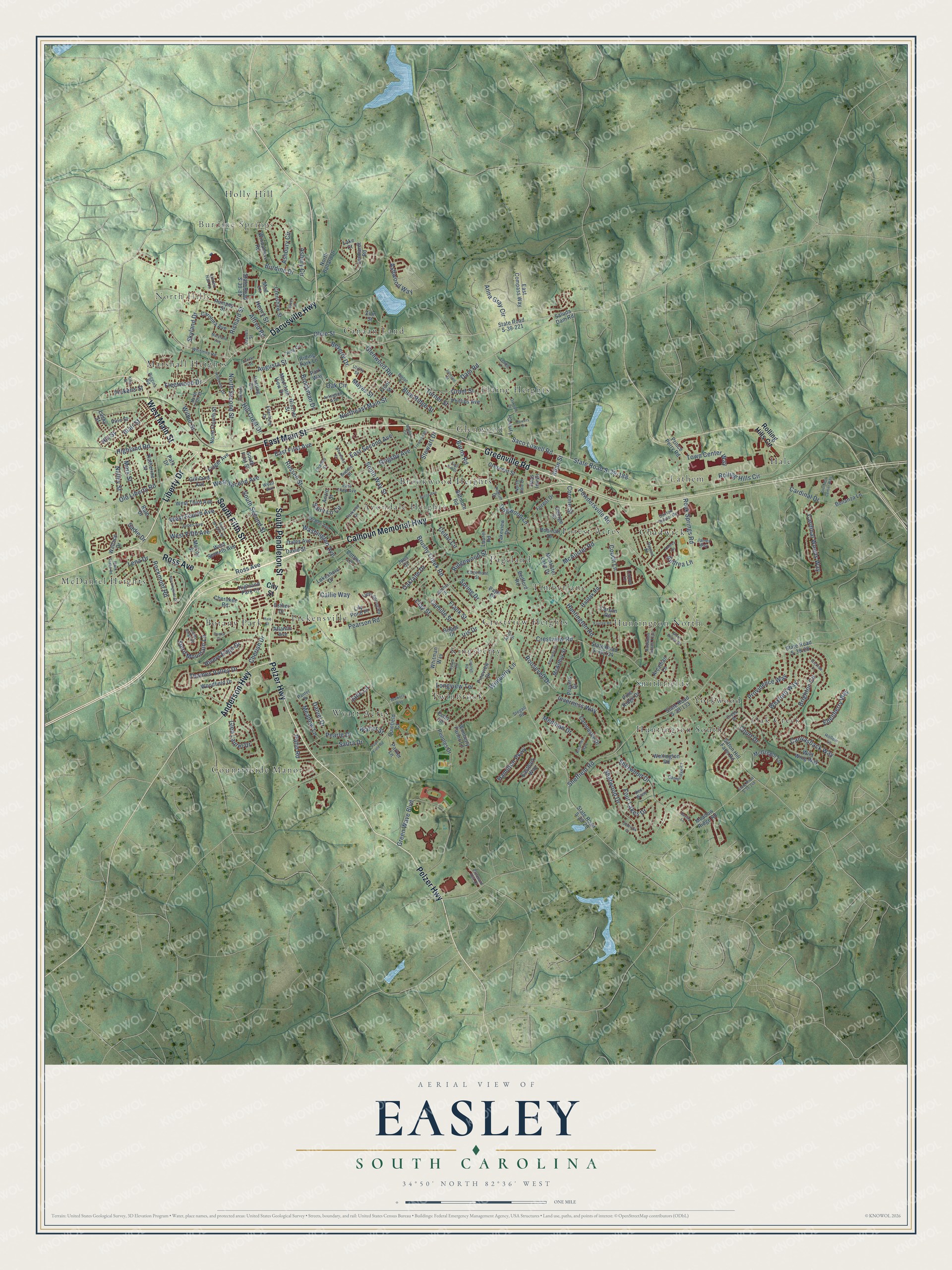
A new map of Easley, South Carolina, made in 2026 and printed to order on thick archival matte paper.
12" x 18" Archival Matte Print
A Map of Home. A Work of Art.
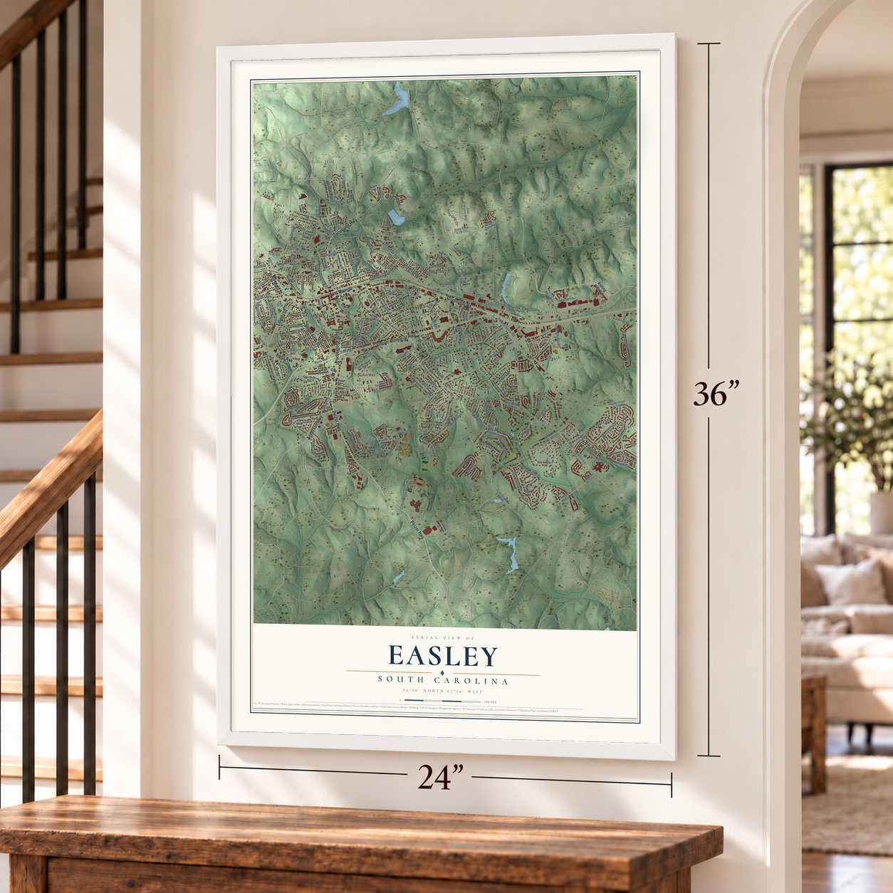
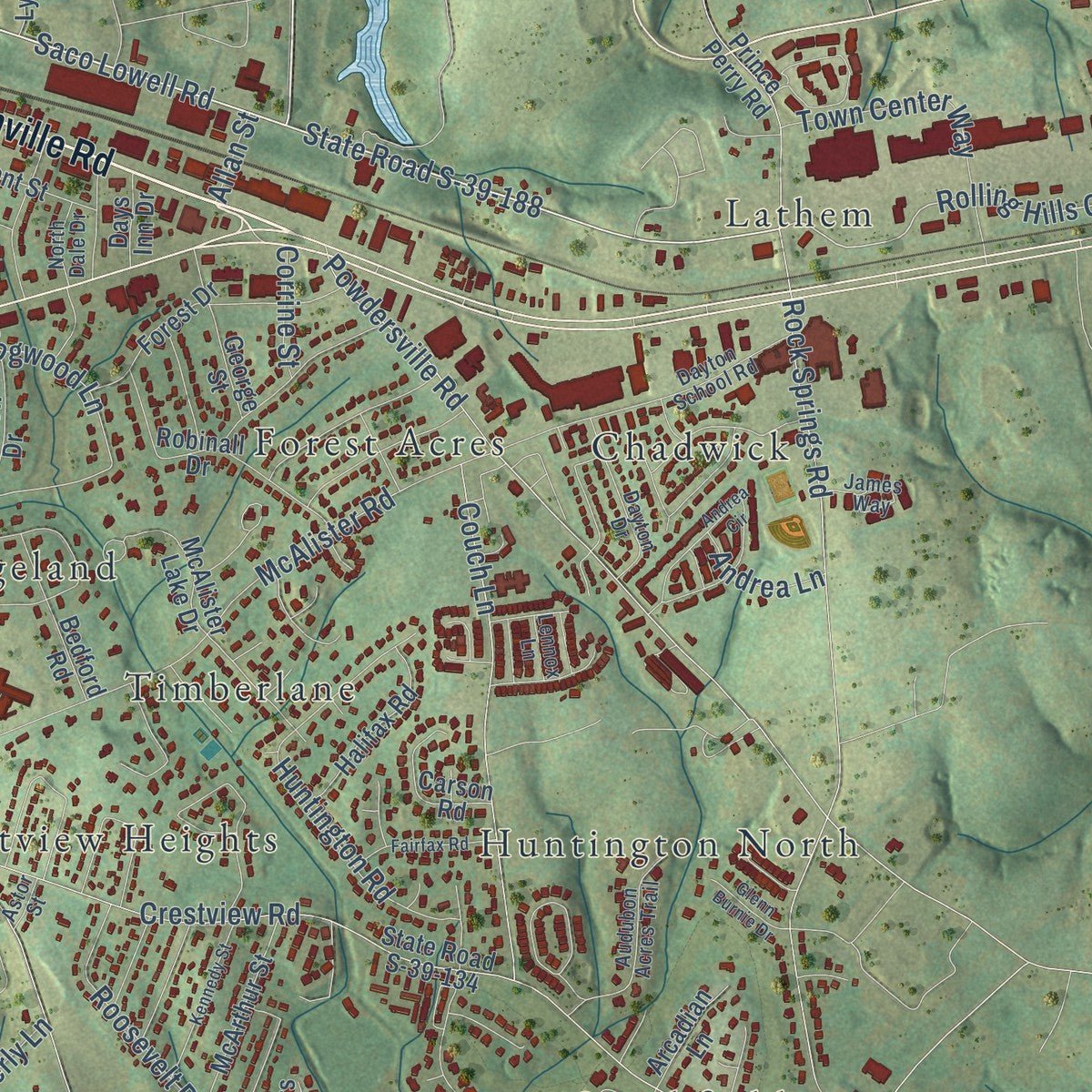
Explore Easley, South Carolina from a whole new perspective. Created using aerial imagery and detailed geographic data, this map captures Easley building by building, with labeled streets, familiar landmarks, and shaded topographical relief that highlights the natural contours of the landscape.
Combining modern data with the timeless character of a vintage atlas, this map is just as interesting up close as it is beautiful on the wall. Whether you grew up in Easley, spent memorable years there, or call it home today, this unique map is a great way to celebrate a place that means something to you. Zoom in on the preview to look for your street, and then order a print to put your memories on the wall.
Three ways to hang it
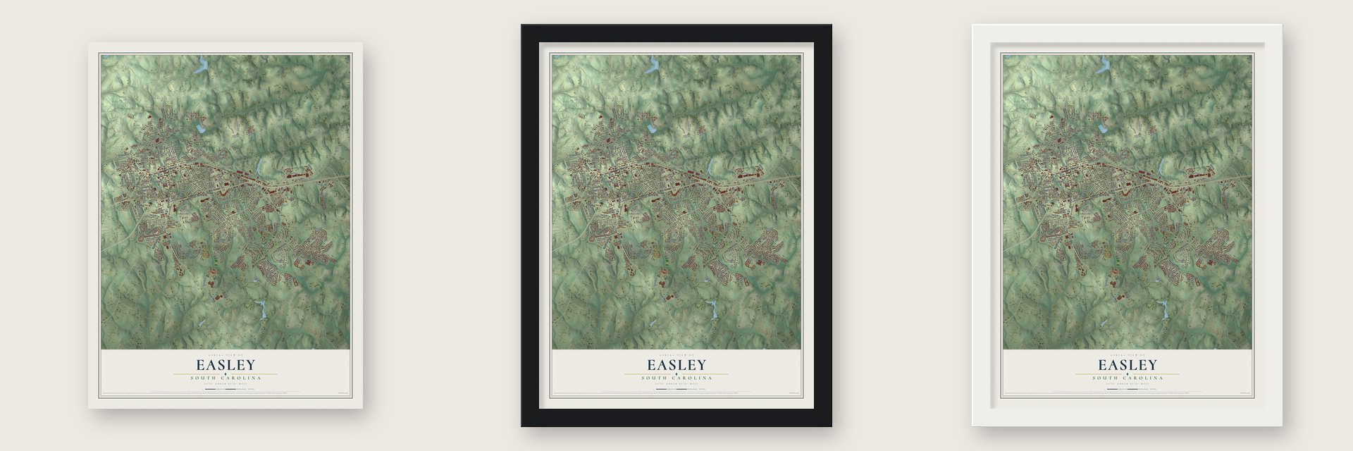
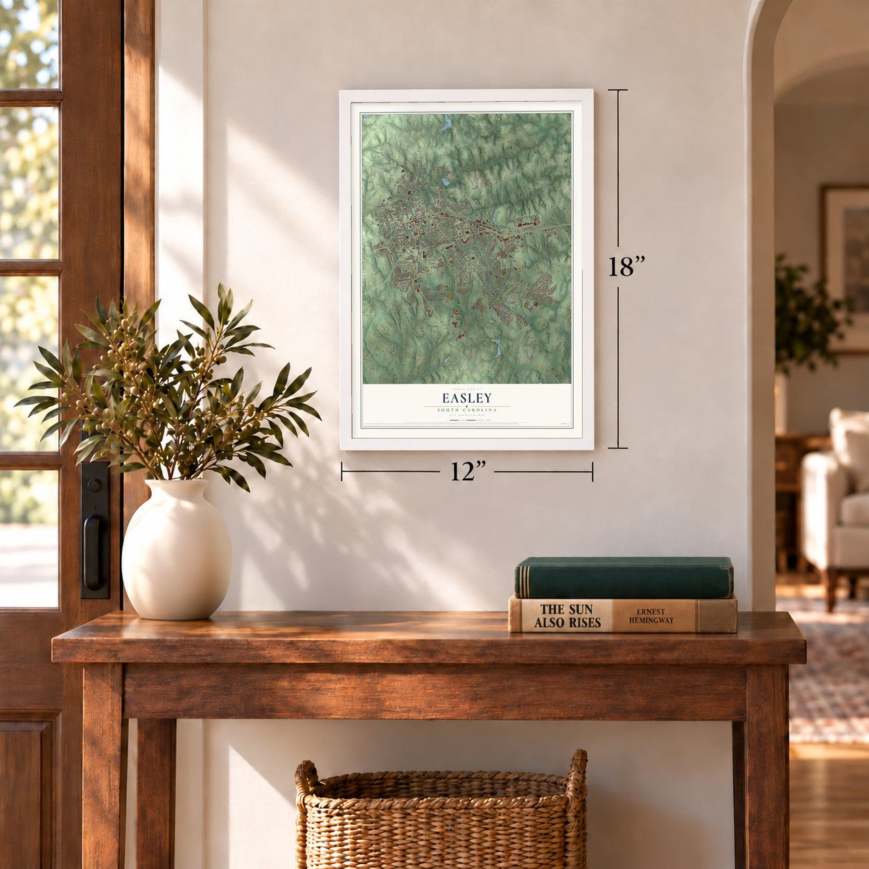
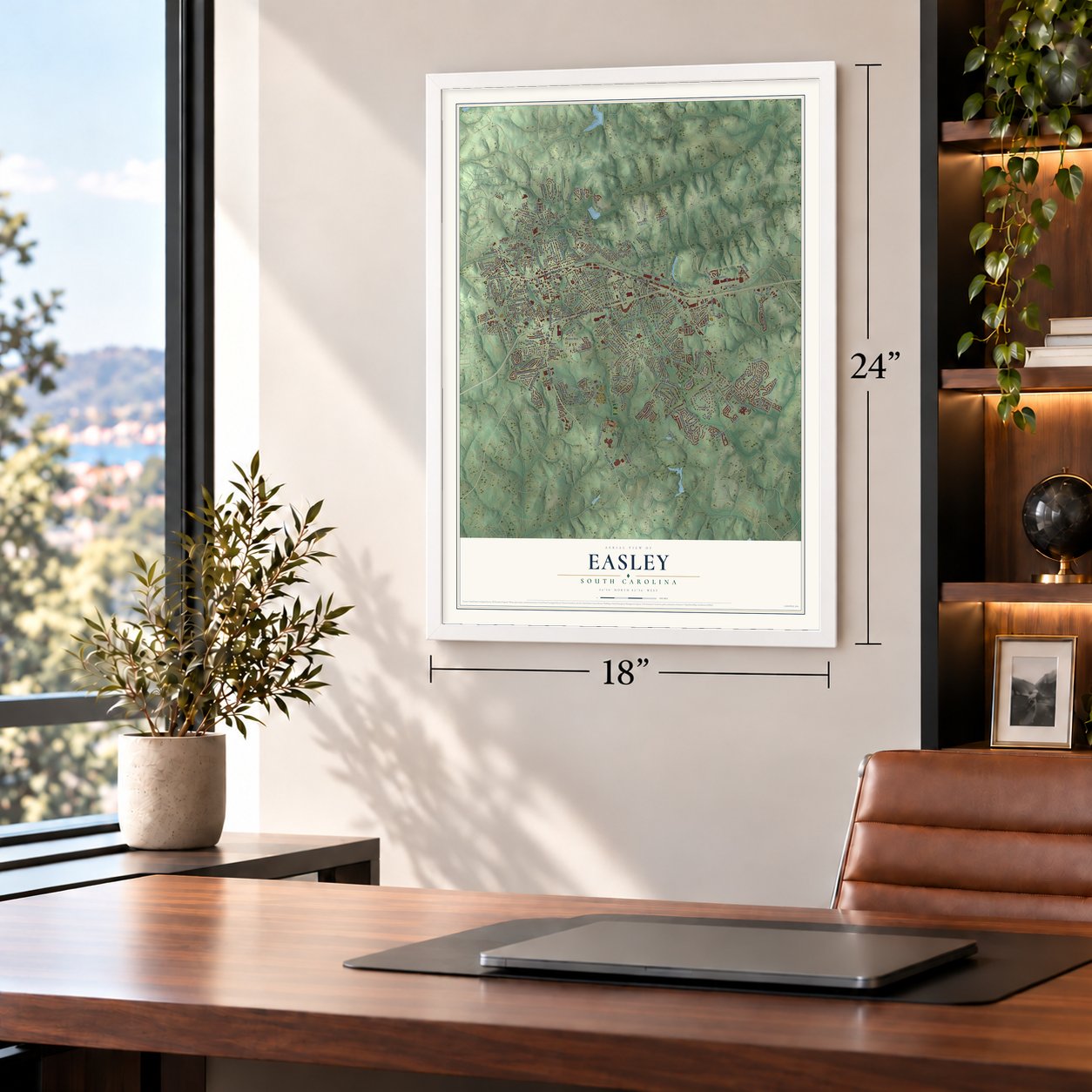
Unframed archival matte, a black wood frame or a white wood frame.
Up close
Geography Worth Displaying
This map was created using accurate cartographic data and authoritative geographic sources, including the U.S. Geological Survey and the Census Bureau. The map brings together terrain, waterways, roads, and building detail. The majority of the streets are labeled, houses are accurately depicted, and the topography is derived from government sources. Combining local data with carefully composed color and shading leads to this beautifully detailed Easley artwork for your wall.
Rather than simply showing street outlines, we’ve included as many of the street names as we could reasonably fit on the map while keeping their names legible. Zoom in on the high resolution preview to see exactly what’s on the map. We truly set out to create a statement piece for anyone who loves Easley. So whether it’s for you, or a gift for someone you love, we hope this map of Easley brings back fond memories.
Read the story behind this map of Easley, South Carolina from 2026.

About Easley, South Carolina
Easley is a city of 22,921 people in Pickens County, with parts reaching into Anderson County, about 12 miles west of Greenville. It grew up around Pickensville, a place created in 1791 as Rockville and renamed the next year, which served as the seat of Washington District. Col. Robert Elliott Holcombe farmed the area and ran a timber mill, and in 1845 he opened a storeroom, the first business here.
After the Civil War, the attorney William King Easley raised $100,000 for the Atlanta and Charlotte Air Line Railway, and that money persuaded the company to run its line through Pickensville. Holcombe used lumber from his family's mill to build the first house and the train depot. He then served as the depot's first agent and the town's first mayor. The town was chartered in 1873, and in 1875 the Pickensville Post Office took the name Easley.
“Many would have thought the new town would be named for Holcombe, who became the first depot agent, but Holcombe asked that it be named for William King Easley, an attorney who was born in Pickens County near the Greenville County line.”
- Major William King EasleyA native of Pickens County, born there in 1825, the town's namesake was one of five men who spoke for the Greenville area at the South Carolina Secession Convention. When the Civil War began, he organized a cavalry company from Greenville and Pickens counties and held the rank of major in the Confederate Army. Once the war ended, he went back to practicing law and helped bring the railroad that started the town.
- A textile town on the railsThe railroad turned Easley into a busy textile town. The Easley Textile Company, later called Swirl Inc., arrived in 1953, and the building of U.S. Route 123 drew new stores and businesses. On April 25, 1951, a burning department store threatened many downtown buildings, but the fire department put the fire out quickly.
- A plane on Main StreetIn 1968 the NASCAR driver Curtis Turner landed his airplane on the town's main street, and in doing so he knocked out Easley's telephone service.
- Host of World Series baseballEasley hosted the Big League World Series every year from 2001 until the tournament was disbanded in 2016. A year later, in 2017, Easley became the yearly home of the Senior League World Series.
- First woman mayor in 2023Butch Womack, the city's longtime fire chief, was elected mayor in 2020. Lisa Talbert ran against him when he sought reelection in 2023, and her win made her the first woman to serve as Easley's mayor.
Find your street
Names on the Easley map
Every name below is printed on this map. Look for your street, your school, the park where you played, or the pond down the road.
Places and landmarks28
- Burdine Springs
- North Hills
- Avondale Heights
- Botany Park
- Brookwood Heights
- Canaan Land
- Chadwick
- Countryside Manor
- Crestview Heights
- Elaine Heights
- Forest Acres
- Glenwood
Show all 28 places
- Hale
- Holly Hill
- Huntington North
- Huntington South
- Kingsberry
- Lathem
- Marshall Heights
- McDaniel Heights
- Oak Creek
- Pageland
- Pickensville
- Smithfields
- Timberlane
- Twinbrook
- Wyatt Acres
- Yorkwood
Streets and roads270
- East Main Street
- Pelzer Highway
- South Pendleton Street
- Liberty Drive
- West Main Street
- South Fifth Street
- Dacusville Highway
- Greenville Road
- Calhoun Memorial Highway
- Ross Avenue
- Anderson Highway
- Olive Street
- Saco Lowell Road
- State Road S-39-188
- Wilbur Street
- Fleetwood Drive
- Hill Crest Drive
- Rolling Hills Circle
- Dam Road
- Dogwood Lane
- Crestview Road
- Brushy Creek Road
- Shefwood Drive
- Powdersville Road
- Sheffield Road
- McAlister Road
- Green Wave Boulevard
- East Second Avenue
- Rock Springs Road
- Anna Gray Circle
Show all 270 streets
- Ashwood Way
- Northeast Main Street
- Blue Ridge Street
- Pearson Road
- Huntington Road
- Brighton Circle
- Glenwood Road
- Roosevelt Drive
- West Second Avenue
- Wimberly Lane
- Glen Laurel Drive
- Inverness Way
- South Second Street
- Couch Lane
- Wexford Way
- Cardinal Woods Way
- Providence Way
- Spirit Mountain Lane
- Stewart Drive
- South Way Street
- East First Avenue
- North Second Street
- Burdine Drive
- Cedar Circle
- Grigsby Avenue
- Blair Street
- Four Lakes Drive
- Iris Drive
- Rivers Edge Drive
- Highland Road
- Saint Lo Circle
- Longview Terrace
- Washington Avenue
- Town Center Way
- Old Liberty Road
- Thames Valley Drive
- Hamilton Parkway
- West Fifth Avenue
- Sherwood Drive
- Brockman Drive
- Richard Street
- Pearle Drive
- Frank Street
- Meadow Lane
- Rockmont Road
- Camille Street
- West Fourth Avenue
- Walter Street
- Burns Road
- Canvasback Way
- Edenberry Way
- Oak Circle
- Clay Street
- Lena Drive
- Russell Street
- Skyland Drive
- Sabra Drive
- Ridgewood Street
- Hill Street
- Cherish Drive
- Medinah Drive
- Grant Street
- Turner Street
- Nalley Street
- Asbury Circle
- Cardinal Drive
- Alfred Road
- Oaklane Drive
- Patio Road
- Daniel Drive
- Beverly Drive
- Mark Street
- Pickens Street
- Spring Drive
- Callie Way
- Augusta Street
- Ashbury Circle
- Mayes Street
- Henry Street
- Andrea Lane
- Sadie Drive
- Court Drive
- Corrine Street
- Jade Lane
- Allan Street
- City Street
- State Road S-39-221
- State Road S-39-29
- State Road S-39-134
- State Road S-39-28
- State Road S-39-133
- Pineview Drive
- Wellington Road
- Laurel Road
- Saluda Dam Road
- Peoples Drive
- Cherokee Road
- Woodfield Drive
- Sitton Hill Farm Road
- Lakeshore Drive
- Pine Ridge Drive
- South First Street
- West Seventh Avenue
- Prince Perry Road
- Robinall Drive
- Katherine Street
- Hasting Circle
- Rampey Street
- North Ballard Drive
- Lynn Circle
- McCoy Street
- Echo Circle
- Biltmore Road
- West Third Avenue
- Meadow Ridge Road
- McAlister Lake Drive
- Wild Wing Way
- Windamere Road
- Forest Drive
- McArthur Street
- Folger Avenue
- Halifax Road
- Carnoustie Drive
- Oates Avenue
- State Road S-39-81
- Carolina Avenue
- Wimberly Farms Lane
- Highland Park Court
- Crescent Street
- Bedford Road
- East Compass Way
- McGregor Lane
- Briggs Drive
- North Fourth Street
- Crenshaw Street
- Anzio Street
- Eastpark Way
- Carson Road
- Atlantic Avenue
- Lakeview Drive
- Mountain View Drive
- Lucky Street
- Whitman Way
- Park Drive
- Phillips Avenue
- Quinfield Court
- Bonanza Lane
- Lily Pond Place
- Arcadian Lane
- Gilliland Avenue
- Lenhardt Road
- Parker Lane
- Pine Street
- George Street
- Wallace Drive
- Riding Park Lane
- Ruth Drive
- David Street
- Zion Street
- Esther Drive
- Players Drive
- Front Street
- Glazner Street
- Days Inn Drive
- Cotton Lane
- Mad Lane
- Park Way
- Luke Court
- Page Drive
- Joes Court
- Hillcrest Drive
- Pilgrim Drive
- Dayton School Road
- Creek Drive
- McBee Avenue
- Parkway Drive
- Alethia Street
- Light Spring Road
- Jones Avenue
- Audubon Acres Trail
- North Fifth Street
- Dayton Drive
- Whitmire Road
- East Third Avenue
- Cambridge Court
- James Way
- Edgemont Street
- Charles Street
- Riggins Road
- Deer Wood
- Ellenburg Drive
- King Circle
- Arlington Avenue
- North Dale Drive
- Pleasant Hill Drive
- Hollow Lane
- Utility Street
- Pantel Drive
- Wyatt Avenue
- Linden Hall Lane
- Stegall Road
- Jeanes Street
- Buddin Street
- Lennox Lane
- Astor Street
- Black Snake Road
- Lucille Avenue
- Pope Field Road
- Andrea Circle
- Sylvia Road
- Morningside Drive
- Bonita Drive
- Barton Street
- Carolyn Road
- Burns Avenue
- State Road S-39-148
- South Seventh Street
- Oakvale Drive
- Killarney Way
- Kennedy Street
- Walkers Way
- Fairfax Road
- Southern Center Way
- King Street
- Mayfair Circle
- East Hill Drive
- Hale Street
- Woodland Circle
- Giants Ridge Road
- Freeman Road
- Glenn Burnie Drive
- Powers Drive
- Maryland Avenue
- Daylily Lane
- Johnson Street
- Overlook Court
- Davis Street
- Wicklow Court
- Hazel Drive
- Lehigh Lane
Names are listed as they appear on the printed map. Zoom into the product photos to find them.
The art of mapping a place
How This Map Was Made
Real places. Remarkable detail. Discover the layers that turn geographic data into a map of home.

The view from above
Aerial imagery reveals the character of the land: woodland, open fields, and the patterns of a place.

The shape of the land
Elevation data brings hills, valleys, and subtle changes in the landscape into view.

The details of home
Roads, waterways, and building footprints come together to make the map feel unmistakably local.

Geography becomes art
Considered color, shading, and typography bring the layers together in a map made for your wall.


Process illustrated with Mendon, Massachusetts. Aerial imagery: USDA NAIP. Terrain: USGS 3D Elevation Program. Map details and finished artwork: KNOWOL.
The Details
About This Print
Choose an archival matte print, or a black or white Ayous wood frame. The archival matte print is unframed.
Select your size and finish above to see the matching product image and price.
Materials & Craftsmanship
A contemporary map with the character of a classic atlas, printed on archival matte paper. Optional frames are made from Ayous wood.
Your printed map does not include the watermark shown in the full-map preview.
Shipping & Delivery
Free shipping within the United States. Every print is made to order in the USA.
Buying a gift? Add a note in your cart and we'll include it. We never put prices in the package.
Prints ship within 2 to 3 business days. Allow 7 to 10 days total from ordering for delivery. Timing may vary during holidays or periods of high order volume.
Read our shipping policy.
Returns and damaged prints
Each print is made to order. Change-of-mind refunds are not available after production.
If your print arrives damaged, misprinted or incorrect, contact support@knowol.com within 30 days of receiving it. Include your order number, photos and a description of the issue.
Read our full refund and replacement policy. For questions about your order, email support@knowol.com.
Find your town
Looking for another city?
Find a map of home in our South Carolina collection, or any town in the country.
Nearby
Maps of towns near Easley
Know someone from one of these towns? Their map makes a great gift.
 Arial
Arial, South Carolina
From $39.99See the map
 Powdersville
, South Carolina
From $39.99See the map
 Liberty
, South Carolina
From $39.99See the map
More maps nearby: Welcome, Parker, Berea, Dacusville and Pickens.