
Search for another town

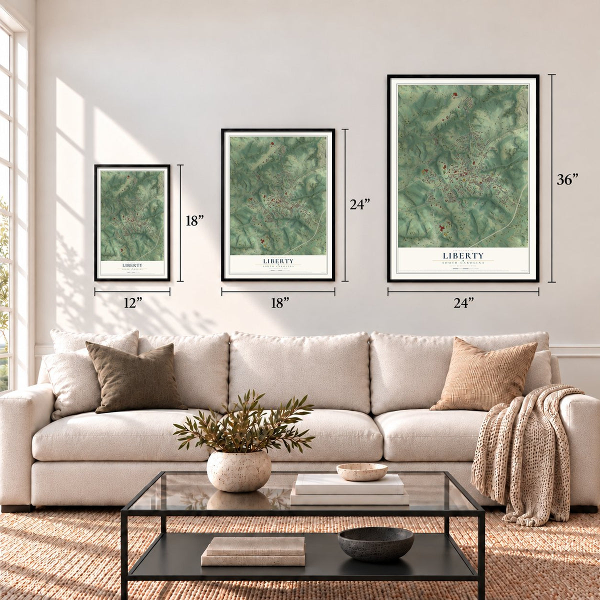

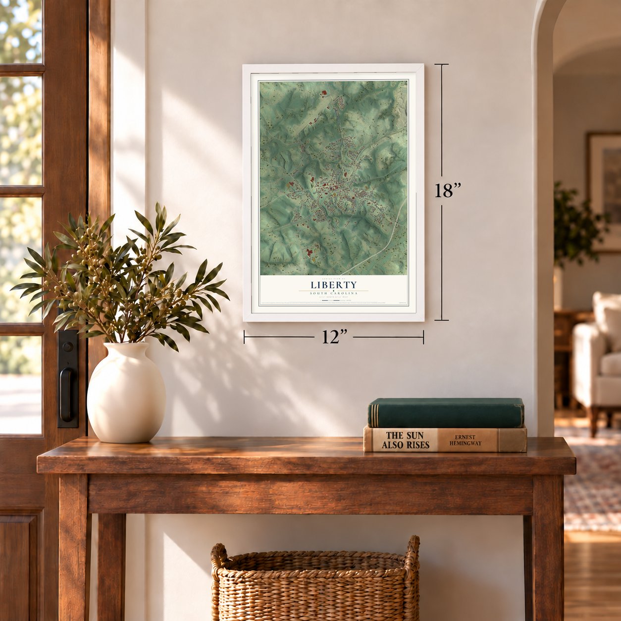

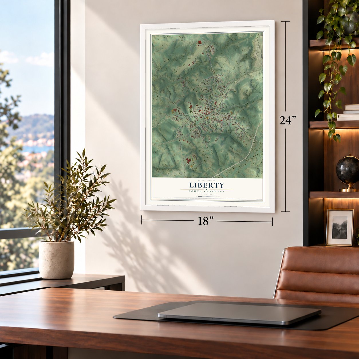
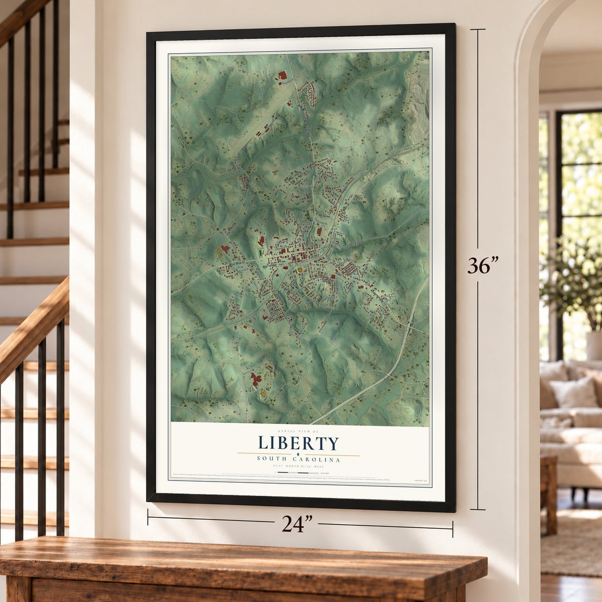

Free U.S. delivery 7 to 10 days after you order
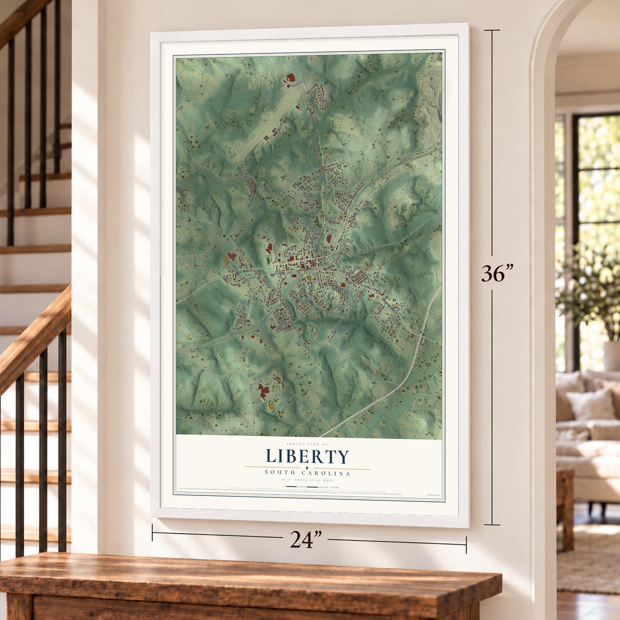
Liberty, South Carolina Map Art
A new map of Liberty, South Carolina, made in 2026 and printed to order on thick archival matte paper.
12" x 18" Archival Matte Print
A Map of Home. A Work of Art.
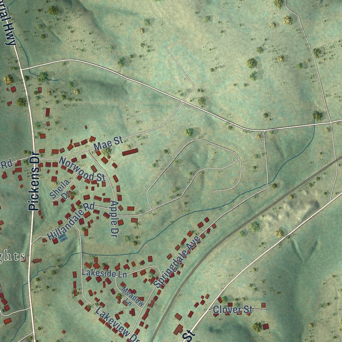
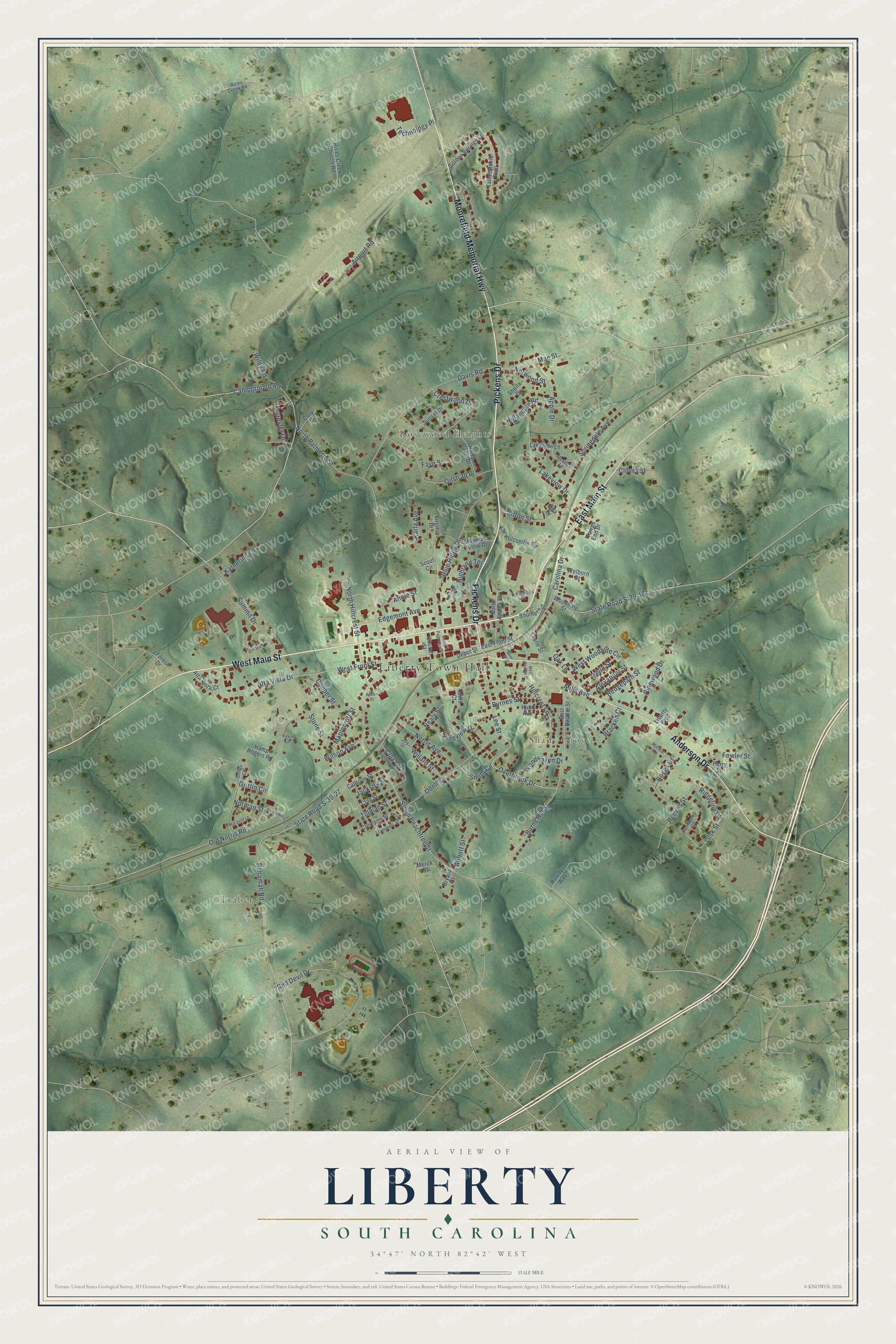
Explore Liberty, South Carolina from a whole new perspective. Created using aerial imagery and detailed geographic data, this map captures Liberty building by building, with labeled streets, familiar landmarks, and shaded topographical relief that highlights the natural contours of the landscape.
Combining modern data with the timeless character of a vintage atlas, this map is just as interesting up close as it is beautiful on the wall. Whether you grew up in Liberty, spent memorable years there, or call it home today, this unique map is a great way to celebrate a place that means something to you. Zoom in on the preview to look for your street, and then order a print to put your memories on the wall.
Three ways to hang it
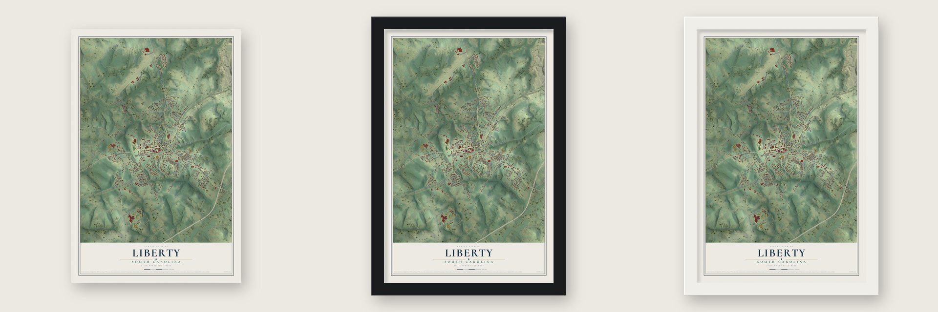
Unframed archival matte, a black wood frame or a white wood frame.
Up close
Geography Worth Displaying
This map was created using accurate cartographic data and authoritative geographic sources, including the U.S. Geological Survey and the Census Bureau. The map brings together terrain, waterways, roads, and building detail. The majority of the streets are labeled, houses are accurately depicted, and the topography is derived from government sources. Combining local data with carefully composed color and shading leads to this beautifully detailed Liberty artwork for your wall.
Rather than simply showing street outlines, we’ve included as many of the street names as we could reasonably fit on the map while keeping their names legible. Zoom in on the high resolution preview to see exactly what’s on the map. We truly set out to create a statement piece for anyone who loves Liberty. So whether it’s for you, or a gift for someone you love, we hope this map of Liberty brings back fond memories.
Read the story behind this map of Liberty, South Carolina from 2026.

About Liberty, South Carolina
Liberty is a city of 3,366 people in Pickens County. Before there was a town, the place was called Liberty Spring. Most of its people farmed only what their families needed, because bad roads made hauling goods to other towns cost more than the goods would bring.
That changed when the Charlotte-Atlanta Airline Railway was finished in the early 1870s. William Easley, a former Confederate general who worked as a lawyer for the railroad, arranged for the tracks to cross southern Pickens County, and Catherine Templeton gave her land to the company. Liberty Station rose north of the old spring by 1873, when John T. Boggs opened the new post office as its first postmaster. The town was chartered on March 2, 1876, with its center on what had been Templeton's land.
“there was nothing for him to do, except to look after the cows that go astray.”
- Liberty Spring or SalubrityNobody knows for sure where the name came from. In 1936 Mrs. Annie Craig told the best-known story: worshippers at a church near a spring heard that Cornwallis had surrendered, so they named the church Liberty. Others claim the place was once Salubrity Springs, but old land records say Liberty Spring. Salubrity was really a farm that the Rev. Allen Fuller bought in 1837, and the post office he opened in his home in 1839 closed in February 1876.
- A mayor who worked from homeW.E. Holcombe, an attorney who had once served in the state senate, was elected the first mayor in 1876. He handled town business at his own house, and so did every mayor after him until the early 20th century. James Avenger was named the first marshal in 1877. The churches were older than the town: Liberty First Baptist had a congregation by 1802 in an old log house, and Liberty Presbyterian built at its present site in 1883.
- The Big and Little MillsJeptha P. Smith opened the Liberty Mill in 1901, with eighteen houses and two overseer houses for its workers. Lang Clayton of Norris built the Calumet Mill, later Maplecroft, in Rabbit Town in 1905. Woodside Mills controlled both by 1920. In the 1970s they employed over one thousand workers and made more Oxford fabric than any mills in the world. Foreign competition drove the local industry down in the 1990s, and the Little Mill came down in 2013.
- Street lights in 1910J. Warren Smith, a salesman, brought electricity to Liberty in 1910 by setting up two gasoline generators downtown to light the town's first street lamps and a few of its shops. Demand kept growing, and in 1928 he sold his business to Duke Power. When the Liberty Fire Department was formed in 1925, Smith became its first chief. The J. Warren Smith House joined the National Register in 2005.
Find your street
Names on the Liberty map
Every name below is printed on this map. Look for your street, your school, the park where you played, or the pond down the road.
Places and landmarks4
- Liberty Town Hall
- Traber
- Shady Grove
- Rosewood Heights
Streets and roads128
- East Main Street
- Pickens Drive
- West Main Street
- Moorefield Memorial Highway
- Anderson Drive
- Lee Street
- Overbrook Drive
- West Front Street
- Campground Road
- South Peachtree Street
- Hedgepath Street
- State Road S-39-27
- Ruhamah Road
- North Palmetto Street
- Mills Avenue
- Old Norris Road
- Red Devil Drive
- Lakeview Drive
- Summit Drive
- Davis Road
- Carolina Drive
- Odell Street
- Blue Ridge Drive
- Edgemont Avenue
- State Road S-39-181
- Maplecroft Street
- Gilstrap Drive
- Hillcrest Lane
- Airport Road
- Alta Vista Drive
Show all 128 streets
- Springdale Avenue
- West Woodside Circle
- North Hillcrest Street
- Burns Hill Street
- Griffin Circle
- Boggs Drive
- Hillandale Road
- Norris Avenue
- Byrnes Street
- Tillman Street
- Pineview Drive
- Crestwood Drive
- Mae Street
- Bracken Court
- Apple Drive
- Sitton Street
- Reeves Street
- Technology Place
- Lusk Street
- Nealy Street
- Clay Circle
- Highland Terrace
- Abbott Street
- Oak Lane
- Pinewood Drive
- Woodhaven Drive
- Fowler Street
- Iselin Street
- Wilson Avenue
- Ridgeline Drive
- Alexander Street
- Katherine Lane
- Cooper Street
- Smith Circle
- Wiley Road
- Willard Street
- Annie Street
- Stone Street
- Clover Street
- Jackson Street
- Forrester Drive
- Karla Avenue
- Norwood Street
- Norman Street
- Faye Street
- East Front Street
- North Azalea Street
- Golden Springs Lane
- Woodbine Street
- East Beattie Street
- Mountain View Drive
- Harry Davis Drive
- Sunset Drive
- Lakeside Lane
- Tallahatchie Trail
- Rices Creek Church Road
- Clemson Street
- Kay Holcombe Road
- Clay Street
- Calhoun Street
- Scout Circle
- Depot Street
- Alta Vista Court
- Towns End Drive
- Southern Street
- Hunt Avenue
- Bryant Street
- Welborn Street
- Hamp Rogers Road
- Sheila Drive
- Rowdys Way
- Cory Drive
- Crane Street
- Church Street
- Virginia Drive
- Liberty Boulevard
- Perry Street
- Merck Street
- Forest Drive
- Mills Court
- Ella Drive
- Rices Creek Road
- Knollwood Circle
- Trammell Street
- Meadow Lane
- Rosewood Street
- Griffin Court
- Joy Street
- West Beattie Street
- Forest View Circle
- South Norman Street
- Highland Court
- Micheal Court
- South Palmetto Street
- Marigold Lane
- Alison Street
- Vickie Lane
- Callie Street
Names are listed as they appear on the printed map. Zoom into the product photos to find them.
The art of mapping a place
How This Map Was Made
Real places. Remarkable detail. Discover the layers that turn geographic data into a map of home.

The view from above
Aerial imagery reveals the character of the land: woodland, open fields, and the patterns of a place.

The shape of the land
Elevation data brings hills, valleys, and subtle changes in the landscape into view.

The details of home
Roads, waterways, and building footprints come together to make the map feel unmistakably local.

Geography becomes art
Considered color, shading, and typography bring the layers together in a map made for your wall.


Process illustrated with Mendon, Massachusetts. Aerial imagery: USDA NAIP. Terrain: USGS 3D Elevation Program. Map details and finished artwork: KNOWOL.
The Details
About This Print
Choose an archival matte print, or a black or white Ayous wood frame. The archival matte print is unframed.
Select your size and finish above to see the matching product image and price.
Materials & Craftsmanship
A contemporary map with the character of a classic atlas, printed on archival matte paper. Optional frames are made from Ayous wood.
Your printed map does not include the watermark shown in the full-map preview.
Shipping & Delivery
Free shipping within the United States. Every print is made to order in the USA.
Buying a gift? Add a note in your cart and we'll include it. We never put prices in the package.
Prints ship within 2 to 3 business days. Allow 7 to 10 days total from ordering for delivery. Timing may vary during holidays or periods of high order volume.
Read our shipping policy.
Returns and damaged prints
Each print is made to order. Change-of-mind refunds are not available after production.
If your print arrives damaged, misprinted or incorrect, contact support@knowol.com within 30 days of receiving it. Include your order number, photos and a description of the issue.
Read our full refund and replacement policy. For questions about your order, email support@knowol.com.
Find your town
Looking for another city?
Find a map of home in our South Carolina collection, or any town in the country.
Nearby
Maps of towns near Liberty
Know someone from one of these towns? Their map makes a great gift.
 Norris
, South Carolina
From $39.99See the map
 Arial
Arial, South Carolina
From $39.99See the map
 Cateechee
, South Carolina
From $39.99See the map
More maps nearby: Central, Easley, Pickens, Six Mile and Clemson.