
Search for another town



Free U.S. delivery 7 to 10 days after you order
Clemson, South Carolina Map Art
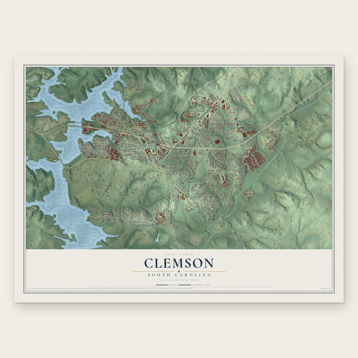
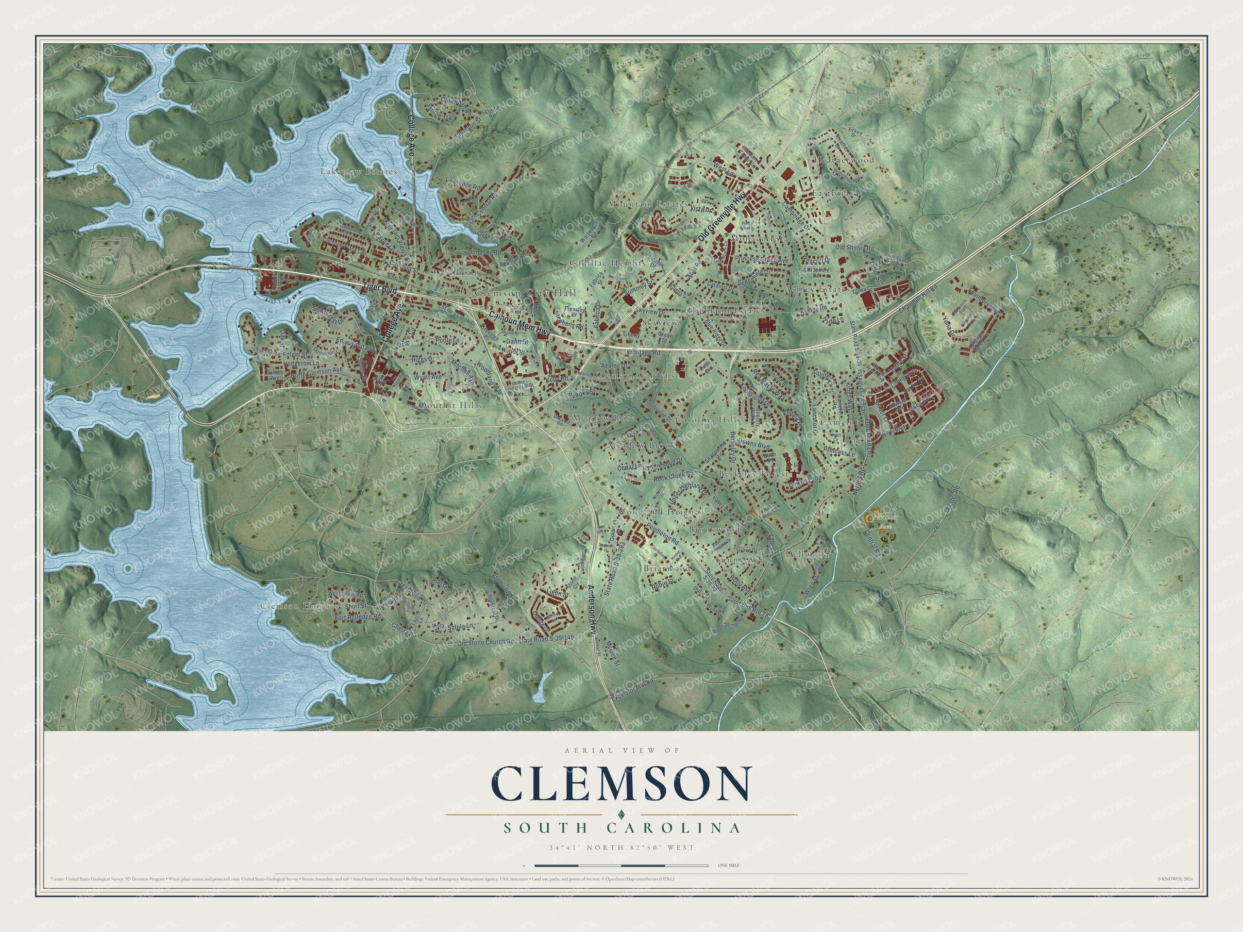
A new map of Clemson, South Carolina, made in 2026 and printed to order on thick archival matte paper.
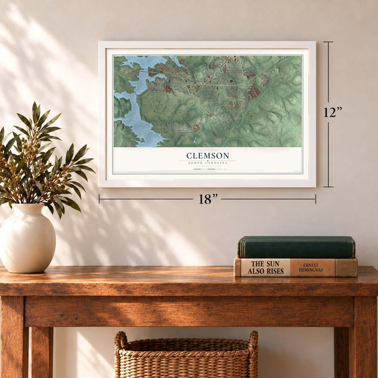
12" x 18" Archival Matte Print
A Map of Home. A Work of Art.
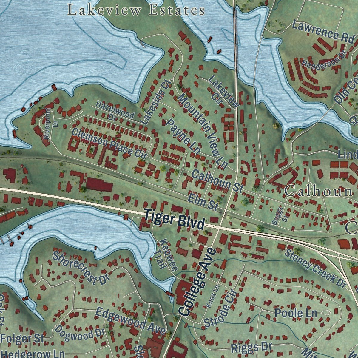
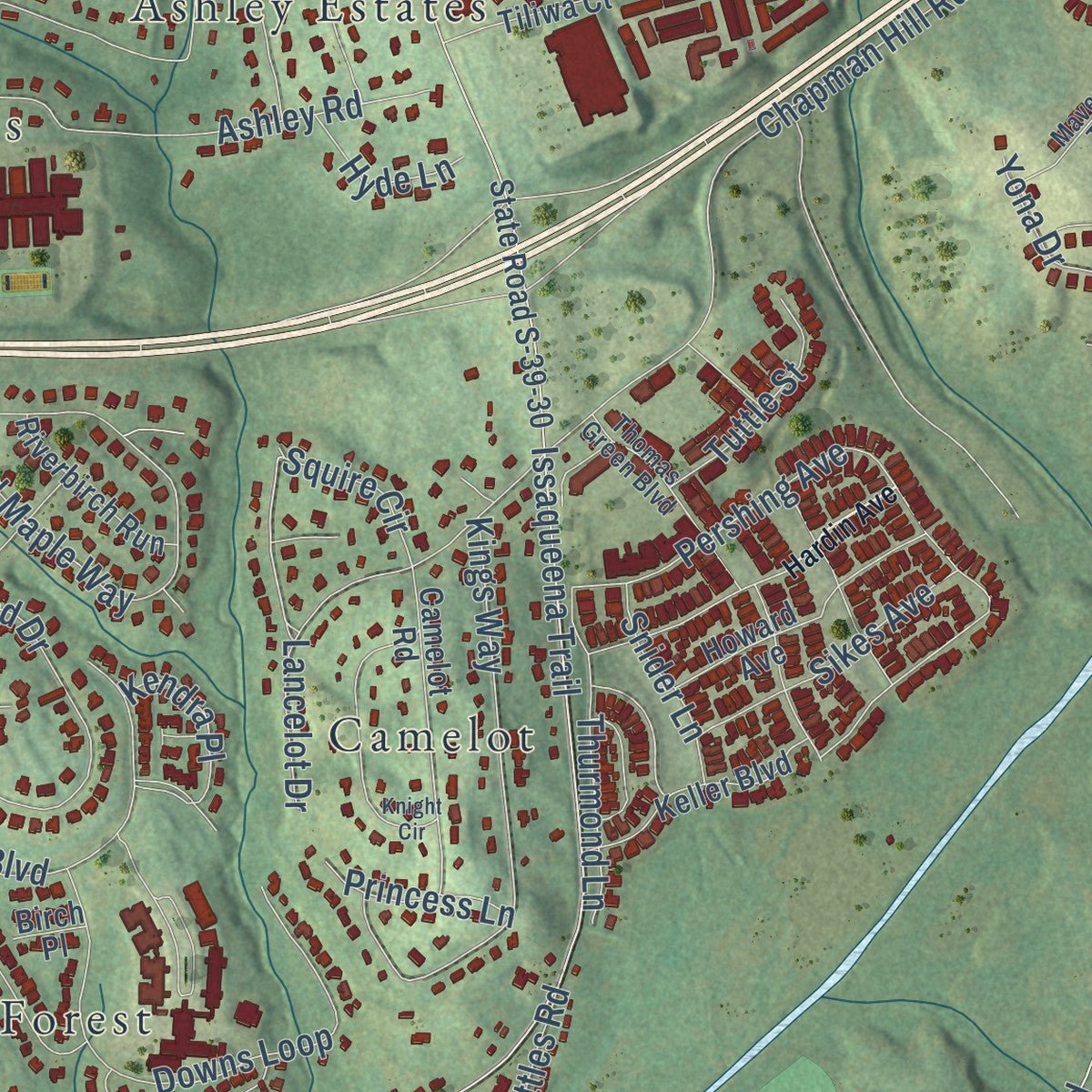
Explore Clemson, South Carolina from a whole new perspective. Created using aerial imagery and detailed geographic data, this map captures Clemson building by building, with labeled streets, familiar landmarks, and shaded topographical relief that highlights the natural contours of the landscape.
Combining modern data with the timeless character of a vintage atlas, this map is just as interesting up close as it is beautiful on the wall. Whether you grew up in Clemson, spent memorable years there, or call it home today, this unique map is a great way to celebrate a place that means something to you. Zoom in on the preview to look for your street, and then order a print to put your memories on the wall.
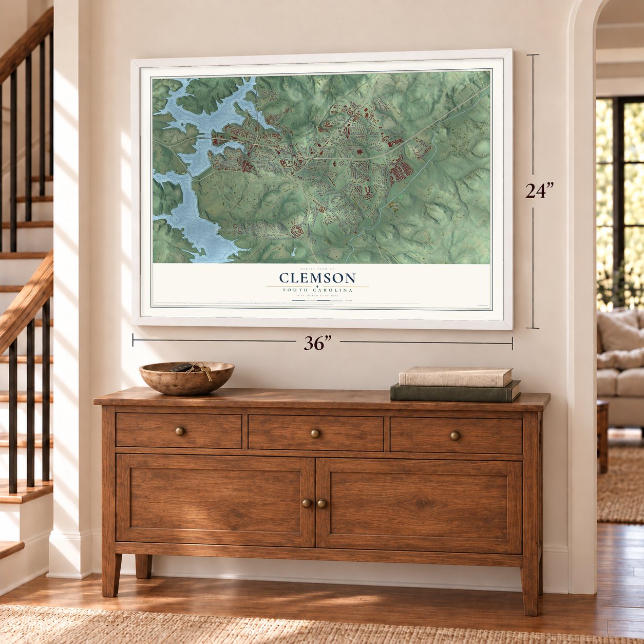
Three ways to hang it
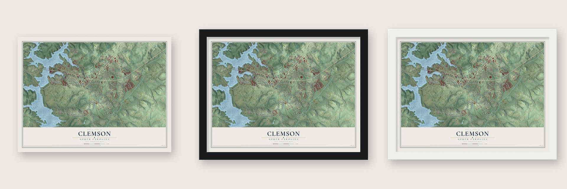
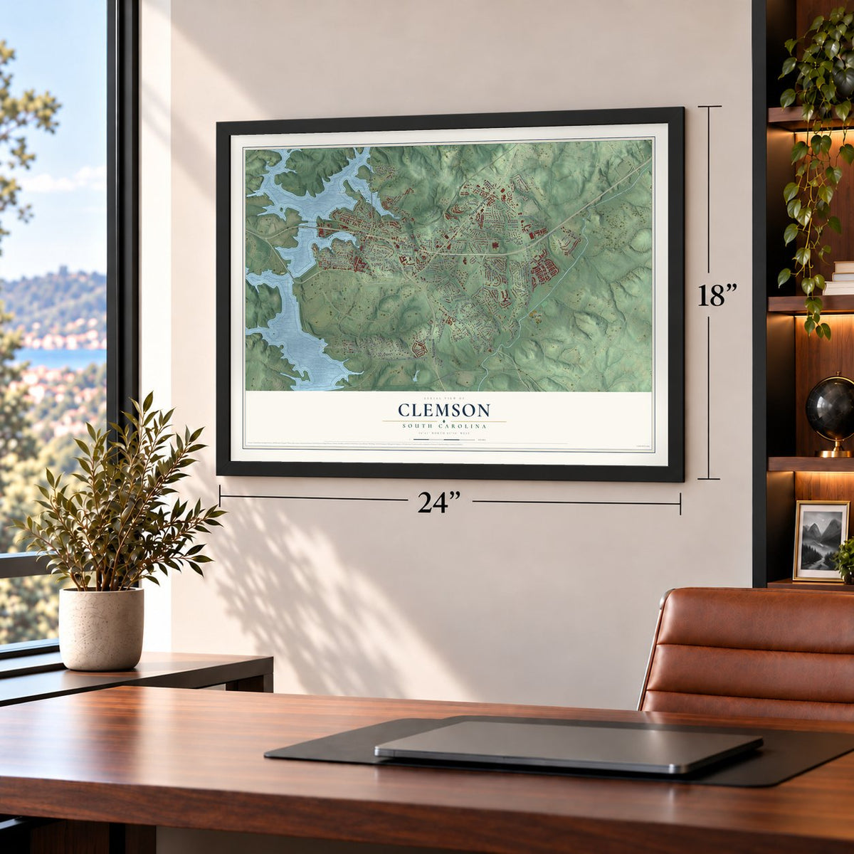
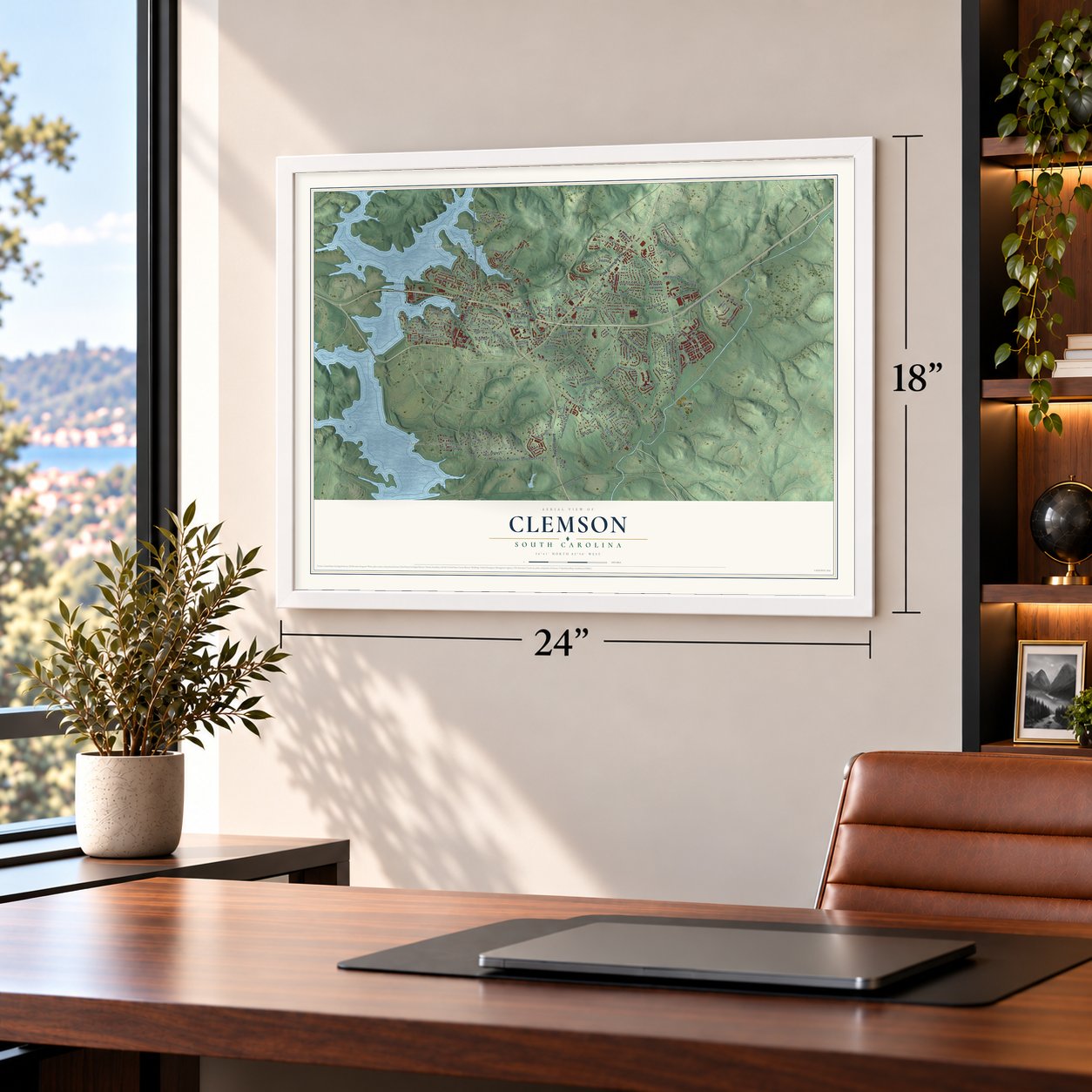
Unframed archival matte, a black wood frame or a white wood frame.
Up close
Geography Worth Displaying
This map was created using accurate cartographic data and authoritative geographic sources, including the U.S. Geological Survey and the Census Bureau. The map brings together terrain, waterways, roads, and building detail. The majority of the streets are labeled, houses are accurately depicted, and the topography is derived from government sources. Combining local data with carefully composed color and shading leads to this beautifully detailed Clemson artwork for your wall.
Rather than simply showing street outlines, we’ve included as many of the street names as we could reasonably fit on the map while keeping their names legible. Zoom in on the high resolution preview to see exactly what’s on the map. We truly set out to create a statement piece for anyone who loves Clemson. So whether it’s for you, or a gift for someone you love, we hope this map of Clemson brings back fond memories.
Read the story behind this map of Clemson, South Carolina from 2026.

About Clemson, South Carolina
Clemson is a city of 17,681 people in Pickens County, beside the university whose name it carries. Keowee and six other Cherokee towns stood along the Keowee River until the Cherokee were forced to give up this land in 1819, and European American settlers moved in after them. The community that grew up here was first called Calhoun.
The land for the college came down through John C. Calhoun's family. His Fort Hill Plantation passed to his widow, Floride, and when she died in 1866 their daughter Anna Maria inherited a share. When Anna Maria died in 1875, it went to her husband, Thomas Green Clemson. He knew she had hoped to see an agricultural college there, so his will left land for one. He died in 1888, and the college was founded in 1889, south of the town. In 1943 Calhoun took the name Clemson.
- First church in 1895Fort Hill Presbyterian, the first church in town, was organized in 1895. Its members gathered on the upper floor of Boggs' Store for a year, until their own sanctuary was finished.
- The depot of 1893Clemson's train depot went up in 1893 and was restored in 2001. It became home to the local chamber of commerce and visitor center. A road project shut the station in 2016, and it opened again in 2019.
- Rebuilt after the 1964 fireThe Calhoun-Clemson School on College Avenue burned in 1964. Only the cafeteria and a newer wing for the first and second grades survived. A new school went up on Frontage Road under the name Margaret Morrison Elementary. Work on a new building on Berkeley Drive began in 1999, and that is today's Clemson Elementary.
- Best town and gown in 2015In 1992 the city proposed bringing Clemson University inside its limits, but in 1993 the university chose not to join. The two stayed separate, and in 2015 the Princeton Review ranked Clemson first in the nation for relations between a town and its university.
Find your street
Names on the Clemson map
Every name below is printed on this map. Look for your street, your school, the park where you played, or the pond down the road.
Places and landmarks25
- Clemson City Hall
- Lakeview Estates
- Clemson Heights
- Nettles Park
- Ashley Estates
- Berkeley Forest
- Briarwood
- Brookwood
- Cadillac Heights
- Calhoun
- Camelot
- Carolina Hills
Show all 25 places
- Clemson Gardens
- Dellwood
- Douthit Hills
- Eastbriar
- Heatherwood
- Highland Estates
- Meadow Brook
- Meadow Rose
- Monaco Estates
- Mountain Estates
- Skyview
- Sunny Acres
- Woodland Heights
Streets and roads190
- Anderson Highway
- Old Greenville Highway
- Calhoun Mem Highway
- Tiger Boulevard
- College Avenue
- Pendleton Road
- Saint Bus Route 28
- Cherry Road
- Old Stone Church Road
- State Road S-39-293
- Kelly Road
- Squire Circle
- Issaqueena Trail
- Folger Street
- Poole Lane
- Berkeley Drive
- Clemson Street
- Old Central Road
- Elm Street
- Riggs Drive
- State Road S-39-149
- Rock Creek Road
- Frontage Road
- Pershing Avenue
- Red Maple Way
- Skyview Drive
- Clarendon Drive
- Kings Way
- Mountain View Lane
- Downs Loop
Show all 190 streets
- Tamassee Drive
- Lancelot Drive
- Knollwood Drive
- Cambridge Drive
- North Clemson Avenue
- Crestwood Drive
- Woodland Way
- Downs Boulevard
- Shorecrest Drive
- Ashley Road
- Princess Grace Avenue
- Calhoun Street
- Tabor Street
- Old Shirley Road
- Lindsay Road
- West Lane
- Wyatt Avenue
- Summey Street
- Porter Road
- Fort Rutledge Road
- Abel Road
- Chapman Hill Road
- Wescott Drive
- Strode Circle
- Edgewood Avenue
- Ligon Street
- Brooks Street
- Fabrica Drive
- Lawrence Road
- Butler Street
- Founders Boulevard
- Azalea Drive
- Santee Trail
- Central Road
- Thurmond Lane
- Sedgefield Drive
- Hedgerow Lane
- Catawbah Road
- Gantt Street
- Oak Street
- Sikes Avenue
- Vista Drive
- Upper Highland Drive
- Bentbrook Lane
- McGee Street
- Excelsior Mill Road
- Wren Street
- Robin Street
- Fife Drive
- Holly Avenue
- Sloan Street
- Stephens Road
- Yona Drive
- Tuttle Street
- Snider Lane
- Short Street
- Payne Lane
- Princess Lane
- Kendra Place
- Cedar Lane
- Mitchell Avenue
- Hyde Lane
- Satula Lane
- Nettles Road
- Tant Street
- Ridgecrest Drive
- State Road S-39-22
- West Lewis Road
- Ford Road
- State Road S-39-30
- Clemson Place Circle
- Cochran Road
- Shaftsbury Road
- Warbranch Road
- Goldman Street
- Creekside Drive
- Country Walk Lane
- Heather Drive
- Freedom Drive
- Stone Circle
- Stonebridge Drive
- Blue Ridge Drive
- Grange Valley Lane
- Grove Drive
- Camelot Road
- Liberty Drive
- Howard Avenue
- Pressley Drive
- Stoney Creek Drive
- Keowee Trail
- Keller Boulevard
- Orange Court
- Cardinal Drive
- Curtis Circle
- Grace Street
- Shadowood Road
- Riverbirch Run
- Mount Tabor Circle
- East Lewis Road
- Valley View Drive
- Willow Street
- Tiliwa Court
- Laurel Lane
- Lincoln Drive
- Forest Lane
- Greenlee Place
- Lakeside Court
- Dove Circle
- Dogwood Drive
- Sunset Avenue
- Lakeview Circle
- Fabrica Street
- Duke Street
- Canoy Lane
- Earle Street
- Holiday Avenue
- Hill Pine Court
- Vista Terrace
- Oak Terrace
- Birch Place
- Vineyard Road
- Lark Circle
- State Road S-39-62
- Berkeley Place Circle
- Thomas Green Boulevard
- Vickery Drive
- Wellington Way
- College Heights Boulevard
- Strawberry Lane
- Booker Springs Road
- Maverick Trail
- East Brookwood Drive
- Henderson Drive
- Walker Street
- Manley Drive
- Shaw Street
- Hazelwood Drive
- White Lane
- Nichols Street
- Hardin Avenue
- Monaco Circle
- Pleasant Lane
- Hunter Avenue
- Knight Circle
- Holden Drive
- Ridgeline Row
- Riverpoint Drive
- Dupree Street
- Hawthorne Street
- Vista Circle
- Rose Circle
- Castleford Drive
- Knox Lane
- Boggs Street
- Singleton Street
- Poplar Drive
- Foy Creek Drive
- Prince Albert Street
- Spencer Street
- Red Hill Court
Names are listed as they appear on the printed map. Zoom into the product photos to find them.
The art of mapping a place
How This Map Was Made
Real places. Remarkable detail. Discover the layers that turn geographic data into a map of home.

The view from above
Aerial imagery reveals the character of the land: woodland, open fields, and the patterns of a place.

The shape of the land
Elevation data brings hills, valleys, and subtle changes in the landscape into view.

The details of home
Roads, waterways, and building footprints come together to make the map feel unmistakably local.

Geography becomes art
Considered color, shading, and typography bring the layers together in a map made for your wall.


Process illustrated with Mendon, Massachusetts. Aerial imagery: USDA NAIP. Terrain: USGS 3D Elevation Program. Map details and finished artwork: KNOWOL.
The Details
About This Print
Choose an archival matte print, or a black or white Ayous wood frame. The archival matte print is unframed.
Select your size and finish above to see the matching product image and price.
Materials & Craftsmanship
A contemporary map with the character of a classic atlas, printed on archival matte paper. Optional frames are made from Ayous wood.
Your printed map does not include the watermark shown in the full-map preview.
Shipping & Delivery
Free shipping within the United States. Every print is made to order in the USA.
Buying a gift? Add a note in your cart and we'll include it. We never put prices in the package.
Prints ship within 2 to 3 business days. Allow 7 to 10 days total from ordering for delivery. Timing may vary during holidays or periods of high order volume.
Read our shipping policy.
Returns and damaged prints
Each print is made to order. Change-of-mind refunds are not available after production.
If your print arrives damaged, misprinted or incorrect, contact support@knowol.com within 30 days of receiving it. Include your order number, photos and a description of the issue.
Read our full refund and replacement policy. For questions about your order, email support@knowol.com.
Find your town
Looking for another city?
Find a map of home in our South Carolina collection, or any town in the country.
Nearby
Maps of towns near Clemson
Know someone from one of these towns? Their map makes a great gift.
 Clemson University
, South Carolina
From $39.99See the map
 Pendleton
, South Carolina
From $39.99See the map
 Central
, South Carolina
From $39.99See the map
More maps nearby: La France, Cateechee, Utica, Sandy Springs and Newry.