
Search for another town



Free U.S. delivery 7 to 10 days after you order
El Cerrito, California Map Art
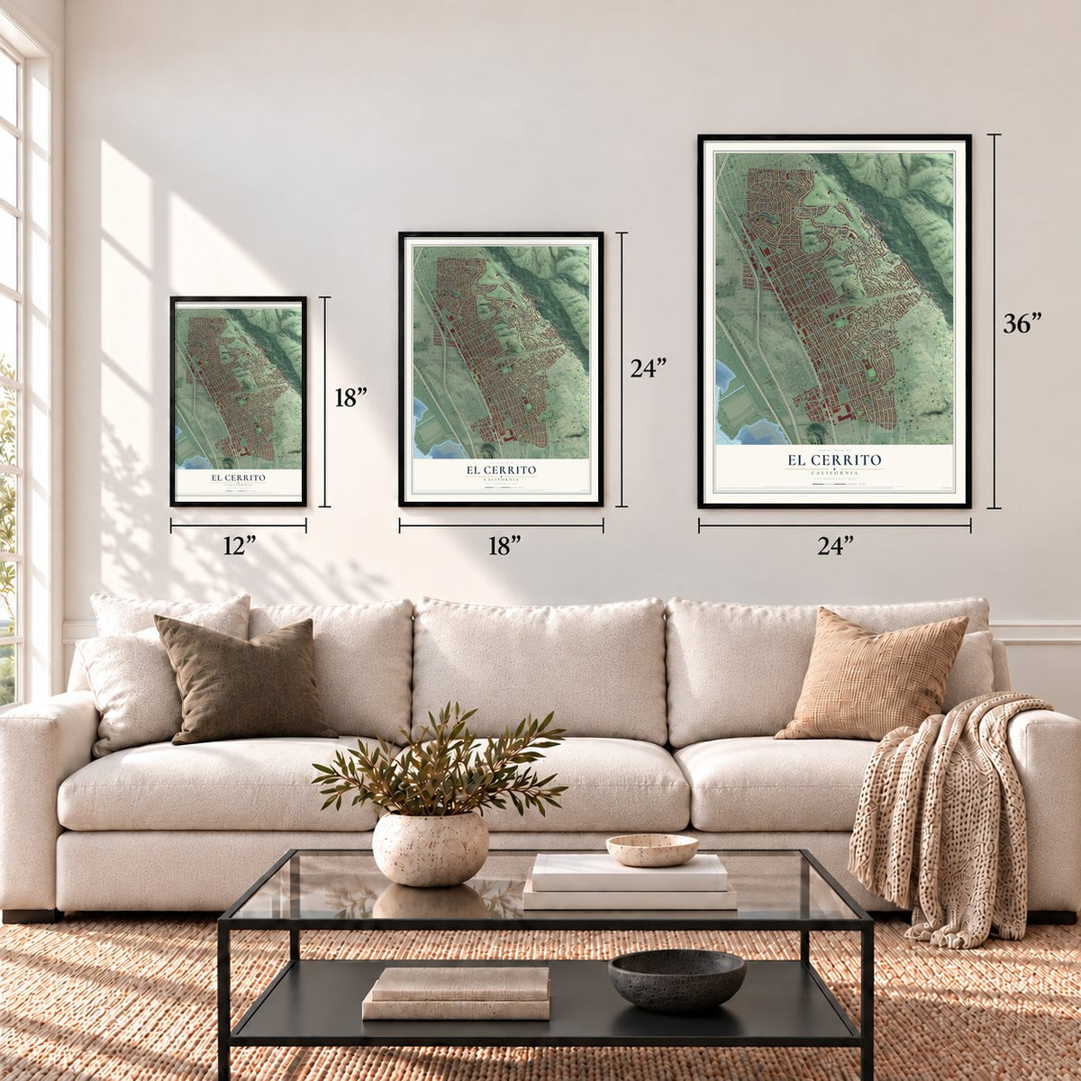
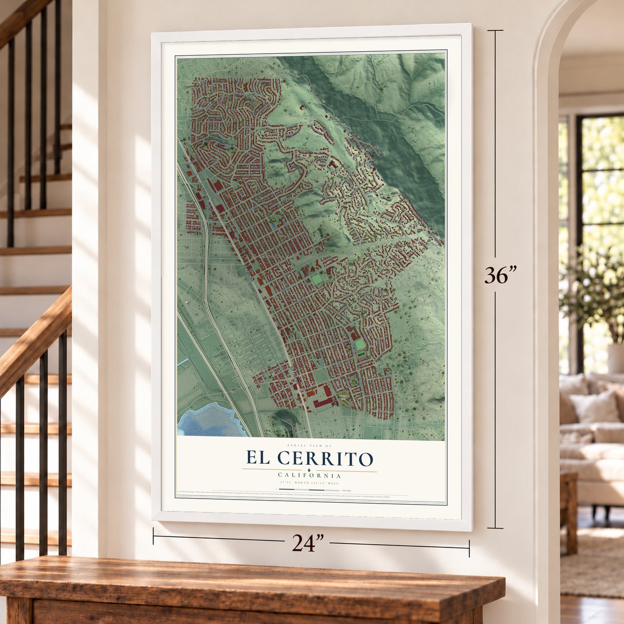
A new map of El Cerrito, California, made in 2026 and printed to order on thick archival matte paper.
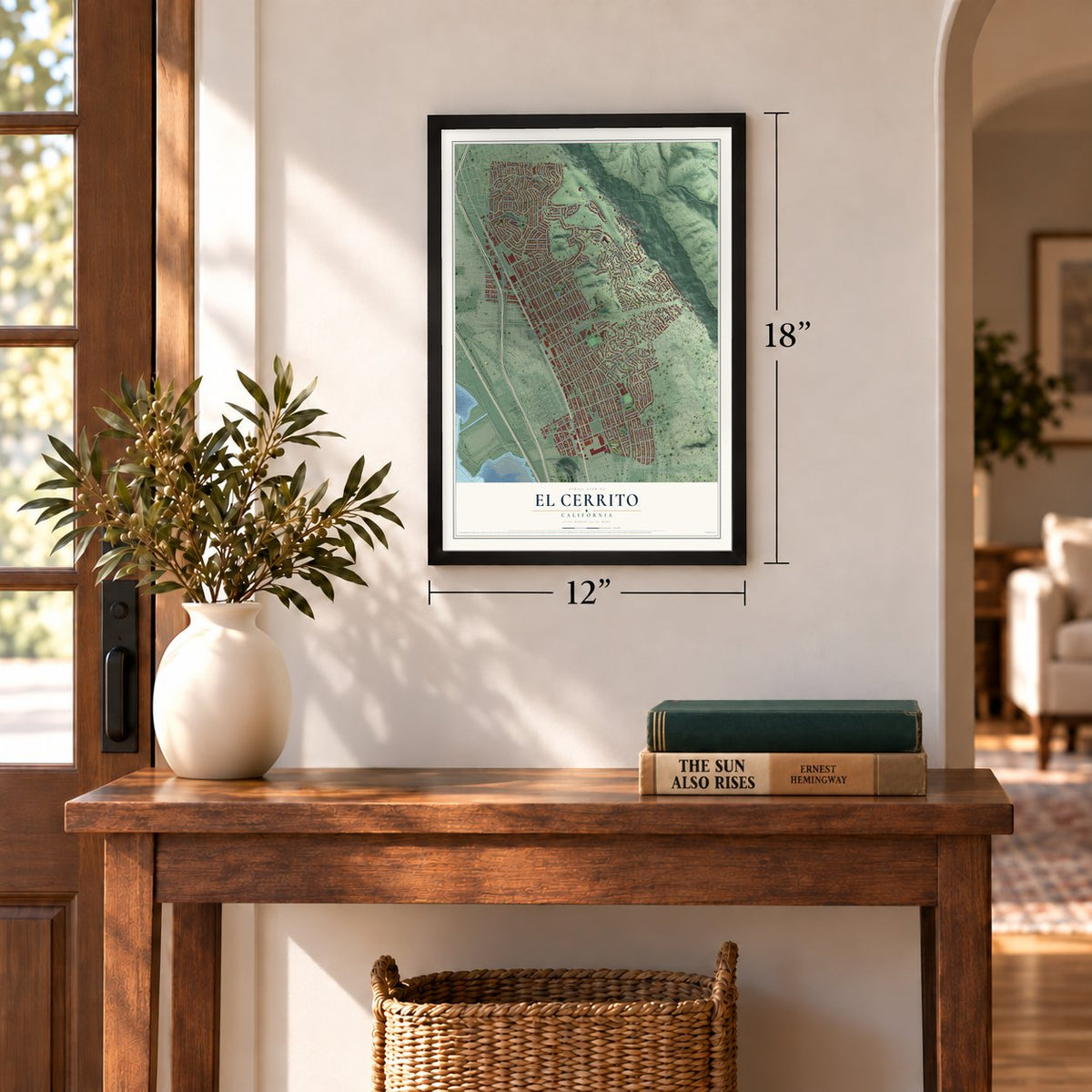
12" x 18" Archival Matte Print
A Map of Home. A Work of Art.
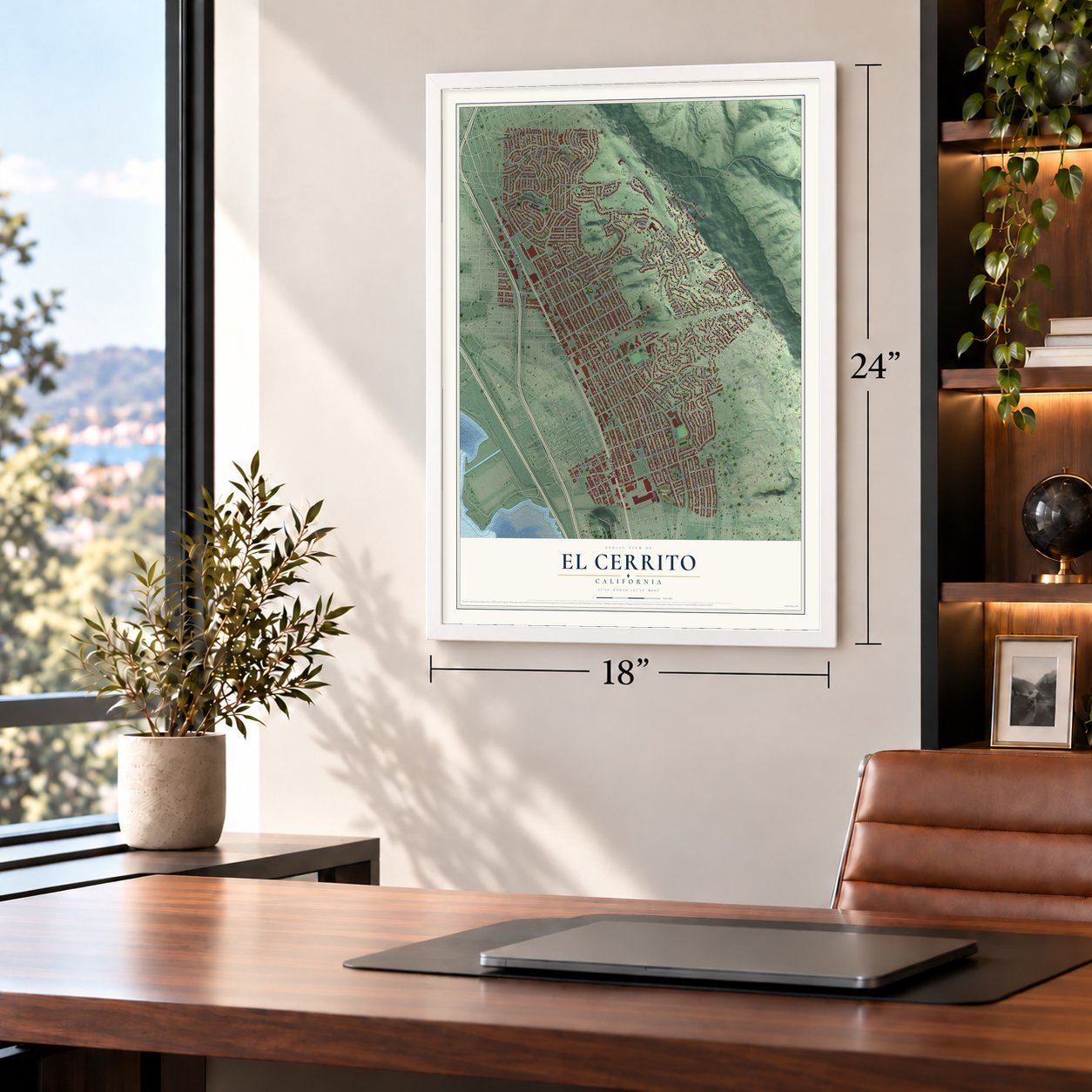
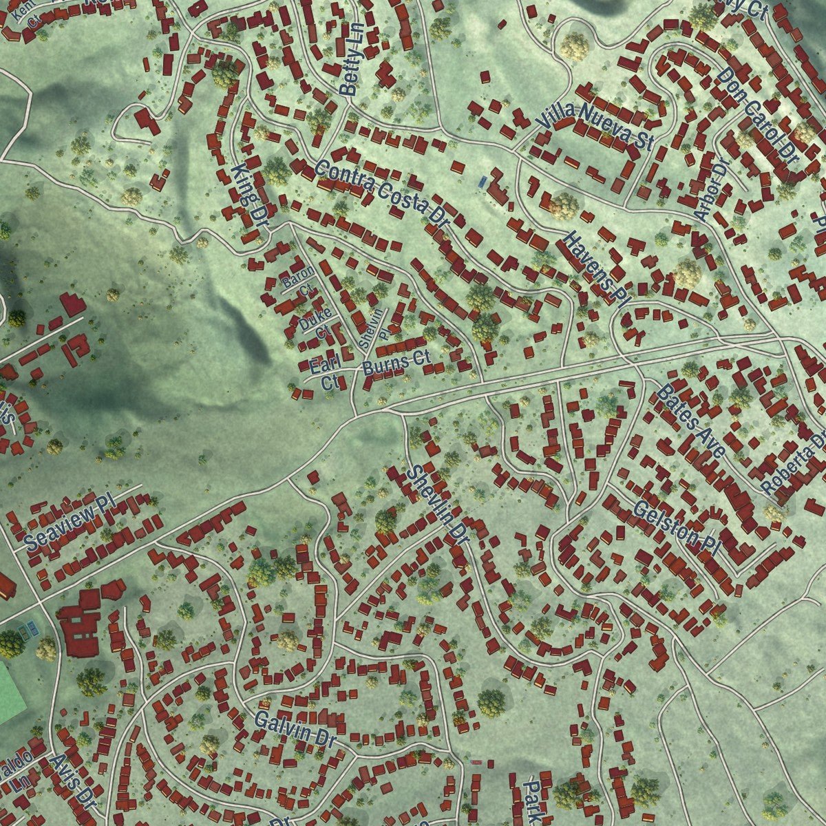
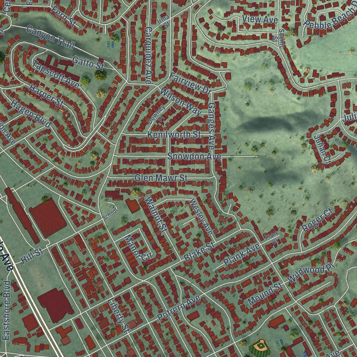
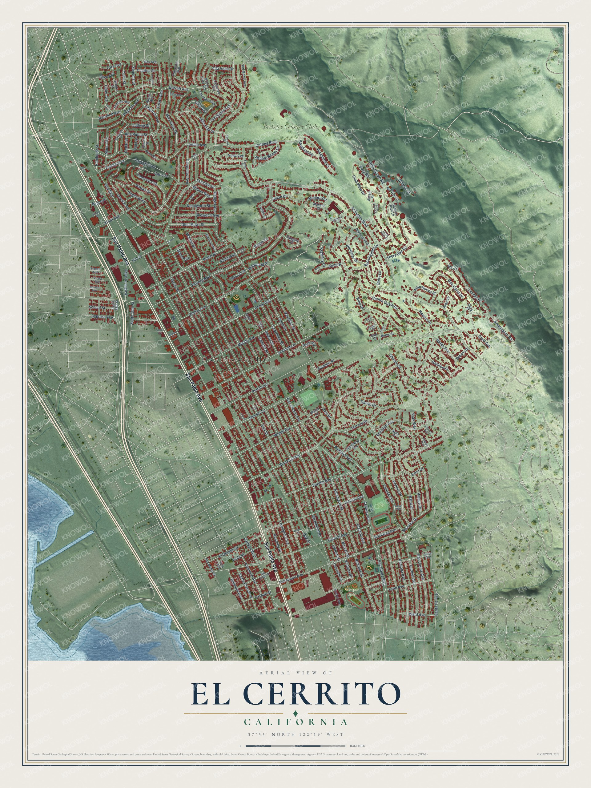
Explore El Cerrito, California from a whole new perspective. Created using aerial imagery and detailed geographic data, this map captures El Cerrito building by building, with labeled streets, familiar landmarks, and shaded topographical relief that highlights the natural contours of the landscape.
Combining modern data with the timeless character of a vintage atlas, this map is just as interesting up close as it is beautiful on the wall. Whether you grew up in El Cerrito, spent memorable years there, or call it home today, this unique map is a great way to celebrate a place that means something to you. Zoom in on the preview to look for your street, and then order a print to put your memories on the wall.
Three ways to hang it
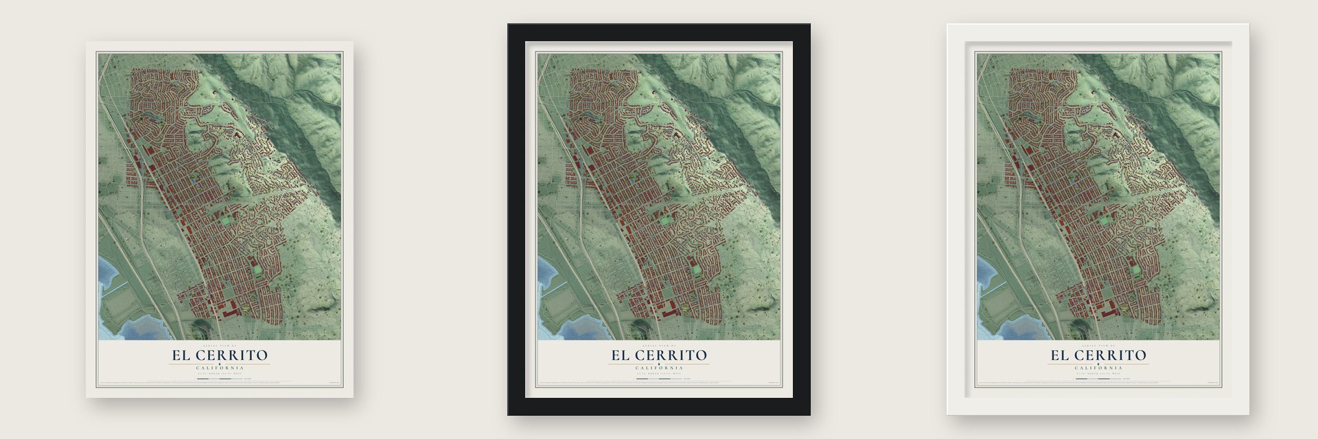
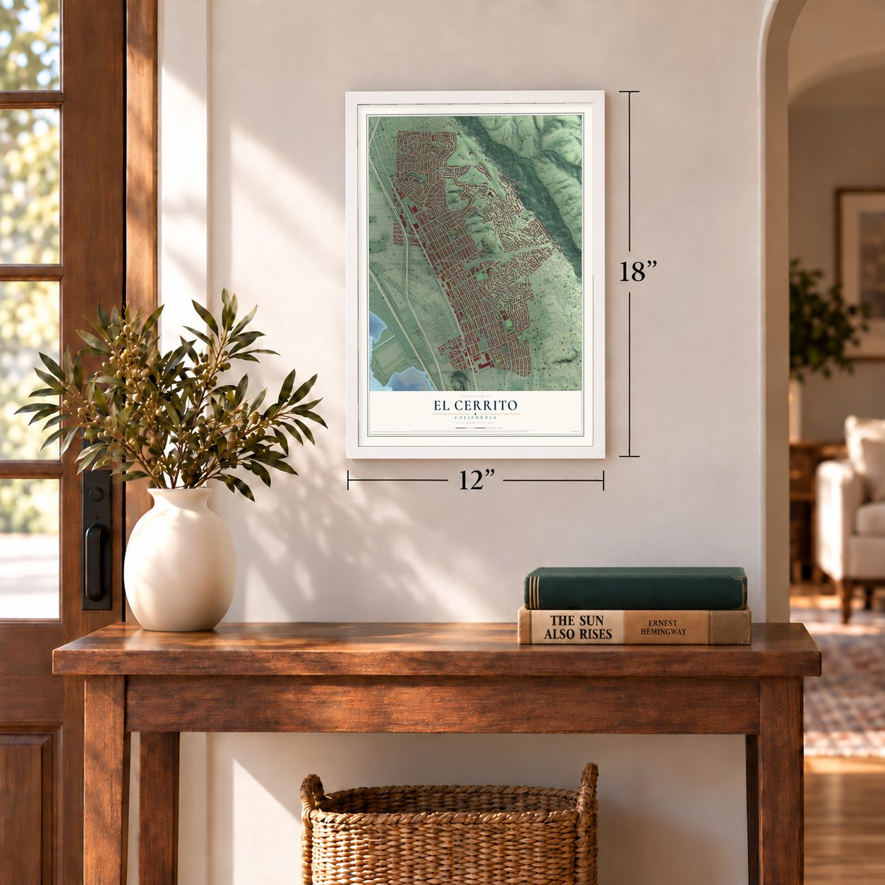
Unframed archival matte, a black wood frame or a white wood frame.
Up close
Geography Worth Displaying
This map was created using accurate cartographic data and authoritative geographic sources, including the U.S. Geological Survey and the Census Bureau. The map brings together terrain, waterways, roads, and building detail. The majority of the streets are labeled, houses are accurately depicted, and the topography is derived from government sources. Combining local data with carefully composed color and shading leads to this beautifully detailed El Cerrito artwork for your wall.
Rather than simply showing street outlines, we’ve included as many of the street names as we could reasonably fit on the map while keeping their names legible. Zoom in on the high resolution preview to see exactly what’s on the map. We truly set out to create a statement piece for anyone who loves El Cerrito. So whether it’s for you, or a gift for someone you love, we hope this map of El Cerrito brings back fond memories.
Read the story behind this map of El Cerrito, California from 2026.
About El Cerrito, California
El Cerrito is a city of 25,962 people in Contra Costa County, on the eastern shore of San Francisco Bay. People who lost their homes in the 1906 San Francisco earthquake settled here, on Don Víctor Castro's Rancho San Pablo. When a post office opened in 1909, the camp took the name Rust, after Wilhelm F. Rust, who served as its first postmaster.
Residents never liked that name, so in 1916 they chose El Cerrito, Spanish for "little hill," after nearby Albany Hill. The hill itself sits just over the line in Albany. On August 23, 1917, El Cerrito was incorporated with 1,500 residents, and the new city took in Stege Junction, Rust, Schmidtville and Schindler. Just over a century later, in November 2018, voters adopted a city charter.
“The El Cerrito adobe, as it was known because it was built near the north bank of El Cerrito Creek, was one of the adobes built by the Castro family on Rancho San Pablo.”
- Schmidtville's Italian familiesSchmidtville had a post office of its own from 1900 to 1901, years before the refugee camp at Rust. By the 1920 census, many of the people living there were immigrants from Italy. Schmidtville became part of El Cerrito when the city incorporated in 1917.
- Creedence started here in 1959In 1959 Creedence Clearwater Revival got its start in El Cerrito, the city where brothers John and Tom Fogerty both grew up. Years after the band broke up, its members came back together for one last concert at the 1983 El Cerrito High School reunion, held at Golden Gate Fields in Albany.
- Metallica's small houseMetallica lived for a while in a small house in El Cerrito, and the band wrote Ride the Lightning and Master of Puppets there. The move happened because Cliff Burton agreed to join Metallica only if the band relocated to El Cerrito.
Find your street
Names on the El Cerrito map
Every name below is printed on this map. Look for your street, your school, the park where you played, or the pond down the road.
Places and landmarks3
- El Cerrito City Hall
- Cougar Field
- Berkeley Country Club
Streets and roads210
- San Pablo Avenue
- Regency Court
- Moeser Lane
- Terrace Drive
- Kensington Road
- Rifle Range Road
- Buckingham Drive
- Victoria Street
- Leneve Place
- Arlington Boulevard
- Liberty Street
- Richmond Street
- Everett Street
- Elm Street
- Norvell Street
- Potrero Avenue
- Kearney Street
- Cutting Boulevard
- Ashbury Avenue
- Lexington Avenue
- Contra Costa Drive
- Colusa Avenue
- Stockton Avenue
- Seaview Drive
- Eureka Avenue
- Pomona Avenue
- Balra Drive
- Navellier Street
- Central Avenue
- Schmidt Lane
Show all 210 streets
- Barrett Avenue
- Fairmount Avenue
- Tamalpais Avenue
- Hagen Boulevard
- Carquinez Avenue
- Mira Vista Drive
- Key Boulevard
- Albemarle Street
- Portola Drive
- Manila Avenue
- Jordan Avenue
- Shevlin Drive
- King Drive
- Brewster Drive
- Lincoln Avenue
- Gladys Avenue
- Blake Street
- Clayton Avenue
- Tulare Avenue
- Carmel Avenue
- Donal Avenue
- Waldo Avenue
- San Carlos Avenue
- Ramona Avenue
- Carlson Boulevard
- Lawrence Street
- Alva Avenue
- Poinsett Avenue
- Edwards Avenue
- Don Carol Drive
- Key Route Boulevard
- Scott Street
- Bonnie Drive
- Ganges Avenue
- Gatto Street
- Galvin Drive
- Tapscott Avenue
- Snowdon Avenue
- El Dorado Street
- Yosemite Avenue
- Behrens Street
- Lagunitas Street
- Julian Drive
- Vista Road
- Knott Avenue
- Canyon Trail
- Santa Clara Avenue
- Club View Drive
- Conlon Avenue
- Cypress Avenue
- Rosalind Avenue
- Lynn Avenue
- Pinehurst Court
- Thors Bay Road
- Harper Street
- Glen Mawr Street
- Betty Lane
- Pebble Beach Drive
- Madera Circle
- Wildcat Drive
- Avis Drive
- Errol Drive
- Yuba Street
- Belmont Avenue
- Hill Street
- Wildwood Place
- Manor Circle
- Humboldt Street
- Gelston Place
- Village Drive
- Mono Avenue
- Kenilworth Street
- Eastshore Boulevard
- Ward Avenue
- Havens Place
- Bates Avenue
- Fern Street
- Spyglass Lane
- Walnut Street
- Villa Nueva Street
- Alta Punta Street
- Avila Street
- Sonoma Street
- Lassen Street
- Rockway Avenue
- Ludwig Street
- View Avenue
- Alta Vista Drive
- Leviston Avenue
- Seaview Place
- Wilson Way
- Fairview Drive
- School Street
- Rivera Street
- Cabrillo Street
- Roger Court
- Tuller Avenue
- Charles Street
- Santa Fe Avenue
- Plank Avenue
- Zara Avenue
- South 56th Street
- Silva Avenue
- Craft Avenue
- Cedar Street
- Kent Drive
- Oak Street
- Wall Avenue
- Mound Street
- Park Way
- Park Vis
- Ivy Court
- Tassajara Avenue
- Junction Avenue
- Devonshire Drive
- Evelyn Avenue
- Curry Avenue
- Wesley Avenue
- Douglas Drive
- Hotchkiss Avenue
- Nason Avenue
- Del Monte Avenue
- East Ashbury Avenue
- La Honda Avenue
- Arbor Drive
- Francisco Way
- Monte Vista Avenue
- South 55th Street
- Hillside Avenue
- Summit Park Lane
- Atwell Road
- San Mateo Street
- Bel View Court
- Coronado Street
- Julian Court
- Brooks Street
- Waldo Lane
- Roberta Drive
- Avila Place
- Gloria Street
- Edith Street
- Victor Avenue
- Burns Court
- Ray Avenue
- Madera Court
- Clark Place
- Yolo Avenue
- Earl Court
- Janie Court
- Ernest Avenue
- San Diego Street
- Scenic Street
- Downey Place
- Harvard Street
- Club View Court
- Alvarado Place
- Irma Street
- Gordon Avenue
- Maiden Lane
- Noble Court
- Linda Vista Drive
- Susan Avenue
- Duke Court
- Macdonald Avenue
- Madison Avenue
- Harris Avenue
- Willow Street
- Ellerhorst Street
- School
- Hancock Way
- Midcrest Way
- Shelvin Place
- Kent Court
- Elm Court
- Plank Court
- Verjane Avenue
- Liberty Court
- Carlos Avenue
- Baron Court
- Ohio Street
Names are listed as they appear on the printed map. Zoom into the product photos to find them.
The art of mapping a place
How This Map Was Made
Real places. Remarkable detail. Discover the layers that turn geographic data into a map of home.

The view from above
Aerial imagery reveals the character of the land: woodland, open fields, and the patterns of a place.

The shape of the land
Elevation data brings hills, valleys, and subtle changes in the landscape into view.

The details of home
Roads, waterways, and building footprints come together to make the map feel unmistakably local.

Geography becomes art
Considered color, shading, and typography bring the layers together in a map made for your wall.


Process illustrated with Mendon, Massachusetts. Aerial imagery: USDA NAIP. Terrain: USGS 3D Elevation Program. Map details and finished artwork: KNOWOL.
The Details
About This Print
Choose an archival matte print, or a black or white Ayous wood frame. The archival matte print is unframed.
Select your size and finish above to see the matching product image and price.
Materials & Craftsmanship
A contemporary map with the character of a classic atlas, printed on archival matte paper. Optional frames are made from Ayous wood.
Your printed map does not include the watermark shown in the full-map preview.
Shipping & Delivery
Free shipping within the United States. Every print is made to order in the USA.
Buying a gift? Add a note in your cart and we'll include it. We never put prices in the package.
Prints ship within 2 to 3 business days. Allow 7 to 10 days total from ordering for delivery. Timing may vary during holidays or periods of high order volume.
Read our shipping policy.
Returns and damaged prints
Each print is made to order. Change-of-mind refunds are not available after production.
If your print arrives damaged, misprinted or incorrect, contact support@knowol.com within 30 days of receiving it. Include your order number, photos and a description of the issue.
Read our full refund and replacement policy. For questions about your order, email support@knowol.com.
Find your town
Looking for another city?
Find a map of home in our California collection, or any town in the country.
Nearby
Maps of towns near El Cerrito
Know someone from one of these towns? Their map makes a great gift.
 Kensington
, California
From $39.99See the map
 East Richmond Heights
, California
From $39.99See the map
 Albany
, California
From $39.99See the map
More maps nearby: Rollingwood, San Pablo, Berkeley, El Sobrante and Richmond.