
Search for another town



Free U.S. delivery 7 to 10 days after you order
El Paso, Texas Map Art
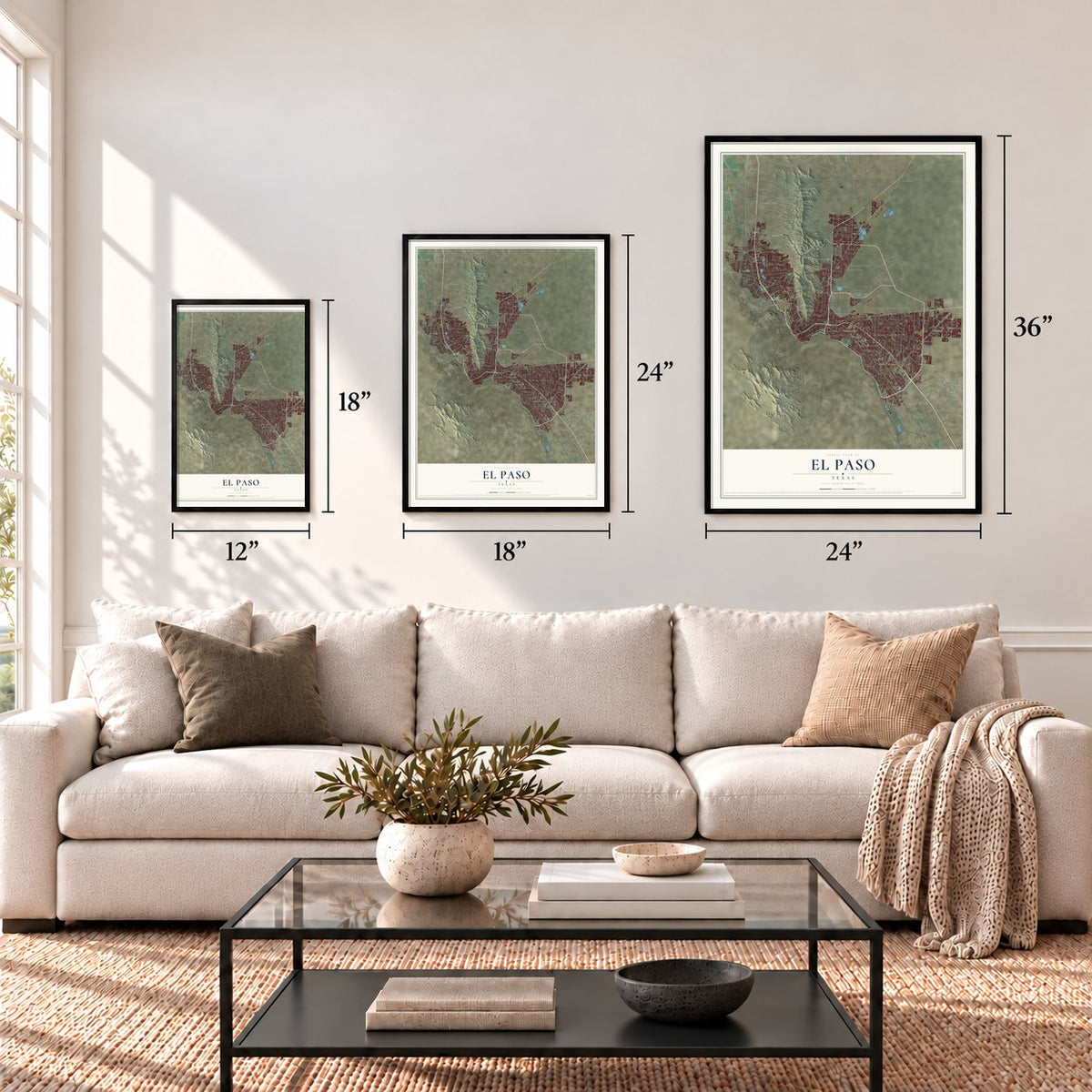
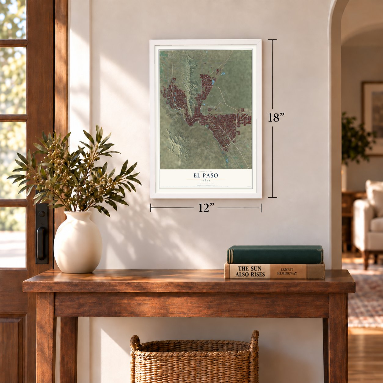
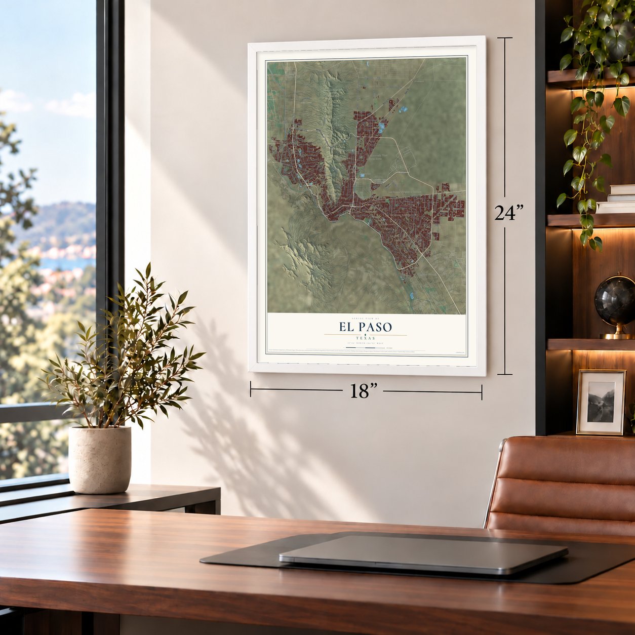
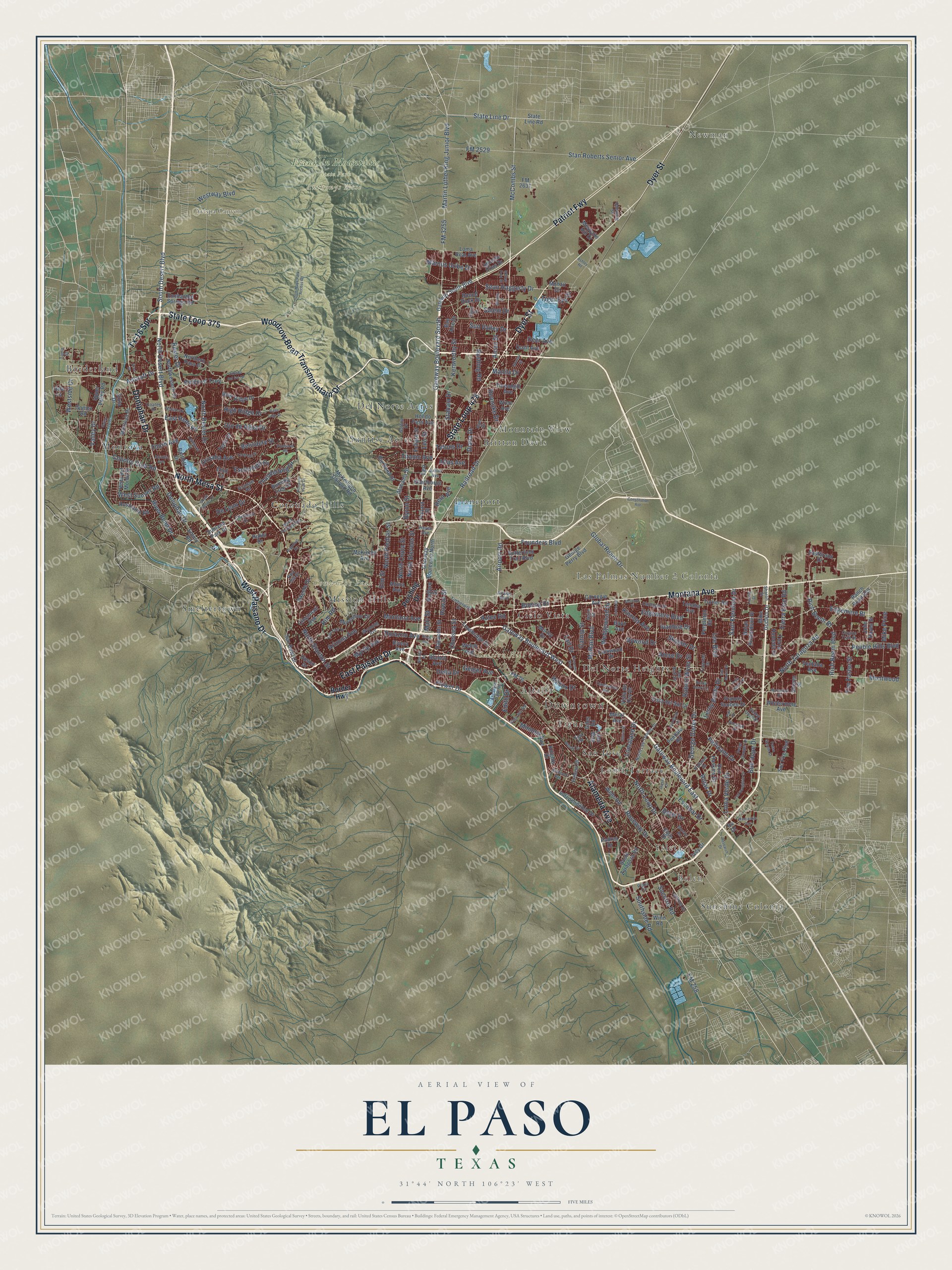
A new map of El Paso, Texas, made in 2026 and printed to order on thick archival matte paper.
12" x 18" Archival Matte Print
A Map of Home. A Work of Art.
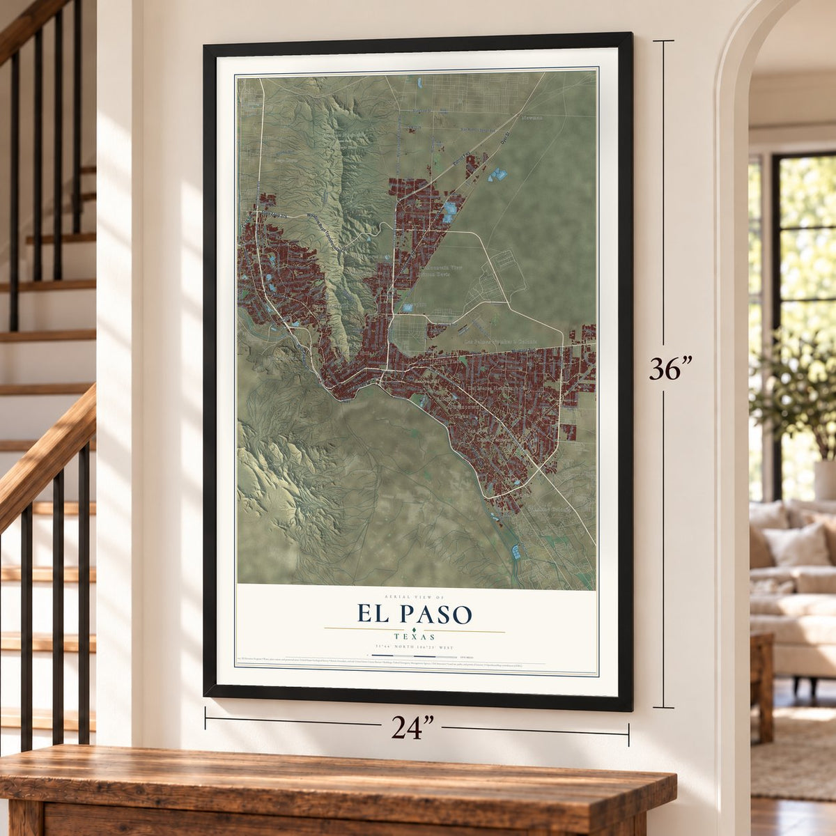
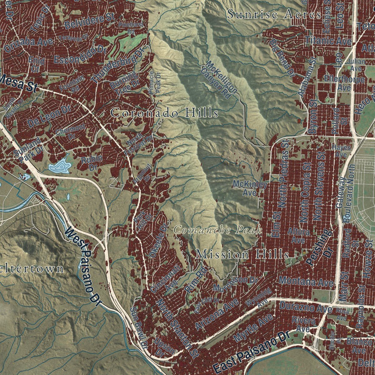
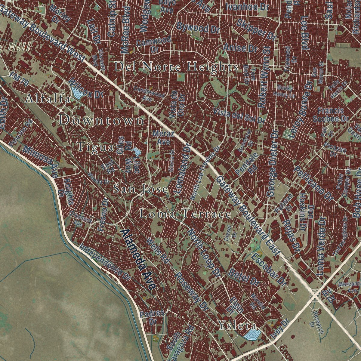
Explore El Paso, Texas from a whole new perspective. Created using aerial imagery and detailed geographic data, this map captures El Paso building by building, with labeled streets, familiar landmarks, and shaded topographical relief that highlights the natural contours of the landscape.
Combining modern data with the timeless character of a vintage atlas, this map is just as interesting up close as it is beautiful on the wall. Whether you grew up in El Paso, spent memorable years there, or call it home today, this unique map is a great way to celebrate a place that means something to you. Zoom in on the preview to look for your street, and then order a print to put your memories on the wall.
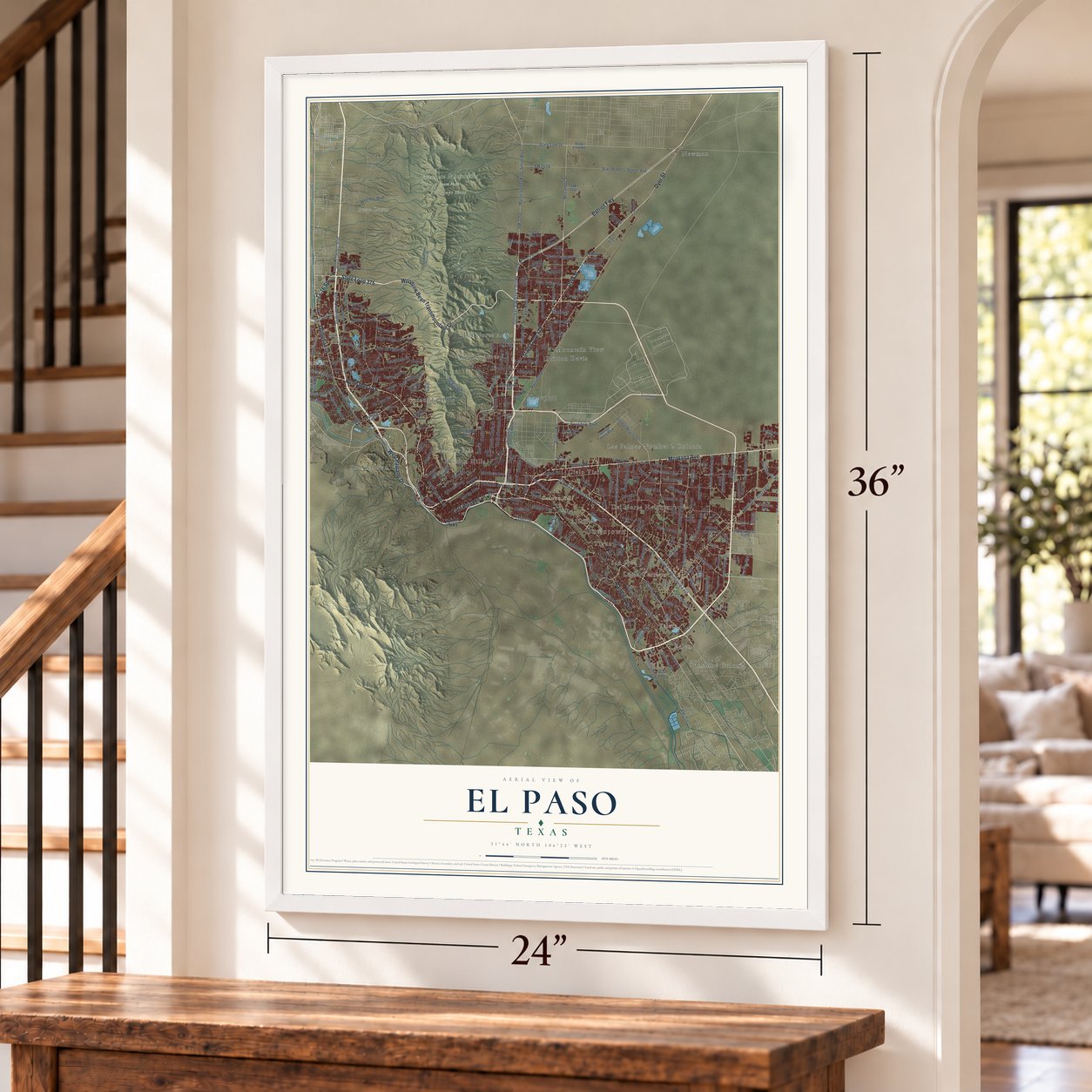
Three ways to hang it
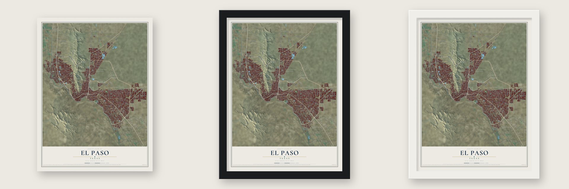
Unframed archival matte, a black wood frame or a white wood frame.
Up close
Geography Worth Displaying
This map was created using accurate cartographic data and authoritative geographic sources, including the U.S. Geological Survey and the Census Bureau. The map brings together terrain, waterways, roads, and building detail. The majority of the streets are labeled, houses are accurately depicted, and the topography is derived from government sources. Combining local data with carefully composed color and shading leads to this beautifully detailed El Paso artwork for your wall.
Rather than simply showing street outlines, we’ve included as many of the street names as we could reasonably fit on the map while keeping their names legible. Zoom in on the high resolution preview to see exactly what’s on the map. We truly set out to create a statement piece for anyone who loves El Paso. So whether it’s for you, or a gift for someone you love, we hope this map of El Paso brings back fond memories.

About El Paso, Texas
El Paso is a city and the seat of El Paso County, positioned on the Rio Grande opposite Ciudad Juarez, Mexico. Its population reached 678,815 in 2020, making it the largest city in West Texas. Incorporated in 1873, the city grew rapidly after three railroad lines arrived in 1881.
- Meaning of the NameIn Spanish, El Paso means "the route" or "the pass."
- Ancient SettlementFolsom points found at Hueco Tanks suggest people inhabited the El Paso region 10,000 to 12,000 years ago.
- International NeighborsEl Paso faces Ciudad Juarez across the Rio Grande along the border between Mexico and the United States.
- Railroad Turning PointThree railroad companies reached El Paso in 1881, preceding a population of 10,000 recorded in the 1890 census.
- Sun Bowl TraditionEl Paso hosts the annual Sun Bowl, described as the country's second-oldest college football bowl game.
Find your street
Names on the El Paso map
Every name below is printed on this map. Look for your street, your school, the park where you played, or the pond down the road.
Places and landmarks27
- Downtown
- Newman
- Belen
- Ysleta
- Las Palmas Number 2 Colonia
- Anthonys Nose
- Avispa Canyon
- Caisson Hill
- Comanche Peak
- Franklin Mountains State Park
- Alfalfa
- Borderland
Show all 27 places
- Britton Davis
- Cielo Vista
- Coronado Hills
- Del Norte Acres
- Del Norte Heights
- Loma Terrace
- Mission Hills
- Montoya
- Mountain View
- Planeport
- San Jose
- Smeltertown
- Sunrise Acres
- Sunshine Colonia
- Tigua
Streets and roads285
- Dyer Street
- State Loop 375
- Alameda Avenue
- North Mesa Street
- Patriot Fwy
- East Paisano Drive
- West Paisano Drive
- Montana Avenue
- State Loop 478
- Woodrow Bean Transmountain Drive
- Doniphan Drive
- Tx-16 Spr
- McCombs Street
- FM 2529
- Gateway Boulevard South
- Artcraft Drive
- State Line Drive
- FM 3255
- Martin Luther King Junior Boulevard
- South Desert Boulevard
- Country Club Road
- Atlas Avenue
- Stan Roberts Senior Avenue
- North Stanton Street
- Airport Road
- Arizona Avenue
- Elm Street
- Edgemere Boulevard
- North Resler Drive
- North Copia Street
Show all 285 streets
- Rojas Drive
- Chelsea Street
- Railroad Drive
- North Loop Drive
- Pebble Hills Boulevard
- Gateway Boulevard East
- Gateway Boulevard West
- George Dieter Drive
- North Zaragoza Road
- Pellicano Drive
- East Redd Road
- Delta Drive
- Sean Haggerty Drive
- Edgemere Bl
- Saul Kleinfeld Drive
- Rich Beem Boulevard
- Diana Drive
- Global Reach Drive
- North Desert Boulevard
- McRae Boulevard
- Lomaland Drive
- North Piedras Street
- North Stevens Street
- Westside Drive
- Belvidere Street
- Resler Drive
- Socorro Road
- Rushing Road
- Roseway Drive
- Sun Valley Drive
- Byron Street
- Valley Drive
- Montwood
- Founders Boulevard
- Robert Wynn Street
- Tierra Este Road
- Kenworthy Street
- Titanic Avenue
- Wedgewood Drive
- Lee Boulevard
- Thunderbird Drive
- Tim Foster Street
- Rich Beem Bl
- Southside Road
- Marcus Uribe Drive
- FM 258
- Bob Hope Drive
- Rim Road
- Helen of Troy
- Ojo de Agua Drive
- Boeing Drive
- High Ridge Drive
- Escobar Drive
- River Bend Drive
- Anise Drive
- Salem Drive
- De Leon Drive
- Durazno Avenue
- Myrtle Avenue
- Marr Street
- Betel Drive
- Escondido Drive
- Ivanhoe Drive
- Tetons Drive
- Mike Price
- Alcan Street
- West Sunset Road
- Roanoke Drive
- Westway Boulevard
- Leroy Bonse Drive
- Thorn Avenue
- Deer Avenue
- Leo Street
- Loma Verde Drive
- Bywood Drive
- Tiger Eye Drive
- Orizaba Avenue
- Lait Drive
- Wilcox Drive
- Mimosa Avenue
- Stahala Drive
- Kinross Avenue
- Flower Drive
- Hero Avenue
- Geiger Avenue
- Catnip Street
- Skipper Drive
- Howze Street
- Manila Drive
- Edith Drive
- Aztec Road
- Leo
- Border Highway
- Pershing Drive
- Alabama Street
- Gateway South Boulevard
- State Line Road
- Gateway Boulevard North
- Hondo Pass Avenue
- FM 76
- Trowbridge Drive
- Vista del Sol Drive
- John Hayes Street
- Ranch Road 659
- Sunland Park Drive
- Pendale Road
- George Perry Boulevard
- Rosinante Road
- Northwestern Drive
- Montoya Drive
- Upper Valley Road
- McKelligon Canyon Road
- Sun Fire Boulevard
- Northern Pass Drive
- McKinley Avenue
- Independence Drive
- Emory Road
- Knights Drive
- Turner Road
- Don Haskins Drive
- Pollard Street
- Raynolds Street
- Altura Avenue
- South Zaragoza Road
- Radford Street
- Sun Bowl Drive
- Gomez Road
- Loma Real Avenue
- Giles Road
- Padres Drive
- Murchison Drive
- Butterfield Trail Boulevard
- Nolan Richardson Drive
- Vista de Oro Drive
- Eclipse Street
- Ellerthorpe Avenue
- Okeefe Drive
- Threadgill Avenue
- Mesquite Hill Drive
- Ivey Drive
- Wren Avenue
- Round Rock Drive
- Bear Ridge Drive
- Vista del Monte Street
- Francis Scobee Drive
- Quail Avenue
- Bartlett Drive
- Enchanted Springs Road
- Windermere Avenue
- Wells Road
- Pendleton Road
- Tepic Drive
- Burning Tree Drive
- Ventana Avenue
- Shreya Street
- Fresno Drive
- Big Bend Drive
- Cincinnati Avenue
- Bon Aire Drive
- Tierra Humeda Drive
- Tenaha Avenue
- Winn Road
- Mohair Drive
- Rivera Avenue
- Eastbrook Drive
- Mike Godwin Drive
- Carnegie Avenue
- Elgin Drive
- FM 2637
- Camwood Drive
- Morley Drive
- Bayo Avenue
- Upson Drive
- Ignacio Frias Drive
- Welch Avenue
- Blanco Avenue
- Meraz Avenue
- Lilac Way
- Rubin Drive
- Ada Lane
- Sixta Drive
- Enid Court
- Rv Drive
- Julian Avenue
- North Lee Trevino Drive
- Trawood Drive
- Airway Boulevard
- Wyoming Avenue
- Ascarate Park Road
- Pullman Drive
- Peter Cooper Drive
- Plaza Circle
- Alps Drive
- Cardigan Drive
- Hayes Avenue
- Timberwolf Drive
- Polo Inn Road
- North Festival Drive
- Coates Drive
- Coyote Trail Drive
- Valley Quail Drive
- Galena Drive
- Chermont Drive
- Fountain Road
- Gifford Drive
- Odonnell Street
- Sharon Street
- Picasso Drive
- Tom Bolt Drive
- Park Hill Drive
- Nairn Street
- Tama Street
- East Road
- South Resler Drive
- Montwood Drive
- Tom Mays Park Access Road
- Rosa Avenue
- Viscount Boulevard
- East Cliff Drive
- Medano Drive
- Ted Houghton Drive
- Goodyear Drive
- Wenda Drive
- Bunky Henry Lane
- Lakehurst Road
- Candlewood Avenue
- Gus Moran Street
- Tarascas Drive
- Diesel Drive
- Bomarc Street
- Murphy Street
- Constitution Avenue
- Ashley Road
- Morelia Road
- Mercantile Avenue
- Lorne Road
- Cabana del Sol Drive
- Pinehurst Road
- Gloria Street
- Polly Harris Drive
- Research Drive
- Craddock Avenue
- Pinnacle Peak Drive
- Argonaut Drive
- Paseo Grande Street
- Sigma Street
- Shannon Place
- Whitey Ford Street
- Calle Lago Drive
- Bauxite Avenue
- Lionetti Street
- Shelter Place
- Valley Laurel
- Pali Drive
- Arce Drive
Names are listed as they appear on the printed map. Zoom into the product photos to find them.
The art of mapping a place
How This Map Was Made
Real places. Remarkable detail. Discover the layers that turn geographic data into a map of home.

The view from above
Aerial imagery reveals the character of the land: woodland, open fields, and the patterns of a place.

The shape of the land
Elevation data brings hills, valleys, and subtle changes in the landscape into view.

The details of home
Roads, waterways, and building footprints come together to make the map feel unmistakably local.

Geography becomes art
Considered color, shading, and typography bring the layers together in a map made for your wall.


Process illustrated with Mendon, Massachusetts. Aerial imagery: USDA NAIP. Terrain: USGS 3D Elevation Program. Map details and finished artwork: KNOWOL.
The Details
About This Print
Choose an archival matte print, or a black or white Ayous wood frame. The archival matte print is unframed.
Select your size and finish above to see the matching product image and price.
Materials & Craftsmanship
A contemporary map with the character of a classic atlas, printed on archival matte paper. Optional frames are made from Ayous wood.
Your printed map does not include the watermark shown in the full-map preview.
Shipping & Delivery
Free shipping within the United States. Every print is made to order in the USA.
Buying a gift? Add a note in your cart and we'll include it. We never put prices in the package.
Prints ship within 2 to 3 business days. Allow 7 to 10 days total from ordering for delivery. Timing may vary during holidays or periods of high order volume.
Read our shipping policy.
Returns and damaged prints
Each print is made to order. Change-of-mind refunds are not available after production.
If your print arrives damaged, misprinted or incorrect, contact support@knowol.com within 30 days of receiving it. Include your order number, photos and a description of the issue.
Read our full refund and replacement policy. For questions about your order, email support@knowol.com.
Find your town
Looking for another city?
Find a map of home in our Texas collection, or any town in the country.
Nearby
Maps of towns near El Paso
Know someone from one of these towns? Their map makes a great gift.
 Fort Bliss
, Texas
From $39.99See the map
 Prado Verde
, Texas
From $39.99See the map
 Canutillo
, Texas
From $39.99See the map
More maps nearby: Westway, Vinton, Anthony, Homestead Meadows North and Homestead Meadows South.