
Search for another town




Free U.S. delivery 7 to 10 days after you order
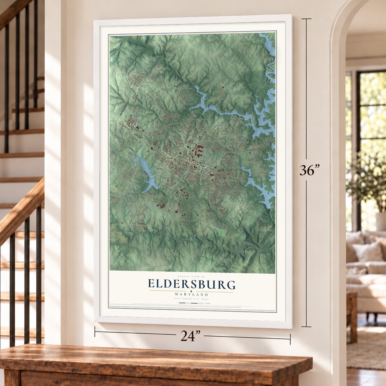
Eldersburg, Maryland Map Art
Building by building, with labeled streets and shaded relief.
12" x 18" Archival Matte Print
A Map of Home. A Work of Art.
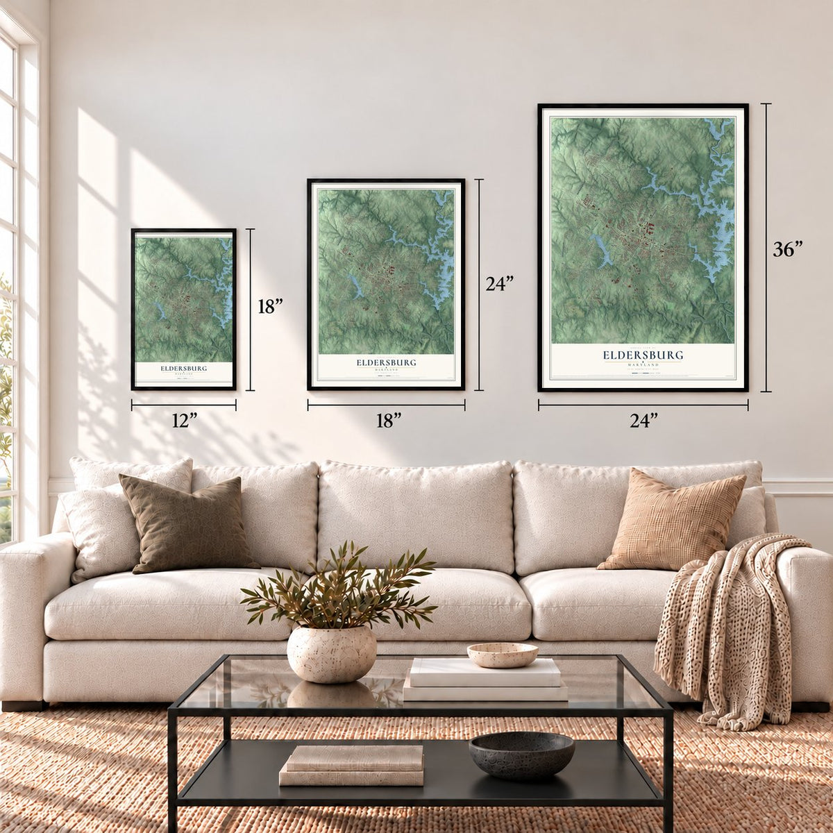
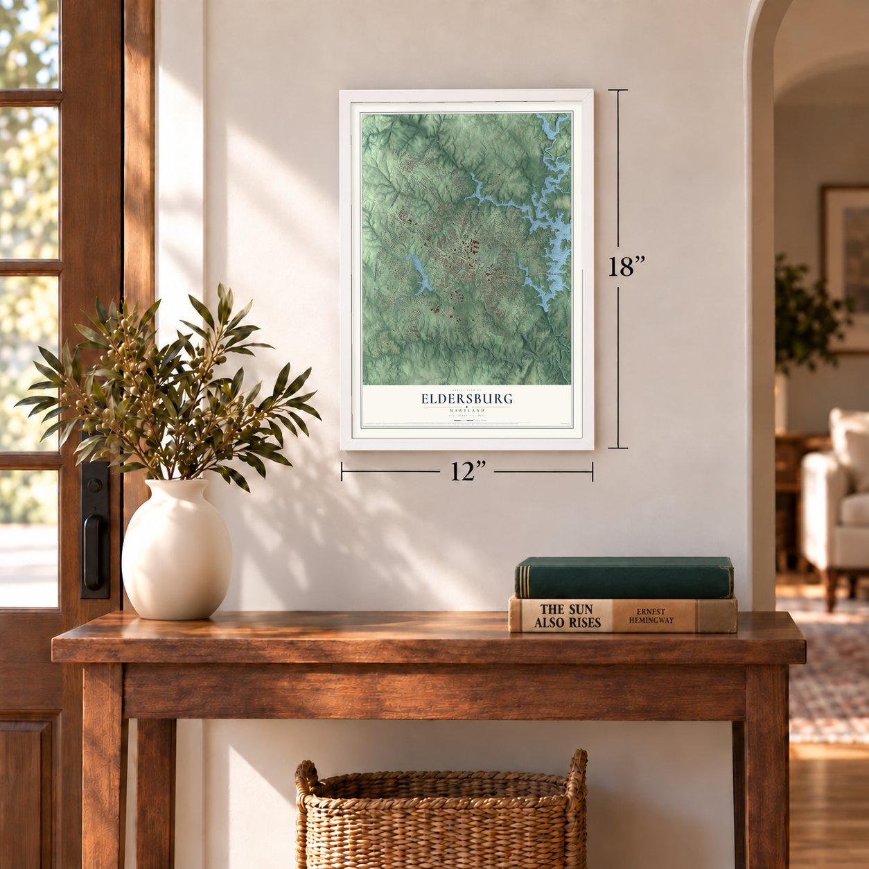
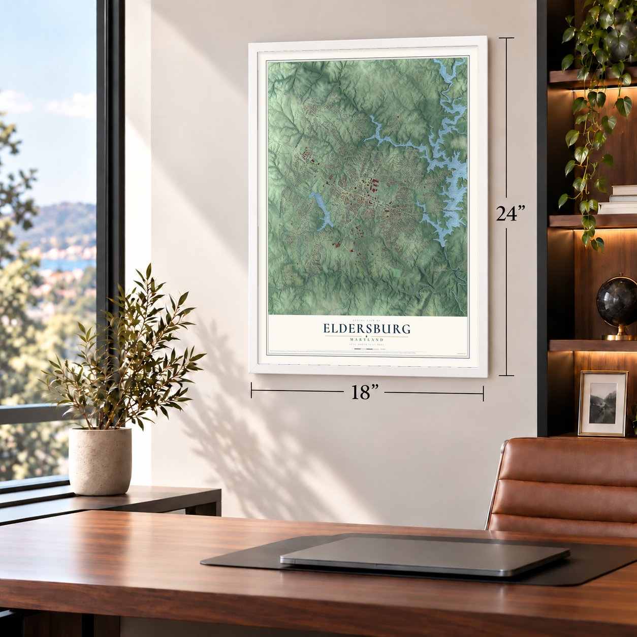
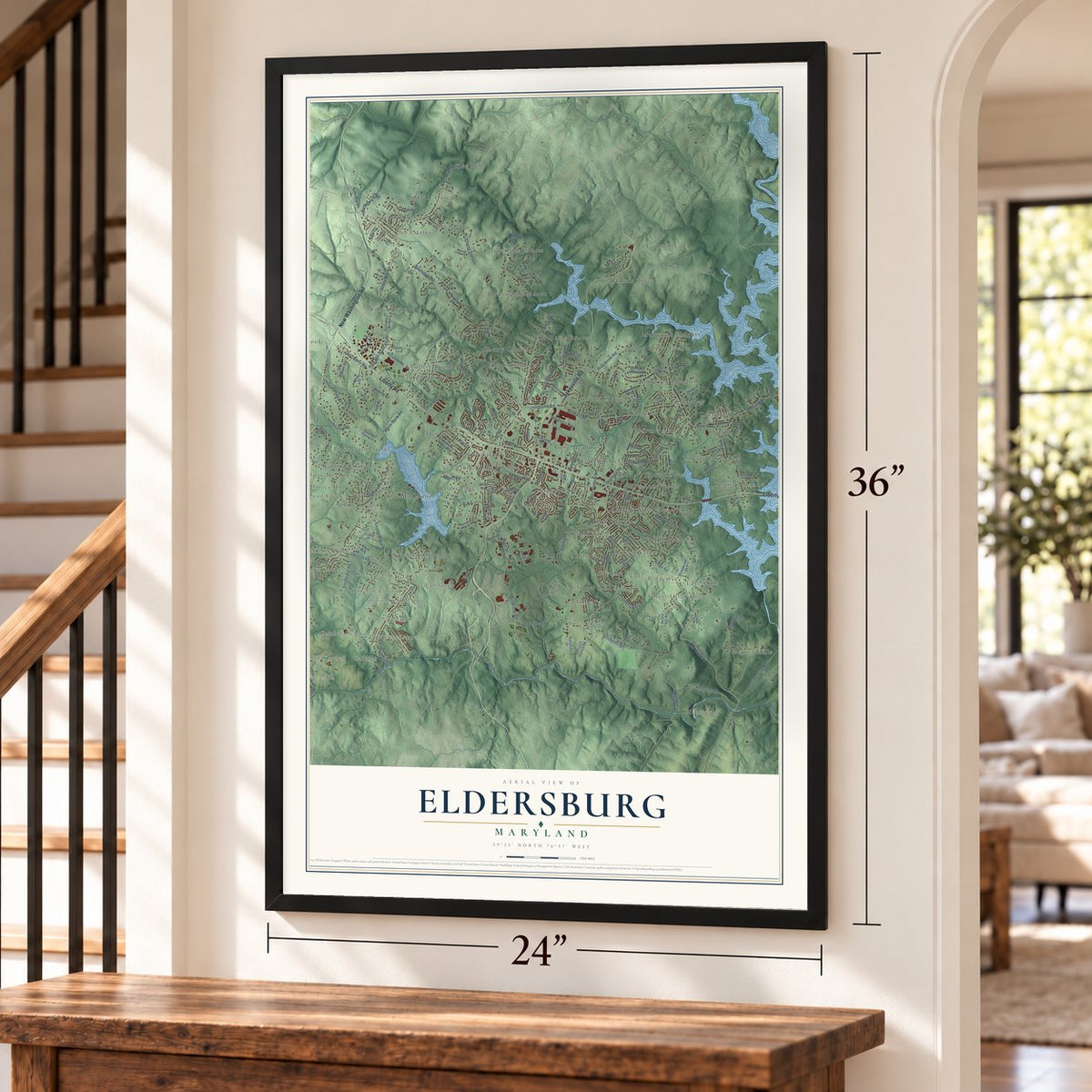
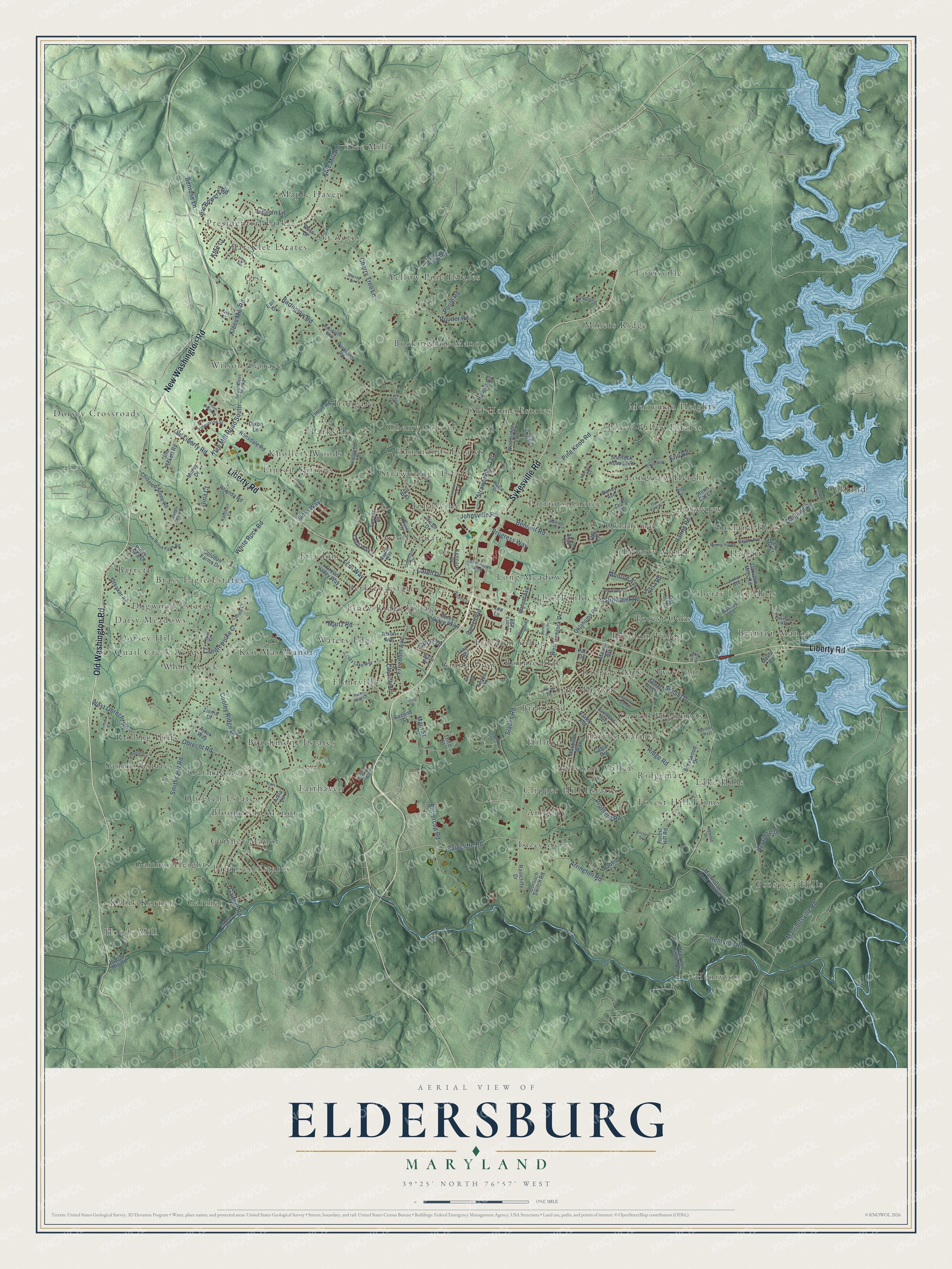
Explore Eldersburg, Maryland from a whole new perspective. Created using aerial imagery and detailed geographic data, this map captures Eldersburg building by building, with labeled streets, familiar landmarks, and shaded topographical relief that highlights the natural contours of the landscape.
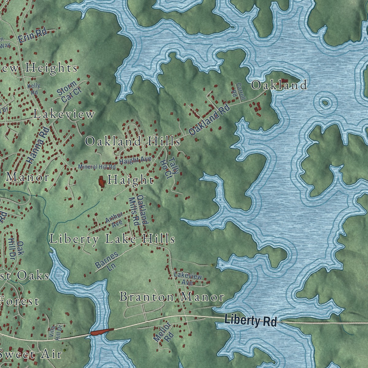
Combining modern data with the timeless character of a vintage atlas, this map is just as interesting up close as it is beautiful on the wall. Whether you grew up in Eldersburg, spent memorable years there, or call it home today, this unique map is a great way to celebrate a place that means something to you. Zoom in on the preview to look for your street, and then order a print to put your memories on the wall.
Three ways to hang it
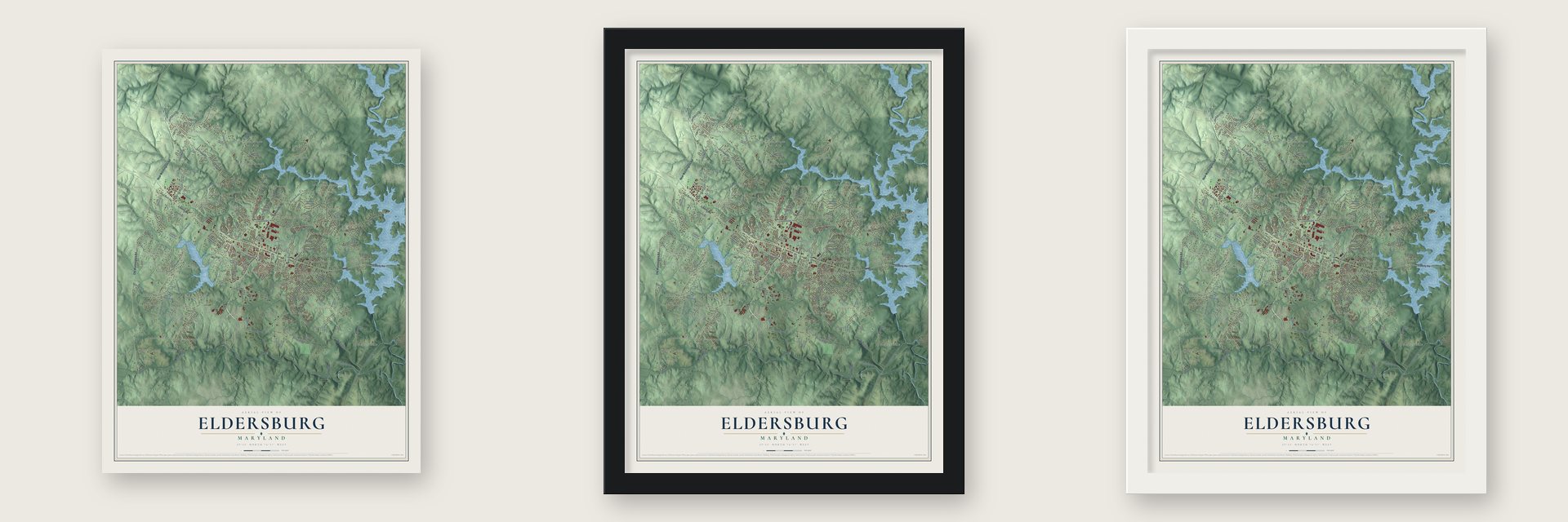
Unframed archival matte, a black wood frame or a white wood frame.
Up close
Geography Worth Displaying
This map was created using accurate cartographic data and authoritative geographic sources, including the U.S. Geological Survey and the Census Bureau. The map brings together terrain, waterways, roads, and building detail. The majority of the streets are labeled, houses are accurately depicted, and the topography is derived from government sources. Combining local data with carefully composed color and shading leads to this beautifully detailed Eldersburg artwork for your wall.
Rather than simply showing street outlines, we’ve included as many of the street names as we could reasonably fit on the map while keeping their names legible. Zoom in on the high resolution preview to see exactly what’s on the map. We truly set out to create a statement piece for anyone who loves Eldersburg. So whether it’s for you, or a gift for someone you love, we hope this map of Eldersburg brings back fond memories.
Read the story behind this map of Eldersburg, Maryland from 2026.

Find your street
Names on the Eldersburg map
Every name below is printed on this map. Look for your street, your school, the park where you played, or the pond down the road.
Places and landmarks83
- Hoods Mill
- Louisville
- Prospect Hills
- Dorsey Crossroads
- Fairhaven
- Liberty Lake Hills
- Presidential Park
- Freedom Village
- Barrett
- Oakland
- Henryton
- Cherry Corner
Show all 83 places
- Sanner Estates
- Klee Mill
- Waters Edge
- Clipper Hill Estates
- Piney Valley Estates
- Yellow Pine Estates
- Wilson Terrace
- Gaither
- Bloomfield Manor
- Freedom Forest
- Freedom
- Quail Creek Acres
- Harvest Farms
- Miners Ridge
- Ken-Mar Manor
- Oakland Hills
- Johnsville
- Knollers Woods
- Eazee Acres
- Old Home Estates
- Buckingham Manor
- Oklahoma
- Rolling Hills
- Patriots Choice
- Brass Eagle Estates
- Merryman Heights
- Grand View
- Lake Hills
- Ridgely Park
- Maple Haven
- Carroll Square
- Forest Hill Farms
- The Hemlocks
- Branton Manor
- Forest Oaks
- Longview Heights
- Brimfield
- Patapsco Estates
- Berkley Estates
- Bar-Klee Estates
- Irongate
- Beachmont Estates
- Parkside
- Melstone Valley
- Kabik Korner
- Dogwood Estates
- Lakeview
- Carroll Highlands
- Carrolltowne
- Amberly
- Flohrville
- Daisy Meadows
- Carmae Acres
- Piney Ridge Village
- Long Meadows
- Haight
- White Rock
- Obretch Estates
- Strawbridge Estates
- Liberty Manor
- Sweet Air
- Gist
- Linton Springs
- Hilltop
- Gaither Heights
- Ski Acres
- Hammonds Estates
- Ridgemar
- Dorsey Hill
- Gaither Manor
- Bonnie Brae
Streets and roads169
- Sykesville Road
- Old Washington Road
- Liberty Road
- New Washington Road
- Slacks Road
- Raincliffe Road
- Old Liberty Road
- Obrecht Road
- White Rock Road
- Klee Mill Road South
- Marriottsville Road
- Bartholow Road
- Ridge Road
- Johnsville Road
- Cherry Tree Lane
- Klee Mill Road
- Klees Mill Road
- Monroe Avenue
- Arrington Road
- Martz Road
- Henryton Road
- Buttercup Road
- Gaither Road
- Smiths Pvt Road
- Caren Drive
- Bennett Road
- Oakland Road
- Poole Road
- Freedom Avenue
- Pine Knob Road
Show all 169 streets
- West Obrecht Road
- Cooley Ridge Drive
- Sunset Drive
- Jim Bowers Road
- Benrose Lane
- Main Street
- Strawbridge Terrace
- Candlewicke Court
- Gera Way
- Progress Way
- Church Street
- Hanna Road
- Fern Way
- Prothero Road
- Bevridge Drive
- Pouder Road
- Stillwater Road
- Lincoln Lane
- Tulsa Road
- Erin Road
- Circle Drive
- Klee Court
- Gina Court
- Macbeth Way
- Piney Ridge Parkway
- Marriottsville Road Number 2
- Oklahoma Road
- Linton Road
- Hodges Road
- Streaker Road
- Woodridge Lane
- Hoods Mill Road
- Oakland Mills Road
- Oak Hill Drive
- Ronsdale Road
- Marvin Avenue
- Rhonda Road
- West Hemlock Drive
- London Bridge Road
- Cable Drive
- Forest Hill Road
- Chiseled Stone Road
- Bandy Avenue
- Second Street
- Jay Road
- Barnes Lane
- Green Valley Way
- Piney View Court
- Gorsuch Switch Road
- Barley Road
- Sherlock Holmes Street
- Aster Way
- Sussex Court
- Victor Drive
- Dale Drive
- Henryton Center Road
- Kali Drive
- Jim Pickett Road
- Cecil Way
- Colodon Farms Drive
- Babbs Court
- Dixon Avenue
- Zinnia Drive
- Kennard Court
- Lee Lane
- Parkland Road
- Brentwood Drive
- Barnett Avenue
- Walnut Avenue
- Storm Cat Court
- Dixon Lane
- Oden Court
- Raincliffe Drive
- Winton Court
- Third Street
- Anna Lane
- Mellor Road
- Tally Ho Court
- Luers Avenue
- Ross Drive
- Earl Drive
- Sweet Air Lane
- Milrey Drive
- Alton Court
- Bull Drive
- Londontown Boulevard
- South Klees Mill Road
- Tanglewood Drive
- Breezy Lake Way
- Pine Brook Farm Road
- Irving Ruby Road
- Courtland Drive
- Enterprise Street
- Arthur Avenue
- Mayfair Way
- Placid Drive
- Hammond Avenue
- Becket Road
- Arlington Drive
- Kathleen Court
- Placidville Way
- Haight Avenue
- Lakeview Avenue
- Moriarty Court
- Sherry Drive
- Candle Court
- Henson Drive
- Taper Court
- Keel Drive
- Sarah Drive
- Waite Avenue
- Tira Court
- Conan Doyle Way
- Oak View Drive
- Mineral Hill Road
- Harvest Farm Road
- Bonnie Brae Drive
- Kingston Circle
- Compton Lane
- Steeple Chase Road
- Red River Road
- Quail Drive
- Kitchen Drive
- Corsair Court
- Homeland Drive
- Railroad Avenue
- Adam Smith Street
- Conifer Way
- Henry Avenue
- Welding Lane
- Waltham Drive
- Villa Hill Drive
- Walden Way
- Allen Road
- First Street
- Waters Edge Court
- Carroll Road
- Maes Court
- Kelly Road
Names are listed as they appear on the printed map. Zoom into the product photos to find them.
About Eldersburg, Maryland
Eldersburg is a community of 32,582 people in Carroll County, where Liberty Road crosses Maryland Route 32. It takes its name from John Elder, who received a land grant from the King of England and laid out the town at that crossroads before 1800. Most of the first settlers nearby, in an area called the Freedom District, were of Scotch and Irish descent.
Baltimore lay 32 miles away, and a wagon could spend two or three days on the road getting there. That changed in 1831, when the railroad reached nearby Sykesville. After that the same journey took only a few hours.
- Eldersburgh until 1894A post office opened here in April 1850 under the name Eldersburgh. At the time the village sat in the Howard district of Anne Arundel County, which became Howard County in 1851. The office was shifted into Carroll County on October 28, 1871, still using the old spelling. In December 1894 the final h was dropped, and the name became Eldersburg.
- Among America's first MethodistsWesley Chapel Methodist Episcopal Church ranks with the oldest Methodist congregations organized anywhere in the country, in a county that helped give birth to the faith in America. The church joined the National Register in 1984.
- A stone church built by handThe Freedom congregation held its first meetings in 1867, in a hall in the neighborhood. Its members later raised a stone church themselves, giving timber cut on their own farms and stone hauled from quarries close by. The building became known as Freedom Methodist Church.
- A synagogue again in 2013Carroll County had gone years without a synagogue after Beth Shalom, a Conservative congregation, closed. In 2013 an Orthodox congregation, the Chabad Jewish Center of Carroll County, opened in Eldersburg.
Keep exploring Maryland
Eldersburg is one of 874 Maryland towns we've mapped. Every dot on the map is a print of its own.
The search covers every state, Maryland first.
Near Eldersburg
Order 2 or more town maps and save 10%. Shown in the size and finish you picked above, so they hang as a set.
- Sykesville 12" x 18" / Archival Matte Print $39.99
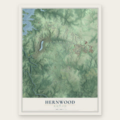
- Hernwood 12" x 18" / Archival Matte Print $39.99
- Winfield 12" x 18" / Archival Matte Print $39.99


More maps nearby: West Friendship, Lisbon, Reisterstown, Randallstown and Owings Mills.
The art of mapping a place
How This Map Was Made
Real places. Remarkable detail. Discover the layers that turn geographic data into a map of home.

The view from above
Aerial imagery reveals the character of the land: woodland, open fields, and the patterns of a place.

The shape of the land
Elevation data brings hills, valleys, and subtle changes in the landscape into view.

The details of home
Roads, waterways, and building footprints come together to make the map feel unmistakably local.

Geography becomes art
Considered color, shading, and typography bring the layers together in a map made for your wall.


Process illustrated with Mendon, Massachusetts. Aerial imagery: USDA NAIP. Terrain: USGS 3D Elevation Program. Map details and finished artwork: KNOWOL.
The Details
About This Print
Choose an archival matte print, or a black or white Ayous wood frame. The archival matte print is unframed.
Select your size and finish above to see the matching product image and price.
Materials & Craftsmanship
A contemporary map with the character of a classic atlas, printed on archival matte paper. Optional frames are made from Ayous wood.
Your printed map does not include the watermark shown in the full-map preview.
Shipping & Delivery
Free shipping within the United States. Every print is made to order in the USA.
Buying a gift? Add a note in your cart and we'll include it. We never put prices in the package.
Prints ship within 2 to 3 business days. Allow 7 to 10 days total from ordering for delivery. Timing may vary during holidays or periods of high order volume.
Read our shipping policy.
Returns and damaged prints
Each print is made to order. Change-of-mind refunds are not available after production.
If your print arrives damaged, misprinted or incorrect, contact support@knowol.com within 30 days of receiving it. Include your order number, photos and a description of the issue.
Read our full refund and replacement policy. For questions about your order, email support@knowol.com.