


Search for another town





Free U.S. delivery 7 to 10 days after you order
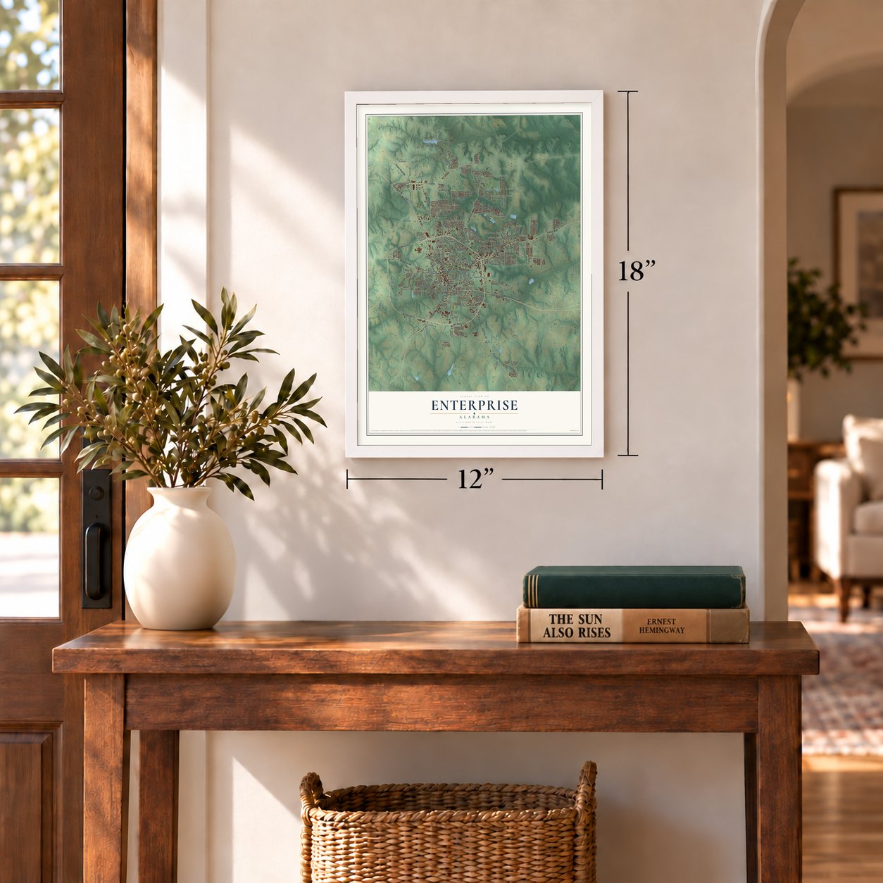
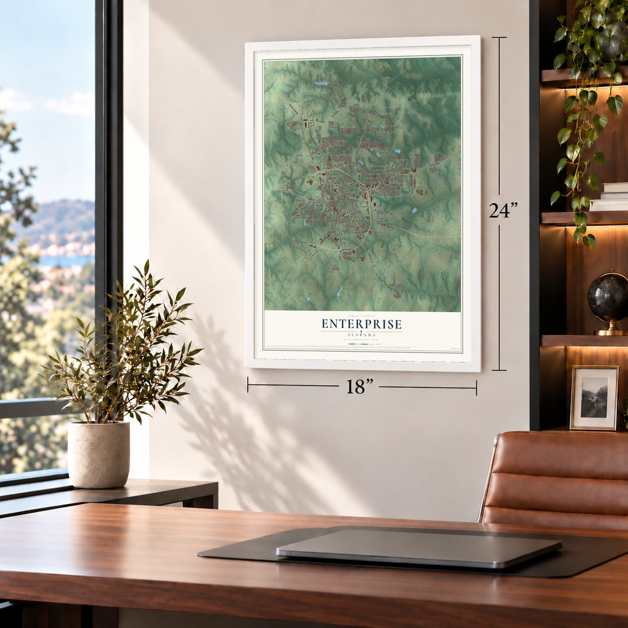
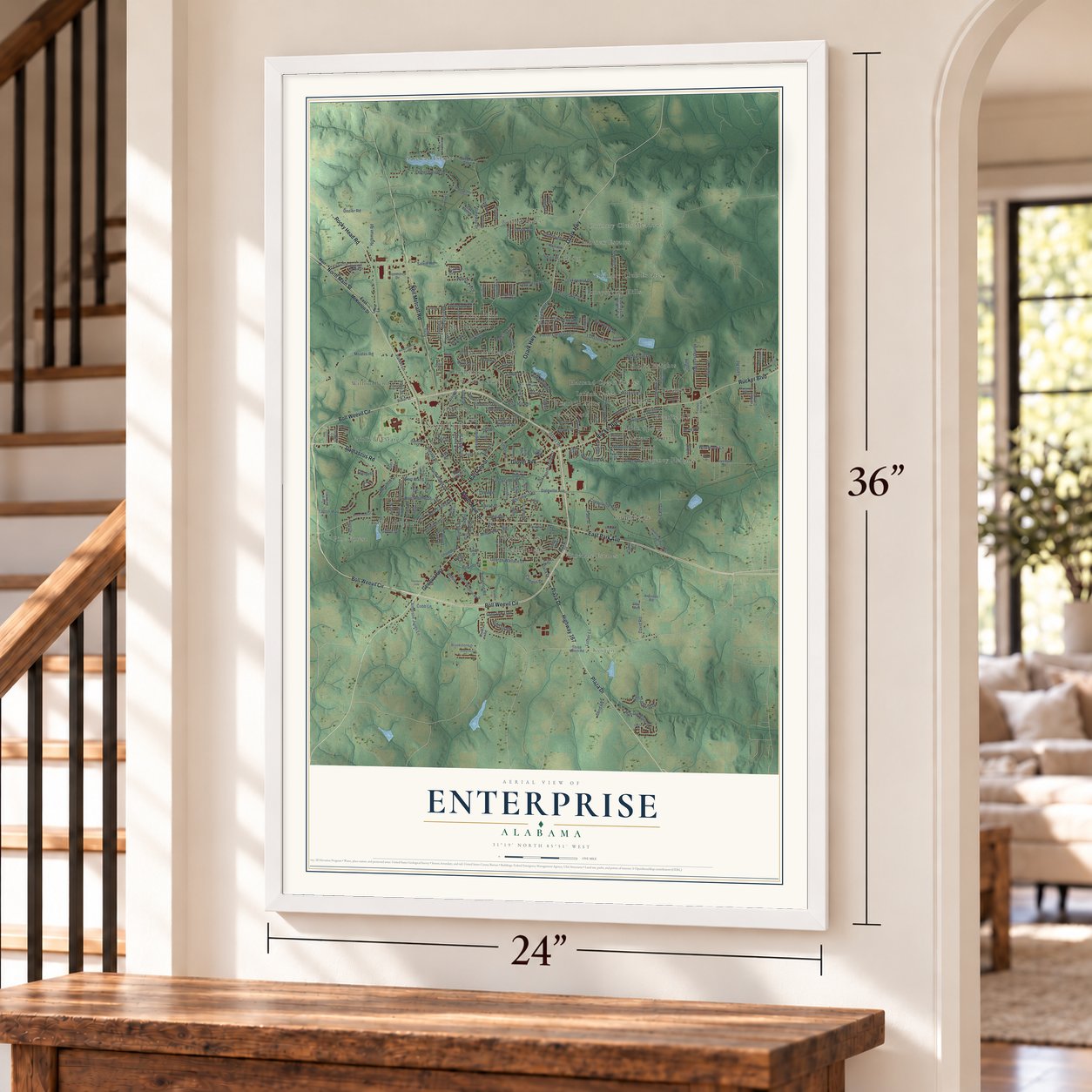
Enterprise, Alabama Map Art
Building by building, with labeled streets and shaded relief.
12" x 18" Archival Matte Print
A Map of Home. A Work of Art.
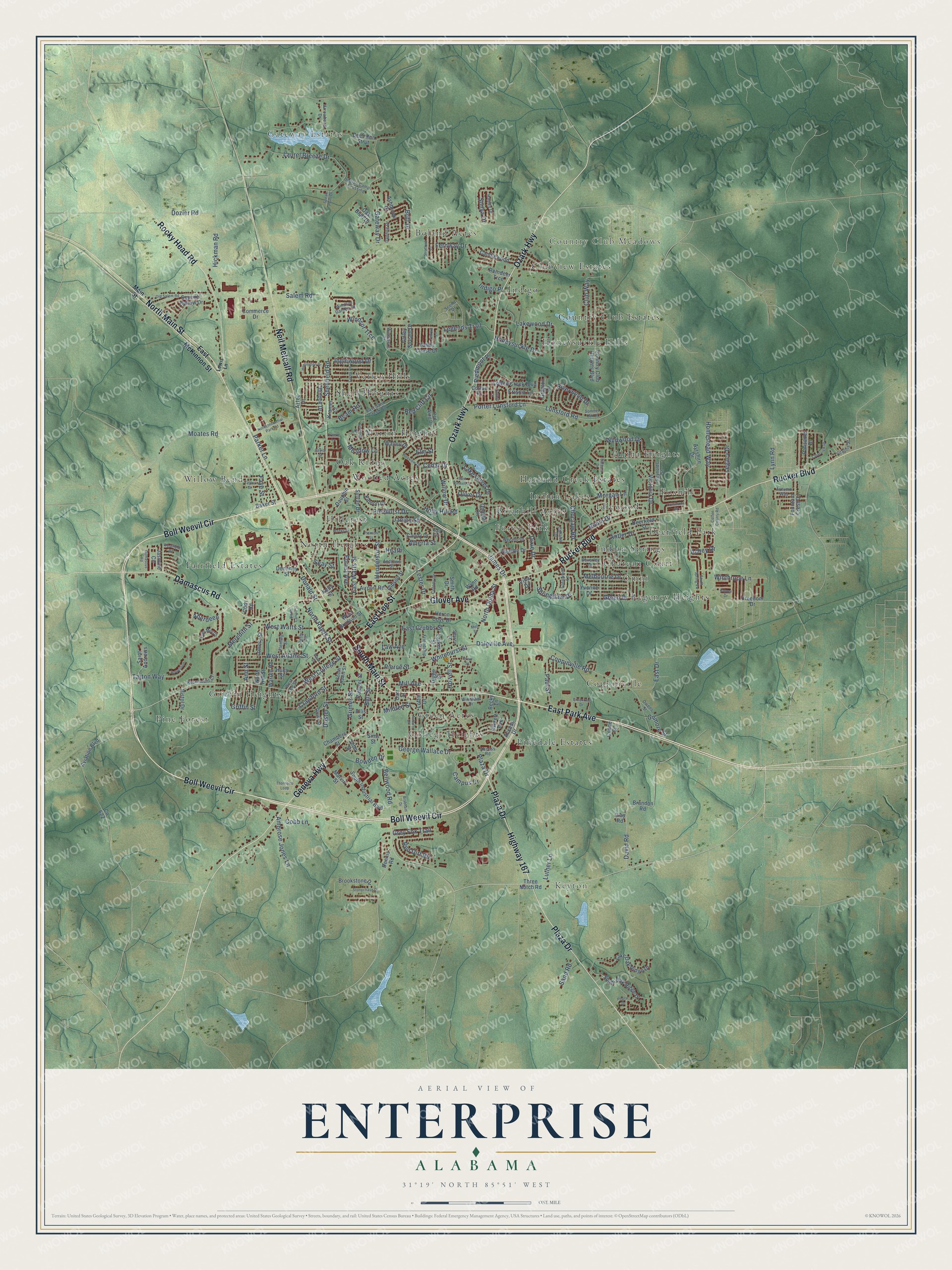
Explore Enterprise, Alabama from a whole new perspective. Created using aerial imagery and detailed geographic data, this map captures Enterprise building by building, with labeled streets, familiar landmarks, and shaded topographical relief that highlights the natural contours of the landscape.
Combining modern data with the timeless character of a vintage atlas, this map is just as interesting up close as it is beautiful on the wall. Whether you grew up in Enterprise, spent memorable years there, or call it home today, this unique map is a great way to celebrate a place that means something to you. Zoom in on the preview to look for your street, and then order a print to put your memories on the wall.
Three ways to hang it
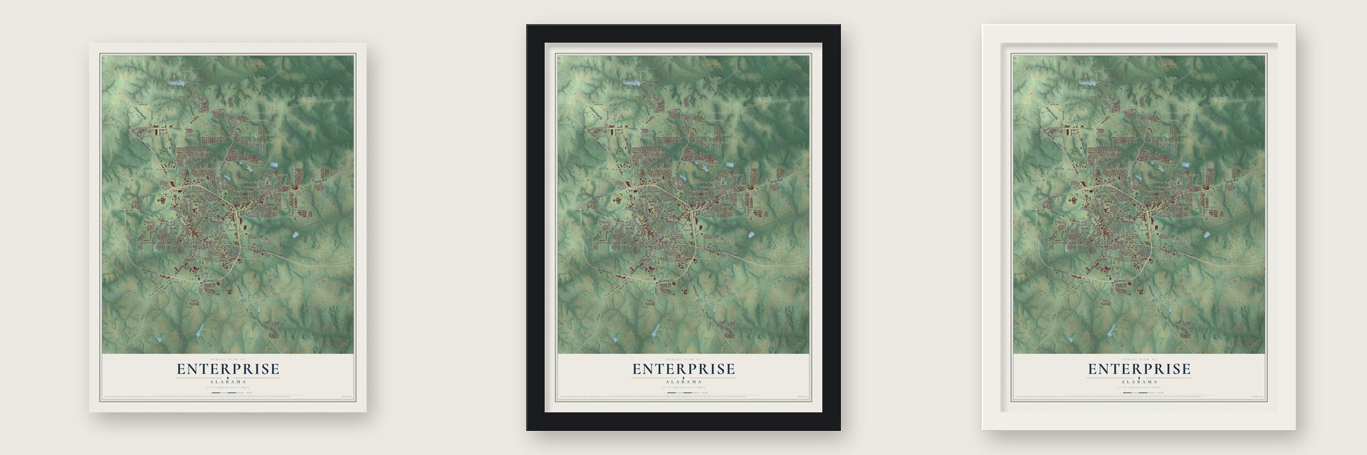
Unframed archival matte, a black wood frame or a white wood frame.
Up close
Geography Worth Displaying
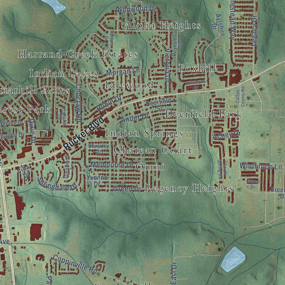
This map was created using accurate cartographic data and authoritative geographic sources, including the U.S. Geological Survey and the Census Bureau. The map brings together terrain, waterways, roads, and building detail. The majority of the streets are labeled, houses are accurately depicted, and the topography is derived from government sources. Combining local data with carefully composed color and shading leads to this beautifully detailed Enterprise artwork for your wall.
Rather than simply showing street outlines, we’ve included as many of the street names as we could reasonably fit on the map while keeping their names legible. Zoom in on the high resolution preview to see exactly what’s on the map. We truly set out to create a statement piece for anyone who loves Enterprise. So whether it’s for you, or a gift for someone you love, we hope this map of Enterprise brings back fond memories.
Read the story behind this map of Enterprise, Alabama from 2026.

Find your street
Names on the Enterprise map
Every name below is printed on this map. Look for your street, your school, the park where you played, or the pond down the road.
Places and landmarks35
- Gateway Estates
- Keyton
- Country Club Meadows
- Alpha Heights
- Boland Acres
- Briarhill Acres
- Chateau Court
- Clubview Estates
- College Heights
- Coppinville
- Country Club Estates
- Deerfield Park
Show all 35 places
- Fairfield Estates
- Forest Park
- Foxhill
- Green Acres
- Griffin Heights
- Harrand Creek Estates
- Hillcrest
- Honeysuckle Hills
- Idlewood
- Indian Lakes
- Indian Springs
- Indigo
- Martin Heights
- North Heights
- Oak Ridge
- Omni
- Pine Forest
- Pinedale Estates
- Regency Heights
- Shell Heights
- Valley Hills
- Willow Bend
- Wooded Acres
Streets and roads249
- Boll Weevil Circle
- East Park Avenue
- South Main Street
- East Lee Street
- North Main Street
- Ozark Highway
- Plaza Drive
- Rucker Boulevard
- Neil Metcalf Road
- Highway 167
- Geneva Highway
- Damascus Road
- Rocky Head Road
- Glover Avenue
- West College Street
- Meredith Street
- West Adams Street
- Lynn Road
- Shellfield Road
- Bellwood Road
- Salem Road
- Coppinville Road
- Laurel Breeze Drive
- Daleville Avenue
- Tarton Way
- Alberta Street
- Lunsford Road
- Porter Lunsford Lane
- Dixie Drive
- Lakewood Drive
Show all 249 streets
- Moates Road
- North Ouida Street
- David Road
- Antler Drive
- Gateway Drive
- Paul Street
- Holly Hill Road
- Legacy Drive
- Morgan Lane
- Pinehurst Drive
- Windsor Trce
- Doster Street
- East Grubbs Street
- James Drive
- George Wallace Drive
- Mill Avenue
- Bell Street
- Victoria Drive
- Springdale Drive
- North Rawls Street
- Melbourne Drive
- Crawford Street
- Homestead Way
- Club Way
- East Watts Street
- West Watts Street
- Cedar Drive
- Wildwood Drive
- Campus Drive
- Britt Drive
- Red Cliff Circle
- Luther Lane
- Legends Trail
- Riverwood Drive
- Hickman Road
- Fernway Drive
- Henderson Street
- Dozier Road
- Grimes Street
- Robin Drive
- Ambrose Jones Lane
- Janice Street
- Pierce Street
- Winthrope Lane
- Honeysuckle Drive
- Bowden Drive
- Choctaw Road
- East Drive
- Meadow Lane
- Ann Street
- Green Drive
- Lake Oliver Drive
- Whitehurst Street
- Heath
- Willow Drive
- Inglewood Drive
- Sonya Drive
- Donald Street
- Forest Avenue
- Piedmont Place
- Sand Road
- Grey Fox Trail
- Beam Road
- Mildred Street
- Frisco Lane
- Gilmore Street
- Howell Street
- Aberdeen
- Red Dirt Road
- Oliver Drive
- Lester Drive
- Parker Lane
- Cobb Lane
- Faye Street
- Indigo Place
- Elm Street
- Griffin Street
- Achey Drive
- Seay Street
- Law Avenue
- East McKinnon Street
- Freedom Drive
- Valley Stream Drive
- South Oak Ridge Drive
- Dauphin Street
- Three Notch Road
- Lake Oak Ridge Drive
- Cotton Creek Boulevard
- Deer Run Strut
- South Industrial Boulevard
- Heron Cove Drive
- Pistol Drive
- Country Club Heights Boulevard
- Commerce Drive
- Grayton Lane
- Sylvan Drive
- West Brunson Street
- Apache Drive
- Airport Road
- Fountain Crest Drive
- Yvonne Drive
- Villa Drive
- Chambers Street
- Gibson Street
- Palisades Drive
- Walnut Drive
- Jasmine Circle
- Candlewood
- Dennis Road
- Brookstone Drive
- Kinnon Drive
- Omega Circle
- Squirrel Hollow Drive
- Lowery Street
- Ayrshire Drive
- Aviation Boulevard
- Deerfield Street
- Valley Chase Drive
- Warren Road
- Saint Andrews
- Loftin Drive
- Marvin Street
- North Hill Street
- Chinook Drive
- Pledger Street
- Brandon Road
- Larkin Street
- Oak Bluff Drive
- Kramer Court
- Diggs Street
- Candy Drive
- Averett Avenue
- Ashbrook Drive
- Reindeer Trce
- Dominey Street
- Baker Street
- Carr Street
- Smith Drive
- Access Drive
- Huey Street
- Becky Lane
- Aztec Drive
- Cotton Place
- John Street
- Sims Street
- Cody Road
- Ellis Street
- Coone Street
- Wynn Road
- Kelly Street
- Clay Road
- Main Street
- West Lee Street
- Reynolds Street
- Windsor Garden Drive
- Arrowhead Drive
- Fleming Street
- East Sand Creek Road
- Rosemount Court
- Daphne Drive
- Navaho Drive
- Virginia Street
- Hayley Drive
- Glenwood Lane
- Glenn Street
- Red Wing Drive
- Indian Camp Crossing
- Friendship Street
- South Rawls Street
- Windham Drive
- Colony Drive
- Tom Morris
- Andrews Street
- Petty Circle
- Windmere Drive
- Cahaba Drive
- Beverley Drive
- Searcy Street
- Autumn Way
- Access Road
- Gail Circle
- Owens Street
- Scenic Drive
- Lewis Lane
- Stratford Lane
- Sommer Oak Drive
- Huntington Drive
- North Industrial Park Road
- Colonial Drive
- Clearview Drive
- Coffee County Road
- Greentree Drive
- Old Salem Road
- Thornbird Loop
- Auburn Drive
- Weeks Drive
- Stonechase Drive
- East Russell Street
- Taylor Street
- Commons Drive
- Pineview Drive
- North Carroll Street
- Barbara Drive
- Creek Road
- Brabham Drive
- Pierson Street
- Telford Lane
- Hallhill Court
- South Spring Vw
- Robertson
- Westfield Road
- Mack Street
- Camen Drive
- Speak Point Drive
- Poplar Drive
- Mell Street
- Creeke Lane
- Caylor Street
- Pruitt Street
Names are listed as they appear on the printed map. Zoom into the product photos to find them.
About Enterprise, Alabama
Enterprise is a city of 28,711 people in Coffee County, part of the Wiregrass in Alabama's southeast corner. John Henry Carmichael moved here in 1881 and opened a store, and his business drew more settlers. A year later the post office at Drake Eye, to the north, was moved to the new town. Enterprise incorporated in 1896 with 250 people, and in 1898 the Alabama Midland Railroad Company made the town its headquarters.
Cotton carried the growing town, and by 1906 it had 3,750 people. Then in 1915 the boll weevil, a cotton pest from Mexico, reached Coffee County and wiped out most of its crop. Farmers close to bankruptcy turned to peanuts, corn and other crops, helped in part by George Washington Carver's work, and two years later Coffee County led the nation in peanuts. On December 11, 1919, the citizens dedicated a monument to the insect on Main Street, the only one in the world honoring a farm pest.
“In Profound Appreciation Of the Boll Weevil And what it has done As the Herald of Prosperity This Monument was Erected By the Citizens of Enterprise, Coffee County, Alabama.”
- The Rawls Hotel, 1903Japheth Rawls, who developed some of Coffee County's earliest turpentine plants, built a two-story brick hotel on South Main Street in 1903. In 1928 Jesse P. Rawls, founder of the town's first electric power system, remodeled it and added three-story wings. The hotel was the heart of business and social life in Enterprise until it closed in the early 1970s, and it joined the National Register in 1980.
- Peanuts since 1917Sessions Peanut Company was founded in 1917, just after the boll weevil forced farmers away from cotton. It is the oldest company in Enterprise, and the city is still a center of Alabama's peanut industry.
- Neighbor to Fort RuckerIn the 1940s the U.S. Army built Fort Rucker just outside Enterprise, and it became the home of Army Aviation. During the 1960s the local college started a training program, now called the Aviation Campus, to prepare residents for jobs on the post, and Fort Rucker is still the region's leading employer.
- A principal's creedEnterprise Academy was founded in 1904, and its beloved principal was William M. Donald (1870-1941). The school was later known as Carroll Street School. Donald taught students that hard work and self-discipline lead to excellence and that knowledge is power no one can take from you. A marker on South Carroll Street, put up in 1979, honors him.
- The tornado of 2007On March 1, 2007, an EF4 tornado tore through Enterprise and killed nine people, eight of them students at Enterprise High School who died when a hallway wall fell on them. At least 647 houses were damaged or destroyed. Students finished their classes at the community college while a new high school went up on Boll Weevil Circle. It opened on August 23, 2010, with reinforced safe rooms built to stand up to an EF5 storm.
Keep exploring Alabama
Enterprise is one of 675 Alabama towns we've mapped. Every dot on the map is a print of its own.
The search covers every state, Alabama first.
Near Enterprise
Order 2 or more town maps and save 10%. Shown in the size and finish you picked above, so they hang as a set.
- Level Plains 12" x 18" / Archival Matte Print $39.99
- New Brockton 12" x 18" / Archival Matte Print $39.99
- Fort Rucker 12" x 18" / Archival Matte Print $39.99


More maps nearby: Daleville, Clayhatchee, Coffee Springs, Ozark and Elba.
The art of mapping a place
How This Map Was Made
Real places. Remarkable detail. Discover the layers that turn geographic data into a map of home.

The view from above
Aerial imagery reveals the character of the land: woodland, open fields, and the patterns of a place.

The shape of the land
Elevation data brings hills, valleys, and subtle changes in the landscape into view.

The details of home
Roads, waterways, and building footprints come together to make the map feel unmistakably local.

Geography becomes art
Considered color, shading, and typography bring the layers together in a map made for your wall.


Process illustrated with Mendon, Massachusetts. Aerial imagery: USDA NAIP. Terrain: USGS 3D Elevation Program. Map details and finished artwork: KNOWOL.
The Details
About This Print
Choose an archival matte print, or a black or white Ayous wood frame. The archival matte print is unframed.
Select your size and finish above to see the matching product image and price.
Materials & Craftsmanship
A contemporary map with the character of a classic atlas, printed on archival matte paper. Optional frames are made from Ayous wood.
Your printed map does not include the watermark shown in the full-map preview.
Shipping & Delivery
Free shipping within the United States. Every print is made to order in the USA.
Buying a gift? Add a note in your cart and we'll include it. We never put prices in the package.
Prints ship within 2 to 3 business days. Allow 7 to 10 days total from ordering for delivery. Timing may vary during holidays or periods of high order volume.
Read our shipping policy.
Returns and damaged prints
Each print is made to order. Change-of-mind refunds are not available after production.
If your print arrives damaged, misprinted or incorrect, contact support@knowol.com within 30 days of receiving it. Include your order number, photos and a description of the issue.
Read our full refund and replacement policy. For questions about your order, email support@knowol.com.