
Search for another town



Free U.S. delivery 7 to 10 days after you order
Evergreen, Alabama Map Art
A new map of Evergreen, Alabama, made in 2026 and printed to order on thick archival matte paper.
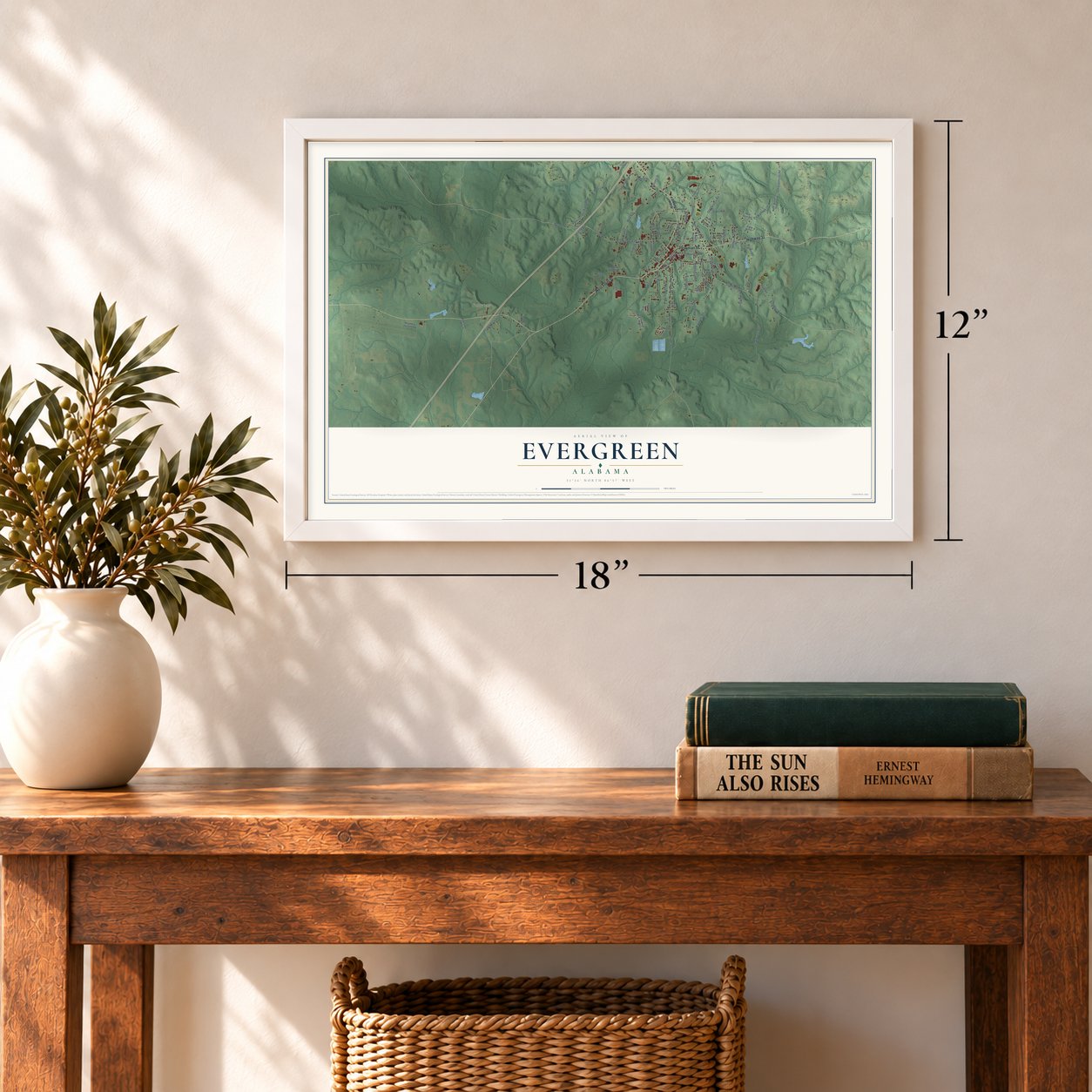
12" x 18" Archival Matte Print
A Map of Home. A Work of Art.
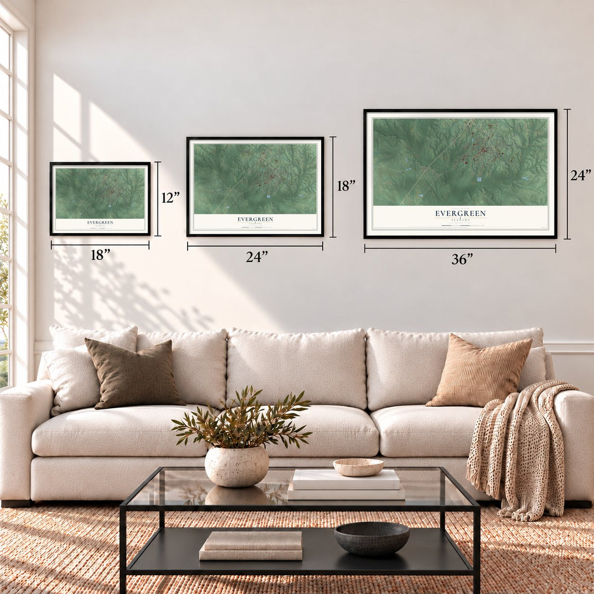
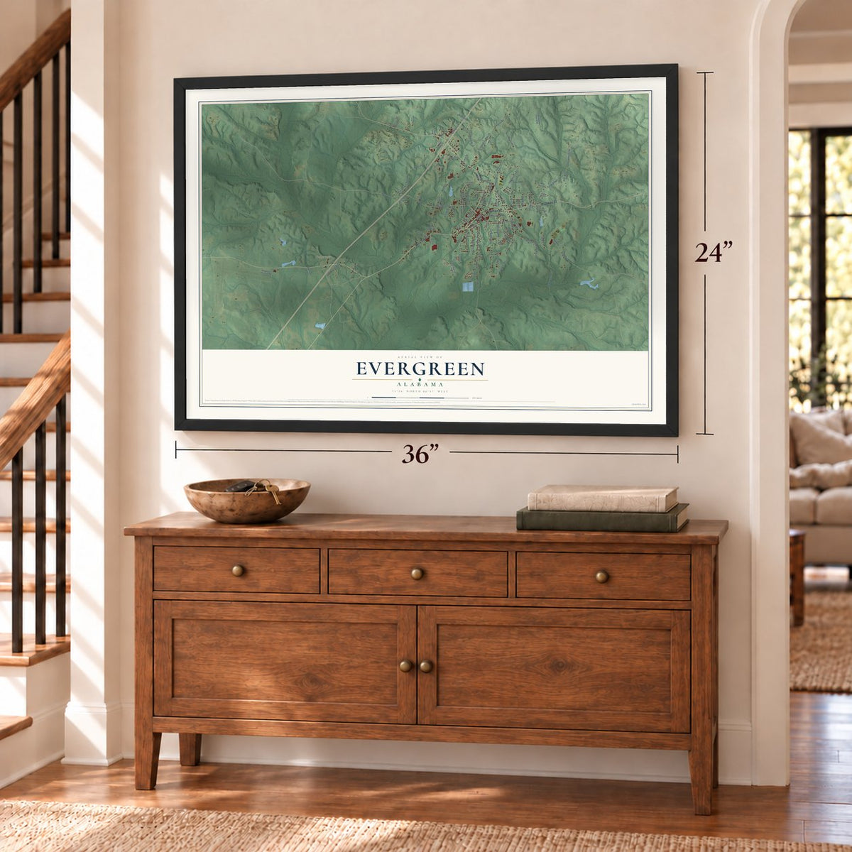
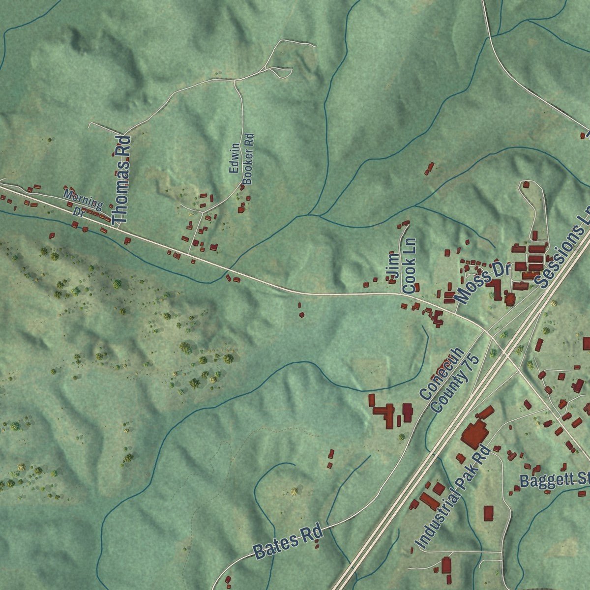
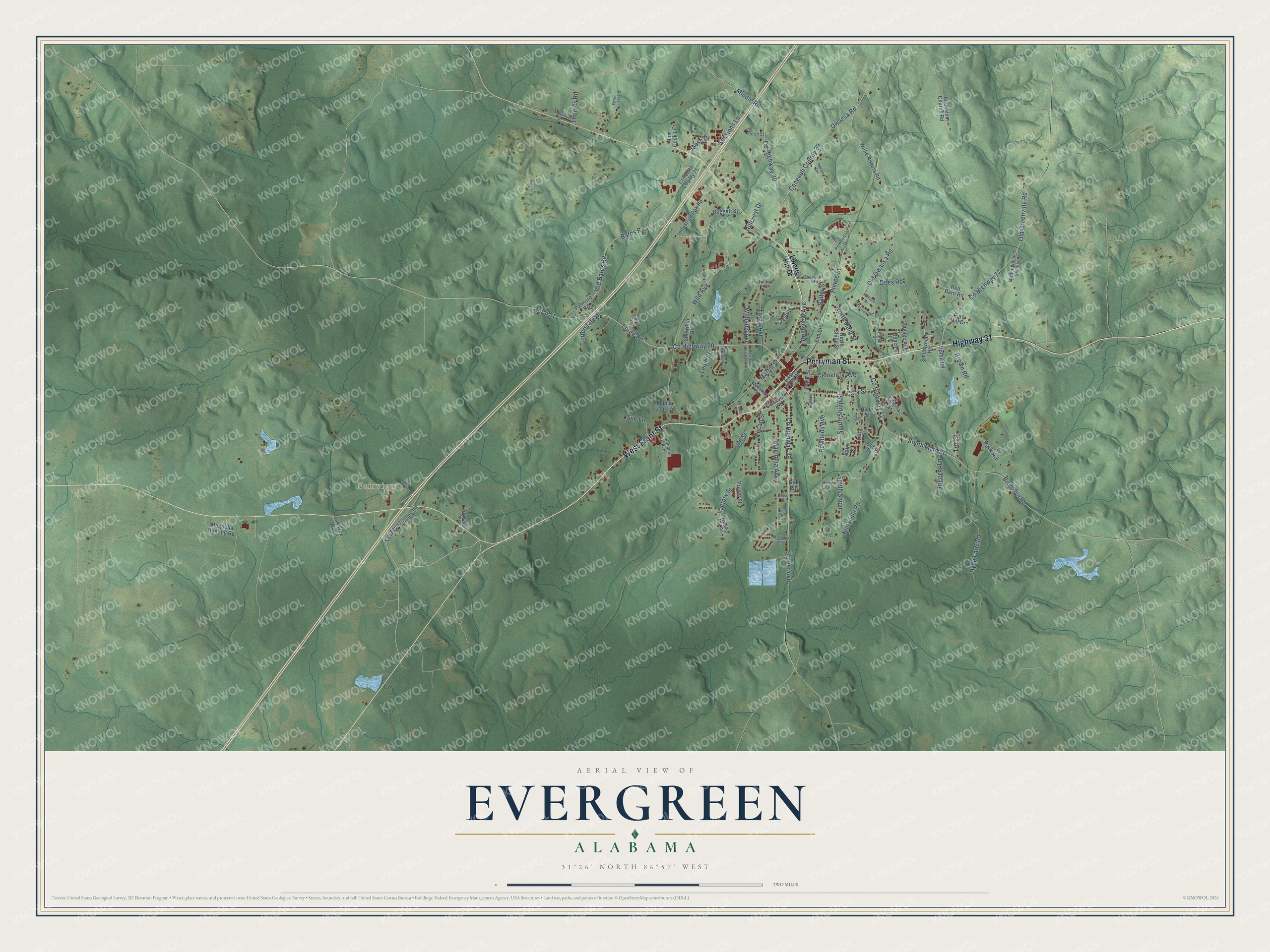
Explore Evergreen, Alabama from a whole new perspective. Created using aerial imagery and detailed geographic data, this map captures Evergreen building by building, with labeled streets, familiar landmarks, and shaded topographical relief that highlights the natural contours of the landscape.
Combining modern data with the timeless character of a vintage atlas, this map is just as interesting up close as it is beautiful on the wall. Whether you grew up in Evergreen, spent memorable years there, or call it home today, this unique map is a great way to celebrate a place that means something to you. Zoom in on the preview to look for your street, and then order a print to put your memories on the wall.
Three ways to hang it
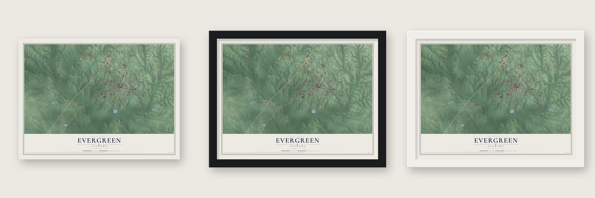
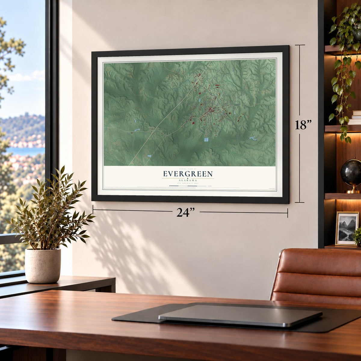
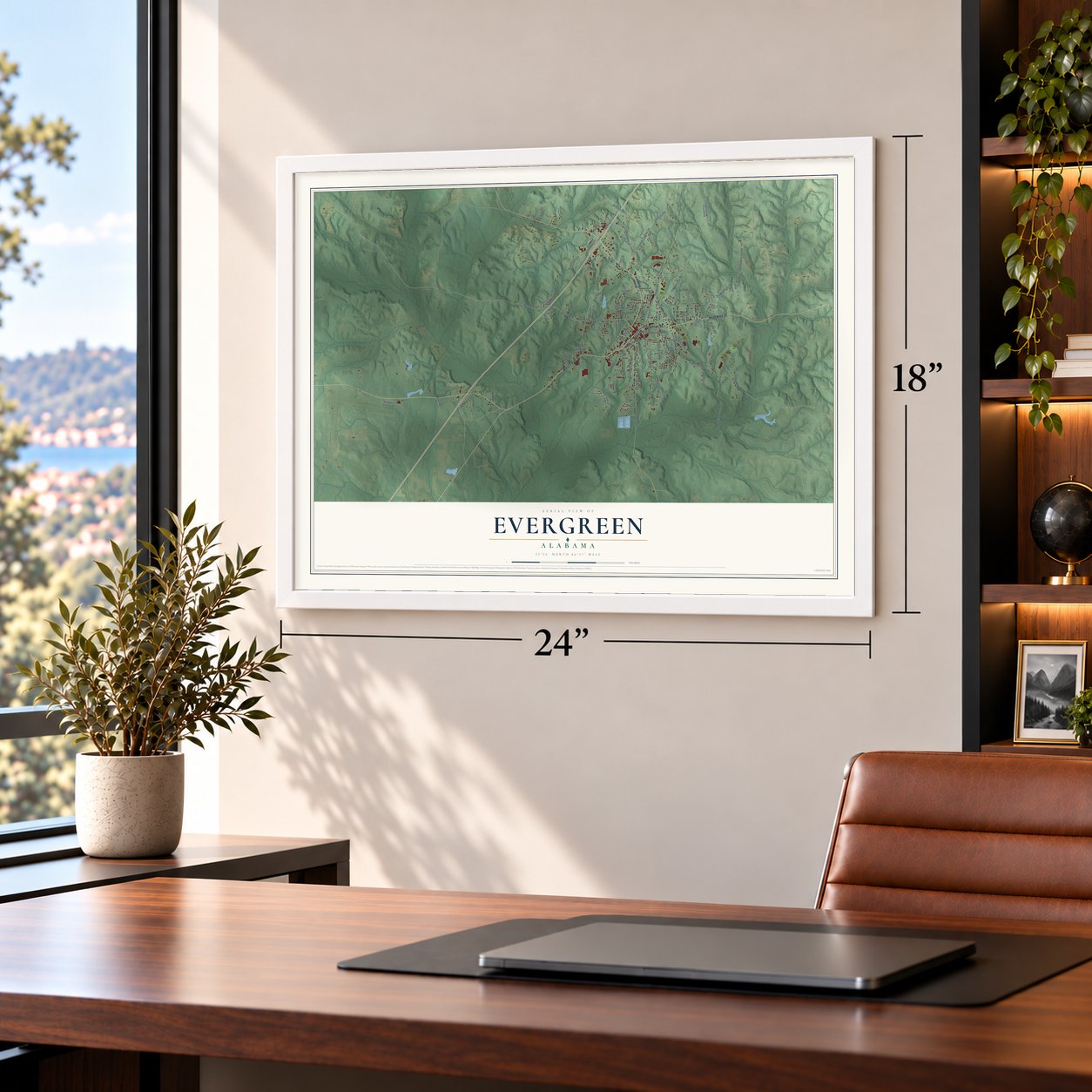
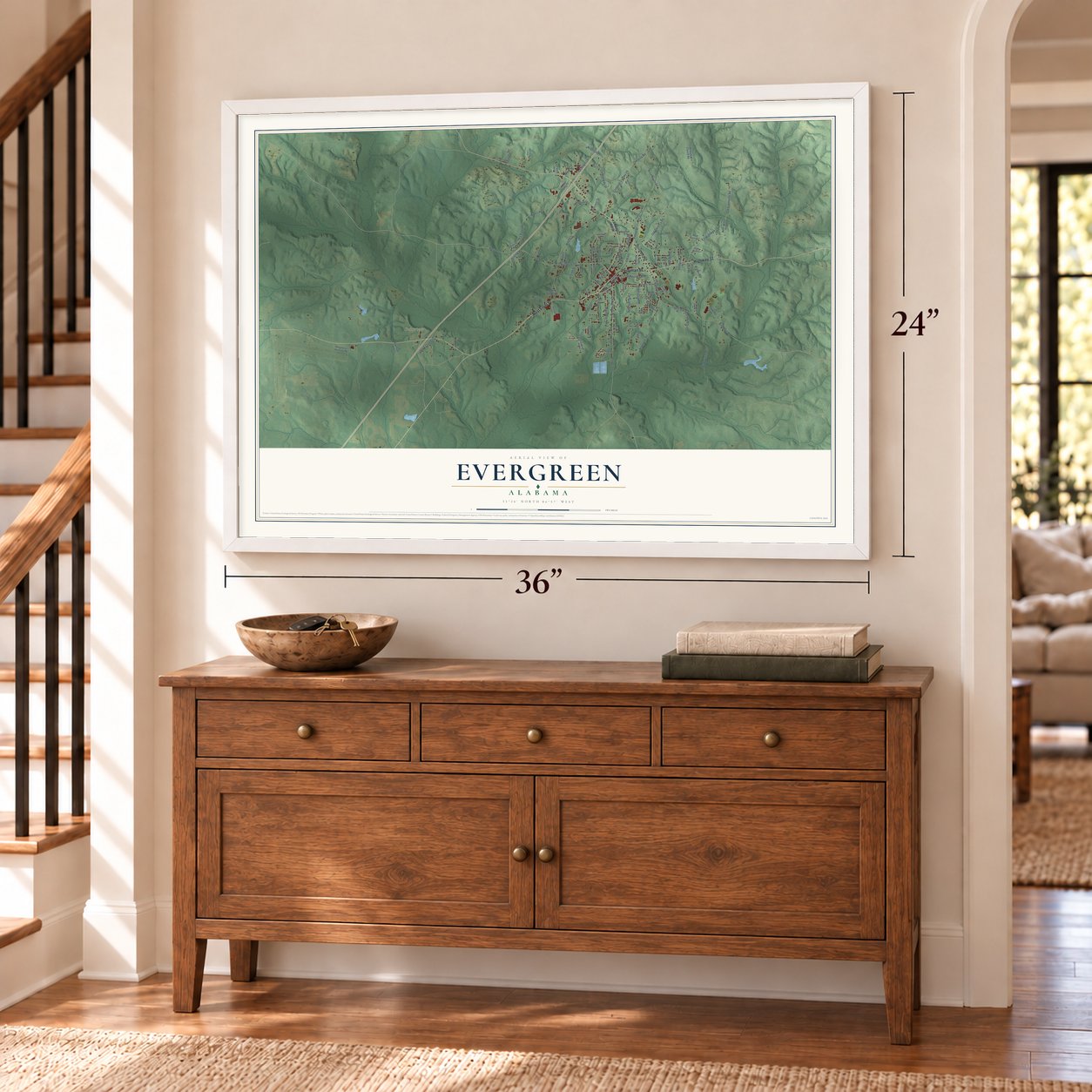
Unframed archival matte, a black wood frame or a white wood frame.
Up close
Geography Worth Displaying
This map was created using accurate cartographic data and authoritative geographic sources, including the U.S. Geological Survey and the Census Bureau. The map brings together terrain, waterways, roads, and building detail. The majority of the streets are labeled, houses are accurately depicted, and the topography is derived from government sources. Combining local data with carefully composed color and shading leads to this beautifully detailed Evergreen artwork for your wall.
Rather than simply showing street outlines, we’ve included as many of the street names as we could reasonably fit on the map while keeping their names legible. Zoom in on the high resolution preview to see exactly what’s on the map. We truly set out to create a statement piece for anyone who loves Evergreen. So whether it’s for you, or a gift for someone you love, we hope this map of Evergreen brings back fond memories.
Read the story behind this map of Evergreen, Alabama from 2026.

About Evergreen, Alabama
Evergreen is a city of 3,520 people and the seat of Conecuh County, in southwestern Alabama. Richard Shipp, who arrived from Georgia in 1818, once held most of the ground the city covers today, and in that same year Malachi Warren opened the area's first general store. In 1819 James Cosey, a veteran of the Revolutionary War, settled with several other men along what is now South Main Street, a spot people called Cosey's Old Field. The clergyman Alexander Travis named the town for the green ferns and foliage all around it.
The Mobile and Montgomery Railway was built through Evergreen in 1861, and the small town finally had fast transportation. The line later became the L&N Railroad, and the Louisville and Nashville Depot joined the National Register in 1975. During the Civil War a federal raid burned Sparta, the old county seat, so in 1866 the seat moved to Evergreen, which sat closer to the middle of the county. On June 20 of that year Isaac Griffith and Julia Ann Hammond, his wife, gave land for a new courthouse. Evergreen became an incorporated city on March 28, 1873.
- Greenery for a presidentIn the late nineteenth century George Caldwell, an immigrant from England, saw that northern states would buy the wild greenery growing around Evergreen and started his own business shipping it. Known as "The Woodsman," he sent smilax vine and other local greens to the White House for Grover Cleveland's inauguration in 1885, and the town became known across the country. It is still called the "Emerald City."
- Rebuilt after storm and fireA tornado struck in 1882 and left only the Episcopal church standing. On November 7, 1895, fire burned every home and business east of the railroad, and five days later another fire took everything on the west side. Fire also destroyed the county courthouse four separate times, in 1868, 1875, 1885 and 1895. Each time, the town rebuilt and kept growing.
- A Baptist home on Main StreetIn 1863 the Alabama Baptist State Convention approved a home for children of soldiers killed in the Civil War. The convention founded it in 1891, with a charter from the legislature that same year. The Louise Short Baptist Widows' and Orphans' Home opened its doors on March 8, 1893, in a 10-room brick residence on 80 acres along Main Street. The Reverend John W. Stewart served as its first superintendent.
- Moved to Troy in 1923After 30 years in Evergreen, the Baptist home moved to Troy on June 14, 1923. In 1938 it took the name The Alabama Baptist Children's Home.
- Sausage, collards and BigfootThe Conecuh Sausage Company opened in Evergreen in 1947 and is still one of the city's leading employers. In 1973 Evergreen was called the collard green capital of Alabama, which the town celebrates with a Collard Green Festival, and in February 2017 the city council named it the Official Bigfoot Capital of Alabama.
Find your street
Names on the Evergreen map
Every name below is printed on this map. Look for your street, your school, the park where you played, or the pond down the road.
Places and landmarks1
- Fairview
Streets and roads109
- West Front Street
- Perryman Street
- Highway 31
- County Highway 29
- Belleview Avenue
- North Main Street
- South Main Street
- County Highway 20
- Conecuh County 29
- County Highway 77
- Old Greenville Road
- Owassa Road
- Rural Street
- South Shipp Street
- Wild Avenue
- Cary Street
- Reynolds Avenue
- County Highway 42
- Brooklyn Road
- Old Owassa Road
- Knoxville Road
- Bruner Avenue
- Bates Road
- Ted Bates Road
- Park Road
- County Highway 30
- Middle Road
- Magnolia Avenue
- Hyde Farm Road
- Loree Road
Show all 109 streets
- South Shipp
- Pierce Street
- Factory Street
- Martin Street
- Cemetery Avenue
- Sessions Lane
- Pecan Street
- Brown Road
- Salter Street
- Park Street
- Travis Avenue
- Interstate Drive
- Griggers Lane
- Williams Avenue
- Sue Lane
- Hillcrest Drive
- Lee Street
- Leigh Street
- Dees Road
- Thomas Road
- Oil Street
- Moss Drive
- Liberty Hill Drive
- Industrial Pak Road
- North Shipp Street
- East Front Street
- Willie Rogers Road
- Magnolia Hunting Road
- Conecuh County 59
- Jerusalem Church Road
- Conecuh County 75
- Palmore Road
- Smithwood Heights
- Red Barn Road
- Belleville Street
- Savage Avenue
- Snowden Road
- Baggett Street
- Oak Tree Way
- Hyde Street
- Jim Cook Lane
- Upton Road
- Edwina Street
- Crestine
- Preyer Street
- Beach Street
- Maple Leaf Lane
- Rabb Drive
- Elm Street
- Robb Drive
- Pine Hill Drive
- Jv Lane
- Oak Street
- Finch Street
- Heading Mill Road
- Walter Williams Senior Lane
- Pemberton Drive
- Frazier Street
- Merriwood Drive
- Kendall Avenue
- Chapman Street
- McGehee Street
- Church Street
- Lily Pond Road
- Hilltop Drive
- Edwin Booker Road
- Magnolia Heights
- Elizabeth Street
- Smallwood
- Valhalla Drive
- Marley Mitchell Lane
- Ingram Drive
- Morning Drive
- Highland Court
- Palmer Lane
- Mimosa Street
- Smith Street
- Cross Street
- Henry Street
Names are listed as they appear on the printed map. Zoom into the product photos to find them.
The art of mapping a place
How This Map Was Made
Real places. Remarkable detail. Discover the layers that turn geographic data into a map of home.

The view from above
Aerial imagery reveals the character of the land: woodland, open fields, and the patterns of a place.

The shape of the land
Elevation data brings hills, valleys, and subtle changes in the landscape into view.

The details of home
Roads, waterways, and building footprints come together to make the map feel unmistakably local.

Geography becomes art
Considered color, shading, and typography bring the layers together in a map made for your wall.


Process illustrated with Mendon, Massachusetts. Aerial imagery: USDA NAIP. Terrain: USGS 3D Elevation Program. Map details and finished artwork: KNOWOL.
The Details
About This Print
Choose an archival matte print, or a black or white Ayous wood frame. The archival matte print is unframed.
Select your size and finish above to see the matching product image and price.
Materials & Craftsmanship
A contemporary map with the character of a classic atlas, printed on archival matte paper. Optional frames are made from Ayous wood.
Your printed map does not include the watermark shown in the full-map preview.
Shipping & Delivery
Free shipping within the United States. Every print is made to order in the USA.
Buying a gift? Add a note in your cart and we'll include it. We never put prices in the package.
Prints ship within 2 to 3 business days. Allow 7 to 10 days total from ordering for delivery. Timing may vary during holidays or periods of high order volume.
Read our shipping policy.
Returns and damaged prints
Each print is made to order. Change-of-mind refunds are not available after production.
If your print arrives damaged, misprinted or incorrect, contact support@knowol.com within 30 days of receiving it. Include your order number, photos and a description of the issue.
Read our full refund and replacement policy. For questions about your order, email support@knowol.com.
Find your town
Looking for another city?
Find a map of home in our Alabama collection, or any town in the country.
Nearby
Maps of towns near Evergreen
Know someone from one of these towns? Their map makes a great gift.
 Castleberry
, Alabama
From $39.99See the map
 Repton
, Alabama
From $39.99See the map
 McKenzie
, Alabama
From $39.99See the map
More maps nearby: Georgiana, Peterman, Monroeville, Excel and Red Level.