


Search for another town





Free U.S. delivery 7 to 10 days after you order
Evesham, New Jersey Map Art
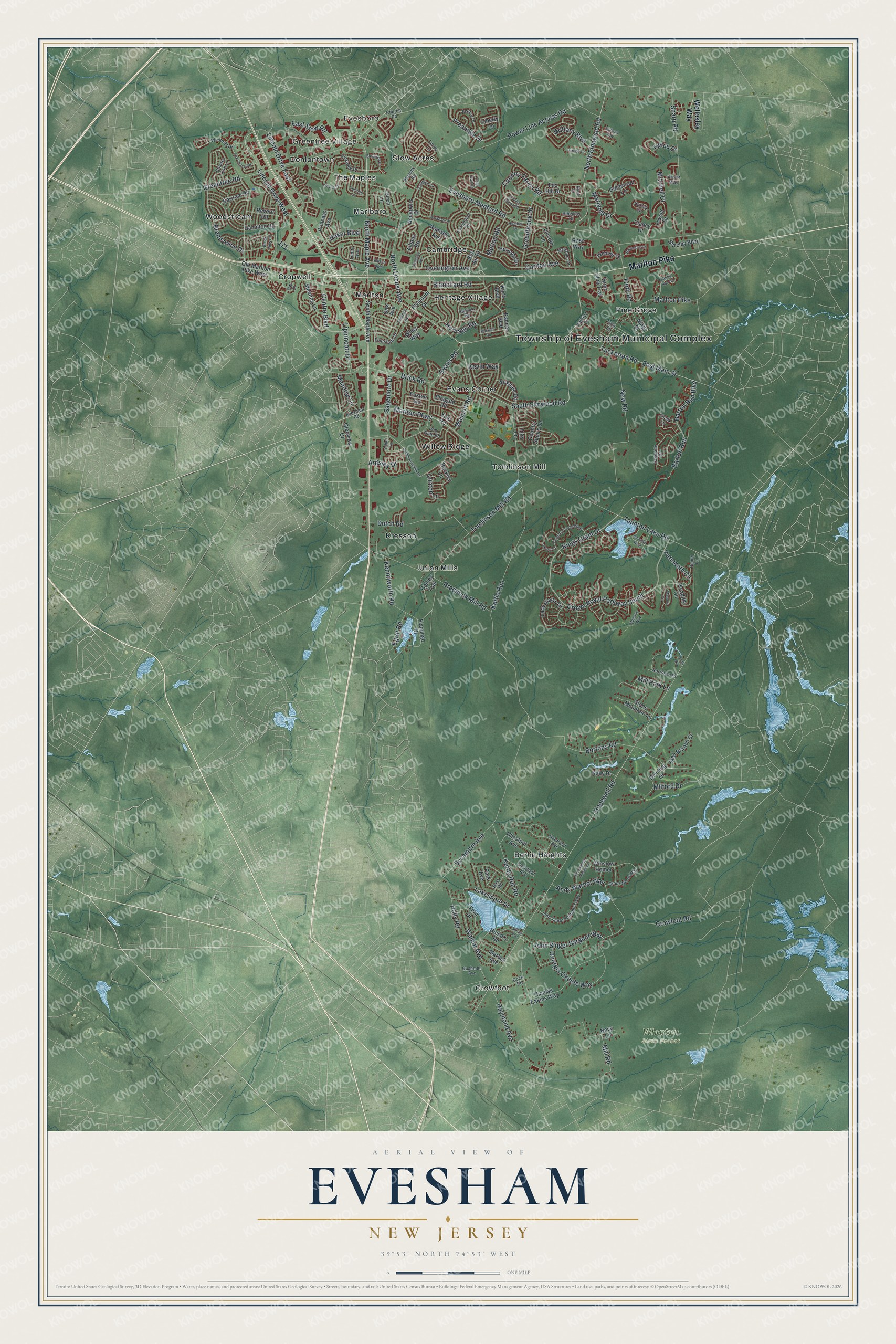
Building by building, with labeled streets and shaded relief.
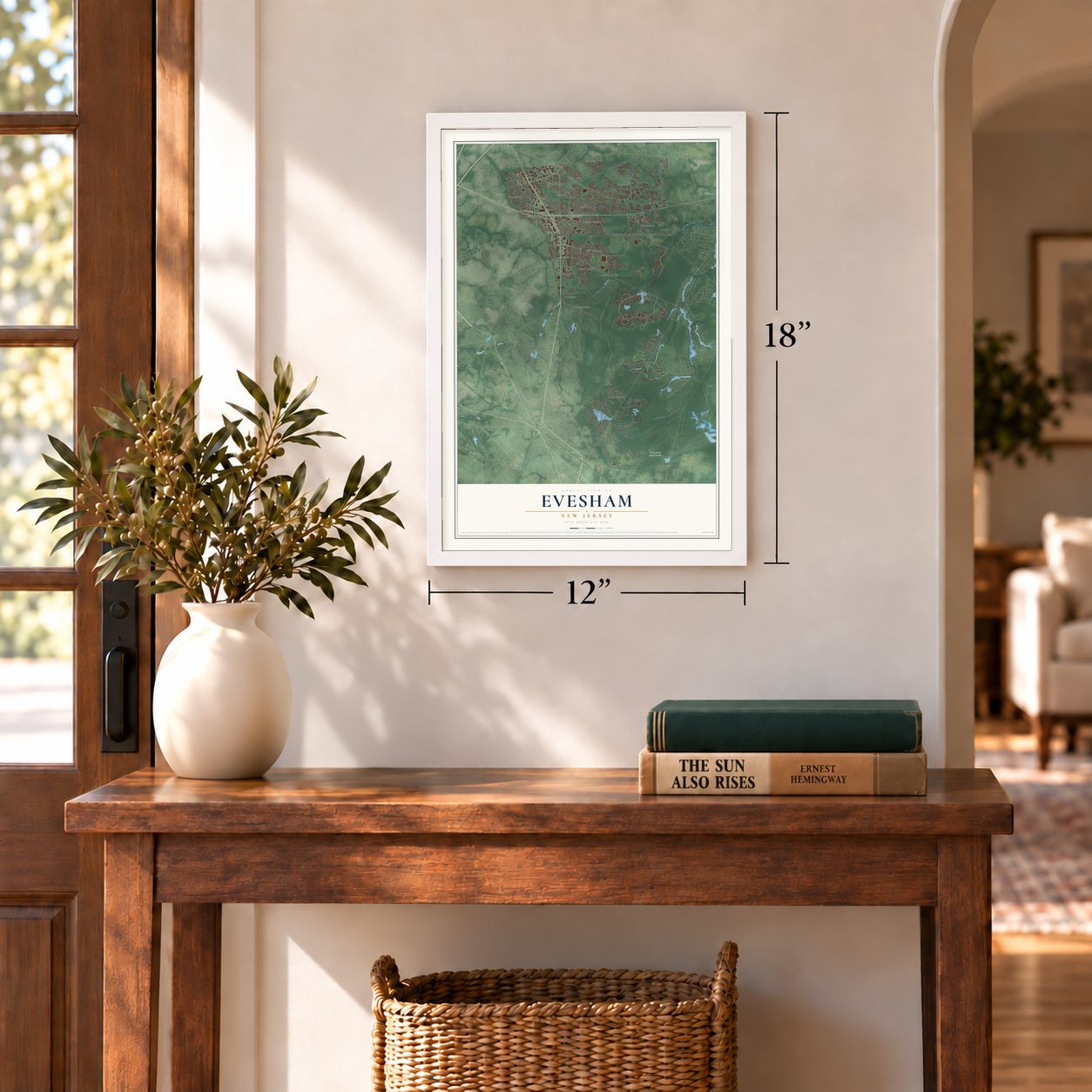
12" x 18" Archival Matte Print
A Map of Home. A Work of Art.
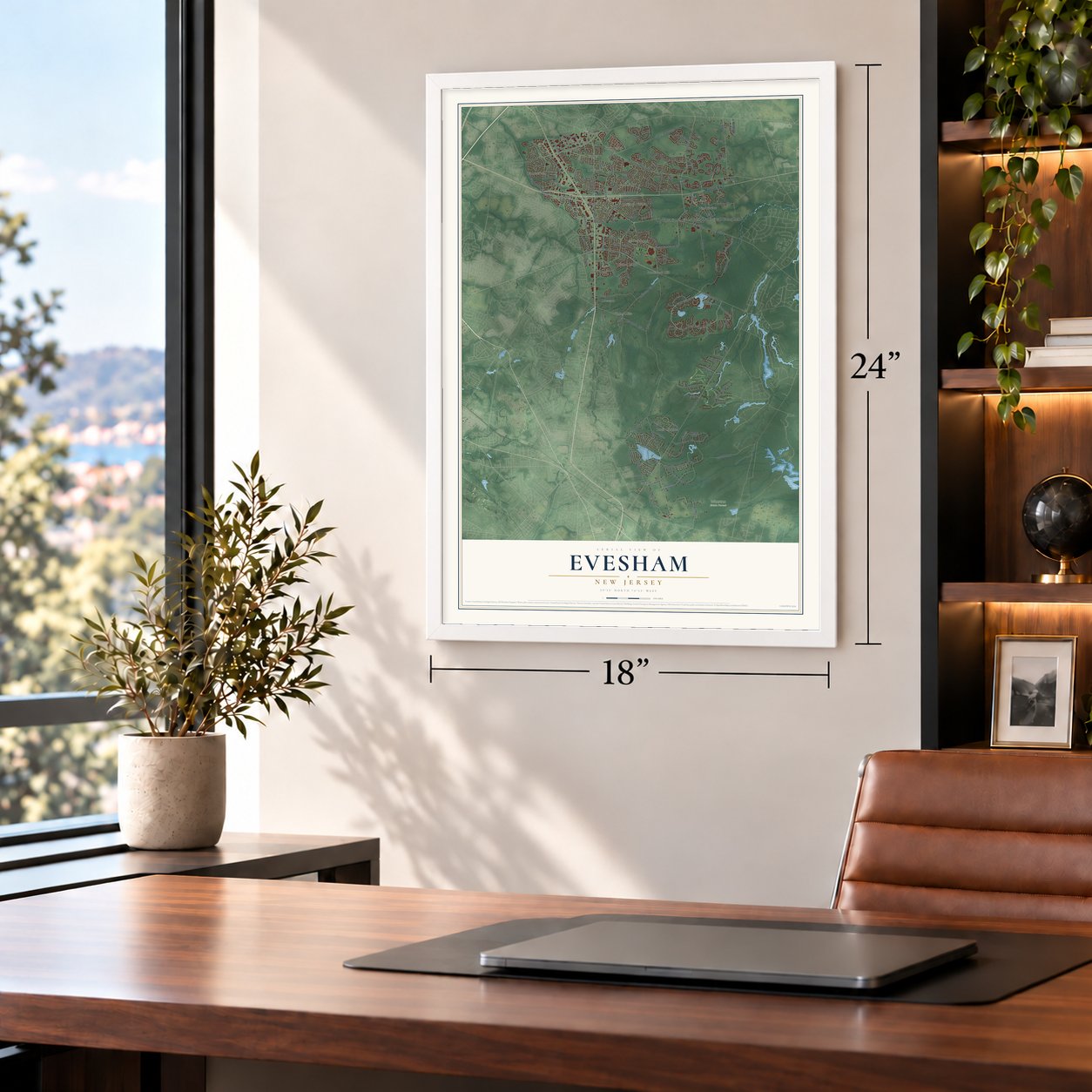
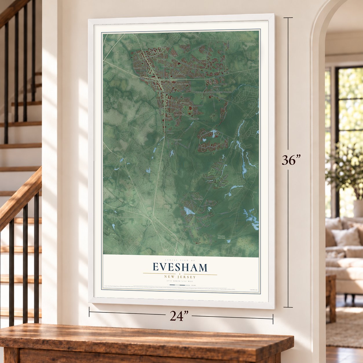
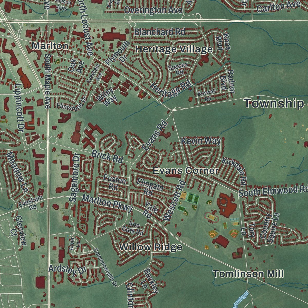
Explore Evesham, New Jersey from a whole new perspective. Created using aerial imagery and detailed geographic data, this map captures Evesham building by building, with labeled streets, familiar landmarks, and shaded topographical relief that highlights the natural contours of the landscape.
Combining modern data with the timeless character of a vintage atlas, this map is just as interesting up close as it is beautiful on the wall. Whether you grew up in Evesham, spent memorable years there, or call it home today, this unique map is a great way to celebrate a place that means something to you. Zoom in on the preview to look for your street, and then order a print to put your memories on the wall.
Three ways to hang it
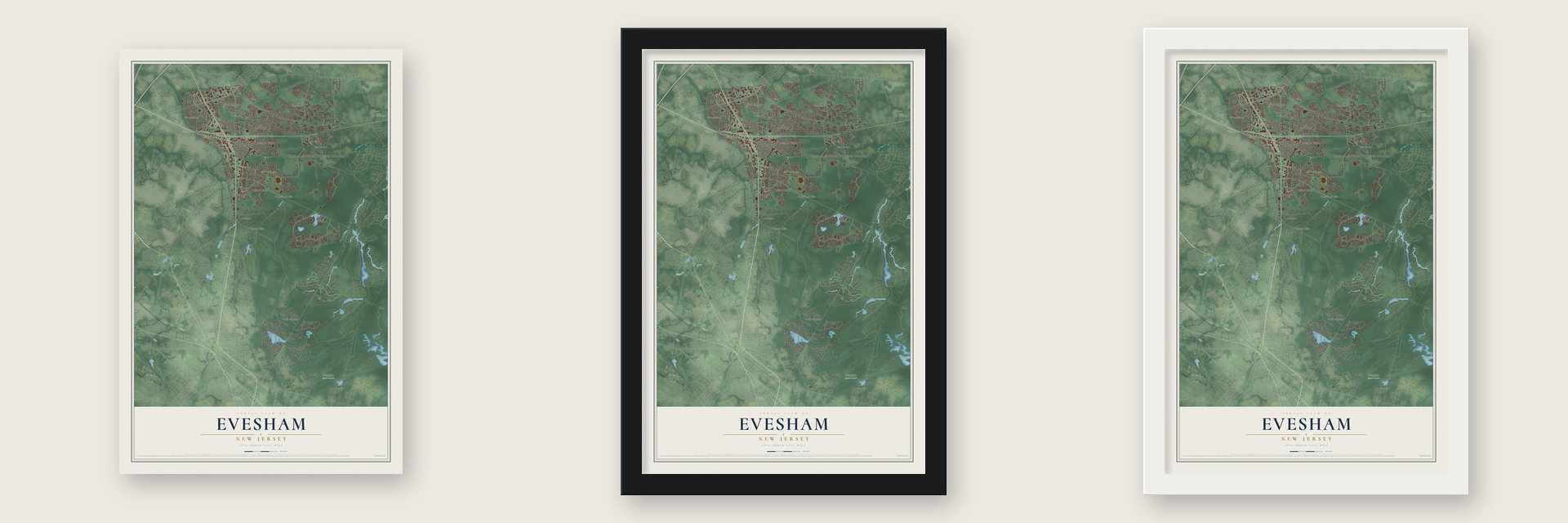
Unframed archival matte, a black wood frame or a white wood frame.
Up close
Geography Worth Displaying
This map was created using accurate cartographic data and authoritative geographic sources, including the U.S. Geological Survey (USGS) and FEMA. The map brings together terrain, waterways, roads, and building detail. The majority of the streets are labeled, houses are accurately depicted, and the topography is derived from government sources. Combining local data with carefully composed color and shading leads to this beautifully detailed Evesham artwork for your wall.
Rather than simply showing street outlines, we’ve included as many of the street names as we could reasonably fit on the map while keeping their names legible. Zoom in on the high resolution preview to see exactly what’s on the map. We truly set out to create a statement piece for anyone who loves Evesham. So whether it’s for you, or a gift for someone you love, we hope this map of Evesham brings back fond memories.
Explore the full map of Evesham, New Jersey and read about the local places it shows.

Find your street
Names on the Evesham map
Every name below is printed on this map. Look for your street, your school, the park where you played, or the pond down the road.
Places and landmarks21
- Township of Evesham Municipal Complex
- Greentree Village
- Evesboro
- Wharton State Forest
- Berlin Heights
- Cambridge
- Cropwell
- Crowfoot
- Donlontown
- Evans Corner
- Heritage Village
- Kresson
Show all 21 places
- Marlboro
- Marlton
- Pine Grove
- Stow Acres
- The Maples
- Tomlinson Mill
- Union Mills
- Willow Ridge
- Woodstream
Streets and roads182
- Marlton Pike
- East Main Street
- North Elmwood Road
- North Maple Avenue
- South Elmwood Road
- Lincoln Drive West
- Marlton Parkway
- Hopewell Road
- Evesboro Medford Road
- Kettle Run Road
- Tomlinson Mill Road
- Kettle Run
- Georgia Okeefe Way
- North Locust Avenue
- Bortons Road
- Power Line Access Road
- Taunton Lake Road
- Crown Royal Parkway South
- Kings Grant Drive
- Centre Boulevard
- Carlton Avenue
- Sharp Road
- New Road
- Braddock Mill Road
- Greenbrook Drive
- Evans Road
- Barton Run Boulevard
- Mill Road
- Brandywine Drive
- Barton Run
Show all 182 streets
- Dutch Road
- Brick Road
- Lincoln Drive East
- Raymond Avenue
- Tuckerton Road
- Kennilworth Road
- Preamble Drive
- Country Farms Road
- John Singer Sargent Way
- Lippincott Drive
- Marigold Drive
- Yarmouth Circle
- Lakeshore Drive
- Sycamore Avenue
- Walnut Avenue
- Milford Drive
- Overington Avenue
- Troth Road
- East Stow Road
- Sagemore Drive
- Andy Warhol Way
- Holly Road
- Baker Boulevard
- Crowfoot Road
- Blanchard Road
- Meadow Lane
- Wescott Road
- Clinton Lane
- Brittany Boulevard
- Merion Road
- Mill Park Lane
- Ardsley Drive
- Egret Road
- Greentree Road
- Heritage Road
- Mitchell Court
- Kevin Way
- Grace Drive
- Wellesley Way
- Knox Boulevard
- Lowell Drive
- Old Marlton Pike West
- Thomas Eakins Way
- Hamilton Road
- Park Avenue
- Chestnut Avenue
- Wiley Way
- Radnor Boulevard
- Lady Diana Circle
- Flamingo Drive
- Bon Air Drive
- Picadilly Circle
- Country Squire Lane
- Hunt Club Trail
- South Maple Avenue
- Albany Road
- Oak Avenue
- Hickory Road
- Weaver Drive
- Meeting Lane
- Plymouth Drive
- Elmgate Road
- Slab Branch Court
- Liberty Lane
- Ross Way
- Stone Mountain Lane
- Yale Road
- Hornsby Drive
- Barclay Boulevard
- Ramsey Avenue
- Fern Drive
- Buckley Lane
- Goldenrod Lane
- Princess Avenue
- Kirkdale Road
- Glenview Court
- Bartram Road
- Marbel Avenue
- Winslow Homer
- Revere Road
- Colony Trail
- Birch Lane
- Annapolis Drive
- Dividing Drive
- Kelly Drive
- Ninth Street
- Fox Hill Drive
- Lincoln Lane
- Euston Road
- Clancy Court
- Navy Lane
- Tory Lane
- Evesham Road
- Lakeside Drive
- Deerfield Avenue
- John James Audubon Way
- Tenby Lane
- Westerly Drive
- Pickwick Drive
- Charter Oak Lane
- Hibiscus Drive
- Norrsken Drive
- Justice Drive
- Church Road
- Huxley Circle
- Grant Wood Way
- Penny Lane
- Flintstone Drive
- Clearfield Avenue
- Shady Lane
- Marsham Drive
- Dock Road
- Cushman Avenue
- Phoenix Road
- Parliament Road
- Fifth Street
- Bass Road
- Kathryn Court
- Alcott Way
- Sussex Road
- Iron Gate Road
- Trinity Avenue
- Owl Court
- Allison Apts
- Colts Gait Road
- Lexington Circle
- Coventry Circle West
- Commonwealth Drive
- Brook View Circle
- Majestic Way
- Masters Circle
- Neville Drive
- Burgundy Drive
- Fox Chase Road
- Parkdale Place
- John James Audubon
- Heather Drive
- Spring Avenue
- Kingsley Avenue
- Baltimore Drive
- Boswell Road
- Country House Drive
- Tinsmith Lane
- Rabbit Run Road
- Tuxedo Court
- Sullivan Way
- Evesham Avenue
- Jarrett Court
- Amenity Way
- Royal Drive
- Arbor Lane
- Knoll Lane
Names are listed as they appear on the printed map. Zoom into the product photos to find them.
About Evesham, New Jersey
Evesham is a township of 46,826 people in Burlington County, and many people call the whole place Marlton, after the village inside it. Quakers settled here in 1672. On November 6, 1688, the township was formed in the Province of West Jersey under the name Eversham, before Burlington County itself existed. The extra r later fell away, and the Township Act of February 21, 1798, made Evesham one of the state's first 104 townships.
The early township was far bigger than it is today. Its land stretched east from Cropwell Creek all the way to the South Branch of the Rancocas, and Lumberton, Hainesport and Shamong grew out of its old lands. Washington Township split off in 1802 and Medford in 1847. The last division came in 1872, when the northern part became Mount Laurel.
- A village named for marlMarl is a green clay mixed with bits of shell, and farmers spread it on their fields as fertilizer. Digging it set off the township's first building boom in the 1830s and 1840s, and the marl was sold nearby and sent by rail to Burlington and Philadelphia. The village, recognized in 1758, took the name Marlton in 1845, and the Evesham post office and Baptist church changed their names that year too. Local mining went on until 1930.
- The Milford SettlementIn the mid 19th century, Black families built a community in Evesham called the Milford Settlement. Some were born free, and others had fled slavery. It was a stop on the Underground Railroad, and in 2025 it was officially recognized as part of New Jersey Black Heritage.
- A Cold War missile siteIn 1955 the U.S. Army opened the PH-32 Nike Ajax site on 38 acres along Tomlinson Mill Road. It was one of twelve bases guarding Philadelphia against air attack. The Army shut it down in the mid-1960s, the grounds later served as a civil defense center, and by the mid-1990s the land had become a housing development.
- A New Yorker cartoonistLiz Montague grew up in Marlton and ran track and played volleyball at Cherokee High School. She went on to draw cartoons for The New Yorker and the series Liz at Large, and in 2020 she made a Google Doodle honoring the cartoonist Jackie Ormes.
Keep exploring New Jersey
Evesham is one of 990 New Jersey towns we've mapped. Every dot on the map is a print of its own.
The search covers every state, New Jersey first.
Near Evesham
Order 2 or more town maps and save 10%. Shown in the size and finish you picked above, so they hang as a set.
- Kresson 12" x 18" / Archival Matte Print $39.99
- Voorhees 12" x 18" / Archival Matte Print $39.99
- Marlton 12" x 18" / Archival Matte Print $39.99


More maps nearby: Berlin Township, Gibbsboro, West Berlin, Springdale and Medford.
The art of mapping a place
How This Map Was Made
Real places. Remarkable detail. Discover the layers that turn geographic data into a map of home.

The view from above
Aerial imagery reveals the character of the land: woodland, open fields, and the patterns of a place.

The shape of the land
Elevation data brings hills, valleys, and subtle changes in the landscape into view.

The details of home
Roads, waterways, and building footprints come together to make the map feel unmistakably local.

Geography becomes art
Considered color, shading, and typography bring the layers together in a map made for your wall.


Process illustrated with Mendon, Massachusetts. Aerial imagery: USDA NAIP. Terrain: USGS 3D Elevation Program. Map details and finished artwork: KNOWOL.
The Details
About This Print
Choose an archival matte print, or a black or white Ayous wood frame. The archival matte print is unframed.
Select your size and finish above to see the matching product image and price.
Materials & Craftsmanship
A contemporary map with the character of a classic atlas, printed on archival matte paper. Optional frames are made from Ayous wood.
Your printed map does not include the watermark shown in the full-map preview.
Shipping & Delivery
Free shipping within the United States. Every print is made to order in the USA.
Buying a gift? Add a note in your cart and we'll include it. We never put prices in the package.
Prints ship within 2 to 3 business days. Allow 7 to 10 days total from ordering for delivery. Timing may vary during holidays or periods of high order volume.
Read our shipping policy.
Returns and damaged prints
Each print is made to order. Change-of-mind refunds are not available after production.
If your print arrives damaged, misprinted or incorrect, contact support@knowol.com within 30 days of receiving it. Include your order number, photos and a description of the issue.
Read our full refund and replacement policy. For questions about your order, email support@knowol.com.