
Search for another town





Free U.S. delivery 7 to 10 days after you order
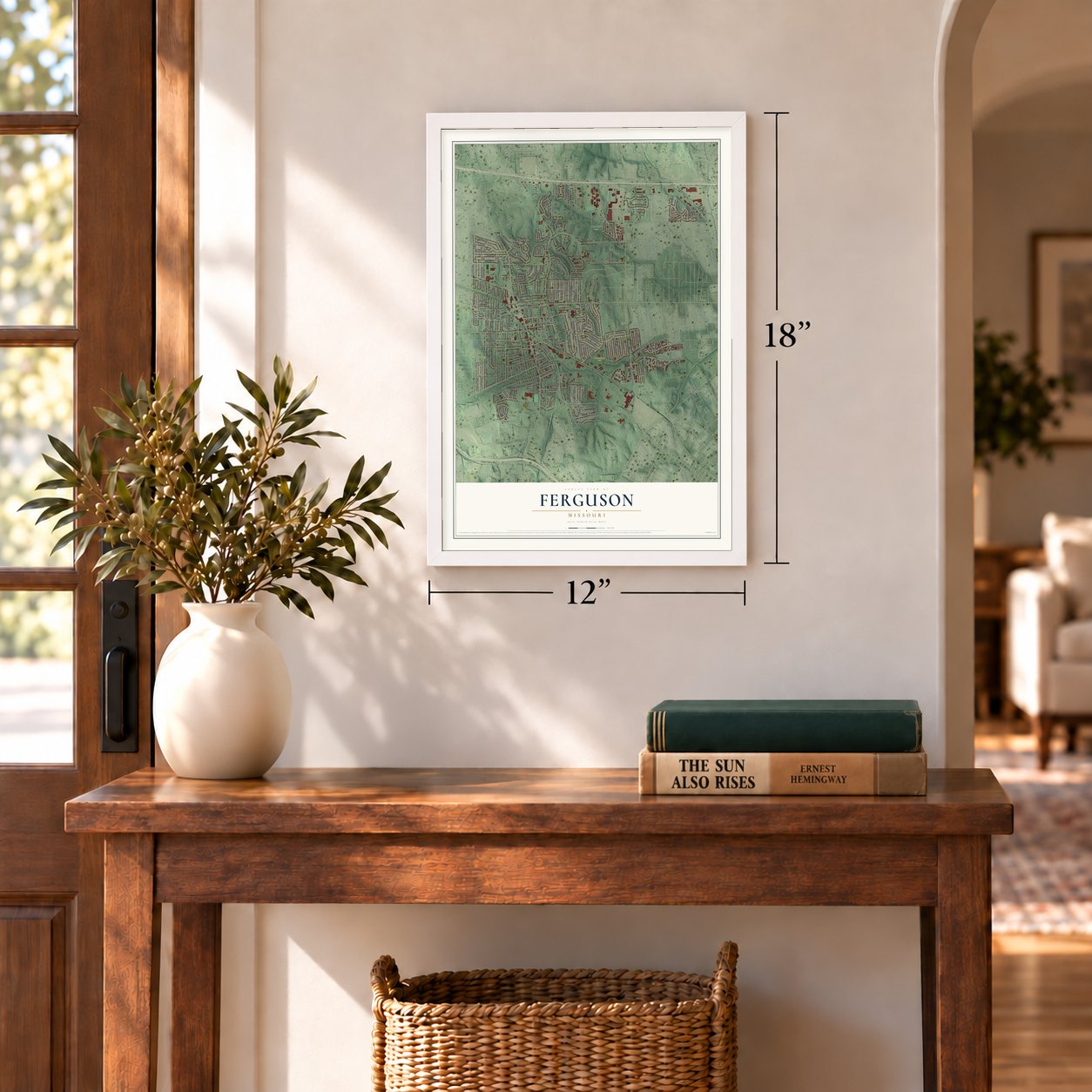
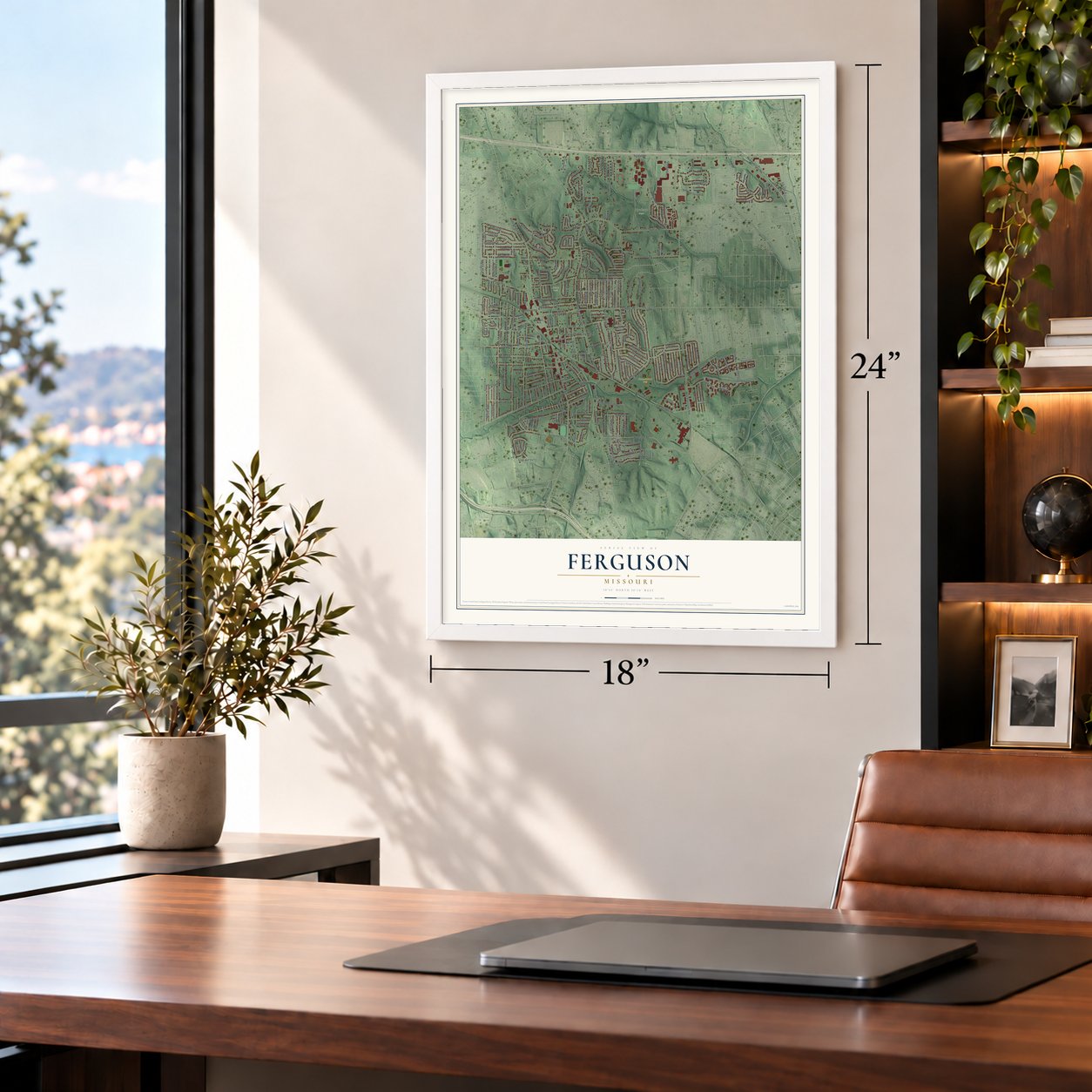
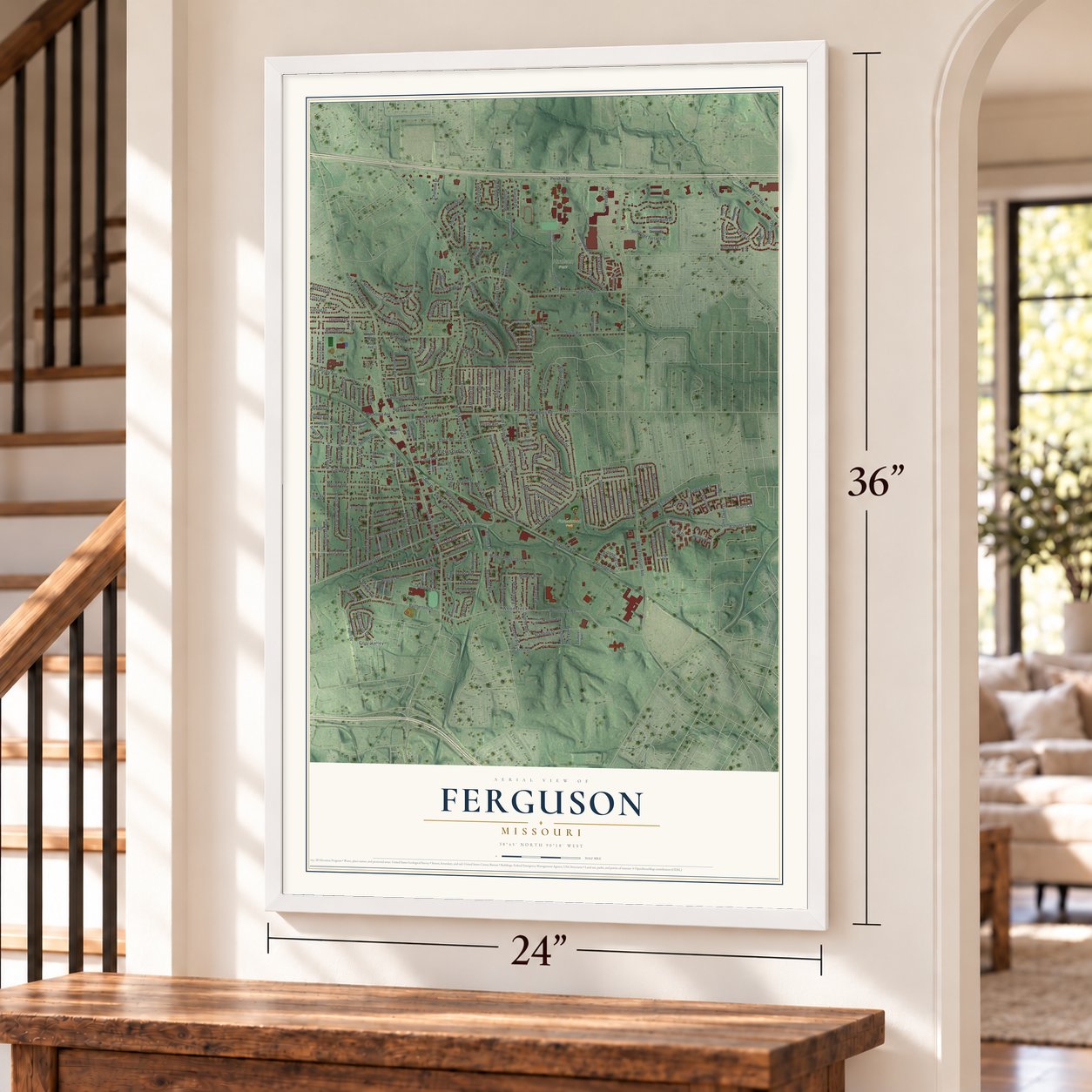
Ferguson, Missouri Map Art
Building by building, with labeled streets and shaded relief.
12" x 18" Archival Matte Print
A Map of Home. A Work of Art.
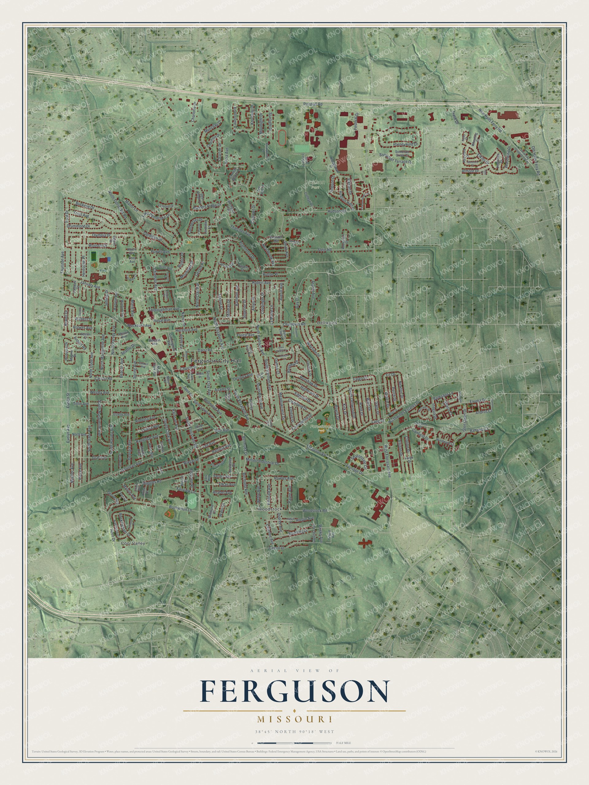
Explore Ferguson, Missouri from a whole new perspective. Created using aerial imagery and detailed geographic data, this map captures Ferguson building by building, with labeled streets, familiar landmarks, and shaded topographical relief that highlights the natural contours of the landscape.
Combining modern data with the timeless character of a vintage atlas, this map is just as interesting up close as it is beautiful on the wall. Whether you grew up in Ferguson, spent memorable years there, or call it home today, this unique map is a great way to celebrate a place that means something to you. Zoom in on the preview to look for your street, and then order a print to put your memories on the wall.
Three ways to hang it
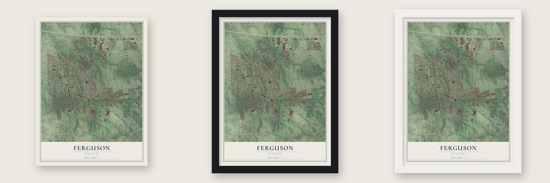
Unframed archival matte, a black wood frame or a white wood frame.
Up close
Geography Worth Displaying
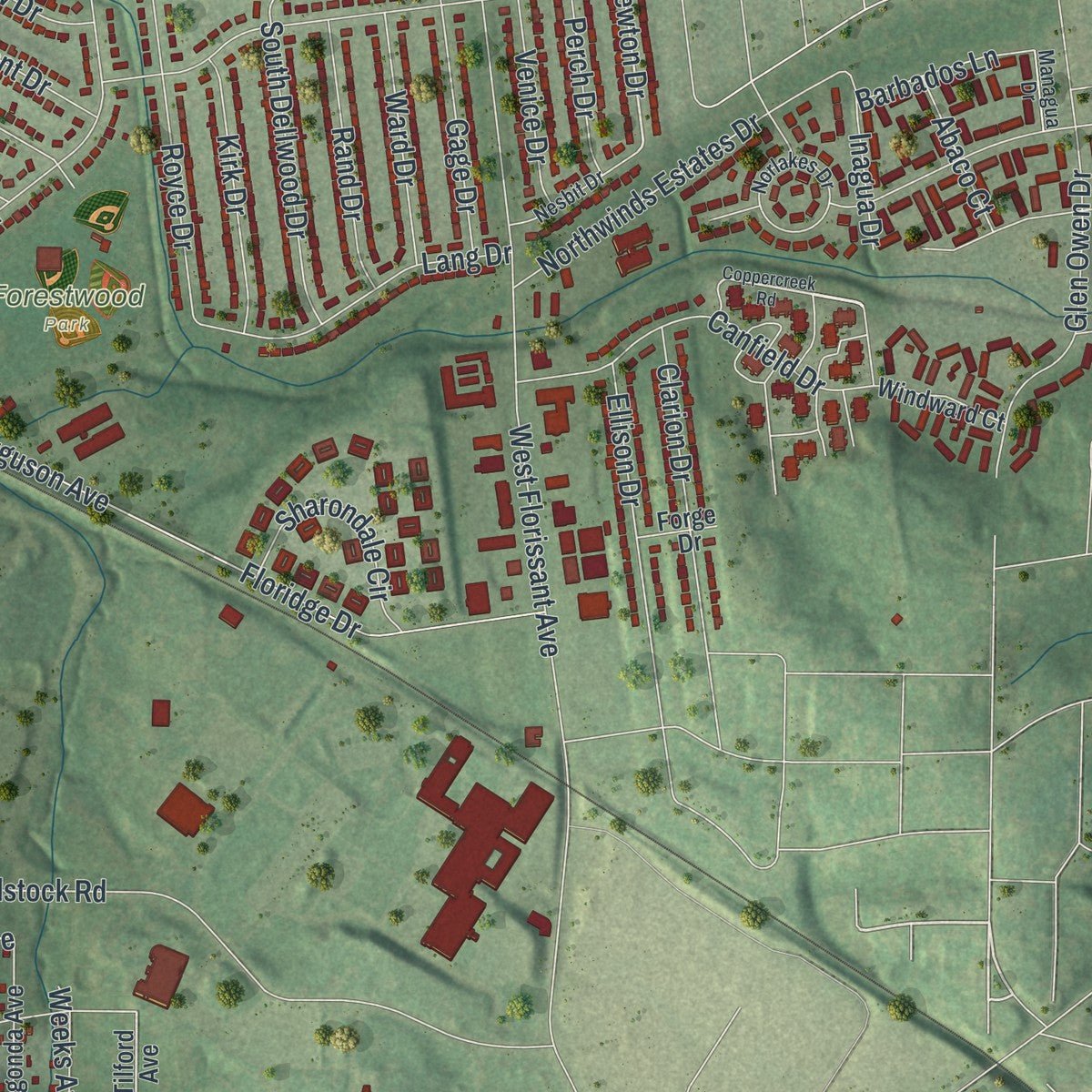
This map was created using accurate cartographic data and authoritative geographic sources, including the U.S. Geological Survey and the Census Bureau. The map brings together terrain, waterways, roads, and building detail. The majority of the streets are labeled, houses are accurately depicted, and the topography is derived from government sources. Combining local data with carefully composed color and shading leads to this beautifully detailed Ferguson artwork for your wall.
Rather than simply showing street outlines, we’ve included as many of the street names as we could reasonably fit on the map while keeping their names legible. Zoom in on the high resolution preview to see exactly what’s on the map. We truly set out to create a statement piece for anyone who loves Ferguson. So whether it’s for you, or a gift for someone you love, we hope this map of Ferguson brings back fond memories.
Read the story behind this map of Ferguson, Missouri from 2026.

Find your street
Names on the Ferguson map
Every name below is printed on this map. Look for your street, your school, the park where you played, or the pond down the road.
Places and landmarks7
- Ferguson City Hall
- Forestwood Park
- Hudson Park
- Jeske Park
- Cool Valley
- Dellwood
- Woodstock
Streets and roads267
- Airport Road
- Payne Avenue
- South Clark Avenue
- South Elizabeth Avenue
- Church Street
- Thatcher Avenue
- South Hartnett Avenue
- South Florissant Road
- Hereford Avenue
- South Barat Avenue
- Newton Drive
- Redmond Avenue
- Woodwind Drive
- Pershall Road
- West Florissant Avenue
- North Elizabeth Avenue
- North Florissant Road
- Woodstock Road
- Hudson Road
- Ferguson Avenue
- Robert Avenue
- Suburban Avenue
- Forestwood Drive
- Highmont Drive
- Wesley Avenue
- Tiffin Avenue
- Harneywold Drive
- Carson Road
- South Dade Avenue
- Chambers Road
Show all 267 streets
- Brotherton Lane
- South Harvey Avenue
- New Halls Ferry Road
- Darst Road
- Hentschel Place
- North Dade Avenue
- Georgia Avenue
- Royal Avenue
- Floridge Drive
- Powell Avenue
- January Avenue
- Wiegel Drive
- Ford Drive
- Ruggles Road
- Bermuda Avenue
- Bermuda Drive
- Stein Road
- Frost Avenue
- Old Halls Ferry Road
- Olympia Drive
- Blanding Drive
- Cardigan Drive
- Thoroughman Avenue
- Evelyn Avenue
- Evelyn Street
- North Marguerite Avenue
- Exuma Drive
- Millman Drive
- Lake Pembroke Drive
- Plantmore Drive
- Thurston Avenue
- Randolph Avenue
- Buckeye Drive
- Nancy Place
- North Clay Avenue
- Northwinds Estates Drive
- Paul Avenue
- Hern Drive
- Castro Drive
- North Harvey Avenue
- Henquin Drive
- Coppinger Drive
- Gerald Place
- Dupree Avenue
- Festival Drive
- Elkins Drive
- South Dellwood Drive
- Canfield Drive
- Mueller Avenue
- Monceau Drive
- Glen Owen Drive
- Plaza Avenue
- South Marguerite Avenue
- Day Drive
- Andros Court
- Argent Avenue
- Meadowcrest Drive
- Somerset Terrace Drive
- Smith Avenue
- Edgehill Drive
- Lang Drive
- Royce Drive
- Halpin Avenue
- Wooster Drive
- Alicia Avenue
- Gage Drive
- Chanslor Avenue
- Adams Street
- Chartier Drive
- Clarion Drive
- Knollstone Drive
- Wayside Drive
- Ballman Avenue
- Bayview Drive
- Ames Place
- La Motte Lane
- Averill Avenue
- Saint Louis Avenue
- Patricia Avenue
- Mintert Industrial Drive
- Renshaw Drive
- Hudson Hills Drive
- Lee Avenue
- Kirk Drive
- Graf Avenue
- Fargo Drive
- Spring Avenue
- Drummond Drive
- Rand Drive
- Elkhart Drive
- Venice Drive
- Sharondale Circle
- Ellison Drive
- Superior Drive
- Harrison Avenue
- Rowles Avenue
- Ward Drive
- Seattle Drive
- Elkan Avenue
- Clearfield Drive
- Perch Drive
- Roberta Avenue
- Teston Drive
- Moundale Drive
- Chatelet Drive
- Charlotte Drive
- Larkin Avenue
- Rockingham Drive
- Starlight Drive
- North Hartnett Avenue
- Hutton Place
- Emerald Avenue
- Behle Avenue
- Louisa Avenue
- Moonlight Drive
- South Clay Avenue
- Knollway Drive
- Bahama Court
- Hunters Ridge Drive
- Atmore Drive
- Marie Avenue
- Laurette Avenue
- Wylin Court
- Fairview Lane
- Colchester Drive
- Hern Avenue
- Barbados Lane
- Manor Lane
- Nearbrook Avenue
- Blackburn Avenue
- Newell Drive
- Derinda Avenue
- Spot Drive
- Fermo Avenue
- Abaco Court
- Risdon Drive
- Forest Avenue
- Elsworth Place
- Grove Avenue
- Beacon Avenue
- Jehling Drive
- Inagua Drive
- Hobson Drive
- Anabel Avenue
- Marvin Avenue
- Walters Drive
- Rolwes Avenue
- Weeks Avenue
- Trask Drive
- Dames Court
- Fir Drive
- North Clark Avenue
- Tilford Avenue
- Abston Avenue
- Abston Street
- Chateau Woods Drive
- College Drive
- Thomas Avenue
- Fenwick Drive
- Godfrey Lane
- Klosterman Drive
- Elmdale Drive
- Briarwood Lane
- Somerset Green Court
- Warford Avenue
- Lagonda Avenue
- Jesskamp Drive
- Joyce Ellen Lane
- Deandell Avenue
- Deer Ridge Drive
- Warfield Avenue
- Adelle Avenue
- Shirley Avenue
- Cunningham Avenue
- Windward Court
- Uplynn Drive
- Charmont Drive
- Beardsley Court
- Aylesford Drive
- Jean Avenue
- Oliver Avenue
- Scott Avenue
- Estelle Avenue
- North Avenue
- Palace Court
- Roussilon Court
- Lomond Drive
- Wheeling Court
- Birchgate Trail
- Arline Drive
- Tee Vee Lane
- Leicester Lane
- Willmann Court
- Marion Place
- Lewis Avenue
- Caldwell Court
- Eddy Avenue
- Albert Avenue
- Bangert Avenue
- Allen Place
- Mayme Drive
- Forge Drive
- Miller Place
- Lois Avenue
- Lakeview Court
- Arbor Village Court
- Wallingford Drive
- Halpin Drive
- Chardonniere Drive
- Central City Shopping Center
- Norlakes Drive
- Emmett Avenue
- Nesbit Drive
- Elliott Avenue
- Geringer Court
- Cross Street
- North College Drive
- North Barat Avenue
- Ronbar Lane
- Elsie Avenue
- Bruce Avenue
- Managua Drive
- Almeda Place
- Estates Court
- Centre Avenue
- Sibley Court
- Tate Drive
- Coppercreek Road
- Shireford Lane
- Falmouth Drive
- Cernicek Lane
- Minneford Drive
- Delworth Court
- Bromley Drive
- Cheri Heights Court
- Samana Drive
- Cunniff Place
Names are listed as they appear on the printed map. Zoom into the product photos to find them.
About Ferguson, Missouri
Ferguson is a city of 18,527 people in St. Louis County, part of the Greater St. Louis area. It began in 1855, when William B. Ferguson gave 10 acres of his land to the Wabash Railroad. In return the railroad built a new depot and let him name it, so the settlement that grew up around the depot was known as Ferguson Station.
That stop was the first railroad station with a direct connection to St. Louis, and the town grew along the tracks. A post office opened in 1876, the first schoolhouse was built in 1878, and Ferguson was incorporated as a city in 1894. When the city's flag was designed in 1994, the old station went on it.
- A ladder that wouldn't fitFor years Fire Station No. 1 worked out of an extension of City Hall on Church Street. The department's ladder truck was too large to fit in the bay, so crews usually parked it outside in the rear lot. A new Station No. 1 was built in 2015, and the old extension became home to FYI Backbay, a youth organization.
- Church Street since 1984The Church Street Commercial District, the old business street where City Hall stands, joined the National Register in 1984. Ferguson's Central School, the brick schoolhouse on Wesley Avenue that the Register calls the Ferguson School Central School, was listed in the same year.
- Emerson Electric's hometownIn the 20th century the Fortune 500 company Emerson Electric chose Ferguson as the home of its headquarters, and it stayed until early February 2025. That month it opened Emerson Tower in Clayton as its new global headquarters.
- A new mayor in 2020On June 2, 2020, Ferguson voters elected Ella Jones mayor. She was the first African American and the first woman to hold the office, which carries a three-year term and works with a six-member city council.
Keep exploring Missouri
Ferguson is one of 1,207 Missouri towns we've mapped. Every dot on the map is a print of its own.
The search covers every state, Missouri first.
Near Ferguson
Order 2 or more town maps and save 10%. Shown in the size and finish you picked above, so they hang as a set.
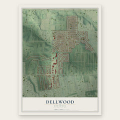
- Dellwood 12" x 18" / Archival Matte Print $39.99
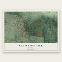
- Calverton Park 12" x 18" / Archival Matte Print $39.99
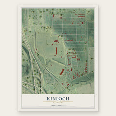
- Kinloch 12" x 18" / Archival Matte Print $39.99
More maps nearby: Cool Valley, Berkeley, Country Club Hills, Norwood Court and Jennings.
The art of mapping a place
How This Map Was Made
Real places. Remarkable detail. Discover the layers that turn geographic data into a map of home.

The view from above
Aerial imagery reveals the character of the land: woodland, open fields, and the patterns of a place.

The shape of the land
Elevation data brings hills, valleys, and subtle changes in the landscape into view.

The details of home
Roads, waterways, and building footprints come together to make the map feel unmistakably local.

Geography becomes art
Considered color, shading, and typography bring the layers together in a map made for your wall.


Process illustrated with Mendon, Massachusetts. Aerial imagery: USDA NAIP. Terrain: USGS 3D Elevation Program. Map details and finished artwork: KNOWOL.
The Details
About This Print
Choose an archival matte print, or a black or white Ayous wood frame. The archival matte print is unframed.
Select your size and finish above to see the matching product image and price.
Materials & Craftsmanship
A contemporary map with the character of a classic atlas, printed on archival matte paper. Optional frames are made from Ayous wood.
Your printed map does not include the watermark shown in the full-map preview.
Shipping & Delivery
Free shipping within the United States. Every print is made to order in the USA.
Buying a gift? Add a note in your cart and we'll include it. We never put prices in the package.
Prints ship within 2 to 3 business days. Allow 7 to 10 days total from ordering for delivery. Timing may vary during holidays or periods of high order volume.
Read our shipping policy.
Returns and damaged prints
Each print is made to order. Change-of-mind refunds are not available after production.
If your print arrives damaged, misprinted or incorrect, contact support@knowol.com within 30 days of receiving it. Include your order number, photos and a description of the issue.
Read our full refund and replacement policy. For questions about your order, email support@knowol.com.