


Search for another town





Free U.S. delivery 7 to 10 days after you order
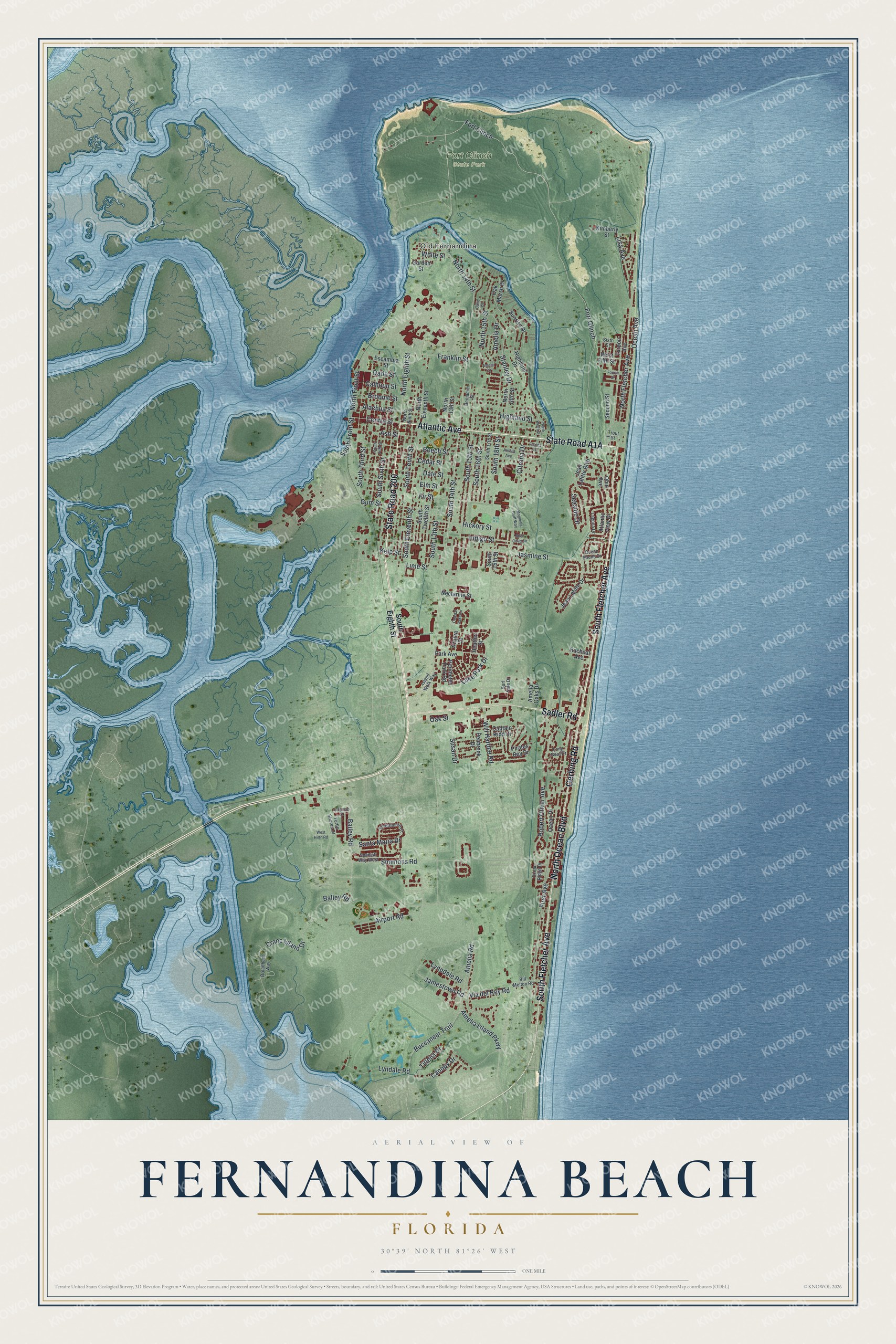
Fernandina Beach, Florida Map Art
Building by building, with labeled streets and shaded relief.
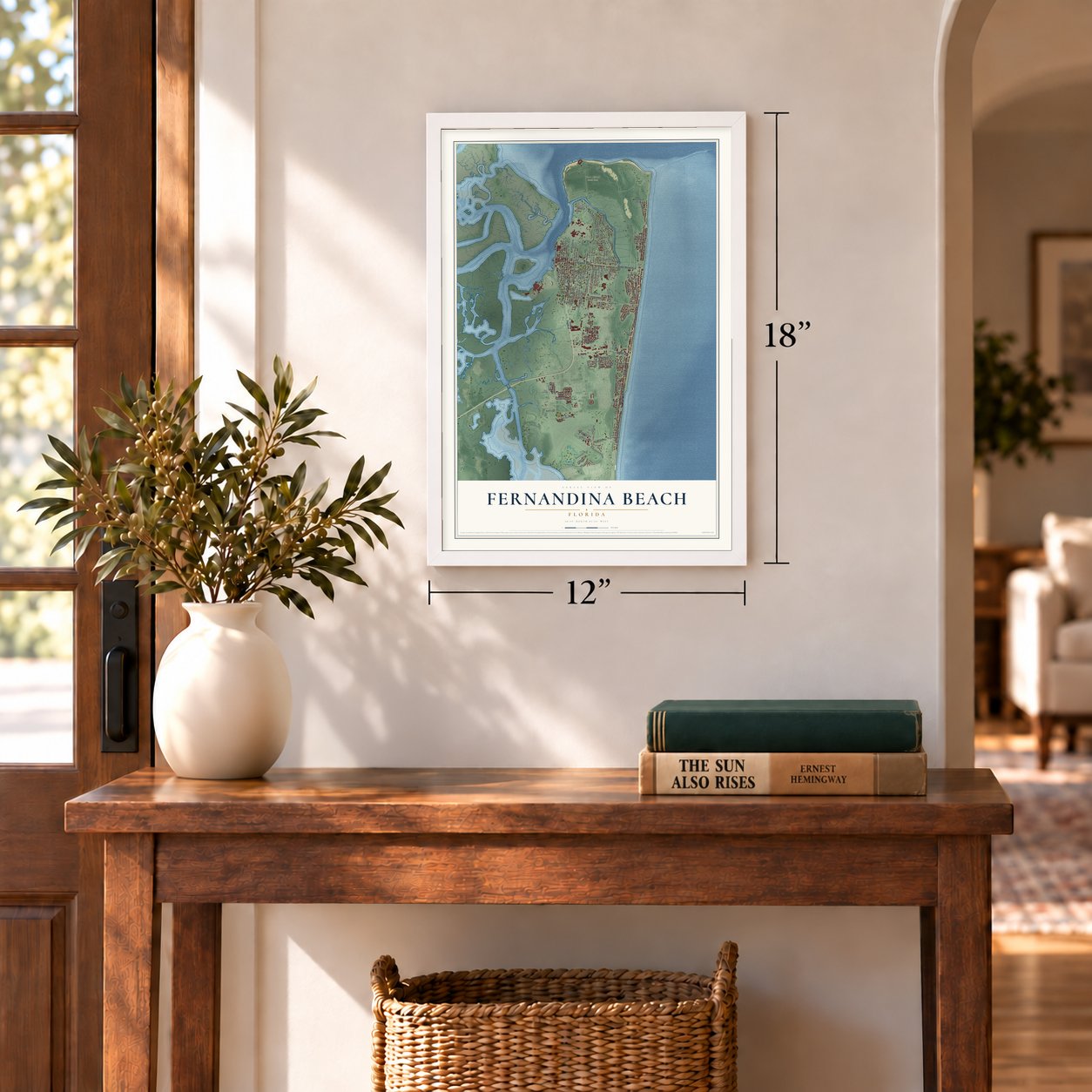
12" x 18" Archival Matte Print
A Map of Home. A Work of Art.
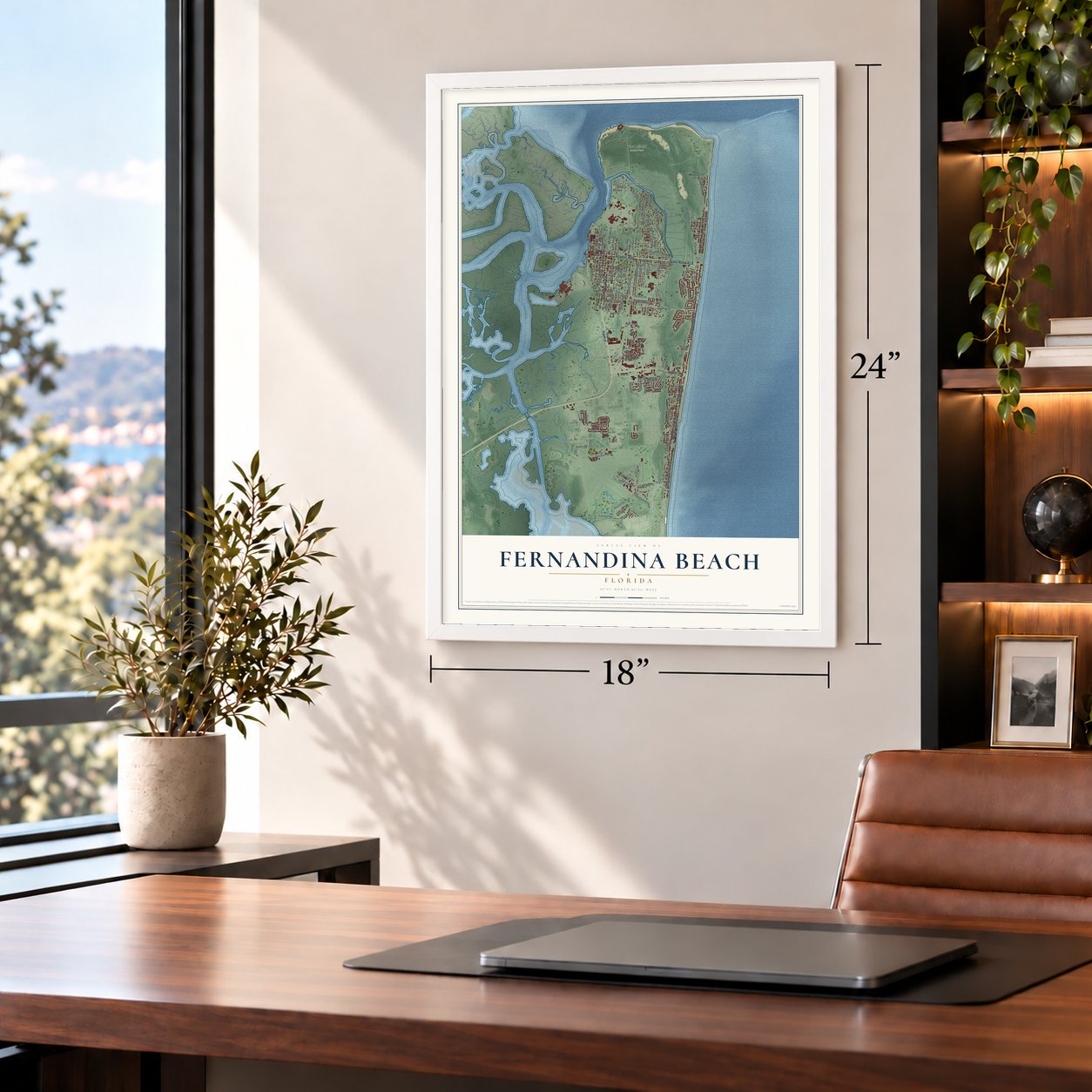
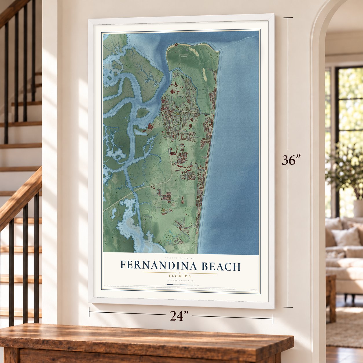
Explore Fernandina Beach, Florida from a whole new perspective. Created using aerial imagery and detailed geographic data, this map captures Fernandina Beach building by building, with labeled streets, familiar landmarks, and shaded topographical relief that highlights the natural contours of the landscape.
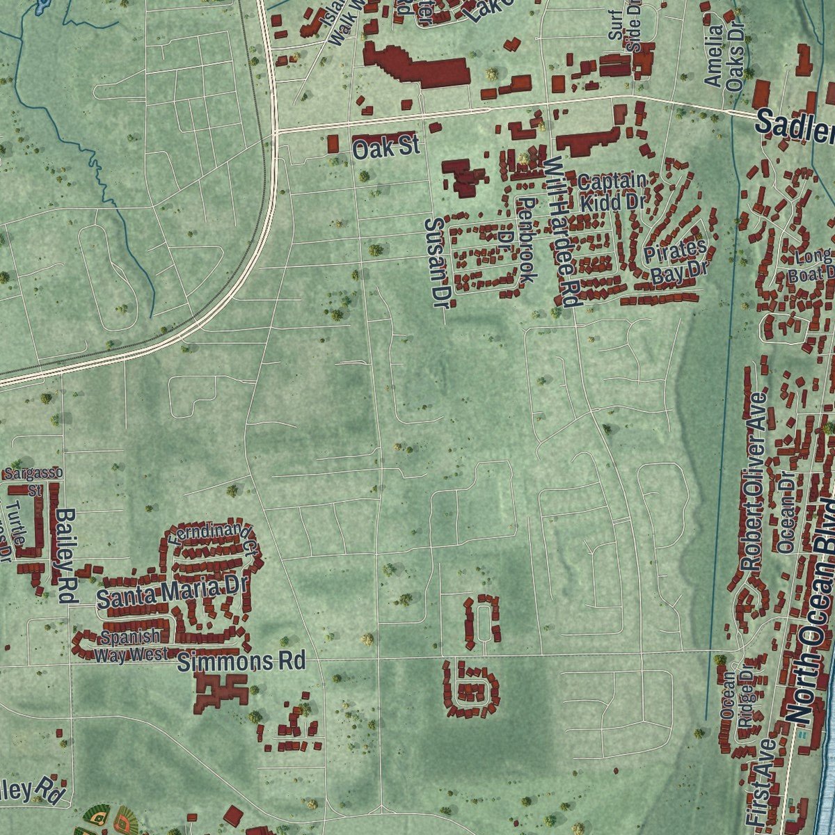
Combining modern data with the timeless character of a vintage atlas, this map is just as interesting up close as it is beautiful on the wall. Whether you grew up in Fernandina Beach, spent memorable years there, or call it home today, this unique map is a great way to celebrate a place that means something to you. Zoom in on the preview to look for your street, and then order a print to put your memories on the wall.
Three ways to hang it
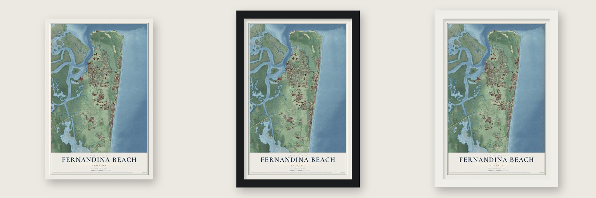
Unframed archival matte, a black wood frame or a white wood frame.
Up close
Geography Worth Displaying
This map was created using accurate cartographic data and authoritative geographic sources, including the U.S. Geological Survey (USGS) and FEMA. The map brings together terrain, waterways, roads, and building detail. The majority of the streets are labeled, houses are accurately depicted, and the topography is derived from government sources. Combining local data with carefully composed color and shading leads to this beautifully detailed Fernandina Beach artwork for your wall.
Rather than simply showing street outlines, we’ve included as many of the street names as we could reasonably fit on the map while keeping their names legible. Zoom in on the high resolution preview to see exactly what’s on the map. We truly set out to create a statement piece for anyone who loves Fernandina Beach. So whether it’s for you, or a gift for someone you love, we hope this map of Fernandina Beach brings back fond memories.
Explore the full map of Fernandina Beach, Florida and read about the local places it shows.

Find your street
Names on the Fernandina Beach map
Every name below is printed on this map. Look for your street, your school, the park where you played, or the pond down the road.
Places and landmarks2
- Old Fernandina
- Fort Clinch State Park
Streets and roads128
- South Fletcher Avenue
- State Road 200
- Atlantic Avenue
- North Ocean Boulevard
- Gerbing Road
- Sadler Road
- Fort Clinch
- North 14th Street
- Lake Park Drive
- Fort Glinch
- Will Hardee Road
- Citrona Drive
- Indigo Street
- North Eighth Street
- Centre Street
- Stanley Drive
- South Sixth Street
- South Third Street
- South 18th Street
- Dade Street
- First Avenue
- South 14th Street
- Amelia Road
- Jasmine Street
- South 15th Street
- Crane Island Drive
- North Fletcher Avenue
- Beech Street
- Amelia Island Parkway
- Lime Street
Show all 128 streets
- South Tenth Street
- Date Street
- South Eleventh Street
- Alachua Street
- Hickory Street
- Simmons Road
- South 13th Street
- Fir Street
- North 15th Street
- Broome Street
- Franklin Street
- Ash Street
- Canopy Drive
- Ocean Avenue
- Via del Rey Road
- Calhoun Street
- Cedar Street
- Elm Street
- Seaside Drive
- Buccaneer Trail
- Robert Oliver Avenue
- Gum Street
- Bailey Road
- Airport Road
- South 16th Street
- Lyndale Road
- Highland Street
- Jamestown Road
- Susan Drive
- Lisa Avenue
- South Front Street
- North Front Street
- Santa Maria Drive
- Titleist Drive
- Lynndale Road
- White Street
- Kelp Street
- Amelia Drive
- Balley Road
- Oak Street
- South Eighth Street
- Heather Street
- Pirates Bay Drive
- Penbrook Drive
- Atlantic View Drive
- Tarpon Avenue
- Highland Drive
- South Twelfth Street
- Park Avenue
- North Eleventh Street
- Sunrise Drive
- Jean Lafitte Drive
- South 19th Street
- North 18th Street
- Amelia Oaks Drive
- Jean Lafitte Boulevard
- Kimberly Street
- Second Street
- North 13th Street
- Captain Kidd Drive
- Nectarine Street
- Escambia Street
- Oak Marsh Drive
- Perimeter Park Road
- West Fifth Street
- Racheal Avenue
- Ocean Drive
- Azalea Street
- Ohio Avenue
- Garden Street
- Island Walk Way
- Trout Street
- South 17th Street
- Ferndinand Court
- Broadbent Way
- Laguna Drive
- Surf Side Drive
- North Ninth Street
- Bill Melton Road
- Ocean Ridge Drive
- Sixth Street
- Spanish Way West
- Turtle Shores Drive
- Benjamin Street
- Ocean Sound Drive
- Long Boat Drive
- North Wolff Street
- South Fifth Street
- Amelia Circle
- Coastal Oaks Circle
- Shell Cove Circle
- Amelia Avenue
- Magnolia Bluff Way
- Florida Avenue
- Sargasso Street
- Calle Court
- West Hirth Road
- Fourth Street
Names are listed as they appear on the printed map. Zoom into the product photos to find them.
About Fernandina Beach, Florida
Fernandina Beach is a city of 13,052 people on Amelia Island, the seat of Nassau County and the northernmost city on the Atlantic side of Florida. Timucua people had made their home on the island by about 1000 CE and called it Napoyca. On January 1, 1811, Enrique White, the Spanish governor of East Florida, gave the town the name Fernandina in honor of King Ferdinand VII. That May 10 it was platted as the final town in the Western Hemisphere planned under Spain's Laws of the Indies, meant to hold back the spread of the United States.
That first town sat among marshes, too cut off to serve as the end of a railroad. When Senator David Levy Yulee began building his Florida Railroad in 1855, he aimed it at the Amelia River about a mile south. The town's leaders feared a rival town would grow up there and pass them by, so they moved Fernandina down to meet the tracks. The line opened on March 1, 1861, running across Florida to Cedar Key, and the new town grew up along Centre Street.
- The Isle of Eight FlagsSpain built Fort San Carlos on the island in 1816. The next year Gregor MacGregor, a Scottish adventurer, seized it with a force of 55 musketeers and hoisted his flag, the Green Cross of Florida. Spanish soldiers pushed him out, but the French-born pirate Louis Aury then claimed the island for Mexico. The U.S. Navy finally drove Aury off, and President James Monroe promised to hold Amelia Island "in trust for Spain."
- Fort Clinch, begun in 1847The brick fort, named for General Duncan Lamont Clinch, used almost five million bricks. Confederates seized it in January 1861, and Robert E. Lee's order in early 1862 to pull out its guns and men came too late. On March 3, 1862, 28 Union gunboats under Commodore Samuel Dupont took the island, and the Union held the fort through the war without a battle there. The state bought it in 1935 and opened Fort Clinch State Park in 1938.
- Freedom read aloud in 1863In January 1863, at Fernandina, Lincoln's Emancipation Proclamation was read to the first all-Black regiment the Union recruited, made up of men who had been enslaved. Three weeks later the regiment sailed up the St. Marys River to fight Confederate forces.
- A lighthouse moved from GeorgiaThe Amelia Island Lighthouse went up in 1838, built from the materials of an older light that had been taken down on Cumberland Island in Georgia. It is counted as the oldest lighthouse still standing in Florida, and the city has owned it since 2001.
- Shrimp Festival since 1964The Isle of Eight Flags Shrimp Festival began in 1964 and returns every year on the first weekend of May, with seafood, live music, a Miss Shrimp Festival pageant, fireworks and a parade.
Keep exploring Florida
Fernandina Beach is one of 1,067 Florida towns we've mapped. Every dot on the map is a print of its own.
The search covers every state, Florida first.
Near Fernandina Beach
Order 2 or more town maps and save 10%. Shown in the size and finish you picked above, so they hang as a set.
- Yulee 12" x 18" / Archival Matte Print $39.99
- Wildlight 12" x 18" / Archival Matte Print $39.99
- Atlantic Beach 12" x 18" / Archival Matte Print $39.99


More maps nearby: Callahan, Nassau Village-Ratliff, Neptune Beach, Jacksonville and Jacksonville Beach.
The art of mapping a place
How This Map Was Made
Real places. Remarkable detail. Discover the layers that turn geographic data into a map of home.

The view from above
Aerial imagery reveals the character of the land: woodland, open fields, and the patterns of a place.

The shape of the land
Elevation data brings hills, valleys, and subtle changes in the landscape into view.

The details of home
Roads, waterways, and building footprints come together to make the map feel unmistakably local.

Geography becomes art
Considered color, shading, and typography bring the layers together in a map made for your wall.


Process illustrated with Mendon, Massachusetts. Aerial imagery: USDA NAIP. Terrain: USGS 3D Elevation Program. Map details and finished artwork: KNOWOL.
The Details
About This Print
Choose an archival matte print, or a black or white Ayous wood frame. The archival matte print is unframed.
Select your size and finish above to see the matching product image and price.
Materials & Craftsmanship
A contemporary map with the character of a classic atlas, printed on archival matte paper. Optional frames are made from Ayous wood.
Your printed map does not include the watermark shown in the full-map preview.
Shipping & Delivery
Free shipping within the United States. Every print is made to order in the USA.
Buying a gift? Add a note in your cart and we'll include it. We never put prices in the package.
Prints ship within 2 to 3 business days. Allow 7 to 10 days total from ordering for delivery. Timing may vary during holidays or periods of high order volume.
Read our shipping policy.
Returns and damaged prints
Each print is made to order. Change-of-mind refunds are not available after production.
If your print arrives damaged, misprinted or incorrect, contact support@knowol.com within 30 days of receiving it. Include your order number, photos and a description of the issue.
Read our full refund and replacement policy. For questions about your order, email support@knowol.com.