


Search for another town





Free U.S. delivery 7 to 10 days after you order
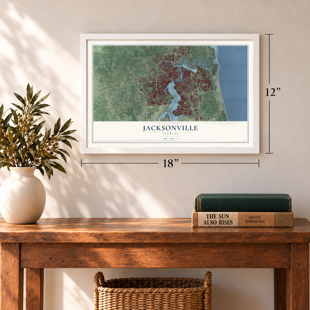
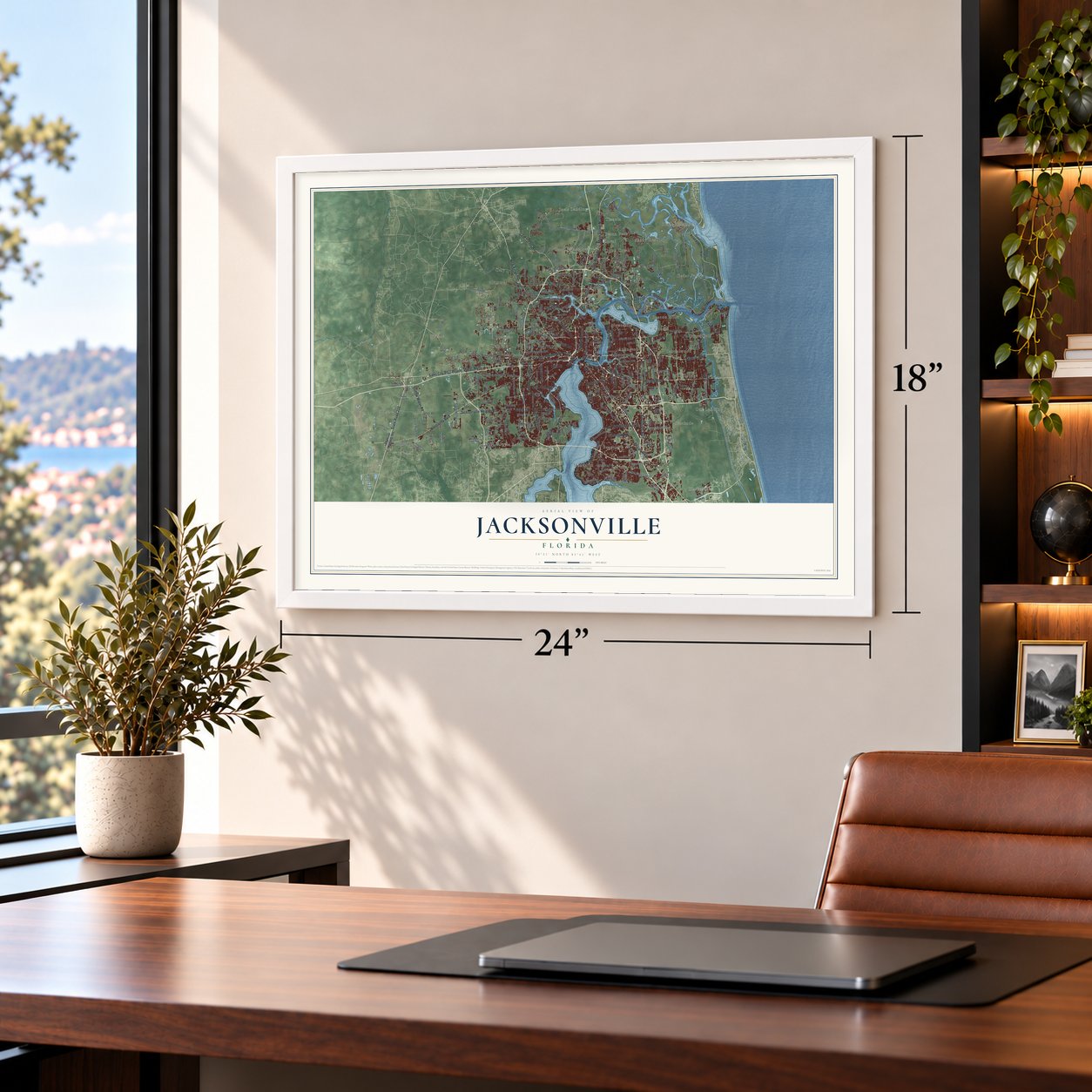
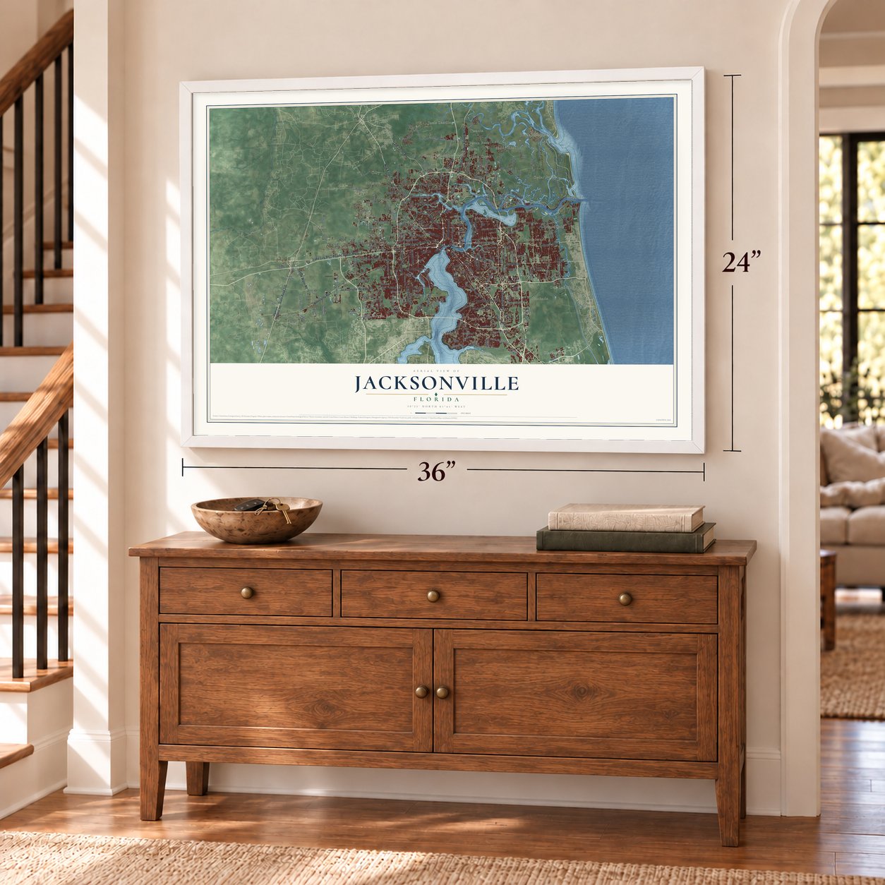
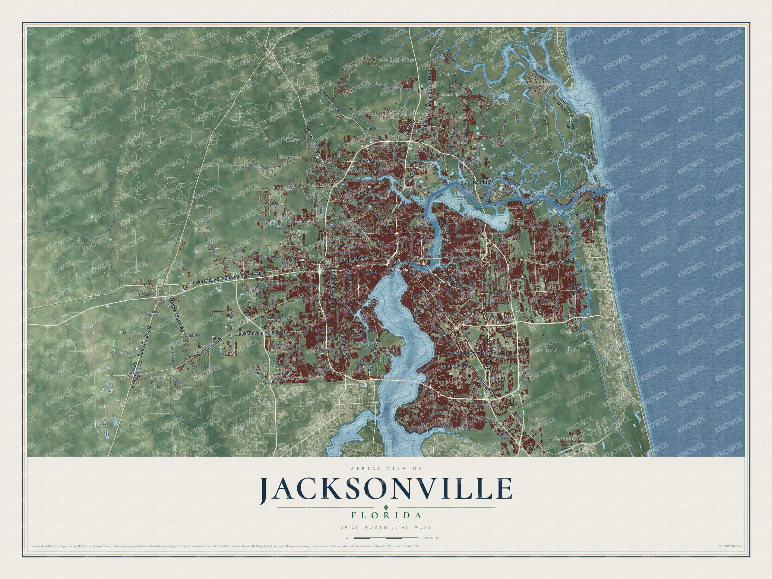
Jacksonville, Florida Map Art
Building by building, with labeled streets and shaded relief.
12" x 18" Archival Matte Print
A Map of Home. A Work of Art.
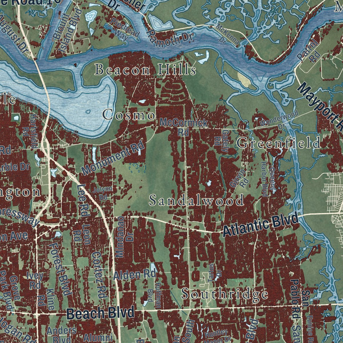
Explore Jacksonville, Florida from a whole new perspective. Created using aerial imagery and detailed geographic data, this map captures Jacksonville building by building, with labeled streets, familiar landmarks, and shaded topographical relief that highlights the natural contours of the landscape.
Combining modern data with the timeless character of a vintage atlas, this map is just as interesting up close as it is beautiful on the wall. Whether you grew up in Jacksonville, spent memorable years there, or call it home today, this unique map is a great way to celebrate a place that means something to you. Zoom in on the preview to look for your street, and then order a print to put your memories on the wall.
Three ways to hang it
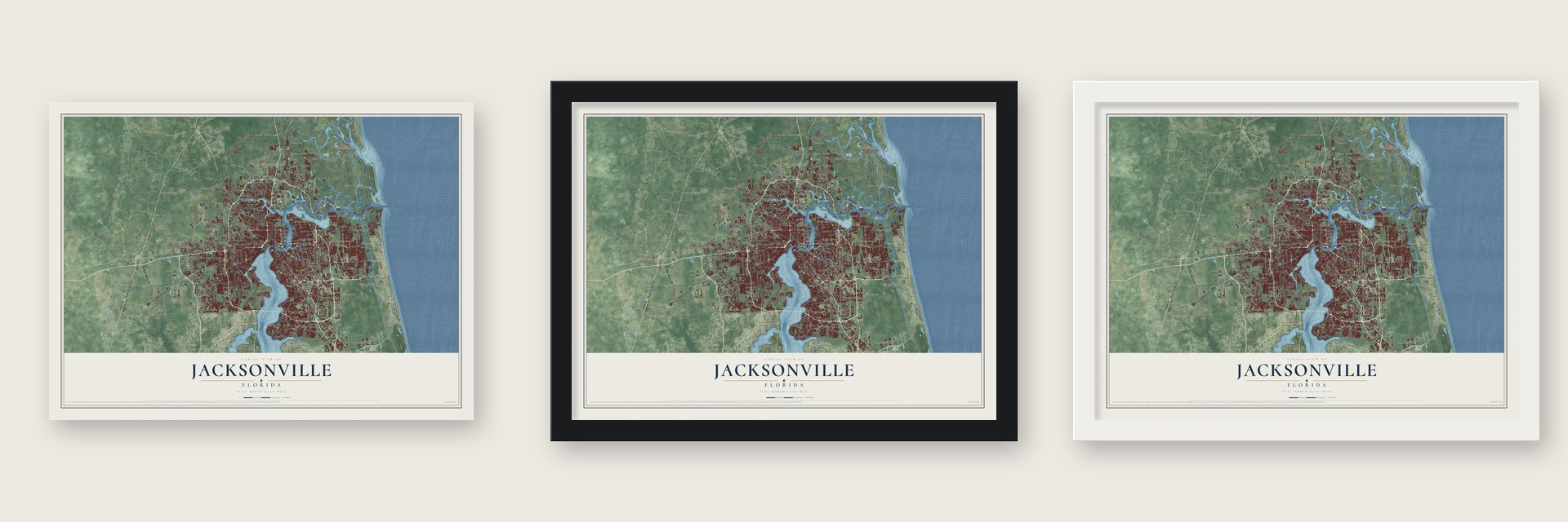
Unframed archival matte, a black wood frame or a white wood frame.
Up close
Geography Worth Displaying
This map was created using accurate cartographic data and authoritative geographic sources, including the U.S. Geological Survey (USGS) and FEMA. The map brings together terrain, waterways, roads, and building detail. The majority of the streets are labeled, houses are accurately depicted, and the topography is derived from government sources. Combining local data with carefully composed color and shading leads to this beautifully detailed Jacksonville artwork for your wall.
Rather than simply showing street outlines, we’ve included as many of the street names as we could reasonably fit on the map while keeping their names legible. Zoom in on the high resolution preview to see exactly what’s on the map. We truly set out to create a statement piece for anyone who loves Jacksonville. So whether it’s for you, or a gift for someone you love, we hope this map of Jacksonville brings back fond memories.
Explore the full map of Jacksonville, Florida and read about the local places it shows.

Find your street
Names on the Jacksonville map
Every name below is printed on this map. Look for your street, your school, the park where you played, or the pond down the road.
Places and landmarks37
- Black Hammock
- Maxville
- Clarksville
- Argyle Forest
- Beeghly Heights
- Tulane
- Mayport
- Cary
- Stockade
- Newcastle
- Beauclerc
- Tisonia
Show all 37 places
- Beacon Hills
- Fiftone
- Cambon
- Mandarin
- Halsema
- Southridge
- Spaulding
- Shady Rest
- Cedar Point
- Dunn Creek
- Loretto
- Greenfield
- Oak Landing
- Joels Landing
- Plummer
- Caleb
- Langmar
- Duval
- Otis
- Pecan Park
- Cosmo
- Arlington
- Sandalwood
- Marietta
- Bayard
Streets and roads286
- Roosevelt Boulevard
- State Road 200
- North Main Street
- Main Street North
- West Beaver Street
- Beach Boulevard
- New Kings Road
- Lem Turner Road
- Southside Boulevard
- Beaver Street West
- Lake City Road
- Kings Road
- Highway 17
- Atlantic Boulevard
- Mayport Road
- North Pearl Street
- State Road 105
- Philips Highway
- Normandy Boulevard
- Blanding Boulevard
- 103rd Street
- Dunn Avenue
- Jacksonville Heights Road
- Duval Road
- Yellow Water Road
- Lane Avenue South
- Baymeadows Road
- Soutel Drive
- Cassat Avenue
- Post Street
Show all 286 streets
- San Juan Avenue
- Emerson Street
- Moncrief Road
- Sunbeam Road
- Monument Road
- Hodges Boulevard
- Otis Road
- Old Kings Road
- Saint Augustine Road
- New Berlin Road
- Old Plank Road
- Pritchard Road
- Yellow Bluff Road
- Collins Road
- Commonwealth Avenue
- Lannie Road
- Cedar Point Road
- Jones Road
- Park Street
- Plummer Road
- Lenox Avenue
- Pecan Park Road
- Garden Street
- Mandarin Road
- Arlington Expressway
- West Twelfth Street
- West Fifth Street
- Sawpit Road
- Imeson Road
- Fifton Road East
- Pow Mia Memorial Parkway
- Old Kings Road South
- Braddock Road
- Firestone Road
- Ricker Road
- 118th Street
- Greenland Road
- Trout River Boulevard
- Broward Road
- Morse Avenue
- Island Drive
- Merrill Road
- Forest Boulevard
- Shindler Drive
- Jay Road
- Pumpkin Hill Road
- Boney Road
- Alta Drive
- Scott Mill Road
- Crystal Springs Road
- Canal Street
- Etown Parkway
- Belfort Road
- Biscayne Boulevard
- Loretto Road
- Blair Road
- Mustin Road
- Alden Road
- North Liberty Street
- Fouraker Road
- Capper Road
- Cortez Road
- Grover Road
- Cisco Drive
- Faye Road
- Noroad
- Bowden Road
- Sandler Road
- San Pablo Parkway
- Harts Road
- Palmetto Avenue
- Hogan Road
- Losco Road
- Wells Road
- First
- Terrell Road
- Dillon Road
- August Drive
- Devoe Street
- Eaton Avenue
- 110th Street
- Ramoth Drive
- Wheat Road
- Leonid Road
- Lee Road
- Percy Road
- East Road
- South US Highway 301
- Riverside Avenue
- Kings Avenue
- Heckscher Drive
- San Jose Boulevard
- University Boulevard North
- Buccaneer Trail
- Eastport Road
- Timuquana Road
- University Boulevard South
- Anders Boulevard
- Talleyrand Avenue
- Argyle Forest Boulevard
- Starratt Road
- Patrol Road
- Pickettville Road
- Kernan Boulevard South
- Old Middleburg Road South
- Chaffee Road South
- Julington Creek Road
- Moncrief Road West
- Jammes Road
- Bartram Park Boulevard
- Dunn Creek Road
- Acree Road
- Spring Park Road
- Rogero Road
- West 45th Street
- Gold Star Family Parkway
- Armsdale Road
- Edison Avenue
- Deep Creek Road
- North Davis Street
- Salisbury Road
- McCormick Road
- Brady Road
- Ortega Boulevard
- Herlong Road
- Cedar Bay Road
- Sycamore Street
- Leon Road
- Nathan Hale Road
- Blount Island Boulevard
- Solomon Road
- East Eleventh Street
- Child Street
- Seminole Road
- Ortega Forest Drive
- Stratton Road
- Losco Road Extension
- Sibbald Road
- Grove Park Boulevard
- Golden Star Family Parkway
- Beauclerc Road
- Sportsman Club Road
- Simmons Road
- Pace Road
- Ortega Bluff Parkway
- Palmdale Street
- Grand Street
- Houston Avenue
- Branan Field Road
- Marbon Road
- Davis Road
- East Duval Street
- Plummer Grant Road
- Buffalo Avenue
- Mindanao Drive
- Burnt Mill Road
- Rebar Road
- West Fish Road
- Maple Avenue
- Tallulah Avenue
- Gun Club Road
- Ethel Road
- Forest Trail 29
- Dennis Street
- Betz Road
- Arble Drive
- Kline Road
- Alumni Way
- Pitts Road
- Snyder Street
- Victor Street
- Ivey Road
- Crane Avenue
- Moale Avenue
- Allene Road
- April Street
- Arnon Road
- Eco Road
- Ida Street
- Bea Lane
- Nocatee Parkway
- San Pablo Road
- Girvin Road
- Hamilton Street
- West 25th Street
- Powers Avenue
- Wilson Boulevard
- Longleaf Branch Drive
- Pulaski Road
- Stuart Avenue
- Lakeshore Boulevard
- Ellis Road
- Gillcreast Road
- Rayford Street
- Ranger Street
- Gilchrist Road
- Messer Road
- Palm Avenue
- Hartsfield Road
- Chaffee Road
- Pierhead Way
- East 30th Street
- Fang Drive
- Ricky Drive
- Park City Drive
- River City Drive
- Gately Road
- Holton Lane
- Shark Road
- Utsey Road
- Patty Drive
- Ibis Road
- Rex Drive
- Jake Road
- Grand Avenue
- Claire Lane
- Wonderwood Drive
- International Airport Boulevard
- Gate Parkway North
- Queens Harbor Boulevard
- Townsend Road
- West 26th Street
- Bell Estates Road
- Eagle Bend Boulevard
- Panther Lake Parkway
- Wm Davis Parkway
- McKenna Drive
- Eagerton Road
- Arlington Road
- Art Museum Drive
- Hunters Grove Road
- Eunice Road
- Huffman Boulevard
- Springtree Road
- Filament Boulevard
- Hemlock Street
- Deercreek Club Road
- Sheffield Road
- Exline Road
- Edenfield Road
- Loys Drive
- Huntley Manor Drive
- Eagle Bend Court
- Sapp Road
- Le Brun Drive
- Roma Boulevard
- Natal Avenue
- Tartus Drive
- Jolynn Road
- Hyatt Road
- Young Road
- Zoo Road
- Alcoy Road
- Cole Court
- Put Road
- Tia Road
Names are listed as they appear on the printed map. Zoom into the product photos to find them.
About Jacksonville, Florida
Jacksonville, home to 949,611 people in 2020, is the largest city in Florida by population, and it stretches over both banks of the St. Johns River in Duval County. The Timucua lived here first. Under British rule, from 1763 to 1783, a settlement grew at a narrow stretch of the river where cattle were driven across. The Seminole called the crossing Wacca Pilatka, and the British called it the Cow Ford, the spot where the King's Road from St. Augustine to Georgia met the water.
In 1821 Spain gave Florida to the United States, and American settlers on the north bank planned a town there, laying out its streets and lots. They named it for Andrew Jackson, the territory's first military governor and later the president. Isaiah D. Hart led the residents who drafted a town charter, and the Florida Legislative Council approved it on February 9, 1832. On October 1, 1968, the city merged with Duval County and grew to 900 square miles, so no city in the contiguous United States covers more total area.
- Fort Caroline, 1564Jean Ribault, a French Huguenot, charted the St. Johns in 1562 and called it the River of May. Near its mouth he raised a stone column claiming the country for France. Two years later, in 1564, René Goulaine de Laudonnière built Fort Caroline close to the main Saturiwa village. Spain answered on September 20, 1565, when troops from St. Augustine stormed the fort, killed almost every French defender and gave it the name San Mateo.
- The Great Fire of 1901A wood-burning cook stove sparked a downtown fire on May 3, 1901, and Spanish moss at a nearby mattress factory fed the flames. Within eight hours it had burned 146 city blocks and more than 2,000 buildings, killed seven people and left about 10,000 homeless. Architect Henry John Klutho led much of the rebuilding.
- Winter Film CapitalIn the 1910s, studios from New York City, Philadelphia and Chicago moved south for the warm weather, cheap labor and good rail connections. More than 30 silent film studios opened during the decade, and people called the city the "Winter Film Capital of the World" until Hollywood won the business away.
- Norman Studios in ArlingtonFrom 1919 to 1928, Norman Studios in Arlington made silent pictures with African American stars, showing Black heroes in a positive light. It is the last studio still standing from that era. It became a National Historic Landmark in 2016 and now serves as a silent film museum.
- Born in Jacksonville, 1871James Weldon Johnson, born in Jacksonville in 1871, later ran the Stanton School, where his mother had once taught. In 1897 he became the first African American since Reconstruction admitted to the Florida Bar. In 1920 he took charge of the NAACP as its first African American leader.
Keep exploring Florida
Jacksonville is one of 1,067 Florida towns we've mapped. Every dot on the map is a print of its own.
The search covers every state, Florida first.
Near Jacksonville
Order 2 or more town maps and save 10%. Shown in the size and finish you picked above, so they hang as a set.
- Bellair-Meadowbrook Terrace 12" x 18" / Archival Matte Print $39.99
- Orange Park 12" x 18" / Archival Matte Print $39.99
- Mandarin 12" x 18" / Archival Matte Print $39.99


More maps nearby: Nassau Village-Ratliff, Lakeside, Oakleaf Plantation, Atlantic Beach and Neptune Beach.
The art of mapping a place
How This Map Was Made
Real places. Remarkable detail. Discover the layers that turn geographic data into a map of home.

The view from above
Aerial imagery reveals the character of the land: woodland, open fields, and the patterns of a place.

The shape of the land
Elevation data brings hills, valleys, and subtle changes in the landscape into view.

The details of home
Roads, waterways, and building footprints come together to make the map feel unmistakably local.

Geography becomes art
Considered color, shading, and typography bring the layers together in a map made for your wall.


Process illustrated with Mendon, Massachusetts. Aerial imagery: USDA NAIP. Terrain: USGS 3D Elevation Program. Map details and finished artwork: KNOWOL.
The Details
About This Print
Choose an archival matte print, or a black or white Ayous wood frame. The archival matte print is unframed.
Select your size and finish above to see the matching product image and price.
Materials & Craftsmanship
A contemporary map with the character of a classic atlas, printed on archival matte paper. Optional frames are made from Ayous wood.
Your printed map does not include the watermark shown in the full-map preview.
Shipping & Delivery
Free shipping within the United States. Every print is made to order in the USA.
Buying a gift? Add a note in your cart and we'll include it. We never put prices in the package.
Prints ship within 2 to 3 business days. Allow 7 to 10 days total from ordering for delivery. Timing may vary during holidays or periods of high order volume.
Read our shipping policy.
Returns and damaged prints
Each print is made to order. Change-of-mind refunds are not available after production.
If your print arrives damaged, misprinted or incorrect, contact support@knowol.com within 30 days of receiving it. Include your order number, photos and a description of the issue.
Read our full refund and replacement policy. For questions about your order, email support@knowol.com.