
Search for another town



Free U.S. delivery 7 to 10 days after you order
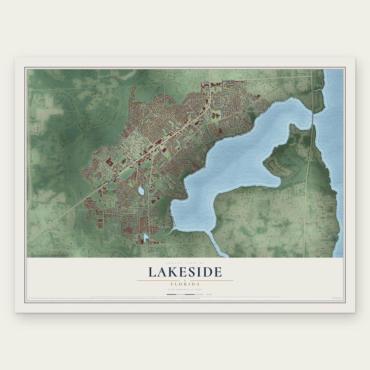
Lakeside, Florida Map Art
Building by building, with labeled streets and shaded relief.
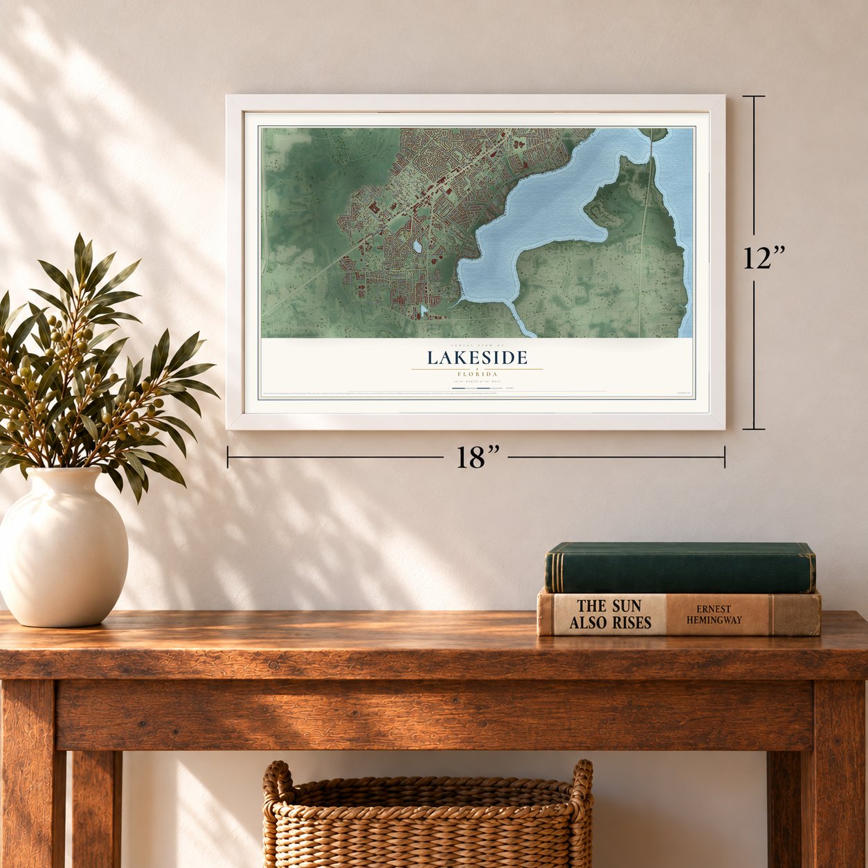
12" x 18" Archival Matte Print
A Map of Home. A Work of Art.
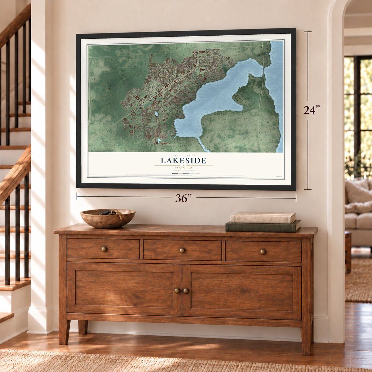
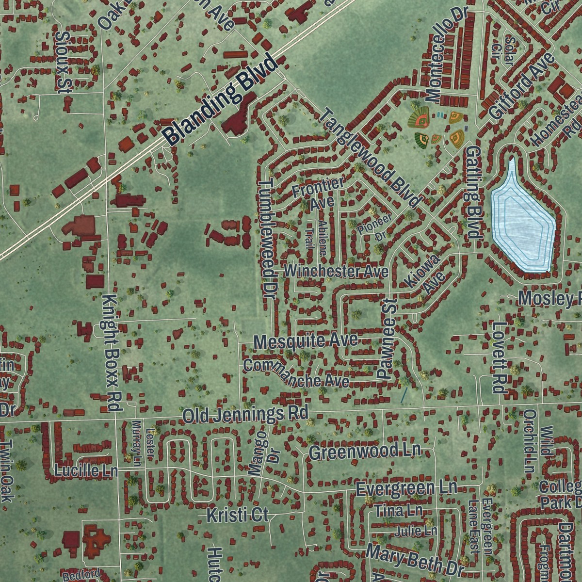
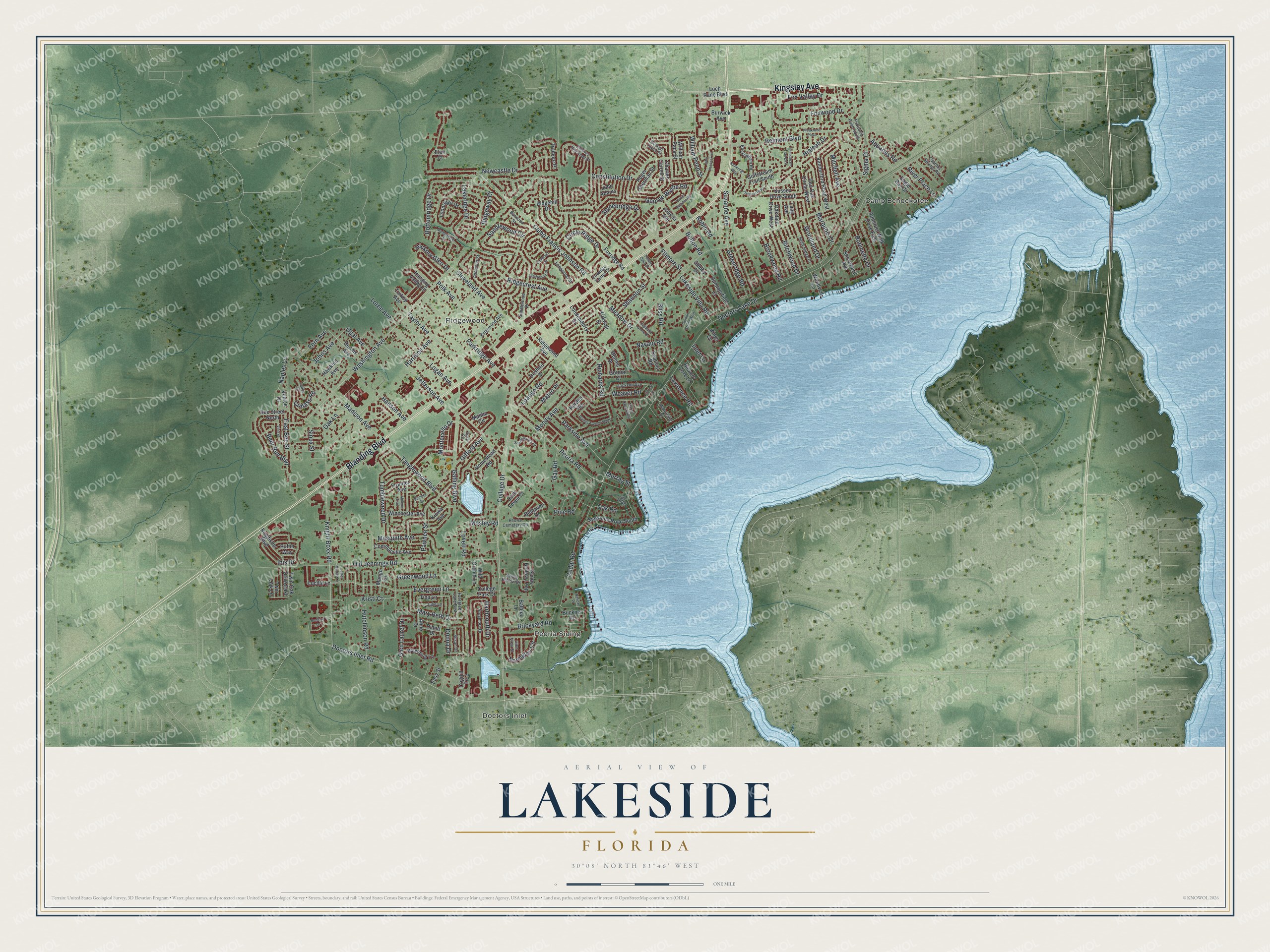
Explore Lakeside, Florida from a whole new perspective. Created using aerial imagery and detailed geographic data, this map captures Lakeside building by building, with labeled streets, familiar landmarks, and shaded topographical relief that highlights the natural contours of the landscape.
Combining modern data with the timeless character of a vintage atlas, this map is just as interesting up close as it is beautiful on the wall. Whether you grew up in Lakeside, spent memorable years there, or call it home today, this unique map is a great way to celebrate a place that means something to you. Zoom in on the preview to look for your street, and then order a print to put your memories on the wall.
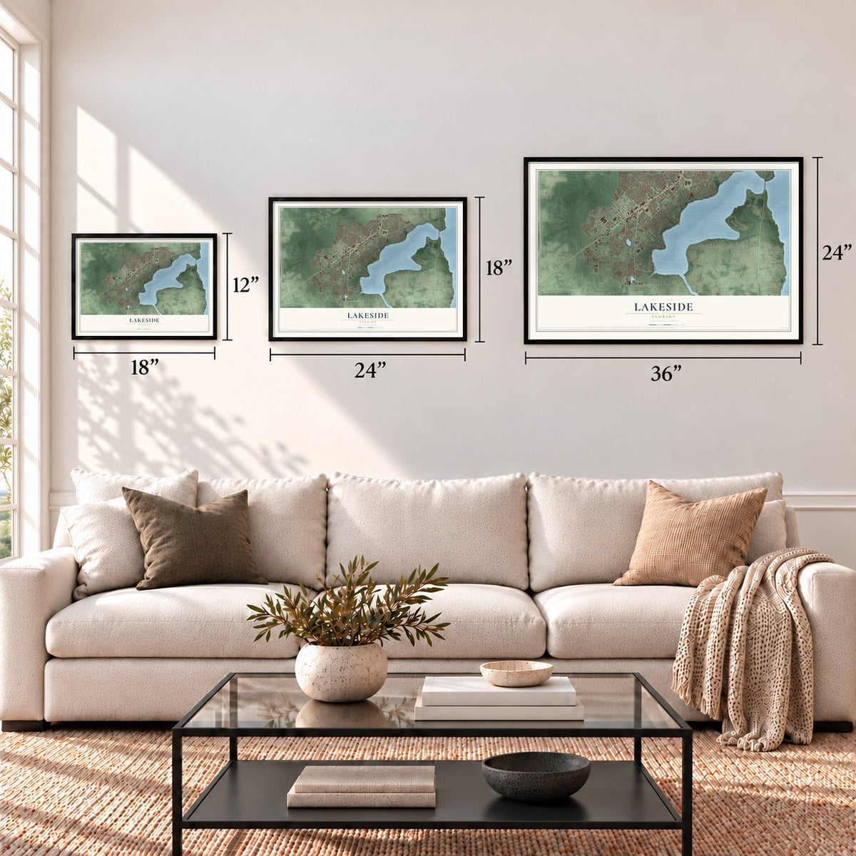
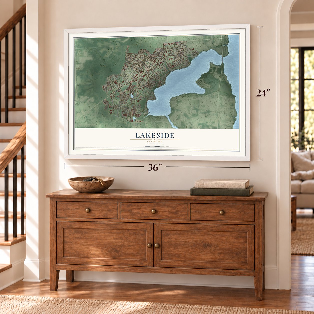
Three ways to hang it
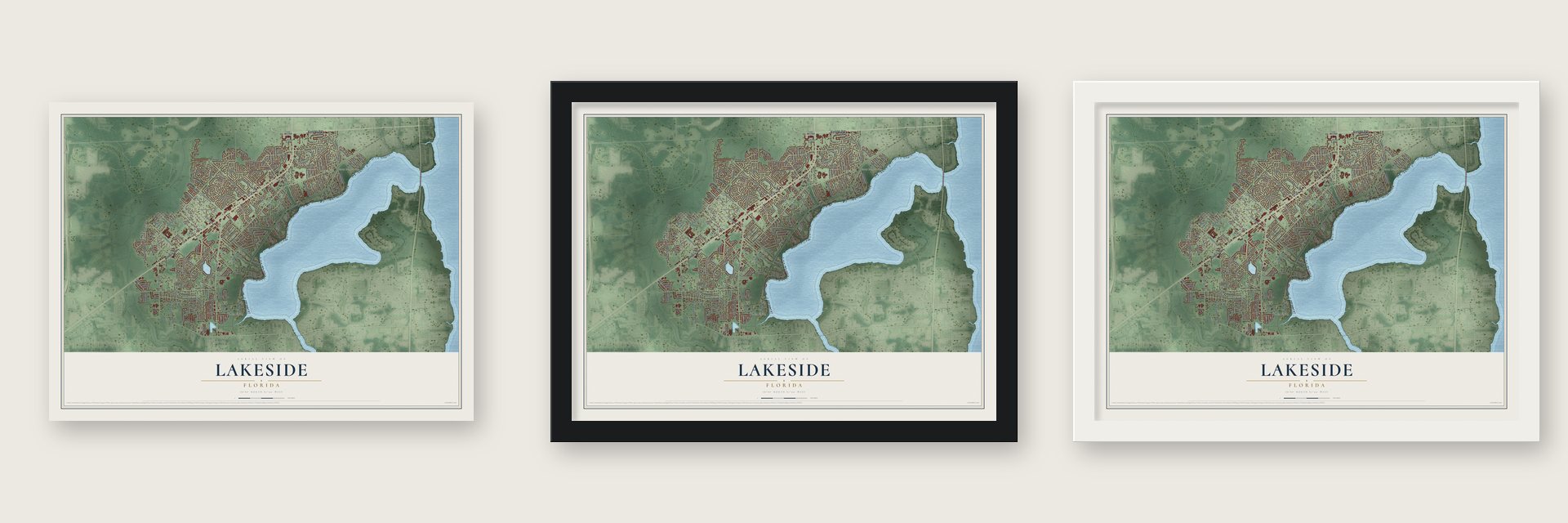
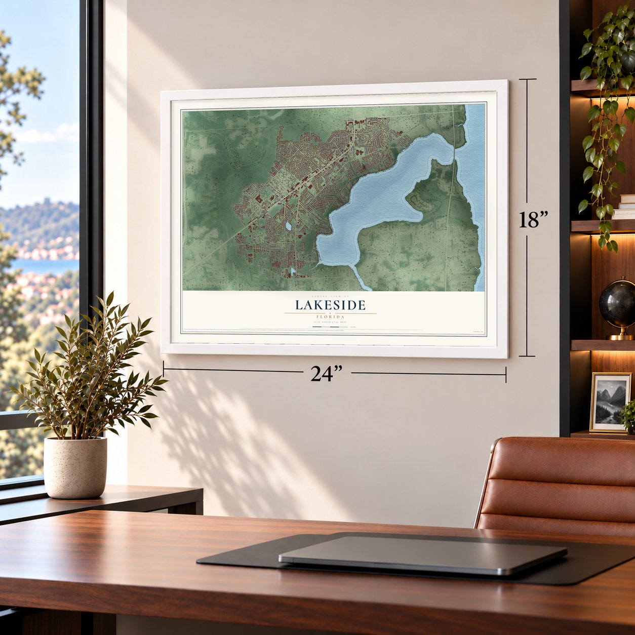
Unframed archival matte, a black wood frame or a white wood frame.
Up close
Geography Worth Displaying
This map was created using accurate cartographic data and authoritative geographic sources, including the U.S. Geological Survey and the Census Bureau. The map brings together terrain, waterways, roads, and building detail. The majority of the streets are labeled, houses are accurately depicted, and the topography is derived from government sources. Combining local data with carefully composed color and shading leads to this beautifully detailed Lakeside artwork for your wall.
Rather than simply showing street outlines, we’ve included as many of the street names as we could reasonably fit on the map while keeping their names legible. Zoom in on the high resolution preview to see exactly what’s on the map. We truly set out to create a statement piece for anyone who loves Lakeside. So whether it’s for you, or a gift for someone you love, we hope this map of Lakeside brings back fond memories.
Read the story behind this map of Lakeside, Florida from 2026.
Find your street
Names on the Lakeside map
Every name below is printed on this map. Look for your street, your school, the park where you played, or the pond down the road.
Places and landmarks4
- Camp Echockotee
- Doctors Inlet
- Peoria Siding
- Ridgewood
Streets and roads209
- Kingsley Avenue
- Blanding Boulevard
- Evergreen Lane
- Washington Avenue
- Cleveland Avenue
- Circle Ridge Drive
- Gifford Avenue
- George Wythe Road
- Pine Road
- Moody Avenue
- Doctors Lake Drive
- College Drive
- Doctors Inlet Road
- Harrison Avenue
- Camp Francis Johnson Road
- Jefferson Avenue
- Old Jennings Road
- Constitution Drive
- Pawnee Street
- Knight Boxx Road
- Bottomridge Drive
- Stonebridge Drive
- Ridgecrest Avenue
- Tanglewood Boulevard
- Foxwood Drive
- Parkridge Avenue
- Madison Avenue
- Peoria Road
- Brickyard Road
- Bear Run Boulevard
Show all 209 streets
- Dartmouth Drive
- Belmont Boulevard
- Polk Avenue
- Cedar Road
- Fox Valley Drive
- Tumbleweed Drive
- Sandlewood Circle
- Taylor Avenue
- Mesquite Avenue
- Northglen Circle
- Oak Lane
- Birchwood Drive
- Logan Avenue
- Newcastle Drive
- Parkside Avenue
- Lakeridge Drive
- Meadow Drive
- Mary Beth Drive
- Johns Avenue
- Ibis Drive
- Robin Road
- Suzanne Avenue
- Naples Lane
- Glen Laurel Drive
- Greenridge Road
- Lakeside Villa Road
- Loango Road
- Robinette Drive
- Woodland Drive
- Brookwood Road
- Gay Road
- Weaver Road
- Aquarius Road
- Filmore Street
- Hialeah Drive
- Hutchinson Road
- Greenwood Lane
- William Penn Street
- Shannon Street
- Hickory Glen Drive
- Lovett Road
- Cutlass Road
- Ridgeway Court
- Bliss Road
- Mateo Place
- Loree Avenue
- River Place Lane
- Oak Road
- East Bee Street
- Montecello Drive
- Hanson Avenue
- Gatling Boulevard
- Mitchell Avenue
- Marquois Drive
- Lawrence Road
- Fern Avenue
- Navajo Road
- Kristi Court
- Opal Avenue
- Bolton Road
- Richards Road
- Sigma Court
- Mosley Road
- Donna Drive
- Murray Street
- Sioux Street
- Inlet Lane
- Charles Carroll Street
- Gulfstream Trail South
- Twin Oak Drive East
- Foxridge Road
- Belhaven Drive
- Kiowa Avenue
- Magnolia Road South
- Londonderry Drive
- Bee Street North
- Sandy Hollow Loop
- Loopridge Drive
- Ridgehill Drive
- Vanderford Road West
- Wavering Lane
- Frontier Avenue
- Commanche Avenue
- Admirals Walk Drive East
- Doshire Drive
- Burwick Avenue
- Hawkins Avenue
- Kirkwall Street
- Hickory Cove Lane
- Dennis Avenue
- Tramore Place
- Malibu Circle
- Winchester Avenue
- Kingfisher Boulevard
- Lucille Lane
- Cogdill Trce
- Roger Sherman Street
- William Paca Street
- Sussex Drive South
- Ridgewood Avenue
- Summerfield Court
- Anne Drive
- Loch Rane Boulevard
- Eagle Bay Drive
- Harden Road
- Homestead Road
- Red Oak Circle West
- Tina Lane
- Hanging Valley Lane
- Sequoia Road
- Shoreward Avenue
- Turkey Avenue
- John Adams
- Gordon Court
- Oakdale Drive West
- Balboa Lane
- Woodveil Lane
- Jobyna Avenue
- Wild Orchid Lane
- Dennis Drive
- College Park Drive
- Loch Leven Court
- Mango Drive
- Puffin Way
- Lang Avenue
- Diana Drive
- Buckner Road
- Shelby Drive
- Kings Cv
- Venice Drive
- Easy Street
- Twin Oak Lane
- Elan Court
- George Taylor Street
- Charles Pinckney Street
- Kingswood Avenue
- Sandlewood Drive
- Foxwood Road South
- Holly Ridge Drive
- Jackson Avenue
- Cypress Springs Road
- Rockingham Road
- Peoria Cemetery Road
- Frogmore Drive
- Evergreen Lane East
- Ashwood Street
- Foxridge Center Drive
- Holly Road
- Sandy Hollow Drive
- Burwood Street
- Waterside Drive
- Susan Drive
- Longwood Street
- Julie Lane
- Glen View Street
- Tahoe Court
- Solar Circle
- Gulfstream Trail East
- Kettering Way
- John Hancock Street
- Forrest Drive
- Tropical Parkway
- Preakness Plaza
- Bedford Drive
- Secret Harbor Drive
- Rainey Avenue South
- Gordon Street West
- Vine Street
- Carter Braxton Road
- Marion Court West
- Elmwood Street
- Marbleridge Drive
- Pioneer Drive
- Abilene Trail
- Larchwood Street
- Highland Grove Drive
- Lester Murray Lane
- Twelve Oaks Drive
- Pelican Place
Names are listed as they appear on the printed map. Zoom into the product photos to find them.
About Lakeside, Florida
Lakeside is a community of 31,275 people in Clay County, just west of Orange Park. It sits on Doctors Lake, which opens off the St. Johns River. In 1930 the psychologist Robert Yerkes opened a primate laboratory here with Yale University and the Rockefeller Foundation. It was the first lab in the country built to study apes and monkeys.
Yerkes had already worked with two apes named Chim and Panzee. What he learned from them persuaded Yale and the Rockefeller and Carnegie foundations to pay for a station in Florida. The lab was planned for about 25 chimpanzees, but over its 35 years researchers worked with an estimated 65. Emory University took charge in 1956 and moved the center to its Atlanta campus in 1965. The next year developer Marvin Wilhite bought the empty buildings and land, and the Foxwood neighborhood grew up there.
- A company named for AlphaWilhite called his company Ahpla, Inc., which is Alpha spelled backward. Alpha was the first chimpanzee born at the Yerkes lab, on September 11, 1930. Wilhite went on to build other neighborhoods, including Foxridge, and still lives in Foxwood.
- Lab buildings still in useThe lab's grounds covered 188 acres, but its research buildings stood on less than an acre. That spot is now part of the Foxwood Center plaza on Kingsley Avenue, across from Orange Park Medical Center. Some of the original buildings still stand there. The old caretaker's house is now The Granary, an organic food and health store, and the Orange Park Chamber of Commerce has a building there too.
- The Monkey FarmGua and Viki, chimpanzees raised as if they were human children, lived at the lab. So did primates that came from the Havana estate of Madame Rosalia Abreu. Some Orange Park residents whispered that scientists were crossing humans with apes, and locals called the place the Monkey Farm. Yerkes was sometimes seen driving to collect his mail with Judy, the chimp he liked best, sitting up front beside him.
- St. Johns River State CollegeThe largest of the college's three campuses sits on College Drive in Lakeside. It has 2,221 regular students, plus dual enrollment students from Clay County high schools, and it is home to the Thrasher-Horne Center, a theater for plays and other events.
Keep exploring Florida
Lakeside is one of 1,039 Florida towns we've mapped. Every dot on the map is a print of its own.
The search covers every state, Florida first.
Near Lakeside
Order 2 or more town maps and save 10%. Shown in the size and finish you picked above, so they hang as a set.
- Rideout 12" x 18" / Archival Matte Print $39.99
- Bellair-Meadowbrook Terrace 12" x 18" / Archival Matte Print $39.99
- Fleming Island 12" x 18" / Archival Matte Print $39.99


More maps nearby: Orange Park, Oakleaf Plantation, Asbury Lake, Mandarin and Fruit Cove.
The art of mapping a place
How This Map Was Made
Real places. Remarkable detail. Discover the layers that turn geographic data into a map of home.

The view from above
Aerial imagery reveals the character of the land: woodland, open fields, and the patterns of a place.

The shape of the land
Elevation data brings hills, valleys, and subtle changes in the landscape into view.

The details of home
Roads, waterways, and building footprints come together to make the map feel unmistakably local.

Geography becomes art
Considered color, shading, and typography bring the layers together in a map made for your wall.


Process illustrated with Mendon, Massachusetts. Aerial imagery: USDA NAIP. Terrain: USGS 3D Elevation Program. Map details and finished artwork: KNOWOL.
The Details
About This Print
Choose an archival matte print, or a black or white Ayous wood frame. The archival matte print is unframed.
Select your size and finish above to see the matching product image and price.
Materials & Craftsmanship
A contemporary map with the character of a classic atlas, printed on archival matte paper. Optional frames are made from Ayous wood.
Your printed map does not include the watermark shown in the full-map preview.
Shipping & Delivery
Free shipping within the United States. Every print is made to order in the USA.
Buying a gift? Add a note in your cart and we'll include it. We never put prices in the package.
Prints ship within 2 to 3 business days. Allow 7 to 10 days total from ordering for delivery. Timing may vary during holidays or periods of high order volume.
Read our shipping policy.
Returns and damaged prints
Each print is made to order. Change-of-mind refunds are not available after production.
If your print arrives damaged, misprinted or incorrect, contact support@knowol.com within 30 days of receiving it. Include your order number, photos and a description of the issue.
Read our full refund and replacement policy. For questions about your order, email support@knowol.com.