
Search for another town




Free U.S. delivery 7 to 10 days after you order
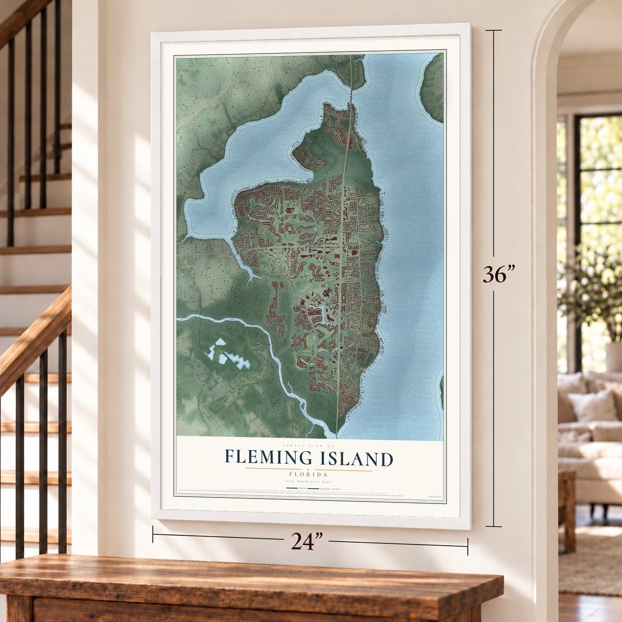
Fleming Island, Florida Map Art
Building by building, with labeled streets and shaded relief.
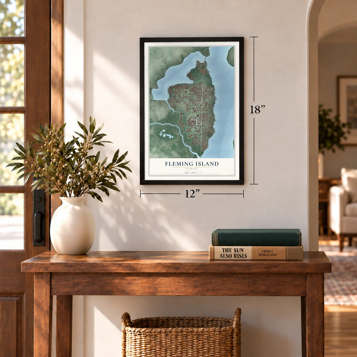
12" x 18" Archival Matte Print
A Map of Home. A Work of Art.
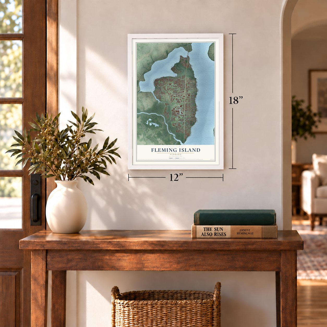
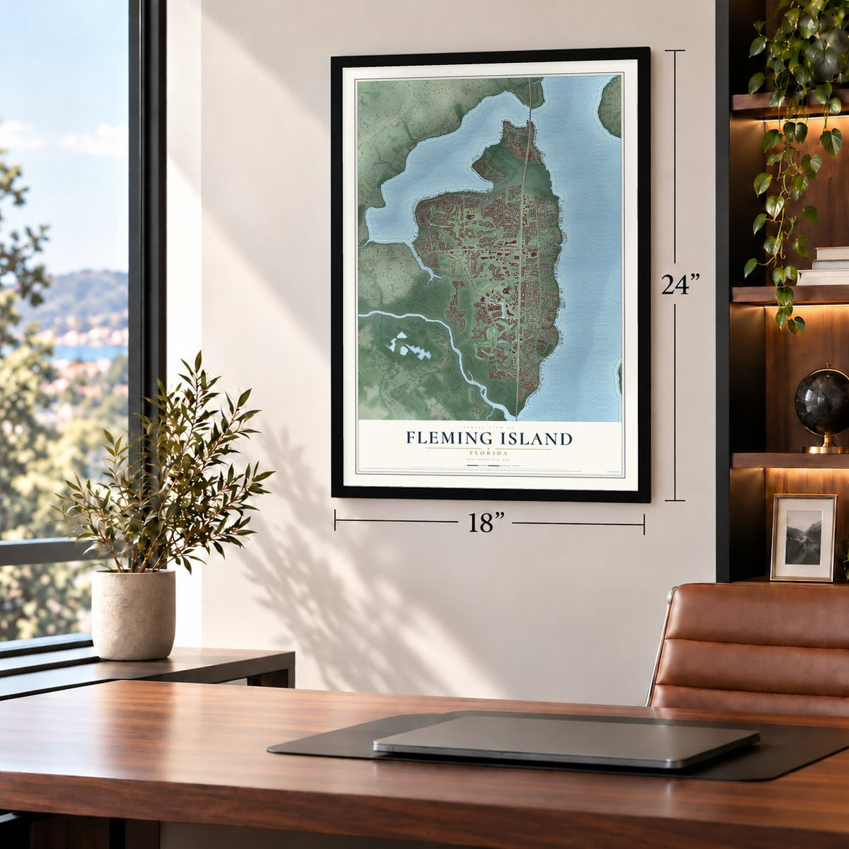
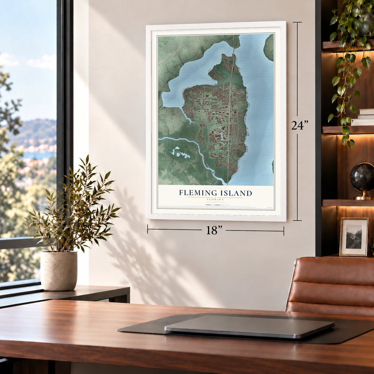
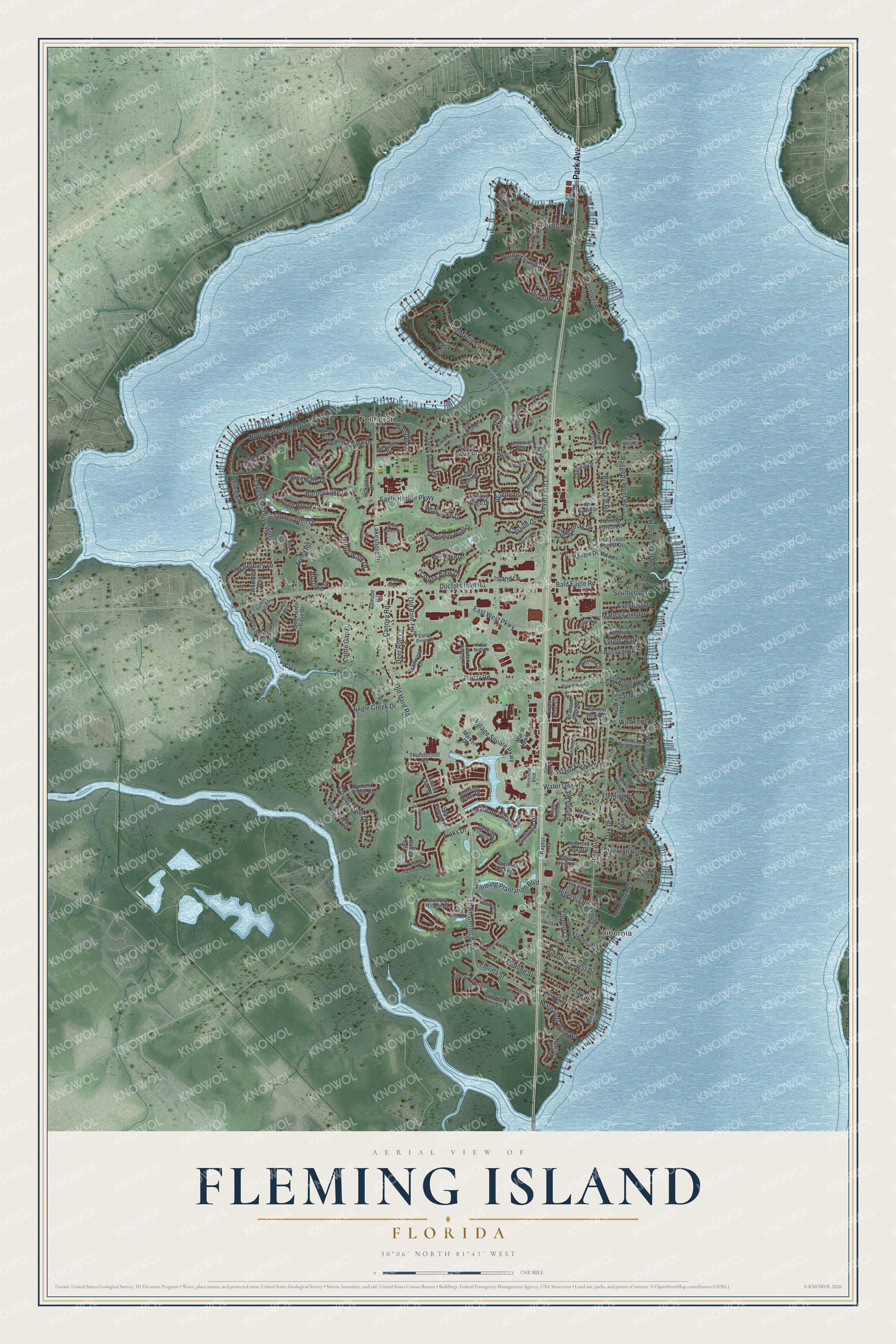
Explore Fleming Island, Florida from a whole new perspective. Created using aerial imagery and detailed geographic data, this map captures Fleming Island building by building, with labeled streets, familiar landmarks, and shaded topographical relief that highlights the natural contours of the landscape.
Combining modern data with the timeless character of a vintage atlas, this map is just as interesting up close as it is beautiful on the wall. Whether you grew up in Fleming Island, spent memorable years there, or call it home today, this unique map is a great way to celebrate a place that means something to you. Zoom in on the preview to look for your street, and then order a print to put your memories on the wall.
Three ways to hang it
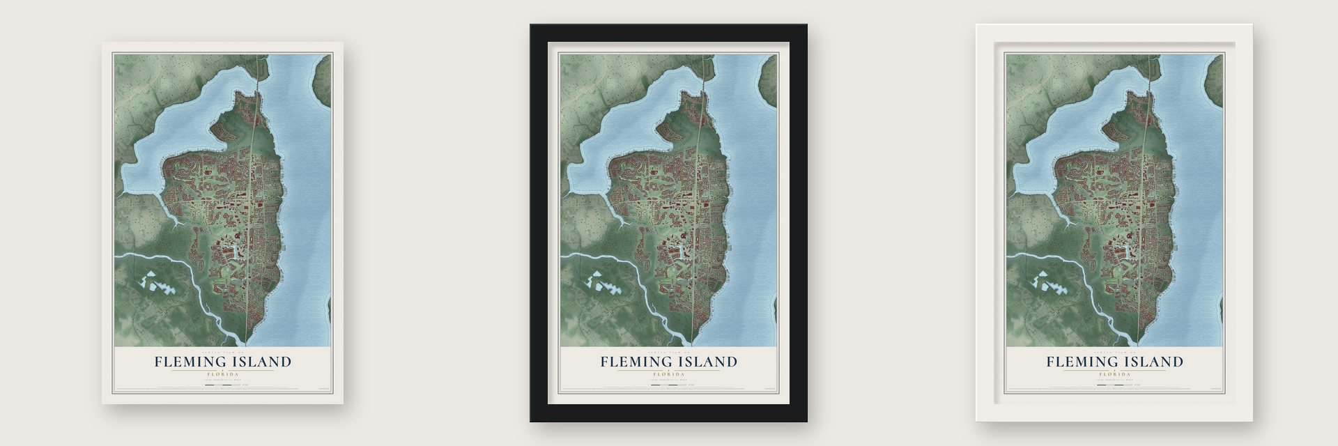
Unframed archival matte, a black wood frame or a white wood frame.
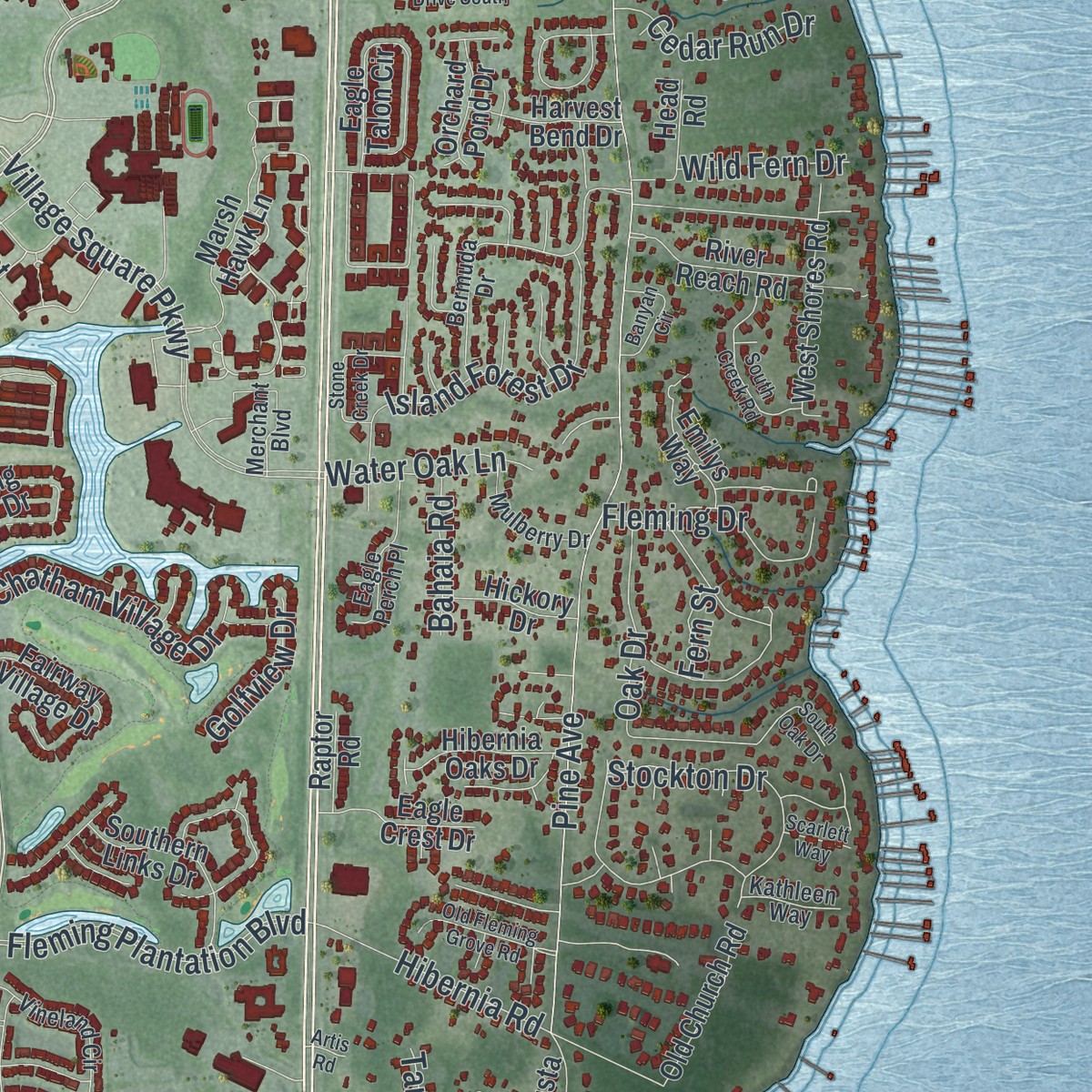
Up close
Geography Worth Displaying
This map was created using accurate cartographic data and authoritative geographic sources, including the U.S. Geological Survey and the Census Bureau. The map brings together terrain, waterways, roads, and building detail. The majority of the streets are labeled, houses are accurately depicted, and the topography is derived from government sources. Combining local data with carefully composed color and shading leads to this beautifully detailed Fleming Island artwork for your wall.
Rather than simply showing street outlines, we’ve included as many of the street names as we could reasonably fit on the map while keeping their names legible. Zoom in on the high resolution preview to see exactly what’s on the map. We truly set out to create a statement piece for anyone who loves Fleming Island. So whether it’s for you, or a gift for someone you love, we hope this map of Fleming Island brings back fond memories.
Read the story behind this map of Fleming Island, Florida from 2026.

Find your street
Names on the Fleming Island map
Every name below is printed on this map. Look for your street, your school, the park where you played, or the pond down the road.
Places and landmarks2
- Hibernia
- Neilhurst
Streets and roads179
- Park Avenue
- Old Hard Road
- North Lakeshore Drive
- Lakeshore Drive West
- Doctors Inlet Road
- Town Center Boulevard
- Pine Avenue
- Eagle Harbor Parkway
- Salt Myrtle Lane
- Royal Fern Lane
- Country Side Drive
- Lakeshore Drive
- East West Parkway
- Raggedy Point Road
- Fleming Plantation Boulevard
- Stockton Drive
- Floyd Street
- Country Walk Drive
- Fleming Street
- Clay Street
- Harbor Lake Drive
- Village Square Parkway
- Radar Road
- Creighton Road
- Bluebonnet Way
- Florida Street
- Margarets Walk Road
- Dockside Drive
- Westover Road
- Island Forest Drive
Show all 179 streets
- Harbor Island Drive
- Keaton Chase Drive
- Arena Road
- Stoney Glen Drive
- Chatham Village Drive
- Winston Lane
- Old Pine Trail
- Links Drive
- Waterbury Lane
- Canova Road
- Castille Drive
- Southerly Lane
- Hibernia Forest Drive
- Fleming Drive
- South Brook Drive
- Hibernia Road
- Harvey Grant Road
- Los Palmas Drive
- Bald Eagle Road
- Woodlake Drive
- Malley Cove Lane
- Eagle Creek Drive
- Eventide Drive
- Rustling Drive
- Island Lane
- Cedar Run Drive
- Deer Run Lane
- Frederic Drive
- Water Oak Lane
- Oak Drive
- Course View Drive
- Rivergate Drive
- Cattle Gap Lane
- Pine Gate Road
- Egrets Walk
- Passage Drive
- Wild Fern Drive
- Golfview Drive
- Bahaia Road
- Rush Lane
- Tarpon Court
- Fern Street
- Marsh Hawk Lane
- Castle Point Court
- Pace Island Trce
- Hickory Trace Drive
- West Shores Road
- Calming Water Drive
- Walnut Creek Drive
- Blue Heron Cove Drive
- Sandy Springs Drive
- Silver Bell Lane
- Eagle Talon Circle
- Old Church Road
- Waters Edge Drive
- Arden Forest Place
- Commodore Point Drive
- Fiddlers Ridge Drive
- Trailwood Drive
- Osprey Bluff Boulevard
- Misty Lake Drive
- Claude Road
- White Owl Road
- Shade Tree Drive
- Weston Circle
- Hollywood Forest Drive
- Pine Eagle Drive
- Shelter Cove Drive
- Fairway Village Drive
- Summit Ridge Road
- Southern Links Drive
- Pickwick Place
- Eagle Watch Drive
- North Ridge Drive
- Water Pipit Lane
- Yellow Jasmine Lane
- River Reach Road
- Holly Flower Lane
- Augusta Drive
- Wexford Way
- Lookout Landing
- Thunderbolt Road
- Hibernia Oaks Drive
- Sea Pines Lane
- Laurel Oak Drive
- Emilys Way
- Eagle Crest Drive
- Wild Iris Lane
- Oldfield Drive
- Harvest Bend Drive
- River Avenue
- Salt Marsh Lane
- Head Road
- Hickory Drive
- Crooked Pine Lane
- Orchard Pond Drive
- Fleming Forest Lane
- Linkside Drive
- Maple Leaf Lane
- Raptor Road
- Golden Bell Lane
- Adams Lane
- Market Drive
- Holly Knowe Road
- Grande Oaks Way
- Majestic View Lane
- Bermuda Drive
- Vista Lakes Drive
- Vineland Circle
- Oaklanding Lane
- Merchant Boulevard
- Adler Nest Lane
- Bay Harbor Drive
- Eagle Perch Place
- Whispering Woods Drive
- River Hills Drive
- Mulberry Drive
- Rivertrace Drive
- Cross Pines Drive
- Tall Timber Drive
- Marsh Rabbit Way
- Wild Ginger Lane
- Chain Fern Way
- Turkey Hill Road
- Beulah Vista Court
- Sailfish Lane
- Kathleen Way
- Westend Place
- Portside Drive
- Rivers Edge Court
- Pine Forest Drive South
- Denmark Drive
- Live Oak Lane
- South Oak Drive
- Covington Lane
- Starboard Court
- Pinecrest Drive
- South Creek Road
- Old Fleming Grove Road
- Suwannee River Drive
- Stone Creek Drive
- Banyan Circle
- Baybrook Drive
- La Vista Lane
- Long Slough Walk
- Moccasin Slough
- Pond Ridge Court
- Scarlett Way
- Artis Road
Names are listed as they appear on the printed map. Zoom into the product photos to find them.
About Fleming Island, Florida
Fleming Island is a community of 29,142 people in Clay County, on the west bank of the St. Johns River about 21 miles southwest of downtown Jacksonville. It takes its name from George Fleming, an Irish immigrant. The Spanish governor of East Florida gave him 1,000 acres as a reward for his military service. In 1790 he started a plantation on that land and called it Hibernia, the Latin name for Ireland.
When George Fleming died in 1821, Hibernia passed to his son, Col. Lewis Michael Fleming, who lived until 1862. His widow, Margaret, started work on a chapel for St. Margaret's Episcopal Church in 1875. The chapel's first service came in 1878, and it was Margaret's own funeral. Her son Francis P. Fleming went on to become Governor of Florida.
- A Navy airfield from 1942In 1942, while the land was still empty, the U.S. Navy paved four asphalt runways here. It opened NOLF Fleming Island as a backup field for Naval Air Station Jacksonville. By the 1960s the runways were too short for the jets at NAS Jacksonville and NAS Cecil Field, so the Navy left. The crumbling runways were torn up in the late 1990s, and homes were built in their place.
- Water on every sideThe St. Johns River runs along the east side of Fleming Island. Doctors Lake borders it on the north, Black Creek on the south and Swimming Pen Creek on the west. Water covers 7.3 of its 23.1 square miles. Black Creek Park on the south end has nature trails. At Moccasin Slough on the north end, a canal for canoes and small boats reaches nearly to Doctors Lake.
- Its own ZIP code in 2004Fleming Island High School opened in 2003, and it is still the only high school on the island. The next year, Fleming Island got its own ZIP code, 32003, which set it apart from Orange Park, the town to the north. The community grew from 27,126 people in 2010 to 29,142 in 2020.
Keep exploring Florida
Fleming Island is one of 1,039 Florida towns we've mapped. Every dot on the map is a print of its own.
The search covers every state, Florida first.
Near Fleming Island
Order 2 or more town maps and save 10%. Shown in the size and finish you picked above, so they hang as a set.
- Lakeside 12" x 18" / Archival Matte Print $39.99
- Rideout 12" x 18" / Archival Matte Print $39.99
- Orange Park 12" x 18" / Archival Matte Print $39.99


More maps nearby: Fruit Cove, Mandarin, Asbury Lake, Bellair-Meadowbrook Terrace and Green Cove Springs.
The art of mapping a place
How This Map Was Made
Real places. Remarkable detail. Discover the layers that turn geographic data into a map of home.

The view from above
Aerial imagery reveals the character of the land: woodland, open fields, and the patterns of a place.

The shape of the land
Elevation data brings hills, valleys, and subtle changes in the landscape into view.

The details of home
Roads, waterways, and building footprints come together to make the map feel unmistakably local.

Geography becomes art
Considered color, shading, and typography bring the layers together in a map made for your wall.


Process illustrated with Mendon, Massachusetts. Aerial imagery: USDA NAIP. Terrain: USGS 3D Elevation Program. Map details and finished artwork: KNOWOL.
The Details
About This Print
Choose an archival matte print, or a black or white Ayous wood frame. The archival matte print is unframed.
Select your size and finish above to see the matching product image and price.
Materials & Craftsmanship
A contemporary map with the character of a classic atlas, printed on archival matte paper. Optional frames are made from Ayous wood.
Your printed map does not include the watermark shown in the full-map preview.
Shipping & Delivery
Free shipping within the United States. Every print is made to order in the USA.
Buying a gift? Add a note in your cart and we'll include it. We never put prices in the package.
Prints ship within 2 to 3 business days. Allow 7 to 10 days total from ordering for delivery. Timing may vary during holidays or periods of high order volume.
Read our shipping policy.
Returns and damaged prints
Each print is made to order. Change-of-mind refunds are not available after production.
If your print arrives damaged, misprinted or incorrect, contact support@knowol.com within 30 days of receiving it. Include your order number, photos and a description of the issue.
Read our full refund and replacement policy. For questions about your order, email support@knowol.com.