
Search for another town




Free U.S. delivery 7 to 10 days after you order
Florissant, Missouri Map Art
Building by building, with labeled streets and shaded relief.
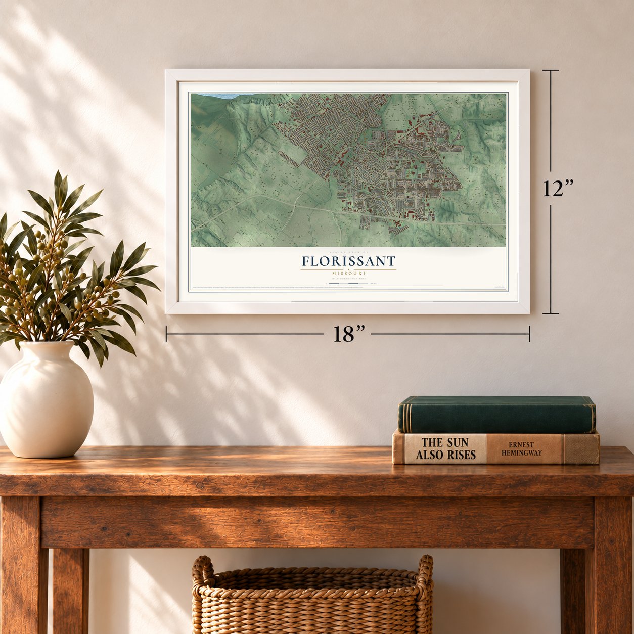
12" x 18" Archival Matte Print
A Map of Home. A Work of Art.
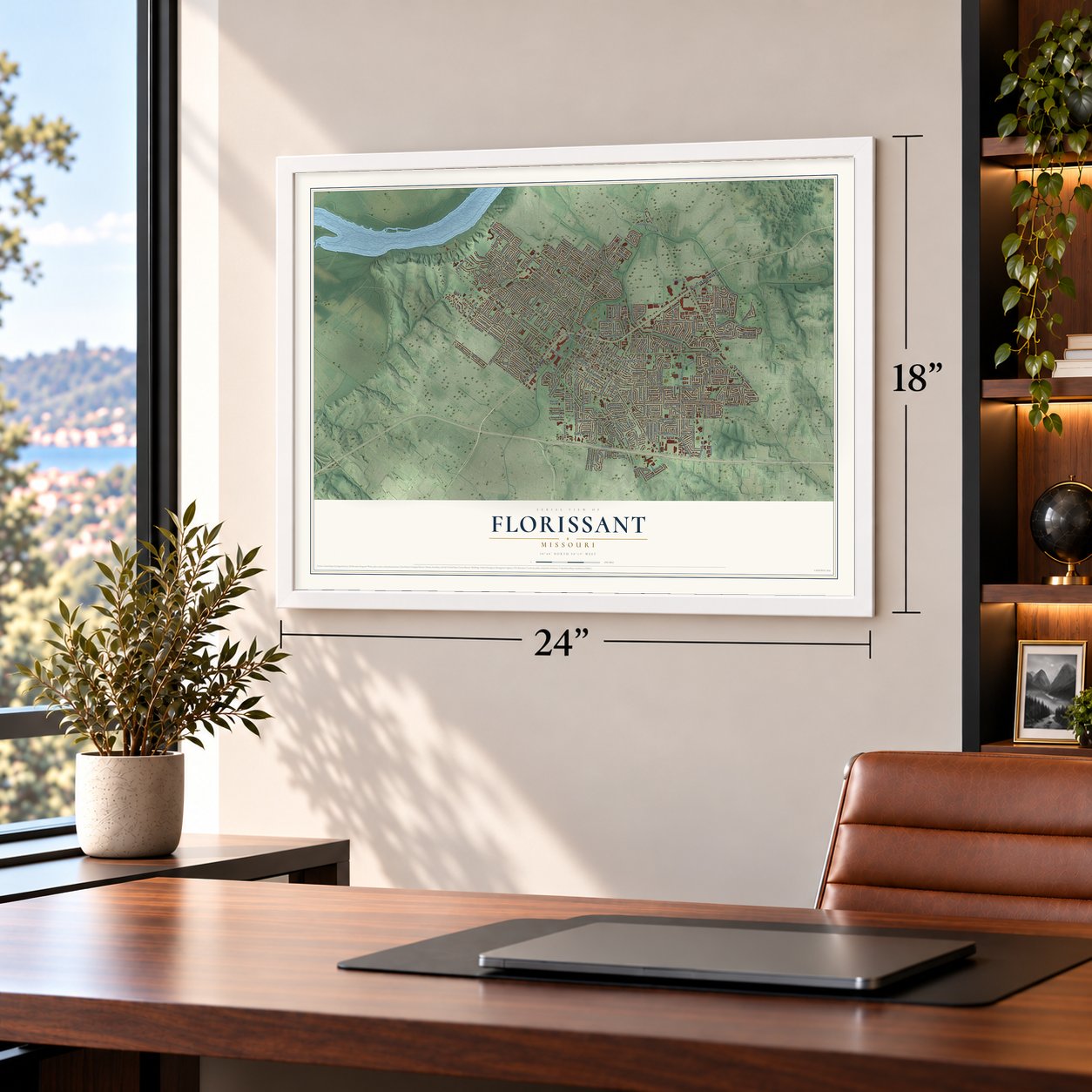
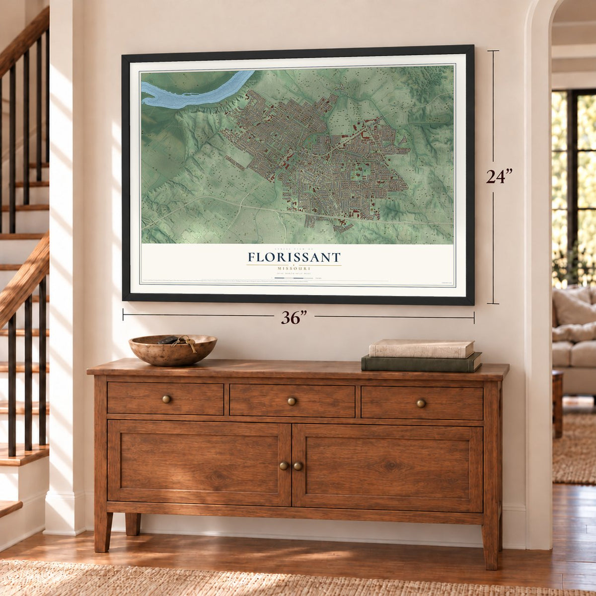
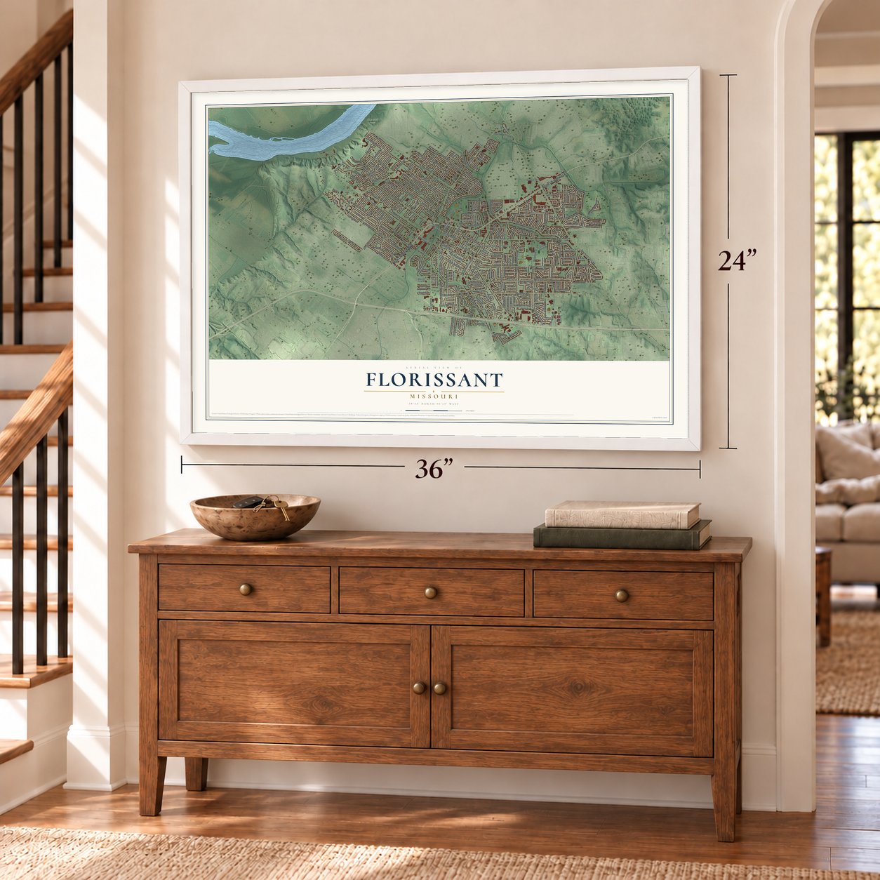
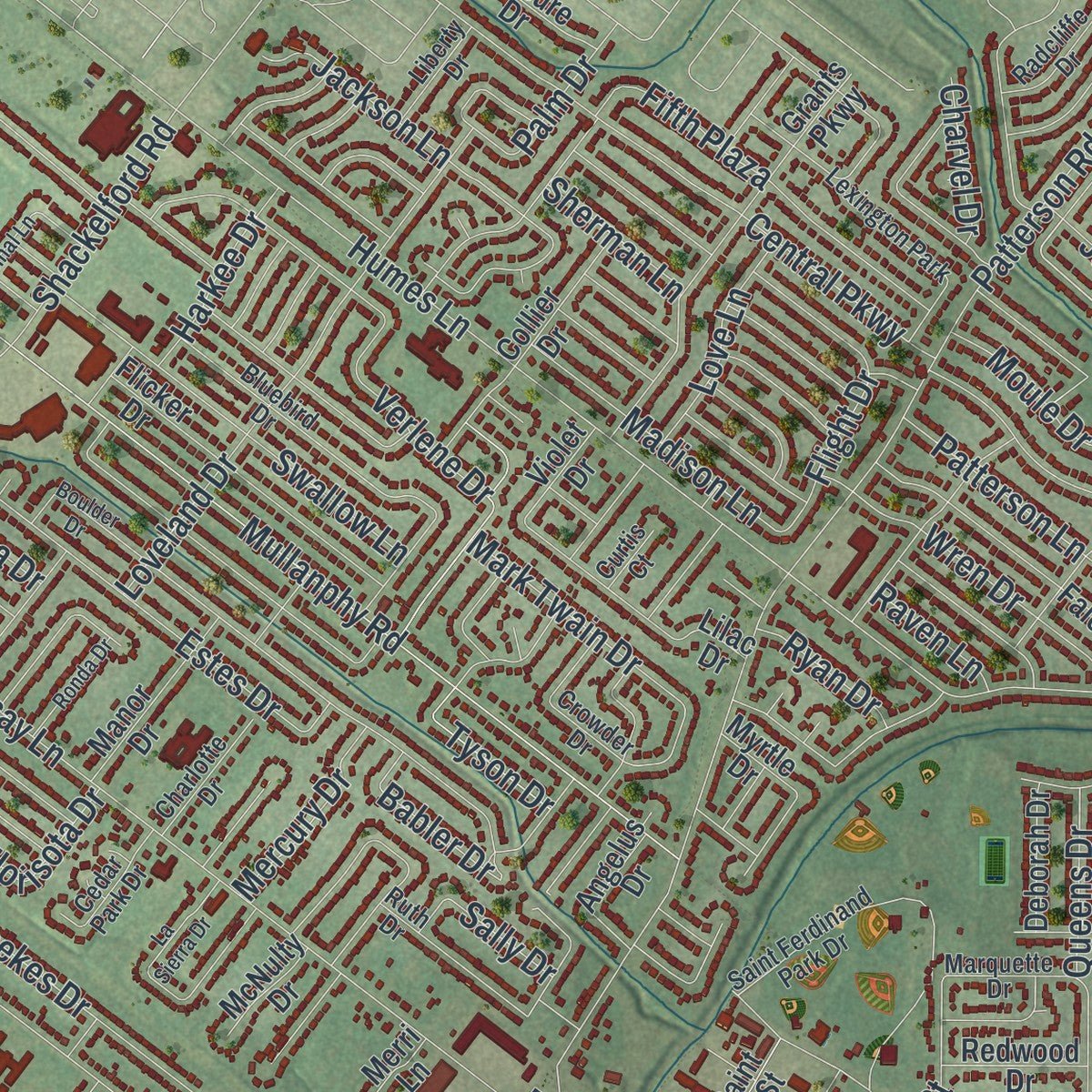
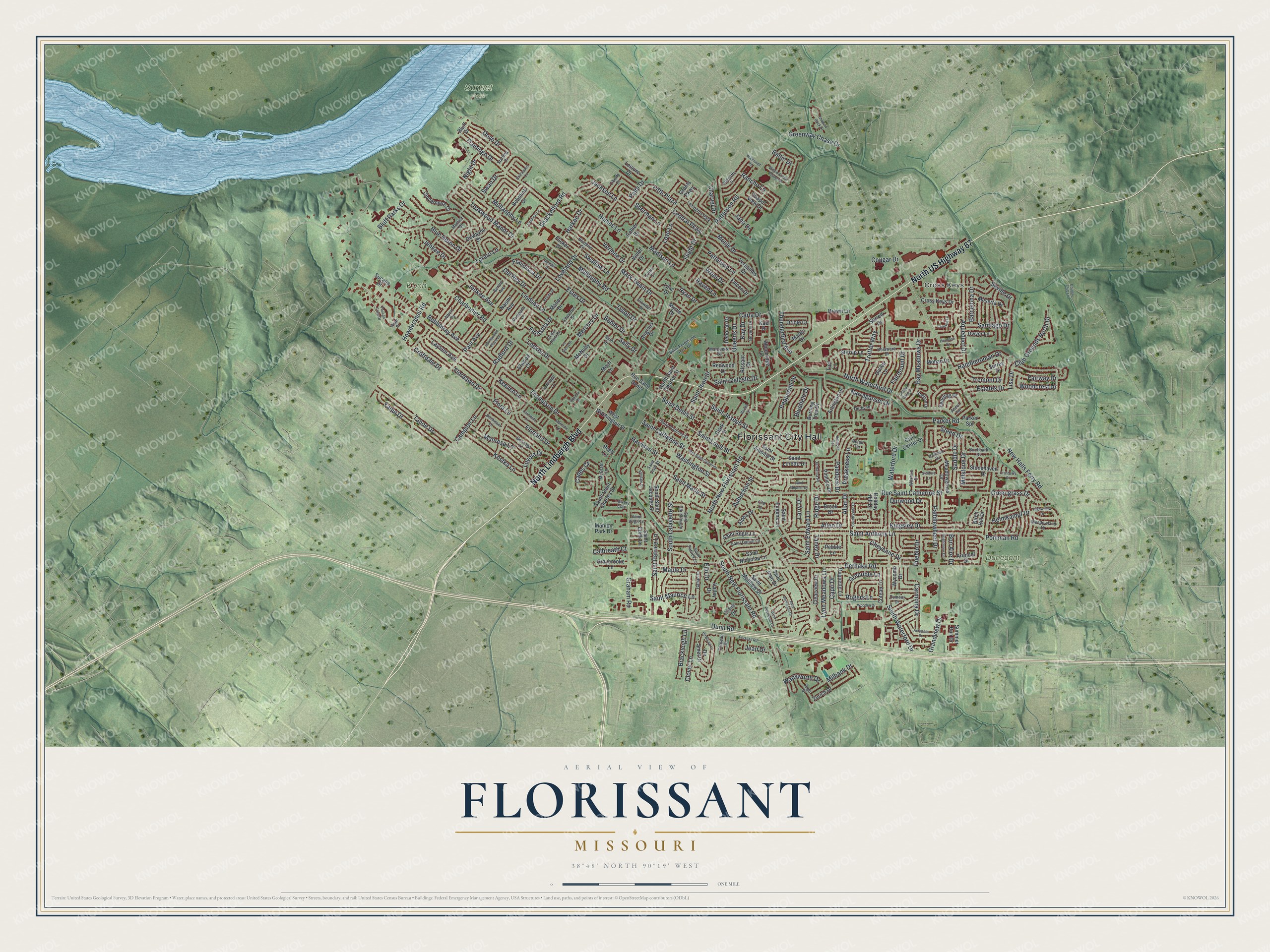
Explore Florissant, Missouri from a whole new perspective. Created using aerial imagery and detailed geographic data, this map captures Florissant building by building, with labeled streets, familiar landmarks, and shaded topographical relief that highlights the natural contours of the landscape.
Combining modern data with the timeless character of a vintage atlas, this map is just as interesting up close as it is beautiful on the wall. Whether you grew up in Florissant, spent memorable years there, or call it home today, this unique map is a great way to celebrate a place that means something to you. Zoom in on the preview to look for your street, and then order a print to put your memories on the wall.
Three ways to hang it
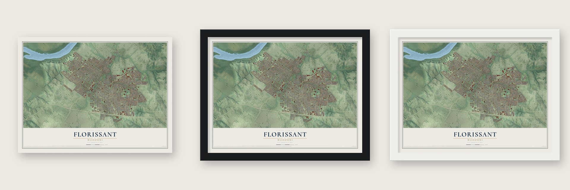
Unframed archival matte, a black wood frame or a white wood frame.
Up close
Geography Worth Displaying
This map was created using accurate cartographic data and authoritative geographic sources, including the U.S. Geological Survey and the Census Bureau. The map brings together terrain, waterways, roads, and building detail. The majority of the streets are labeled, houses are accurately depicted, and the topography is derived from government sources. Combining local data with carefully composed color and shading leads to this beautifully detailed Florissant artwork for your wall.
Rather than simply showing street outlines, we’ve included as many of the street names as we could reasonably fit on the map while keeping their names legible. Zoom in on the high resolution preview to see exactly what’s on the map. We truly set out to create a statement piece for anyone who loves Florissant. So whether it’s for you, or a gift for someone you love, we hope this map of Florissant brings back fond memories.
Read the story behind this map of Florissant, Missouri from 2026.

Find your street
Names on the Florissant map
Every name below is printed on this map. Look for your street, your school, the park where you played, or the pond down the road.
Places and landmarks6
- Florissant City Hall
- Cross Keys
- Dunegant Park
- Koch Park
- Sunset Park
- Lexington Park
Streets and roads303
- North US Highway 67
- North Lindbergh Boulevard
- Dunn Road
- Rancho Lane
- Parker Road
- Millstone Drive
- Steed Drive
- Charbonier Road
- New Halls Ferry Road
- Derhake Road
- Saint Catherine Street
- Patterson Road
- Washington Street
- Lindsay Lane
- Saint Anthony Lane
- Rue Saint Catherine Street
- Mullanphy Lane
- Mullanphy Road
- Humes Lane
- North New Florissant Road
- South New Florissant Road
- Keeven Lane
- Flordawn Drive
- Saint Denis Street
- Flamingo Drive
- North Waterford Drive
- Waterford Drive
- Saint Louis Street
- Shackelford Road
- Santiago Drive
Show all 303 streets
- Graham Road
- Paddock Drive
- Saint Jean Street
- South Lafayette Street
- Saint Joseph Street
- Harrison Street
- Saint Marie Street
- Aubuchon Street
- Central Parkway
- Loveland Drive
- Manresa Lane
- Paul Avenue
- Loekes Drive
- Verlene Drive
- Florland Drive
- Yaqui Drive
- Tahoe Drive
- Swallow Lane
- Madison Lane
- South Waterford Drive
- Aqueduct Drive
- Estes Drive
- Jackson Lane
- Teakwood Manor Drive
- Saint Edward Lane
- Blue Heron Drive
- Thompson Drive
- Bobbinray Avenue
- Bluefield Drive
- Layven Avenue
- Kostka Lane
- Pohlman Road
- Flora Lane
- Allan Drive
- Allen Drive
- Helmkampf Drive
- Patterson Lane
- Trotter Way
- Jenkee Drive
- Kingsley Drive
- Fifth Plaza
- Cougar Drive
- Howdershell Road
- Club Grounds North Drive
- Mark Twain Drive
- Wren Drive
- Bay Meadows Drive
- Moule Drive
- Saint Patrice Lane
- Dove Drive
- Maple Drive
- Greengrass Drive
- Torero Lane
- Tyson Drive
- Hambletonian Drive
- Durwood Drive
- Cheyenne Drive
- Saddle Drive
- Lynn Meadows Lane
- Loyola Drive
- Greenway Chase Drive
- Paddlewheel Drive
- Milbank Drive
- Thunderbird Avenue
- Saint Celeste Drive
- Francisca Drive
- Night Drive
- Preakness Lane
- Clover Lane
- Grandview Drive
- Carmona Drive
- Grenoble Lane
- Woodcrest Drive
- Radford Drive
- Swan Drive
- Tremont Drive
- Pepperhill Drive
- Saint Maurice Lane
- Croftdale Drive
- Jean Drive
- Brackleigh Lane
- Capri Drive
- Cades Cv
- Campion Lane
- Fairway Drive
- Barcelona Drive
- Estates Drive
- Bluff Parks Drive
- Carla Drive
- Love Lane
- Rogers Lane
- Fairmount Drive
- Wadsworth Drive
- Narraganset Drive
- Mercury Drive
- Jenkee Avenue
- Harkee Drive
- Florisota Drive
- Calbreath Court
- Babler Drive
- Jana Drive
- Del Rey Drive
- Queens Drive
- Seville Drive
- Sally Drive
- Flight Drive
- Ridge Drive
- Sherman Lane
- Taney Drive
- Bon Aire Drive
- Pueblo Drive
- Elm Drive
- Charvel Drive
- Ryan Drive
- Larry Drive
- Raven Lane
- Kay Drive
- Palm Drive
- Baltic Drive
- Lisa Drive
- Rue Saint Denis
- North Saint Charles Street
- Saint Antoine Street
- Clark Street
- Grants Parkway
- Dewayne Drive
- Flicker Drive
- Meadowgrass Drive
- Saint Eugene Lane
- Holiday Hill Drive
- Versailles Drive
- Falcon Drive
- South Saint Jacques Street
- Chapel View Drive
- Woodridge Lane
- Lilac Drive
- South Saint Charles Street
- De Smet Drive
- Zurich Drive
- Stonehaven Drive
- Civic Center Drive
- Saint Nicholas Lane
- Meserta Drive
- Summer Run Drive
- Sorrell Drive
- Coteau Lane
- Manor Drive
- Stirrup Lane
- Burning Tree Drive
- Saint Regis Lane
- West Washington Street
- Brown Lane
- Cross Keys Drive
- Arlington Drive
- Naomi Avenue
- Clovermere Court
- Pimlico Drive
- Valley Drive
- Manion Park Drive
- Sucasa Drive
- Saint Matthew Drive
- Reeb Lane
- Clearview Drive
- Rissant Drive
- Graybrooke Lane
- Bobolink Drive
- Arundel Drive
- Saint Loretto Drive
- Duquette Lane
- Collier Drive
- Brook Drive
- Martin Drive
- Angelus Drive
- Gallop Lane
- Deborah Drive
- Oriole Drive
- Dwyer Lane
- Surrey Drive
- Redwood Drive
- Saint Edith Lane
- Yearling Drive
- Claire Drive
- Leisure Drive
- Birch Hill Drive
- Wycomb Drive
- Parker Spr
- Mohan Drive
- McNulty Drive
- Violet Drive
- Elwood Court
- Alpha Drive
- Saint Joan Drive
- Pebble Lane
- Merri Lane
- Myrtle Drive
- Bluff Drive
- Kael Drive
- Turf Lane
- Saint Christina Lane
- Saint Francois Street
- Saint Ferdinand Park Drive
- Bluebird Drive
- Albert Drive
- Gerald Avenue
- Marquette Drive
- Delaware Drive
- Marrisa Drive
- Radcliffe Drive
- Saint Patrick Lane
- Gahan Drive
- Gonzaga Lane
- Saint Daniel Lane
- Ruth Drive
- Jamaica Place
- Crowder Drive
- Wilshire Drive
- Harness Drive
- Sunridge Lane
- Beverly Drive
- Argo Drive
- Charlotte Drive
- Meadowland Drive
- McGrath Lane
- Birchbark Drive
- Ascot Terrace
- Cedar Park Drive
- Liberty Drive
- Stallion Drive
- Pompano Lane
- Ozment Drive
- Lowery Ests
- Saint Virgil Lane
- Chateau Drive
- Derby Place
- Starling Drive
- Lila Lane
- Curtis Court
- Belair Terrace
- Pratt Place
- Boone Street
- Rue Saint Catherine
- Pershall Road
- Willow Creek Estates Drive
- Boulder Drive
- Rosetta Drive
- Countryside Drive
- Du Bourg Lane
- East Duchesne Drive
- Acredale Drive
- Shadow Rock Drive
- Wooden Drive
- Cranberry Court
- Carmelita Lane
- Golden Gate Drive
- Stafford Lane
- Carefree Lane
- Brightmoor Drive
- Highwillow Drive
- Materdie Lane
- Hermoso Drive
- Ronda Drive
- West Duchesne Drive
- Belmont Terrace
- Cardinal Lane
- La Sierra Drive
- Berchmans Lane
- Springwood Place Court
- Elmdale Court
- Saint Stephen Drive
- Chickadee Lane
- Wiethaupt Road
- Pelican Cove Drive
- Country Club Lane
Names are listed as they appear on the printed map. Zoom into the product photos to find them.
About Florissant, Missouri
Florissant is a city of 52,533 people in St. Louis County, in the northern suburbs of St. Louis, and it is the largest city in the county. No one recorded the year the first settlers came to the Valley of Florissant, and some historians think the village began around the same time as St. Louis. A civilian government formed in 1786, and the Spanish census of 1787, kept in archives in Havana, counted 40 people and seven plantations.
The settlers laid out a French village with commons and shared fields, and it grew up around the parish of St. Ferdinand. French was still the main language in town as late as 1889. A rail line extended from Normandy reached Florissant in 1878, and the last train ran on November 14, 1931. After World War II, builders such as Alfred H. Mayer Co. turned farmland into subdivisions. About 18,000 houses went up between 1947 and 1980, and the population peaked near 76,000 in the mid-1970s.
“Named Florissant (flowering) by its first French settlers, and called St. Ferdinand by Spanish authorities, the village was known as St. Ferdinand de Florissant until 1939, when it officially became Florissant.”
- The Old St. Ferdinand ShrineThe parish of St. Ferdinand was the heart of the old village, and people often called the town by the parish name. Four of its buildings still stand where they were built: the convent of 1819, the church of 1821, the rectory of 1840 and the schoolhouse of 1888. Together they form the St. Ferdinand's Shrine Historic District on the National Register.
- A mayor for 37 yearsJames J. Eagan became Florissant's first mayor in 1963, once a charter amendment created the office. Voters re-elected him nine times, and he served until his death on November 2, 2000, one of the longest terms of any mayor in the country. In his last year the Riverfront Times named him Best Politician in St. Louis, and the community center off Parker Road now carries his name.
- Old Town since 1969A city ordinance created the Florissant Old Town Historic District in 1969. The wider City of St. Ferdinand Multiple Resource Area covers about 156 city blocks, roughly the old City of St. Ferdinand, as the town was called from 1857 to 1939. It holds 124 historic properties built between 1790 and 1940.
- German brick, French frameFlorissant's Missouri German buildings are mostly brick stores and institutional buildings. The finest is the Kuehn House, with a toothed corbel table across its front, and the Tebeau House and Withington House are other strong examples; each is on the National Register. The town's Missouri French buildings are mostly wood frame homes, such as the Hubecky House and the Meyer House.
Keep exploring Missouri
Florissant is one of 1,207 Missouri towns we've mapped. Every dot on the map is a print of its own.
The search covers every state, Missouri first.
Near Florissant
Order 2 or more town maps and save 10%. Shown in the size and finish you picked above, so they hang as a set.
- Calverton Park 12" x 18" / Archival Matte Print $39.99
- Old Jamestown 12" x 18" / Archival Matte Print $39.99
- Black Jack 12" x 18" / Archival Matte Print $39.99
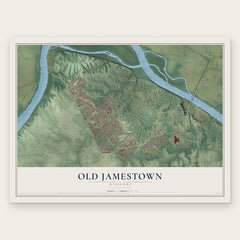
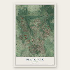
More maps nearby: Berkeley, Hazelwood, Ferguson, Dellwood and Kinloch.
The art of mapping a place
How This Map Was Made
Real places. Remarkable detail. Discover the layers that turn geographic data into a map of home.

The view from above
Aerial imagery reveals the character of the land: woodland, open fields, and the patterns of a place.

The shape of the land
Elevation data brings hills, valleys, and subtle changes in the landscape into view.

The details of home
Roads, waterways, and building footprints come together to make the map feel unmistakably local.

Geography becomes art
Considered color, shading, and typography bring the layers together in a map made for your wall.


Process illustrated with Mendon, Massachusetts. Aerial imagery: USDA NAIP. Terrain: USGS 3D Elevation Program. Map details and finished artwork: KNOWOL.
The Details
About This Print
Choose an archival matte print, or a black or white Ayous wood frame. The archival matte print is unframed.
Select your size and finish above to see the matching product image and price.
Materials & Craftsmanship
A contemporary map with the character of a classic atlas, printed on archival matte paper. Optional frames are made from Ayous wood.
Your printed map does not include the watermark shown in the full-map preview.
Shipping & Delivery
Free shipping within the United States. Every print is made to order in the USA.
Buying a gift? Add a note in your cart and we'll include it. We never put prices in the package.
Prints ship within 2 to 3 business days. Allow 7 to 10 days total from ordering for delivery. Timing may vary during holidays or periods of high order volume.
Read our shipping policy.
Returns and damaged prints
Each print is made to order. Change-of-mind refunds are not available after production.
If your print arrives damaged, misprinted or incorrect, contact support@knowol.com within 30 days of receiving it. Include your order number, photos and a description of the issue.
Read our full refund and replacement policy. For questions about your order, email support@knowol.com.