


Search for another town





Free U.S. delivery 7 to 10 days after you order
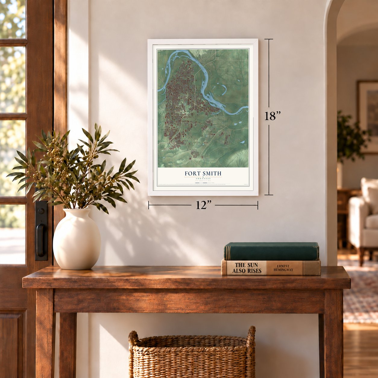
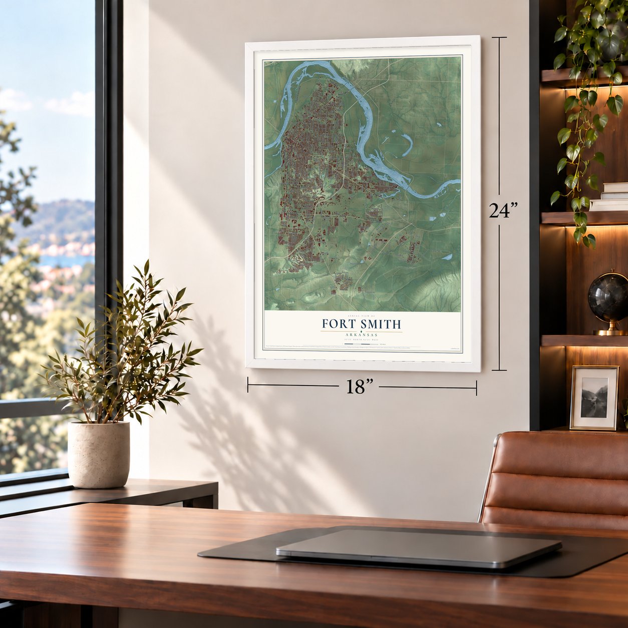
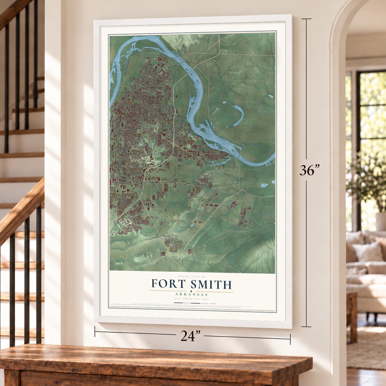
Fort Smith, Arkansas Map Art
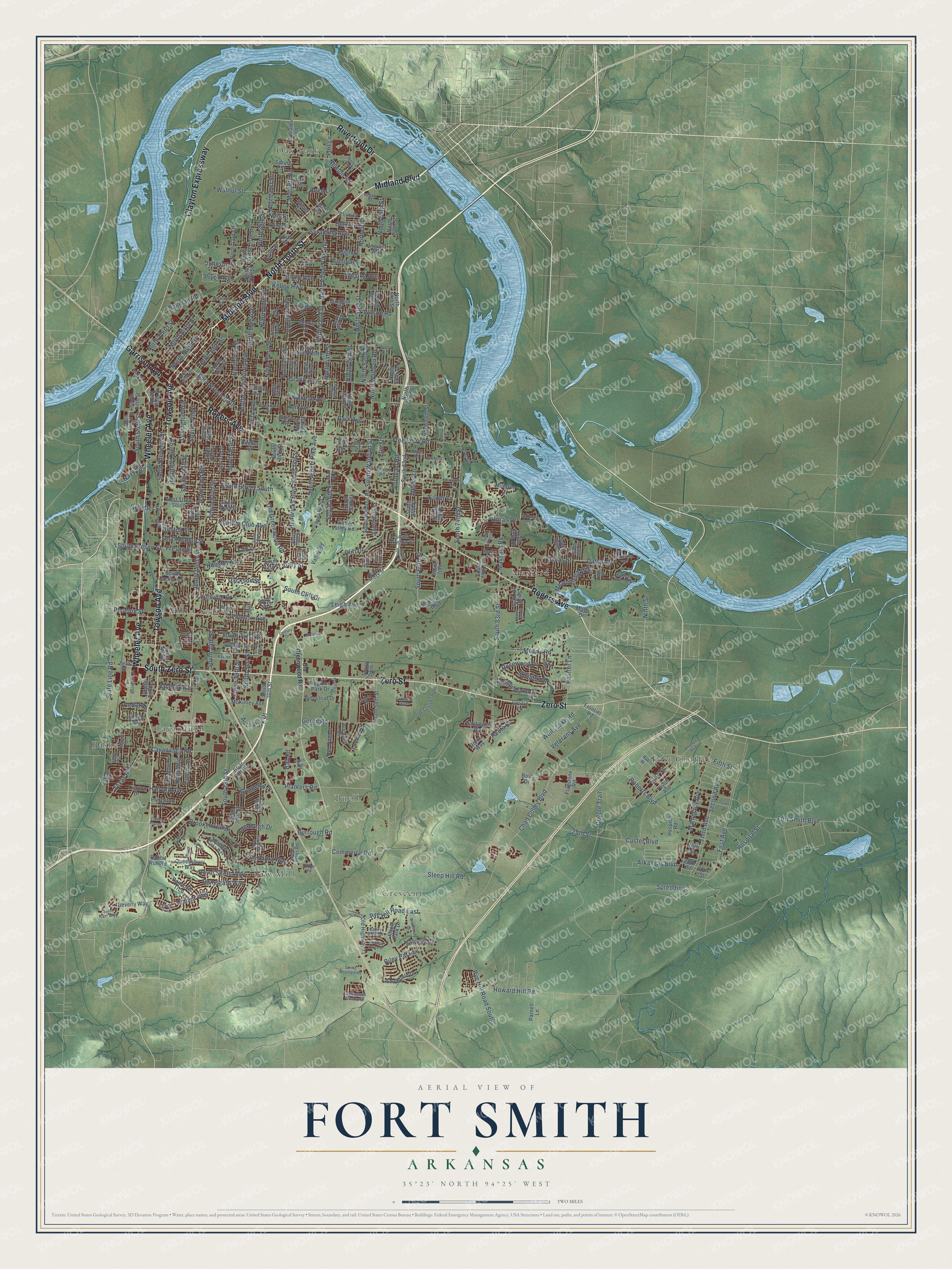
Building by building, with labeled streets and shaded relief.
12" x 18" Archival Matte Print
A Map of Home. A Work of Art.
Explore Fort Smith, Arkansas from a whole new perspective. Created using aerial imagery and detailed geographic data, this map captures Fort Smith building by building, with labeled streets, familiar landmarks, and shaded topographical relief that highlights the natural contours of the landscape.
Combining modern data with the timeless character of a vintage atlas, this map is just as interesting up close as it is beautiful on the wall. Whether you grew up in Fort Smith, spent memorable years there, or call it home today, this unique map is a great way to celebrate a place that means something to you. Zoom in on the preview to look for your street, and then order a print to put your memories on the wall.
Three ways to hang it
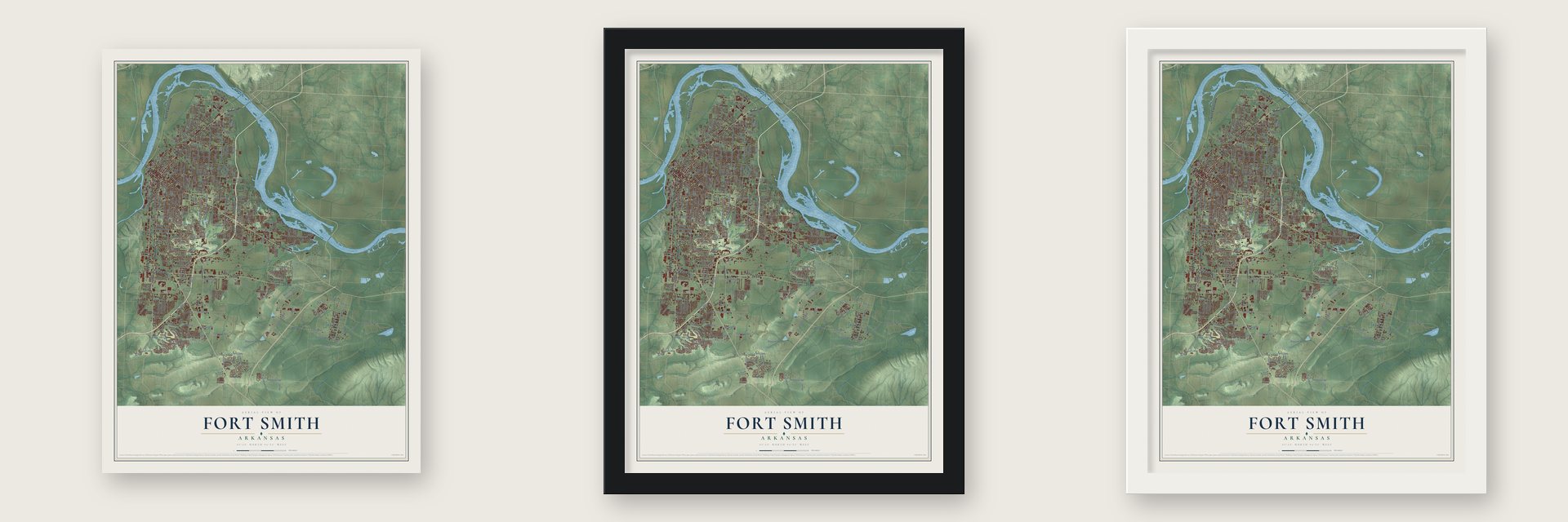
Unframed archival matte, a black wood frame or a white wood frame.
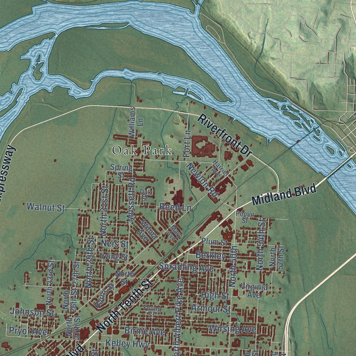
Up close
Geography Worth Displaying
This map was created using accurate cartographic data and authoritative geographic sources, including the U.S. Geological Survey and the Census Bureau. The map brings together terrain, waterways, roads, and building detail. The majority of the streets are labeled, houses are accurately depicted, and the topography is derived from government sources. Combining local data with carefully composed color and shading leads to this beautifully detailed Fort Smith artwork for your wall.
Rather than simply showing street outlines, we’ve included as many of the street names as we could reasonably fit on the map while keeping their names legible. Zoom in on the high resolution preview to see exactly what’s on the map. We truly set out to create a statement piece for anyone who loves Fort Smith. So whether it’s for you, or a gift for someone you love, we hope this map of Fort Smith brings back fond memories.
Read the story behind this map of Fort Smith, Arkansas from 2026.

Find your street
Names on the Fort Smith map
Every name below is printed on this map. Look for your street, your school, the park where you played, or the pond down the road.
Places and landmarks10
- Bashe
- Buell
- Cavanaugh
- Crescent
- Fort Chaffee
- Massard
- Mill Creek
- Oak Park
- Saw Mill
- Highland Park
Streets and roads333
- Zero Street
- North Tenth Street
- Midland Boulevard
- Wheeler Avenue
- Rogers Avenue
- Towson Avenue
- Clayton Expressway
- South Zero Street
- Riverfront Drive
- Garrison Avenue
- Painter Lane
- Chad Colley Boulevard
- Old Greenwood Road
- Louisville Street
- South Sixth Street
- South 24th Street
- Newlon Road
- North Sixth Street
- South 66th Street
- Country Club Avenue
- Steep Hill Road
- North 13th Street
- Ballman Road
- Rye Hill Road East
- North 50th
- North Albert Pike Avenue
- Fresno Street
- South Fresno Street
- South Albert Pike Avenue
- Jenny Lind Road
Show all 333 streets
- Jenny Lind Avenue
- Massard Road
- Dallas Street
- Cliff Drive
- Phoenix Avenue
- Grand Avenue
- State Line Road
- South 28th Street
- Fort Smith Boulevard
- Roberts Boulevard
- Custer Boulevard
- First Avenue
- North 32nd Street
- North 50th Street
- Free Ferry Road
- Kelley Highway
- South 31st Street
- North 42nd Street
- Park Avenue
- North 31st Street
- Kinkead Avenue
- South 16th Street
- Brooken Hill Drive
- Dallas Drive
- South Dallas Street
- Spradling Avenue
- South 22nd Street
- Gary Street
- 25th Street
- Cavanaugh Road
- Spredding
- Phoenix Street
- South 17th Street
- South 74th Street
- Wells Lake Road
- Hospital Street
- High Street
- Johnson Street
- North 30th Street
- Wirsing Avenue
- South Street South
- South 83rd Street
- Mahogany Avenue
- Euper Lane
- South Cliff Drive
- North May Avenue
- Third Avenue
- East Street North
- North Ninth Street
- Houston Street
- South 25th Street
- Veterans Avenue
- North 29th Street
- North 52nd Street
- Boston Street
- South 29th Street
- Second Avenue
- Hendricks Boulevard
- North Greenwood Avenue
- North 49th Street
- South Eleventh Street
- Glen Flora Way
- Coyote Trail
- North 21st Street
- South 46th Street
- South Twelfth Street
- Texas Road
- Birnie Avenue
- Jackson Street
- Meandering Way
- North Waldron Road
- Harvard Avenue
- Howard Hill Road
- Lexington Avenue
- North 44th Street
- Ramsgate Way
- North 54th Street
- Moody Road
- Mussett Road
- Geren Road
- Walnut Street
- Horan Drive
- South Tulsa Street
- Armour Street
- Burnham Road
- Planters Road
- Royal Scots Way
- Fianna Way
- Leigh Avenue
- Rosewood Drive
- Riley Park Drive
- Rye Hill Road South
- South Waldron Street
- Holly Avenue
- Lecta Avenue
- Pryor Avenue
- Arkansas Boulevard
- Edinburgh Drive
- North Third Street
- Canopy Oaks Drive
- Commerce Road
- Grinnell Avenue
- Churchill Road
- Schulter Street
- Auto Park Drive
- Ninth Street
- Reed Lane
- Colony Lane
- Elm Street
- Skypark Drive
- Jacobs Avenue
- Ball Road
- Ellis Street
- Wilson Road
- Neis Street
- Burrough Road
- Fort Lane
- Fifth Street
- Berkley
- Weeks Lane
- Navy Road
- Hon Avenue
- Reata Street
- Cedar Lane
- Frontier Road
- South 35 Drive
- Mayo Drive
- South 70th Street
- South 21st Street
- South Boston Street
- Taylor Avenue
- South Tenth Street
- North 35th Street
- North Street North
- South 38th Street
- Vicksburg Street
- North 39th Street
- South 34th Street
- South 58th Street
- North 48th Street
- South 30th Street
- West Street South
- Virginia Avenue
- South 14th Street
- South Gary Street
- Bluff Avenue
- South Fifth Street
- South 96th Street
- McKennon Boulevard
- North 27th Street
- North 23rd Street
- North Street
- North 53rd Street
- Old Highway 71
- Utica Street
- South Jackson Street
- Valley Road
- Enid Street
- Maple Park Drive
- South 36th Street
- Plum Street
- 27th Street
- South Waldron Road
- North 16th Street
- Meadow Drive
- South Ninth Street
- 30th Street
- Queensbury Way
- Hillside Drive
- South West Street
- Barry Avenue
- South 56th Street
- South 62nd
- Briar Cliff Avenue
- North 58th Street
- Williams Lane
- South 64th Street
- Windsor Drive
- McKinley Avenue
- North 66th Street
- Irving Street
- South 20th Street
- East Valley Road
- Bradley Drive
- Red Pine Drive
- Southfield Drive
- Morris Drive
- 29th Street
- Rannoch Trce
- Trenton Drive
- North 26th Street
- Industrial Drive
- Huntington Way
- Hardie Avenue
- Regions Park Drive
- Beverly Way
- Princeton Drive
- Parnell Lane
- 26th Street
- Lookout Drive
- Hospital Road
- North 58th Terrace
- North 57th Street
- Miletree Drive
- South 87th Drive
- Flagstone Road
- Fern Street
- Wilma Avenue
- South 79th Street
- South 87th Street
- Gracie Lane
- Harris Street
- South 50th Street
- North 62nd Street
- Spring Street
- Reeder Street
- Rabbit Run Road
- South 55th
- South 70th
- Rome Way
- Bost Drive
- South 23rd Street
- North 33rd Street
- North 40th Street
- North 34th Street
- Division Street
- North 45th Street
- Bryn Mawr Circle
- North 37th Street
- 21st Street
- Atlanta Street
- Duncan Road
- South Fourth Street
- Golf Course Loop
- Osage Street
- Xavier Street
- South 35th Terrace
- Columbus Acres Road
- Poplar Street
- Blackburn Street
- Rs Boreham Street
- Heather Oaks Way
- Young Street
- Berry Hill Road
- Harriet Avenue
- South 39th Street
- Saint Karr Way
- Riverlyn Drive
- Hunters Point Road
- South 41 Street
- North 46th Terrace
- Valley View Drive
- Blackjack Drive
- Avignon Lane
- Tennessee Circle Road
- Futral Drive
- Heather Ridge Street
- Martin Drive
- Tony Street
- Ayers Road
- Bolton Road
- South 99th Street
- Hestand Lane
- Mark Lane
- Autumn Oaks Lane
- Cross Lane
- Crimson Avenue
- Oak Street
- 31st Street
- Didier Road
- Rak Place
- Mary Avenue
- Chaffee Boulevard
- North Twelfth Street
- Savannah Street
- South 62nd Street
- South 32nd Street
- Ellsworth Road
- South 33rd Street
- South 46 Street
- South 88th Street
- South 57th Street
- 14th Street
- Woodland Drive
- Wheaton Trce
- Prairie Drive
- Belhaven Vw
- Fincastle Drive
- Spring Mountain Road
- Meadow Brook Drive
- Edgewater Road
- Chapen Drive
- South 80th Street
- South 94th Street
- Village Road
- Paddock Lane
- Essex Place
- Fianna Place Court
- Garland Avenue
- Copper Oaks Drive
- Century Drive
- South 54th Street
- Short Lane
Names are listed as they appear on the printed map. Zoom into the product photos to find them.
About Fort Smith, Arkansas
From the CALS Encyclopedia of Arkansas: "Around the fort, a small settlement began forming, taking its name from the fort that, in turn, was named for General Thomas A. Smith, the military district’s commander."
Keep exploring Arkansas
Fort Smith is one of 658 Arkansas towns we've mapped. Every dot on the map is a print of its own.
The search covers every state, Arkansas first.
Near Fort Smith
Order 2 or more town maps and save 10%. Shown in the size and finish you picked above, so they hang as a set.
- Barling 12" x 18" / Archival Matte Print $39.99
- Van Buren 12" x 18" / Archival Matte Print $39.99
- Central City 12" x 18" / Archival Matte Print $39.99


The art of mapping a place
How This Map Was Made
Real places. Remarkable detail. Discover the layers that turn geographic data into a map of home.

The view from above
Aerial imagery reveals the character of the land: woodland, open fields, and the patterns of a place.

The shape of the land
Elevation data brings hills, valleys, and subtle changes in the landscape into view.

The details of home
Roads, waterways, and building footprints come together to make the map feel unmistakably local.

Geography becomes art
Considered color, shading, and typography bring the layers together in a map made for your wall.


Process illustrated with Mendon, Massachusetts. Aerial imagery: USDA NAIP. Terrain: USGS 3D Elevation Program. Map details and finished artwork: KNOWOL.
The Details
About This Print
Choose an archival matte print, or a black or white Ayous wood frame. The archival matte print is unframed.
Select your size and finish above to see the matching product image and price.
Materials & Craftsmanship
A contemporary map with the character of a classic atlas, printed on archival matte paper. Optional frames are made from Ayous wood.
Your printed map does not include the watermark shown in the full-map preview.
Shipping & Delivery
Free shipping within the United States. Every print is made to order in the USA.
Buying a gift? Add a note in your cart and we'll include it. We never put prices in the package.
Prints ship within 2 to 3 business days. Allow 7 to 10 days total from ordering for delivery. Timing may vary during holidays or periods of high order volume.
Read our shipping policy.
Returns and damaged prints
Each print is made to order. Change-of-mind refunds are not available after production.
If your print arrives damaged, misprinted or incorrect, contact support@knowol.com within 30 days of receiving it. Include your order number, photos and a description of the issue.
Read our full refund and replacement policy. For questions about your order, email support@knowol.com.