
Search for another town





Free U.S. delivery 7 to 10 days after you order
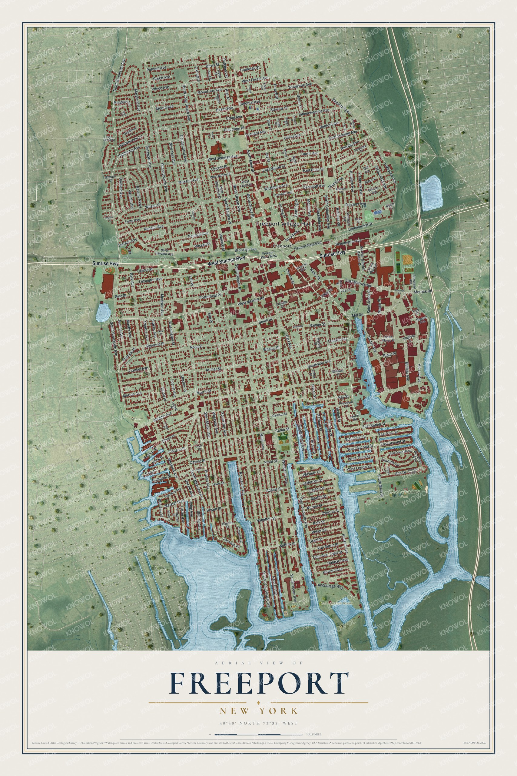
Freeport, New York Map Art
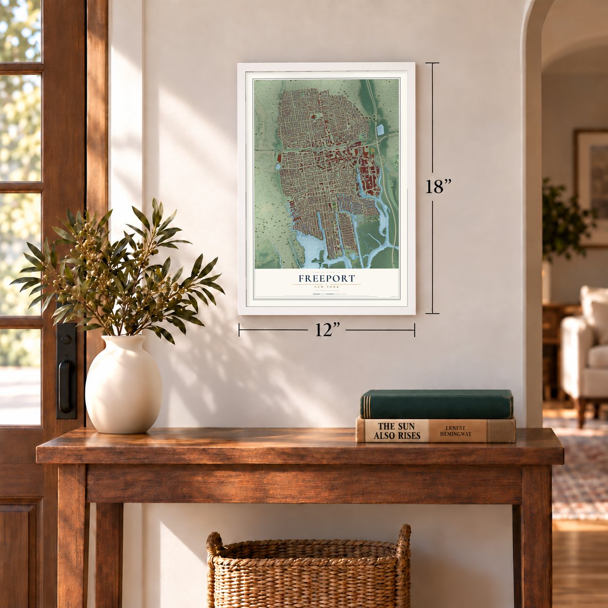
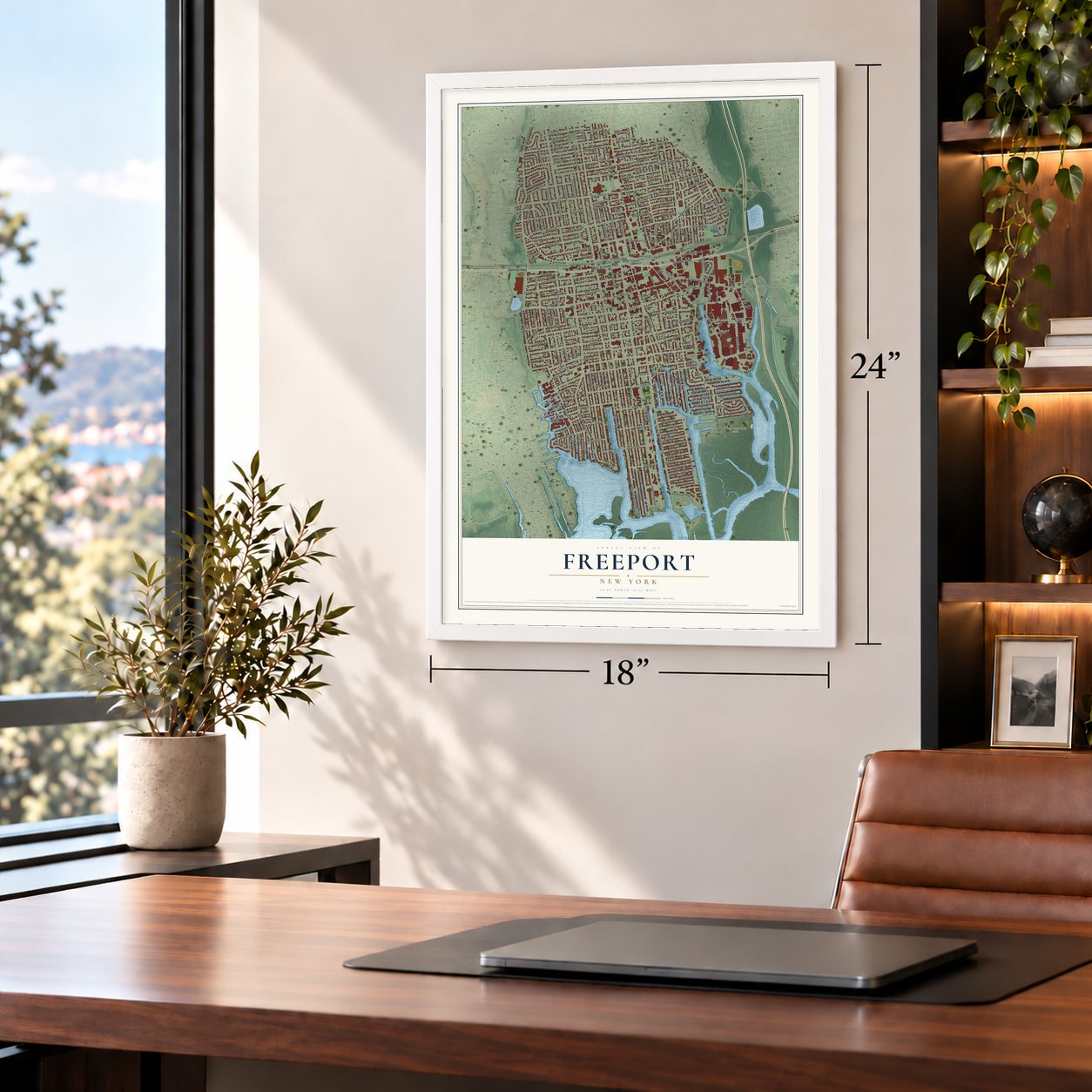
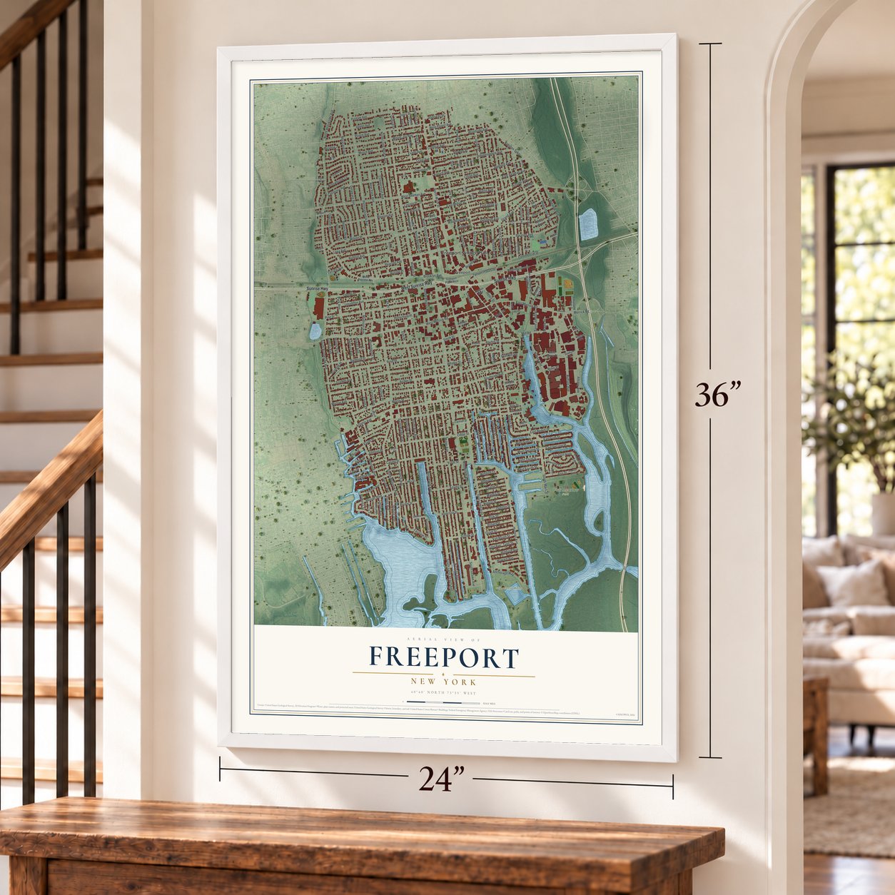
A new map of Freeport, New York, made in 2026 and printed to order on thick archival matte paper.
12" x 18" Archival Matte Print
A Map of Home. A Work of Art.
Bring a piece of Freeport home. Whether it’s where you grew up, your current home, or simply a moment in your life, this Freeport, New York map print brings those memories to your wall. Antique-inspired styling and modern geographic detail combine to create artwork that’s beautiful from across the room, with plenty to study and explore when you get up close.
Three ways to hang it
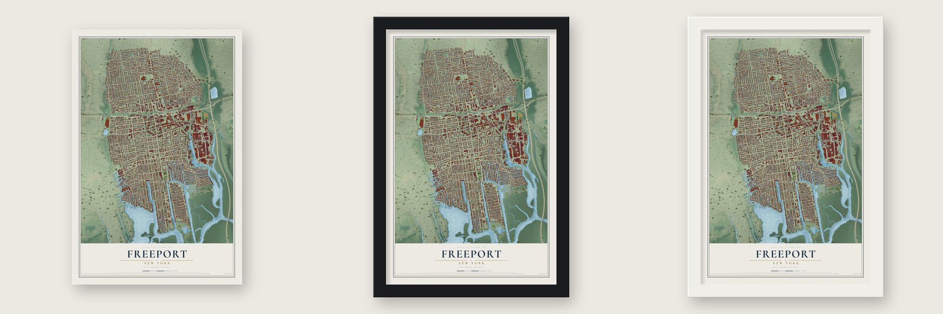
Unframed archival matte, a black wood frame or a white wood frame.
Up close
Real geography. Art worth displaying.
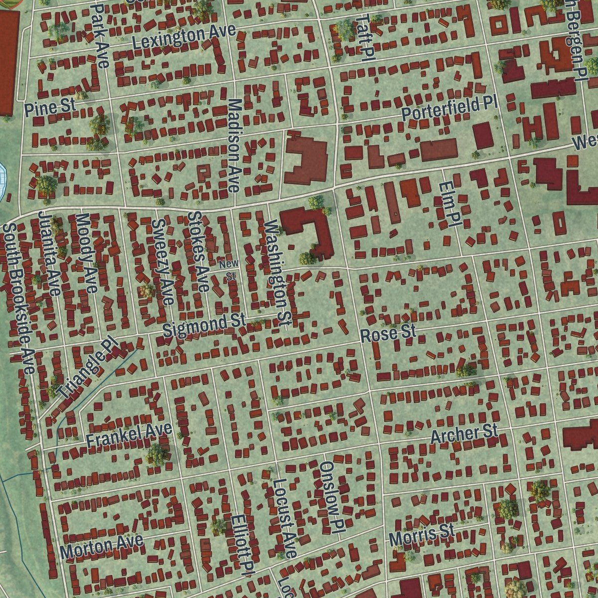
This map was created using accurate cartographic data and authoritative geographic sources, including the U.S. Geological Survey (USGS) and FEMA. The map brings together terrain, waterways, roads, and building detail. The majority of the streets are labeled, houses are accurately depicted, and the topography is derived from government sources. Combining local data with carefully composed color and shading leads to this beautifully detailed Freeport artwork for your wall.
Rather than simply showing street outlines, we’ve included as many of the street names as we could reasonably fit on the map while keeping their names legible. Zoom in on the high resolution preview to see exactly what’s on the map. We truly set out to create a statement piece for anyone who loves Freeport. So whether it’s for you, or a gift for someone you love, we hope this map of Freeport brings back fond memories.
Explore the full map of Freeport, New York and read about the local places it shows.

About Freeport, New York
Freeport is a community in Nassau County, New York. The 2020 census recorded 44,472 residents. In the mid-17th century, the area was renamed Raynor South, and ultimately Raynortown, after a herdsman named Edward Raynor, who had moved to the area from Hempstead in 1659.
- 44,472 residentsThe 2020 census recorded 44,472 residents.
- A recorded beginningIn the mid-17th century, the area was renamed Raynor South, and ultimately Raynortown, after a herdsman named Edward Raynor, who had moved to the area from Hempstead in 1659.
- A familiar landmarkFreeport is a village located within the town of Hempstead, in Nassau County, on the South Shore of Long Island, in New York, United States.
- Part of the local storyThe population was 44,472 at the time of the 2020 census, making it the second largest village in New York by population.
Find your street
Names on the Freeport Village map
Every name below is printed on this map. Look for your street, your school, the park where you played, or the pond down the road.
Places and landmarks5
- Freeport Village Hall
- Cow Meadow Park
- Guy Lombardo Marina
- Milburn Park
- Freeport
Streets and roads257
- Sunrise Highway
- West Sunrise Highway
- South Bayview Avenue
- South Main Street
- North Main Street
- North Brookside Avenue
- West Merrick Road
- Branch Avenue
- Merrick Road
- South Brookside Avenue
- Fairview Place
- Ray Street
- East Merrick Road
- West Forest Avenue
- Brunella Street
- South Long Beach Avenue
- South Ocean Avenue
- Guy Lombardo Avenue
- Miller Avenue
- Southside Avenue
- Archer Street
- Nassau Avenue
- Atlantic Avenue
- Roosevelt Avenue
- Pennsylvania Avenue
- Pine Street
- North Long Beach Avenue
- Randall Avenue
- Wallace Street
- Smith Street
Show all 257 streets
- Rose Street
- Buffalo Avenue
- Bedell Street
- North Columbus Avenue
- Woodcleft Avenue
- West Seaman Avenue
- Lena Avenue
- Westside Avenue
- Park Avenue
- Rutland Road
- Saint Marks Avenue
- Grand Avenue
- Maryland Avenue
- Prince Avenue
- Babylon Turnpike
- East Seaman Avenue
- Delaware Avenue
- Whaley Street
- Albany Avenue
- Porterfield Place
- Moore Avenue
- East Dean Street
- Church Street
- Commercial Street
- Sportsmans Avenue
- Independence Avenue
- Lexington Avenue
- Mount Joy Avenue
- Westend Avenue
- North Ocean Avenue
- Gordon Place
- Maxson Avenue
- Hanse Avenue
- Ann Drive
- Hudson Avenue
- Cedar Street
- Colonial Avenue
- Wilson Place
- Craig Avenue
- Evans Avenue
- Woodside Avenue
- East Avenue
- Madison Avenue
- South Bay Avenue
- Henry Street
- New York Avenue
- Connecticut Avenue
- Parsons Avenue
- Lakeview Avenue
- Mill Road
- East Milton Street
- Washburn Avenue
- Graffing Place
- Brooklyn Avenue
- California Avenue
- Pearsall Avenue
- Union Street
- North Grove Street
- Broadway
- Meister Boulevard
- Jay Street
- Willowbrook Lane
- Sigmond Street
- Weberfield Avenue
- Frederick Avenue
- Stevens Street
- Lillian Avenue
- Leonard Avenue
- North Bergen Place
- Casino Street
- Washington Street
- Harrison Avenue
- Centre Street
- Virginia Avenue
- Harris Avenue
- Front Street
- Hillside Avenue
- Putnam Avenue
- Bedford Avenue
- South Bergen Place
- Garfield Street
- Bennington Avenue
- Elliott Place
- Raynor Street
- Cary Place
- Locust Avenue
- Adams Street
- Claurome Place
- Laurette Lane
- Lincoln Place
- Anchorage Way
- Arthur Street
- Hampton Place
- East Bedell Street
- Green Avenue
- Juanita Avenue
- Stirling Avenue
- Irving Avenue
- Russell Place
- Beverly Parkway
- East First Street
- Mount Avenue
- Oakfield Avenue
- Hamilton Street
- Suffolk Street
- Rosedale Avenue
- East Second Street
- Howard Avenue
- Tyler Avenue
- Tyler Street
- Hubbard Avenue
- Polk Street
- Van Buren Street
- Norton Street
- Jefferson Street
- Martha Street
- Grant Street
- Overton Street
- Robert Street
- Layton Street
- Davis Street
- Dehnhoff Avenue
- Lester Avenue
- West Second Street
- West First Street
- West Third Street
- West Fourth Street
- Moody Avenue
- Morton Avenue
- Frankel Avenue
- Elinor Place
- Saint Johns Place
- Sweezy Avenue
- Meadow Lane
- Anchor Street
- Stokes Avenue
- Triangle Place
- Wilshire Court
- Powell Street
- Morris Street
- Dutchess Street
- Bryant Street
- Holloway Street
- Franklin Square
- Johnson Place
- Oxford Drive
- Elm Place
- Onslow Place
- Terrace Avenue
- High Place
- Gerald Avenue
- Dock Drive
- Rider Place
- Hayes Street
- Maple Place
- Lee Place
- Shea Court
- Star Place
- Taft Place
- Ann Drive East
- Prospect Street
- North Bayview Avenue
- Rev East Mitchell Mallette Drive
- Shonnard Avenue
- West Milton Street
- Liberty Park Drive
- Freeport Plaza East
- Willow Avenue
- President Street
- Harding Place
- Jesse Street
- Ann Drive North
- Agnes Street
- Lewis Street
- King Street
- Newton Boulevard
- Saint Marys Place
- Florence Avenue
- Queen Street
- West Woodbine Drive
- Milburn Court
- Freeport Plaza West
- West Dean Street
- Buchanan Street
- Gill Avenue
- Denhoff Avenue
- Cleveland Avenue
- Carman Street
- Stadium Drive
- Laurel Road
- Cottage Court
- Clinton Street
- Coolidge Place
- Lenox Place
- Halsey Street
- Locust Place
- Niagara Avenue
- Gold Street
- Stillwell Place
- Hope Place
- Robin Court
- Bond Street
- Troy Place
- Utz Street
- Tanglewood Lane
- Ellison Avenue
- Remson Avenue
- Lessing Place
- Muriel Street
- Gladys Lane
- Forbes Place
- High School Drive
- Rogers Place
- Glenada Court
- Best Street
- Prato Court
- Gold Circle
- Ann Drive South
- Pershing Place
- Noon Place
- Charlick Place
- Hansome Place
- Lafayette Place
- Emerrick Road
- New Street
- Radam Court
- Mayfair Court
Names are listed as they appear on the printed map. Zoom into the product photos to find them.
The art of mapping a place
How This Map Was Made
Real places. Remarkable detail. Discover the layers that turn geographic data into a map of home.

The view from above
Aerial imagery reveals the character of the land: woodland, open fields, and the patterns of a place.

The shape of the land
Elevation data brings hills, valleys, and subtle changes in the landscape into view.

The details of home
Roads, waterways, and building footprints come together to make the map feel unmistakably local.

Geography becomes art
Considered color, shading, and typography bring the layers together in a map made for your wall.


Process illustrated with Mendon, Massachusetts. Aerial imagery: USDA NAIP. Terrain: USGS 3D Elevation Program. Map details and finished artwork: KNOWOL.
The Details
About This Print
Choose an archival matte print, or a black or white Ayous wood frame. The archival matte print is unframed.
Select your size and finish above to see the matching product image and price.
Materials & Craftsmanship
A contemporary map with the character of a classic atlas, printed on archival matte paper. Optional frames are made from Ayous wood.
Your printed map does not include the watermark shown in the full-map preview.
Shipping & Delivery
Free shipping within the United States. Every print is made to order in the USA.
Buying a gift? Add a note in your cart and we'll include it. We never put prices in the package.
Prints ship within 2 to 3 business days. Allow 7 to 10 days total from ordering for delivery. Timing may vary during holidays or periods of high order volume.
Read our shipping policy.
Returns and damaged prints
Each print is made to order. Change-of-mind refunds are not available after production.
If your print arrives damaged, misprinted or incorrect, contact support@knowol.com within 30 days of receiving it. Include your order number, photos and a description of the issue.
Read our full refund and replacement policy. For questions about your order, email support@knowol.com.
Find your town
Looking for another city?
Find a map of home in our New York collection.
Nearby
Maps of towns near Freeport
Know someone from one of these towns? Their map makes a great gift.


