
Search for another town




Free U.S. delivery 7 to 10 days after you order
Front Royal, Virginia Map Art
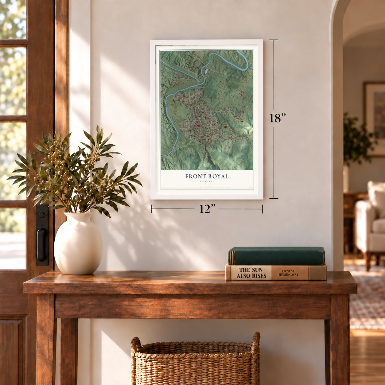
A new map of Front Royal, Virginia, made in 2026 and printed to order on thick archival matte paper.
12" x 18" Archival Matte Print
A Map of Home. A Work of Art.
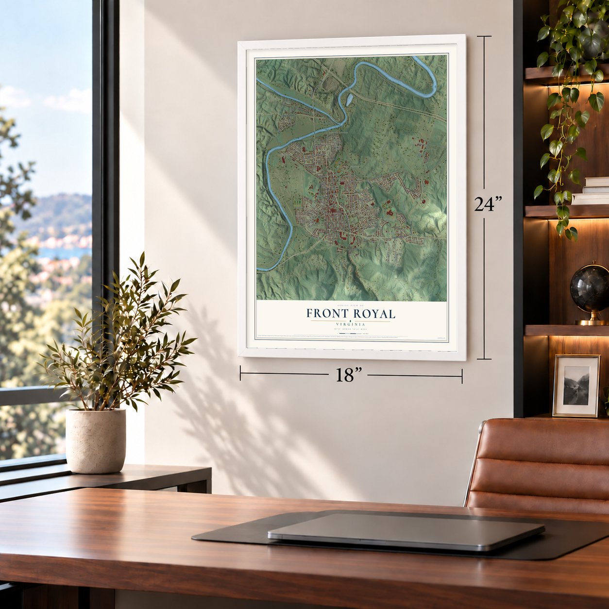
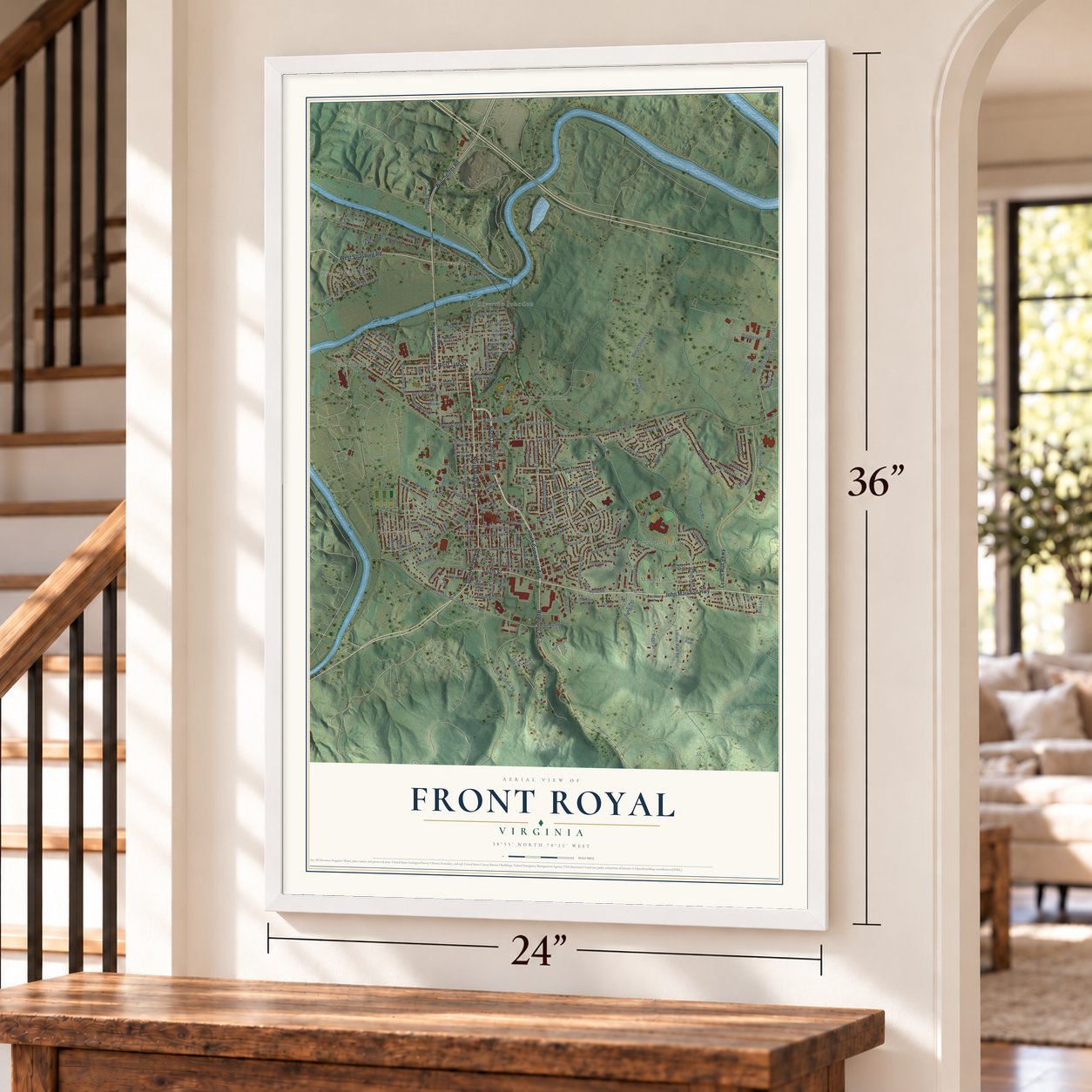
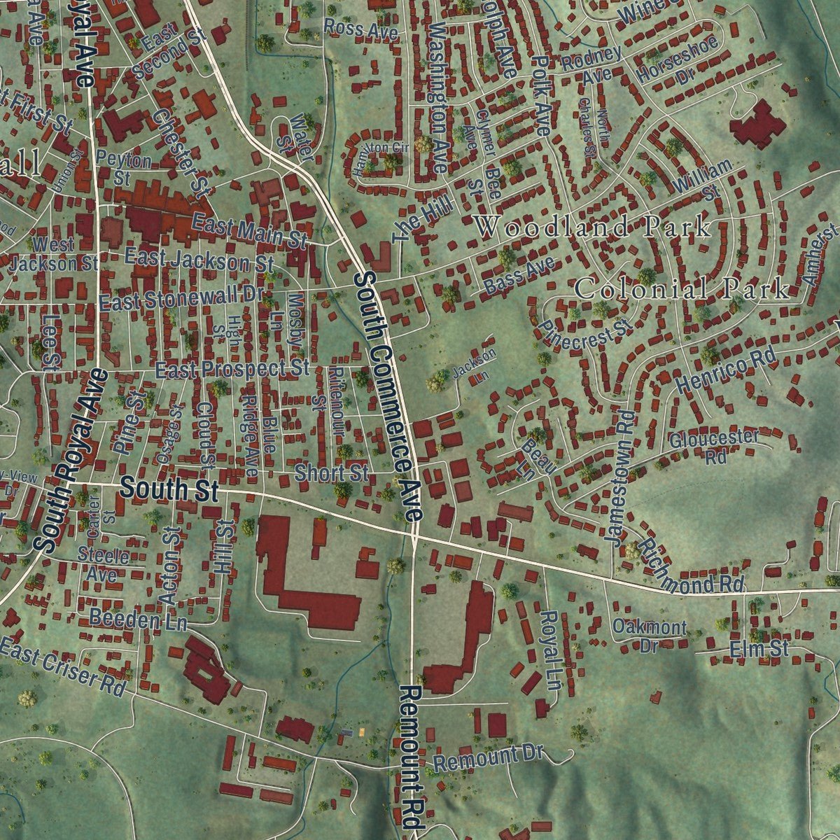
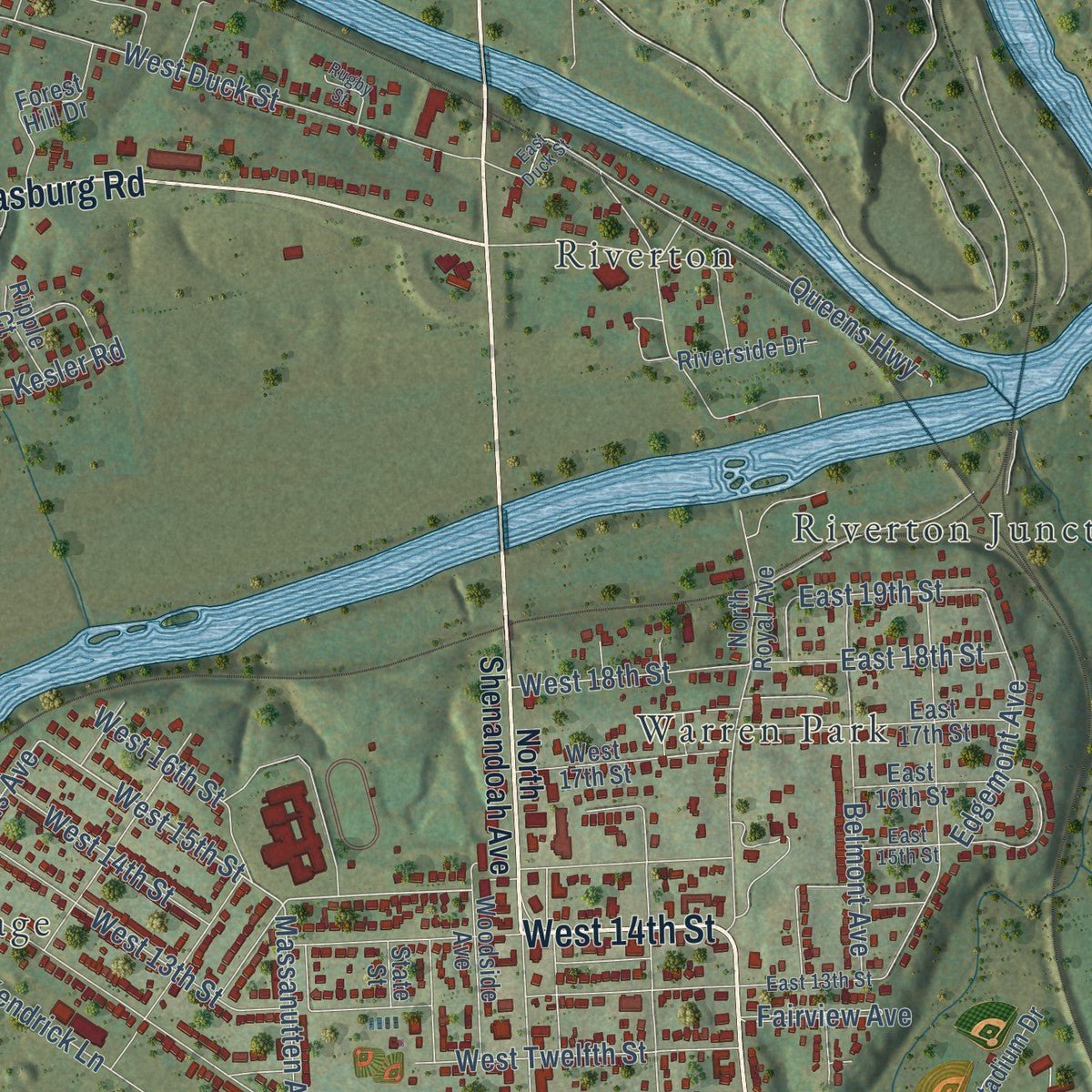
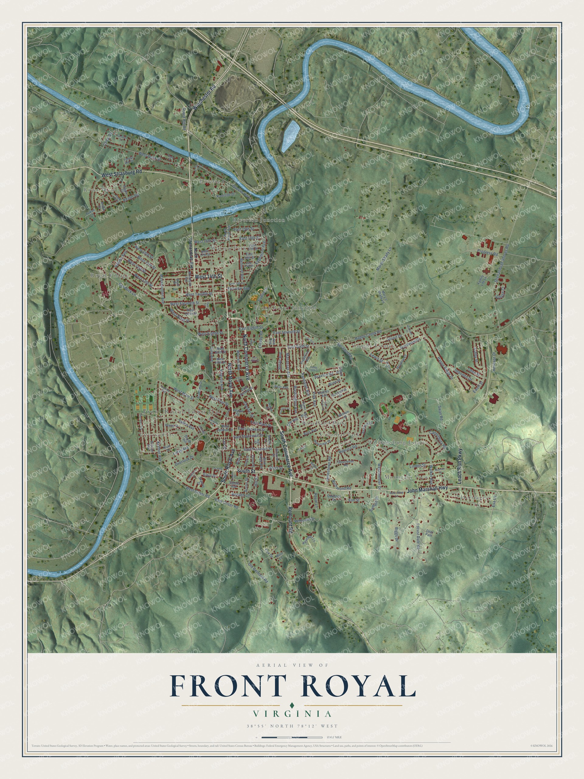
Explore Front Royal, Virginia from a whole new perspective. Created using aerial imagery and detailed geographic data, this map captures Front Royal building by building, with labeled streets, familiar landmarks, and shaded topographical relief that highlights the natural contours of the landscape.
Combining modern data with the timeless character of a vintage atlas, this map is just as interesting up close as it is beautiful on the wall. Whether you grew up in Front Royal, spent memorable years there, or call it home today, this unique map is a great way to celebrate a place that means something to you. Zoom in on the preview to look for your street, and then order a print to put your memories on the wall.
Three ways to hang it
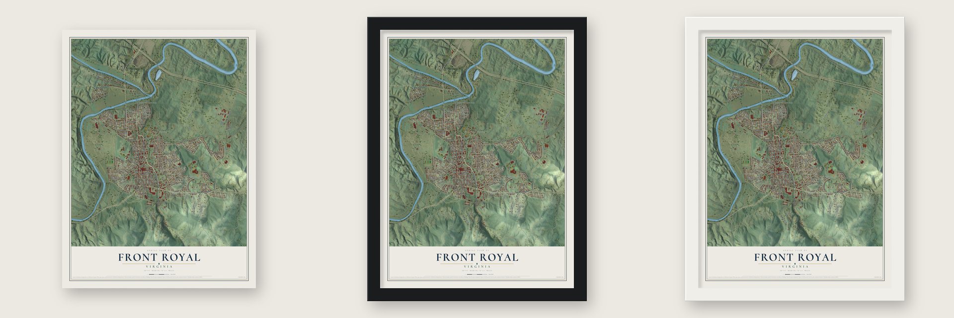
Unframed archival matte, a black wood frame or a white wood frame.
Up close
Geography Worth Displaying
This map was created using accurate cartographic data and authoritative geographic sources, including the U.S. Geological Survey and the Census Bureau. The map brings together terrain, waterways, roads, and building detail. The majority of the streets are labeled, houses are accurately depicted, and the topography is derived from government sources. Combining local data with carefully composed color and shading leads to this beautifully detailed Front Royal artwork for your wall.
Rather than simply showing street outlines, we’ve included as many of the street names as we could reasonably fit on the map while keeping their names legible. Zoom in on the high resolution preview to see exactly what’s on the map. We truly set out to create a statement piece for anyone who loves Front Royal. So whether it’s for you, or a gift for someone you love, we hope this map of Front Royal brings back fond memories.
Read the story behind this map of Front Royal, Virginia from 2026.
About Front Royal, Virginia
Front Royal is a town of 15,011 people and the county seat of Warren County. It sits at the spot where the Shenandoah River's North Fork and South Fork join. Chester's Ferry was running nearby by 1736, and the town itself was settled in 1754. It was incorporated in 1788 as Front-Royal. By the 1790s it had a rougher nickname, Helltown, because cattle drovers and river boatmen came through looking for a drink.
The railroad arrived in 1854, when the Alexandria, Orange and Manassas Gap line was built from Manassas to Riverton. It was soon extended to Strasburg, and the line figured in the fighting at Front Royal on May 23, 1862, and all through the Civil War. In the 1930s the American Viscose Corporation opened a rayon plant here that grew to 3,000 workers. It made rayon for tires in World War II and later for rocket nozzles. The plant closed in 1989 after more than 2,000 environmental violations in five years, and its main buildings came down in 1997.
- Bing Crosby's ballparkOn April 30, 1948, Bing Crosby sang on the courthouse steps to raise money for a new stadium, and he gave the first $1,000 to the fund. On April 1, 1950, he led a two-hour parade past 20,000 people to dedicate it. That night his film Riding High had its world premiere at the Park Theater, and his $3,595 check brought the day's take to $15,000.
- Front the Royal Oak!The best-known story says a huge oak, the Royal Tree of England, stood in the colonial square where Chester and Main Streets now meet. The militia drilled under it, and the sergeant's order to "front the Royal Oak" was shortened to Front Royal. A 1905 U.S. Geological Survey bulletin agreed, saying the town was first called Royal Oak. Another story credits a Revolutionary sentry's call of "Front" and the password "Royal."
- A library since 1799Samuels Public Library began in 1799 as the second subscription library in Virginia. It became the Front Royal Library Society in 1836. Bernard Samuels gave it a building in 1952, and the present library opened in 2009.
- Old houses and museumsThe Warren Heritage Society keeps museums in the Balthis House from about 1788, the Belle Boyd Cottage from about 1836 and Ivy Lodge from about 1859. The Balthis House is on the National Register, along with Killahevlin, Lackawanna, Riverside, Rose Hill, Sonner Hall, the Warren County Courthouse and the Front Royal Historic District.
Find your street
Names on the Front Royal map
Every name below is printed on this map. Look for your street, your school, the park where you played, or the pond down the road.
Places and landmarks14
- Front Royal Town Hall
- Colonial Park
- Front Royal Junction
- Heritage
- Mountain View
- River View
- Riverton
- Riverton Junction
- Royal Village
- Vaught Estates
- Viscose City
- Warren Park
Show all 14 places
- Williamsburg Estates
- Woodland Park
Streets and roads179
- South Commerce Avenue
- North Royal Avenue
- West 14th Street
- North Commerce Avenue
- John Marshall Highway
- South Royal Avenue
- West Strasburg Road
- Leach Run Parkway
- Remount Road
- South Street
- Winchester Road
- East Main Street
- Adams Avenue
- West 15th Street
- West Criser Road
- Kerfoot Avenue
- East Eighth Street
- Edgemont Avenue
- Happy Creek Road
- Virginia Avenue
- East Stonewall Drive
- Kendrick Lane
- West Eleventh Street
- Marys Shady Lane
- Westminster Drive
- Luray Avenue
- Swan Road
- Manassas Avenue
- West 13th Street
- East Sixth Street
Show all 179 streets
- Old Belmont Road
- Washington Avenue
- West Duck Street
- Shenandoah Shores Road
- Kesler Road
- Warren Avenue
- West Main Street
- Jamestown Road
- East Criser Road
- Locust Dale Road
- Braxton Road
- Biggs Drive
- Elm Street
- Salem Avenue
- Happy Ridge Drive
- Randolph Avenue
- Ewell Street
- Fox Drive
- East Seventh Street
- Walker Avenue
- Heritage Drive
- West Ninth Street
- Stuart Drive
- Queens Highway
- West Twelfth Street
- East Prospect Street
- Belmont Avenue
- Lewis Street
- Belair Avenue
- Villa Avenue
- Chester Street
- Overlook Drive
- Lee Street
- Richmond Road
- Henrico Road
- Massanutten Avenue
- West First Street
- Polk Avenue
- Progress Road
- Cedar Drive
- Fairview Avenue
- Short Street
- East Jackson Street
- Imboden Drive
- Linden Street
- East 18th Street
- Goodview Drive
- Canterbury Road
- East 19th Street
- Remount Drive
- West 18th Street
- West Eighth Street
- Ashby Street
- West 16th Street
- Wine Street
- Beeden Lane
- Sycamore Lane
- Acton Street
- Guard Hill Road
- Royal Lane
- Oden Street
- Summit Drive
- Hill Street
- Elsia Drive
- Pine Street
- Crosby Road
- The Hill
- Esa Lane
- Village Court
- North Shenandoah Avenue
- Mary's Shady Lane
- Academy Drive
- Aqueduct Lane
- Cloud Street
- Blue Ridge Avenue
- Stadium Drive
- Gloucester Road
- Rodney Avenue
- Horseshoe Drive
- East 17th Street
- Duncan Avenue
- Meadow Court
- William Street
- West 17th Street
- River Drive
- Water Street
- Forest Hill Drive
- Family Life Lane
- Pinecrest Street
- Fulton Lane
- Ross Avenue
- West Tenth Street
- Oakmont Drive
- Woodside Avenue
- East Second Street
- Bass Avenue
- Frederick Avenue
- Druid Hill
- Riverside Drive
- East 16th Street
- Ritenour Street
- Steele Avenue
- Leach Street
- Amherst Drive
- West Fifth Street
- West Sixth Street
- Peyton Street
- West Jackson Street
- Pence Street
- Skyway Drive
- Deer Path
- Bee Street
- Mills Lane
- Ripple Court
- Mosby Lane
- New Avenue
- Beau Lane
- Brook Court
- State Street
- Viscose Avenue
- High Street
- Clymer Avenue
- East 13th Street
- Osage Street
- East 15th Street
- Robinhood Lane
- Carter Street
- Cherrydale Avenue
- East Fifth Street
- South Fork Drive
- Markham Street
- Union Street
- Jackson Lane
- Hamilton Circle
- North Charles Street
- Happy Creek Court
- East Third Street
- Ay-View Drive
- Sherwood Avenue
- Oakridge Court
- Jocelyne Court
- Riverview Street
- Cresthaven Court
- Bradford Drive
- Kibler Street
- Wakeland Court
- Rugby Street
- East Duck Street
- Park Lane
Names are listed as they appear on the printed map. Zoom into the product photos to find them.
The art of mapping a place
How This Map Was Made
Real places. Remarkable detail. Discover the layers that turn geographic data into a map of home.

The view from above
Aerial imagery reveals the character of the land: woodland, open fields, and the patterns of a place.

The shape of the land
Elevation data brings hills, valleys, and subtle changes in the landscape into view.

The details of home
Roads, waterways, and building footprints come together to make the map feel unmistakably local.

Geography becomes art
Considered color, shading, and typography bring the layers together in a map made for your wall.


Process illustrated with Mendon, Massachusetts. Aerial imagery: USDA NAIP. Terrain: USGS 3D Elevation Program. Map details and finished artwork: KNOWOL.
The Details
About This Print
Choose an archival matte print, or a black or white Ayous wood frame. The archival matte print is unframed.
Select your size and finish above to see the matching product image and price.
Materials & Craftsmanship
A contemporary map with the character of a classic atlas, printed on archival matte paper. Optional frames are made from Ayous wood.
Your printed map does not include the watermark shown in the full-map preview.
Shipping & Delivery
Free shipping within the United States. Every print is made to order in the USA.
Buying a gift? Add a note in your cart and we'll include it. We never put prices in the package.
Prints ship within 2 to 3 business days. Allow 7 to 10 days total from ordering for delivery. Timing may vary during holidays or periods of high order volume.
Read our shipping policy.
Returns and damaged prints
Each print is made to order. Change-of-mind refunds are not available after production.
If your print arrives damaged, misprinted or incorrect, contact support@knowol.com within 30 days of receiving it. Include your order number, photos and a description of the issue.
Read our full refund and replacement policy. For questions about your order, email support@knowol.com.
Find your town
Looking for another city?
Find a map of home in our Virginia collection, or any town in the country.
Nearby
Maps of towns near Front Royal
Know someone from one of these towns? Their map makes a great gift.
 Shenandoah Shores
, Virginia
From $39.99See the map
 Apple Mountain Lake
, Virginia
From $39.99See the map
 Skyland Estates
, Virginia
From $39.99See the map
More maps nearby: Chester Gap, Shenandoah Farms, Middletown, Strasburg and Clary.