
Search for another town

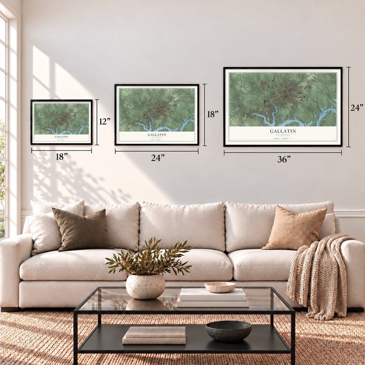
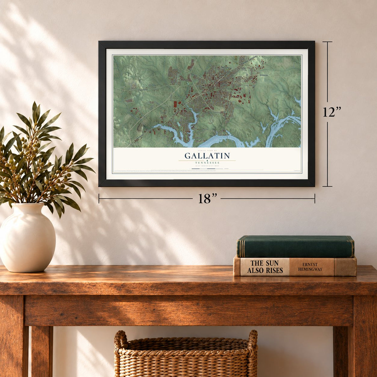
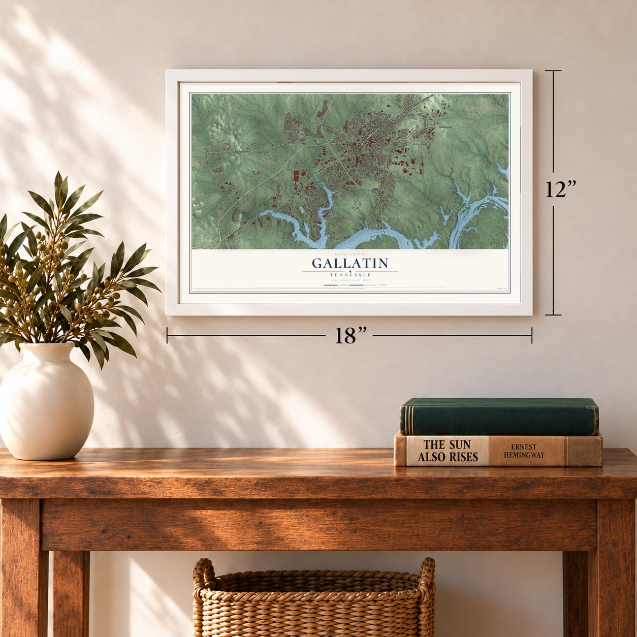
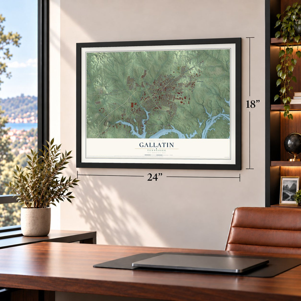


Free U.S. delivery 7 to 10 days after you order
Gallatin, Tennessee Map Art
A new map of Gallatin, Tennessee, made in 2026 and printed to order on thick archival matte paper.
12" x 18" Archival Matte Print
A Map of Home. A Work of Art.
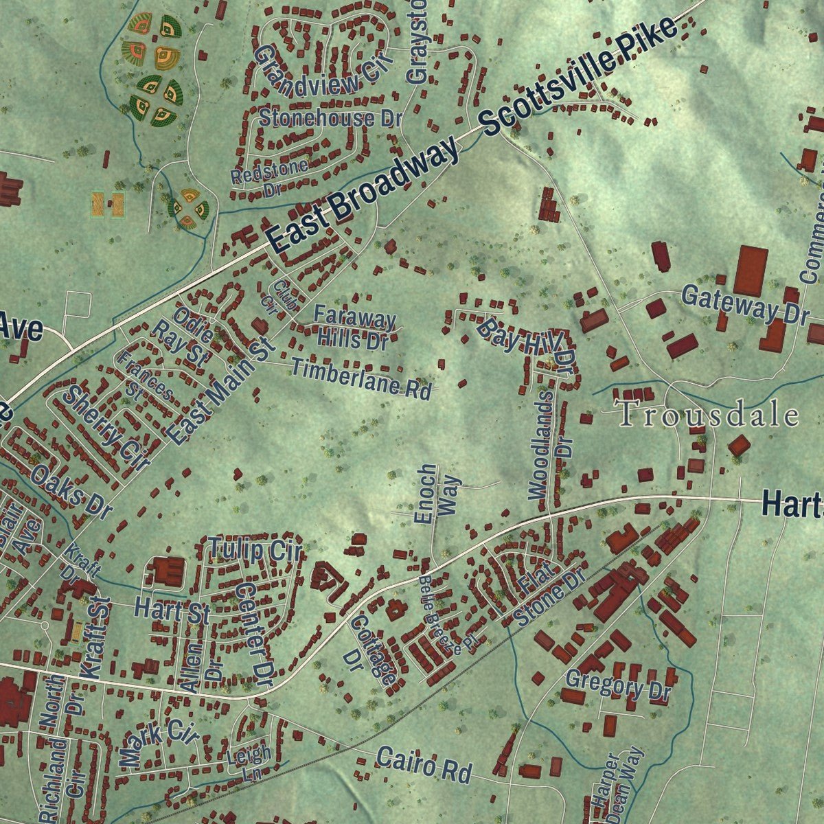
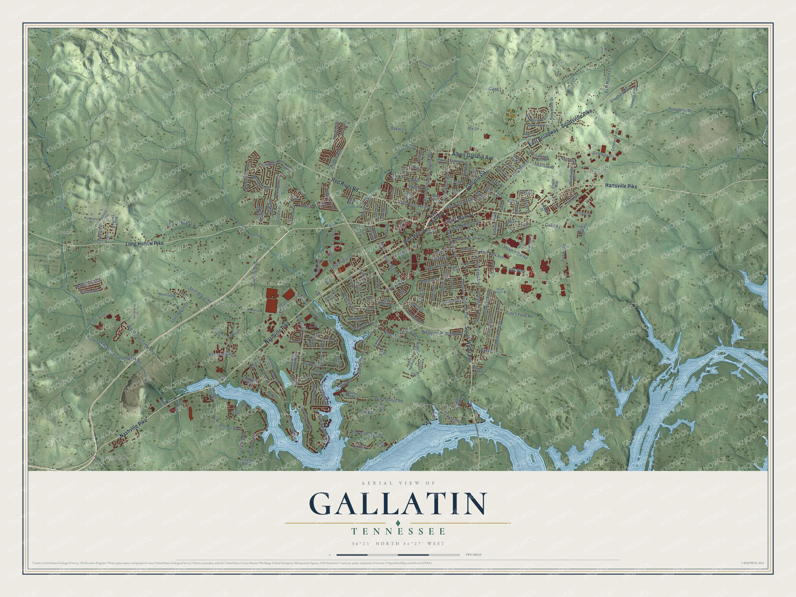
Explore Gallatin, Tennessee from a whole new perspective. Created using aerial imagery and detailed geographic data, this map captures Gallatin building by building, with labeled streets, familiar landmarks, and shaded topographical relief that highlights the natural contours of the landscape.
Combining modern data with the timeless character of a vintage atlas, this map is just as interesting up close as it is beautiful on the wall. Whether you grew up in Gallatin, spent memorable years there, or call it home today, this unique map is a great way to celebrate a place that means something to you. Zoom in on the preview to look for your street, and then order a print to put your memories on the wall.
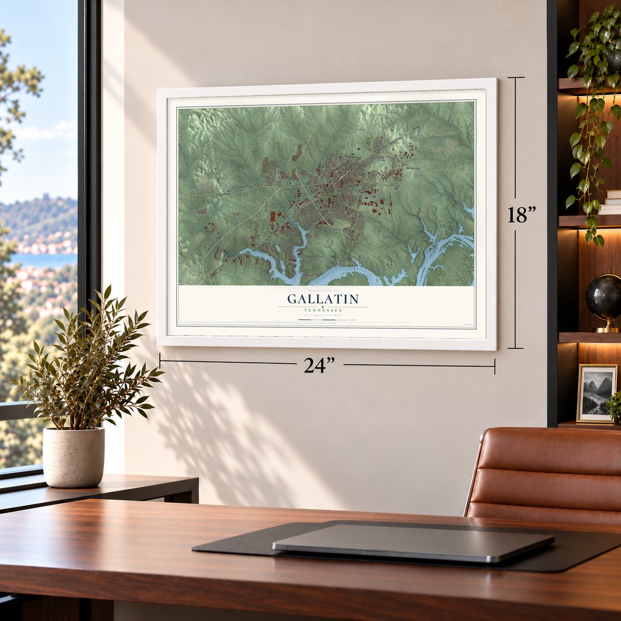
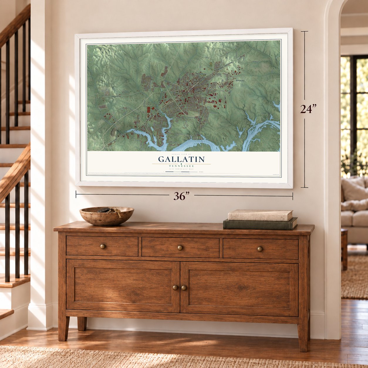
Three ways to hang it
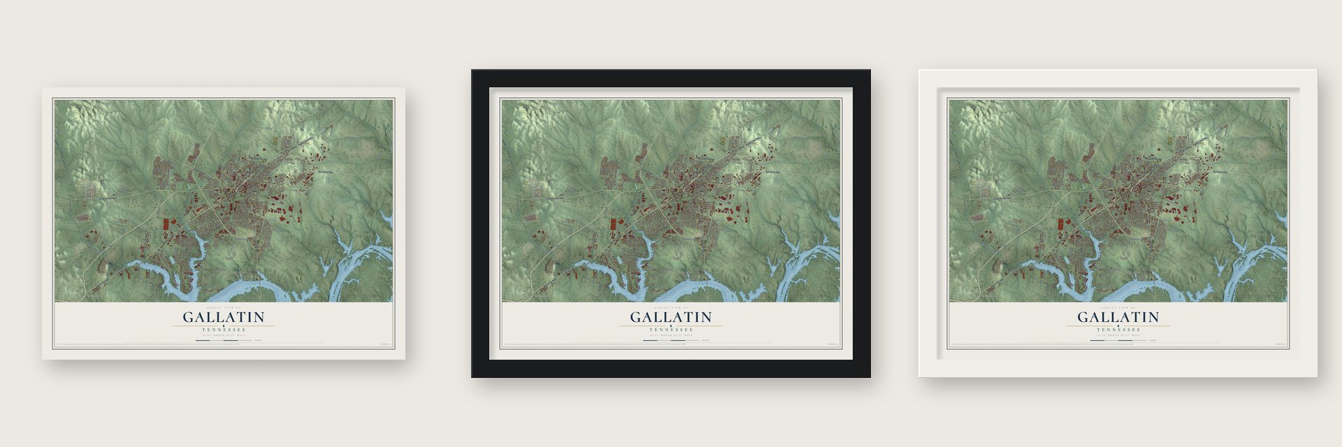
Unframed archival matte, a black wood frame or a white wood frame.
Up close
Geography Worth Displaying
This map was created using accurate cartographic data and authoritative geographic sources, including the U.S. Geological Survey and the Census Bureau. The map brings together terrain, waterways, roads, and building detail. The majority of the streets are labeled, houses are accurately depicted, and the topography is derived from government sources. Combining local data with carefully composed color and shading leads to this beautifully detailed Gallatin artwork for your wall.
Rather than simply showing street outlines, we’ve included as many of the street names as we could reasonably fit on the map while keeping their names legible. Zoom in on the high resolution preview to see exactly what’s on the map. We truly set out to create a statement piece for anyone who loves Gallatin. So whether it’s for you, or a gift for someone you love, we hope this map of Gallatin brings back fond memories.
Read the story behind this map of Gallatin, Tennessee from 2026.

About Gallatin, Tennessee
Gallatin is a city of 44,431 people and the county seat of Sumner County, on Station Camp Creek about 3 miles north of the Cumberland River. In 1780 Captain William Asher built Asher's Station, a fortified stockade on the creek that also served as a voting place under the Cumberland Compact. In 1802 the county made Gallatin its permanent seat, on 5 acres from Captain James Trousdale, and named it for Albert Gallatin, Treasury Secretary to Thomas Jefferson and James Madison. Lots were laid out around an open square in 1803, and Andrew Jackson bought one of the first and opened the town's first general store. Gallatin was incorporated in 1815.
When secession came, Gallatin's citizens opposed leaving the Union and hoped to stay neutral, but once war broke out nearly all of them backed the Confederacy. The railroad and the river made the town a prize. Union troops took it in February 1862, after Ulysses S. Grant captured Fort Donelson, and General John Hunt Morgan won it back that July and held it until October. In November Union General Eleazer A. Paine retook Gallatin, and Union soldiers stayed for the rest of the war. Paine had men accused of spying shot without a trial, some on the public square, as Alice Williamson, 16, wrote in her 1864 diary. He was removed from command before the war ended.
- Enlisting on the square, 1863Many enslaved people freed themselves by leaving farms and plantations for Union lines at Gallatin. The Army ran a contraband camp there with food, housing and work, and in 1864 it added schools for children and adults. On the public square in July 1863, about 200 of the men enlisted as United States Colored Troops, then went to Nashville to join the 13th Tennessee.
- The cholera summer of 1873Cholera reached Gallatin with its first case on May 29, 1873, and that patient died. In June alone 68 people in the small town lost their lives, many of them children, before the disease faded by August. Sumner County counted an estimated 120 deaths that year, and four-fifths of them were African Americans.
- Cheese, power and a collegeA Kraft Cheese plant opened in Gallatin in 1928 and gave dairy farmers across the county a ready buyer for their milk. After the Corps of Engineers built Old Hickory Dam on the Cumberland, TVA put up a steam electric generating plant at Gallatin. Volunteer State Community College opened here in 1969.
- The Palace, since 1908Gallatin's single-screen theater, The Palace, was built in 1908 and has been fully restored. Each year on the first Saturday in October, the Candlelight Cemetery Tour brings actors into the old cemetery near the square to play lawyers, doctors and merchants who lived in and around Gallatin, with proceeds going to the Sumner County Museum.
Find your street
Names on the Gallatin map
Every name below is printed on this map. Look for your street, your school, the park where you played, or the pond down the road.
Places and landmarks6
- Ocana
- Trousdale
- Avondale
- Cedar Grove
- Peytona
- Union Park
Streets and roads244
- Nashville Pike
- East Broadway
- Gallatin Pike
- Scottsville Pike
- East Main Street
- Hartsville Pike
- Red River Road
- South Water Avenue
- Long Hollow Pike
- Albert Gallatin Avenue
- Airport Road
- Old State Highway 109
- North Water Avenue
- West Eastland Avenue
- Greenlea Boulevard
- Noah Lane
- Blythe Avenue
- Hall Street
- Gibbs Lane
- Plantation Boulevard
- Bay Point Drive
- Saint Blaise Road
- Tulip Poplar Drive
- Peninsula Drive
- Gap Boulevard
- Bate Avenue
- Lock 4 Park Road
- Big Station Camp Boulevard
- Harris Lane
- Lower Station Camp Creek Road
Show all 244 streets
- Browns Lane
- Steam Plant Road
- Peach Valley Road
- Nichols Lane
- Gateway Drive
- Foxland Boulevard
- Cole's Ferry Road
- Lakeshore Drive
- Goodman Drive
- Remington Avenue
- East Park Avenue
- South Westland Avenue
- Chloe Drive
- Wentworth Drive
- North Blythe Avenue
- Cairo Road
- Boardwalk Place
- Ironwood Circle
- Maple Street
- Hancock Street
- Spencer Avenue
- Joslin Avenue
- Langwood Drive
- Wildcat Run
- Grandview Circle
- Roundtree Drive
- Bison Trail
- Neals Lane
- East Bledsoe Street
- Woodlake Drive
- Drivers Lane
- Graystone Drive
- Plantation Way
- East Eastland Street
- Blue Jay Way
- Harris Drive
- Rozella Way
- Vinings Boulevard
- East Martin Lane
- Saint Blaise Court
- Carellton Drive
- Fannis Circle
- Green Wave Drive
- Tulip Circle
- Timberwood Drive
- Sherry Circle
- Brights Lane
- Pace Street
- Westgate Drive
- Pittman Drive
- Kennesaw Boulevard
- Fredericksburg Drive
- Meadowview Drive
- Bales Street
- Bradford Drive
- Huntington Drive
- West Hite Street
- Trail Drive
- Shagbark Way
- Hix Lane
- Ryan Avenue
- Long Street
- Beacon Street
- Kathy Circle
- Notting Hill Drive
- Hart Street
- Calvert Drive
- Potter Lane
- Savannah Avenue
- Baker Lane
- Morrison Street
- Bell Road
- Kenny Street
- Rodney Street
- Aqua Drive
- Mimosa Drive
- Oaks Drive
- Center Drive
- Kraft Street
- ABC Boulevard
- Ann Avenue
- Quarry Road
- Craig Street
- Small Street
- Bay Hill Drive
- Stanley Drive
- Mark Circle
- Dirt Road
- Derby Drive
- West Broadway
- West Main Street
- Nichols Circle
- Woods Ferry Road
- Buckingham Boulevard
- Belvedere Drive North
- Commerce Way
- Albatross Way
- Douglas Bend Road
- Inneswood Drive
- Jacobs Drive
- Osprey Drive
- Richland Circle
- Anthony Street
- Black Thorn Lane
- Putter Point Drive
- Turnbo Drive
- Stonehouse Drive
- Walnut Crest Drive
- Timberlane Road
- Tupper Drive
- Stratford Park Boulevard
- Albion Circle
- Woodmont Drive
- Montrose Drive
- Jones Street
- Connie Drive
- Woodlands Drive
- Kelvington Boulevard
- Cape Circle
- Factory Street
- East Morris Drive
- Kirkpatrick Drive
- Grassland Chase Boulevard
- Trousdale Avenue
- West Gray Street
- Davis Drive
- Faraway Hills Drive
- Eastover Street
- Dickerson Bay Drive
- Marina Pvt Drive
- Gregory Drive
- Morton Avenue
- Joann Street
- Enoch Way
- Blade Street
- Flat Stone Drive
- Hull Circle
- Odie Ray Street
- South Electra Street
- Elleta Avenue
- Allen Drive
- Lock 4 Road
- Cottage Drive
- Ross Avenue
- Herron Drive
- Wayne Street
- Trey Lane
- Hill Court
- Pilot Vw
- North Drive
- Blair Avenue
- Brian Drive
- Lake Street
- East Nichols Circle
- Leigh Lane
- Smoky Mountains Drive
- Westbrook Drive
- Chesire Way
- Rendale Circle
- South Airport Drive
- Redstone Drive
- National Drive
- Computer Lane
- Northridge Drive
- Blackshear Drive
- Harper Dean Way
- Frances Street
- Katherine Street
- Enterprise Drive
- Fairington Pvt Way
- Hackney Lane
- Liberty Lane
- Gray Bill Drive
- Ferdinand Drive
- Robbie Lane
- Sumner Hall Drive
- Paradise Street
- Winslow Court
- Nelms Drive
- Arlington Pk
- Deer Path
- Morris Drive
- Kraft Drive
- Neals Court
- Giles Lane
- Lake Drive
- West Smith Street
- West Nichols Circle
- Belvedere Drive
- Rodman Boulevard
- Woodvale Drive
- Cottage Grove Circle
- Rappahannock Wire Road
- Hatten Track Road
- Springdale Lane
- Club Circle
- Branch Creek Road
- Belle Breeze Place
- Lake Point Drive
- North Blue Jay Way
- Fortrose Drive
- Aristidies Alley
- Martha Avenue
- Longboat Drive
- Church Street
- Calgy Drive
- Shute Lane
- Appaloosa Way
- Albright Farms Drive
- Cages Bend Road
- Henley Lane
- Teal Drive
- Thorne Boulevard
- Yale Drive
Names are listed as they appear on the printed map. Zoom into the product photos to find them.
The art of mapping a place
How This Map Was Made
Real places. Remarkable detail. Discover the layers that turn geographic data into a map of home.

The view from above
Aerial imagery reveals the character of the land: woodland, open fields, and the patterns of a place.

The shape of the land
Elevation data brings hills, valleys, and subtle changes in the landscape into view.

The details of home
Roads, waterways, and building footprints come together to make the map feel unmistakably local.

Geography becomes art
Considered color, shading, and typography bring the layers together in a map made for your wall.


Process illustrated with Mendon, Massachusetts. Aerial imagery: USDA NAIP. Terrain: USGS 3D Elevation Program. Map details and finished artwork: KNOWOL.
The Details
About This Print
Choose an archival matte print, or a black or white Ayous wood frame. The archival matte print is unframed.
Select your size and finish above to see the matching product image and price.
Materials & Craftsmanship
A contemporary map with the character of a classic atlas, printed on archival matte paper. Optional frames are made from Ayous wood.
Your printed map does not include the watermark shown in the full-map preview.
Shipping & Delivery
Free shipping within the United States. Every print is made to order in the USA.
Buying a gift? Add a note in your cart and we'll include it. We never put prices in the package.
Prints ship within 2 to 3 business days. Allow 7 to 10 days total from ordering for delivery. Timing may vary during holidays or periods of high order volume.
Read our shipping policy.
Returns and damaged prints
Each print is made to order. Change-of-mind refunds are not available after production.
If your print arrives damaged, misprinted or incorrect, contact support@knowol.com within 30 days of receiving it. Include your order number, photos and a description of the issue.
Read our full refund and replacement policy. For questions about your order, email support@knowol.com.
Find your town
Looking for another city?
Find a map of home in our Tennessee collection, or any town in the country.
Nearby
Maps of towns near Gallatin
Know someone from one of these towns? Their map makes a great gift.
 Cottontown
, Tennessee
From $39.99See the map
 Graball
, Tennessee
From $39.99See the map
 Shackle Island
, Tennessee
From $39.99See the map
More maps nearby: Castalian Springs, Hendersonville, New Deal, Walnut Grove and Bethpage.