
Search for another town





Free U.S. delivery 7 to 10 days after you order
Gillette, Wyoming Map Art
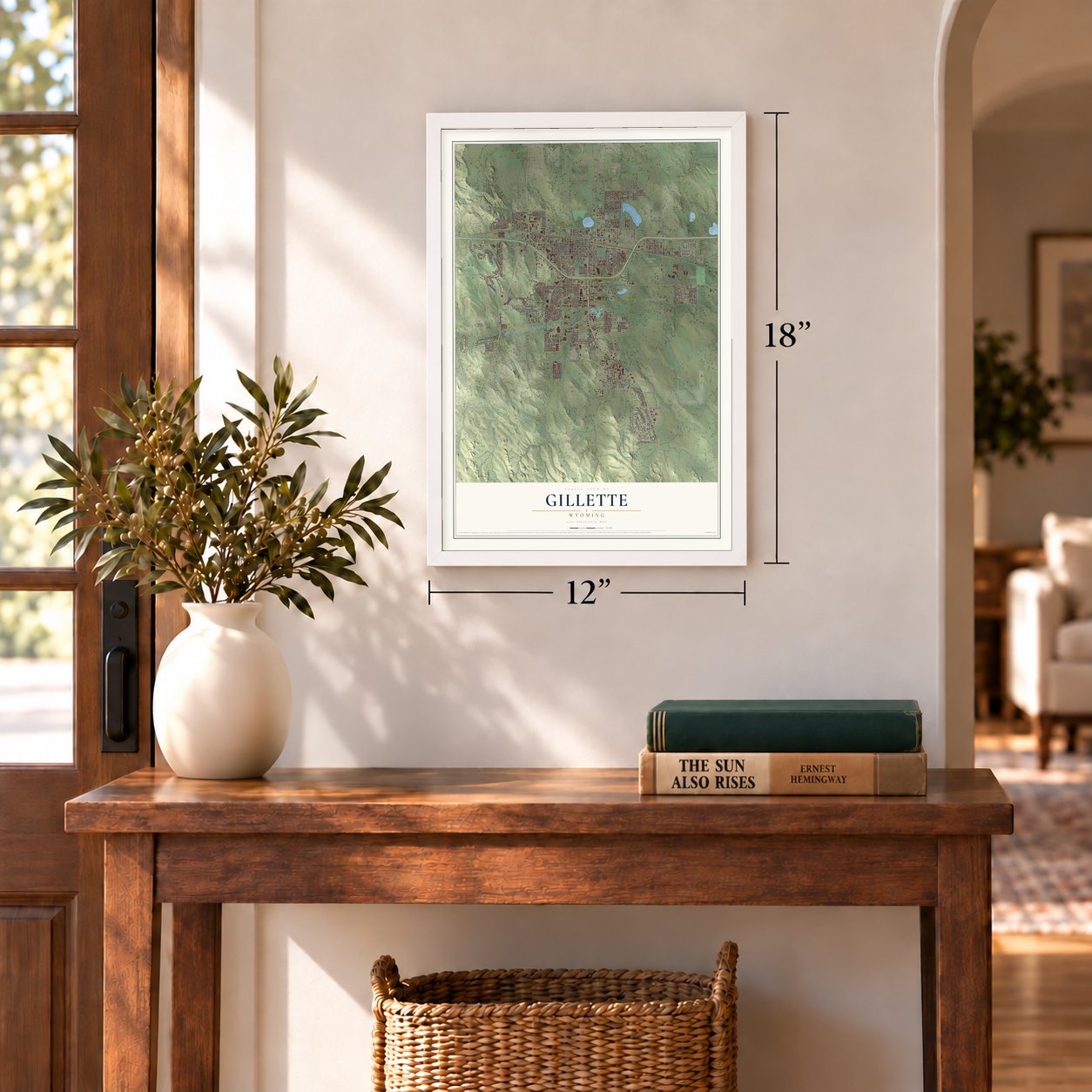
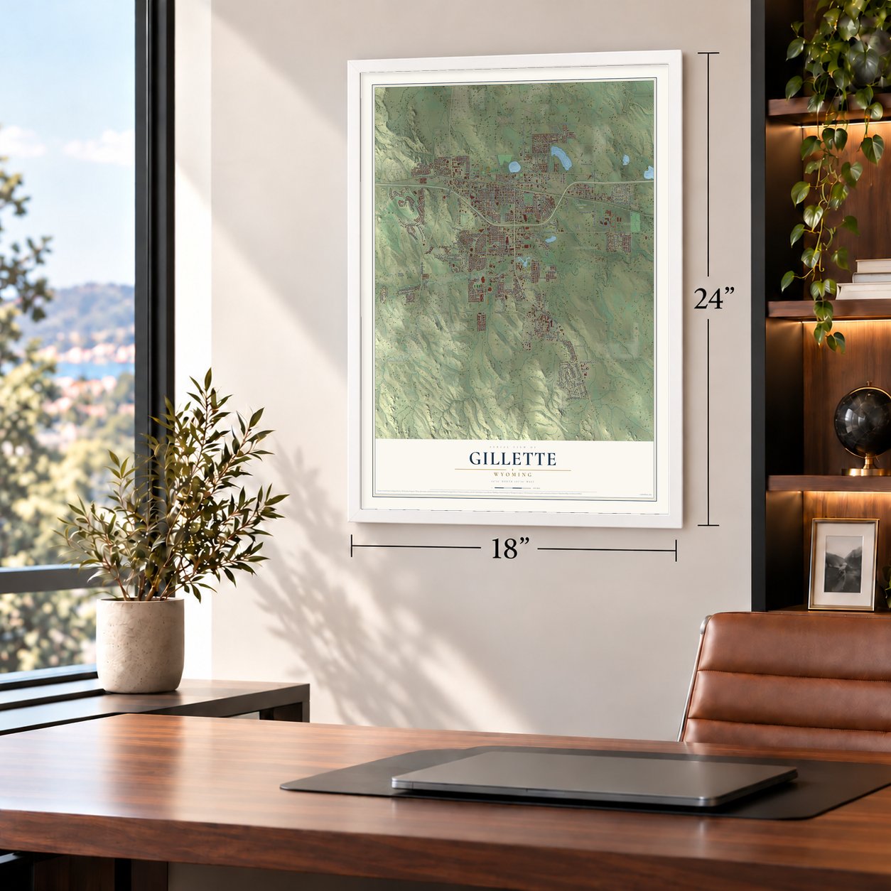
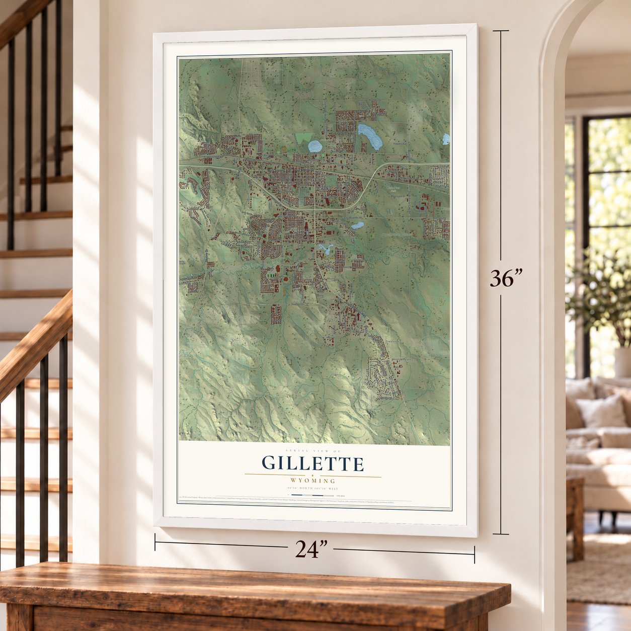
A new map of Gillette, Wyoming, made in 2026 and printed to order on thick archival matte paper.
12" x 18" Archival Matte Print
A Map of Home. A Work of Art.
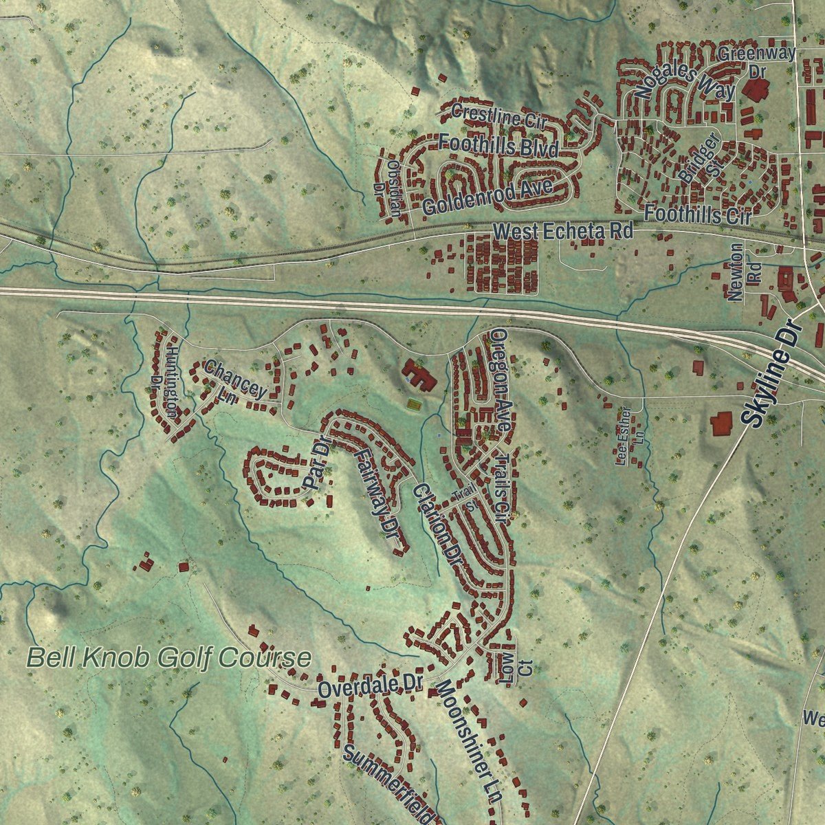
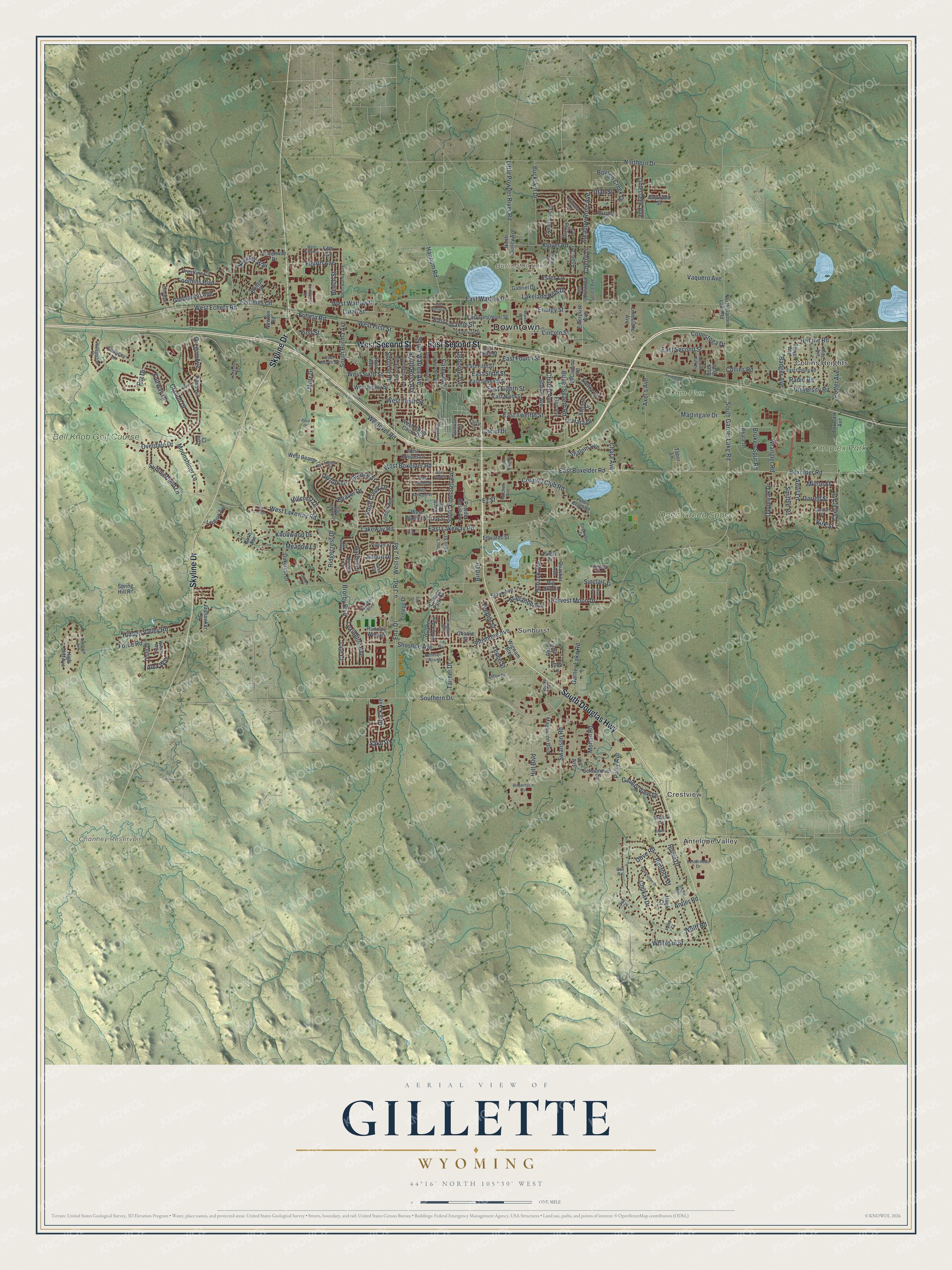
Explore Gillette, Wyoming from a whole new perspective. Created using aerial imagery and detailed geographic data, this map captures Gillette building by building, with labeled streets, familiar landmarks, and shaded topographical relief that highlights the natural contours of the landscape.
Combining modern data with the timeless character of a vintage atlas, this map is just as interesting up close as it is beautiful on the wall. Whether you grew up in Gillette, spent memorable years there, or call it home today, this unique map is a great way to celebrate a place that means something to you. Zoom in on the preview to look for your street, and then order a print to put your memories on the wall.
Three ways to hang it
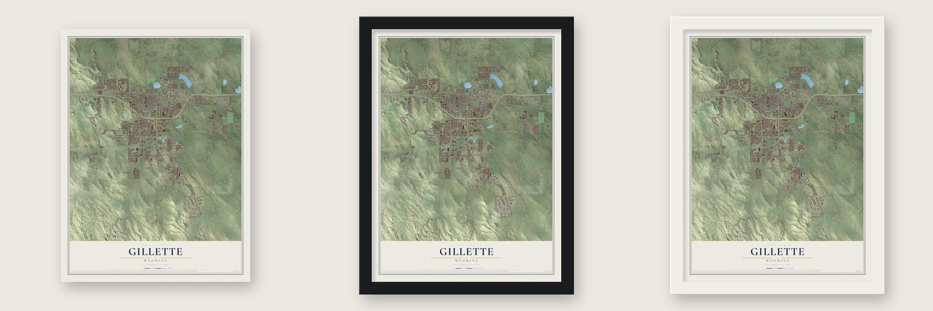
Unframed archival matte, a black wood frame or a white wood frame.
Up close
Geography Worth Displaying
This map was created using accurate cartographic data and authoritative geographic sources, including the U.S. Geological Survey and the Census Bureau. The map brings together terrain, waterways, roads, and building detail. The majority of the streets are labeled, houses are accurately depicted, and the topography is derived from government sources. Combining local data with carefully composed color and shading leads to this beautifully detailed Gillette artwork for your wall.
Rather than simply showing street outlines, we’ve included as many of the street names as we could reasonably fit on the map while keeping their names legible. Zoom in on the high resolution preview to see exactly what’s on the map. We truly set out to create a statement piece for anyone who loves Gillette. So whether it’s for you, or a gift for someone you love, we hope this map of Gillette brings back fond memories.
Read the story behind this map of Gillette, Wyoming from 2026.

About Gillette, Wyoming
Gillette is a city of 33,403 people and the county seat of Campbell County, in the Powder River Basin between the Bighorn Mountains and the Black Hills. The settlement began as Donkey Town, named for Donkey Creek, then moved and became Rocky Pile, after Rocky Draw. When the Chicago, Burlington & Quincy Railroad arrived in 1891, the company renamed its end-of-track town for Edward Gillette, one of its surveyors.
Gillette was incorporated on January 6, 1892. For about a year it sat at the end of the line, and the railroad commissary brought a small boom, but the boom faded once the tracks reached Sheridan in November 1892. Then, in November 1895, a fire burned most of the town, and only two saloons, two stores and a restaurant were left standing. New settlers kept arriving in the decade after the fire, and the town grew around their churches.
- Four churches, four homelandsBetween 1895 and 1905, families from Mathews County and Gloucester County, Virginia, moved to Gillette. All of them were Episcopalians, and the congregation they started still meets. In the same years, Presbyterians of Scottish descent came from County Antrim, Ireland, along with Lutheran settlers from Norway and a small group of Congregationalists from rural New England.
- The Gillette syndromeGrowth in the energy industry doubled Gillette's population during the 1960s, from 3,580 to 7,194. In 1974 the psychologist ElDean Kohrs made the town his main example of what he called the Gillette syndrome. He argued that growing that fast brought more crime, higher living costs and weaker ties between neighbors. Critics later pointed out that other fast-growing places saw the same changes for different reasons.
- Energy Capital of the NationGillette sits at the center of a region that produces huge amounts of coal, oil and coalbed methane gas. Wyoming supplies nearly 35% of the country's coal, so the city adopted the title Energy Capital of the Nation.
- Home of a national rodeoCrews broke ground on the Wyoming Center at the CAM-PLEX, just outside town, in 2006 and finished it in 2008. The 9,000-seat arena has walls that move to split it into separate halls, and it hosts the National High School Finals Rodeo.
Find your street
Names on the Gillette map
Every name below is printed on this map. Look for your street, your school, the park where you played, or the pond down the road.
Places and landmarks11
- Downtown
- Collins Heights
- Antelope Valley
- Crestview
- Sunburst
- Burlington Lake
- Channey Reservoir
- Camplex Park
- Bell Knob Golf Course
- Open Green Space
- Cam-Plex Park
Streets and roads265
- South Douglas Highway
- Skyline Drive
- West Second Street
- East Second Street
- East Boxelder Road
- West Boxelder Road
- South Garner Lake Road
- Swanson Road
- Country Club Road
- Lakeway Road
- Cheryl Avenue
- Kirk Street
- East Warlow Drive
- Sinclair Street
- East Laramie Street
- Butler Spaeth Road
- West Lakeway Road
- West Warlow Drive
- Lincoln Street
- Carey Avenue
- West Tenth Street
- South Burma Avenue
- East Fourth Street
- Badger Avenue
- Westover Road
- 4-J Road
- West 4-J Road
- Southern Drive
- Garner Lake Road
- Overdale Drive
Show all 265 streets
- West Echeta Road
- Echeta Road
- Shoshone Avenue
- Boxelder Road
- Foothills Boulevard
- Wolff Road
- Tanner Drive
- Force Road
- Robin Drive
- East Sixth Street
- East Lakeway Road
- Knollwood Drive
- Hidden Valley Road
- Northern Drive
- South Emerson Avenue
- Meadow Lane
- East Eighth Street
- Kluver Road
- Foothills Circle
- Wrangler Road
- Martingale Drive
- Clarion Drive
- West First Street
- West Sixth Street
- Beaver Drive
- Brorby Boulevard
- Buckskin Drive
- Little Powder River Road
- East Twelfth Street
- Sierra Circle
- Rimrock Drive
- Mohan Road
- Arapahoe Avenue
- Metz Drive
- Antler Road
- Energy Street
- Potter Avenue
- Teepee Street
- Tepee Street
- Conestoga Drive
- South Ross Avenue
- Whitetail Street
- Lakeland Hills Drive
- Fairway Drive
- Estes Lane
- South Warren Avenue
- Enzi Drive
- Ridgecrest Drive
- Hillcrest Drive
- Dove Road
- Summerfield Lane
- Church Avenue
- Goldenrod Avenue
- Lexington Avenue
- Sako Drive
- Boysen Creek Drive
- Fourth Avenue
- Hi-Line Road
- Collins Road
- Shoshoe Avenue
- University Road
- Moonshiner Lane
- Limecreek Avenue
- Meadow Rose Avenue
- Hannum Road
- Glock Avenue
- Harvest Moon Drive
- Rose Creek Drive
- Gallery View Drive
- Oregon Avenue
- Patty Avenue
- Nogales Way
- Larch Street
- Daybreak Drive
- Osborne Avenue
- Chukar Drive
- Granite Street
- Almon Drive
- Shalom Avenue
- Broken Spur Road
- Beech Street
- Harder Drive
- Smithie Road
- Anvil Lane
- Axel's Avenue
- Par Drive
- Hitt Boulevard
- Vaquero Avenue
- Radio Road
- Alex Way
- Hoback Avenue
- Chara Avenue
- Darrell Street
- Dryfork Drive
- Camel Drive
- Milton Street
- Ez Street
- Cherry Lane
- O' Hara Drive
- Tate Court
- Utah Street
- First Street
- Bird Drive
- High Cliff Avenue
- Lobo Lane
- North Gurley Avenue
- East Seventh Street
- East Fifth Street
- East Ninth Street
- East Third Street
- Oakcrest Drive
- Fox Park Avenue
- Sioux Avenue
- Wigwam Boulevard
- Running West Drive
- East Longmont Street
- West Eighth Street
- Stanley Avenue
- North Garner Lake Road
- Pathfinder Circle
- American Lane
- Reata Drive
- Greenway Drive
- Elon Avenue
- Crestline Circle
- Quarter Horse Avenue
- Powder Basin Avenue
- Enterprise Avenue
- West Beaver Drive
- Lodahl Avenue
- Stetson Drive
- Magnuson Boulevard
- College Park Circle
- Limestone Avenue
- Fifth Avenue
- Orchid Lane
- Schoonover Street
- West Juniper Lane
- West Flying Circle Drive
- West Walnut Street
- Pintail Drive
- Ledoux Avenue
- Jayhawker Street
- Tower Avenue
- College Drive
- Arizona Street
- Spring Hill Road
- Vivian Street
- Trails Circle
- Aspen Lane
- Chancey Lane
- Edwards Street
- Gabriel Drive
- Alison Avenue
- Quacker Avenue
- Bridger Street
- El Camino Road
- Baywood Street
- Fern Street
- Kinner Drive
- Doud Drive
- Hunt Avenue
- Big Sky Street
- Birch Avenue
- Lee Avenue
- Newton Road
- Sunrise Lane
- Tabor Lane
- Charlie Street
- Bush Avenue
- Buck Trail
- Hawk Court
- Low Court
- Circle Drive
- Pebble Beach Road
- Cocklebur Drive
- Rourke Avenue
- West Fourth Street
- Robertson Circle
- North Burma Avenue
- Primrose Drive
- Mills Avenue
- Rockpile Boulevard
- Gordon Street
- East Collins Road
- Saunders Boulevard
- Spruce Avenue
- Huntington Drive
- Poplar Lane
- Wilson Way
- Augusta Circle
- Almon Circle
- Letourneau Drive
- Elder Street
- Teak Street
- Longhorn Avenue
- Sage Valley Drive
- West Laurel Street
- Tipton Drive
- Mitchell Avenue
- Sassick Street
- Obsidian Drive
- Davis Street
- Fawn Court
- Doe Court
- Owl Road
- South Gillette Avenue
- South Richards Avenue
- Doubletree Lane
- South Kendrick Avenue
- East Lincoln Street
- Commercial Drive
- West Fifth Avenue
- Roadrunner Drive
- East Sunset Drive
- Big Lost Drive
- Melissa Drive
- Kettleson Crossing
- Lee-Esther Lane
- Industrial Park Drive
- Works Avenue
- West Redwood Street
- Rapid Street
- Shipwheel Lane
- East Tonk Street
- Grouse Avenue
- Blue Avenue
- Crestfield Avenue
- Villa Way
- Trail Street
- Little Davis Drive
- Cameo Court
- Poco Drive
- Tech Drive
- Ash Street
Names are listed as they appear on the printed map. Zoom into the product photos to find them.
The art of mapping a place
How This Map Was Made
Real places. Remarkable detail. Discover the layers that turn geographic data into a map of home.

The view from above
Aerial imagery reveals the character of the land: woodland, open fields, and the patterns of a place.

The shape of the land
Elevation data brings hills, valleys, and subtle changes in the landscape into view.

The details of home
Roads, waterways, and building footprints come together to make the map feel unmistakably local.

Geography becomes art
Considered color, shading, and typography bring the layers together in a map made for your wall.


Process illustrated with Mendon, Massachusetts. Aerial imagery: USDA NAIP. Terrain: USGS 3D Elevation Program. Map details and finished artwork: KNOWOL.
The Details
About This Print
Choose an archival matte print, or a black or white Ayous wood frame. The archival matte print is unframed.
Select your size and finish above to see the matching product image and price.
Materials & Craftsmanship
A contemporary map with the character of a classic atlas, printed on archival matte paper. Optional frames are made from Ayous wood.
Your printed map does not include the watermark shown in the full-map preview.
Shipping & Delivery
Free shipping within the United States. Every print is made to order in the USA.
Buying a gift? Add a note in your cart and we'll include it. We never put prices in the package.
Prints ship within 2 to 3 business days. Allow 7 to 10 days total from ordering for delivery. Timing may vary during holidays or periods of high order volume.
Read our shipping policy.
Returns and damaged prints
Each print is made to order. Change-of-mind refunds are not available after production.
If your print arrives damaged, misprinted or incorrect, contact support@knowol.com within 30 days of receiving it. Include your order number, photos and a description of the issue.
Read our full refund and replacement policy. For questions about your order, email support@knowol.com.
Find your town
Looking for another city?
Find a map of home in our Wyoming collection, or any town in the country.
Nearby
Maps of towns near Gillette
Know someone from one of these towns? Their map makes a great gift.
 Sleepy Hollow
, Wyoming
From $39.99See the map
 Moorcroft
, Wyoming
From $39.99See the map
 Pine Haven
, Wyoming
From $39.99See the map
More maps nearby: Wright, Arvada, Upton, Clearmont and Hulett.