Search for another town





Free U.S. delivery 7 to 10 days after you order
Glens Falls, New York Map Art
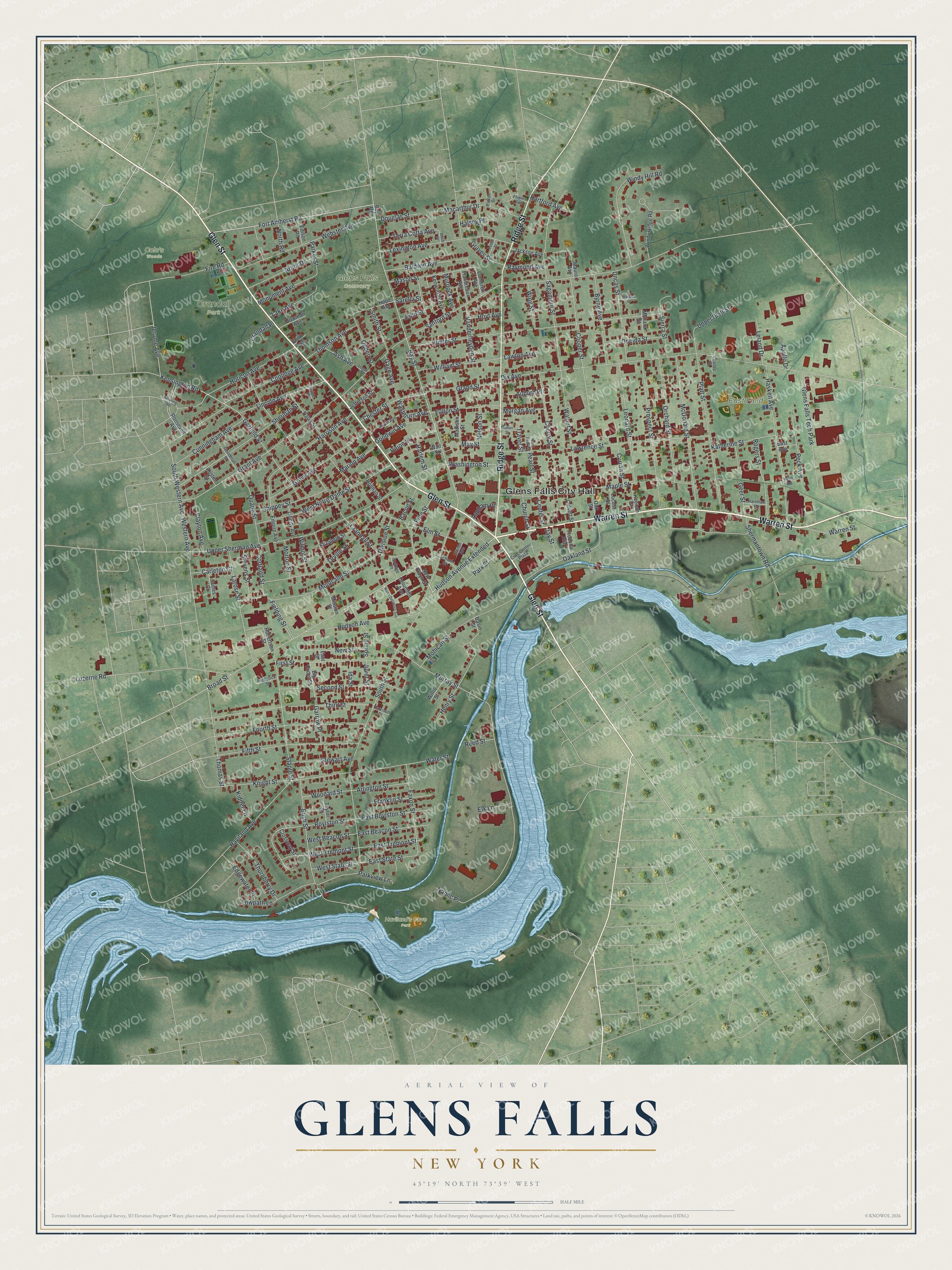
A new map of Glens Falls, New York, made in 2026 and printed to order on thick archival matte paper.
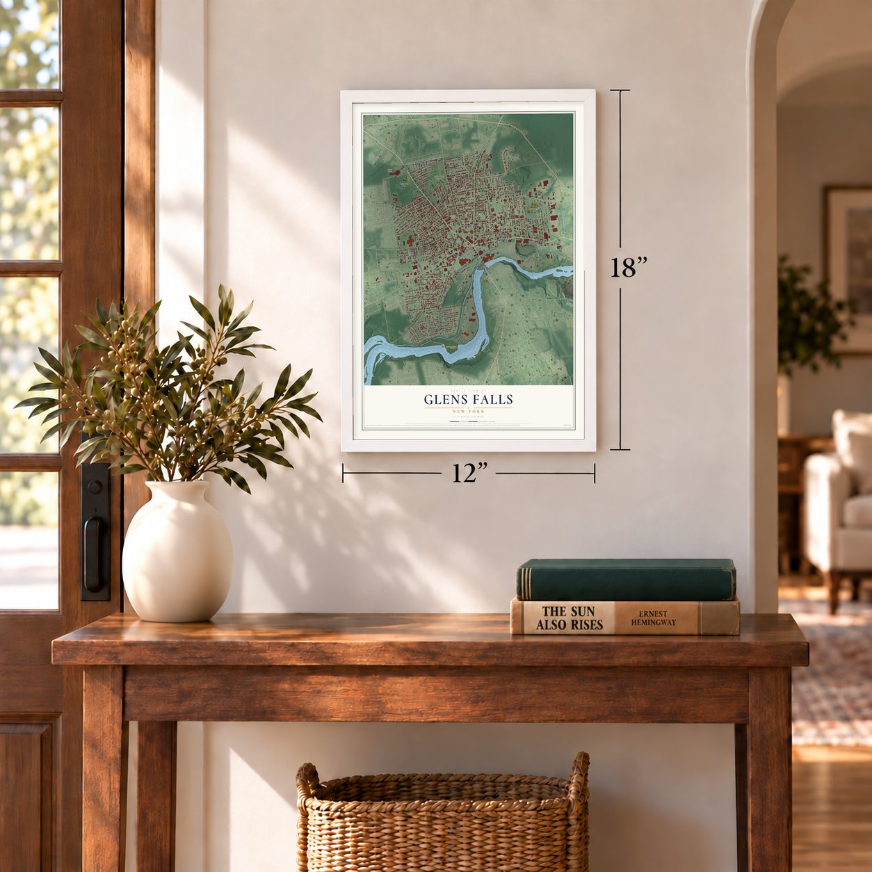
12" x 18" Archival Matte Print
A Map of Home. A Work of Art.
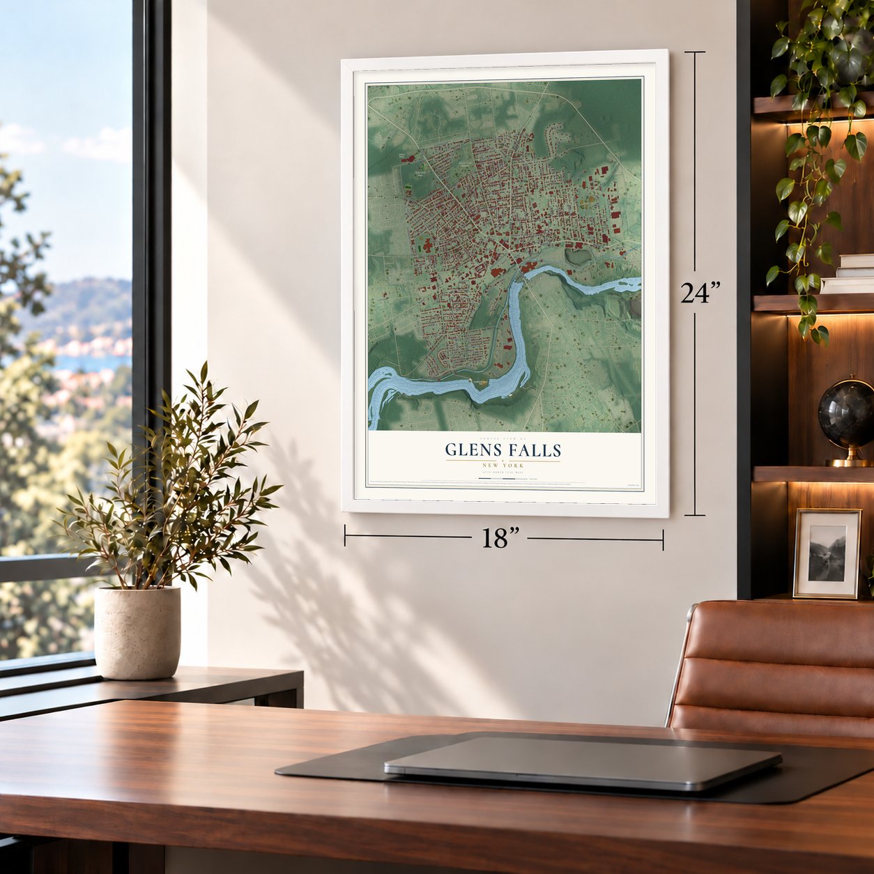
Bring a piece of Glens Falls home. Whether it’s where you grew up, your current home, or simply a moment in your life, this Glens Falls, New York map print brings those memories to your wall. Antique-inspired styling and modern geographic detail combine to create artwork that’s beautiful from across the room, with plenty to study and explore when you get up close.
Three ways to hang it
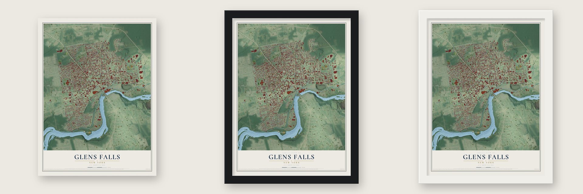
Unframed archival matte, a black wood frame or a white wood frame.
Up close
Real geography. Art worth displaying.
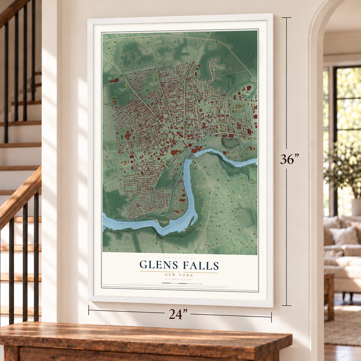
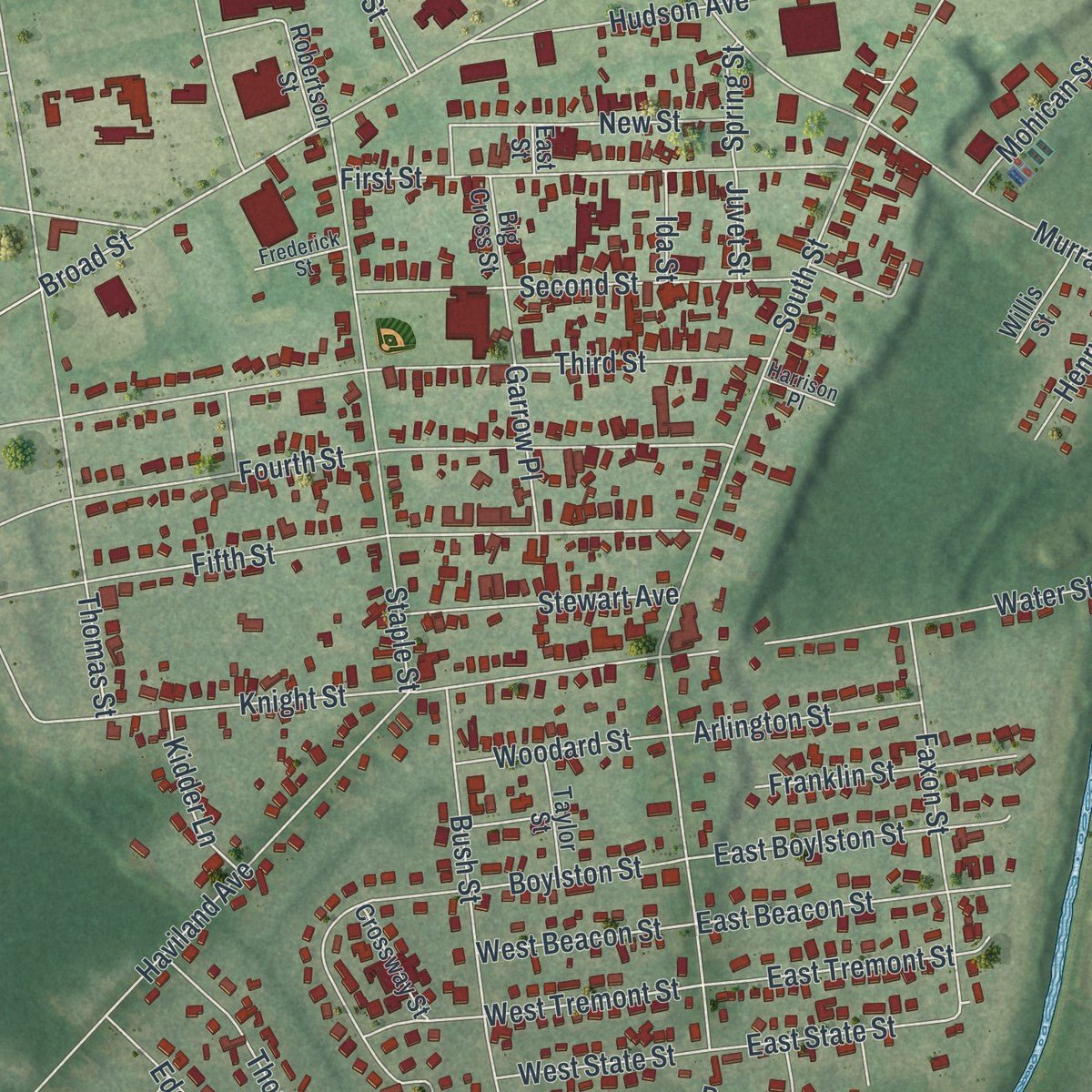
This map was created using accurate cartographic data and authoritative geographic sources, including the U.S. Geological Survey (USGS) and FEMA. The map brings together terrain, waterways, roads, and building detail. The majority of the streets are labeled, houses are accurately depicted, and the topography is derived from government sources. Combining local data with carefully composed color and shading leads to this beautifully detailed Glens Falls artwork for your wall.
Rather than simply showing street outlines, we’ve included as many of the street names as we could reasonably fit on the map while keeping their names legible. Zoom in on the high resolution preview to see exactly what’s on the map. We truly set out to create a statement piece for anyone who loves Glens Falls. So whether it’s for you, or a gift for someone you love, we hope this map of Glens Falls brings back fond memories.
Explore the full map of Glens Falls, New York and read about the local places it shows.

About Glens Falls, New York
Glens Falls is a city within Warren County, New York, United States, and is the central city of the Glens Falls Metropolitan Statistical Area. In 1766, it was renamed Wing's Falls for Abraham Wing, the leader of the group of Quakers who established the permanent settlement, and for the falls on the Hudson River. The 2020 census counted 14,830 residents.
- 14,830 peopleCounted in the 2020 census.
- Local watersThe name was given by Colonel Johannes Glen, the falls referring to a large waterfall in the Hudson River at the southern end of the city.
- Established in 1893The Glens Falls Cement company, established 1893, is now a part of Lehigh Northeast, itself a division of HeidelbergCement, one of the world's largest cement producers.
- A 1853 milestoneEvergreen Bank, N.A., formerly the First National Bank of Glens Falls, originated in 1853, and is now owned by banking conglomerate TD Banknorth.
- A local distinctionThe Glens Falls September 11 Memorial is a tribute to the lives lost on that day, and the first responders.
Find your street
Names on the Glens Falls map
Every name below is printed on this map. Look for your street, your school, the park where you played, or the pond down the road.
Places and landmarks7
- Glens Falls City Hall
- Crandall Park
- East Field
- Glens Falls Cemetery
- Haviland's Cove Park
- Cole's Woods
- Glens Falls Tech Park
Streets and roads224
- Glen Street
- Warren Street
- Ridge Street
- Hudson Avenue Extended
- Fort Amherst Road
- Bay Street
- Kensington Road
- Broad Street
- Jerome Avenue
- West Tremont Street
- Oakland Street
- South Western Avenue
- Windy Hill Road
- Gage Avenue
- Sanford Street
- Murray Street
- Upper Sherman Avenue
- South Street
- Dix Avenue
- Crandall Street
- Hunter Street
- Maple Street
- Cooper Street
- Lawrence Street
- Grant Avenue
- Sagamore Street
- Prospect Street
- Bush Street
- Coolidge Avenue
- Third Street
Show all 224 streets
- Haskell Avenue
- Platt Street
- McDonald Street
- Montcalm Street
- Fourth Street
- West Notre Dame Street
- Webster Avenue
- Sheridan Street
- Orville Street
- Fifth Street
- Hudson Avenue
- Mohican Street
- Horicon Avenue
- Boylston Street
- Lexington Avenue
- Staple Street
- Elm Street
- Knight Street
- Harrison Avenue
- Orchard Street
- Cherry Street
- Walnut Street
- Leonard Street
- Grove Avenue
- First Street
- Larose Street
- Thornberry Drive
- Western Avenue
- Garfield Street
- Second Street
- Macarthur Drive
- Thomas Street
- Washington Street
- Lincoln Avenue
- Uncas Street
- Byrne Avenue
- Water Street
- Haviland Avenue
- Fielding Street
- Faxon Street
- Peck Avenue
- William Street
- Cunningham Avenue
- Rogers Street
- Baldwin Avenue
- Fire Road
- Parkview Lane
- Mason Street
- Henry Street
- Pine Street
- Quade Street
- Grand Street
- New Street
- Shippey Street
- East Boylston Street
- Arbor Drive
- Upper Platt Street
- East Beacon Street
- Chester Street
- Fulton Street
- Sierra Street
- East Tremont Street
- Katherine Street
- Monument Avenue
- Stewart Avenue
- Luzerne Road
- Goodwin Avenue
- East State Street
- Towpath Lane
- Thomson Avenue
- Oneida Street
- Franklin Street
- Terra Cotta Avenue
- Park Street
- Apollo Drive
- May Street
- Church Street
- Lake Avenue
- Vanderheyden Street
- Arlington Street
- Geer Street
- Union Street
- Ogden Street
- Shermantown Road
- Clayton Avenue
- Stevens Street
- Cortland Street
- West Beacon Street
- Woodard Street
- Halsey Place
- West State Street
- Graves Street
- Smith Street
- Wing Street
- Leland Drive
- Hartford Avenue
- Douglas Street
- Marion Avenue
- Edgewater Place
- Morgan Avenue
- Pearl Street
- Washburn Avenue
- Kidder Lane
- Carleton Court
- Auburn Place
- Raymond Avenue
- Murdock Avenue
- Garrow Place
- Division Street
- Wilmot Street
- Morton Street
- Lawton Avenue
- Nelson Street
- Bacon Street
- Crandall Place
- Harlem Street
- Elk Lane
- Parker Street
- Hoyt Avenue
- Ash Avenue
- Lapham Place
- Center Street
- Curran Street
- North Road
- Traver Street
- Reed Street
- Spring Street
- Namic Place
- Jay Street
- Sarella Street
- John Street
- Juvet Street
- Ida Street
- New Pruyn Street
- Bay Road
- Windy Ridge Road
- Roosevelt Avenue
- Davis Street
- Jackson Avenue
- Madison Street
- Robertson Street
- Empire Avenue
- Big Cross Street
- Hope Avenue
- Basin Street
- Kenworthy Avenue
- Elizabeth Street
- Oak Street
- Cameron Avenue
- Liberty Avenue
- Flandreaux Avenue
- Fredella Avenue
- Mission Street
- Crossway Street
- Culvert Street
- Bowman Avenue
- Locust Street
- Keenan Street
- Taylor Street
- Jefferson Street
- Mohawk Street
- James Court
- Edison Road
- Willis Street
- Mauro Avenue
- Holman Street
- Columbia Avenue
- Wait Street
- Austin Street
- East Avenue
- Philo Avenue
- East Street
- Birch Avenue
- Goodman Street
- School Street
- Civic Center Plaza
- Clinton Avenue
- Hartman Place
- Fowler Avenue
- Cottage Place
- Frederick Street
- Peck Road
- Harrison Place
- Charles Street
- Patton Drive
- Pulver Place
- Logan Avenue
- North Delaware Avenue
- Potter Street
- Pershing Road
- Numan Street
- Wallace Drive
- North Pearl Street
- Webb Street
Names are listed as they appear on the printed map. Zoom into the product photos to find them.
The art of mapping a place
How This Map Was Made
Real places. Remarkable detail. Discover the layers that turn geographic data into a map of home.

The view from above
Aerial imagery reveals the character of the land: woodland, open fields, and the patterns of a place.

The shape of the land
Elevation data brings hills, valleys, and subtle changes in the landscape into view.

The details of home
Roads, waterways, and building footprints come together to make the map feel unmistakably local.

Geography becomes art
Considered color, shading, and typography bring the layers together in a map made for your wall.


Process illustrated with Mendon, Massachusetts. Aerial imagery: USDA NAIP. Terrain: USGS 3D Elevation Program. Map details and finished artwork: KNOWOL.
The Details
About This Print
Choose an archival matte print, or a black or white Ayous wood frame. The archival matte print is unframed.
Select your size and finish above to see the matching product image and price.
Materials & Craftsmanship
A contemporary map with the character of a classic atlas, printed on archival matte paper. Optional frames are made from Ayous wood.
Your printed map does not include the watermark shown in the full-map preview.
Shipping & Delivery
Free shipping within the United States. Every print is made to order in the USA.
Buying a gift? Add a note in your cart and we'll include it. We never put prices in the package.
Prints ship within 2 to 3 business days. Allow 7 to 10 days total from ordering for delivery. Timing may vary during holidays or periods of high order volume.
Read our shipping policy.
Returns and damaged prints
Each print is made to order. Change-of-mind refunds are not available after production.
If your print arrives damaged, misprinted or incorrect, contact support@knowol.com within 30 days of receiving it. Include your order number, photos and a description of the issue.
Read our full refund and replacement policy. For questions about your order, email support@knowol.com.
Find your town
Looking for another city?
Find a map of home in our New York collection.
Nearby
Maps of towns near Glens Falls
Know someone from one of these towns? Their map makes a great gift.