
Search for another town




Free U.S. delivery 7 to 10 days after you order
Haledon, New Jersey Map Art
Building by building, with labeled streets and shaded relief.
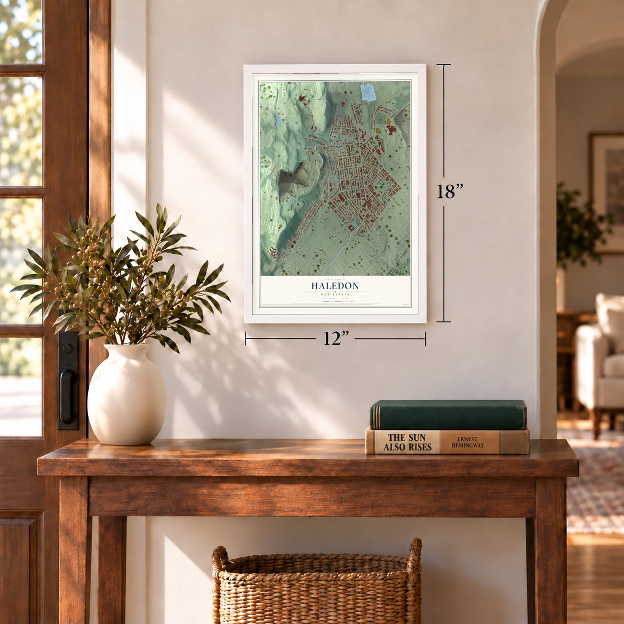
12" x 18" Archival Matte Print
A Map of Home. A Work of Art.
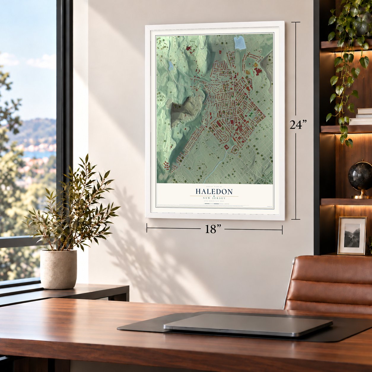
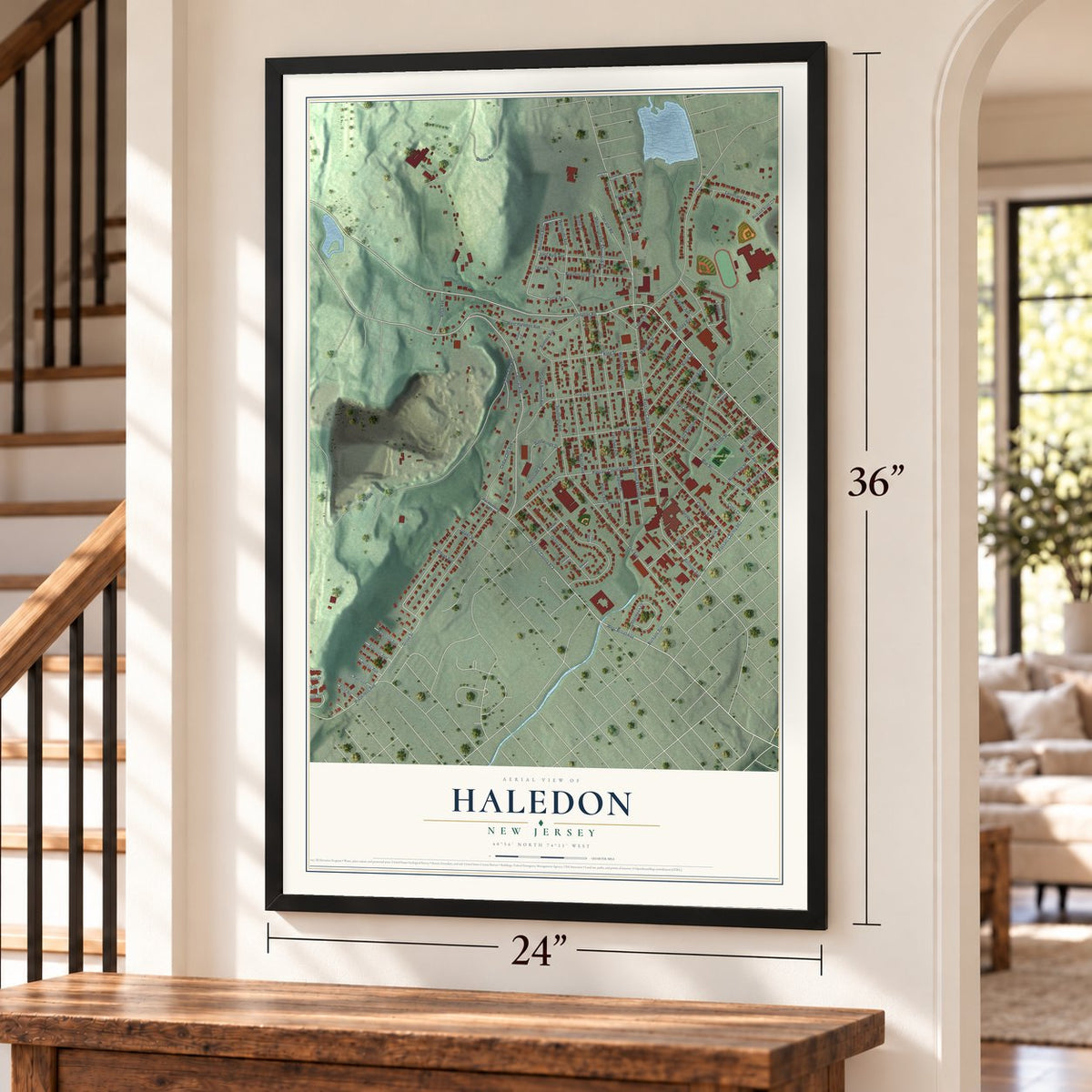
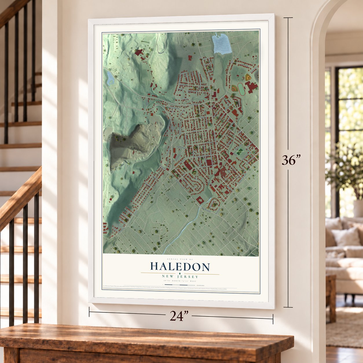
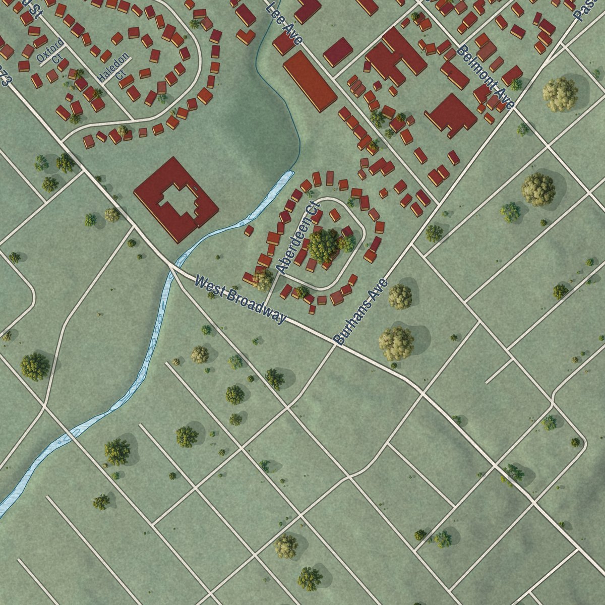
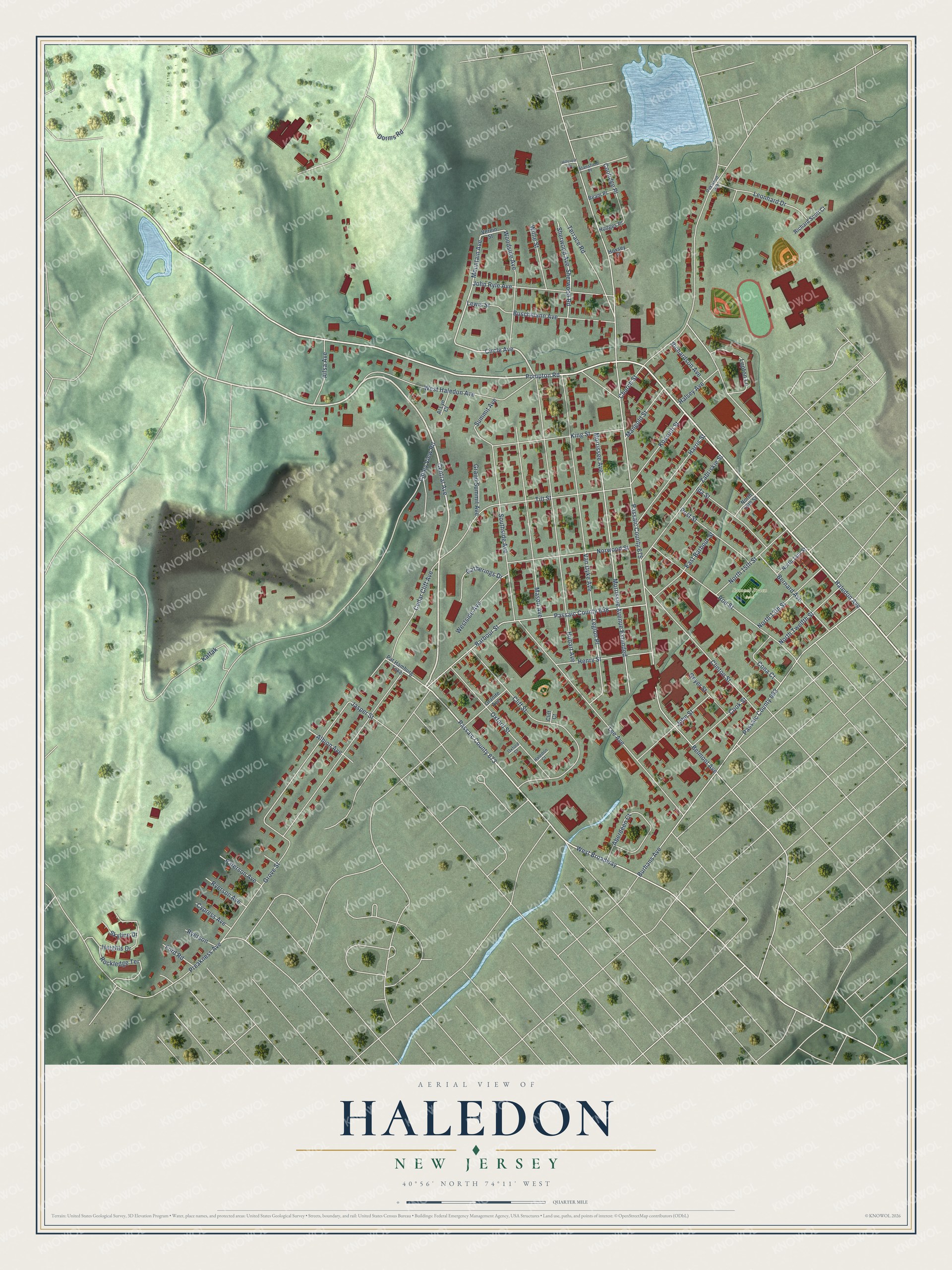
Explore Haledon, New Jersey from a whole new perspective. Created using aerial imagery and detailed geographic data, this map captures Haledon building by building, with labeled streets, familiar landmarks, and shaded topographical relief that highlights the natural contours of the landscape.
Combining modern data with the timeless character of a vintage atlas, this map is just as interesting up close as it is beautiful on the wall. Whether you grew up in Haledon, spent memorable years there, or call it home today, this unique map is a great way to celebrate a place that means something to you. Zoom in on the preview to look for your street, and then order a print to put your memories on the wall.
Three ways to hang it
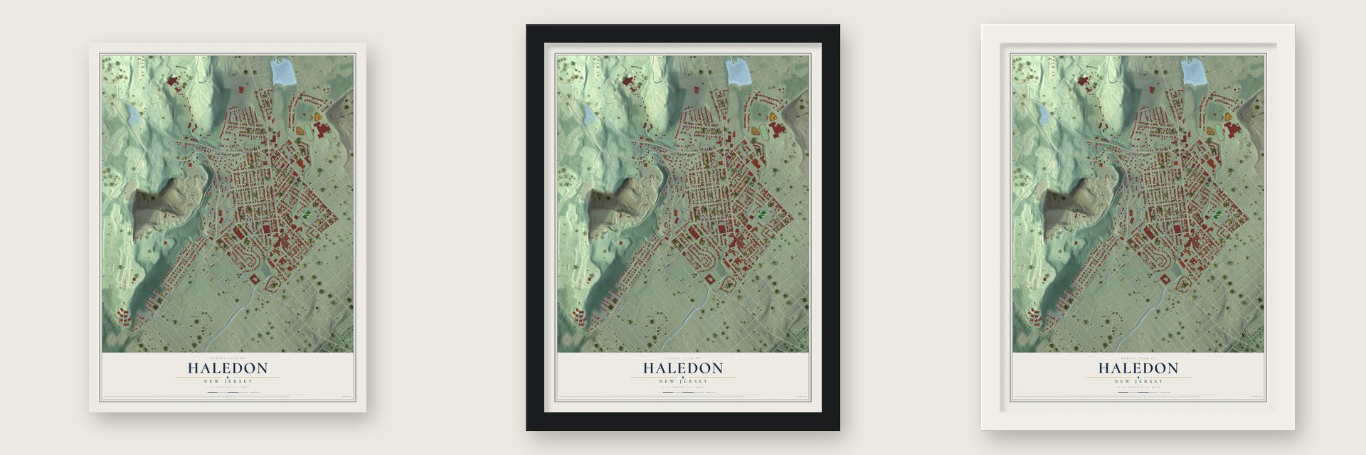
Unframed archival matte, a black wood frame or a white wood frame.
Up close
Geography Worth Displaying
This map was created using accurate cartographic data and authoritative geographic sources, including the U.S. Geological Survey (USGS) and FEMA. The map brings together terrain, waterways, roads, and building detail. The majority of the streets are labeled, houses are accurately depicted, and the topography is derived from government sources. Combining local data with carefully composed color and shading leads to this beautifully detailed Haledon artwork for your wall.
Rather than simply showing street outlines, we’ve included as many of the street names as we could reasonably fit on the map while keeping their names legible. Zoom in on the high resolution preview to see exactly what’s on the map. We truly set out to create a statement piece for anyone who loves Haledon. So whether it’s for you, or a gift for someone you love, we hope this map of Haledon brings back fond memories.
Explore the full map of Haledon, New Jersey and read about the local places it shows.

Find your street
Names on the Haledon map
Every name below is printed on this map. Look for your street, your school, the park where you played, or the pond down the road.
Places and landmarks1
- Samuel Braen Park
Streets and roads97
- Central Avenue
- Haledon Avenue
- West Haledon Avenue
- Circle Avenue
- Passaic County 673
- Mountain Avenue
- Pompton Road
- Belmont Avenue
- Passaic County 675
- Valley View Road
- Burhans Avenue
- Passaic County 662
- Hobart Avenue
- West Broadway
- Morrissee Avenue
- Morrissee Avenue Extended
- Lee Avenue
- Church Street
- Barbour Street
- Passaic County 658
- Van Dyke Avenue
- Cliff Street
- Tilt Street
- Lupton Lane
- Mason Avenue
- Preakness Avenue
- Roe Street
- Southside Avenue
- Clinton Street
- Oxford Street
Show all 97 streets
- Grove Street
- John Ryle Avenue
- Aberdeen Court
- Zabriskie Street
- Norwood Street
- King Street
- Woodside Avenue
- Harris Street
- Heights Drive
- Cedar Cliff Avenue
- Leonhard Drive
- Bernard Avenue
- Buschmann Avenue
- Legion Place
- Sherwood Avenue
- Sherwood Road
- Henry Street
- North 15th Street
- John Street
- Rockledge Terrace
- Grand Summit Avenue
- Ida Street
- Halsey Avenue
- Terrace Road
- Kossuth Street
- Post Street
- North 13th Street
- East Barbour Street
- North Twelfth Street
- Westside Avenue
- Cook Street
- Gatherings Drive
- Ailsa Avenue
- Willie Street
- Cona Court
- Mangold Street
- Coolidge Place
- Summit Avenue
- Kattak
- Geyer Street
- Albion Avenue
- Paterson Avenue
- Richardson Avenue
- Ryerson Avenue
- Lewis Street
- Cypress Avenue
- Skyline Drive
- Dorms Road
- Ford Road
- Jasper Street
- Ryerson
- Verein Street
- Pat Hamburg Turnpike
- Granite Avenue
- Richard Scott Court
- North 14th Street
- North 16th Street
- Beam Place
- Al Lyn Court
- Hodges Place
- Hoxsey Place
- Cliff Court
- Stansfield Place
- Oakwood Avenue
- Haledon Court
- Oxford Court
- Hillcrest Drive
Names are listed as they appear on the printed map. Zoom into the product photos to find them.
About Haledon, New Jersey
Haledon is a borough of 9,052 people in Passaic County, on the northern edge of Paterson. Farm families of Dutch colonial descent, among them the Van Ripers, Berdans, Bantas, Posts and Zabriskies, worked this land first. After the Civil War it grew into a streetcar suburb. A horse railroad company formed in 1871 laid tracks out from Paterson along today's Belmont Avenue, and the line ran on electricity by 1888.
Several of the trolley's owners also founded the Cedar Cliff Land Company, which bought up much of the area and named its streets for businessmen such as Hoxey, Van Dyke and Barbour. It sold small lots of 25 by 100 feet at auctions with free lunches and brass bands, aiming its ads at immigrants who worked in Paterson's silk industry, and it opened a silk mill of its own. Skilled textile workers from Europe bought in, and in 1908 Haledon became a borough, replacing what was left of Manchester Township.
- A socialist mayor in 1912Haledon's silk workers elected the Socialist William Bruekmann mayor in 1912. When the great Paterson silk strike broke out the next year, Paterson banned worker meetings, so Haledon's mayor invited the strikers to gather across the line in his borough instead.
- The Botto HousePietro Botto and Maria Boggio emigrated from Biella, Italy, to America in 1892. Their family moved in 1908 into a new house on a hillside in Haledon. Pietro and his daughters were silk weavers, and Maria finished silk and fed boarders. In 1913 thousands of strikers gathered on that open hillside to hear Elizabeth Gurley Flynn, John Reed, Carlo Tresca and Big Bill Haywood. Made a National Historic Landmark in 1982, the house became the American Labor Museum in 1983.
- Villas on the hillsidesWhile the flat lower ground was cut into small city lots, the Cedar Cliff Land Company set aside Haledon's hillsides for larger Victorian villas. The Barbour family, linen flax manufacturers, built here, and the villa site of Vice President Garret A. Hobart is now William Paterson University. Few villas followed, and through much of the 20th century the small lots kept Haledon a blue-collar town.
- Stainless steel dinersThe Paramount Dining Car Company made its home in Haledon and built many of New Jersey's best-known stainless steel modular diners. Among them are White Manna in Hackensack and Rosie's Diner, which once stood on Route 46 in Little Ferry.
- Olympic gold in 1984 and 1992Born in Haledon, Bruce Baumgartner went to Manchester Regional High School and became one of America's great freestyle wrestlers. He took Olympic gold at the 1984 Los Angeles Games and again at Barcelona in 1992, added silver in 1988 and bronze in 1996, and won three world championships.
Keep exploring New Jersey
Haledon is one of 990 New Jersey towns we've mapped. Every dot on the map is a print of its own.
The search covers every state, New Jersey first.
Near Haledon
Order 2 or more town maps and save 10%. Shown in the size and finish you picked above, so they hang as a set.
- William Paterson University of New Jersey 12" x 18" / Archival Matte Print $39.99
- Prospect Park 12" x 18" / Archival Matte Print $39.99
- North Haledon 12" x 18" / Archival Matte Print $39.99


More maps nearby: Preakness, Paterson, Hawthorne, Totowa and Wayne.
The art of mapping a place
How This Map Was Made
Real places. Remarkable detail. Discover the layers that turn geographic data into a map of home.

The view from above
Aerial imagery reveals the character of the land: woodland, open fields, and the patterns of a place.

The shape of the land
Elevation data brings hills, valleys, and subtle changes in the landscape into view.

The details of home
Roads, waterways, and building footprints come together to make the map feel unmistakably local.

Geography becomes art
Considered color, shading, and typography bring the layers together in a map made for your wall.


Process illustrated with Mendon, Massachusetts. Aerial imagery: USDA NAIP. Terrain: USGS 3D Elevation Program. Map details and finished artwork: KNOWOL.
The Details
About This Print
Choose an archival matte print, or a black or white Ayous wood frame. The archival matte print is unframed.
Select your size and finish above to see the matching product image and price.
Materials & Craftsmanship
A contemporary map with the character of a classic atlas, printed on archival matte paper. Optional frames are made from Ayous wood.
Your printed map does not include the watermark shown in the full-map preview.
Shipping & Delivery
Free shipping within the United States. Every print is made to order in the USA.
Buying a gift? Add a note in your cart and we'll include it. We never put prices in the package.
Prints ship within 2 to 3 business days. Allow 7 to 10 days total from ordering for delivery. Timing may vary during holidays or periods of high order volume.
Read our shipping policy.
Returns and damaged prints
Each print is made to order. Change-of-mind refunds are not available after production.
If your print arrives damaged, misprinted or incorrect, contact support@knowol.com within 30 days of receiving it. Include your order number, photos and a description of the issue.
Read our full refund and replacement policy. For questions about your order, email support@knowol.com.