


Search for another town


Free U.S. delivery 7 to 10 days after you order
Harrodsburg, Kentucky Map Art
Building by building, with labeled streets and shaded relief.
12" x 18" Archival Matte Print
A Map of Home. A Work of Art.
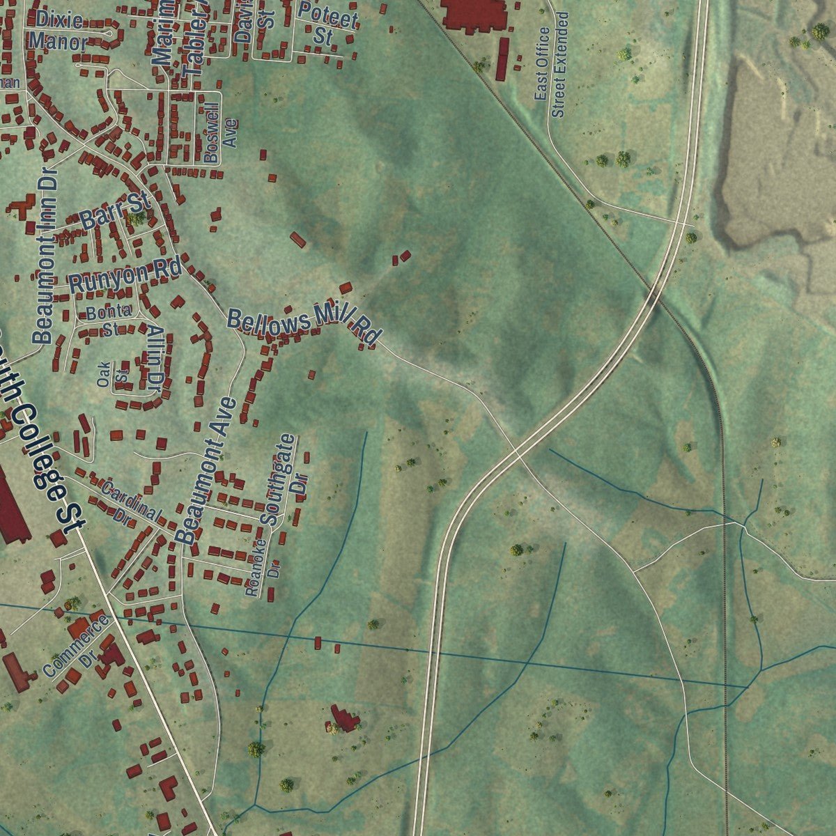
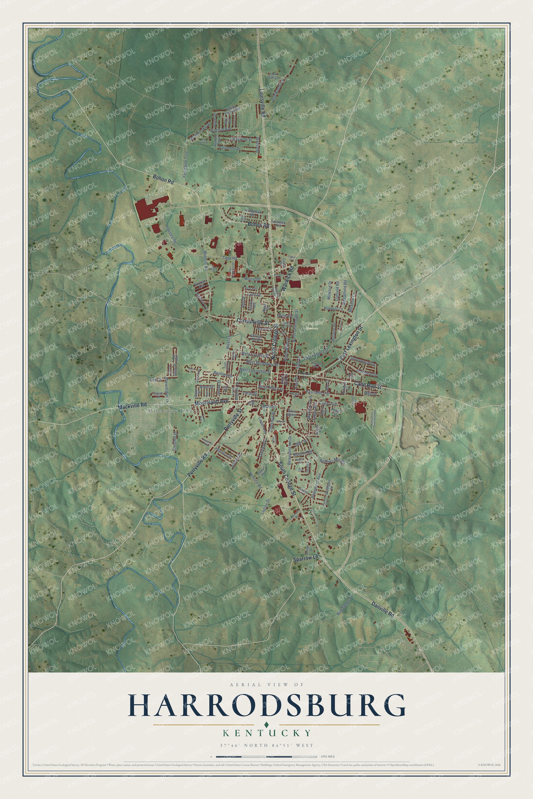
Explore Harrodsburg, Kentucky from a whole new perspective. Created using aerial imagery and detailed geographic data, this map captures Harrodsburg building by building, with labeled streets, familiar landmarks, and shaded topographical relief that highlights the natural contours of the landscape.
Combining modern data with the timeless character of a vintage atlas, this map is just as interesting up close as it is beautiful on the wall. Whether you grew up in Harrodsburg, spent memorable years there, or call it home today, this unique map is a great way to celebrate a place that means something to you. Zoom in on the preview to look for your street, and then order a print to put your memories on the wall.
Three ways to hang it
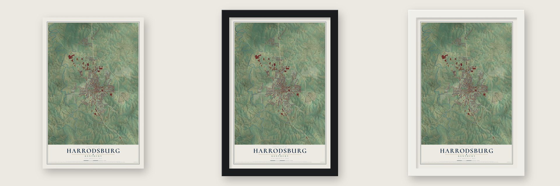
Unframed archival matte, a black wood frame or a white wood frame.
Up close
Geography Worth Displaying
This map was created using accurate cartographic data and authoritative geographic sources, including the U.S. Geological Survey and the Census Bureau. The map brings together terrain, waterways, roads, and building detail. The majority of the streets are labeled, houses are accurately depicted, and the topography is derived from government sources. Combining local data with carefully composed color and shading leads to this beautifully detailed Harrodsburg artwork for your wall.
Rather than simply showing street outlines, we’ve included as many of the street names as we could reasonably fit on the map while keeping their names legible. Zoom in on the high resolution preview to see exactly what’s on the map. We truly set out to create a statement piece for anyone who loves Harrodsburg. So whether it’s for you, or a gift for someone you love, we hope this map of Harrodsburg brings back fond memories.
Read the story behind this map of Harrodsburg, Kentucky from 2026.

Find your street
Names on the Harrodsburg map
Every name below is printed on this map. Look for your street, your school, the park where you played, or the pond down the road.
Places and landmarks2
- Spring Hill Cemetery
- Riverview Estates
Streets and roads137
- North College Street
- East Lexington Street
- Perryville Road
- Mooreland Avenue
- Warwick Road
- Cane Run Street
- Bohon Road
- Danville Road
- South College Street
- Louisville Road
- Perryville Street
- Cornishville Street
- Mackville Road
- Sparrow Lane
- Moberly Road
- Beaumont Avenue
- West Lexington Street
- Industry Road
- Tapp Road
- Shewmaker Lane
- East Office Street
- West Office Street
- West Broadway Street
- Marimon Avenue
- North Greenville Street
- North Main Street
- East Factory Street
- West Factory Street
- Bellaire Drive
- Harvest Lane
Show all 137 streets
- Virginia Avenue
- Fountaine Trce
- Ash Brook Lane
- Henrico Road
- Legion Drive
- Bud James Lane
- Beaumont Inn Drive
- Morris Drive
- Greenwood Drive
- West Lane
- Longview Street
- Palomino Drive
- Wheatfield Road
- Chestnut Street
- Cogar Avenue
- Tabler Avenue
- Meadow Lane
- Ada Drive
- Belmont Street
- Lynn Drive
- Spring Lake Drive
- Fairview Court
- Henrico Street
- Bellows Mill Road
- Oatfield Road
- Milward Drive
- Cresthill Drive
- East Lane
- James Street
- Runyon Road
- Barr Street
- Larue Street
- Agee Street
- Hycliff Street
- Wren Street
- Cedar Street
- Lee Court
- East Street
- High Street
- South Main Street
- Allin Drive
- Hunters Trail
- Greenbriar Drive
- Linden Avenue
- South Magnolia Street
- Jenn Oak Lane
- College Manor
- Sleepy Hollow Road
- Shannon Avenue
- Tulip Avenue
- Arrowhead Road
- Ewing Avenue
- Bacon Court
- Blake Drive
- Pope Avenue
- Dixie Manor
- Southgate Drive
- Colton Drive
- Hildeen Drive
- Crozer Avenue
- Hensley Avenue
- Mac Court
- Scooter Avenue
- Grace Court
- Boone Street
- Davis Street
- Robards Court
- Daisy Street
- Drew Street
- Poteet Street
- Raven Street
- Dove Court
- Elm Street
- Boswell Avenue
- Ross Avenue
- Pioneer Way
- Cardinal Drive
- Don Robinson Drive
- North Lane Street
- Allah Avenue
- Commerce Drive
- Collin Drive
- Bonta Street
- Dudley Drive
- Coleman Court
- Hillcrest Street
- East Office Street Extended
- Bleu Brook Drive
- Beaumont Plaza
- Castle Heights
- Oakley Avenue
- Titans Way
- South Sunset Lane
- Price Avenue
- Prosperous Way
- Harrods Trce
- Nicholas Avenue
- Veterans Park Road
- Dedman Street
- Donovan Circle
- Azalea Drive
- Roanoke Drive
- Houchton Place
- Stoner Street
- Apache Trail
- Eagle Street
- Oak Street
Names are listed as they appear on the printed map. Zoom into the product photos to find them.
About Harrodsburg, Kentucky
Harrodsburg is a city of 9,064 people and the county seat of Mercer County. James Harrod led a party of 31 men from Fort Redstone in Pennsylvania by canoe down the Monongahela and Ohio Rivers, and on June 16, 1774, he laid out Harrod's Town. That summer, during Dunmore's War, Daniel Boone and Michael Stoner came to warn the surveyors of Shawnee attacks. The men stayed a few more weeks until one of them was killed, then left, and they came back to resettle the town by March of the next year.
When the colonies declared independence in 1776, it was one of only three settlements in present-day Kentucky, along with Logan's Fort and Boonesborough. It served as the first seat of Kentucky County in 1776, Lincoln County in 1780 and Mercer County in 1785. That same year the Virginia General Assembly formally established the town as Harrodsburg, and the Kentucky legislature incorporated it in 1836.
- 52 settlers by 1778A count of Harrodstown residents, made from Dec. 16, 1777, to Oct. 16, 1778, listed 52 people. Among them were Squire Boone, Daniel Boone's younger brother, and Silas Harlan, who had come down the rivers with Harrod in 1774. David Glenn, another member of that first party, later moved farther west and settled at Yellow Banks.
- Hospitals after PerryvilleHarrodsburg leaned toward the Confederacy, but under Union control it raised the 19th Kentucky Infantry at nearby Camp Harwood in 1862 and four companies of the 11th Kentucky Cavalry that July. After the Battle of Perryville, the town filled with makeshift hospitals. On October 10, 1862, Lieutenant Colonel John Boyle led the 9th Kentucky Cavalry in a raid on the town, capturing 1600 sick and wounded Confederate soldiers, and Harrodsburg stayed under martial law until the war ended.
- Old Fort Harrod since 1927On June 16, 1927, the same day of the year Harrod had laid out the town, Pioneer Memorial Park opened. It is known today as Old Fort Harrod State Park. In 1936 President Franklin D. Roosevelt honored Harrodsburg with a monument naming it the first permanent settlement west of the Appalachians.
- From college to innThe building that is now the Beaumont Inn began as the Christian Baptist School from 1830 to 1833, then housed the Greeneville Institute from 1841 to 1856. It was Daughters' College from 1856 to 1893 and later Beaumont College, before opening as the Beaumont Inn in 1917. Daughters' College joined the National Register in 1980.
- Glass for the iPhoneCorning's plant in Harrodsburg makes Gorilla Glass. Apple said in August 2025 that it would put $2.5 billion into a deal with Corning to make cover glass for every iPhone and Apple Watch, and Corning is turning the whole Harrodsburg plant over to Apple production.
Keep exploring Kentucky
Harrodsburg is one of 659 Kentucky towns we've mapped. Every dot on the map is a print of its own.
The search covers every state, Kentucky first.
Near Harrodsburg
Order 2 or more town maps and save 10%. Shown in the size and finish you picked above, so they hang as a set.
- Burgin 12" x 18" / Archival Matte Print $39.99
- High Bridge 12" x 18" / Archival Matte Print $39.99
- Danville 12" x 18" / Archival Matte Print $39.99
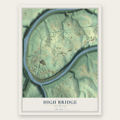
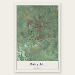
More maps nearby: Perryville, Salvisa, Mackville, Wilmore and Junction City.
The art of mapping a place
How This Map Was Made
Real places. Remarkable detail. Discover the layers that turn geographic data into a map of home.

The view from above
Aerial imagery reveals the character of the land: woodland, open fields, and the patterns of a place.

The shape of the land
Elevation data brings hills, valleys, and subtle changes in the landscape into view.

The details of home
Roads, waterways, and building footprints come together to make the map feel unmistakably local.

Geography becomes art
Considered color, shading, and typography bring the layers together in a map made for your wall.


Process illustrated with Mendon, Massachusetts. Aerial imagery: USDA NAIP. Terrain: USGS 3D Elevation Program. Map details and finished artwork: KNOWOL.
The Details
About This Print
Choose an archival matte print, or a black or white Ayous wood frame. The archival matte print is unframed.
Select your size and finish above to see the matching product image and price.
Materials & Craftsmanship
A contemporary map with the character of a classic atlas, printed on archival matte paper. Optional frames are made from Ayous wood.
Your printed map does not include the watermark shown in the full-map preview.
Shipping & Delivery
Free shipping within the United States. Every print is made to order in the USA.
Buying a gift? Add a note in your cart and we'll include it. We never put prices in the package.
Prints ship within 2 to 3 business days. Allow 7 to 10 days total from ordering for delivery. Timing may vary during holidays or periods of high order volume.
Read our shipping policy.
Returns and damaged prints
Each print is made to order. Change-of-mind refunds are not available after production.
If your print arrives damaged, misprinted or incorrect, contact support@knowol.com within 30 days of receiving it. Include your order number, photos and a description of the issue.
Read our full refund and replacement policy. For questions about your order, email support@knowol.com.