


Search for another town





Free U.S. delivery 7 to 10 days after you order
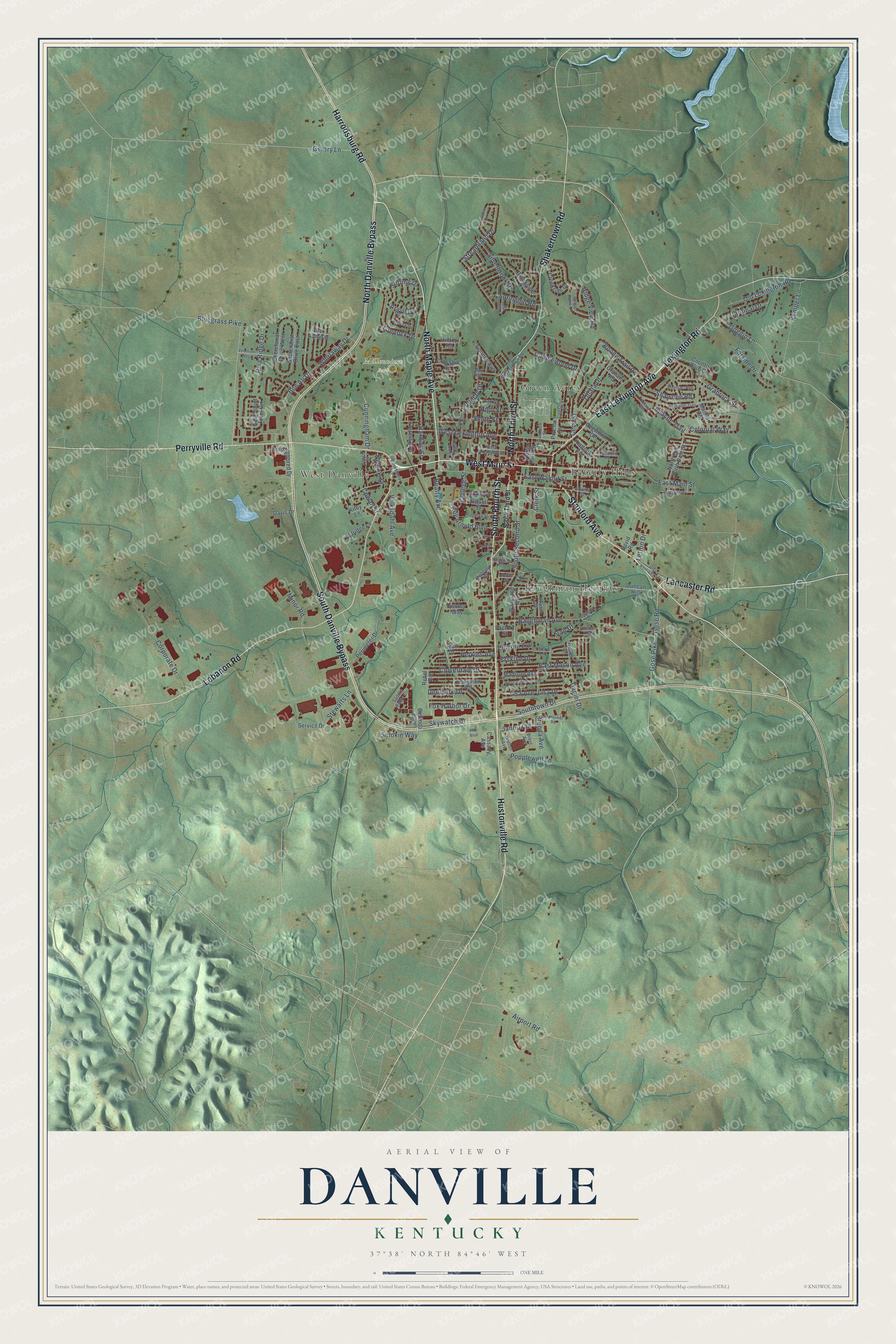
Danville, Kentucky Map Art
Building by building, with labeled streets and shaded relief.
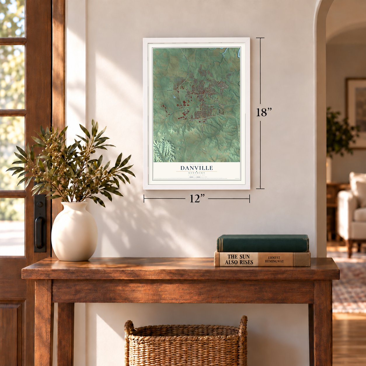
12" x 18" Archival Matte Print
A Map of Home. A Work of Art.
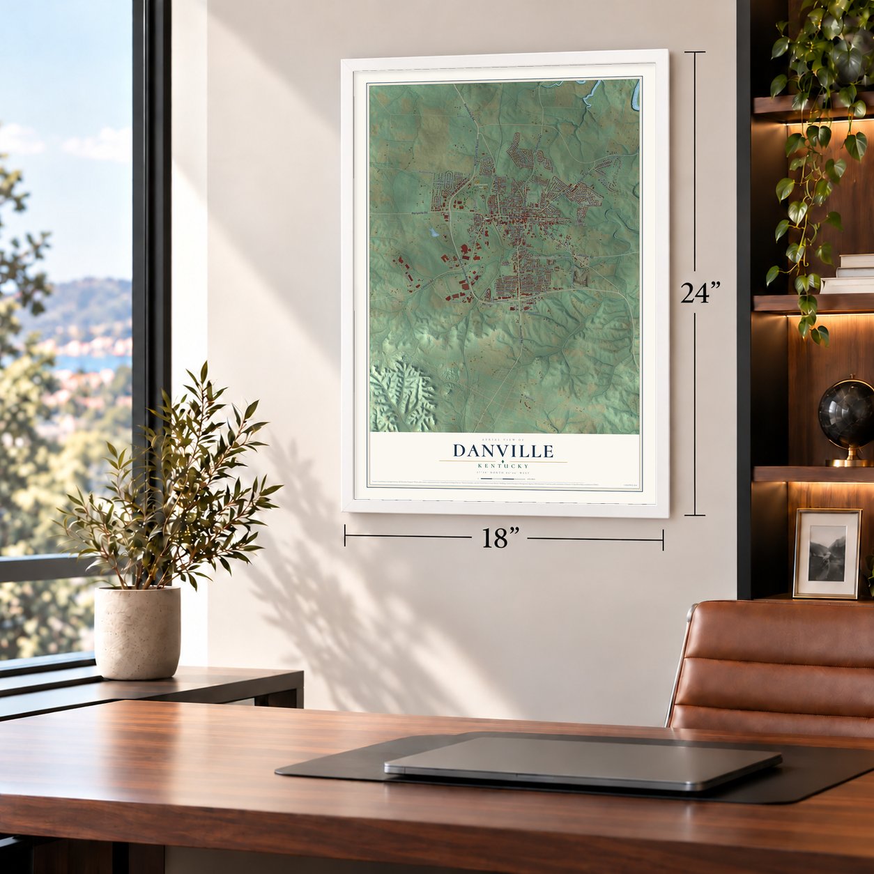
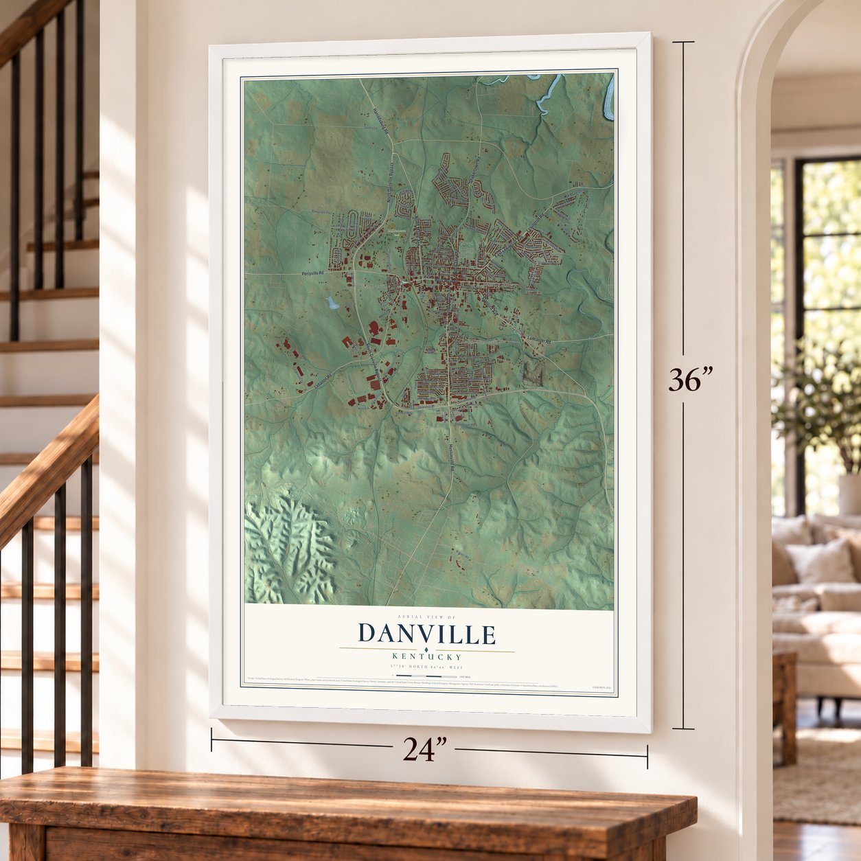
Explore Danville, Kentucky from a whole new perspective. Created using aerial imagery and detailed geographic data, this map captures Danville building by building, with labeled streets, familiar landmarks, and shaded topographical relief that highlights the natural contours of the landscape.
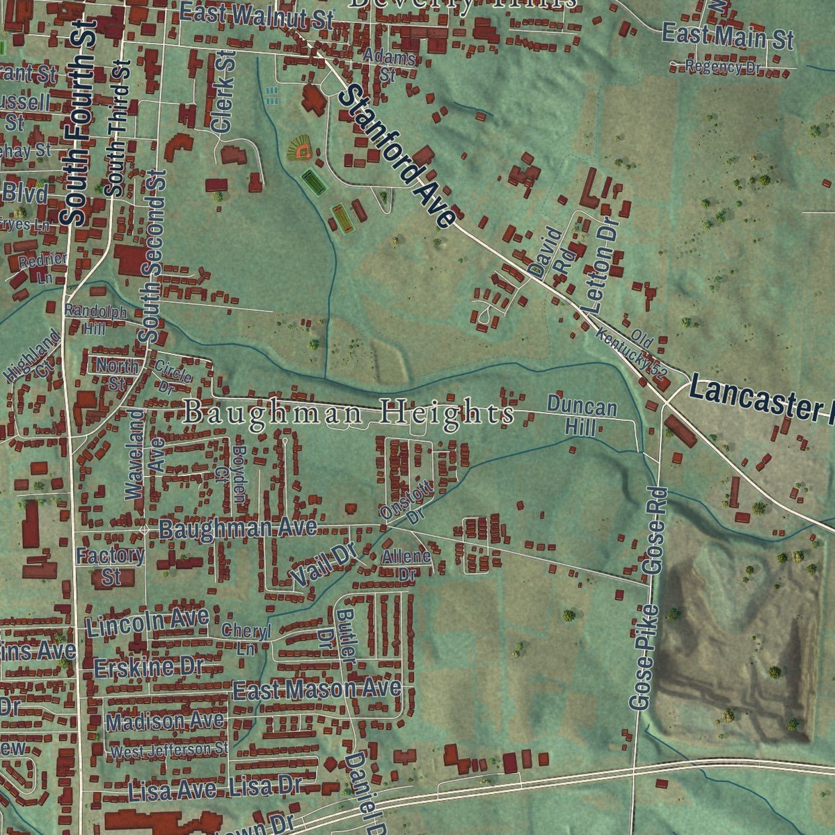
Combining modern data with the timeless character of a vintage atlas, this map is just as interesting up close as it is beautiful on the wall. Whether you grew up in Danville, spent memorable years there, or call it home today, this unique map is a great way to celebrate a place that means something to you. Zoom in on the preview to look for your street, and then order a print to put your memories on the wall.
Three ways to hang it
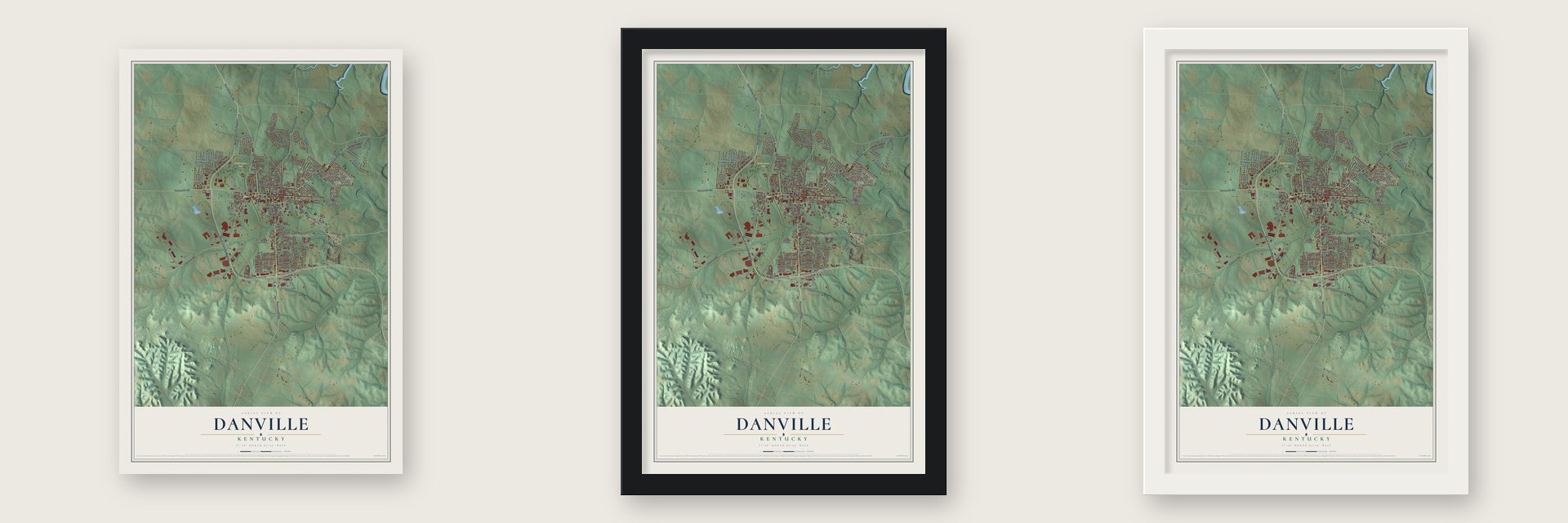
Unframed archival matte, a black wood frame or a white wood frame.
Up close
Geography Worth Displaying
This map was created using accurate cartographic data and authoritative geographic sources, including the U.S. Geological Survey and the Census Bureau. The map brings together terrain, waterways, roads, and building detail. The majority of the streets are labeled, houses are accurately depicted, and the topography is derived from government sources. Combining local data with carefully composed color and shading leads to this beautifully detailed Danville artwork for your wall.
Rather than simply showing street outlines, we’ve included as many of the street names as we could reasonably fit on the map while keeping their names legible. Zoom in on the high resolution preview to see exactly what’s on the map. We truly set out to create a statement piece for anyone who loves Danville. So whether it’s for you, or a gift for someone you love, we hope this map of Danville brings back fond memories.
Read the story behind this map of Danville, Kentucky from 2026.

Find your street
Names on the Danville map
Every name below is printed on this map. Look for your street, your school, the park where you played, or the pond down the road.
Places and landmarks5
- Millennium Park
- Baughman Heights
- Beverly Hills
- Green Acres
- West Danville
Streets and roads159
- Hustonville Road
- West Main Street
- South Fourth Street
- Stanford Avenue
- Lancaster Road
- North Third Street
- East Lexington Avenue
- Harrodsburg Road
- North Danville Bypass
- North Maple Avenue
- South Danville Bypass
- Lebanon Road
- Perryville Road
- Shakertown Road
- Lexington Road
- South Second Street
- Gose Pike
- Gose Road
- Streamland Drive
- Apache Trail
- Lisa Drive
- Boone Trail Road
- Bluegrass Pike
- Baughman Avenue
- East Main Street
- West Lexington Avenue
- Ben Ali Drive
- Cunningham Drive
- Popplewell Lane
- Corporate Drive
Show all 159 streets
- Goggin Lane
- Springhill Road
- Southtown Drive
- Ridge View Road
- Kemper Lane
- Grabruck Street
- Skywatch Drive
- Lannock Drive
- Old Lexington Road
- East Walnut Street
- Harding Street
- Cloverdale Drive
- Denmark Drive
- Gentry Lane
- Colonial Way
- Perkins Avenue
- Argyll Drive
- Riva Ridge Drive
- Ohara Drive
- Silverbrook Drive
- Stewarts Lane
- Roy Arnold Boulevard
- Shawnee Road
- Whirlaway Drive
- East Mason Avenue
- Candlewood Drive
- Cardinal Drive
- Stirling Drive
- High Street
- Valksdahl Avenue
- Brenda Avenue
- Fox Harbor Drive
- Daniel Drive
- Lincoln Avenue
- Jane Trail
- College Street
- Smith Street
- Lisa Avenue
- Minor Road
- Beatty Avenue
- Erskine Drive
- Farside Drive
- Airport Road
- Smokie Way
- Holiday Drive
- Nichols Street
- Clerk Street
- Cecil Street
- Vail Drive
- Letton Drive
- Cowan Street
- North Hill North Dale Street
- Duncan Hill
- Waveland Avenue
- Perimeter Drive
- Secretariat Drive West
- Secretariat Drive East
- North First Street
- Brookside Drive
- Longview Drive
- Russell Street
- Jean Drive
- Thoroughbred Drive
- Creekside Drive
- Butler Drive
- East Count Fleet Circle
- Cassady Avenue
- Country Club Drive
- Timothy Avenue
- Rebel Road
- Madison Avenue
- Grant Street
- Kentucky Avenue
- War Admiral
- Forrest Avenue
- Aldridge Lane
- Crosshill Road
- Mannor Hill
- Service Drive
- Hilltop Road
- Dogwood Drive
- Kilby Lane
- Bellinda Boulevard
- Ashley Way
- Davis Drive
- Graham Road
- David Road
- Proctor Street
- Factory Street
- South Third Street
- Old Shakertown Road
- West Broadway Street
- Swope Drive
- Saddle Ridge Circle
- Highland Court
- Dillehay Street
- Betsy Ross Lane
- Beech Street
- Onstott Drive
- Cheryl Lane
- Earl Street
- Jackson Street
- Brent Avenue
- North Street
- Allene Drive
- Chestnut Street
- Pontiac Avenue
- Adams Street
- Boyden Court
- Highfield Road
- Walton Avenue
- Elm Street
- Quisenberry Avenue
- Clearbrook Drive
- Seminole Trail
- Venetian Way
- Rolling Hill
- Old Kentucky 52
- West Jefferson Street
- Berwick Drive
- Saint Mildreds Court
- Mark Avenue
- Regency Drive
- Hightower Road
- Randolph Hill
- Fryes Lane
- Circle Drive
- Redrier Lane
- May Boulevard
Names are listed as they appear on the printed map. Zoom into the product photos to find them.
About Danville, Kentucky
Danville is a city of 17,234 people and the county seat of Boyle County. Settlers reached this area in 1774, in the Great Settlement Area that grew around Fort Harrod, and the spot was first called Crow's Station after the settler John Crow. In 1783 Walker Daniel, Kentucky's first district attorney, bought 76 acres from Crow beside the Wilderness Road. He surveyed and platted a town there, and it took his name. Virginia's legislature formally established Danville on December 4, 1787.
Danville became the center of Kentucky's push to break away from Virginia. Between 1784 and 1792, ten conventions gathered here to ask for better government and finally for separation. From 1786 the Danville Political Club met every Saturday night at Grayson's Tavern to debate the issues of the day. Kentucky's first constitution was written and signed in Danville, and the town became the state's first capital. Once separation was confirmed in 1792, Danville lost its statewide role, and many of its leading citizens moved away.
- A surgery first in 1809Dr. Ephraim McDowell performed the first known successful laparotomy in Danville in 1809. He took an ovarian tumor out of a woman with no anesthesia. His house, where the operation took place, is now the Ephraim McDowell House Museum.
- Centre College since 1819Transylvania University began here in 1783, then left for Lexington in 1789. Centre College opened in 1819, and its campus and administration building are the oldest of any college west of the Allegheny Mountains. It has hosted two vice-presidential debates: Dick Cheney and Joe Lieberman on October 5, 2000, and Joe Biden and Paul Ryan on October 11, 2012.
- The march to Camp NelsonAfter the Union won the Battle of Perryville on October 8, 1862, the army took over many Danville buildings as hospitals, the courthouse among them. In May 1864, 250 men, most of them enslaved and some free, walked from Danville to Camp Nelson. Colonel Andrew Clark hesitated at first but let them join the Union Army. They arrived with wounds from the road and were the first to enlist at the camp, where 10,000 United States Colored Troops trained.
- Kentucky's first hemp cropIn 1775 Archibald McNeill grew the first hemp crop on record in Kentucky, along Clark's Run Creek. By 1889 Boyle County ranked among ten Kentucky counties that, between them, grew more than 90% of the U.S. crop. Hemp stayed the state's largest cash crop until 1915, when imported jute took over its market.
- A freed man's schoolAround 1840 Willis Russell, who had been freed by the Revolutionary War veteran Robert Craddock, opened Danville's first school for African-American children. Craddock had deeded him a log house in town, and Russell moved there after Craddock died. The house stood on Walnut Street, across from St. James AME Church, and it no longer stands.
Keep exploring Kentucky
Danville is one of 659 Kentucky towns we've mapped. Every dot on the map is a print of its own.
The search covers every state, Kentucky first.
Near Danville
Order 2 or more town maps and save 10%. Shown in the size and finish you picked above, so they hang as a set.
- Junction City 12" x 18" / Archival Matte Print $39.99
- Burgin 12" x 18" / Archival Matte Print $39.99
- Perryville 12" x 18" / Archival Matte Print $39.99

More maps nearby: Harrodsburg, Stanford, Lancaster, Hustonville and McKinney.
The art of mapping a place
How This Map Was Made
Real places. Remarkable detail. Discover the layers that turn geographic data into a map of home.

The view from above
Aerial imagery reveals the character of the land: woodland, open fields, and the patterns of a place.

The shape of the land
Elevation data brings hills, valleys, and subtle changes in the landscape into view.

The details of home
Roads, waterways, and building footprints come together to make the map feel unmistakably local.

Geography becomes art
Considered color, shading, and typography bring the layers together in a map made for your wall.


Process illustrated with Mendon, Massachusetts. Aerial imagery: USDA NAIP. Terrain: USGS 3D Elevation Program. Map details and finished artwork: KNOWOL.
The Details
About This Print
Choose an archival matte print, or a black or white Ayous wood frame. The archival matte print is unframed.
Select your size and finish above to see the matching product image and price.
Materials & Craftsmanship
A contemporary map with the character of a classic atlas, printed on archival matte paper. Optional frames are made from Ayous wood.
Your printed map does not include the watermark shown in the full-map preview.
Shipping & Delivery
Free shipping within the United States. Every print is made to order in the USA.
Buying a gift? Add a note in your cart and we'll include it. We never put prices in the package.
Prints ship within 2 to 3 business days. Allow 7 to 10 days total from ordering for delivery. Timing may vary during holidays or periods of high order volume.
Read our shipping policy.
Returns and damaged prints
Each print is made to order. Change-of-mind refunds are not available after production.
If your print arrives damaged, misprinted or incorrect, contact support@knowol.com within 30 days of receiving it. Include your order number, photos and a description of the issue.
Read our full refund and replacement policy. For questions about your order, email support@knowol.com.