
Search for another town



Free U.S. delivery 7 to 10 days after you order
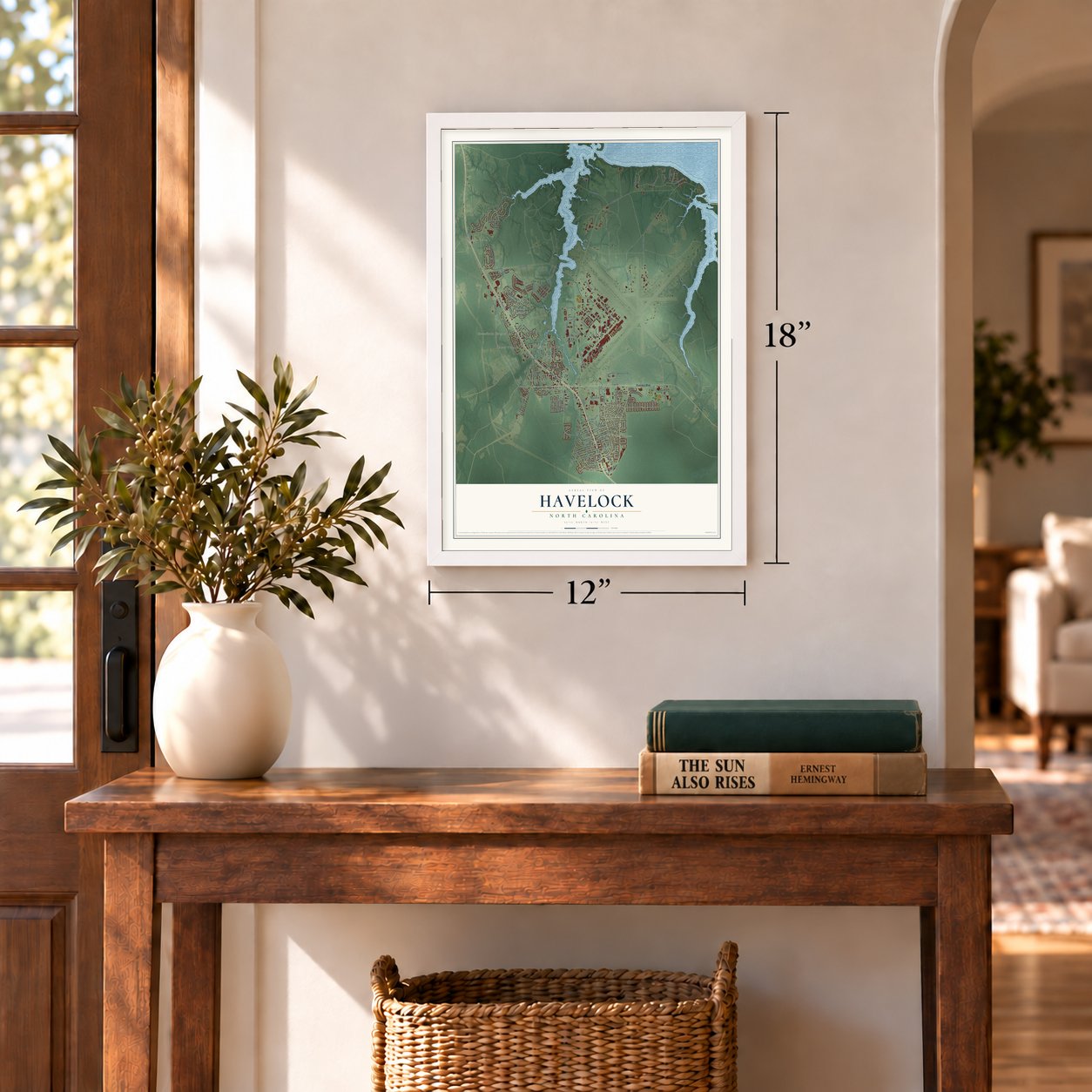
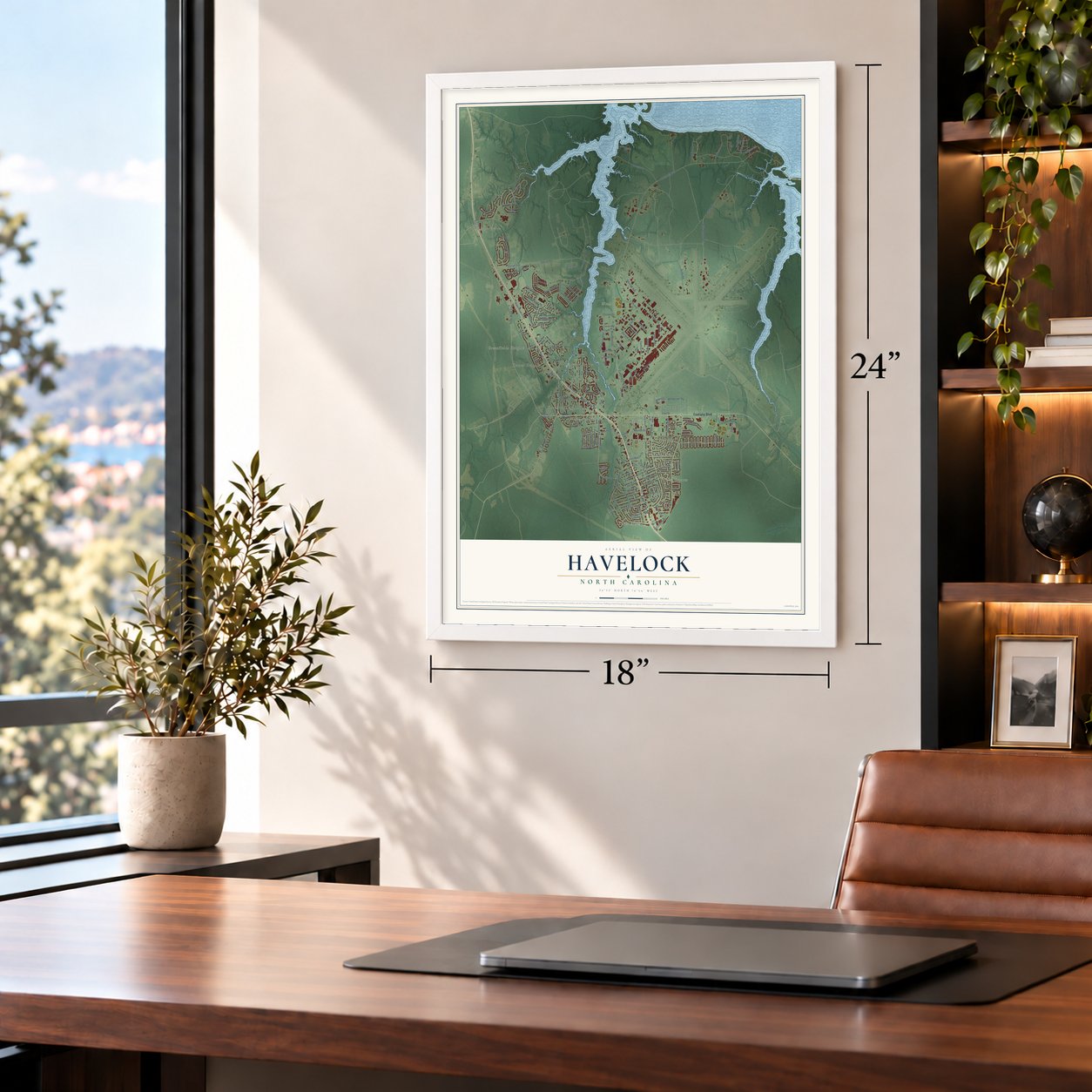
Havelock, North Carolina Map Art
Building by building, with labeled streets and shaded relief.
12" x 18" Archival Matte Print
A Map of Home. A Work of Art.
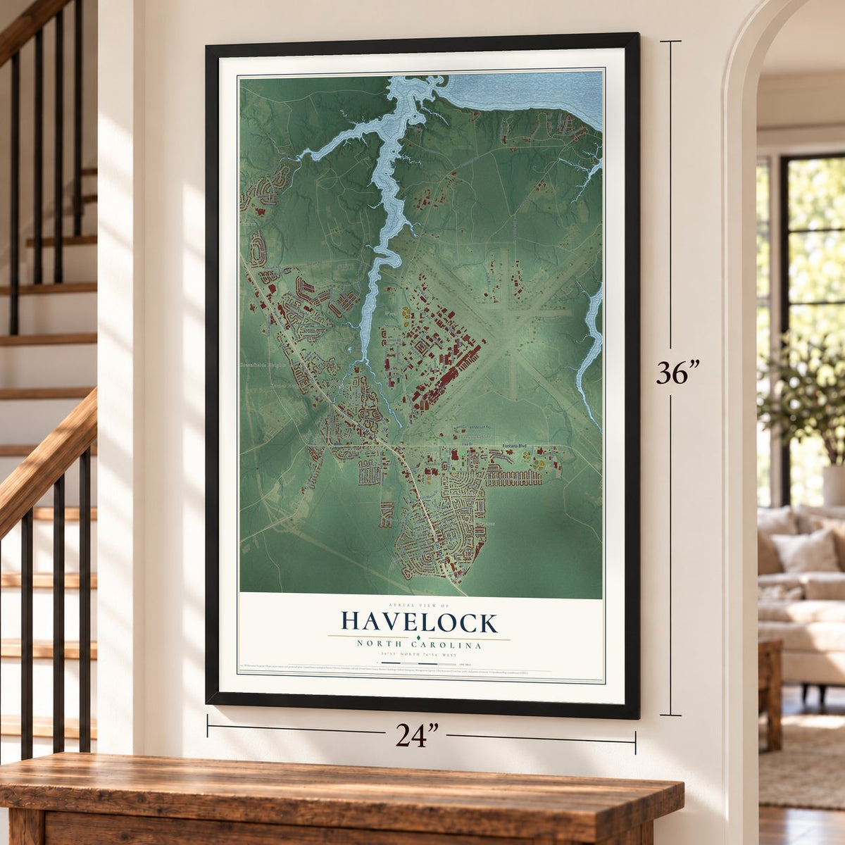
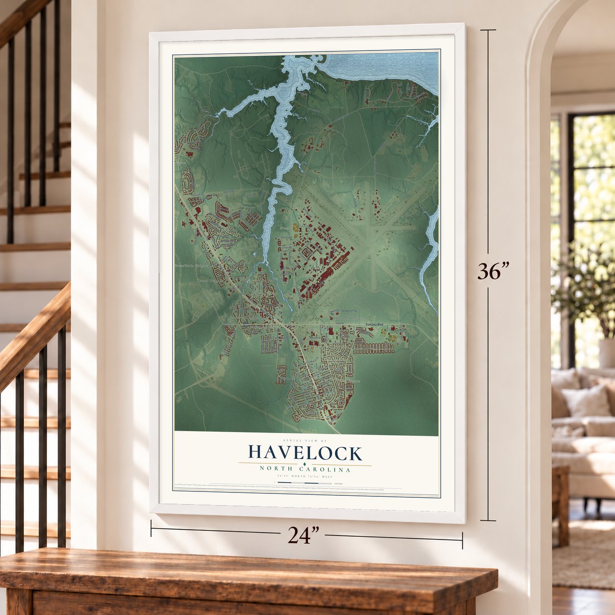
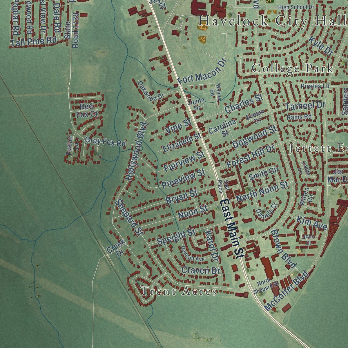
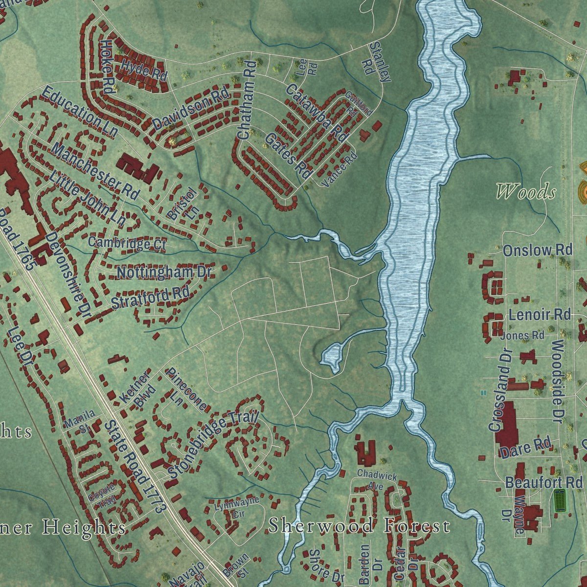
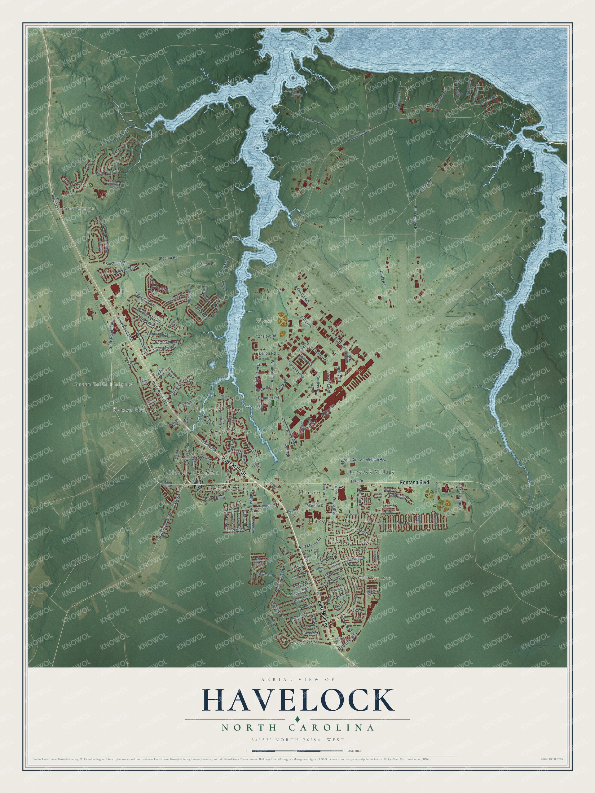
Explore Havelock, North Carolina from a whole new perspective. Created using aerial imagery and detailed geographic data, this map captures Havelock building by building, with labeled streets, familiar landmarks, and shaded topographical relief that highlights the natural contours of the landscape.
Combining modern data with the timeless character of a vintage atlas, this map is just as interesting up close as it is beautiful on the wall. Whether you grew up in Havelock, spent memorable years there, or call it home today, this unique map is a great way to celebrate a place that means something to you. Zoom in on the preview to look for your street, and then order a print to put your memories on the wall.
Three ways to hang it
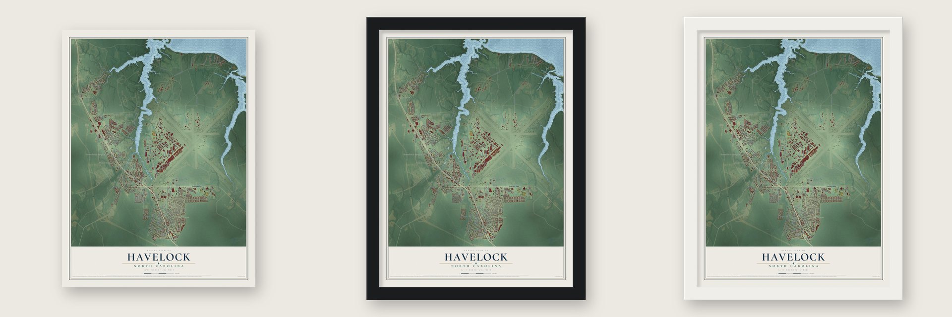
Unframed archival matte, a black wood frame or a white wood frame.
Up close
Geography Worth Displaying
This map was created using accurate cartographic data and authoritative geographic sources, including the U.S. Geological Survey and the Census Bureau. The map brings together terrain, waterways, roads, and building detail. The majority of the streets are labeled, houses are accurately depicted, and the topography is derived from government sources. Combining local data with carefully composed color and shading leads to this beautifully detailed Havelock artwork for your wall.
Rather than simply showing street outlines, we’ve included as many of the street names as we could reasonably fit on the map while keeping their names legible. Zoom in on the high resolution preview to see exactly what’s on the map. We truly set out to create a statement piece for anyone who loves Havelock. So whether it’s for you, or a gift for someone you love, we hope this map of Havelock brings back fond memories.
Read the story behind this map of Havelock, North Carolina from 2026.

Find your street
Names on the Havelock map
Every name below is printed on this map. Look for your street, your school, the park where you played, or the pond down the road.
Places and landmarks15
- Havelock City Hall
- Trent Acres
- Jerrett Estates
- Greenfields Heights
- Woods
- College Park
- Hancock Village
- Havelock Park
- Havelock Station
- Ketner Heights
- Manteo
- Pine Grove
Show all 15 places
- Sherwood Forest
- Slocun Village
- Kelley Park
Streets and roads178
- West Main Street
- East Main Street
- Fontana Boulevard
- Madison Drive
- Church Road
- State Road 1746
- Lake Road
- State Road 1756
- Second Avenue
- Lenoir Road
- Wilson Drive
- Rifle Range Road
- Roosevelt Boulevard
- Slocum Road
- State Road 1773
- McCotter Boulevard
- State Road 1765
- Alexander Road
- Webb Boulevard
- Jackson Drive
- Cunningham Boulevard
- Range Road
- Catawba Road
- Sixth Avenue
- Macdonald Boulevard
- Jefferson Drive
- Hollywood Boulevard
- Gates Road
- Farina Drive
- Monroe Drive
Show all 178 streets
- Rice Lane
- Slocum Avenue
- Mimosa Drive
- Seventh Avenue
- Shepard Street
- Sermons Boulevard
- Lee Drive
- Manchester Road
- Duffy Road
- Henderson Avenue
- Shipman Road
- Fifth Avenue
- Crossland Drive
- East Street
- Woodside Drive
- Stonebridge Trail
- Belltown Road
- Buchanan Drive
- Forest Hill Drive
- Fike Drive
- Bryan Street
- Fourth Avenue
- Davidson Road
- Curtiss Road
- Chatham Road
- Bryan Boulevard
- Devonshire Drive
- Stratford Road
- Nunn Street
- Pineview Street
- Little John Lane
- Fort Macon Drive
- Colin Drive
- Ives Street
- Speight Street
- Fairview Street
- Outer Banks Drive
- Charles Street
- Gooding Drive
- Education Lane
- Hoke Road
- Rowell Circle
- Craven Drive
- Nottingham Drive
- Dogwood Street
- Taylor Drive
- North Nunn Street
- Langley Road
- Beachey Road
- Third Avenue
- Karol Drive
- Beaufort Road
- Tall Pine Road
- Kyle Drive
- Pine Dale Road
- Poplar Road
- Brown Boulevard
- Tarheel Drive
- Holly Drive
- Oak Drive
- Stracky
- Manteo Drive
- Union Road
- Onslow Road
- Vine Street
- Jerrett Lane
- Oak Street
- Kim Avenue
- Dare Road
- Miller Boulevard
- Wright Road
- Russell Street
- Ketner Boulevard
- State Road 1739
- Woodhaven Drive
- Cedar Drive
- Stanley Road
- Gray Fox Road
- Washington Drive
- Cryogenics Drive
- Sanders Lane
- Webb Street
- Smith Circle
- Jer Mar Drive
- Forest View Drive
- Tucker Creek Lane
- Wildwood Road
- State Road 1772
- Barden Drive
- Cambridge Court
- Park Lane
- Elizabeth Street
- Cleveland Drive
- Carolina Street
- Hyde Road
- Sand Run Road
- Sunrise Lane
- Pinecone Lane
- Shellbark Court
- Wayne Drive
- Shore Drive
- Jaycee Street
- Locust Court
- Red Fox Court
- Navajo Trail
- Bristol Lane
- Bern Street
- Creek Drive
- Witten Circle
- Oakwood Drive
- Village Court
- Vance Road
- Mc Kinley Drive
- Pirates Lane
- Daniels Court
- Second Road
- Poplar Drive
- Kobe Drive
- Jones Road
- Rams Road
- Harrier Drive
- Realini Drive
- Evelyn Circle
- Manila Street
- Crocker Road
- Foxlair Lane
- Joann Drive
- Brown Street
- Tyler Drive
- Lee Road
- High School Drive
- Chadwick Avenue
- Lynnwayne Circle
- Woodland Drive
- Marsha's Way
- East Plaza
- Guilford Road
- Wynne Road
- Leslie Lane
- Donnell Avenue
- North Shepard Street
- John Court
- Recreation Drive
- Ashwood Court
- Harrison Drive
- Leana Lane
- Coyote Trail
- Jenny Lane
Names are listed as they appear on the printed map. Zoom into the product photos to find them.
About Havelock, North Carolina
Havelock is a city of 16,621 people in Craven County, reaching north to the tidal Neuse River. It began in the late 1850s as Havelock Station, a depot the Atlantic and North Carolina Railroad put up where its tracks crossed today's Miller Boulevard. The name honors Sir Henry Havelock, a British officer who made his name in India in 1857, and eight cities around the world share it.
In the 19th century the local economy leaned on naval supplies such as tar and turpentine. Once steam engines came along, fewer wooden ships were built and that trade faded, so many turpentine distillers turned to making moonshine. Marine Corps Air Station Cherry Point arrived in 1940, and Havelock was officially established as a town in 1959.
- The Union landing of 1862On March 11, 1862, Brigadier General Ambrose Burnside's troops sailed from Roanoke Island to meet Union gunboats at Hatteras Inlet. On March 13 the fleet went up the Neuse, anchored at Slocum Creek and put its infantry ashore on the south bank, opening the Battle of New Bern. Rhode Island Heavy Artillery units landed near today's Cherry Point Officers' Club. After New Bern fell, the Federals marched through Havelock toward Fort Macon.
- A blockhouse burned in 1864The Union built a blockhouse fort on Slocum Creek. Confederates tried several times to win back New Bern and the land around it, and during one of those tries the fort was burned in 1864. The Federals still held on until the war was over. A diorama of the fort is on display at the Havelock Tourist & Events Center.
- Home of Cherry PointHavelock's city limits take in most of Marine Corps Air Station Cherry Point, the largest Marine Corps air station in the world and home of the 2nd Marine Aircraft Wing. Its Fleet Readiness Center East is a major employer of local residents.
- Olympians and a Super Bowl championHavelock's notable people include Kristin Armstrong, who won three Olympic gold medals in women's road cycling, Olympic sprinter Dennis Mitchell, and Guy Whimper, an NFL offensive guard who won a Super Bowl with the Pittsburgh Steelers.
Keep exploring North Carolina
Havelock is one of 952 North Carolina towns we've mapped. Every dot on the map is a print of its own.
The search covers every state, North Carolina first.
Near Havelock
Order 2 or more town maps and save 10%. Shown in the size and finish you picked above, so they hang as a set.
- Neuse Forest 12" x 18" / Archival Matte Print $39.99
- Cherry Branch 12" x 18" / Archival Matte Print $39.99
- Minnesott Beach 12" x 18" / Archival Matte Print $39.99


More maps nearby: Arapahoe, Newport, James City, Fairfield Harbour and Broad Creek.
The art of mapping a place
How This Map Was Made
Real places. Remarkable detail. Discover the layers that turn geographic data into a map of home.

The view from above
Aerial imagery reveals the character of the land: woodland, open fields, and the patterns of a place.

The shape of the land
Elevation data brings hills, valleys, and subtle changes in the landscape into view.

The details of home
Roads, waterways, and building footprints come together to make the map feel unmistakably local.

Geography becomes art
Considered color, shading, and typography bring the layers together in a map made for your wall.


Process illustrated with Mendon, Massachusetts. Aerial imagery: USDA NAIP. Terrain: USGS 3D Elevation Program. Map details and finished artwork: KNOWOL.
The Details
About This Print
Choose an archival matte print, or a black or white Ayous wood frame. The archival matte print is unframed.
Select your size and finish above to see the matching product image and price.
Materials & Craftsmanship
A contemporary map with the character of a classic atlas, printed on archival matte paper. Optional frames are made from Ayous wood.
Your printed map does not include the watermark shown in the full-map preview.
Shipping & Delivery
Free shipping within the United States. Every print is made to order in the USA.
Buying a gift? Add a note in your cart and we'll include it. We never put prices in the package.
Prints ship within 2 to 3 business days. Allow 7 to 10 days total from ordering for delivery. Timing may vary during holidays or periods of high order volume.
Read our shipping policy.
Returns and damaged prints
Each print is made to order. Change-of-mind refunds are not available after production.
If your print arrives damaged, misprinted or incorrect, contact support@knowol.com within 30 days of receiving it. Include your order number, photos and a description of the issue.
Read our full refund and replacement policy. For questions about your order, email support@knowol.com.