
Search for another town





Free U.S. delivery 7 to 10 days after you order
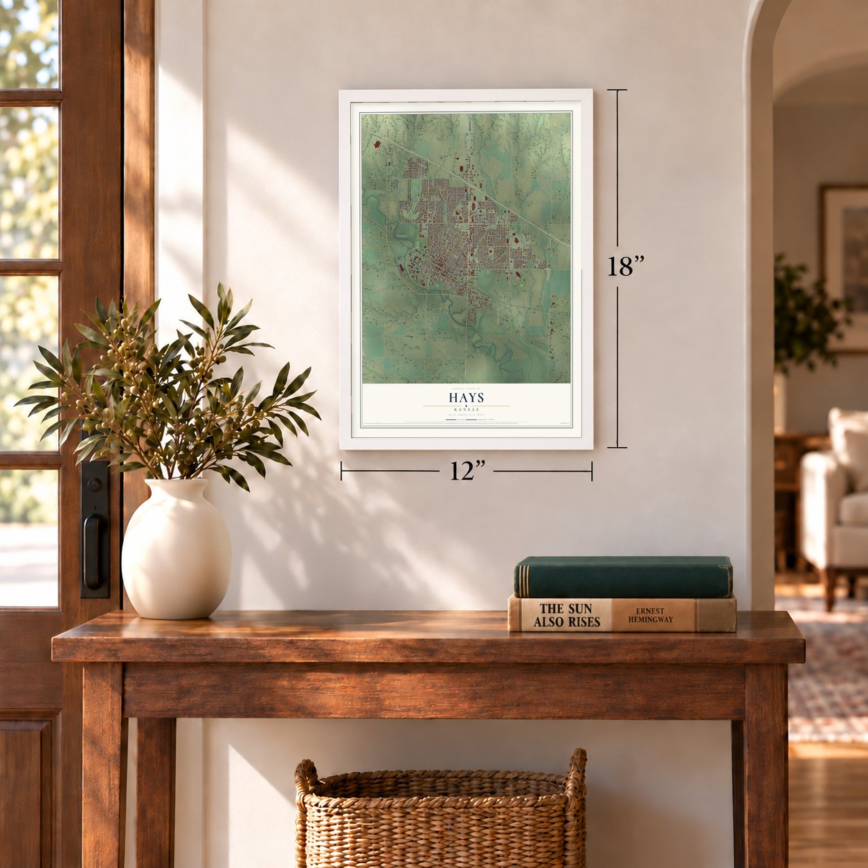
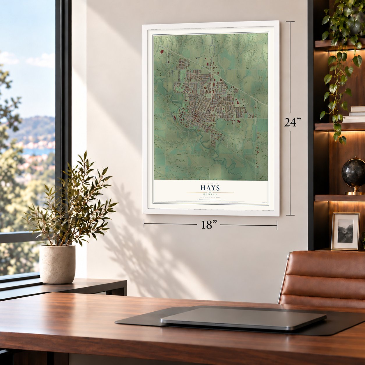
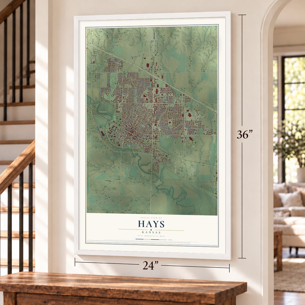
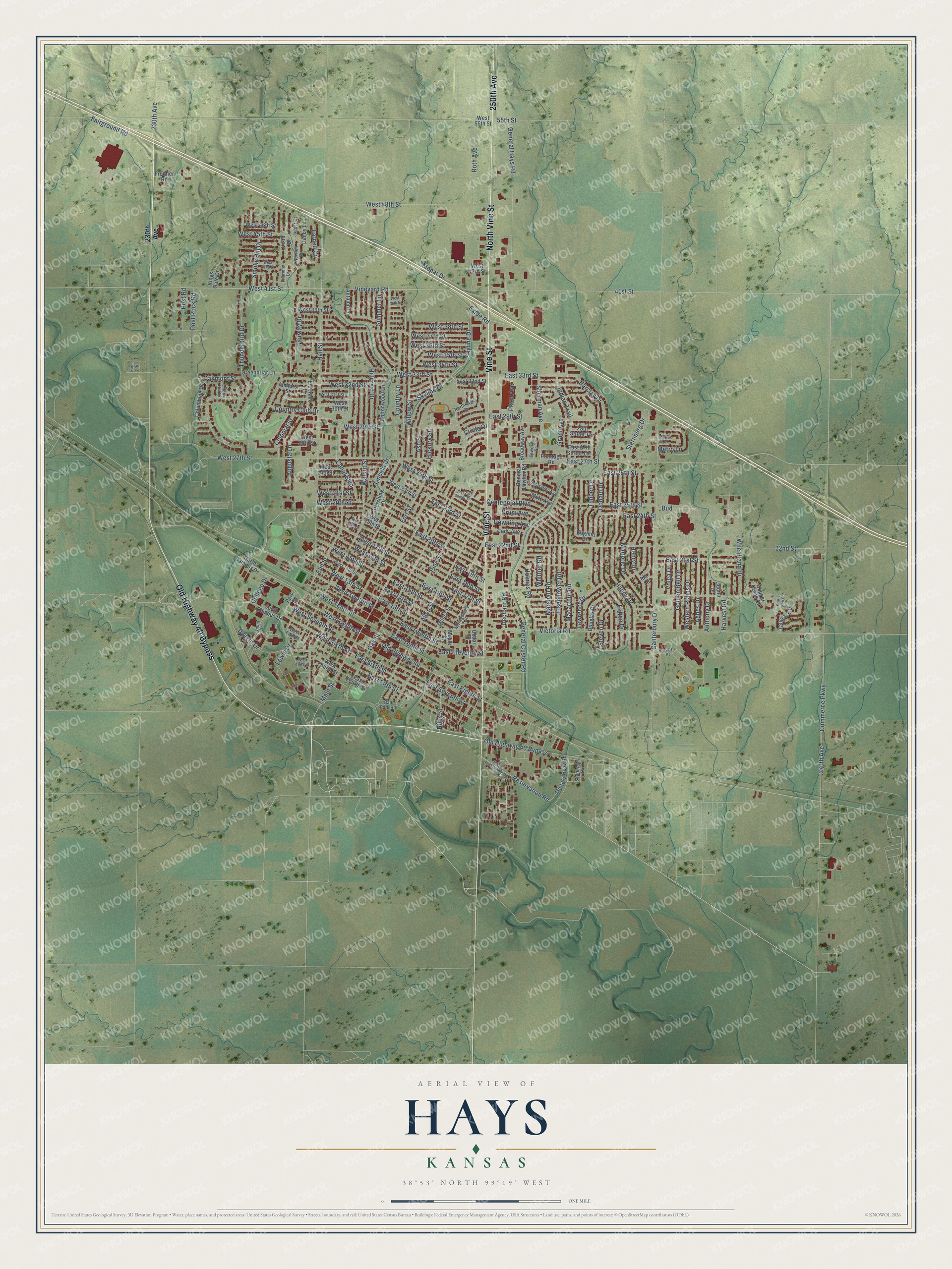
Hays, Kansas Map Art
Building by building, with labeled streets and shaded relief.
12" x 18" Archival Matte Print
A Map of Home. A Work of Art.
Explore Hays, Kansas from a whole new perspective. Created using aerial imagery and detailed geographic data, this map captures Hays building by building, with labeled streets, familiar landmarks, and shaded topographical relief that highlights the natural contours of the landscape.
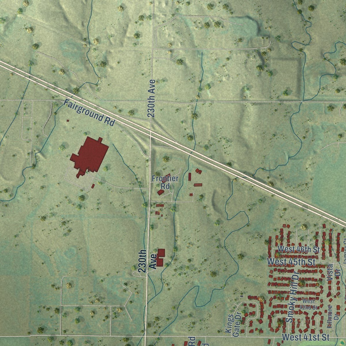
Combining modern data with the timeless character of a vintage atlas, this map is just as interesting up close as it is beautiful on the wall. Whether you grew up in Hays, spent memorable years there, or call it home today, this unique map is a great way to celebrate a place that means something to you. Zoom in on the preview to look for your street, and then order a print to put your memories on the wall.
Three ways to hang it
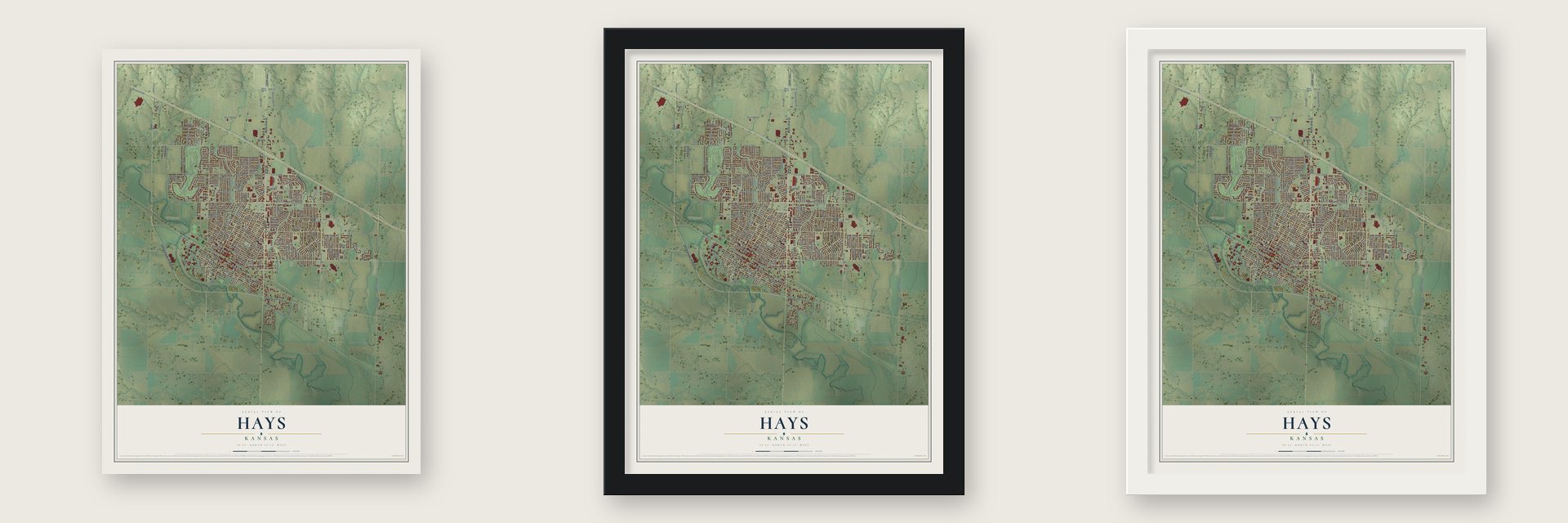
Unframed archival matte, a black wood frame or a white wood frame.
Up close
Geography Worth Displaying
This map was created using accurate cartographic data and authoritative geographic sources, including the U.S. Geological Survey and the Census Bureau. The map brings together terrain, waterways, roads, and building detail. The majority of the streets are labeled, houses are accurately depicted, and the topography is derived from government sources. Combining local data with carefully composed color and shading leads to this beautifully detailed Hays artwork for your wall.
Rather than simply showing street outlines, we’ve included as many of the street names as we could reasonably fit on the map while keeping their names legible. Zoom in on the high resolution preview to see exactly what’s on the map. We truly set out to create a statement piece for anyone who loves Hays. So whether it’s for you, or a gift for someone you love, we hope this map of Hays brings back fond memories.

Find your street
Names on the Hays map
Every name below is printed on this map. Look for your street, your school, the park where you played, or the pond down the road.
Streets and roads201
- North Vine Street
- Vine Street
- Old Highway 40 Bypass
- 250th Avenue
- Skyline Drive
- East 16th Street
- West Twelfth Street
- Reservation Road
- East Seventh Street
- East Twelfth Street
- West 17th Street
- West 15th Street
- General Custer Road
- East Fifth Street
- West Sixth Street
- East 13th Street
- Old Highway 40
- Fort Street
- Commerce Parkway
- Ash Street
- Oak Street
- Victoria Road
- 270th Avenue
- Canal Boulevard
- Hall Street
- Elm Street
- Main Street
- East 17th Street
- Walnut Street
- West 27th Street
Show all 201 streets
- Canterbury Drive
- Vineyard Road
- West 41st Street
- East 22nd Street
- East Eighth Street
- Thunderbird Drive
- Pine Street
- General Hays Road
- East 27th Street
- Allen Street
- East 19th Street
- Donald Drive
- Haney Drive
- Felten Drive
- East 26th Street
- 41st Street
- Country Lane
- 22nd Street
- East 15th Street
- Lincoln Drive
- West 37th Street
- East 29th Street
- West 35th Street
- Hillcrest Drive
- East 21st Street
- Roth Avenue
- Indian Trail
- East Sixth Street
- Willow Street
- East 25th Street
- Marjorie Drive
- West 33rd Street
- Sternberg Drive
- West 29th Street
- Henry Drive
- East 20th Street
- West 48th Street
- Sherman Avenue
- East Eleventh Street
- East 24th Street
- West 45th Street
- West 36th Street
- Wheatland Drive
- West 32nd Street
- East 18th Street
- West 20th Street
- Centennial Boulevard
- Fairway Drive
- East 14th Street
- Barclay Drive
- East 33rd Street
- West Eighth Street
- Fairground Road
- West 16th Street
- Golden Belt Drive
- Marshall Road
- Eisenhower Road
- Macarthur Road
- Mopar Drive
- West 13th Street
- West 38th Street
- Plaza Avenue
- Oakmont Street
- Summer Lane
- Augusta Lane
- West Seventh Street
- West 21st Street
- Holmes Road
- Western Plains Drive
- Agnes Drive
- Anthony Drive
- Drum Avenue
- Downing Avenue
- Metro Lane
- East 23rd Street
- East Tenth Street
- West Tenth Street
- West 34th Street
- Bud
- Harvest Road
- Lawrence Drive
- Timber Drive
- West 25th Street
- Smoky Hill Drive
- Dwight Drive
- Riley Street
- 230th Avenue
- Country Club Drive
- Skyline Court
- Lewis Drive
- Grant Avenue
- Larned Circle
- Post Road
- Post Rock Road
- Steven Drive
- Colonial Street
- Dechant Road
- Volga Drive
- College Drive
- Whittier Road
- Hickory Street
- Circle Drive
- Exide Road
- 55th Street
- South Campus Drive
- West 55th Street
- West Fourth Street
- East Fourth Street
- Milner Street
- Douglas Drive
- West 23rd Street
- West 24th Street
- Broadway Avenue
- West 19th Street
- North Campus Drive
- Virginia Drive
- East 32nd Street
- Cottonwood Lane
- West 28th Street
- Frontage Road
- Pershing Drive
- Autumn Lane
- West 43rd Street
- Military Resv Road
- East 27th Street Terrace
- Motz Avenue
- Columbine Drive
- West 30th Street
- West 39th Street
- General Lawton Road
- Judith Drive
- Cody Avenue
- Tallgrass Drive
- Greenbriar Lane
- Cedar Street
- West 46th Street
- Eldorado Lane
- Copper Creek Court
- Amhurst Street
- Park Street
- Vista Drive
- 28th Street Terrace
- Kings Gate Drive
- Danby Lane
- Frontier Road
- Maple Street
- Ida Lane
- West 14th Street
- Northridge Drive
- West Fifth Street
- Epworth Street
- Southridge Drive
- Schwaller Avenue
- Lyman Drive
- Montgomery Street
- West 31st Street
- Cherry Hill Drive
- Twelfth Street
- Fillmore Drive
- Jagger Court
- Newton Circle
- Patio Drive
- Ball Park Road
- Military Reservation Road
- West Third Street
- West 18th Street
- West 42nd Street
- West 40th Street
- East 25th Street Terrace
- Prarie Run Court
- Karen Drive
Names are listed as they appear on the printed map. Zoom into the product photos to find them.
About Hays, Kansas
Hays is a city of 21,116 people and the county seat of Ellis County. In 1865 the Army built Fort Fletcher southeast of today's city to guard stagecoaches on the Smoky Hill Trail. A year later it renamed the post Fort Hays, for Brig. Gen. Alexander Hays, who was killed at the Battle of the Wilderness. Late in 1866, three men, Judge Knight, W. F. Webb and W. J. Wells, picked out land near the fort, expecting the Kansas Pacific Railway to come through.
In June 1867 the Army moved the fort 15 miles northwest, close to where the tracks would cross Big Creek. Buffalo Bill Cody and William Rose started a rival town called Rome beside it, and Rome passed 2,000 people within a month. Webb's Big Creek Land Company then platted Hays City about a mile east, and the railroad put its depot there. The depot and a cholera outbreak in Rome that summer pulled Rome's people and shops to Hays City, and Rome stood empty within a year.
“Hays was the point from which the west and southwest obtained supplies before the railroad was completed to Dodge City.”
- County seat in 1870Hays City became the seat of Ellis County in 1870, and a United States land office opened there in 1874. The town was incorporated in 1885. In 1895 it dropped the word City and became simply Hays, the same year a fire burned 60 buildings downtown.
- Wild Bill's townGeorge Armstrong Custer and Elizabeth Bacon Custer, Calamity Jane and Buffalo Bill Cody all lived in early Hays City, and Wild Bill Hickok served a short term as sheriff in 1869. The town saw 30 homicides from 1867 to 1873, and by 1885 the Boot Hill cemetery north of town held some 79 outlaws. Hays recalls those years each July with its Wild West Festival.
- Turkey Red WheatVolga Germans began farming in Ellis County in 1876 and brought Turkey Red Wheat, a winter wheat that helped change farming across the region. Bukovina Germans followed in 1886. Their culture still shapes Hays, which holds two Oktoberfests each fall.
- From fort to universityFort Hays closed in 1889. In 1900 the state's members of Congress won its land and buildings for schools, and the Western Branch of Kansas State Normal School opened on the old reservation in 1902. That school grew into Fort Hays State University, and the fort itself became the Fort Hays State Historic Site in 1967.
- Eight on the National RegisterFirst Presbyterian Church (1973), Phillip Hardware Store (1982), Drees House (2001), the Justus Bissing, Jr. Historic District (2004), St. Joseph's Church and Parochial School (2008), the J.A. Mermis House (2009), the Chestnut Street Historic District boundary increase (2011) and Washington Grade School (2021) are all listed.
Keep exploring Kansas
Hays is one of 764 Kansas towns we've mapped. Every dot on the map is a print of its own.
The search covers every state, Kansas first.
Near Hays
Order 2 or more town maps and save 10%. Shown in the size and finish you picked above, so they hang as a set.
- Munjor 12" x 18" / Archival Matte Print $39.99
- Catharine 12" x 18" / Archival Matte Print $39.99
- Victoria 12" x 18" / Archival Matte Print $39.99


More maps nearby: Schoenchen, Ellis, Liebenthal, Gorham and Codell.
The art of mapping a place
How This Map Was Made
Real places. Remarkable detail. Discover the layers that turn geographic data into a map of home.

The view from above
Aerial imagery reveals the character of the land: woodland, open fields, and the patterns of a place.

The shape of the land
Elevation data brings hills, valleys, and subtle changes in the landscape into view.

The details of home
Roads, waterways, and building footprints come together to make the map feel unmistakably local.

Geography becomes art
Considered color, shading, and typography bring the layers together in a map made for your wall.


Process illustrated with Mendon, Massachusetts. Aerial imagery: USDA NAIP. Terrain: USGS 3D Elevation Program. Map details and finished artwork: KNOWOL.
The Details
About This Print
Choose an archival matte print, or a black or white Ayous wood frame. The archival matte print is unframed.
Select your size and finish above to see the matching product image and price.
Materials & Craftsmanship
A contemporary map with the character of a classic atlas, printed on archival matte paper. Optional frames are made from Ayous wood.
Your printed map does not include the watermark shown in the full-map preview.
Shipping & Delivery
Free shipping within the United States. Every print is made to order in the USA.
Buying a gift? Add a note in your cart and we'll include it. We never put prices in the package.
Prints ship within 2 to 3 business days. Allow 7 to 10 days total from ordering for delivery. Timing may vary during holidays or periods of high order volume.
Read our shipping policy.
Returns and damaged prints
Each print is made to order. Change-of-mind refunds are not available after production.
If your print arrives damaged, misprinted or incorrect, contact support@knowol.com within 30 days of receiving it. Include your order number, photos and a description of the issue.
Read our full refund and replacement policy. For questions about your order, email support@knowol.com.