


Search for another town


Free U.S. delivery 7 to 10 days after you order
Henderson, North Carolina Map Art
Building by building, with labeled streets and shaded relief.
12" x 18" Archival Matte Print
A Map of Home. A Work of Art.
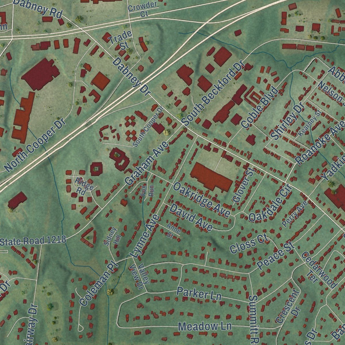
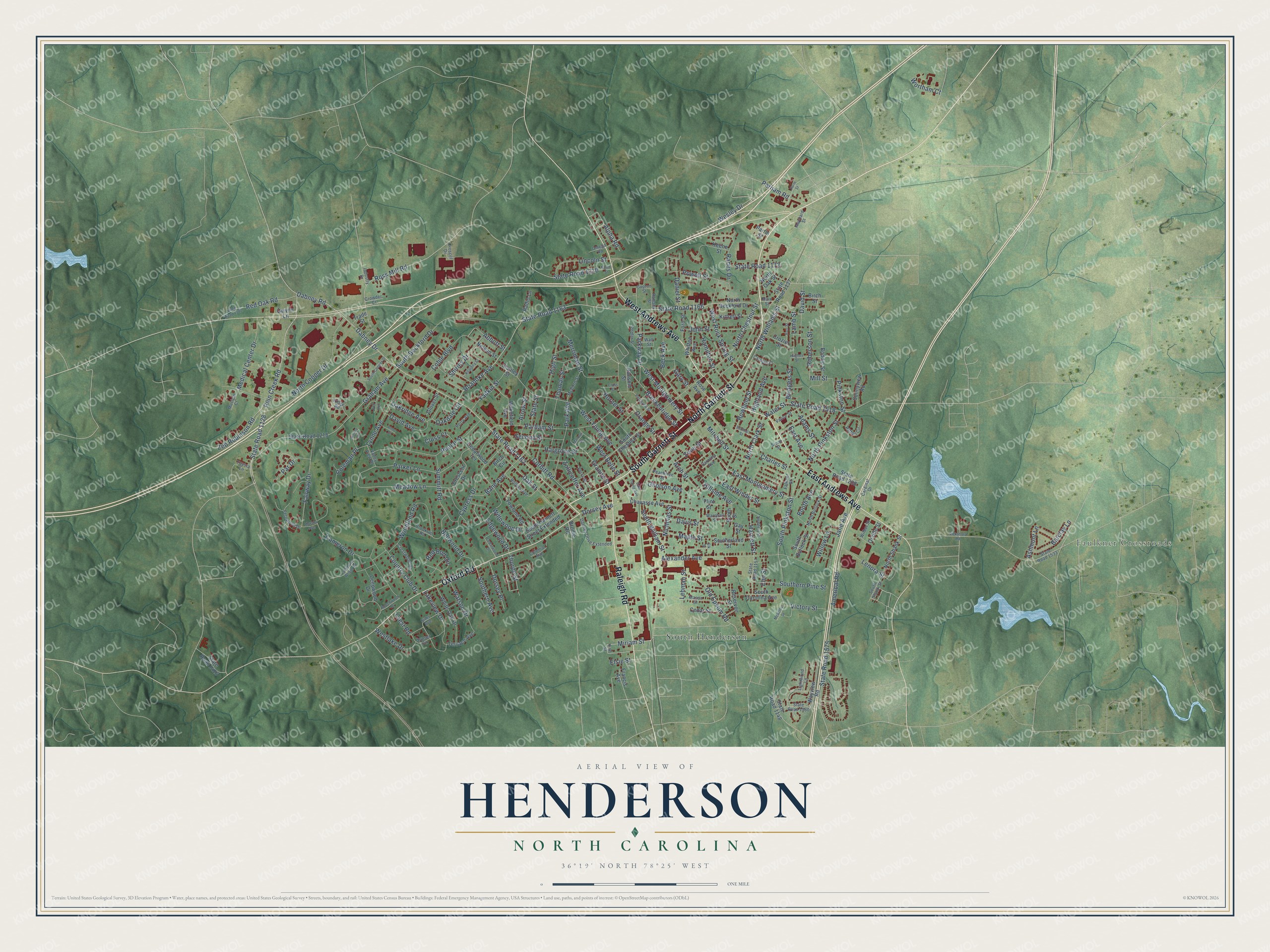
Explore Henderson, North Carolina from a whole new perspective. Created using aerial imagery and detailed geographic data, this map captures Henderson building by building, with labeled streets, familiar landmarks, and shaded topographical relief that highlights the natural contours of the landscape.
Combining modern data with the timeless character of a vintage atlas, this map is just as interesting up close as it is beautiful on the wall. Whether you grew up in Henderson, spent memorable years there, or call it home today, this unique map is a great way to celebrate a place that means something to you. Zoom in on the preview to look for your street, and then order a print to put your memories on the wall.
Three ways to hang it
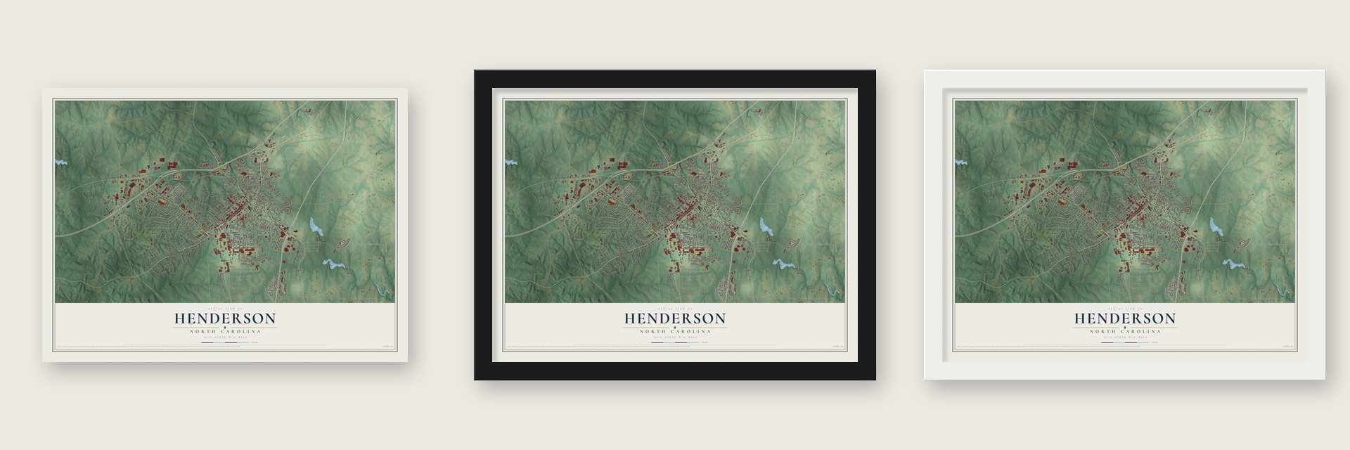
Unframed archival matte, a black wood frame or a white wood frame.
Up close
Geography Worth Displaying
This map was created using accurate cartographic data and authoritative geographic sources, including the U.S. Geological Survey and the Census Bureau. The map brings together terrain, waterways, roads, and building detail. The majority of the streets are labeled, houses are accurately depicted, and the topography is derived from government sources. Combining local data with carefully composed color and shading leads to this beautifully detailed Henderson artwork for your wall.
Rather than simply showing street outlines, we’ve included as many of the street names as we could reasonably fit on the map while keeping their names legible. Zoom in on the high resolution preview to see exactly what’s on the map. We truly set out to create a statement piece for anyone who loves Henderson. So whether it’s for you, or a gift for someone you love, we hope this map of Henderson brings back fond memories.
Read the story behind this map of Henderson, North Carolina from 2026.

Find your street
Names on the Henderson map
Every name below is printed on this map. Look for your street, your school, the park where you played, or the pond down the road.
Places and landmarks2
- Faulkner Crossroads
- South Henderson
Streets and roads249
- North Garnett Street
- South Garnett Street
- Raleigh Road
- West Andrews Avenue
- East Andrews Avenue
- Oxford Road
- State Road 1162
- Ruin Creek Road
- State Road 1128
- East Montgomery Street
- West Montgomery Street
- State Road 1163
- South Pinkston Street
- Miriam Street
- Granite Street
- Dorsey Avenue
- Roanoke Avenue
- Ashmont Lane
- Dabney Drive
- South Beckford Drive
- Ross Mill Road
- Meadow Lane
- Orange Street
- State Road 1166
- Dabney Road
- West Young Avenue
- Parker Lane
- Oak Street
- Mill Street
- Americal Road
Show all 249 streets
- State Road 1575
- State Road 1310
- South William Street
- Graham Avenue
- Old Epsom Road
- Woodland Road
- Alexander Avenue
- North Williams Street
- Parham Street
- North Chestnut Street
- Nicholas Street
- Cameron Drive
- Hargrove Street
- North Cooper Drive
- East Winder Street
- Peace Street
- Corbitt Road
- Park Avenue
- State Road 1518
- Water Street
- Lakeview Drive
- North Pinkston Street
- Willowood Drive
- Charles Street
- West Rock Spring Street
- Harriett Street
- High Street
- East Avenue
- Cypress Drive
- Arch Street
- Coble Boulevard
- Bane Avenue
- Breckenridge Street
- Fairway Drive
- North Clark Street
- Horner Street
- Rowland Street
- Merriman Street
- Red Oak Road
- Lehman Street
- Lynne Avenue
- Summitt Road
- Medical Center Drive
- Southern Pine Street
- Zeb Robinson Road
- Jane Avenue
- Oakdale Circle
- John Street
- Bellwood Drive
- Ranes Drive
- Lenora Street
- Thomas Street
- Coleman Place
- Parkway Drive
- West Belle Street
- Hamilton Street
- Lincoln Street
- Highland Avenue
- Wesley Drive
- Powell Street
- Davis Street
- Oakridge Avenue
- Mitchell Street
- Shirley Drive
- Maple Street
- Watson Drive
- Barclay Lane
- Country Club Drive
- Zollicoffer Avenue
- Lamb Street
- Adams Street
- Second Street
- Yadkin Street
- David Avenue
- Zene Street
- Par Drive
- State Road 1173
- Southern Avenue
- Dorsey Place
- Parham Road
- Roberson Street
- Westlake Drive
- David Street
- Willow Lane
- Red Bud Circle
- Daniel Street
- Alpha Road
- Abbott Street
- Bridgers Street
- Beck Avenue
- Hillside Avenue
- Thorpe Street
- Booth Avenue
- Victory Street
- Edgewood Drive
- Elm Street
- Arrow Street
- Gholson Avenue
- Closs Court
- Wortham Court
- Gary Street
- Pinkston Street
- State Street
- Crest Road
- Elsie Street
- Reservoir Street
- Booth Street
- State Road 1218
- State Road 1148
- South Chestnut Street
- North Beckford Drive
- State Road 1208
- Chavasse Avenue
- Boddie Street
- Deepwood Drive
- White Oak Drive
- Whitten Avenue
- Wayview Road
- Wakefield Avenue
- Kittrell Street
- South Carolina Avenue
- State Road 1137
- North Shank Street
- Flint Street
- Yowland Road
- Southerland Street
- South Garnett Street Extended
- Keene Street
- Nelson Street
- Ford Street
- Cedarwood Terrace
- South Bullock Street
- State Road 1416
- Sunnyview Road
- Crescent Drive
- Crozier Street
- Radio Lane
- Cedar Street
- Terrace Avenue
- Gay Street
- Glover Street
- Stanley Street
- Rose Avenue
- Orville Street
- Ransom Street
- Brodie Road
- Birch Street
- Gwynn Lane
- Francis Avenue
- North Oak Street
- Partin Street
- Trade Street
- Birch Circle
- South Shank Street
- Fort Street
- Sunset Circle
- Gupton Street
- State Road 1157
- State Road 1533
- Brookrun Road
- Mason Street
- Ridge Road
- Patton Circle
- Dabney Drive Extended
- Sims Avenue
- North Bullock Street
- Rollins Avenue
- Crestwood Road
- Cardinal Drive
- Perry Street
- Main Street
- Fernwood Drive
- Omega Road
- Maynard Street
- Vance Street
- McBorn Street
- State Road 1580
- Peachtree Street
- Falkner Street
- Poplar Street
- Toyota Lane
- Carolina Avenue
- Marshall Street
- Lightwood Lane
- Croscill Drive
- Valley View Drive
- Perry Avenue
- Musical Court
- Carolyn Court
- Ramsey Street
- Wilbur Street
- Industry Drive
- Crowder Court
- Colonial Avenue
- Wall Street
- Stone Street
- Beechwood Drive
- State Road 1302
- Vicksboro Road
- South Cooper Drive
- Pettigrew Street
- East Young Avenue
- Hughes Street
- Cedarwood Drive
- North Street
- Farm Street
- Neathery Street
- Burr Street
- Kearney Street
- Sidney Hill
- Southall Street
- Lattimore Wright Road
- Anne Street
- Fox Run
- Cross Street
- McArthur Street
- Marsha Avenue
- Marrow Drive
- Elk Street
Names are listed as they appear on the printed map. Zoom into the product photos to find them.
About Henderson, North Carolina
Henderson is a city of 15,060 people and the county seat of Vance County. It is named for Leonard Henderson, who served as chief justice of the state's Supreme Court from 1829 to 1833. He lived close by and counted the early settler Lewis Reavis as a friend. The North Carolina General Assembly chartered the town in 1841.
For its first forty years Henderson stood in the far eastern part of Granville County. That changed in 1881, when the state created Vance County and made Henderson its seat. The new county's courthouse went up in 1884, and the Vance County Courthouse joined the National Register in 1979.
- A church from 1773St. John's Episcopal Church was established in 1773. Only three colonial church buildings still stand in North Carolina, and this is one of them. It joined the National Register in 1971.
- Home of Roses storesPaul Howard Rose founded Roses Discount Stores, and the chain keeps its headquarters in Henderson.
- On the old Seaboard main lineHenderson grew up on the S-Line, which served as the Seaboard Air Line Railroad's main route and today belongs to CSX. Passenger trains stopped here until 1986, when Amtrak sent its Silver Star through Rocky Mount and part of the line was abandoned. Plans for the Southeast High Speed Rail Corridor call for bringing the line back.
Keep exploring North Carolina
Henderson is one of 952 North Carolina towns we've mapped. Every dot on the map is a print of its own.
The search covers every state, North Carolina first.
Near Henderson
Order 2 or more town maps and save 10%. Shown in the size and finish you picked above, so they hang as a set.
- South Henderson 12" x 18" / Archival Matte Print $39.99
- Dabney 12" x 18" / Archival Matte Print $39.99
- Middleburg 12" x 18" / Archival Matte Print $39.99


More maps nearby: Kittrell, Oxford, Stovall, Norlina and Tar River.
The art of mapping a place
How This Map Was Made
Real places. Remarkable detail. Discover the layers that turn geographic data into a map of home.

The view from above
Aerial imagery reveals the character of the land: woodland, open fields, and the patterns of a place.

The shape of the land
Elevation data brings hills, valleys, and subtle changes in the landscape into view.

The details of home
Roads, waterways, and building footprints come together to make the map feel unmistakably local.

Geography becomes art
Considered color, shading, and typography bring the layers together in a map made for your wall.


Process illustrated with Mendon, Massachusetts. Aerial imagery: USDA NAIP. Terrain: USGS 3D Elevation Program. Map details and finished artwork: KNOWOL.
The Details
About This Print
Choose an archival matte print, or a black or white Ayous wood frame. The archival matte print is unframed.
Select your size and finish above to see the matching product image and price.
Materials & Craftsmanship
A contemporary map with the character of a classic atlas, printed on archival matte paper. Optional frames are made from Ayous wood.
Your printed map does not include the watermark shown in the full-map preview.
Shipping & Delivery
Free shipping within the United States. Every print is made to order in the USA.
Buying a gift? Add a note in your cart and we'll include it. We never put prices in the package.
Prints ship within 2 to 3 business days. Allow 7 to 10 days total from ordering for delivery. Timing may vary during holidays or periods of high order volume.
Read our shipping policy.
Returns and damaged prints
Each print is made to order. Change-of-mind refunds are not available after production.
If your print arrives damaged, misprinted or incorrect, contact support@knowol.com within 30 days of receiving it. Include your order number, photos and a description of the issue.
Read our full refund and replacement policy. For questions about your order, email support@knowol.com.