
Search for another town


Free U.S. delivery 7 to 10 days after you order
Oxford, North Carolina Map Art
Building by building, with labeled streets and shaded relief.
12" x 18" Archival Matte Print
A Map of Home. A Work of Art.
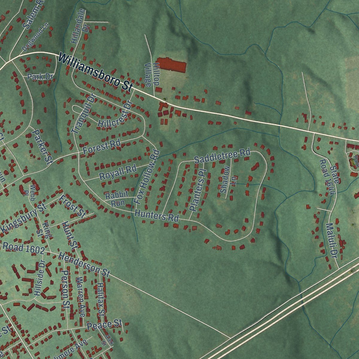
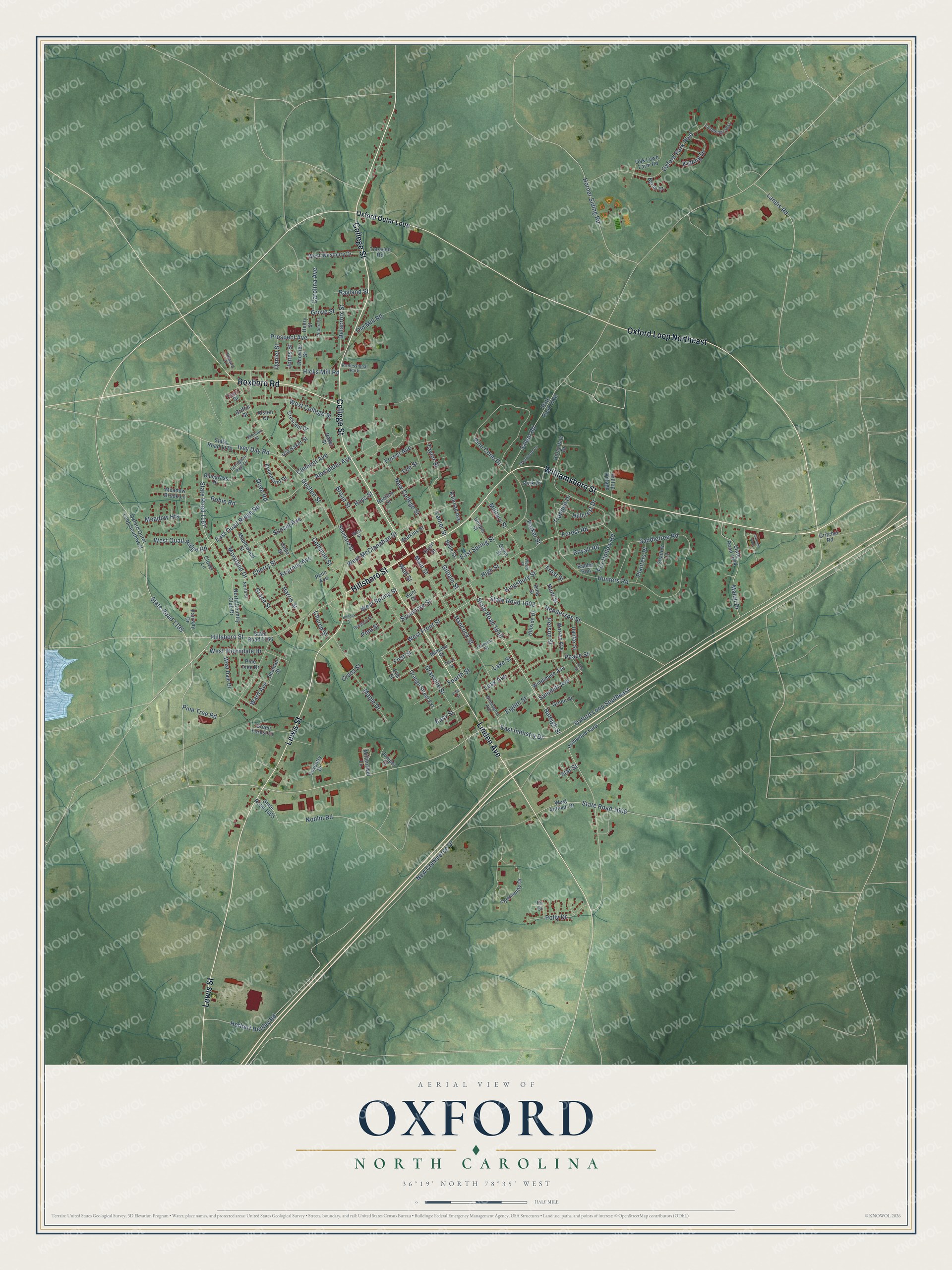
Explore Oxford, North Carolina from a whole new perspective. Created using aerial imagery and detailed geographic data, this map captures Oxford building by building, with labeled streets, familiar landmarks, and shaded topographical relief that highlights the natural contours of the landscape.
Combining modern data with the timeless character of a vintage atlas, this map is just as interesting up close as it is beautiful on the wall. Whether you grew up in Oxford, spent memorable years there, or call it home today, this unique map is a great way to celebrate a place that means something to you. Zoom in on the preview to look for your street, and then order a print to put your memories on the wall.
Three ways to hang it
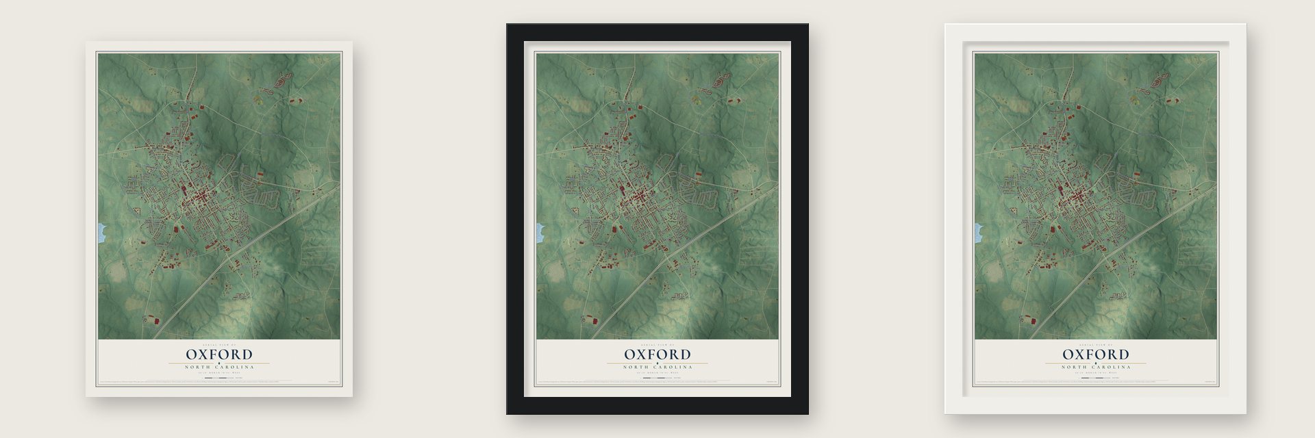
Unframed archival matte, a black wood frame or a white wood frame.
Up close
Geography Worth Displaying
This map was created using accurate cartographic data and authoritative geographic sources, including the U.S. Geological Survey and the Census Bureau. The map brings together terrain, waterways, roads, and building detail. The majority of the streets are labeled, houses are accurately depicted, and the topography is derived from government sources. Combining local data with carefully composed color and shading leads to this beautifully detailed Oxford artwork for your wall.
Rather than simply showing street outlines, we’ve included as many of the street names as we could reasonably fit on the map while keeping their names legible. Zoom in on the high resolution preview to see exactly what’s on the map. We truly set out to create a statement piece for anyone who loves Oxford. So whether it’s for you, or a gift for someone you love, we hope this map of Oxford brings back fond memories.
Read the story behind this map of Oxford, North Carolina from 2026.

Find your street
Names on the Oxford map
Every name below is printed on this map. Look for your street, your school, the park where you played, or the pond down the road.
Places and landmarks2
- Professional Park
- Autumn Park
Streets and roads180
- Hillsboro Street
- College Street
- Williamsboro Street
- Lewis Street
- Linden Avenue
- Roxboro Road
- Oxford Loop Northeast
- State Road 1650
- Raleigh Street
- East Industry Drive
- West Thorndale Drive
- State Road 1195
- East Quail Ridge Road
- State Road 1167
- Oxford Loop Southeast
- Alexander Avenue
- Ivey Day Road
- State Road 1602
- West McClanahan Street
- Granville Street
- Saddletree Road
- Pine Cone Drive
- Goshen Street
- Henderson Street
- Broad Street
- East Spring Street
- Oxford Park Boulevard
- Forest Road
- New Commerce Drive
- Cherry Street
Show all 180 streets
- Pine Tree Road
- High Street
- Harris Street
- Sunset Avenue
- Hicks Mill Road
- West Spring Street
- Maluli Drive
- Salem Road
- Hunters Road
- State Road 1606
- Maple Drive
- West College Street
- Lanier Street
- Noblin Road
- New College Street
- Sycamore Street
- Forest Avenue
- West Front Street
- Prospect Avenue
- Hancock Street
- Person Street
- Main Street
- Gilliam Street
- Peace Street
- Grace Street
- Kingsbury Street
- Meadow Heights
- Tranquil Drive
- Fourth Street
- West Quail Ridge Road
- Delacroix Street
- Military Street
- Polly Drive
- Kipling Drive
- Taylor Street
- Coleman Street
- Fox Hollow Road
- Horner Siding Road
- Grove Street
- Herbert Henley Road
- Clement Avenue
- Hillcrest Drive
- Summitt Avenue
- Kearney Avenue
- Moreland Drive
- Royall Road
- Carolina Avenue
- Eighth Street
- Leak Avenue
- Planters Place
- Robin Road
- Old Mill Road
- Easy Street
- Wall Street
- Landis Road
- Rayland Street
- Daniel Street
- Jones Street
- Church Street
- First Street
- Hunt Street
- Parker Street
- Lake Street
- Lee Street
- Dove Road
- Hays Street
- Ward Avenue
- Pine Street
- Cross Street
- Star Street
- Frost Street
- Oxford Outer Loop
- North Country Club Drive
- Old Baker Street
- Orange Street Extension
- State Road 1166
- Park Drive
- Community Drive
- Keeneland Drive
- State Road 1644
- State Road 1522
- West Antioch Drive
- Oxford Outer Loop Southwest
- State Road 1605
- State Road 1170
- Mimosa Street
- Hillside Drive
- West Westbury Drive
- Rectory Street
- Meadow Brook Lane
- Belle Street
- West Dale Drive
- Maplewood Street
- Mittenzwei Lane
- Warren Avenue
- Crescent Drive
- Windimere Avenue
- Green Forest Drive
- Green Street
- Pulpwood Yard
- Halifax Street
- Tobacco Road
- Penn Avenue
- Hillandale Drive
- Bluegrass Drive
- Standard Street
- Railroad Avenue
- Coventry Drive
- Knowles Street
- Oak Lawn Farm Road
- Shadow Lane
- King Street
- Cooper Street
- Hilltop Village
- Juniper Court
- Seaman Street
- Fairway Drive
- Watkins Street
- Court Street
- Elm Street
- Devin Street
- Clover Lane
- Della Street
- Critcher Road
- Henry Street
- Rabbit Run
- Griffin Street
- Byron Court
- Baker Street
- Pine Tree Drive
- Alston Court
- Hunt Drive
- Pearl Street
- Fir Court
- Wilmington Avenue
- Lexington Park Drive
- Cambridge Way
- Dogwood Lane
- Franklin Street
- Albert Street
- Gregory Place
- North Street
- Phocian Street
- Webb Place
- West Street
- Howard Drive
- Third Street
- Bullock Street
- Fifth Street
- Alex Street
Names are listed as they appear on the printed map. Zoom into the product photos to find them.
About Oxford, North Carolina
Oxford is a city of 8,628 people and the seat of Granville County. In 1761 Samuel Benton, who represented the area in the legislature, built a plantation house and gave it the name Oxford. Lawmakers then made the land around his home the county seat, though the town waited until 1816 to incorporate.
In the 1850s Oxford grew into a school town. North Carolina Baptists founded Oxford Female College in 1850, but money troubles forced them to sell it, and it went on as a private school called Oxford Female Seminary. F. P. Hobgood took charge in 1880 and made it popular, and the school closed in 1925, a year after his death.
- First Masonic orphanageSt. John's College opened here in 1858 and shut down soon after. In 1872 the community chose to use its grounds to teach children in need, and in December 1873 the Oxford Orphans Asylum took in its first residents. It was the first Masonic orphanage for children in the country, and it now runs as the Masonic Home for Children at Oxford.
- Horner Military School, 1851James H. Horner started his military school in 1851, and it drew students from as far away as New York and South Carolina. Many went on to careers in government, among them James Crawford Biggs, who served as Solicitor General under Franklin D. Roosevelt as the New Deal began. Fire destroyed the barracks in 1913, and the school moved to Charlotte.
- Colored Orphan Asylum, 1883The state legislature founded the Colored Orphan Asylum in Oxford in 1883. In the early 1900s Henry Plummer Cheatham, who had served in Congress from 1889 to 1893, became its superintendent, and he ran the institution for 28 years.
- Blood Done Sign My NameHenry Marrow was shot and killed in Oxford in 1970, and his death set off a racial protest. After the protests the city moved the Confederate monument, put up on the courthouse square in 1909, to the front of the Richard H. Thornton Library, and in June 2020 the statue was taken down and put in storage. Timothy Tyson told the story of 1970 in his 2004 book, and a movie with the same title followed in 2010.
Keep exploring North Carolina
Oxford is one of 952 North Carolina towns we've mapped. Every dot on the map is a print of its own.
The search covers every state, North Carolina first.
Near Oxford
Order 2 or more town maps and save 10%. Shown in the size and finish you picked above, so they hang as a set.
- Dabney 12" x 18" / Archival Matte Print $39.99
- Stovall 12" x 18" / Archival Matte Print $39.99
- Tar River 12" x 18" / Archival Matte Print $39.99


More maps nearby: Henderson, South Henderson, Kittrell, Stem and Wilton.
The art of mapping a place
How This Map Was Made
Real places. Remarkable detail. Discover the layers that turn geographic data into a map of home.

The view from above
Aerial imagery reveals the character of the land: woodland, open fields, and the patterns of a place.

The shape of the land
Elevation data brings hills, valleys, and subtle changes in the landscape into view.

The details of home
Roads, waterways, and building footprints come together to make the map feel unmistakably local.

Geography becomes art
Considered color, shading, and typography bring the layers together in a map made for your wall.


Process illustrated with Mendon, Massachusetts. Aerial imagery: USDA NAIP. Terrain: USGS 3D Elevation Program. Map details and finished artwork: KNOWOL.
The Details
About This Print
Choose an archival matte print, or a black or white Ayous wood frame. The archival matte print is unframed.
Select your size and finish above to see the matching product image and price.
Materials & Craftsmanship
A contemporary map with the character of a classic atlas, printed on archival matte paper. Optional frames are made from Ayous wood.
Your printed map does not include the watermark shown in the full-map preview.
Shipping & Delivery
Free shipping within the United States. Every print is made to order in the USA.
Buying a gift? Add a note in your cart and we'll include it. We never put prices in the package.
Prints ship within 2 to 3 business days. Allow 7 to 10 days total from ordering for delivery. Timing may vary during holidays or periods of high order volume.
Read our shipping policy.
Returns and damaged prints
Each print is made to order. Change-of-mind refunds are not available after production.
If your print arrives damaged, misprinted or incorrect, contact support@knowol.com within 30 days of receiving it. Include your order number, photos and a description of the issue.
Read our full refund and replacement policy. For questions about your order, email support@knowol.com.