
Search for another town



Free U.S. delivery 7 to 10 days after you order
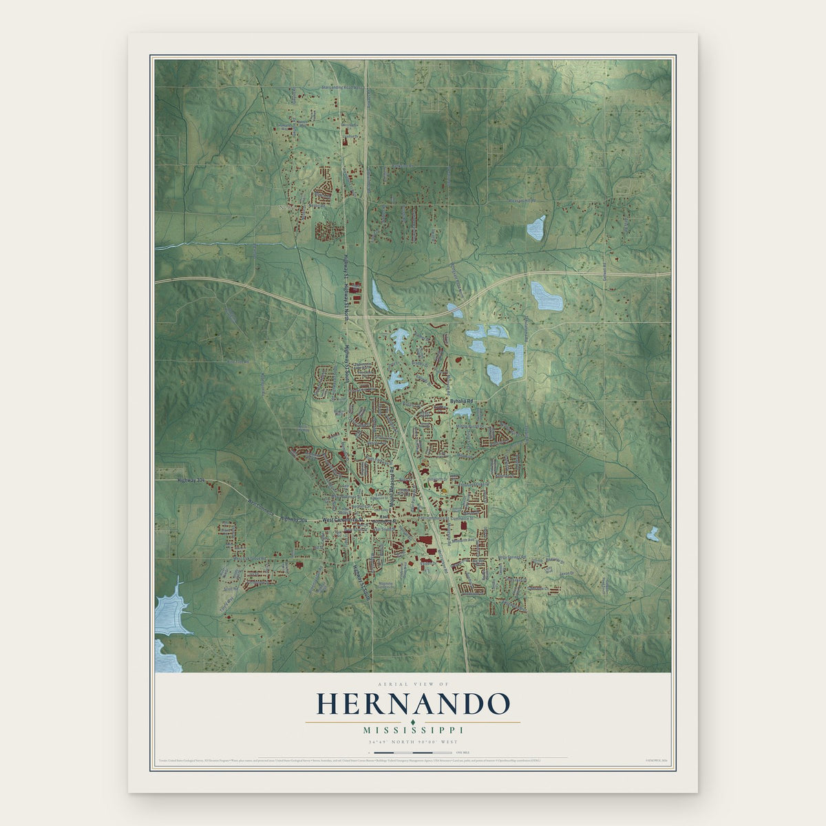
Hernando, Mississippi Map Art
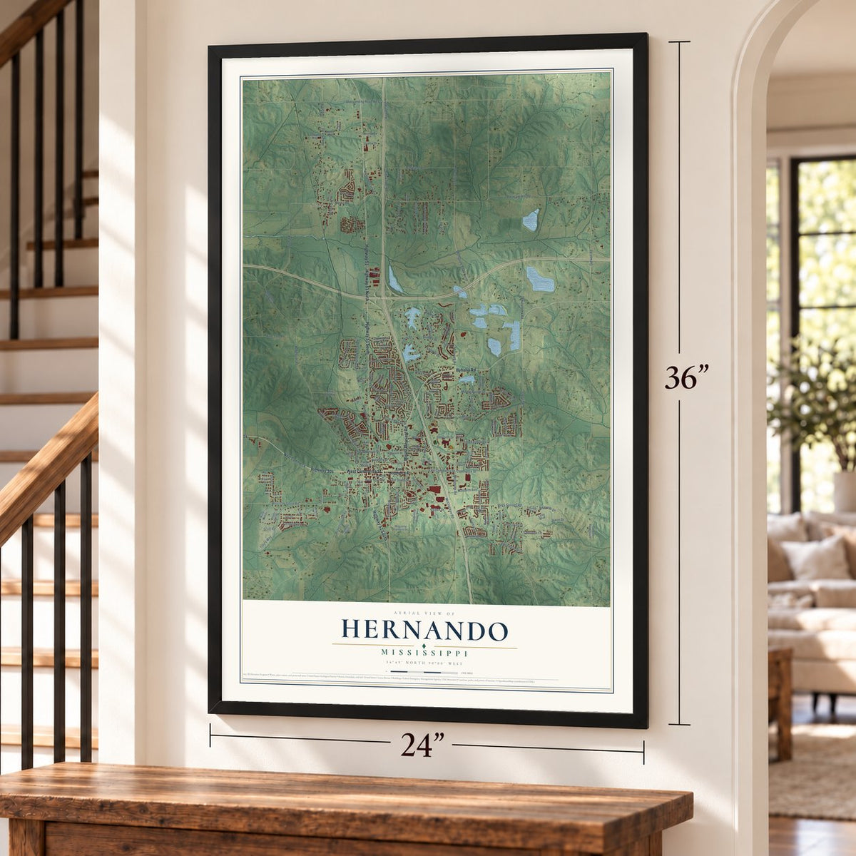
A new map of Hernando, Mississippi, made in 2026 and printed to order on thick archival matte paper.
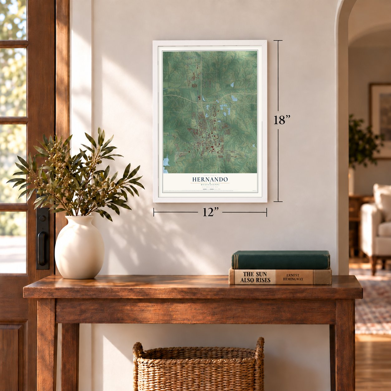
12" x 18" Archival Matte Print
A Map of Home. A Work of Art.
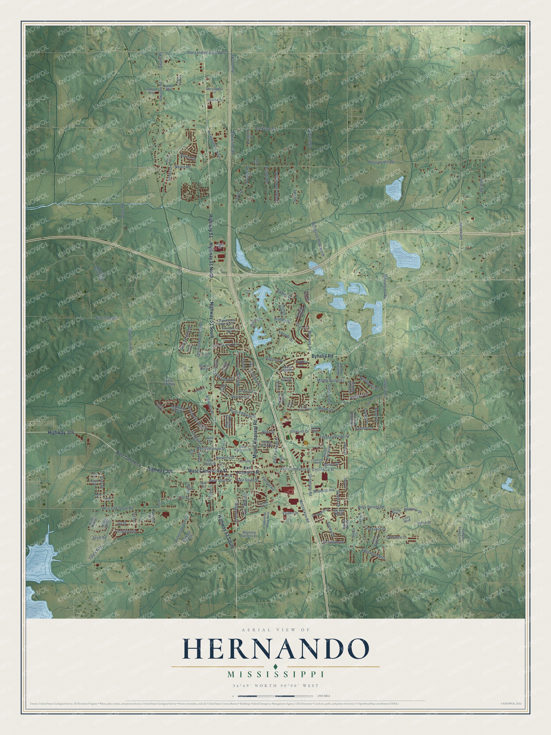
Explore Hernando, Mississippi from a whole new perspective. Created using aerial imagery and detailed geographic data, this map captures Hernando building by building, with labeled streets, familiar landmarks, and shaded topographical relief that highlights the natural contours of the landscape.
Combining modern data with the timeless character of a vintage atlas, this map is just as interesting up close as it is beautiful on the wall. Whether you grew up in Hernando, spent memorable years there, or call it home today, this unique map is a great way to celebrate a place that means something to you. Zoom in on the preview to look for your street, and then order a print to put your memories on the wall.
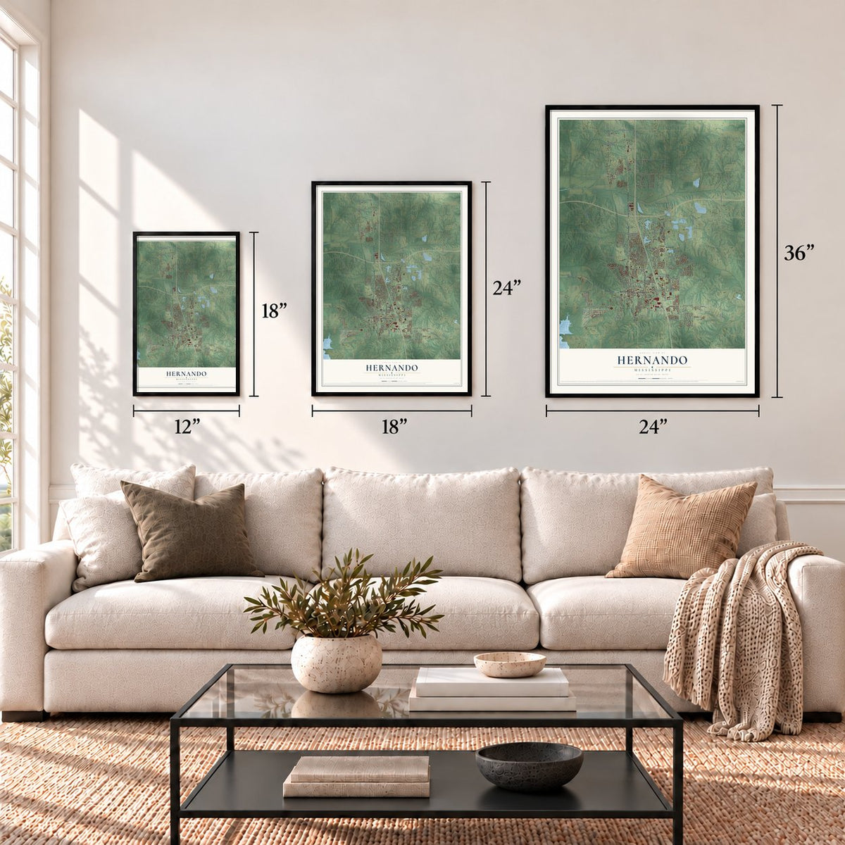
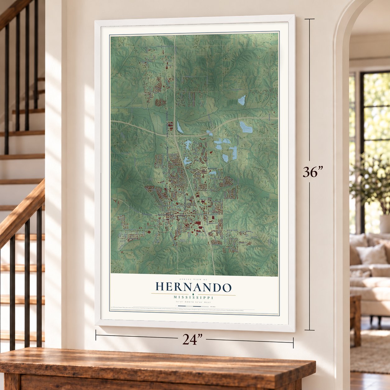
Three ways to hang it
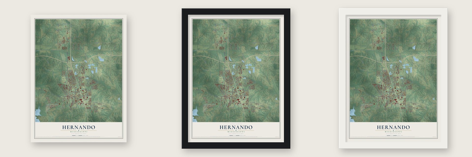
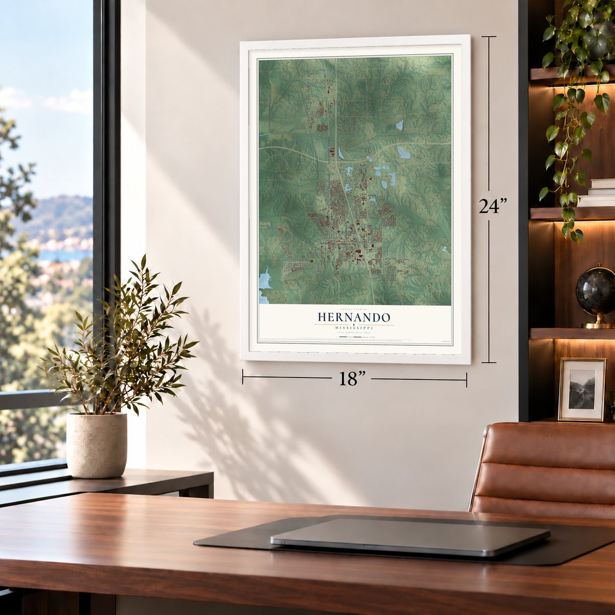
Unframed archival matte, a black wood frame or a white wood frame.
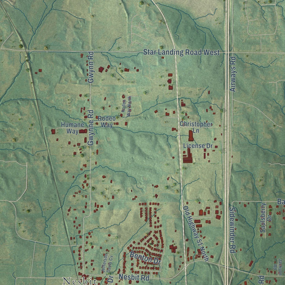
Up close
Geography Worth Displaying
This map was created using accurate cartographic data and authoritative geographic sources, including the U.S. Geological Survey and the Census Bureau. The map brings together terrain, waterways, roads, and building detail. The majority of the streets are labeled, houses are accurately depicted, and the topography is derived from government sources. Combining local data with carefully composed color and shading leads to this beautifully detailed Hernando artwork for your wall.
Rather than simply showing street outlines, we’ve included as many of the street names as we could reasonably fit on the map while keeping their names legible. Zoom in on the high resolution preview to see exactly what’s on the map. We truly set out to create a statement piece for anyone who loves Hernando. So whether it’s for you, or a gift for someone you love, we hope this map of Hernando brings back fond memories.
Read the story behind this map of Hernando, Mississippi from 2026.
About Hernando, Mississippi
Hernando is a city of 17,138 people in the northwest corner of Mississippi. It is the seat of DeSoto County. The Chickasaw people lived on this land for a long time. In the 1832 Treaty of Pontotoc, they gave it up to the United States, and most of the tribe was forced west of the Mississippi River.
The settlers who came next called their town Jefferson. In 1832 they renamed it Hernando, honoring Hernando de Soto, a Spanish explorer and the first European to explore the Mississippi River. DeSoto County was created on February 9, 1836, and it was named for the same man.
- The March against Fear, 1966James Meredith had been the first Black student at the University of Mississippi. In June 1966 he set out to walk from Memphis to Jackson. He wanted to draw attention to Black voter registration in the state. He was shot several times at Hernando, and his own walk ended there. Other activists then finished the march for him.
- A home of the bluesIn the early 20th century, many blues musicians came of age in Hernando, among them Frank Stokes, Jim Jackson and Robert Wilkins. Many Black families along the river worked as sharecroppers on cotton farms, and their music grew out of that life. During the Great Migration, blues players took it north to Chicago. Decades later, in the mid-1990s, Hernando gave rise to North Mississippi Allstars, a band that plays blues rock.
- A Memphis mural on the squareThe DeSoto County courthouse stands on Hernando's old downtown square, where Commerce Street meets U.S. 51. Inside hangs a mural first painted for the Gayoso Hotel in Memphis. Memphis lies 25 miles to the north, and the county has long had close ties to the city.
- Felix LaBauve's houseFelix LaBauve was born in France in 1809 and died in 1879. He was one of Hernando's early settlers and became a leader in the town. His home, the Felix LaBauve House, joined the National Register in 1978.
Find your street
Names on the Hernando map
Every name below is printed on this map. Look for your street, your school, the park where you played, or the pond down the road.
Places and landmarks1
- Nesbit
Streets and roads180
- Highway 304
- West Commerce Street
- Byhalia Road
- Highway 51 South
- Highway 51
- Highway 51 North
- Mount Pleasant Road
- Shadow View Drive
- Banbury Lane
- Bradley Drive
- Summit Drive
- Memphis Street
- East Commerce Street
- Middle Buster Drive
- Edgewood Boulevard
- Wren Street
- Keenlan Drive
- Pleasant Hill Road
- West Oak Grove Road
- Old Highway 51 South
- McIngvale Road
- Robertson Road
- Gwynn Road
- Holly Springs Road
- Getwell Road
- Gwynne Road
- McIngvale Road North
- Star Landing Road West
- Odom Road
- Tara Drive
Show all 180 streets
- Jaybird Road
- Nesbit Road
- Vaiden Drive
- McCracken Road
- Bankston Road
- McInvale Road
- West South Street
- Magnolia Drive
- Scott Road
- Tchulahoma Road
- Pine Tree Road
- North Parkway Street
- Hill Street
- Robertson Gin Road
- Elm Street
- West Robinson Street
- East Parkway Street
- Northern Street
- Jaxon Drive
- Saint Ives Lane
- Wooten Road
- Thousand Oaks Drive
- Aday Road
- Northwood Hills Drive
- Hall Road
- Commerce Street
- Cross Creek Drive
- Swinnea Road
- Airways Road
- Dogwood Hollow Drive
- Broady Road
- Pontotoc Street
- Desoto Avenue
- Palmer Drive
- Milam Lane
- Sidewinder Road
- Della Street
- Notting Hill Drive
- Riley Street
- Tara Lakes Drive
- East South Street
- Fieldstone Street
- Sundial Drive
- Monteith Avenue
- Tate's Way
- Dillworth Drive
- Ivy Lane
- Ivy Drive
- Elise Drive
- Pendulum Drive
- Mason Drive
- Biloxi Street
- Ready Drive
- Benton Drive
- Beauvior Drive
- Augusta Drive
- Carlee Drive
- Fairway Drive
- Nesbit Drive
- Fronie Drive
- West Commerce
- Notting Hill West
- East Robinson Street
- Big Ben South
- Caffey Street
- Rhett Butler Drive
- Park Street
- West Valley Street
- Single Tree Drive
- Losher Street
- Old Highway 51 North
- Industrial Drive West
- Northwood West Drive
- Forked Creek Parkway
- Cedar Crossing
- College Street
- Mason Drive North
- Country Club Drive
- Magnolia Manor Drive
- Fairway Oaks Drive
- Railroad Avenue
- Cobblestone Lane North
- Madison Ridge
- Double Shovel Drive
- Christopher Lane
- Getwell Road South
- Timberlane Street
- Lambert Drive
- Magnolia Gardens Drive
- River Oak Drive
- Doe Creek Trail
- Greenwich Drive
- Keenlan Drive West
- Robertson Road South
- South Lake Drive
- Lambert Cv
- Saulsberry Drive
- Rodeo Way
- Humane Way
- Flushing Cv
- License Drive
- Gracie Road
- Shady Grove Drive
- Rowan Oak Place
- Cardinal Lane
- Bella Vita Way
- Big Ben North
- Lake Grove Drive
- Kapik Road
- Loisy Boulevard
- Rose Drive
- Delia Street
- Beacon Hill Drive
- Shady Hill Drive
- Loma Vis
- Gale Street
- East Valley Street
- Sweetbriar Avenue
- Jefferson Parkway
- Fairway Trace Drive
- Clubhouse Drive
- Cross Winds Drive
- Creekside Boulevard
- Cotton Drive
- East Oak Grove
- Whitfield Drive
- Fletcher Street
- Coles Way Cv
- Daisy Drive
- Fawn Drive
- Bibb Street
- Shadow Vw East
- Bending Oak North
- North Wren Street
- Cedar Grove Parkway
- Carlee Drive South
- East Street
- Deer Creek Drive
- Ferguson Road
- Tanner Cv
- Weatherby Drive
- Jefferson Davis Cv
- Rodeo Way North
- Bending Oak West
- Lantis Drive
- Village Wood Drive
- Cedar Lake Circle
- Jackson Road
- Paris Cv
- Cooke Cv
Names are listed as they appear on the printed map. Zoom into the product photos to find them.
The art of mapping a place
How This Map Was Made
Real places. Remarkable detail. Discover the layers that turn geographic data into a map of home.

The view from above
Aerial imagery reveals the character of the land: woodland, open fields, and the patterns of a place.

The shape of the land
Elevation data brings hills, valleys, and subtle changes in the landscape into view.

The details of home
Roads, waterways, and building footprints come together to make the map feel unmistakably local.

Geography becomes art
Considered color, shading, and typography bring the layers together in a map made for your wall.


Process illustrated with Mendon, Massachusetts. Aerial imagery: USDA NAIP. Terrain: USGS 3D Elevation Program. Map details and finished artwork: KNOWOL.
The Details
About This Print
Choose an archival matte print, or a black or white Ayous wood frame. The archival matte print is unframed.
Select your size and finish above to see the matching product image and price.
Materials & Craftsmanship
A contemporary map with the character of a classic atlas, printed on archival matte paper. Optional frames are made from Ayous wood.
Your printed map does not include the watermark shown in the full-map preview.
Shipping & Delivery
Free shipping within the United States. Every print is made to order in the USA.
Buying a gift? Add a note in your cart and we'll include it. We never put prices in the package.
Prints ship within 2 to 3 business days. Allow 7 to 10 days total from ordering for delivery. Timing may vary during holidays or periods of high order volume.
Read our shipping policy.
Returns and damaged prints
Each print is made to order. Change-of-mind refunds are not available after production.
If your print arrives damaged, misprinted or incorrect, contact support@knowol.com within 30 days of receiving it. Include your order number, photos and a description of the issue.
Read our full refund and replacement policy. For questions about your order, email support@knowol.com.
Find your town
Looking for another city?
Find a map of home in our Mississippi collection, or any town in the country.
Nearby
Maps of towns near Hernando
Know someone from one of these towns? Their map makes a great gift.
 Bridgetown
, Mississippi
From $39.99See the map
 Southaven
, Mississippi
From $39.99See the map
 Horn Lake
, Mississippi
From $39.99See the map
More maps nearby: Eudora, Lynchburg, Coldwater, Walls and Olive Branch.