
Search for another town





Free U.S. delivery 7 to 10 days after you order
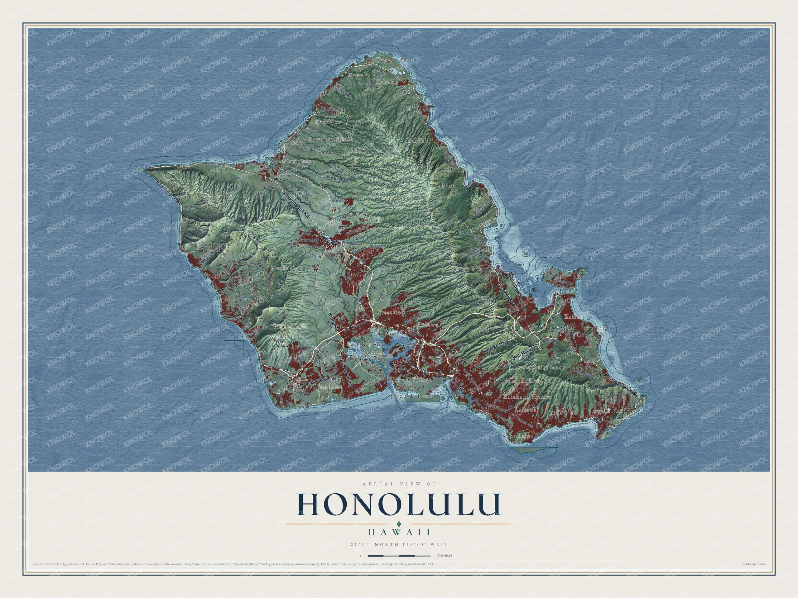
Honolulu, Hawaii Map Art
Building by building, with labeled streets and shaded relief.
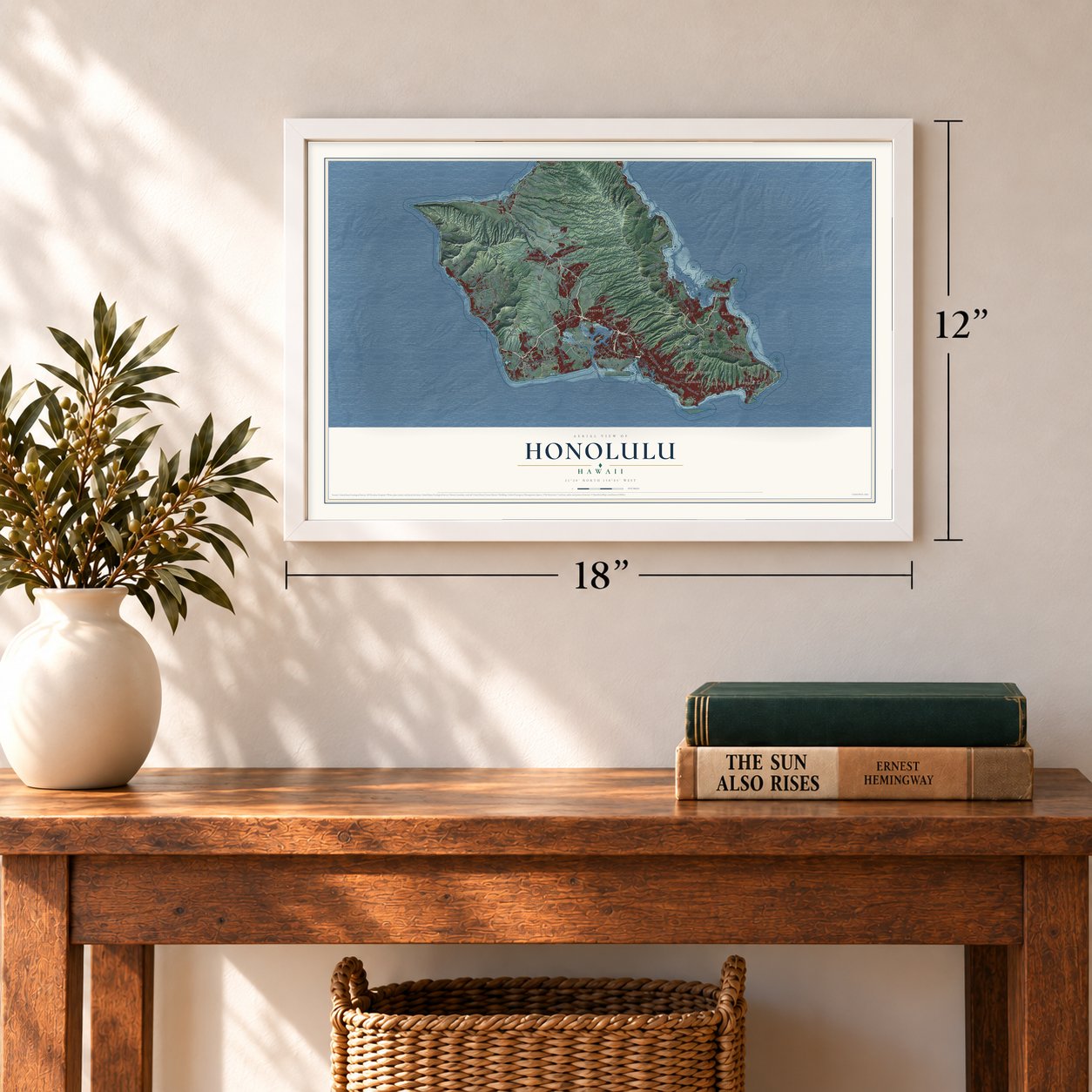
12" x 18" Archival Matte Print
A Map of Home. A Work of Art.
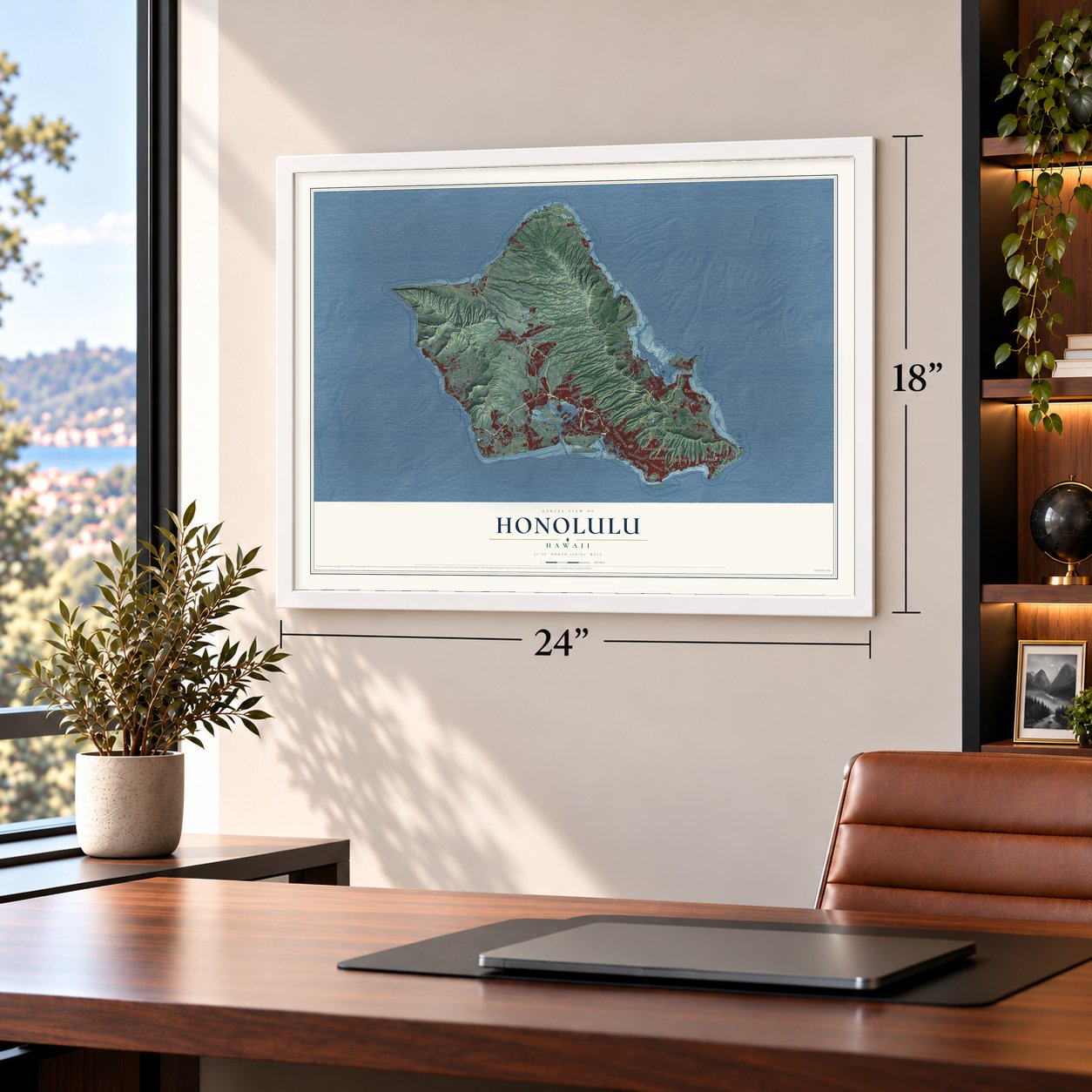
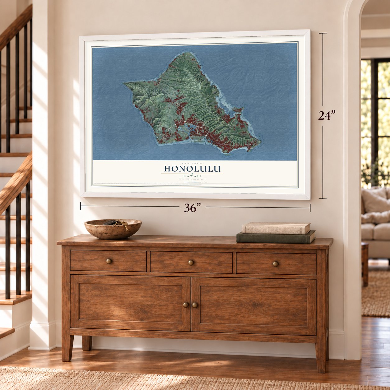
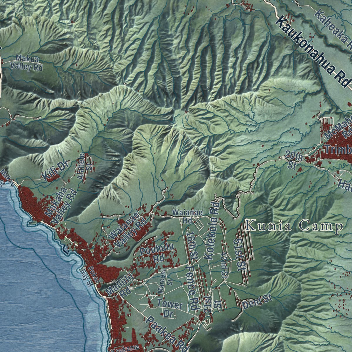
Explore Honolulu, Hawaii from a whole new perspective. Created using aerial imagery and detailed geographic data, this map captures Honolulu building by building, with labeled streets, familiar landmarks, and shaded topographical relief that highlights the natural contours of the landscape.
Combining modern data with the timeless character of a vintage atlas, this map is just as interesting up close as it is beautiful on the wall. Whether you grew up in Honolulu, spent memorable years there, or call it home today, this unique map is a great way to celebrate a place that means something to you. Zoom in on the preview to look for your street, and then order a print to put your memories on the wall.
Three ways to hang it
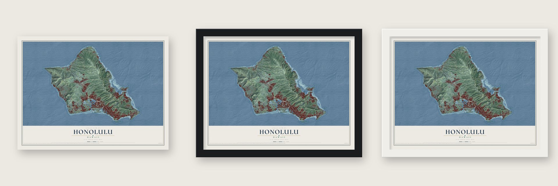
Unframed archival matte, a black wood frame or a white wood frame.
Up close
Geography Worth Displaying
This map was created using accurate cartographic data and authoritative geographic sources, including the U.S. Geological Survey and the Census Bureau. The map brings together terrain, waterways, roads, and building detail. The majority of the streets are labeled, houses are accurately depicted, and the topography is derived from government sources. Combining local data with carefully composed color and shading leads to this beautifully detailed Honolulu artwork for your wall.
Rather than simply showing street outlines, we’ve included as many of the street names as we could reasonably fit on the map while keeping their names legible. Zoom in on the high resolution preview to see exactly what’s on the map. We truly set out to create a statement piece for anyone who loves Honolulu. So whether it’s for you, or a gift for someone you love, we hope this map of Honolulu brings back fond memories.
Read the story behind this map of Honolulu, Hawaii from 2026.

Find your street
Names on the Honolulu map
Every name below is printed on this map. Look for your street, your school, the park where you played, or the pond down the road.
Places and landmarks29
- Akupu
- Crestview
- Dowsett Highlands
- East Kapolei
- Hauʻula
- Hawaiʻi Kai
- Hickam Village
- Hālawa
- Iroquois Point
- Kahaluʻu
- Kahana
- Kahuku
Show all 29 places
- Kailua
- Kaimukī
- Kalakaua Homes
- Kalauao
- Kamoʻoloa
- Kapaeloa
- Kapahulu
- Kapolei
- Kawailoa Beach
- Kawela
- Kawela Bay
- Kuliʻouʻou
- Kunia Camp
- Lanikai
- Lower Village
- Lāʻie
- Makiki Heights
Streets and roads166
- Kamehameha Highway
- Farrington Highway
- Kalanianaole Highway
- Pali Highway
- Wilikina Drive
- Kaukonahua Road
- Kahekili Highway
- Roosevelt Avenue
- Likelike Highway
- Kunia Road
- Fort Weaver Road
- South King Street
- North School Street
- Plantation Road
- Kolekole Road
- Twin Bridge Road
- Kawailoa Road
- California Avenue
- Kaheaka Road
- Salt Lake Boulevard
- Waikupanaha Street
- Mokapu Road
- Keolu Drive
- Trimble Road
- North Road
- Pupukea Road
- Fence Road
- Paakea Road
- Waialua Beach Road
- Hauula Street
Show all 166 streets
- Quarry Road
- Midway Street
- Comsat Road
- Auloa Road
- Alewa Drive
- Pahoa Avenue
- Wikao Street
- Saipan Drive
- Ala Wai Boulevard
- Hanua Street
- Kaahele Street
- Kili Drive
- Welch Road
- Booth Road
- Iliaina Street
- 51st Street
- Hiapo Street
- Welo Street
- North Nimitz Highway
- Kam Highway
- Nimitz Highway
- Kailua Road
- Cane Haul Road
- Moanalua Road
- Waianae Valley Road
- Aliinui Drive
- Palehua Road
- Tinker Road
- Kualakai Parkway
- Komo Mai Drive
- Ashley Road
- Likini Street
- Kuahelani Avenue
- Lagoon Drive
- Sixth Street
- Waikane Valley Road
- Koolau Road
- Walawa Prison Road
- Hakimo Road
- Iroquois Drive
- Leia Street
- McMahon Road
- Kaaawa Valley Road
- South Waiahole Valley Road
- Charlie Road
- Higgins Road
- Kahala Avenue
- Fox Boulevard
- Coral Sea Road
- Haleiwa Road
- 16th Street
- Ka Uka Boulevard
- Tower Drive
- Nanakuli Avenue
- Poipu Drive
- Pulama Road
- Makaha Valley Road
- Papipi Road
- Puuhulu Road
- Queen Street
- Anoi Road
- 20th Street
- Olai Street
- Mailiilii Road
- Kupau Street
- 21st Street
- Dent Street
- Iwaena Street
- Park Road
- Nihi Street
- Lulani Street
- Enos Road
- Tripoli Road
- Daly Road
- Ahoka Street
- Pump Road
- Eleu Street
- Kii Street
- Geiger Road
- Kaua Street
- Rim Loop
- Paalaa Uka Pupukea Road
- Opaeula Road
- Meheula Parkway
- Renton Road
- Lunalilo Home Road
- Makakilo Drive
- Maunawili Road
- Lyman Road
- Lualualei Naval Road
- Bravo Road
- Lumiauau Street
- Kionaole Road
- Worchester Avenue
- Hihimanu Street
- Kalainanea Street
- Waimanalo Road
- Center Street
- Wiser Road
- Waianae Road
- Makua Valley Road
- 42nd Street
- Lai Road
- Crozier Drive
- Makiki Street
- Aamanu Street
- Iosepa Street
- Alahele Street
- Beard Avenue
- Sumner Road
- Aiki Street
- Kalaeloa Boulevard
- Whitmore Avenue
- Kaneohe Bay Drive
- Kilauea Avenue
- Nuuanu Pali Drive
- Kawela Camp Road
- Kama'aha Avenue
- Paiwa Street
- Dole Street
- Kaukama Road
- Ala Aolani Street
- Kealahou Street
- Waihee Road
- Marconi Street
- Kunia Drive
- Ford Island Bridge
- Alani Drive
- Anapalau Street
- Makau Street
- Bunker Place
- Pokai Bay Street
- Iwilei Road
- Haku Street
- Oio Drive
- Lolii Street
Names are listed as they appear on the printed map. Zoom into the product photos to find them.
About Honolulu, Hawaii
Honolulu is the capital of Hawaii, on the southeast coast of Oʻahu, and the 2020 census counted 350,964 people in the city. Its name is Hawaiian for "sheltered harbor." Oral histories and artifacts show that Polynesian people had a settlement here in the 11th century. The old name, Kou, belonged to the area that is now the heart of downtown.
Kamehameha I won Oʻahu at the Battle of Nuʻuanu and brought his royal court to Waikiki in 1804, then to present-day downtown in 1809. The court went back to Kailua-Kona in 1812, but Kamehameha III made Honolulu the kingdom's permanent capital in 1845. The city stayed the capital after the monarchy was overthrown in 1893, after the U.S. annexed the islands in 1898 and after statehood in 1959.
- The first foreign ship, 1794Captain William Brown of Great Britain sailed into the harbor in November 1794, the first foreigner to do so. Other ships soon followed, and Honolulu became a regular stop for merchant vessels crossing between North America and Asia. Early in the 19th century the settlement grew from a few homes into a city.
- A royal capital from 1845Kamehameha III moved the kingdom's capital from Lahaina, on Maui, to Honolulu in 1845. He and the kings who followed him put up ʻIolani Palace and Aliʻiōlani Hale, as well as St. Andrew's Cathedral. In the same years, descendants of American missionaries opened major businesses downtown, and the city became the center of trade for the islands.
- A school for young chiefsIn 1840 Honolulu opened a family school for the young chiefs, both boys and girls, and every lesson was taught in English. By 1896 the Kamehameha Schools, one for boys and one for girls, stood north of the city. They were founded for Hawaiians under the will of Bernice Pauahi Bishop.
- December 7, 1941Japan attacked nearby Pearl Harbor on December 7, 1941, and the attack brought the United States into World War II and made Honolulu known around the world. Pearl Harbor is still a major Navy base and the home of the U.S. Pacific Fleet.
Keep exploring Hawaii
Honolulu is one of 168 Hawaii towns we've mapped. Every dot on the map is a print of its own.
The search covers every state, Hawaii first.
Near Honolulu
Order 2 or more town maps and save 10%. Shown in the size and finish you picked above, so they hang as a set.
- Mililani Mauka 12" x 18" / Archival Matte Print $39.99
- Waipio Acres 12" x 18" / Archival Matte Print $39.99
- Wahiawa 12" x 18" / Archival Matte Print $39.99

More maps nearby: Mililani Town, Wheeler AFB, Waipio, Whitmore Village and Pearl City.
The art of mapping a place
How This Map Was Made
Real places. Remarkable detail. Discover the layers that turn geographic data into a map of home.

The view from above
Aerial imagery reveals the character of the land: woodland, open fields, and the patterns of a place.

The shape of the land
Elevation data brings hills, valleys, and subtle changes in the landscape into view.

The details of home
Roads, waterways, and building footprints come together to make the map feel unmistakably local.

Geography becomes art
Considered color, shading, and typography bring the layers together in a map made for your wall.


Process illustrated with Mendon, Massachusetts. Aerial imagery: USDA NAIP. Terrain: USGS 3D Elevation Program. Map details and finished artwork: KNOWOL.
The Details
About This Print
Choose an archival matte print, or a black or white Ayous wood frame. The archival matte print is unframed.
Select your size and finish above to see the matching product image and price.
Materials & Craftsmanship
A contemporary map with the character of a classic atlas, printed on archival matte paper. Optional frames are made from Ayous wood.
Your printed map does not include the watermark shown in the full-map preview.
Shipping & Delivery
Free shipping within the United States. Every print is made to order in the USA.
Buying a gift? Add a note in your cart and we'll include it. We never put prices in the package.
Prints ship within 2 to 3 business days. Allow 7 to 10 days total from ordering for delivery. Timing may vary during holidays or periods of high order volume.
Read our shipping policy.
Returns and damaged prints
Each print is made to order. Change-of-mind refunds are not available after production.
If your print arrives damaged, misprinted or incorrect, contact support@knowol.com within 30 days of receiving it. Include your order number, photos and a description of the issue.
Read our full refund and replacement policy. For questions about your order, email support@knowol.com.