
Search for another town





Free U.S. delivery 7 to 10 days after you order
Hubbardston, Massachusetts Map Art
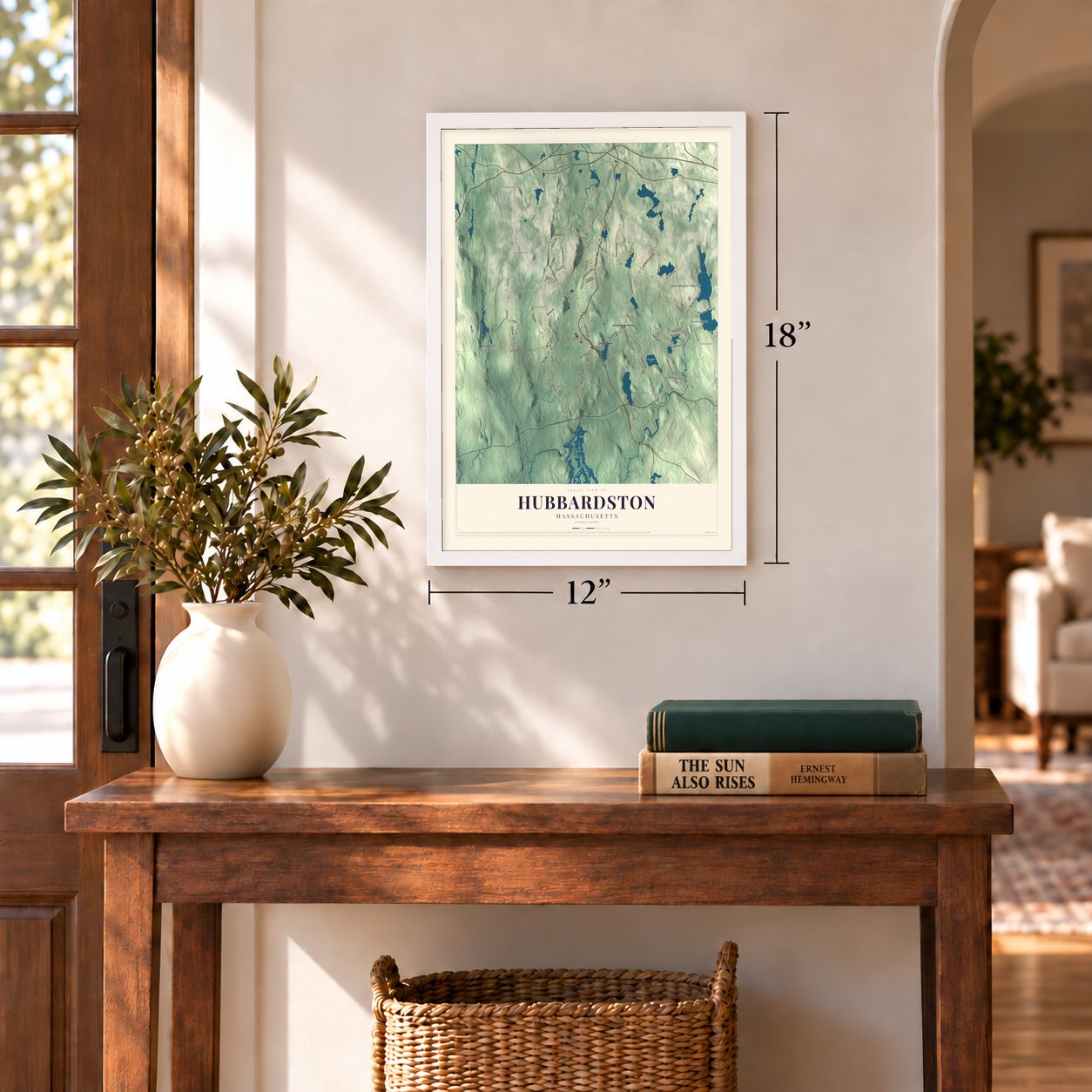
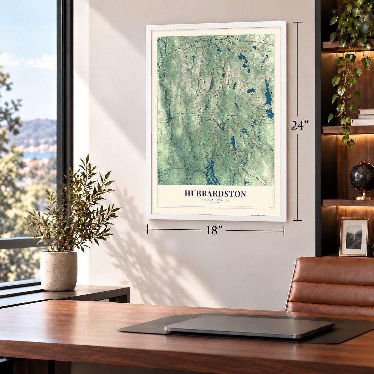
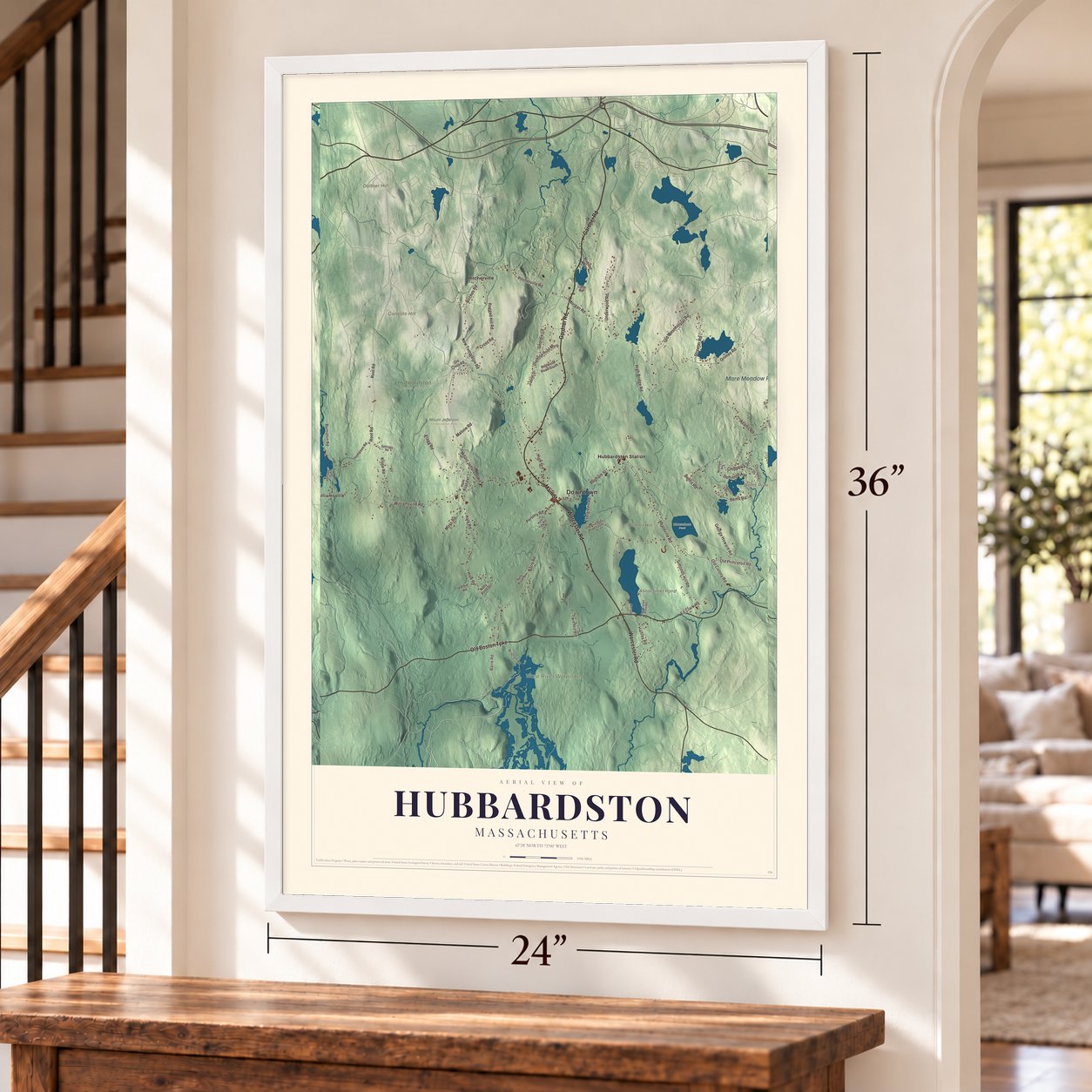
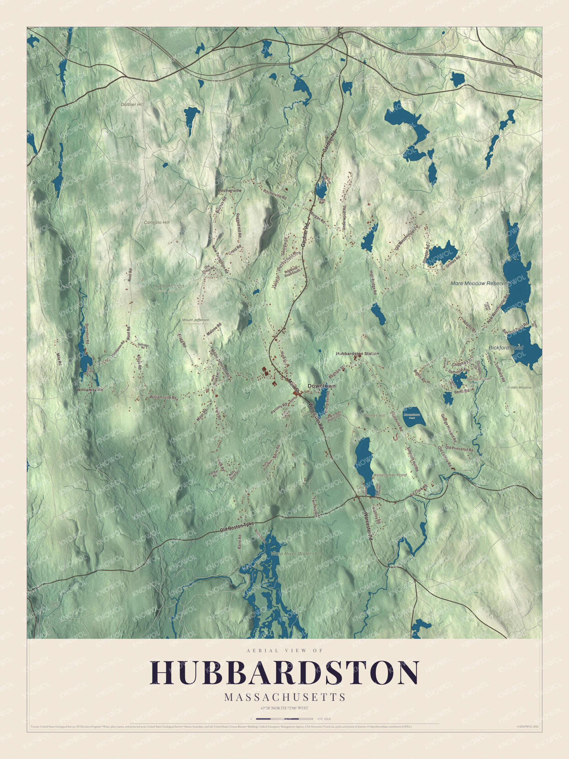
A new map of Hubbardston, Massachusetts, made in 2026 and printed to order on thick archival matte paper.
12" x 18" Archival Matte Print
A Map of Home. A Work of Art.
Explore Hubbardston, Massachusetts from a whole new perspective. Created using aerial imagery and detailed geographic data, this map captures Hubbardston building by building, with labeled streets, familiar landmarks, and shaded topographical relief that highlights the natural contours of the landscape.
Combining modern data with the timeless character of a vintage atlas, this map is just as interesting up close as it is beautiful on the wall. Whether you grew up in Hubbardston, spent memorable years there, or call it home today, this unique map is a great way to celebrate a place that means something to you. Zoom in on the preview to look for your street, and then order a print to put your memories on the wall.
Three ways to hang it
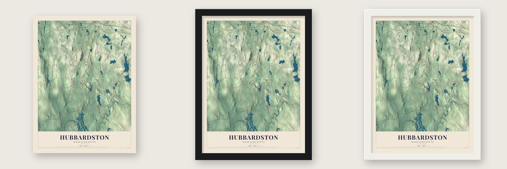
Unframed archival matte, a black wood frame or a white wood frame.
Up close
Geography Worth Displaying
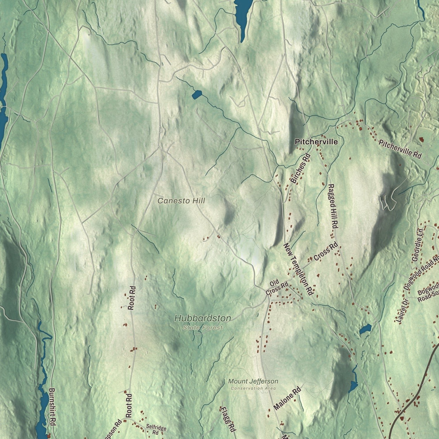
This map was created using accurate cartographic data and authoritative geographic sources, including the U.S. Geological Survey (USGS) and FEMA. The map brings together terrain, waterways, roads, and building detail. The majority of the streets are labeled, houses are accurately depicted, and the topography is derived from government sources. Combining local data with carefully composed color and shading leads to this beautifully detailed Hubbardston artwork for your wall.
Rather than simply showing street outlines, we’ve included as many of the street names as we could reasonably fit on the map while keeping their names legible. Zoom in on the high resolution preview to see exactly what’s on the map. We truly set out to create a statement piece for anyone who loves Hubbardston. So whether it’s for you, or a gift for someone you love, we hope this map of Hubbardston brings back fond memories.
Explore the full map of Hubbardston, Massachusetts and read about the local places it shows.

About Hubbardston, Massachusetts
Hubbardston is a town of 4,328 people in Worcester County, set high in the hills at 1,015 feet above sea level. It began as the "Northeast Quarter" of Rutland. In 1737 Rutland's proprietors granted Eleazer Brown a farm of 60 acres, and in return he had to run an inn there. For years Brown and his wife had the place to themselves, and no one else settled here until 1746. After Brown died, reportedly killed by a deer, his widow lived here alone for several years and kept the inn for important travelers.
Israel Green moved in during 1749, and his daughter Molly is said to be the first child born in town. Green later became the first chairman of the selectmen. The quarter was set off from Rutland as a district in 1767 and became a town in 1775. It stayed a poor farm town, with sawmills, potash works and families braiding palm-leaf hats at home, and in the 1800s dairies, berry farms and market gardens drew workers from Ireland, French Canada, England, Sweden and Finland.
- The glass that never cameHubbardston takes its name from Thomas Hubbard, who served the province as its Commissary General and also kept Harvard College's accounts as treasurer. Local history says he promised to cover the cost of glass for the town's first meeting house, so residents put in extra windows to show off his gift. When Hubbard died in 1773, his estate was in such a tangle that the town got nothing and had to buy the glass itself.
- A meeting house rebuilt in 1842The meeting house was framed in 1773. In 1842 it was rebuilt in the Greek Revival style on its old frame, and town meetings were still held there into the 20th century. Today the building is the First Parish Church, and it sits inside the Hubbardston Town Common Historic District, which joined the National Register in 2000.
- Eighty men march on WorcesterCaptain Adam Wheeler of Hubbardston was a leader of Shays' Rebellion. In 1786 he marched eighty local men to Worcester. There they joined hundreds of other farmers and took over the courthouse, protesting against creditors who were seizing farms and property at a time when cash was scarce.
- The first backhoe swing frameThe first backhoe swing frame came out of Hubbardston in July 1947, the work of Vaino J. Holopainen and Roy E. Handy, Jr. They named their company Wain-Roy, joining Holopainen's first name, said "Waino," with Handy's. Holopainen filed patent # 2,698,697 for the design in July 1948.
- Founder of Clark UniversityJonas Gilman Clark was born in Hubbardston in 1815 and started out building carriages. He ran stores here and in other towns, then made his fortune in California. In 1887 he used it to found Clark University in Worcester.
Find your street
Names on the Hubbardston map
Every name below is printed on this map. Look for your street, your school, the park where you played, or the pond down the road.
Places and landmarks16
- Downtown
- Canesto Hill
- Comet Hill
- Dolbier Hill
- Asnacomet Pond
- Bems Pond
- Mare Meadow Reservoir
- Bickford Pond
- Hidden Meadow
- Hubbardston State Forest
- Moosehorn Pond
- Mount Jefferson Conservation Area
Show all 16 places
- Ware River Watershed
- Hubbardston Station
- Pitcherville
- Williamsville
Streets and roads71
- Main Street
- Gardner Road
- Worcester Road
- Old Boston Turnpike
- Brigham Street
- Old Westminster Road
- Barre Road
- Root Road
- Old Colony Road
- Williamsville Road
- New Westminster Road
- Ragged Hill Road
- Lombard Road
- Adams Road
- Healdville Road
- Seminole Avenue
- New Templeton Road
- Old Princeton Road
- Mount Jefferson Road
- Hale Road
- Grimes Road
- Twin Hill Road
- Morgan Road
- Burnshirt Road
- Pitcherville Road
- Flagg Road
- Kruse Road
- Bemis Road
- Bems Road
- Underwood Road
Show all 71 streets
- Simonds Hill Road
- Birches Road
- Ed Clark Road
- Halfrey Road
- Geordie Lane
- High Bridge Road
- Mile Road
- Cross Road
- Bickford Pond Road
- Streeter Road
- High Street
- Evergreen Road
- George Howard Road
- Mayo Road
- Chippewa Street
- Malone Road
- Parsons Road
- Chicopee Drive
- Old Cross Road
- Thompson Road
- Brigham Road
- Dogwood Road North
- Natty Pond Drive
- Dogwood Road South
- Madison Way
- Hale Road Extension
- Ferdie Road
- Grove Street
- Laurel Drive
- Cove Road
- Elm Street
- Green Road
- Old Princeton Road Cutoff
- Natty Brook Road
- Iroquois Drive
- East Comet Pond Road
- Selfridge Road
- Morrow Lane
- Prentiss Hill Road
- Pond View Way
- Muskogee Avenue
Names are listed as they appear on the printed map. Zoom into the product photos to find them.
The art of mapping a place
How This Map Was Made
Real places. Remarkable detail. Discover the layers that turn geographic data into a map of home.

The view from above
Aerial imagery reveals the character of the land: woodland, open fields, and the patterns of a place.

The shape of the land
Elevation data brings hills, valleys, and subtle changes in the landscape into view.

The details of home
Roads, waterways, and building footprints come together to make the map feel unmistakably local.

Geography becomes art
Considered color, shading, and typography bring the layers together in a map made for your wall.


Process illustrated with Mendon, Massachusetts. Aerial imagery: USDA NAIP. Terrain: USGS 3D Elevation Program. Map details and finished artwork: KNOWOL.
The Details
About This Print
Choose an archival matte print, or a black or white Ayous wood frame. The archival matte print is unframed.
Select your size and finish above to see the matching product image and price.
Materials & Craftsmanship
A contemporary map with the character of a classic atlas, printed on archival matte paper. Optional frames are made from Ayous wood.
Your printed map does not include the watermark shown in the full-map preview.
Shipping & Delivery
Free shipping within the United States. Every print is made to order in the USA.
Buying a gift? Add a note in your cart and we'll include it. We never put prices in the package.
Prints ship within 2 to 3 business days. Allow 7 to 10 days total from ordering for delivery. Timing may vary during holidays or periods of high order volume.
Read our shipping policy.
Returns and damaged prints
Each print is made to order. Change-of-mind refunds are not available after production.
If your print arrives damaged, misprinted or incorrect, contact support@knowol.com within 30 days of receiving it. Include your order number, photos and a description of the issue.
Read our full refund and replacement policy. For questions about your order, email support@knowol.com.
Find your town
Looking for another city?
Find a map of home in our Massachusetts collection, or any town in the country.
Nearby
Maps of towns near Hubbardston
Know someone from one of these towns? Their map makes a great gift.
 Templeton
, Massachusetts
From $39.99See the map
 Gardner
, Massachusetts
From $39.99See the map
 Westminster
, Massachusetts
From $39.99See the map
More maps nearby: Princeton, Rutland, Barre, Baldwinville and Phillipston.