
Search for another town



Free U.S. delivery 7 to 10 days after you order
Hutchinson, Kansas Map Art
A new map of Hutchinson, Kansas, made in 2026 and printed to order on thick archival matte paper.
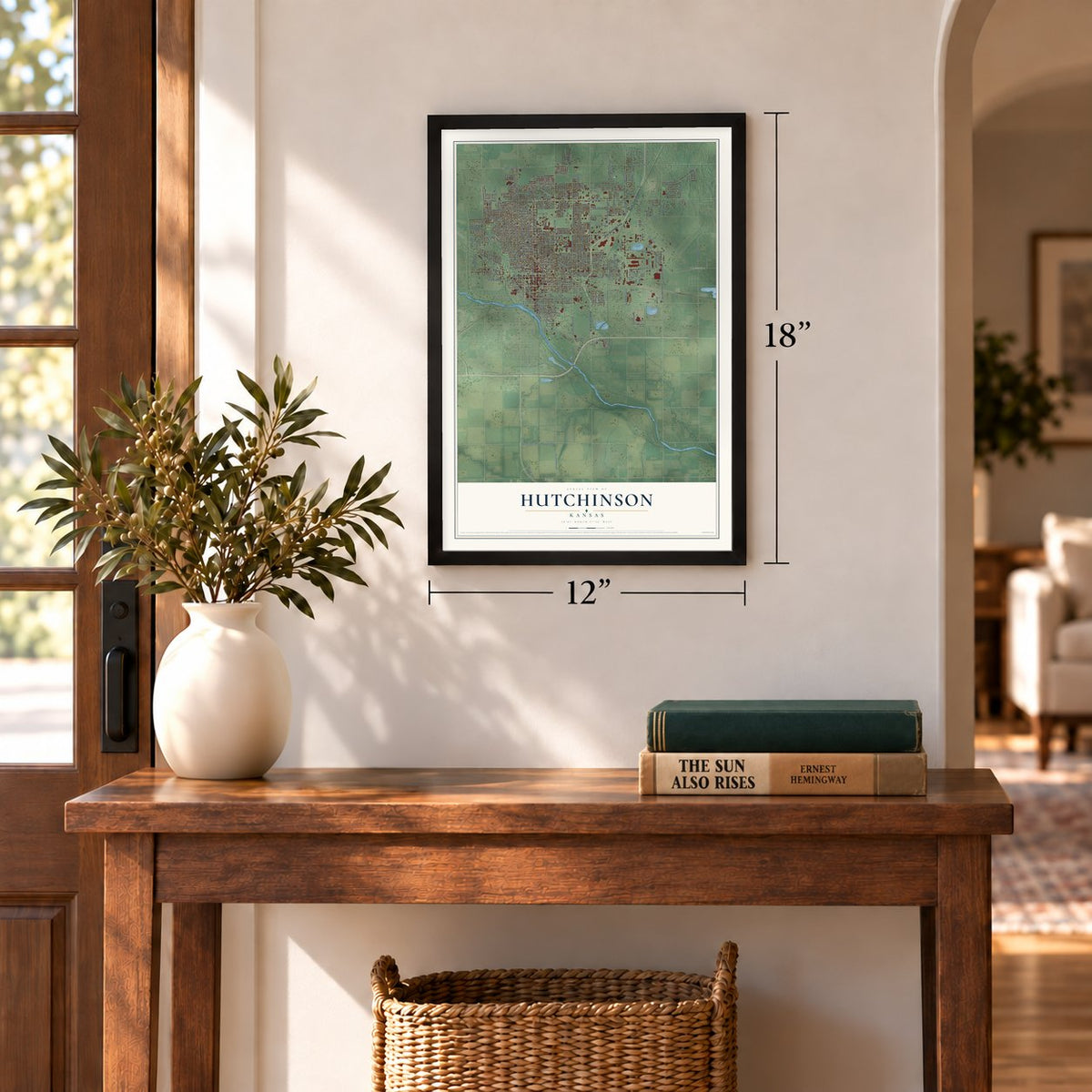
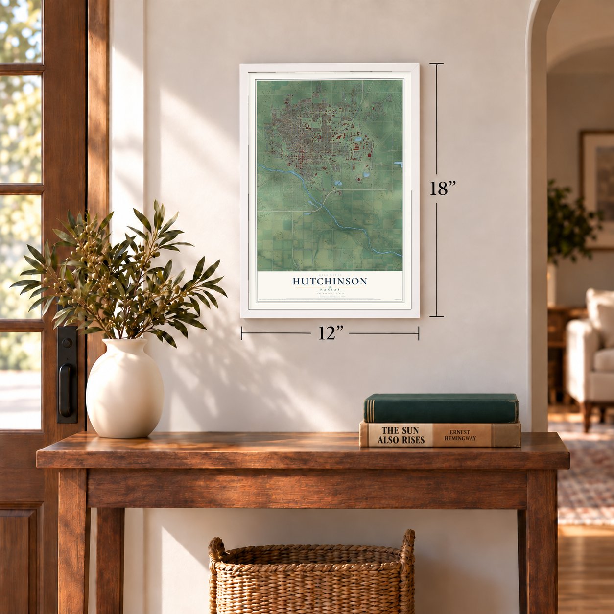
12" x 18" Archival Matte Print
A Map of Home. A Work of Art.
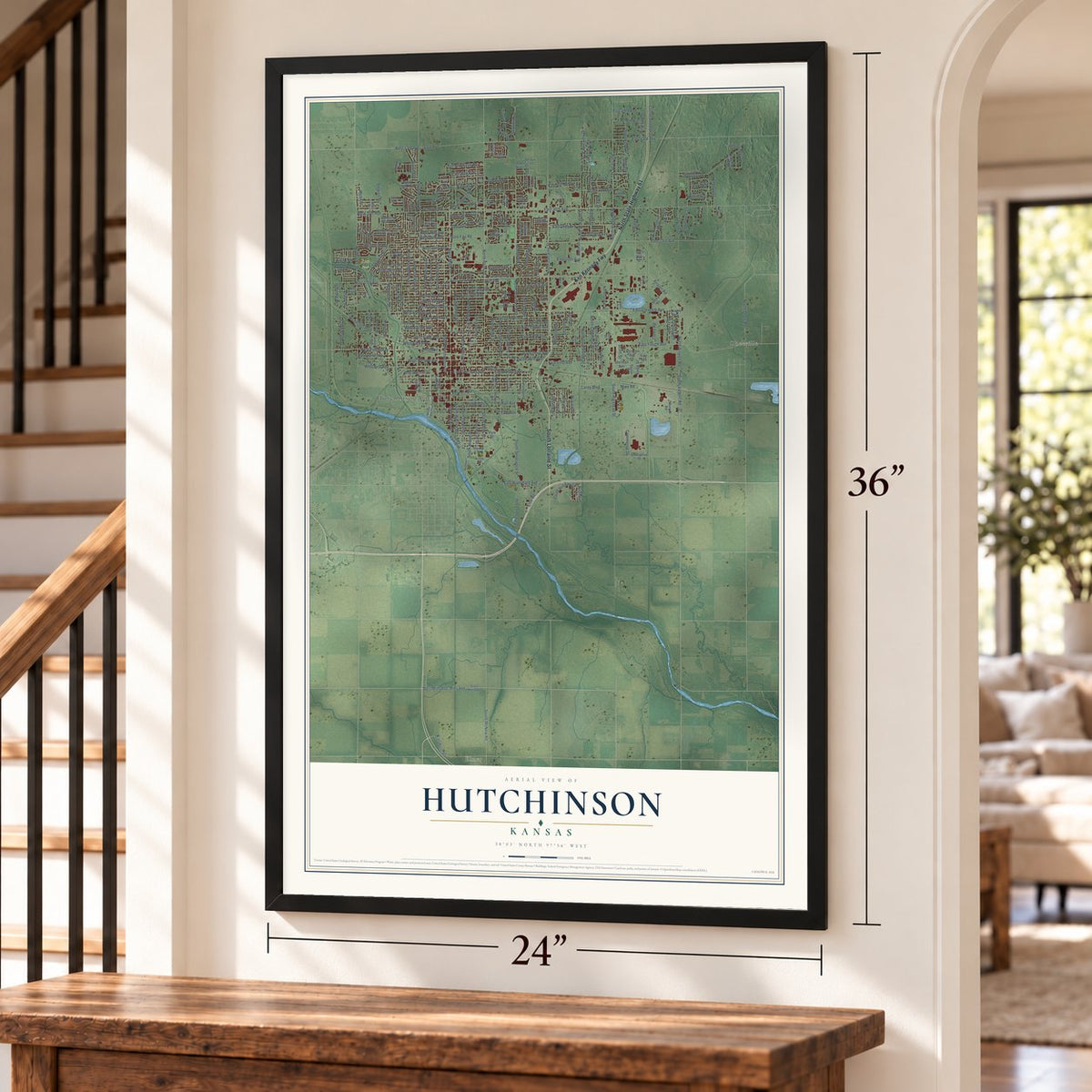
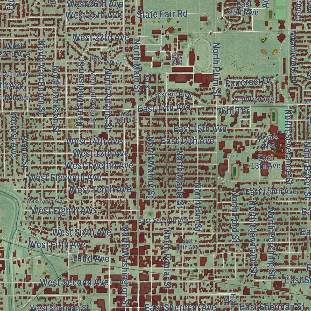
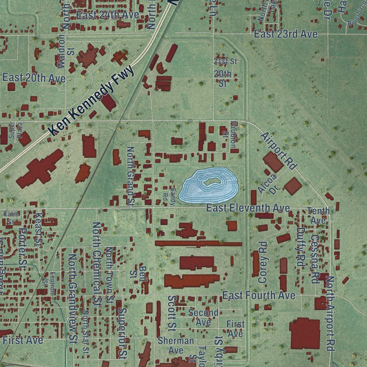
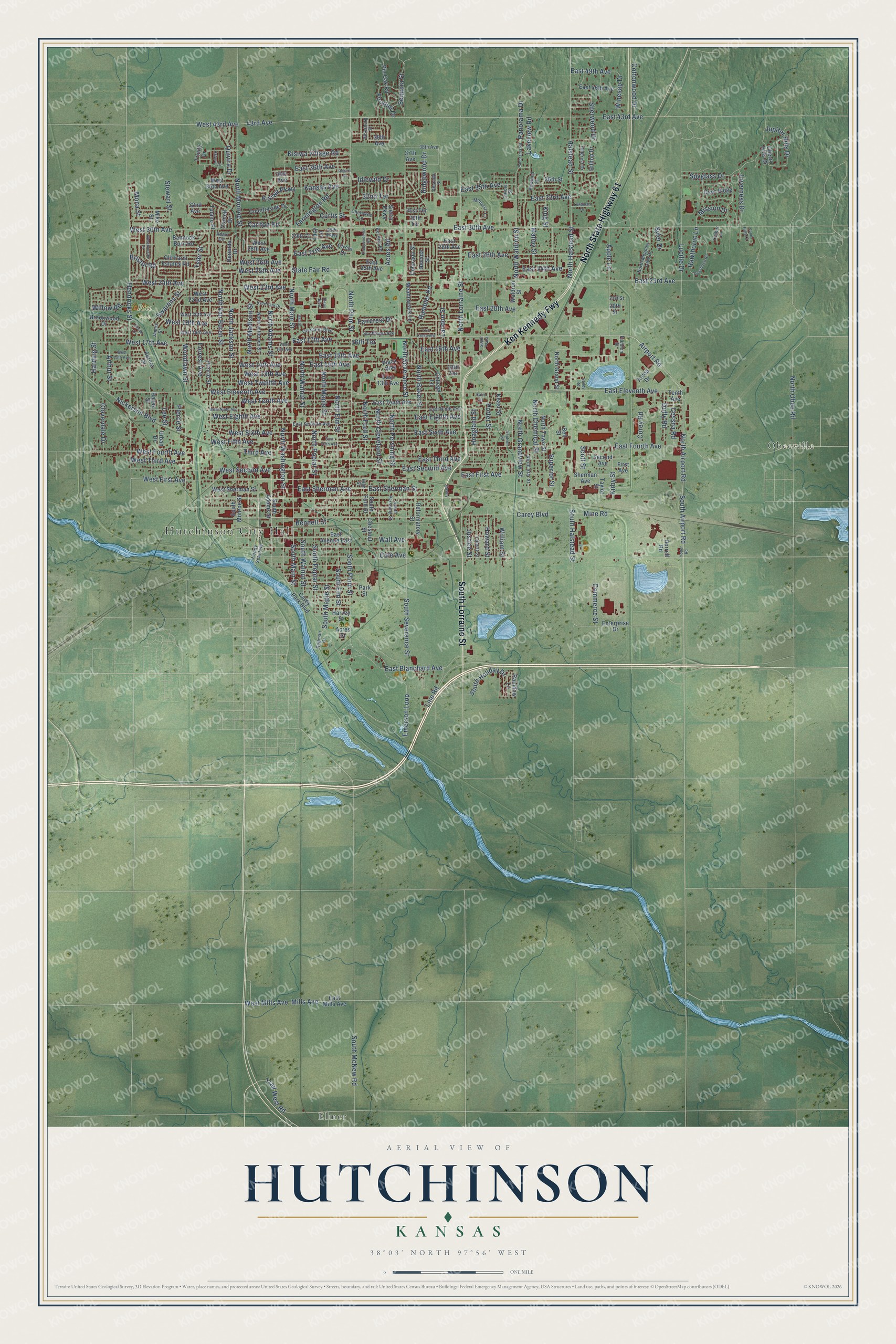
Explore Hutchinson, Kansas from a whole new perspective. Created using aerial imagery and detailed geographic data, this map captures Hutchinson building by building, with labeled streets, familiar landmarks, and shaded topographical relief that highlights the natural contours of the landscape.
Combining modern data with the timeless character of a vintage atlas, this map is just as interesting up close as it is beautiful on the wall. Whether you grew up in Hutchinson, spent memorable years there, or call it home today, this unique map is a great way to celebrate a place that means something to you. Zoom in on the preview to look for your street, and then order a print to put your memories on the wall.
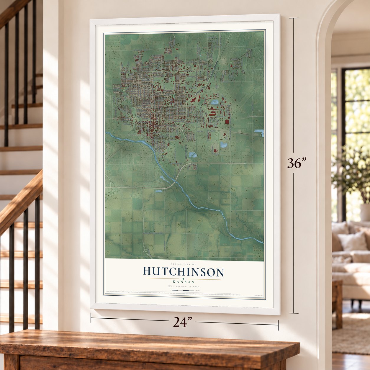
Three ways to hang it
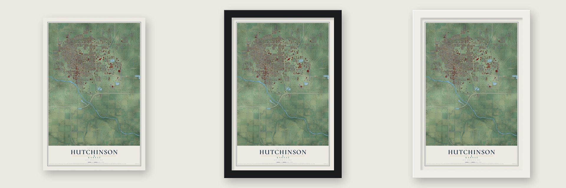
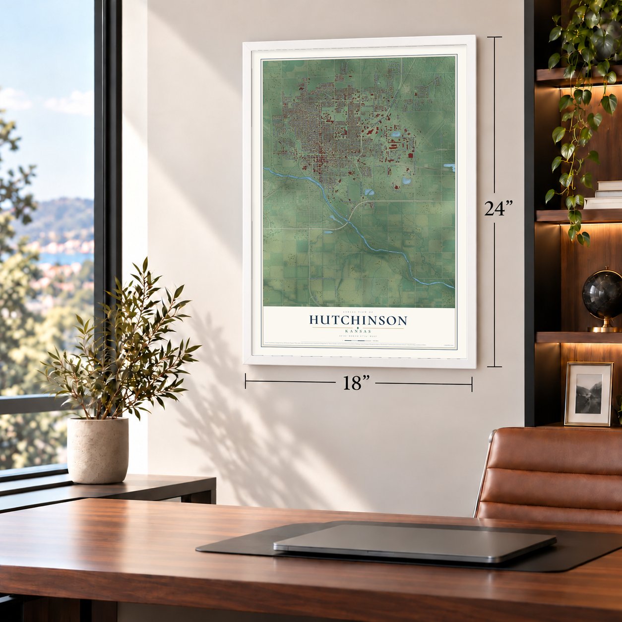
Unframed archival matte, a black wood frame or a white wood frame.
Up close
Geography Worth Displaying
This map was created using accurate cartographic data and authoritative geographic sources, including the U.S. Geological Survey and the Census Bureau. The map brings together terrain, waterways, roads, and building detail. The majority of the streets are labeled, houses are accurately depicted, and the topography is derived from government sources. Combining local data with carefully composed color and shading leads to this beautifully detailed Hutchinson artwork for your wall.
Rather than simply showing street outlines, we’ve included as many of the street names as we could reasonably fit on the map while keeping their names legible. Zoom in on the high resolution preview to see exactly what’s on the map. We truly set out to create a statement piece for anyone who loves Hutchinson. So whether it’s for you, or a gift for someone you love, we hope this map of Hutchinson brings back fond memories.
Read the story behind this map of Hutchinson, Kansas from 2026.

About Hutchinson, Kansas
Hutchinson is a city of 40,006 people and the seat of Reno County, on the Arkansas River. In 1871 C. C. Hutchinson, who had already founded Ottawa, agreed to buy Section 13 from the Santa Fe railroad as its line pushed west from Newton. There was no wagon road yet, so he followed the engineers' stakes out to the site, and his cousin W. E. Hutchinson then surveyed the town.
Every deed carried a clause: anyone who sold or gave away liquor on a lot before 1875 would lose it, along with everything built on it. A saloonkeeper from Newton tested the rule at once by pitching a tent with a barrel of whiskey. Deputy U.S. Marshal Charles Collins arrested him and took him back to Newton. The town grew to several hundred people in 1872, and on August 26 of that year it held its first city election and chose Taylor Flick as mayor.
- A building on its third moveThe first lumber reached the townsite on November 12, 1871, as A. F. Homer's building. It was the first one raised in Rossville and was later moved to Florence. Taken apart and shipped here in sections, the oak and black walnut building, 16x60 feet, housed Tucker & Clapp's store, a hotel and the post office. C. C. Hutchinson's real estate office, the county's first, sat in one corner. In 1882 it still stood as M. J. Ruddy's furniture store.
- Salt City since 1887Ben Blanchard, the land speculator who founded South Hutchinson, was drilling for oil when he struck salt on September 26, 1887. That find led to the first salt plants west of the Mississippi. The Carey Salt Company opened the city's only salt mine in 1923, and Hutchinson Salt Company still works it. Vaults in its old tunnels hold the masters of The Wizard of Oz, Gone with the Wind and Star Wars.
- Home of the Kansas State FairHutchinson held county fairs from 1873, and by 1900 many people already called its fair the Kansas State Fair, though the state did not yet fund one. After lobbying the Legislature, the city gave Kansas the land for the fairgrounds in 1913. The official state fair has been held in Hutchinson since.
Find your street
Names on the Hutchinson map
Every name below is printed on this map. Look for your street, your school, the park where you played, or the pond down the road.
Places and landmarks4
- Hutchinson City Hall
- Obeeville
- Rice Park
- Elmer
Streets and roads278
- Ken Kennedy Fwy
- North State Highway 61
- South Lorraine Street
- East First Avenue
- North Ford Street
- East Sherman Avenue
- South Main Street
- North Pershing Street
- East Eleventh Avenue
- West 14th Avenue
- West 17th Avenue
- East 17th Avenue
- Airport Road
- North Airport Road
- North Plum Street
- East 14th Avenue
- East 30th Avenue
- North Main Street
- North Washington Street
- Kansas Avenue
- Hendricks Street
- North Adams Street
- West First Avenue
- East 27th Avenue
- Rambler Road
- East 23rd Avenue
- Acres Road
- West Eighth Avenue
- North Poplar Street
- North Waldron Street
Show all 278 streets
- State Fair Road
- West Eleventh Avenue
- South Airport Road
- North Monroe Street
- East Second Avenue
- East 43rd Avenue
- 43rd Avenue
- East 33rd Avenue
- West Tenth Avenue
- West Sixth Avenue
- Willow Road
- North Lorraine Street
- East Sixth Avenue
- North Baker Street
- West 43rd Avenue
- Sequoia Street
- Hawthorne Lane
- East Fourth Avenue
- North Halstead Street
- North Severance Street
- East Third Avenue
- North Van Buren Street
- East Eighth Avenue
- Emerson Loop
- North Elm Street
- North Walnut Street
- Halstead Street
- West Fourth Avenue
- North Maple Street
- Carey Boulevard
- North Madison Street
- South Severance Street
- North Jackson Street
- North Obee Road
- South Plum Street
- East 20th Avenue
- West Second Avenue
- West 30th Avenue
- West 24th Avenue
- South Halstead Street
- Lucille Drive
- East 26th Avenue
- South Maple Street
- West 19th Avenue
- South Elm Street
- West 13th Avenue
- East 16th Avenue
- South Poplar Street
- Spyglass Drive
- Lakeview Road
- Apple Lane
- Nickerson Boulevard
- West Fifth Avenue
- East 36th Avenue
- South Walnut Street
- Mills Avenue
- West Twelfth Avenue
- West 23rd Avenue
- North Cleveland Street
- East 24th Avenue
- East 15th Avenue
- West 25th Avenue
- King Street
- East 35th Avenue
- North Chemical Street
- South McNew Road
- Panorama Drive
- Kisiwa Village Road
- Mine Road
- Landon Street
- 32nd Terrace
- Porter Street
- North Grandview Street
- William Street
- Trail West Road
- Commerce Street
- Malloy Street
- Kisiwa Parkway
- Faircrest Drive
- Duffy Road
- East Sherman Street
- Jupiter Hills Drive
- Corey Road
- East Blanchard Avenue
- Farmington Road
- Carlton Road
- Cloverdale Drive
- Inverness Drive
- Syler Drive
- Foothill Drive
- South Holiday Drive
- Kirby Street
- Cessna Road
- West Third Avenue
- Hoagland Street
- Idlewild Drive
- Quivira Drive
- Cottonwood Drive
- West 26th Avenue
- Ridgewood Drive
- Swarens Street
- Arthur Street
- Sherwood Drive
- East 49th Avenue
- West Mills Avenue
- Woodlawn Street
- Forrest Avenue
- Stewart Street
- Howard Street
- Lee Street
- Tyler Street
- Third Avenue
- Curtis Street
- Mission Drive
- Winesap Drive
- Line Road
- Justice Street
- Superior Street
- Harding Street
- Mona Street
- Bennett Street
- Scott Street
- Bristol Road
- Wall Avenue
- Cole Avenue
- Pierce Street
- 16th Terrace
- West Sherman Street
- South Adams Street
- East 25th Avenue
- Second Avenue
- South Monroe Street
- Countryside Drive
- 39th Avenue
- East Tenth Avenue
- East 13th Avenue
- West 22nd Avenue
- Carey Park Boulevard
- Waldron Street
- East Avenue East
- North Grand Street
- North Town Street
- Hayes Street
- Park Street
- Old Farm Estates Road
- Sherman Avenue
- Pin Oak Road
- Enterprise Drive
- East Mills Avenue
- College Lane
- 37th Avenue
- West 36th Avenue
- Prairie Street
- Meadowlark Lane
- Reformatory Street
- First Avenue
- East 46th Avenue
- East 28th Avenue
- Bannock Burn Road
- Brookwood Drive
- Keast Street
- Cherry Hills Drive
- Circle Drive
- Alcoa Drive
- Colorado Street
- Harvey Street
- West 28th Avenue
- Lazy Lane
- Urban Drive
- Chestnut Street
- South Ford Street
- Deer Ridge
- Aurora Drive
- Cornell Drive
- Derenda Drive
- Tulane Place
- Sierra Parkway
- Hilltop Drive
- Rainbow Lane
- 36th Street
- Acres Street
- Horrell Road
- Nevada Street
- 32nd Avenue
- 36th Avenue
- Tenth Avenue
- 29th Court
- 31st Terrace
- Taylor Street
- Trinity Drive
- Plaza Way
- Mike Street
- 30th Terrace
- Bell Street
- 20th Street
- 13th Terrace
- Woody Seat Fwy
- East Ninth Avenue
- East Seventh Avenue
- North Jefferson Street
- West 18th Avenue
- West 20th Avenue
- North Star Street
- Monarch Lane
- Crescent Boulevard
- North Meadow Lake Drive
- Rowland Street
- Liberty Street
- James Street
- South Pershing Street
- 38th Avenue
- Sunflower Avenue
- Hillcrest Drive
- Bel Aire Road
- Adair Circle
- Vicksburg Street
- Cherokee Lane
- Redman Drive
- 29th Parkway
- Faubion Street
- Amanda Street
- 21st Street
- Timber Lane
- Carole Street
- High Street
- Bison Boulevard
- Hyde Park Drive
- East Fifth Avenue
- West 15th Avenue
- West Ninth Avenue
- West 16th Avenue
- Robert Street
- Westminster Drive
- Panorama Road
- Riverbirch Road
- Yoder Road
- Independence Road
- Asbury Drive
- Sand Hills Court
- Lundman Drive
- 17th Crestview
- Ash Street
- Seville Drive
- Super Plaza
- Fontron Street
- Easley
- Katie Street
- Sandy Road
Names are listed as they appear on the printed map. Zoom into the product photos to find them.
The art of mapping a place
How This Map Was Made
Real places. Remarkable detail. Discover the layers that turn geographic data into a map of home.

The view from above
Aerial imagery reveals the character of the land: woodland, open fields, and the patterns of a place.

The shape of the land
Elevation data brings hills, valleys, and subtle changes in the landscape into view.

The details of home
Roads, waterways, and building footprints come together to make the map feel unmistakably local.

Geography becomes art
Considered color, shading, and typography bring the layers together in a map made for your wall.


Process illustrated with Mendon, Massachusetts. Aerial imagery: USDA NAIP. Terrain: USGS 3D Elevation Program. Map details and finished artwork: KNOWOL.
The Details
About This Print
Choose an archival matte print, or a black or white Ayous wood frame. The archival matte print is unframed.
Select your size and finish above to see the matching product image and price.
Materials & Craftsmanship
A contemporary map with the character of a classic atlas, printed on archival matte paper. Optional frames are made from Ayous wood.
Your printed map does not include the watermark shown in the full-map preview.
Shipping & Delivery
Free shipping within the United States. Every print is made to order in the USA.
Buying a gift? Add a note in your cart and we'll include it. We never put prices in the package.
Prints ship within 2 to 3 business days. Allow 7 to 10 days total from ordering for delivery. Timing may vary during holidays or periods of high order volume.
Read our shipping policy.
Returns and damaged prints
Each print is made to order. Change-of-mind refunds are not available after production.
If your print arrives damaged, misprinted or incorrect, contact support@knowol.com within 30 days of receiving it. Include your order number, photos and a description of the issue.
Read our full refund and replacement policy. For questions about your order, email support@knowol.com.
Find your town
Looking for another city?
Find a map of home in our Kansas collection, or any town in the country.
Nearby
Maps of towns near Hutchinson
Know someone from one of these towns? Their map makes a great gift.
 South Hutchinson
, Kansas
From $39.99See the map
 Willowbrook
, Kansas
From $39.99See the map
 The Highlands
, Kansas
From $39.99See the map
More maps nearby: Yoder, Buhler, Nickerson, Partridge and Haven.