
Search for another town





Free U.S. delivery 7 to 10 days after you order
Hutto, Texas Map Art
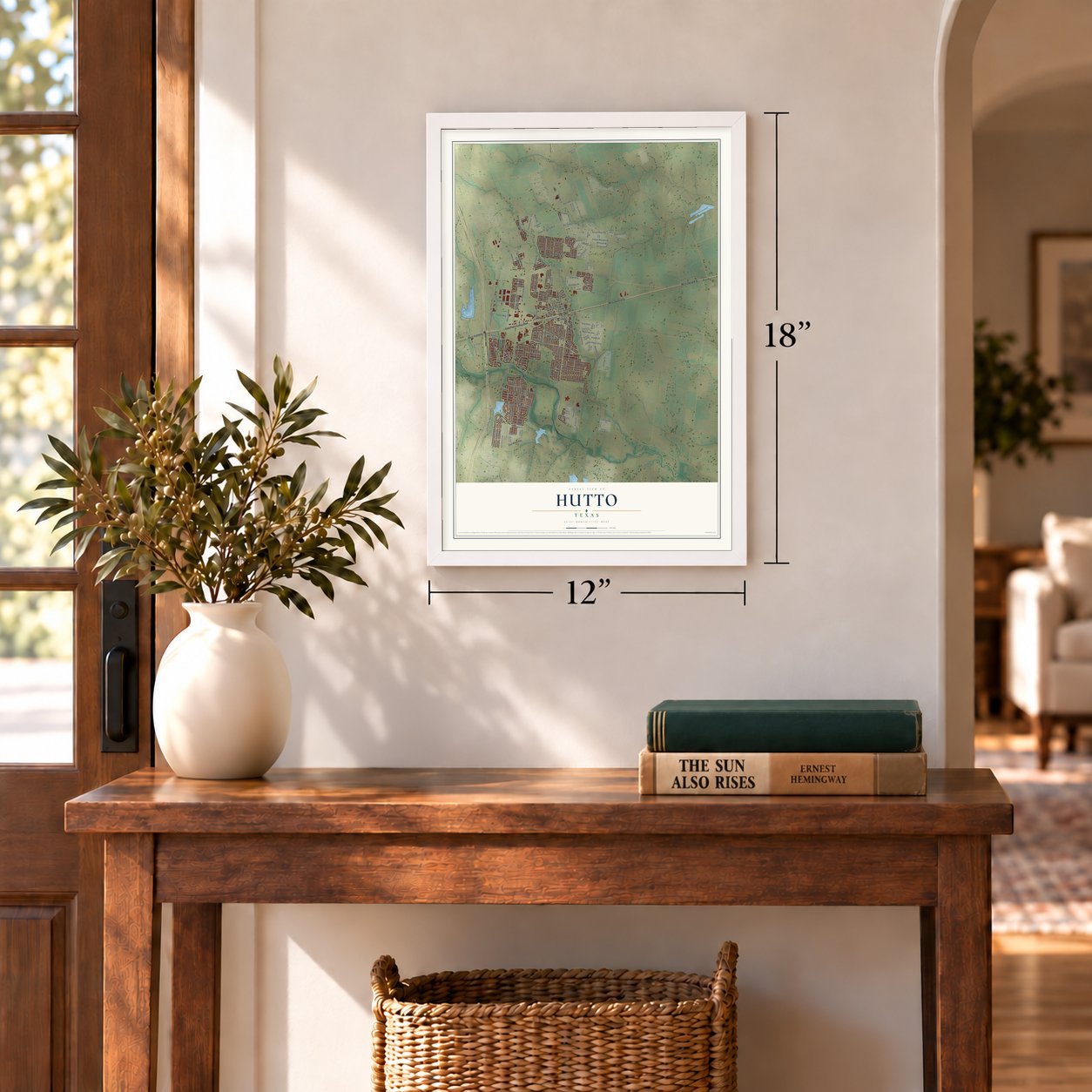
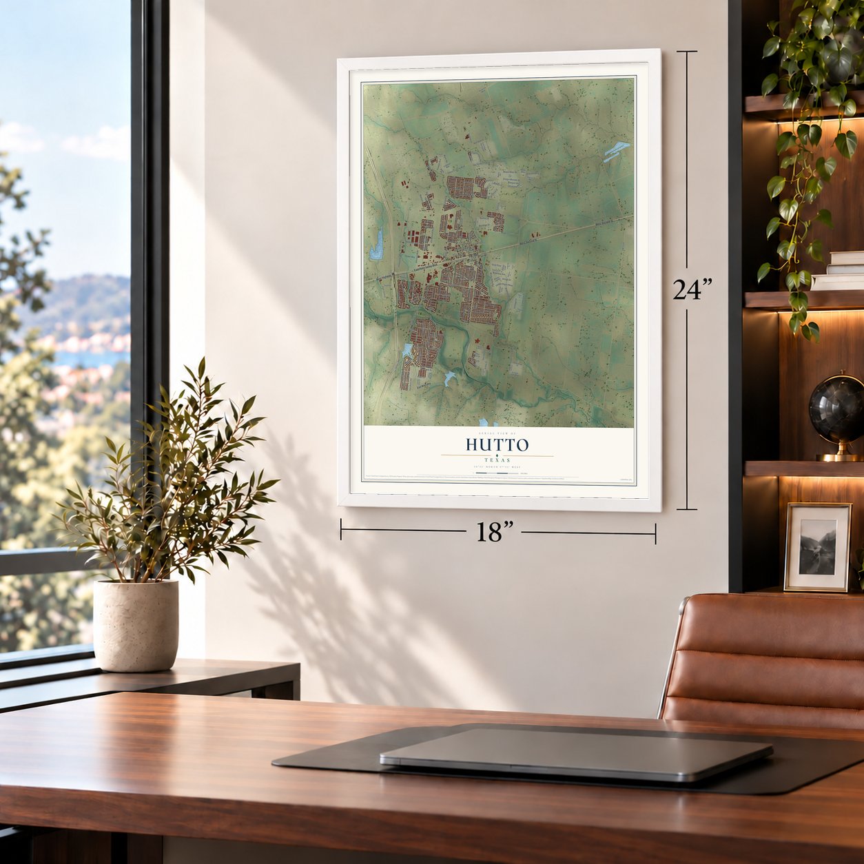
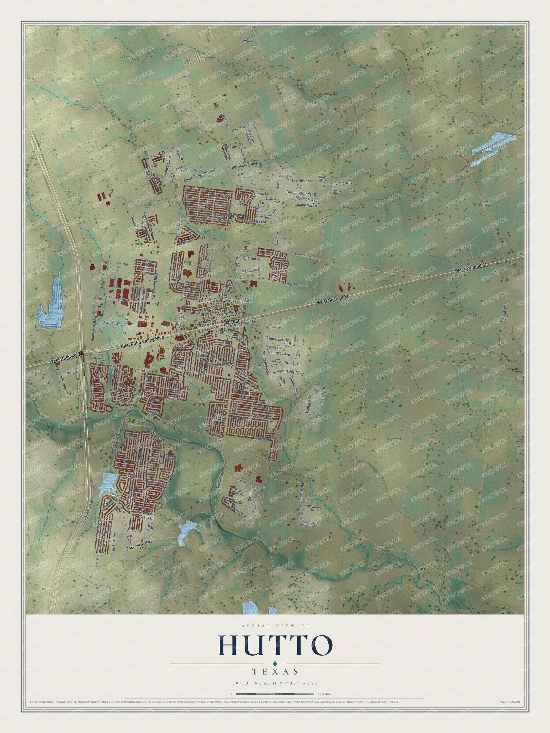
A new map of Hutto, Texas, made in 2026 and printed to order on thick archival matte paper.
12" x 18" Archival Matte Print
A Map of Home. A Work of Art.
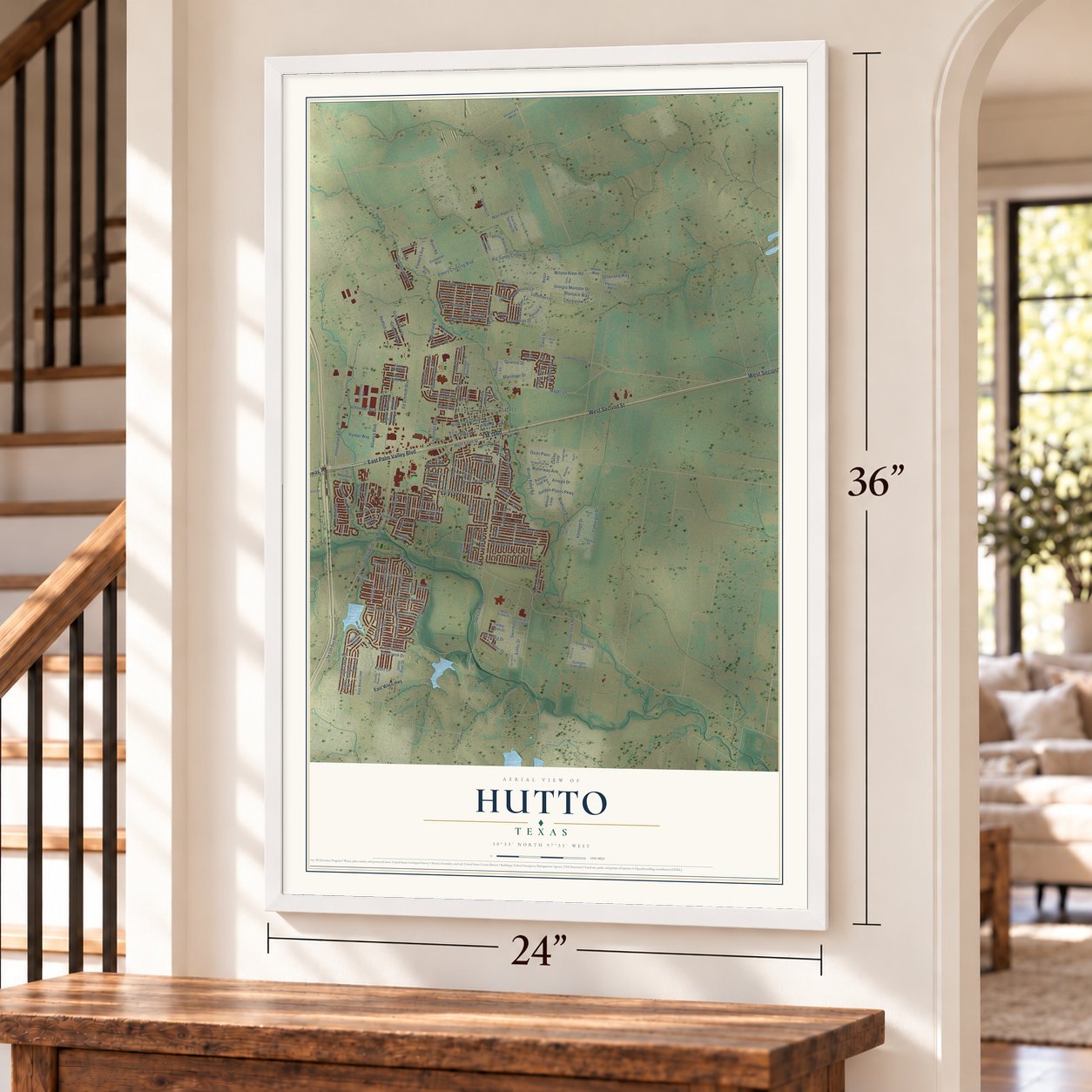
This beautifully detailed map of Hutto, Texas was created in 2026 using aerial imagery combined with modern topographical, census, street and landmark data. It's a modern aerial view of Hutto in Williamson County, Texas, that combines modern data with a vintage aesthetic. Zoom in on the preview and look for your block.
Three ways to hang it
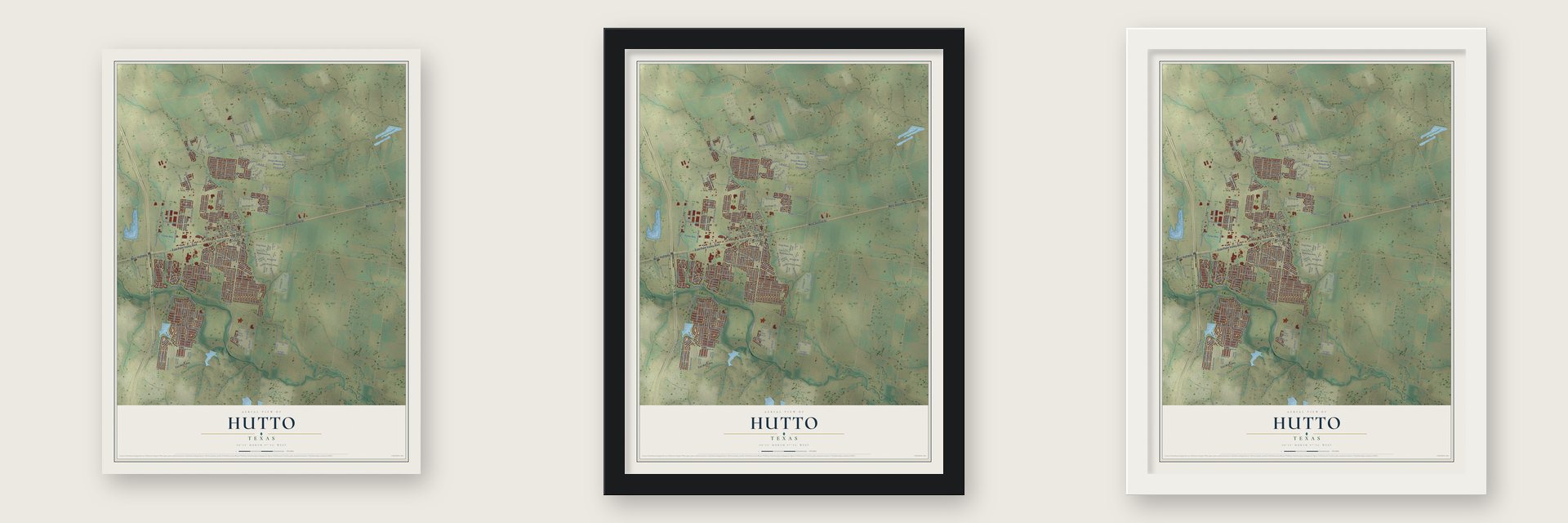
Unframed archival matte, a black wood frame or a white wood frame.
Up close
Real geography. Art worth displaying.
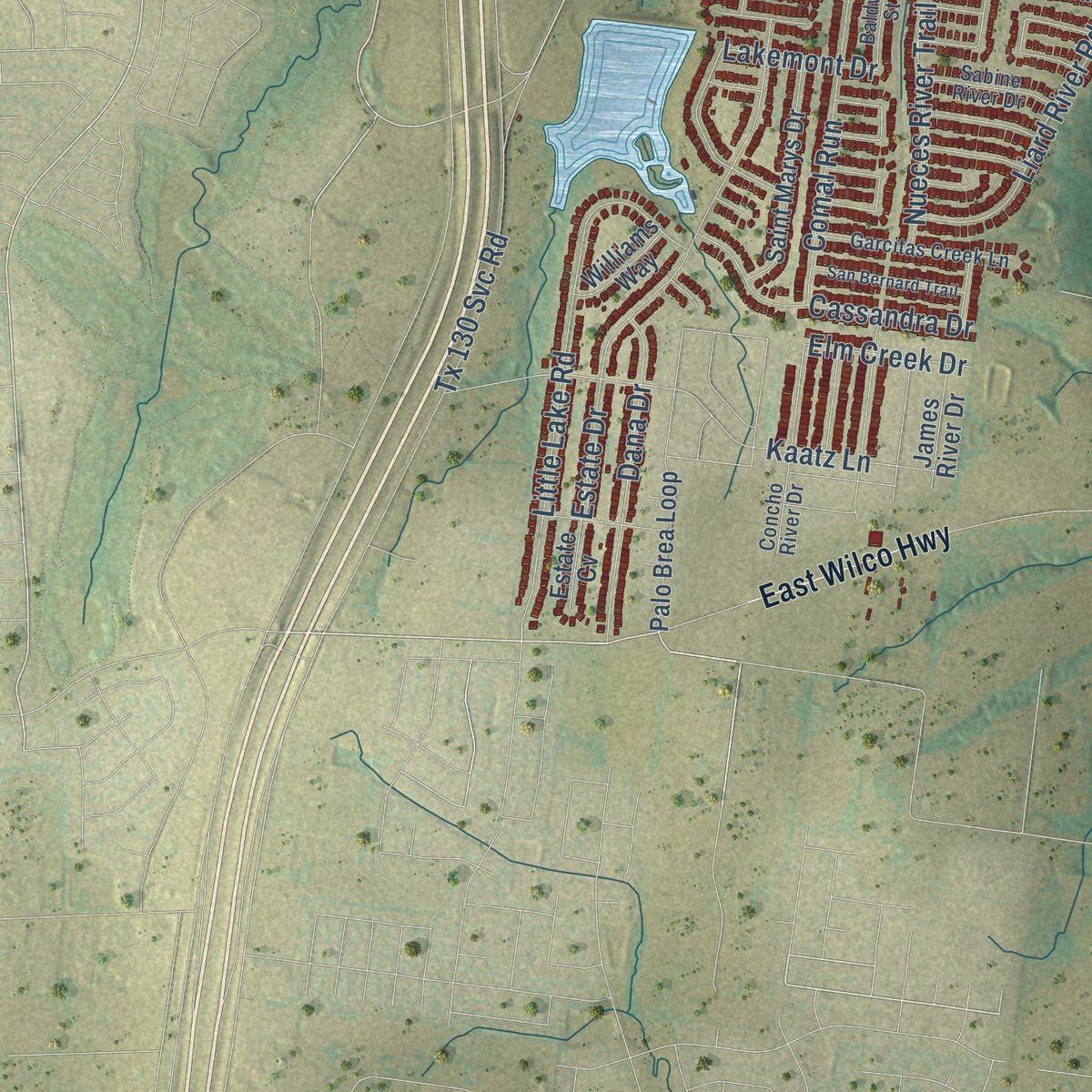
This map was created using accurate cartographic data and authoritative geographic sources, including the U.S. Geological Survey and the Census Bureau. The map brings together terrain, waterways, roads, and building detail. The majority of the streets are labeled, houses are accurately depicted, and the topography is derived from government sources. Combining local data with carefully composed color and shading leads to this beautifully detailed Hutto artwork for your wall.
Rather than simply showing street outlines, we’ve included as many of the street names as we could reasonably fit on the map while keeping their names legible. Zoom in on the high resolution preview to see exactly what’s on the map. We truly set out to create a statement piece for anyone who loves Hutto. So whether it’s for you, or a gift for someone you love, we hope this map of Hutto brings back fond memories.

About Hutto, Texas
Located in Texas, Hutto is a city within Williamson County. Historical records follow the community through the people and institutions that shaped local life. The 2020 census recorded 27,577 residents, providing a recent count within that longer story.
“The following year the community, which soon changed its name to Hutto, had a railroad depot, a post office, a general store, and a lumber business.”
- 27,577 residentsThe Census Bureau recorded this population in 2020.
- Williamson CountyThis city is part of the county.
- Incorporated in 1940Historical accounts place Hutto's incorporation in 1940.
- Hutto Commercial Historic DistrictHutto Commercial Historic District appears in the National Register records, with a listing date in 2011.
- Local schoolsPublic schools are served by Hutto Independent School District.
Find your street
Names on the Hutto map
Every name below is printed on this map. Look for your street, your school, the park where you played, or the pond down the road.
Places and landmarks1
- Hutto City Hall
Streets and roads221
- West Second Street
- East Palm Valley Boulevard
- West Highway 79
- FM 1660
- Alliance Boulevard
- Marimoor Drive
- Emory Crossing Boulevard
- Milano River Road
- Saul Street
- Holmstrom Street
- Delby Street
- Brooke Street
- Carl Stern Drive
- Limmer Loop
- Mager Lane
- Chris Kelley Boulevard
- Innovation Boulevard
- FM 685
- Ed Schmidt Boulevard
- Branson Boulevard
- Estate Drive
- West Front Street
- Little Lake Road
- Luna Vista Drive
- Carol Drive
- FM 3349
- Simmental Loop
- Hyltin Street
- Stewart Drive
- Kaatz Lane
Show all 221 streets
- Knowles Drive
- West Live Oak Street
- Gray Fox Loop
- Duroc Drive
- Mitchell Drive
- Liard River Road
- Riverwalk Drive
- Exchange Boulevard
- Foxglove Drive
- Cedar Fork Road
- Park Central
- East Street
- Lakemont Drive
- Bluejack Way
- Swindoll Lane
- Carrington Street
- Almquist Street
- Meadowside Drive
- Brown Street
- Pentire Way
- Flinn Street
- Dana Drive
- Lone Star Boulevard
- Kates Way
- Destiny Lane
- Giorgio Moroder Drive
- Altamont Street
- Phillips Street
- Sassafras Street
- Comal Run
- Emory Fields Drive
- Hendelson Lane
- Cassandra Drive
- Old County Road 137
- Gainer Drive
- Nueces River Trail
- Rinehardt Street
- Paige Bend
- Gemsbok Road
- Arnage Drive
- Mangold Drive
- Big Sandy Creek Drive
- Golden Plains Parkway
- Vantage Drive
- Windy Reed Road
- Ottaviano Way
- Fistral Drive
- Stinchcomb Road
- Waterway Avenue
- Roaming Drive
- Wimberley Street
- Creston Street
- Kerley Drive
- Tx 130 Svc Road
- Chickasaw Lane
- Westfield Street
- Creekbend Drive
- Redfish Lane
- Quarton Drive
- Decker Drive
- Swenson
- Schneider Boulevard
- Pulitzer Drive
- Flowers Avenue
- Quail Hollow Drive
- Richards Drive
- Lidell Street
- Marklawn Lane
- Parker Way
- Kothman Drive
- Liberty Street
- Cyril Drive
- Austin Avenue
- McCoy Lane
- Finley Street
- Ashby Drive
- Camargue Drive
- Marvin Cv
- Elm Creek Drive
- Holman Path
- Clarks Way
- Farley Street
- Wynn Road
- Osier Pass
- Samson Drive
- East Wilco Highway
- Otello Way
- Farm Creek Drive
- Emory Stable Drive
- Palo Brea Loop
- Hereford Loop
- Milliner Loop
- North FM 1660
- Canley Loop
- Main Hippo Drive
- Colthorpe Lane
- Plantain Drive
- East Front Street
- Stonebrook Drive
- Sylvan Street
- Big Cypress Bayou Road
- Timber Brook Drive
- Saint Marys Drive
- Wells Bend
- Country Estates Drive
- Fort Clark Springs Drive
- Methodius Drive
- Killian Loop
- Balsam Street
- Sunlight Lake Boulevard
- Grisham Drive
- Brookside Street
- Autumn Leaf Road
- Inman Drive
- Barton Creek Lane
- Barley Fork Lane
- Herrera Trail
- Floating Leaf Drive
- Warner Bend
- Janis Mae Drive
- Cockrill Street
- Crumpton Way
- Park Avenue
- University Boulevard
- Pickle Drive
- Enclave Way
- Coyote Trail
- James River Drive
- Hibiscus Drive
- Adeline Road
- Williams Way
- Betsy Road
- Rochester Lane
- Mollie Drive
- Bosco Road
- East Pecan Street
- Panico Road
- South Ash Cv
- Estate Cv
- Concho Pearl Place
- North Ash Cv
- Wold Drive
- Baldwin Street
- Wegstrom Street
- San Antonio River Walk
- Mossy Rock Cv
- Wiley Street
- Hanstrom Drive
- Lagonda Drive
- Concho River Drive
- Anderson Street
- Eagle Lake Drive
- Garcitas Creek Lane
- Willowbrook Drive
- Holland Street
- Wallin Farms Drive
- Fairmeadow Downs Drive
- South FM 1660
- Sabine River Drive
- Grapefruit Road
- Bent Creek Drive
- Adriana Lane
- Great Western Drive
- Co Op Boulevard
- Aguilar Drive
- Will Lane
- Lucky Clover Lane
- Tricia Lane
- Iola Drive
- Main Street
- Divisadero Drive
- Corniche Circle
- Waterlily Way
- Doodle Lane
- New Technology Boulevard
- San Bernard Trail
- Arlington Park Loop
- Creekside Drive
- Longbridge Drive
- Edison Drive
- Windgate Drive
- Wheat Street
- Cona Way
- Oconee Street
- Wolseley Drive
- Millook Haven
- Creek Ledge Drive
- Helen Road
- Miglia Street
- Golden Lane
- Ascari Court
Names are listed as they appear on the printed map. Zoom into the product photos to find them.
The art of mapping a place
How This Map Was Made
Real places. Remarkable detail. Discover the layers that turn geographic data into a map of home.

The view from above
Aerial imagery reveals the character of the land: woodland, open fields, and the patterns of a place.

The shape of the land
Elevation data brings hills, valleys, and subtle changes in the landscape into view.

The details of home
Roads, waterways, and building footprints come together to make the map feel unmistakably local.

Geography becomes art
Considered color, shading, and typography bring the layers together in a map made for your wall.


Process illustrated with Mendon, Massachusetts. Aerial imagery: USDA NAIP. Terrain: USGS 3D Elevation Program. Map details and finished artwork: KNOWOL.
The Details
About This Print
Choose an archival matte print, or a black or white Ayous wood frame. The archival matte print is unframed.
Select your size and finish above to see the matching product image and price.
Materials & Craftsmanship
A contemporary map with the character of a classic atlas, printed on archival matte paper. Optional frames are made from Ayous wood.
Your printed map does not include the watermark shown in the full-map preview.
Shipping & Delivery
Free shipping within the United States. Every print is made to order in the USA.
Buying a gift? Add a note in your cart and we'll include it. We never put prices in the package.
Prints ship within 2 to 3 business days. Allow 7 to 10 days total from ordering for delivery. Timing may vary during holidays or periods of high order volume.
Read our shipping policy.
Returns and damaged prints
Each print is made to order. Change-of-mind refunds are not available after production.
If your print arrives damaged, misprinted or incorrect, contact support@knowol.com within 30 days of receiving it. Include your order number, photos and a description of the issue.
Read our full refund and replacement policy. For questions about your order, email support@knowol.com.
Find your town
Looking for another city?
Find a map of home in our Texas collection.
Nearby
Maps of towns near Hutto
Know someone from one of these towns? Their map makes a great gift.
 Taylor
, Texas
From $39.99See the map
 Round Rock
, Texas
From $39.99See the map
 Pflugerville
, Texas
From $39.99See the map
More maps nearby: Weir, Wells Branch, Coupland, Brushy Creek and Georgetown.