


Search for another town


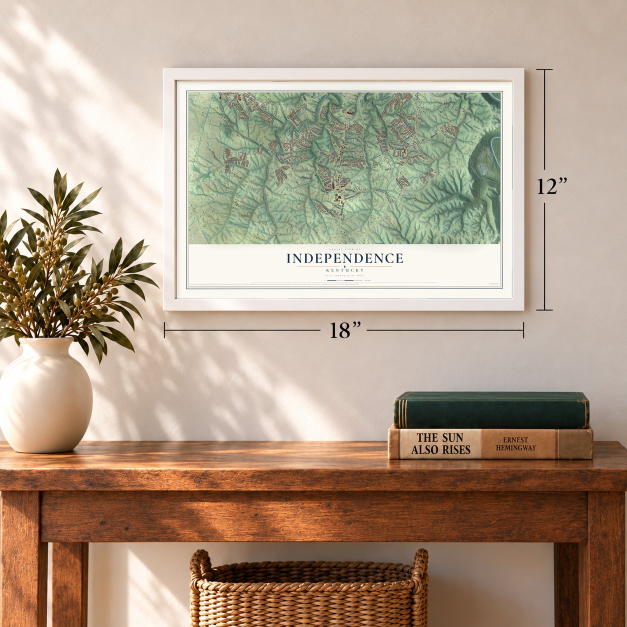

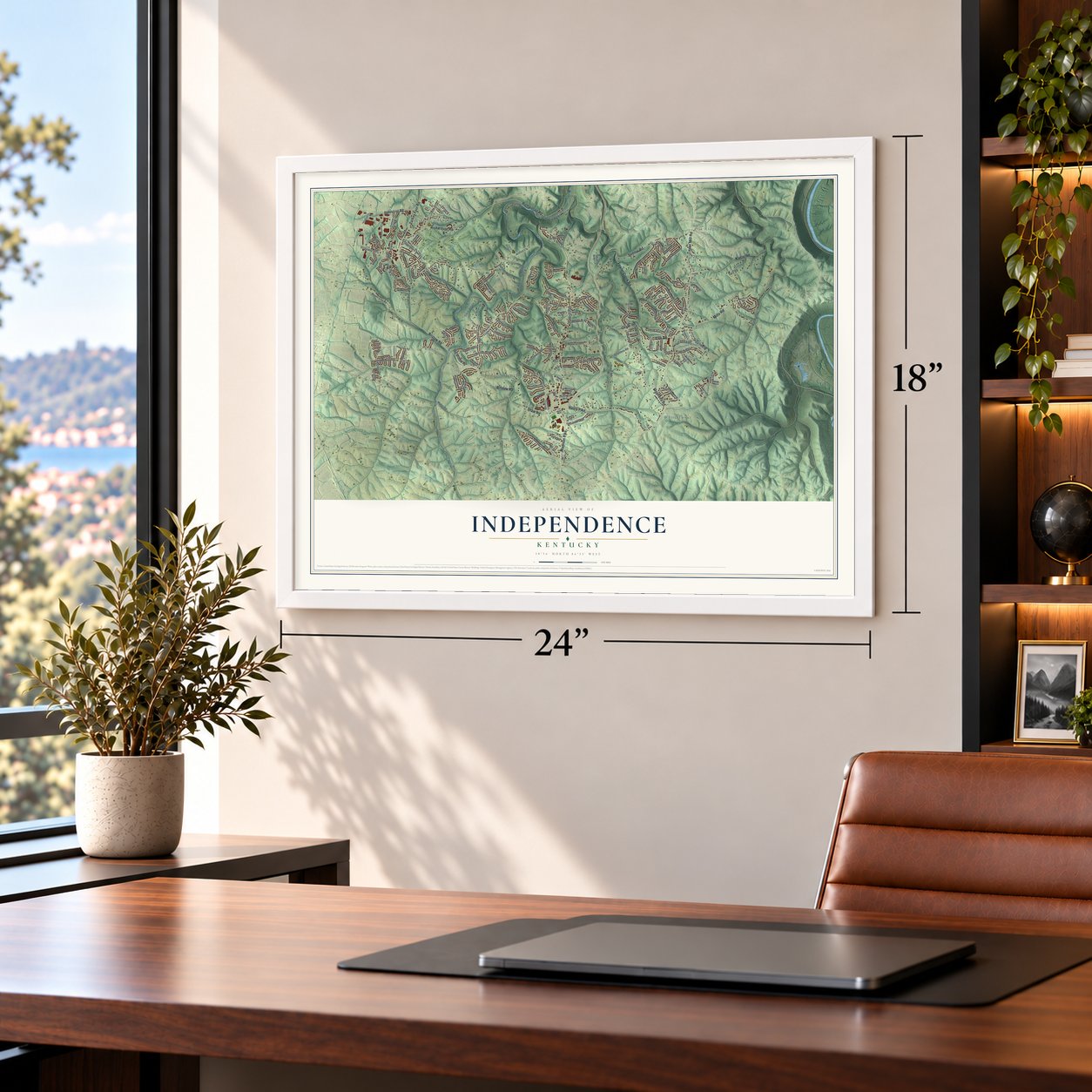

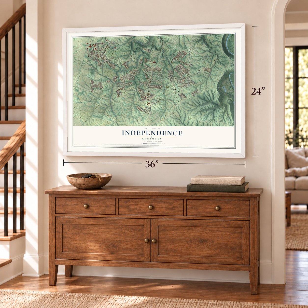

Free U.S. delivery 7 to 10 days after you order
Independence, Kentucky Map Art
Building by building, with labeled streets and shaded relief.
12" x 18" Archival Matte Print
A Map of Home. A Work of Art.
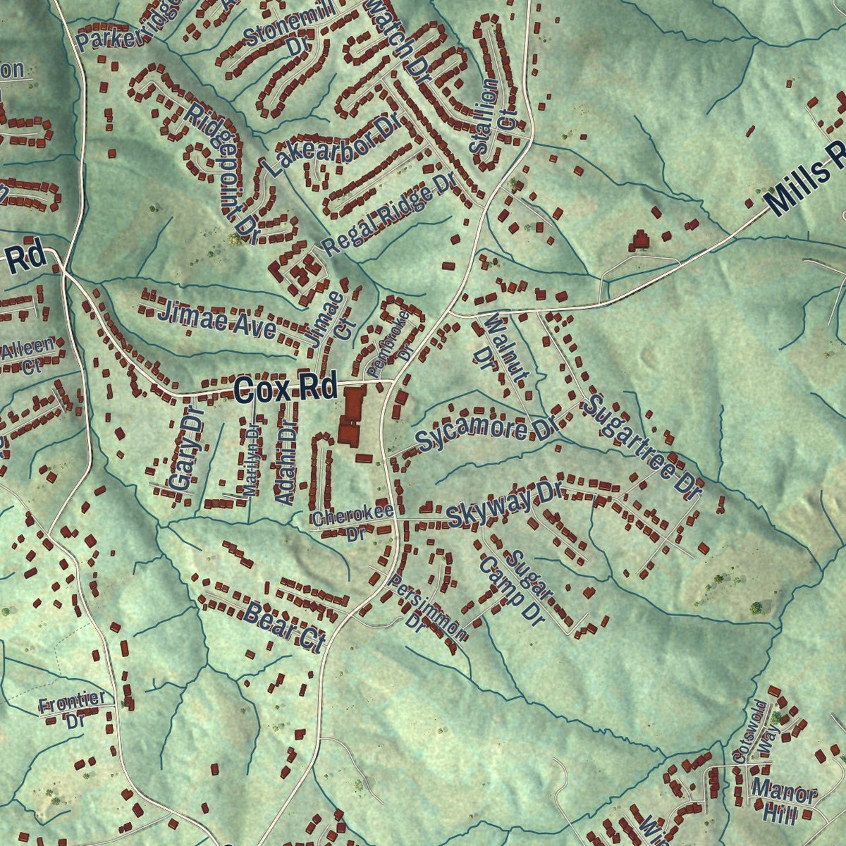
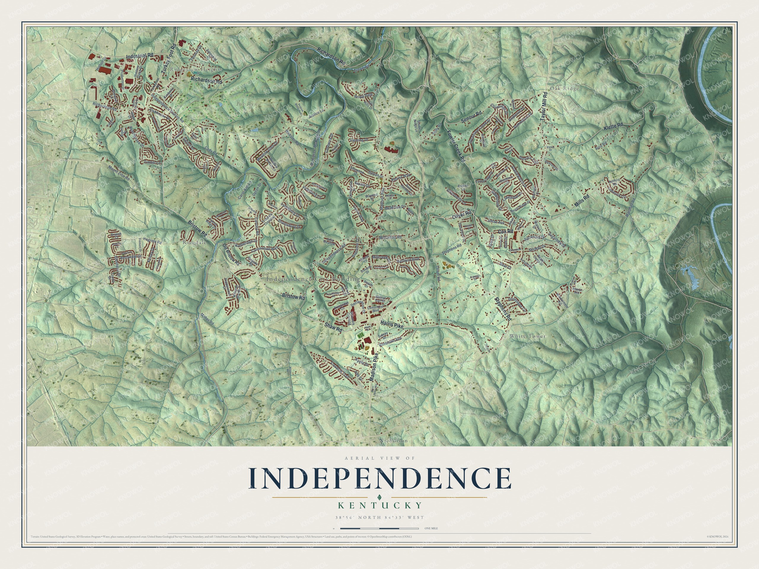
Explore Independence, Kentucky from a whole new perspective. Created using aerial imagery and detailed geographic data, this map captures Independence building by building, with labeled streets, familiar landmarks, and shaded topographical relief that highlights the natural contours of the landscape.
Combining modern data with the timeless character of a vintage atlas, this map is just as interesting up close as it is beautiful on the wall. Whether you grew up in Independence, spent memorable years there, or call it home today, this unique map is a great way to celebrate a place that means something to you. Zoom in on the preview to look for your street, and then order a print to put your memories on the wall.
Three ways to hang it
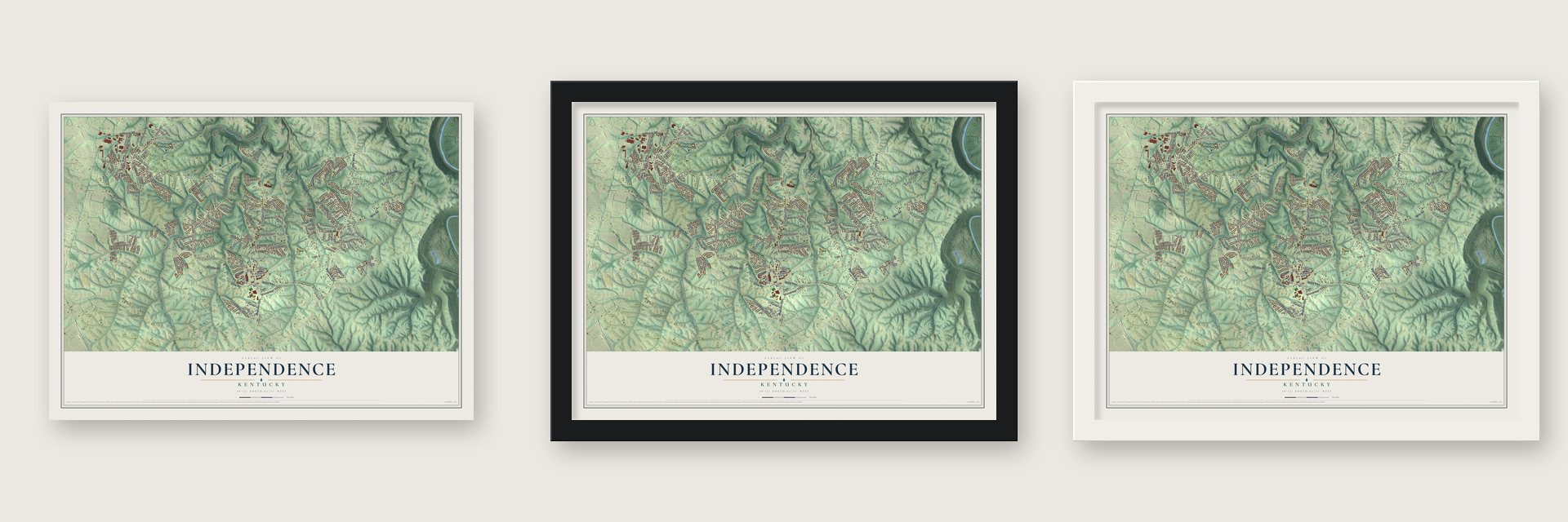
Unframed archival matte, a black wood frame or a white wood frame.
Up close
Geography Worth Displaying
This map was created using accurate cartographic data and authoritative geographic sources, including the U.S. Geological Survey and the Census Bureau. The map brings together terrain, waterways, roads, and building detail. The majority of the streets are labeled, houses are accurately depicted, and the topography is derived from government sources. Combining local data with carefully composed color and shading leads to this beautifully detailed Independence artwork for your wall.
Rather than simply showing street outlines, we’ve included as many of the street names as we could reasonably fit on the map while keeping their names legible. Zoom in on the high resolution preview to see exactly what’s on the map. We truly set out to create a statement piece for anyone who loves Independence. So whether it’s for you, or a gift for someone you love, we hope this map of Independence brings back fond memories.
Read the story behind this map of Independence, Kentucky from 2026.

Find your street
Names on the Independence map
Every name below is printed on this map. Look for your street, your school, the park where you played, or the pond down the road.
Places and landmarks9
- Independence City Building
- Ridgeview Heights
- Oak Ridge
- Fox Run Park
- Independence Cemetery
- Nicholson
- Ricedale
- White Tower
- Banklick Woods Park
Streets and roads173
- Bristow Road
- Richardson Road
- Shaw Road
- Turkey Foot Road
- Cox Road
- Oliver Road
- Taylor Mill Road
- Fowler Creek Road
- Klette Road
- Harris Pike
- Mills Road
- Senour Road
- Stephens Road
- Industrial Road
- Madison Pike
- Independence Station Road
- Marshall Road
- Cody Road
- Webster Road
- Independence Road
- Mount Zion Road
- Summitrun Drive
- Calvary Road
- Pelly Road
- Meadow Glen Drive
- Glenhurst Drive
- Hartland Boulevard
- Stevie's Trail
- Berlander Drive
- Griststone Circle
Show all 173 streets
- Hogrefe Road
- McCullum Road
- Freedom Trail
- Beechgrove Drive
- Stablewatch Drive
- Sugartree Drive
- Cannonball Way
- Sycamore Creek Drive
- Limerick Circle
- Sylvan Drive
- Declaration Drive
- McHugh Drive
- Cloveridge Drive
- Skyway Drive
- Thomas Drive
- Rice Road
- Roselawn Avenue
- Carrie Way
- McMillan Drive
- Holton Drive
- Ridgepoint Drive
- Carol Ann Lane
- Bridle Path
- Justice Lane
- Battleridge Drive
- Lakearbor Drive
- Millcreek Circle
- Sycamore Drive
- Sharpsburg Drive
- Patriot Way
- Canberra Drive
- Silversmith Lane
- Clubhouse Drive
- Oby Drive
- Supreme Court
- Fleming Drive
- Jimae Avenue
- Apple Drive
- Lynchburg Drive
- Kelsey Drive
- Nicole Drive
- Upton Drive
- Bridlerun Drive
- Vicksburg Lane
- Maher Road
- Timber Lane
- Crowe Road
- Bear Court
- Saturn Drive
- Gary Drive
- Old Bristow Road
- Williams Woods Drive
- Hunters Green Drive
- Troopers Crossing
- Delaware Crossing
- Regal Ridge Drive
- Forest Run Drive
- Production Drive
- Ashford Road
- McHugh Lane
- Sherwood Drive
- Centennial Boulevard
- Christopher Drive
- Don Victor Drive
- Far Hills Drive
- Falcon Ridge Drive
- Parkerridge Drive
- Meadow Breeze Lane
- Scenic Ridge Lane
- Stevens Drive
- Stonemill Drive
- Brentridge Circle
- Dana Harvey Lane
- Sugar Camp Drive
- Arabian Drive
- Aspen Drive
- Dalewood Drive
- Windermere Hill
- Arbor Court
- Stallion Court
- Julia Meadow
- Walnut Hall Drive
- Tupelo Drive
- Pepperwood Drive
- Walnut Drive
- Rusconi Drive
- Wayman Drive
- Kimberly Drive
- Adahi Drive
- Boxwood Lane
- Victory Lane
- Brigade Road
- Sidney Drive
- Jimae Court
- Belle Drive
- Branch Court
- Locust Lane
- Boston Lane
- Peach Drive
- Manor Hill
- Tyler Court
- Fremont Drive
- Cherryknoll Court
- Brentwood Drive
- Shenandoah Court
- Codyview Drive
- Catalpa Road
- Astoria Court
- Cairns Court
- Mohawk Lane
- Persimmon Drive
- Ally Way
- Cherokee Drive
- Blooming Court
- McKim Drive
- Faubush Court
- Alleen Court
- Infantry Drive
- Frontier Drive
- Apple Valley Drive
- Harbor Court
- Vanna Drive
- Alvin Drive
- Turkeyfoot Road
- Wedgewood Drive
- Ackerly Drive
- Autumnridge Road
- Pembroke Drive
- Stoneharbor Lane
- Water Tower Way
- Marilyn Drive
- Flintwood Court
- Cynthiana Court
- Finchley Road
- Cotswold Way
- Amblewood Court
- Manassas Drive
- Burnsides Way
- Tamarita Lane
- Rebecca Way
- Wilson Road
- Totten Lane
- Jam Court
Names are listed as they appear on the printed map. Zoom into the product photos to find them.
About Independence, Kentucky
From the National Park Service: "As the county seat, Independence continued to play an active part in the political life of the county. Notable local politicians who began their careers there included John G. Carlisle, Secretary of the Treasury; Kentucky Governor John Stevenson; and Lieutenant Governor Bryan."
Keep exploring Kentucky
Independence is one of 659 Kentucky towns we've mapped. Every dot on the map is a print of its own.
The search covers every state, Kentucky first.
Near Independence
Order 2 or more town maps and save 10%. Shown in the size and finish you picked above, so they hang as a set.
- Edgewood 12" x 18" / Archival Matte Print $39.99
- Elsmere 12" x 18" / Archival Matte Print $39.99
- Taylor Mill 12" x 18" / Archival Matte Print $39.99


More maps nearby: Ryland, Fairview, Crestview Hills, Lakeside Park and Covington.
The art of mapping a place
How This Map Was Made
Real places. Remarkable detail. Discover the layers that turn geographic data into a map of home.

The view from above
Aerial imagery reveals the character of the land: woodland, open fields, and the patterns of a place.

The shape of the land
Elevation data brings hills, valleys, and subtle changes in the landscape into view.

The details of home
Roads, waterways, and building footprints come together to make the map feel unmistakably local.

Geography becomes art
Considered color, shading, and typography bring the layers together in a map made for your wall.


Process illustrated with Mendon, Massachusetts. Aerial imagery: USDA NAIP. Terrain: USGS 3D Elevation Program. Map details and finished artwork: KNOWOL.
The Details
About This Print
Choose an archival matte print, or a black or white Ayous wood frame. The archival matte print is unframed.
Select your size and finish above to see the matching product image and price.
Materials & Craftsmanship
A contemporary map with the character of a classic atlas, printed on archival matte paper. Optional frames are made from Ayous wood.
Your printed map does not include the watermark shown in the full-map preview.
Shipping & Delivery
Free shipping within the United States. Every print is made to order in the USA.
Buying a gift? Add a note in your cart and we'll include it. We never put prices in the package.
Prints ship within 2 to 3 business days. Allow 7 to 10 days total from ordering for delivery. Timing may vary during holidays or periods of high order volume.
Read our shipping policy.
Returns and damaged prints
Each print is made to order. Change-of-mind refunds are not available after production.
If your print arrives damaged, misprinted or incorrect, contact support@knowol.com within 30 days of receiving it. Include your order number, photos and a description of the issue.
Read our full refund and replacement policy. For questions about your order, email support@knowol.com.