
Search for another town


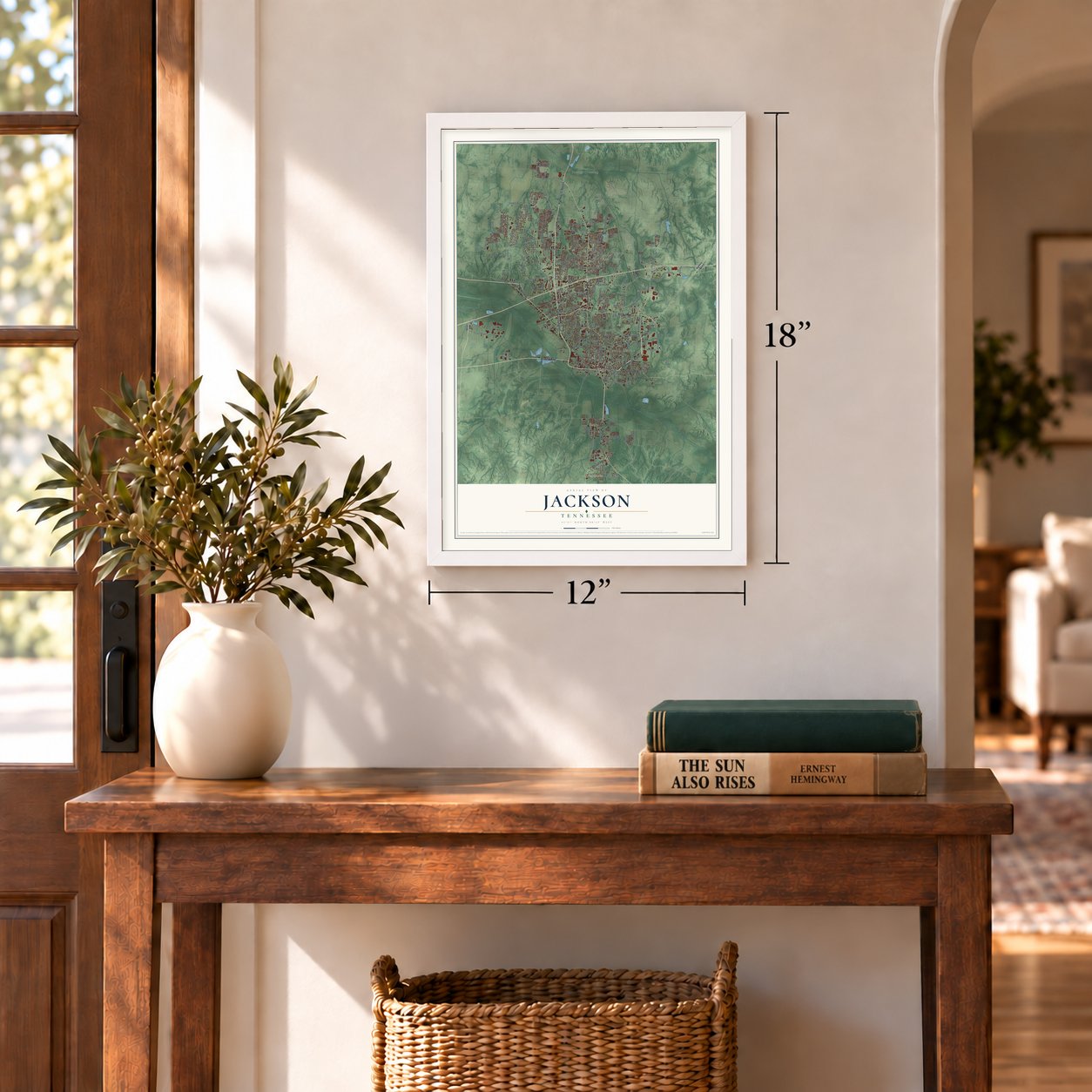

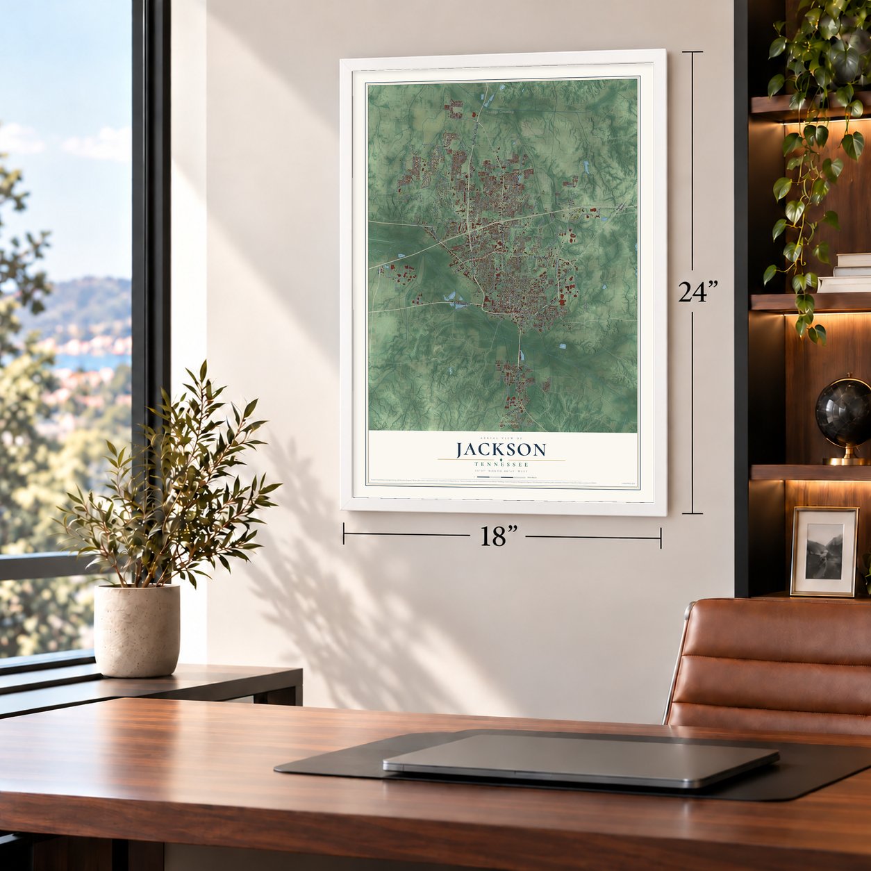

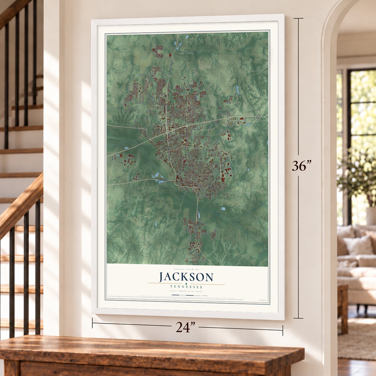
Free U.S. delivery 7 to 10 days after you order
Jackson, Tennessee Map Art
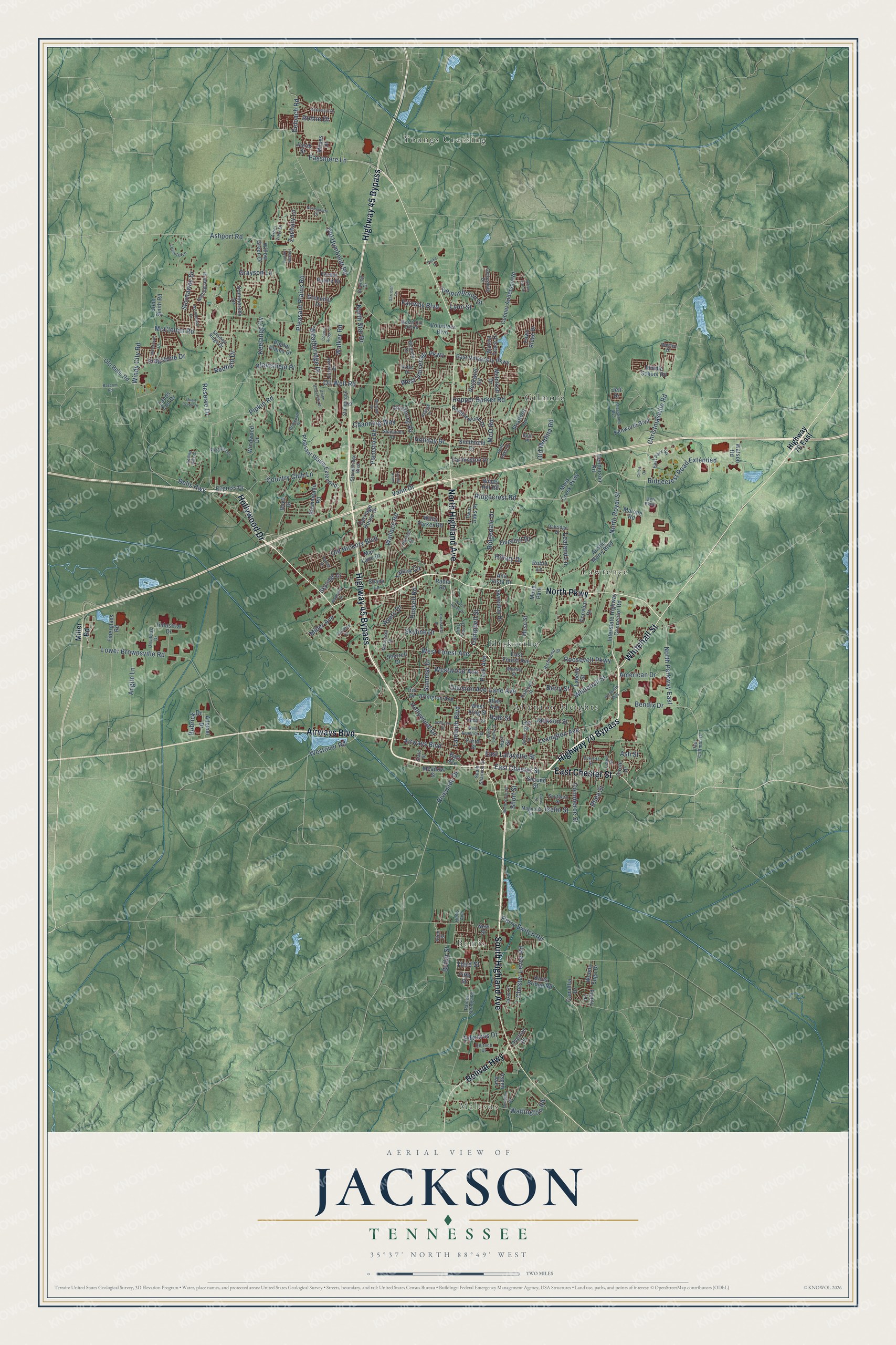
A new map of Jackson, Tennessee, made in 2026 and printed to order on thick archival matte paper.
12" x 18" Archival Matte Print
A Map of Home. A Work of Art.
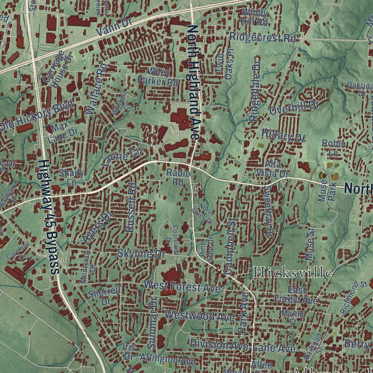
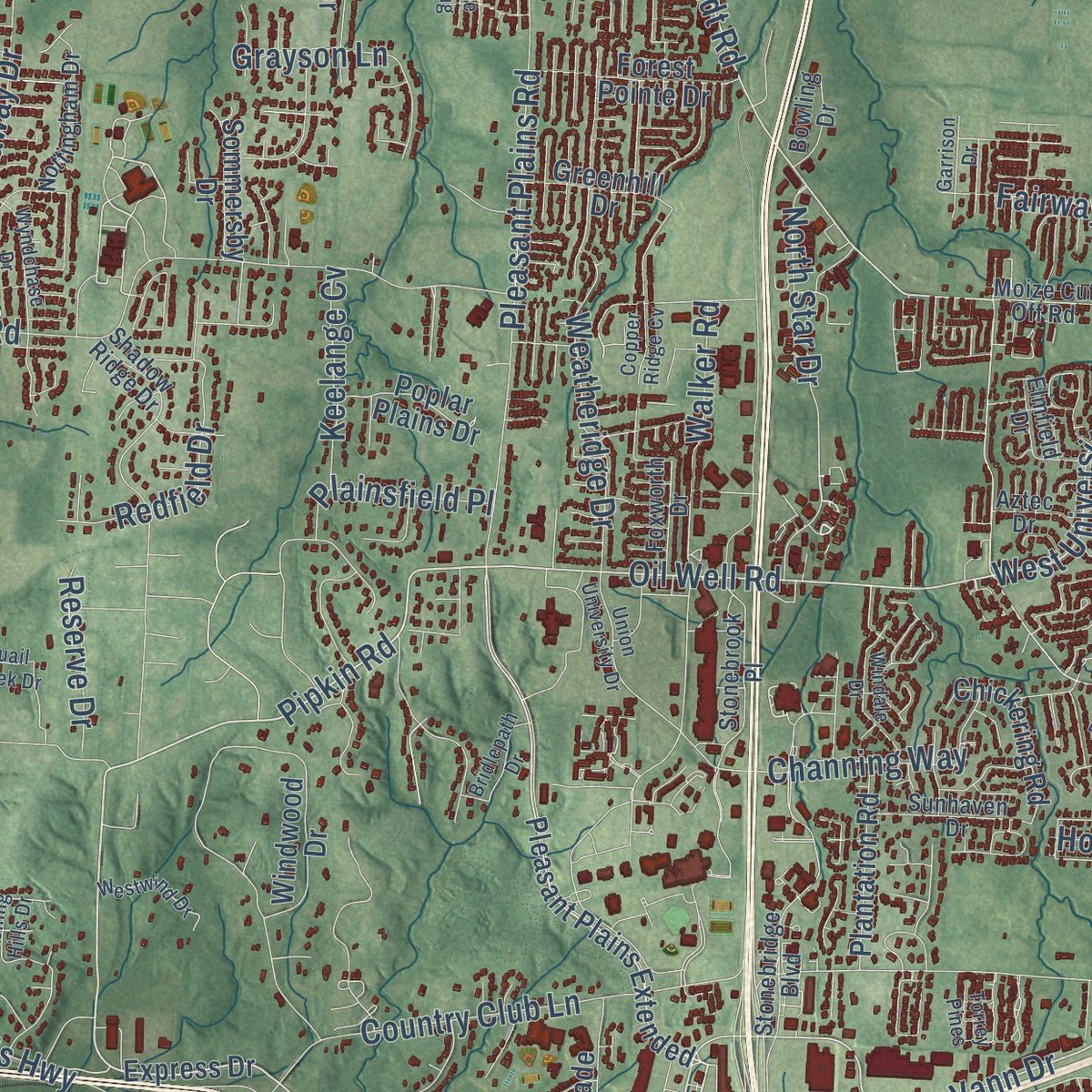
Explore Jackson, Tennessee from a whole new perspective. Created using aerial imagery and detailed geographic data, this map captures Jackson building by building, with labeled streets, familiar landmarks, and shaded topographical relief that highlights the natural contours of the landscape.
Combining modern data with the timeless character of a vintage atlas, this map is just as interesting up close as it is beautiful on the wall. Whether you grew up in Jackson, spent memorable years there, or call it home today, this unique map is a great way to celebrate a place that means something to you. Zoom in on the preview to look for your street, and then order a print to put your memories on the wall.
Three ways to hang it
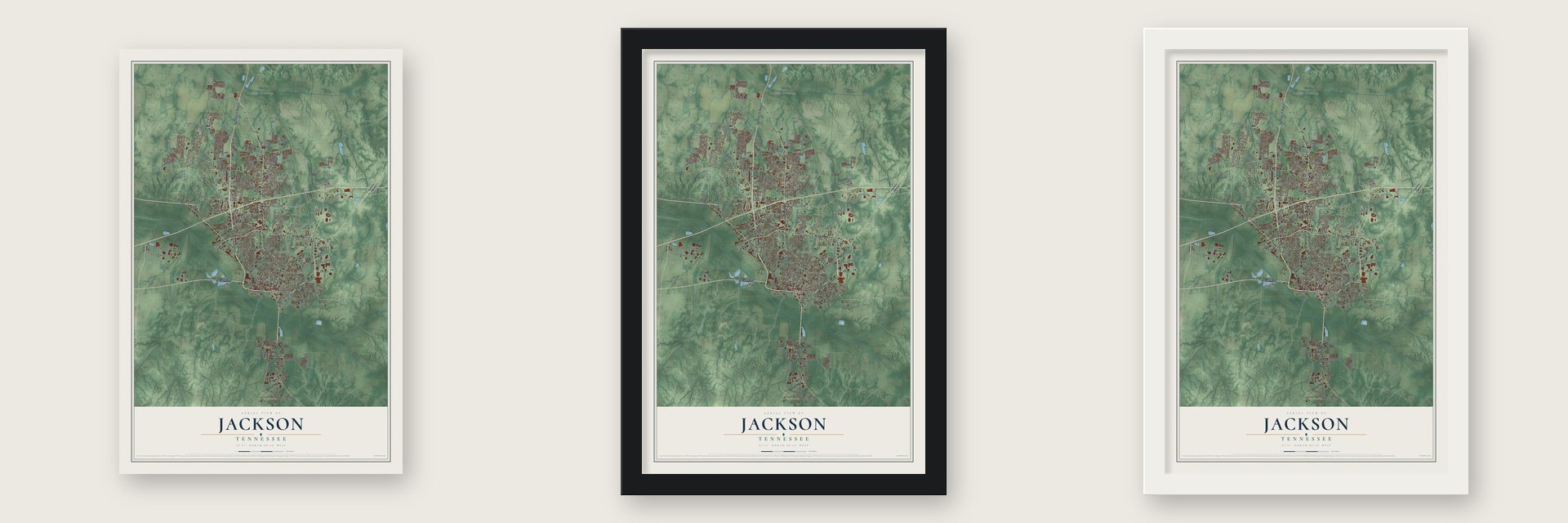
Unframed archival matte, a black wood frame or a white wood frame.
Up close
Geography Worth Displaying
This map was created using accurate cartographic data and authoritative geographic sources, including the U.S. Geological Survey and the Census Bureau. The map brings together terrain, waterways, roads, and building detail. The majority of the streets are labeled, houses are accurately depicted, and the topography is derived from government sources. Combining local data with carefully composed color and shading leads to this beautifully detailed Jackson artwork for your wall.
Rather than simply showing street outlines, we’ve included as many of the street names as we could reasonably fit on the map while keeping their names legible. Zoom in on the high resolution preview to see exactly what’s on the map. We truly set out to create a statement piece for anyone who loves Jackson. So whether it’s for you, or a gift for someone you love, we hope this map of Jackson brings back fond memories.
Read the story behind this map of Jackson, Tennessee from 2026.
About Jackson, Tennessee
Jackson is a city of 68,205 people and the county seat of Madison County, in West Tennessee. The Chickasaw held this land first. Before 1820, settlers from Virginia, Kentucky and other parts of the Upper South made homes along the Forked Deer River. In 1821 the state sent two men, Sterling Brewer and James Fentress, to pick a seat of justice. They looked at Alexandria, Golden's Station and Jackson. Most settlers lived close to Jackson on Cotton Grove Road, so Jackson won. It became the county seat in September 1822 and was named for Andrew Jackson, who had won fame in the War of 1812.
In 1834 Tennessee set up its Supreme Court. Memphis was not yet built up, so the court's seat for the west went to Jackson. Cotton farms worked by enslaved people lay all around, and the town grew as their market. The railroads did even more. From 1851 on, lines met here from the north, south, east and west, and through the 1960s, 15 passenger trains served the city each day. At the end of that decade the railroads merged and cut service, and many jobs were lost. The city then turned to new businesses and factories.
- Forrest's raid of 1862In December 1862, Confederate General Nathan Bedford Forrest led 2,100 horsemen across the Tennessee River to cut the railroad that fed Grant's army. Union Colonel Adolph Englemann's two infantry regiments turned back a mounted attack at Old Salem Cemetery, but that fight was only a trick. Meanwhile, other Confederate columns tore up track north and south of town. With the line wrecked, Grant gave up his plan to invade Mississippi from Tennessee and turned toward Vicksburg.
- Home of Casey JonesCasey Jones, the famous Illinois Central Railroad engineer, made his home in Jackson. Four buildings from the city's busy travel years joined the National Register in 1993: the Illinois Central Railroad Division Office, the Nashville, Chattanooga & St. Louis Passenger Depot, the Greyhound Bus Station and the Murphy Hotel.
- A college townJackson is home to Union University, Lane College, Lambuth University and Jackson State Community College. The Lane College Historic District grew in 1991, when its National Register boundary was made larger.
- A new charter in 1989In 1915 Jackson began electing a mayor and two commissioners, all by a citywide vote. After that, no Black resident ever won a seat on the board. In 1977 three residents sued. In Buchanan v. City of Jackson, the federal court found that the system was unfair to Black voters, and it approved a new plan in 1988. A new charter in 1989 split the city into nine districts, each electing one member. The mayor is still chosen citywide.
Find your street
Names on the Jackson map
Every name below is printed on this map. Look for your street, your school, the park where you played, or the pond down the road.
Places and landmarks8
- Malesus
- Allenton Heights
- Bemis
- Gilmore
- Hicksville
- Lawrence
- Youngs Crossing
- Muse Park
Streets and roads240
- North Parkway
- Whitehall Street
- Highway 70 Bypass
- East Chester Street
- Highway 45 Bypass
- South Highland Avenue
- Hollywood Drive
- North Highland Avenue
- Airways Boulevard
- Bolivar Highway
- Vann Drive
- Pipkin Road
- Oil Well Road
- Old Humboldt Road
- North Parkway East
- West University Parkway
- East Lafayette Street
- Passmore Lane
- Ayers Drive
- North Royal Street
- Campbell Street
- Ashport Road
- Country Club Lane
- Old Hickory Boulevard
- Wallace Road
- McClellan Road
- Christmasville Road
- Ridgecrest Road
- Lower Brownsville Road
- Ridgecrest Road Extended
Show all 240 streets
- Windy City Road
- Russell Road
- Pleasant Plains Road
- Walker Road
- Bells Highway
- Lexington Avenue
- Chester Levee Road
- Lambuth Boulevard
- West Forest Avenue
- Riverside Drive
- Old Medina Road
- Hopper Barker Road
- McO Road
- Summar Drive
- Westwood Avenue
- Lane Avenue
- Perry Switch Road
- Skyline Drive
- Redfield Drive
- Weatheridge Drive
- Stornaway Drive
- Westover Road
- Demonbreun Drive
- Channing Way
- Jackson Street
- Grayson Lane
- Flagstone Drive
- Fairway Boulevard
- Deloach Road
- Commerce Street
- Roosevelt Parkway
- North Star Drive
- Bendix Drive
- Ridgedale Drive
- Watlington Road
- American Drive
- Butler Street
- Keelange Cv
- Plainsfield Place
- Anglin Lane
- Bobrick Drive
- Edwards Drive
- Laurie Circle
- Reserve Drive
- Short Street
- Park Avenue
- Division Avenue
- Overhill Drive
- Zachary Lane
- Holiday Drive
- Rhea Street
- Miller Avenue
- Lealand Lane
- Romie Drive
- Lynn Street
- Iselin Street
- Hillary Drive
- Berry Street
- Third Street
- Hale Street
- Ash Street
- Miller Road
- Highway 70 East
- Pleasant Plains Extended
- Interstate Highway Connector Road
- Express Drive
- East University Parkway
- Cooper Anderson Road
- Windwood Drive
- Austin Merry Boulevard
- Carriage House Drive
- Wiley Parker Road
- Harts Bridge Road
- Rushmeade Road
- Arlington Avenue
- Moss Creek Parkway
- Old Bells Road
- Watson Road
- John Smith Road
- Rockwell Road
- Henderson Road
- Greenhill Drive
- Ramblewood Drive
- Radio Road
- West King Street
- Second Street
- Forest Pointe Drive
- Kenworth Boulevard
- Plantation Road
- Sweetbay Drive
- Chickering Road
- Circle Drive
- McIntosh Drive
- East Forest Avenue
- Muse Street
- Stratford Lane
- Farmington Drive
- Willow Green Drive
- Fiberglass Road
- Conalco Drive
- Middle School Road
- Meadow Street
- Labelle Street
- Sommersby Drive
- Skyridge Drive
- Allen Avenue
- Poplar Plains Drive
- Smithfield Drive
- Volunteer Boulevard
- Penny Lane
- Walnut Trace Drive
- Alta Vista Drive
- Moses Drive
- Malone Road
- Industrial Drive
- Fawn Ridge Drive
- Max Lane Drive
- Woods Edge Drive
- Twin Oaks Place
- Aspen Avenue
- Camellia Drive
- Windy Hill Road
- Overton Drive
- Allsteel Drive
- Jacob Street
- Lands End Drive
- Fifth Street
- Sherrell Drive
- Robin Lane
- Farrar Street
- Barr Avenue
- Shady Lane
- Boyd Drive
- Hurt Street
- New Street
- Jeff Drive
- Iris Drive
- Lee Street
- Paul Coffman Drive
- Moize Cut Off Road
- Stonebridge Boulevard
- Gettysburg Drive
- Foxworth Drive
- Shadow Ridge Drive
- Stonebrook Place
- Magnolia Street
- Montclair Drive
- Leisure Lane
- Aztec Drive
- Railroad Street
- Nottingham Drive
- Sunhaven Drive
- East Park Square
- Richmond Street
- Southern Street
- Raines Springs Road
- South Shannon Street
- Elmfield Drive
- Devilbiss Drive
- State Street
- Unitech Drive
- Pine Tree Drive
- Dixie Lane
- Oakridge Drive
- Bowling Drive
- Talbot Street
- Bent Oaks Drive
- Everett Street
- Arbor View Drive
- Wesley Drive
- Martha Street
- Hicks Avenue
- Allen Street
- Ugn Parkway
- Beth Place
- Union University Drive
- Rolling Hills Drive
- South Royal Street
- Williams Street
- Coatsland Drive
- Northpointe Drive
- Sebastain Drive
- Millstream Drive
- Wyndchase Drive
- Whitfield Drive
- Quail Creek Drive
- Chesswood Boulevard
- Bascom Road
- North Liberty Street
- Windale Drive
- West Deadrick Street
- Liddon Street
- Westwind Drive
- Richsnith Way
- Bridlepath Drive
- Raleigh Place
- North Acres Drive
- Meridian Drive
- Hillside Landing
- Union Fort Drive
- Foxlea Drive
- Bayberry Drive
- Copper Ridge Cv
- Carolane Drive
- Garrison Drive
- Davis Street
- Torrey Pines
- Parker Drive
- Chloe Drive
- Gates Street
Names are listed as they appear on the printed map. Zoom into the product photos to find them.
The art of mapping a place
How This Map Was Made
Real places. Remarkable detail. Discover the layers that turn geographic data into a map of home.

The view from above
Aerial imagery reveals the character of the land: woodland, open fields, and the patterns of a place.

The shape of the land
Elevation data brings hills, valleys, and subtle changes in the landscape into view.

The details of home
Roads, waterways, and building footprints come together to make the map feel unmistakably local.

Geography becomes art
Considered color, shading, and typography bring the layers together in a map made for your wall.


Process illustrated with Mendon, Massachusetts. Aerial imagery: USDA NAIP. Terrain: USGS 3D Elevation Program. Map details and finished artwork: KNOWOL.
The Details
About This Print
Choose an archival matte print, or a black or white Ayous wood frame. The archival matte print is unframed.
Select your size and finish above to see the matching product image and price.
Materials & Craftsmanship
A contemporary map with the character of a classic atlas, printed on archival matte paper. Optional frames are made from Ayous wood.
Your printed map does not include the watermark shown in the full-map preview.
Shipping & Delivery
Free shipping within the United States. Every print is made to order in the USA.
Buying a gift? Add a note in your cart and we'll include it. We never put prices in the package.
Prints ship within 2 to 3 business days. Allow 7 to 10 days total from ordering for delivery. Timing may vary during holidays or periods of high order volume.
Read our shipping policy.
Returns and damaged prints
Each print is made to order. Change-of-mind refunds are not available after production.
If your print arrives damaged, misprinted or incorrect, contact support@knowol.com within 30 days of receiving it. Include your order number, photos and a description of the issue.
Read our full refund and replacement policy. For questions about your order, email support@knowol.com.
Find your town
Looking for another city?
Find a map of home in our Tennessee collection, or any town in the country.
Nearby
Maps of towns near Jackson
Know someone from one of these towns? Their map makes a great gift.
 Three Way
, Tennessee
From $39.99See the map
 Medina
, Tennessee
From $39.99See the map
 Gadsden
, Tennessee
From $39.99See the map
More maps nearby: Humboldt, Beech Bluff, Pinson, Medon and Bells.