
Search for another town




Free U.S. delivery 7 to 10 days after you order
Joplin, Missouri Map Art
A new map of Joplin, Missouri, made in 2026 and printed to order on thick archival matte paper.
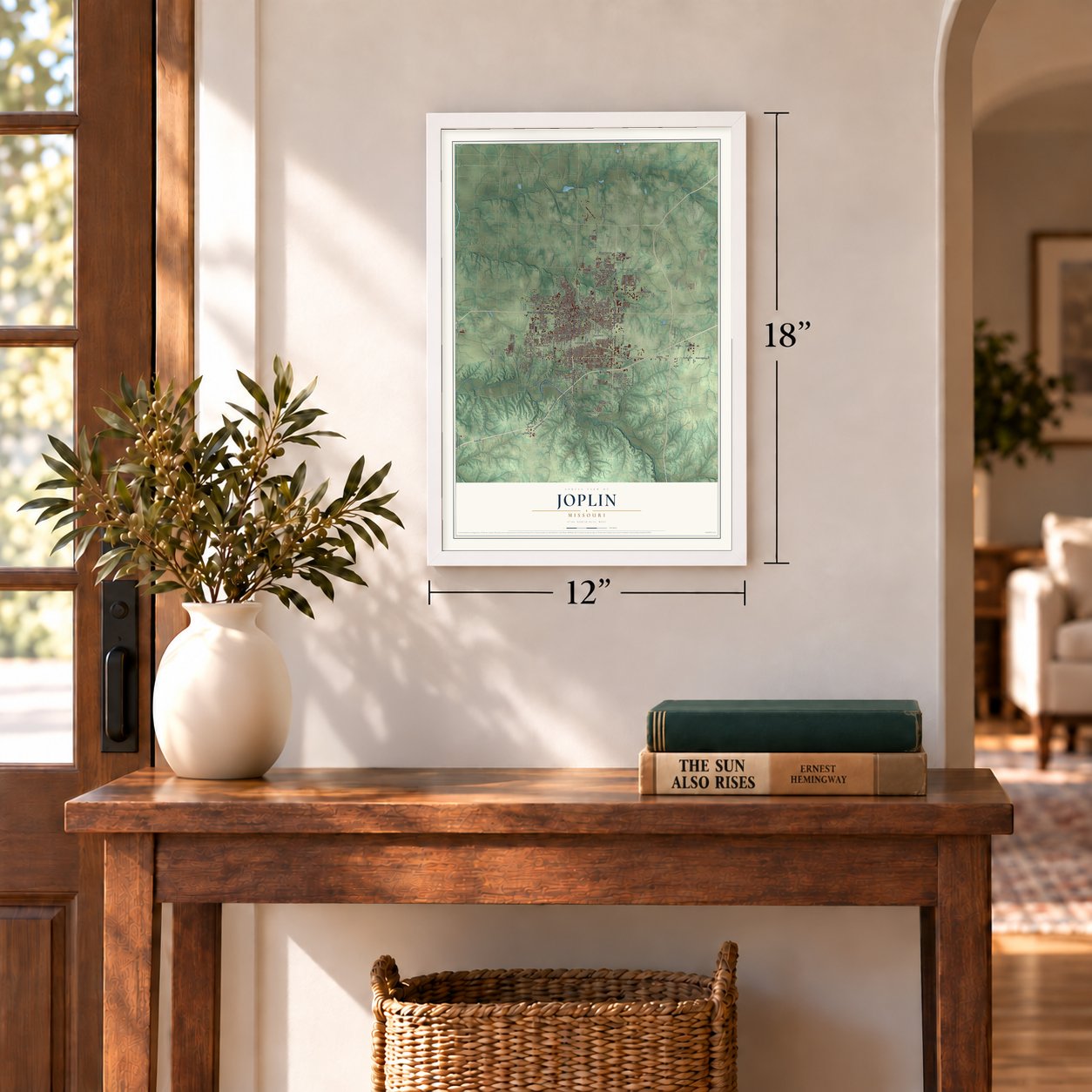
12" x 18" Archival Matte Print
A Map of Home. A Work of Art.
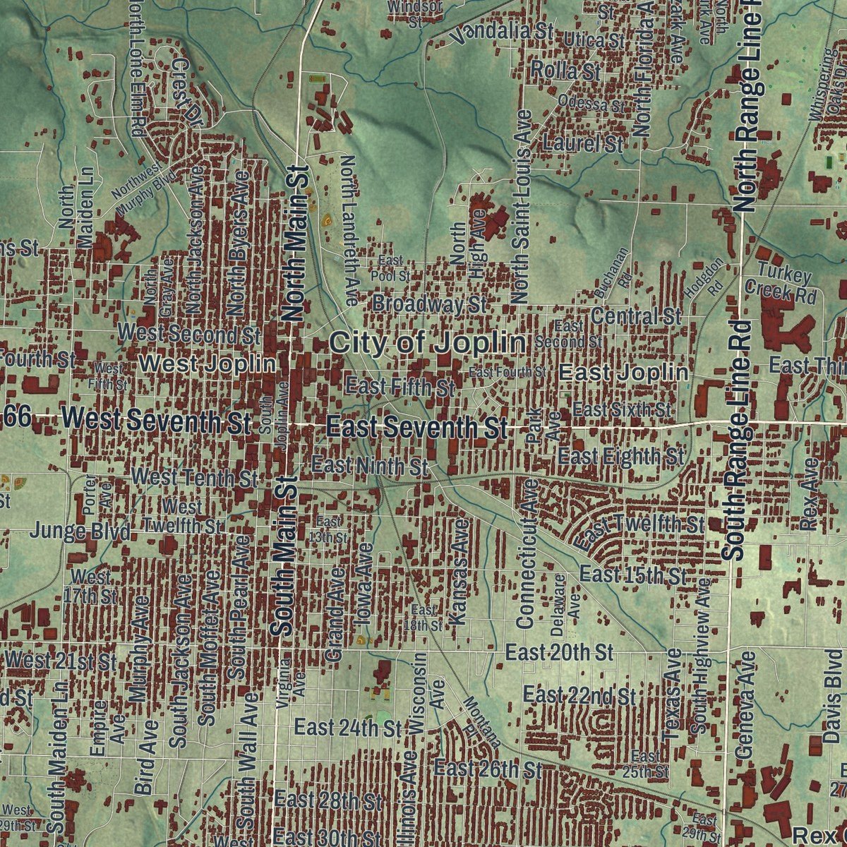
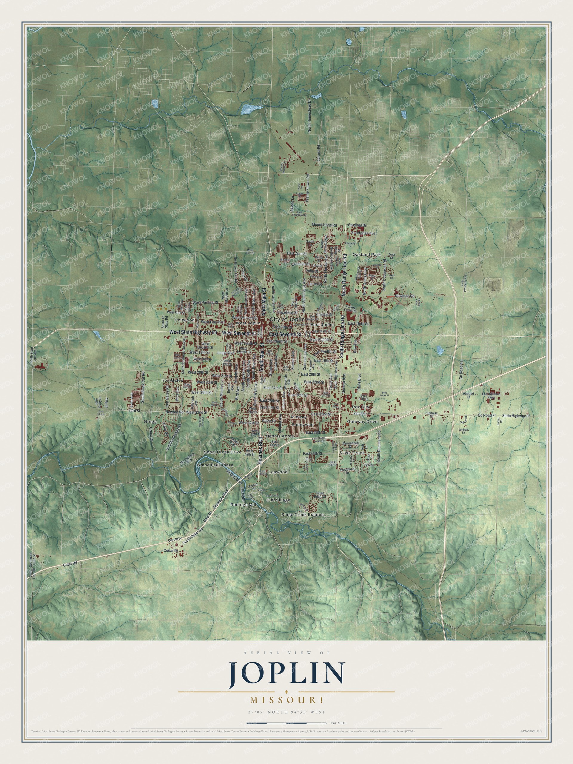
Explore Joplin, Missouri from a whole new perspective. Created using aerial imagery and detailed geographic data, this map captures Joplin building by building, with labeled streets, familiar landmarks, and shaded topographical relief that highlights the natural contours of the landscape.
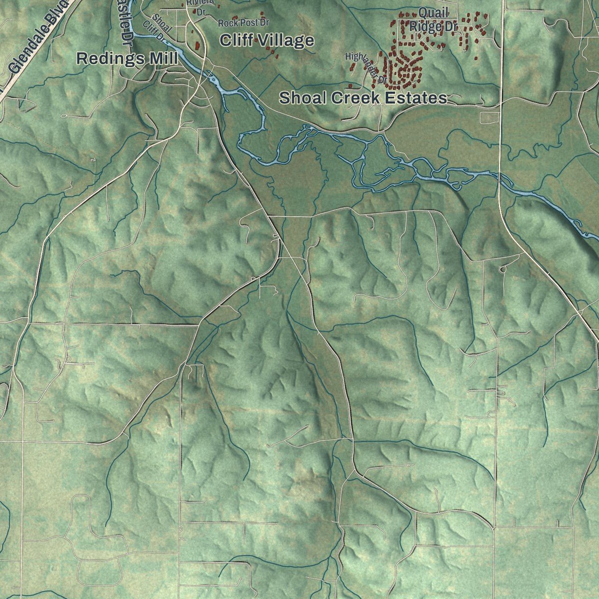
Combining modern data with the timeless character of a vintage atlas, this map is just as interesting up close as it is beautiful on the wall. Whether you grew up in Joplin, spent memorable years there, or call it home today, this unique map is a great way to celebrate a place that means something to you. Zoom in on the preview to look for your street, and then order a print to put your memories on the wall.
Three ways to hang it
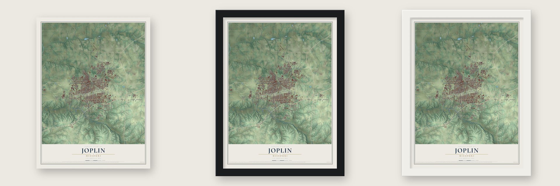
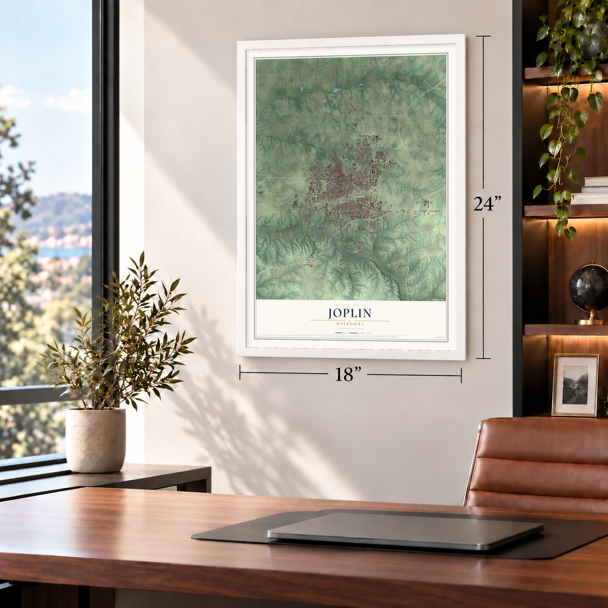
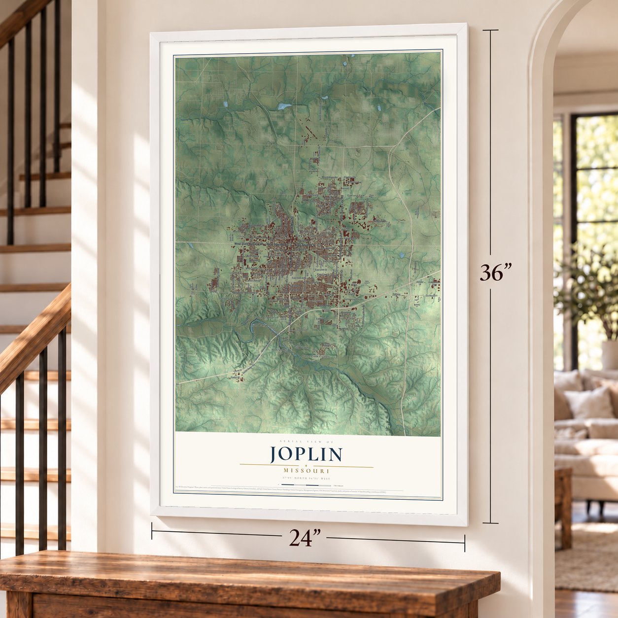
Unframed archival matte, a black wood frame or a white wood frame.
Up close
Geography Worth Displaying
This map was created using accurate cartographic data and authoritative geographic sources, including the U.S. Geological Survey and the Census Bureau. The map brings together terrain, waterways, roads, and building detail. The majority of the streets are labeled, houses are accurately depicted, and the topography is derived from government sources. Combining local data with carefully composed color and shading leads to this beautifully detailed Joplin artwork for your wall.
Rather than simply showing street outlines, we’ve included as many of the street names as we could reasonably fit on the map while keeping their names legible. Zoom in on the high resolution preview to see exactly what’s on the map. We truly set out to create a statement piece for anyone who loves Joplin. So whether it’s for you, or a gift for someone you love, we hope this map of Joplin brings back fond memories.
Read the story behind this map of Joplin, Missouri from 2026.

About Joplin, Missouri
Joplin is a city of 51,762 people in southwest Missouri, mostly in Jasper County, with its southern edge in Newton County. Miners had found lead along Joplin Creek before the Civil War, yet the mining camps only grew up once the war was over. By 1871 camps crowded the valley, and John C. Cox filed a plan for a town on its east side. He called it Joplin City for the nearby creek and spring, which were named for the Reverend Harris G. Joplin, who had settled there around 1840.
Patrick Murphy of Carthage answered with a town of his own across the valley, called Murphysburg. The nearest sheriff was in Carthage, and the lawless years that followed were remembered as the "Reign of Terror." The two towns joined as Union City, then split when the merger was ruled illegal. On March 23, 1873, they united for good under the name Murphy proposed, Joplin. Zinc, which miners called "jack," soon mattered more than lead, and once railroads arrived the city became the world's capital of lead and zinc mining.
“Joplin's three-story "House of Lords" was its most famous saloon, with a bar and restaurant on the first floor, gambling on the second, and a brothel on the third.”
- A shootout in 1933Bonnie and Clyde hid in Joplin for some weeks in 1933 and robbed several businesses nearby. When a neighbor alerted police, the pair fought their way out, and two lawmen died: Harry McGinnis, a Joplin detective, and John Wesley Harryman, a constable for Newton County. The Bonnie & Clyde Garage Apartment is on the National Register.
- Bonnie and Clyde's cameraThe outlaws left most of their belongings behind when they fled, among them a camera. The Joplin Globe developed its film, and the photos of Bonnie holding a pistol and a cigar became famous.
- A library and a movie palaceIn 1902 voters passed a tax for a public library, and matching funds paid for the Joplin Carnegie Library, which joined the National Register in 1979. The Electric Theater, a grand movie house, was built in 1930. Fox Theatres later bought it and renamed it the Fox. It joined the National Register in 1990 and now serves as the Central Christian Center.
- The Connor Hotel fallsThe Joplin Connor Hotel joined the National Register in 1973, but it was later set to be imploded to make room for a new public library. On November 11, 1978, it collapsed early and without warning. Two demolition workers died at once. A third, Alfred Sommers, was trapped in the ruins for four days and lived.
- The 2011 tornadoAt about 5:34 pm on May 22, 2011, an EF5 tornado formed at Joplin's west edge and crossed to Interstate 44. It leveled about 2,400 houses, mostly between 13th and 32nd Streets, and destroyed Joplin High School and St. John's Regional Medical Center, razed in 2012 and replaced by Mercy Hospital Joplin. By late July, 161 had died. Three weeks later the Boomtown Run became a service day: about 270 people cleared debris for over 1,200 hours.
Find your street
Names on the Joplin map
Every name below is printed on this map. Look for your street, your school, the park where you played, or the pond down the road.
Places and landmarks19
- City of Joplin
- Chitwood
- Cliff Village
- Dennis Acres
- East Joplin
- Gateway Drive
- Grand Falls Plaza
- Gregg
- Iron Gates
- Leawood
- Midway
- Oakland Park
Show all 19 places
- Redings Mill
- Rex City
- Shoal Creek Drive
- Shoal Creek Estates
- Silver Creek
- Sunnyvale
- West Joplin
Streets and roads201
- South Main Street
- South Range Line Road
- Hearnes Boulevard
- North Range Line Road
- East Seventh Street
- West Seventh Street
- West State Highway 66
- North Main Street
- East 32nd Street
- 32nd Street
- State Highway Ff
- West 20th Street
- County Road Ff
- East Zora Street
- East 20th Street
- West 32nd Street
- Newton Road
- South Maiden Lane
- County Road Aa
- Schifferdecker Road
- 32rd Street
- South Black Cat Road
- Mount Hope Road
- North Saint Louis Avenue
- South Duquesne Road
- North Duquesne Road
- Kansas Avenue
- East 30th Street
- Outer Road
- South Outer Road
Show all 201 streets
- South Wall Avenue
- East 24th Street
- East 26th Street
- West 26th Street
- Indiana Avenue
- Connecticut Avenue
- South Jackson Avenue
- West 13th Street
- Newman Road
- Junge Boulevard
- Grand Avenue
- East Third Street
- South Pearl Avenue
- West 23rd Street
- South Moffet Avenue
- East 15th Street
- West Second Street
- West Fourth Street
- East Twelfth Street
- East Eighth Street
- Illinois Avenue
- East Fifth Street
- East 44th Street
- Texas Avenue
- West Tenth Street
- Iowa Avenue
- West 21st Street
- East 28th Street
- North Florida Avenue
- Central Street
- East 36th Street
- East 22nd Street
- Murphy Avenue
- Deer Drive
- Broadway Street
- East Ninth Street
- Prairie Flower Road
- West Perkins Street
- Iron Gates Road
- Bird Avenue
- North Homestead Drive
- Crane Drive
- Davis Boulevard
- Geneva Avenue
- Murphy Boulevard
- Rex Avenue
- Vandalia Street
- Mina Avenue
- Arbor Road
- Glendale Boulevard
- North Byers Avenue
- Rolla Street
- Enterprise Avenue
- North Goetz Boulevard
- Jj Highway
- Ivy Lane
- Cedar Drive
- West 34th Street
- Cardinal Drive
- Swede Lane
- Castle Drive
- Plaza Drive
- Even Avenue
- Laurel Street
- Crest Drive
- South Schifferdecker Avenue
- Highway Ff
- West First Street
- State Line Road
- Mc Clelland Boulevard
- North Lone Elm Road
- East Alliance Parkway
- Southeast 118th Street
- Wisconsin Avenue
- Coyote Drive
- West 17th Street
- West 16th Street
- Empire Avenue
- East Sixth Street
- West Eleventh Street
- East 27th Street
- Jefferson Avenue
- West Twelfth Street
- North Brownell Avenue
- North Jackson Avenue
- North Landreth Avenue
- Park Avenue
- South Highview Avenue
- North Ozark Avenue
- North Maiden Lane
- South Tri State Road
- Woodland Drive
- John Duffy Drive
- West 31st Street
- North High Avenue
- Utica Street
- East 41st Street
- Moorehead Drive
- West 44th Street
- Colonial Road
- South State Line Avenue
- Quail Ridge Drive
- Turkey Creek Road
- Xenia Street
- Almond Lane
- West 36th Street
- Zora Street
- Rustic Ridge
- Rivera Drive
- Oak Drive
- Beale Street
- Rob Lane
- Sadie Lane
- North Prosperity Avenue
- West Zora Street
- Jaguar Road
- North Gray Avenue
- South Joplin Avenue
- Virginia Avenue
- West 24th Street
- Delaware Avenue
- East Second Street
- East 25th Street
- Porter Avenue
- Windsor Street
- Montana Place
- Dennis Weaver Drive
- East 50th Street
- East Fountain Road
- Ridge Drive
- Monroe Avenue
- Odessa Street
- Hickory Lane
- Logan Drive
- Whispering Oaks Drive
- Shady Lane
- North Turk Avenue
- North Mina Avenue
- North Oak Avenue
- East 48th Street
- Kennedy Lane
- Kodiac Road
- Andrea Lane
- East 29th Street
- Old 32nd Street
- East Fourth Street
- Northwest Murphy Boulevard
- Glendale Road
- East 18th Street
- East 13th Street
- West 15th Street
- West 29th Street
- West Fifth Street
- McIntosh Circle
- South Richard Joseph Boulevard
- Rock Post Drive
- Shoal Cliff Drive
- West 33rd Street
- Richard Joseph Boulevard
- East Pool Street
- Highlander Drive
- Hodgdon Road
- McClelland Park Boulevard
- Buchanan Road
- Jakes Road
- North Blair Road
- Belle Locke Place
- Adrienne Drive
- Cessna Avenue
- Riviera Drive
- Wendi Road
Names are listed as they appear on the printed map. Zoom into the product photos to find them.
The art of mapping a place
How This Map Was Made
Real places. Remarkable detail. Discover the layers that turn geographic data into a map of home.

The view from above
Aerial imagery reveals the character of the land: woodland, open fields, and the patterns of a place.

The shape of the land
Elevation data brings hills, valleys, and subtle changes in the landscape into view.

The details of home
Roads, waterways, and building footprints come together to make the map feel unmistakably local.

Geography becomes art
Considered color, shading, and typography bring the layers together in a map made for your wall.


Process illustrated with Mendon, Massachusetts. Aerial imagery: USDA NAIP. Terrain: USGS 3D Elevation Program. Map details and finished artwork: KNOWOL.
The Details
About This Print
Choose an archival matte print, or a black or white Ayous wood frame. The archival matte print is unframed.
Select your size and finish above to see the matching product image and price.
Materials & Craftsmanship
A contemporary map with the character of a classic atlas, printed on archival matte paper. Optional frames are made from Ayous wood.
Your printed map does not include the watermark shown in the full-map preview.
Shipping & Delivery
Free shipping within the United States. Every print is made to order in the USA.
Buying a gift? Add a note in your cart and we'll include it. We never put prices in the package.
Prints ship within 2 to 3 business days. Allow 7 to 10 days total from ordering for delivery. Timing may vary during holidays or periods of high order volume.
Read our shipping policy.
Returns and damaged prints
Each print is made to order. Change-of-mind refunds are not available after production.
If your print arrives damaged, misprinted or incorrect, contact support@knowol.com within 30 days of receiving it. Include your order number, photos and a description of the issue.
Read our full refund and replacement policy. For questions about your order, email support@knowol.com.
Find your town
Looking for another city?
Find a map of home in our Missouri collection, or any town in the country.
Nearby
Maps of towns near Joplin
Know someone from one of these towns? Their map makes a great gift.
 Dennis Acres
, Missouri
From $39.99See the map
 Duquesne
, Missouri
From $39.99See the map
 Shoal Creek Drive
, Missouri
From $39.99See the map
More maps nearby: Leawood, Grand Falls Plaza, Cliff Village, Saginaw and Redings Mill.