
Search for another town



Free U.S. delivery 7 to 10 days after you order
Kansas City, Kansas Map Art
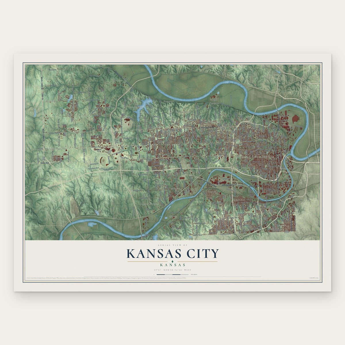
A new map of Kansas City, Kansas, made in 2026 and printed to order on thick archival matte paper.
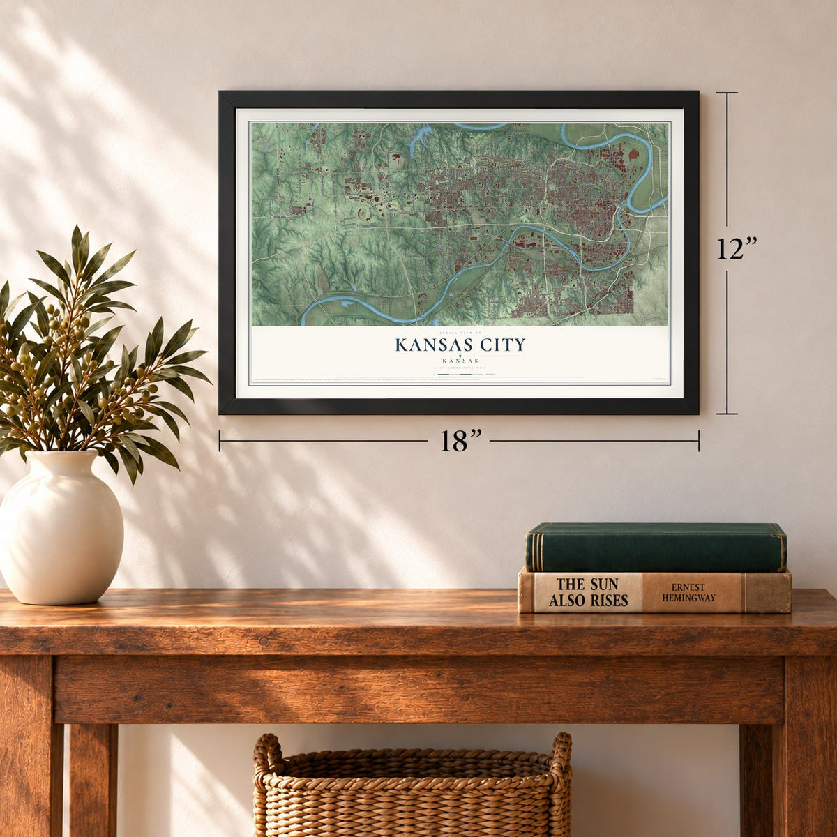
12" x 18" Archival Matte Print
A Map of Home. A Work of Art.
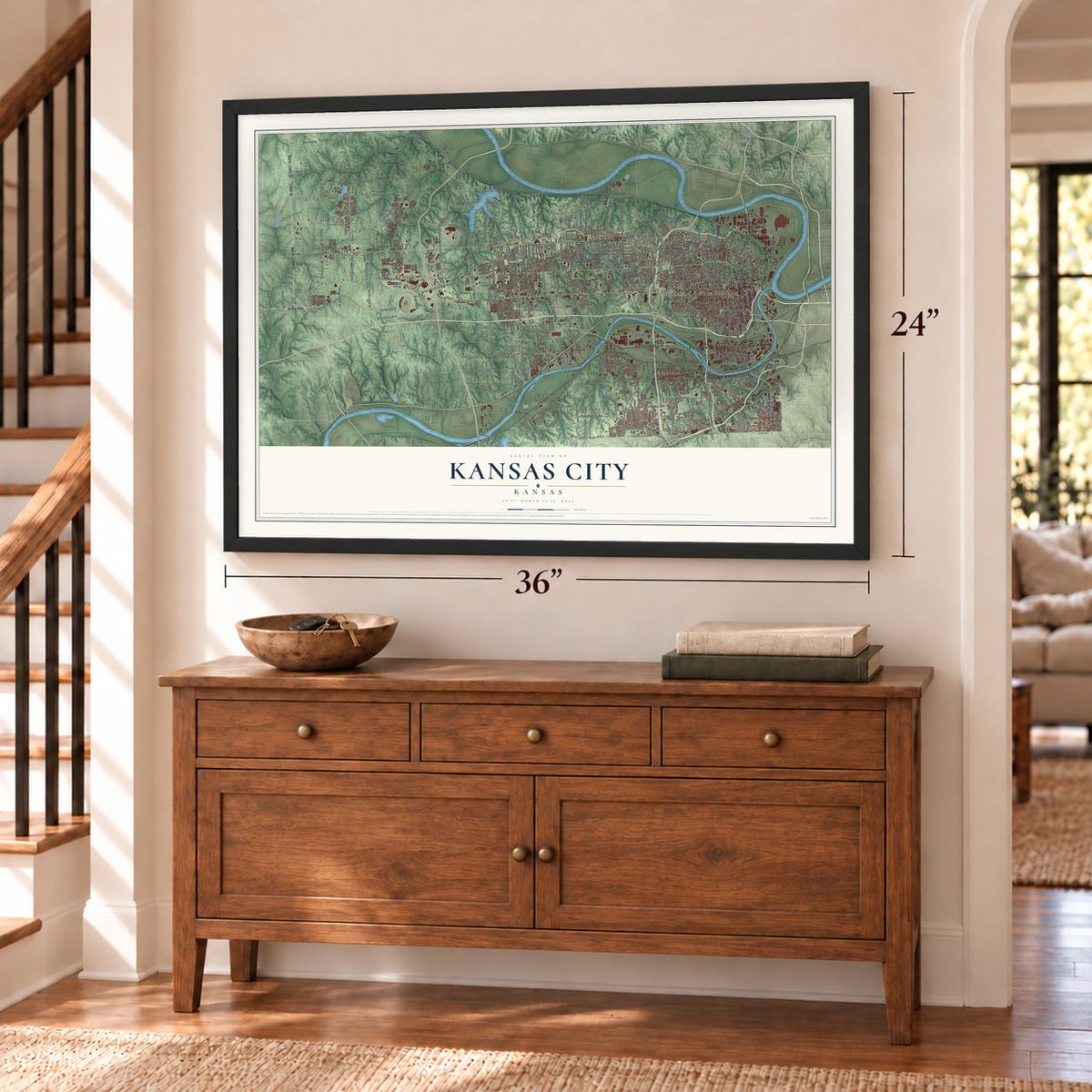
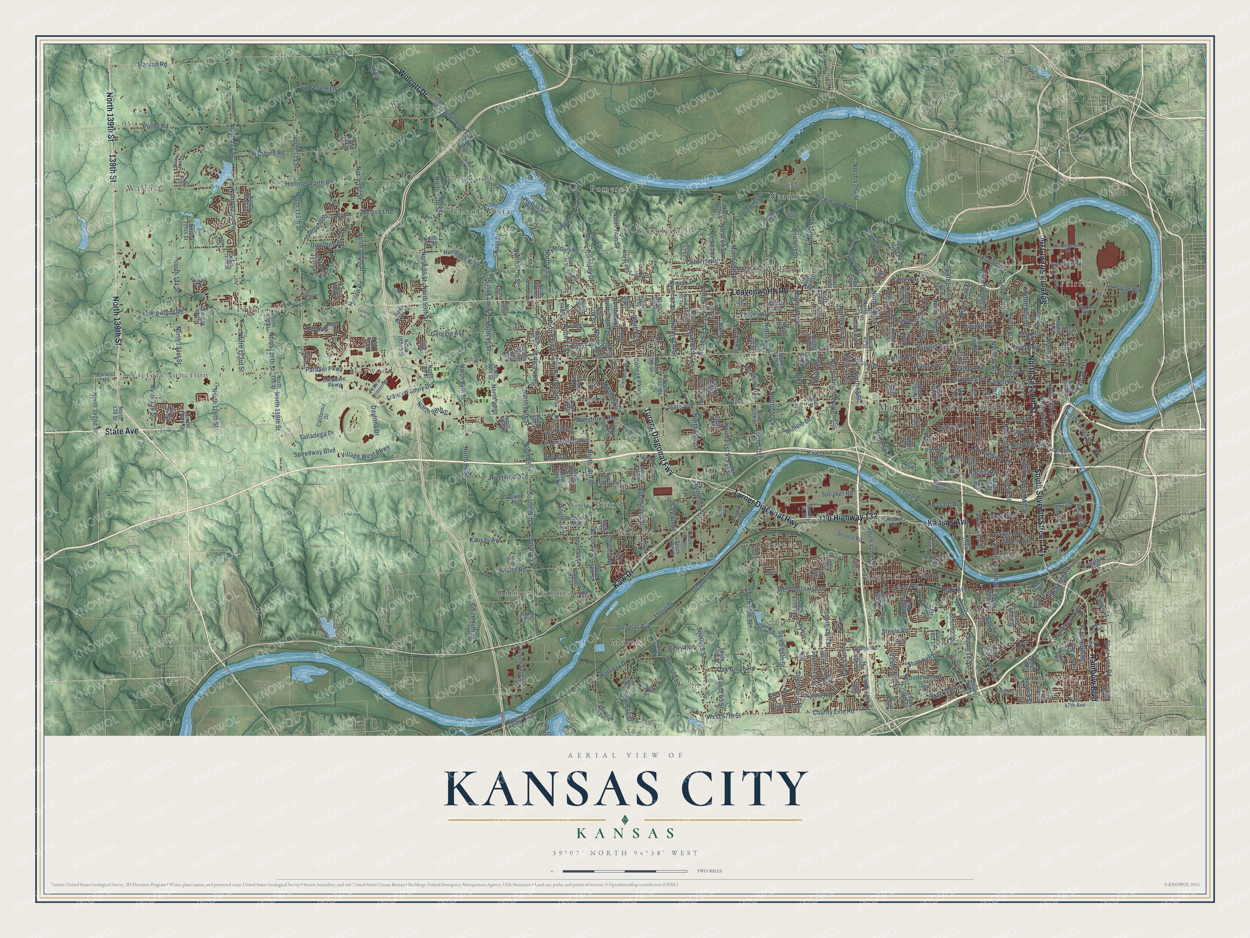
Explore Kansas City, Kansas from a whole new perspective. Created using aerial imagery and detailed geographic data, this map captures Kansas City building by building, with labeled streets, familiar landmarks, and shaded topographical relief that highlights the natural contours of the landscape.
Combining modern data with the timeless character of a vintage atlas, this map is just as interesting up close as it is beautiful on the wall. Whether you grew up in Kansas City, spent memorable years there, or call it home today, this unique map is a great way to celebrate a place that means something to you. Zoom in on the preview to look for your street, and then order a print to put your memories on the wall.
Three ways to hang it
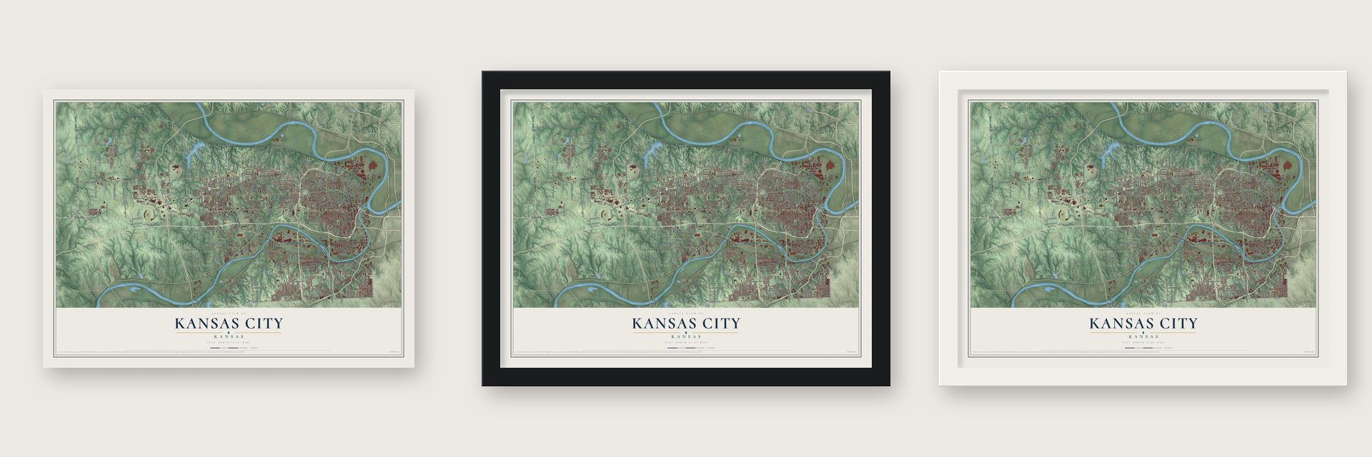
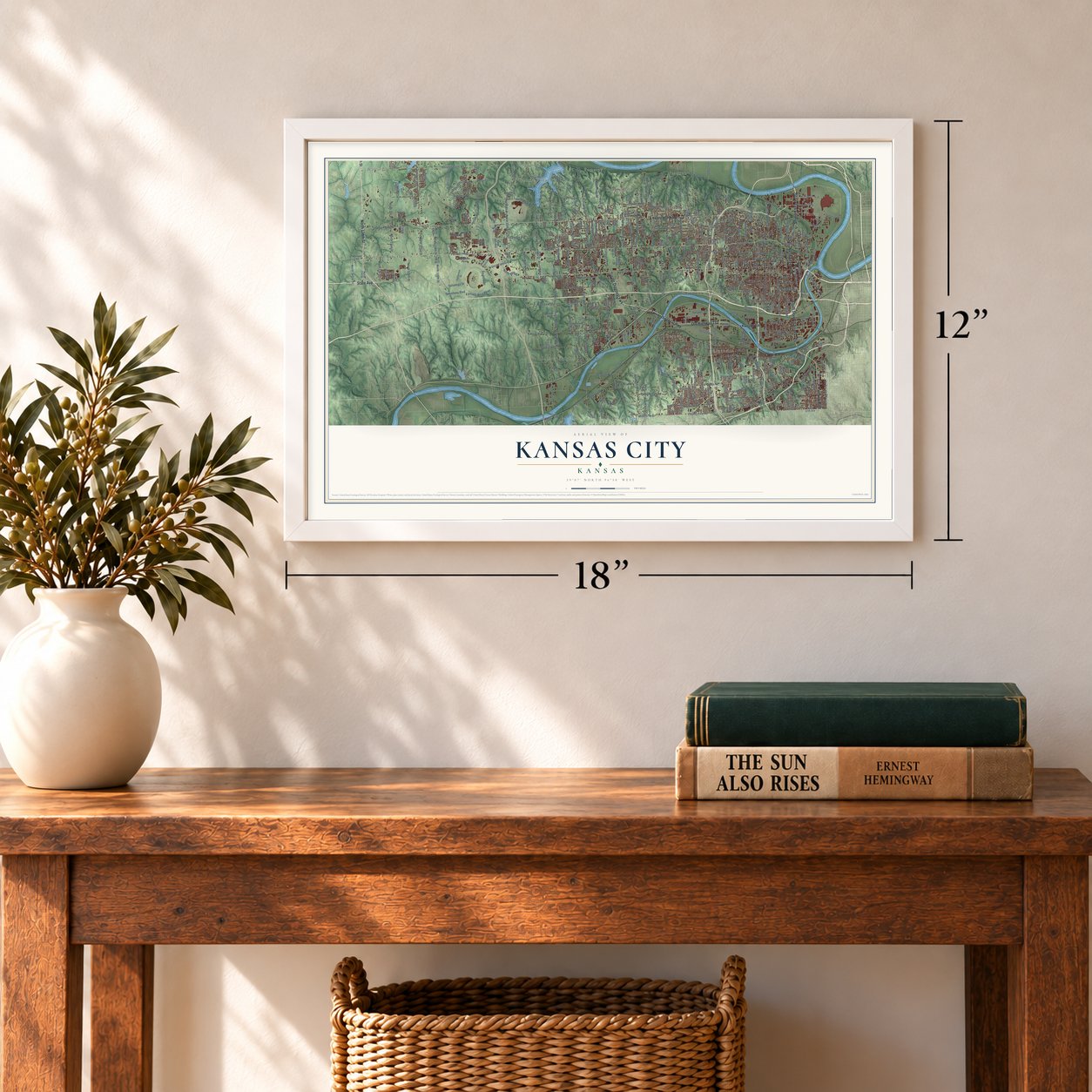
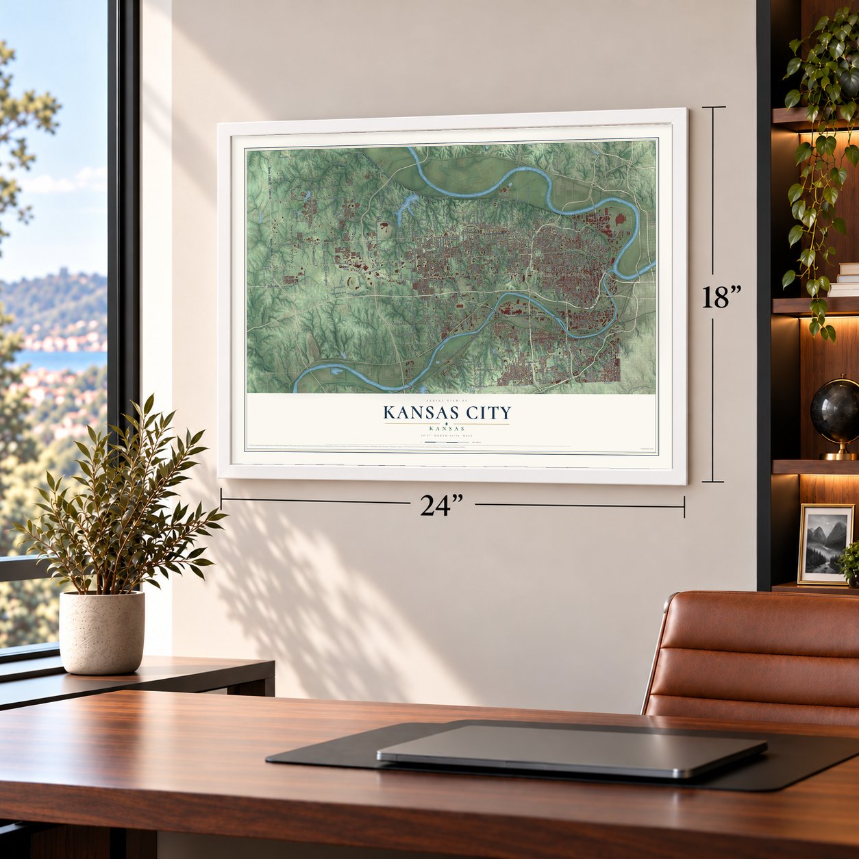
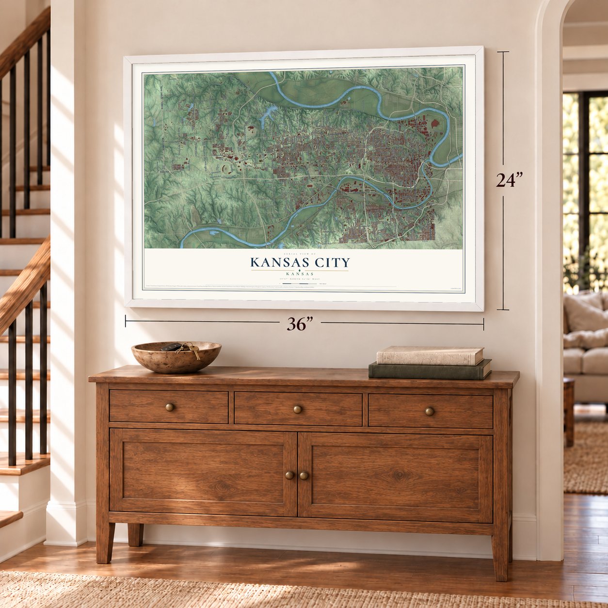
Unframed archival matte, a black wood frame or a white wood frame.
Up close
Geography Worth Displaying
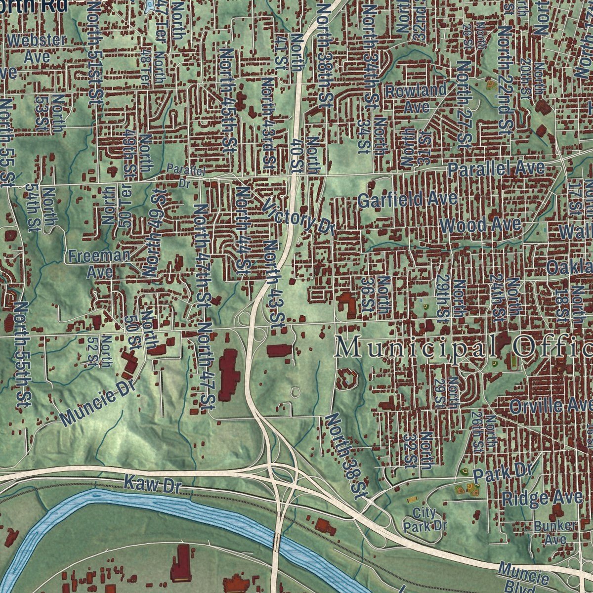
This map was created using accurate cartographic data and authoritative geographic sources, including the U.S. Geological Survey and the Census Bureau. The map brings together terrain, waterways, roads, and building detail. The majority of the streets are labeled, houses are accurately depicted, and the topography is derived from government sources. Combining local data with carefully composed color and shading leads to this beautifully detailed Kansas City artwork for your wall.
Rather than simply showing street outlines, we’ve included as many of the street names as we could reasonably fit on the map while keeping their names legible. Zoom in on the high resolution preview to see exactly what’s on the map. We truly set out to create a statement piece for anyone who loves Kansas City. So whether it’s for you, or a gift for someone you love, we hope this map of Kansas City brings back fond memories.
Read the story behind this map of Kansas City, Kansas from 2026.
About Kansas City, Kansas
Kansas City is a city of 156,607 people at Kaw Point, where the Kansas River flows into the Missouri, and it is the county seat of Wyandotte County. Its oldest root is Wyandotte, a town formed in 1857 by Wyandot people and Methodist missionaries. The territorial legislature made Wyandotte City official on January 29, 1859. That same year, the delegates who wrote the constitution that brought Kansas into the Union met there, in a building people long called Constitution Hall.
A separate town named Kansas City, Kansas, was incorporated in October 1872, and its first election, on October 22, made James Boyle mayor. In March 1886 it joined with Wyandotte, Armourdale, Armstrong and Riverview to form the present city. Streetcars linked it to Kansas City, Missouri, and the population boomed from the 1890s into the 1930s. In 1920 it topped 100,000 people for the first time.
“Carpenters were at a premium, lumber was in great demand, so that sawmills sprang up almost over night, to supply building materials. Within six months from the time it was laid out Wyandotte was a city in full blast.”
- Argentine and Rosedale joinArgentine took its name from the silver smelter that once operated there, and it became part of the city in 1910. Rosedale followed in 1922. In 1997 voters agreed to merge the city with Wyandotte County, which created the Unified Government.
- Firefighters since Christmas 1883The city's firefighters first organized on Christmas Day, December 25, 1883. The police department followed in 1898 with 46 people on staff, and by 1918 its officers photographed and fingerprinted everyone they arrested.
- Google Fiber's first cityOn March 30, 2011, Google chose Kansas City from 1,100 communities that had applied for its experimental fiber-optic network. Google built the network at no cost to the city, and it went live in 2012. Piper became the first whole community in the country to get home internet at 1 Gbit/s in both directions.
Find your street
Names on the Kansas City map
Every name below is printed on this map. Look for your street, your school, the park where you played, or the pond down the road.
Places and landmarks21
- Municipal Office Building
- Argentine
- Bethel
- Beverly Hills
- Fairfax
- Grays Park
- Grinter Heights
- Loma Vista
- Maywood
- Morris
- Muncie
- Nearman
Show all 21 places
- Piper
- Pomeroy
- Stony Point
- Turner
- Victory Junction
- Vinewood
- Wallula
- Welborn
- Wolcott
Streets and roads459
- Turner Diagonal Fwy
- Kaw Drive
- Old Highway 132
- Kansas Avenue
- South Seventh Street Trfy
- Rainbow Boulevard
- North 139th Street
- 139th Street
- Leavenworth Road
- North Seventh Street
- State Avenue
- Seventh Street Trfy
- Turner Diagonal Highway
- Wolcott Drive
- Levee Road
- Parallel Parkway
- Old Highway 32
- Thorn Drive
- Park Drive
- South 18 Street
- North James Street
- Victory Drive
- North 47th Street
- Merriam Lane
- Parallel Avenue
- Southwest Boulevard
- County Line Road
- West 47th Street
- North 38 Street
- North 142nd Street
Show all 459 streets
- North 18th Street
- North Tenth Street
- North 38th Street
- North 10 Street
- Garfield Avenue
- North 47 Street
- Fairfax Trfy
- North 45th Street
- College Parkway
- Shawnee Drive
- Haskell Avenue
- Walker Avenue
- North 34th Street
- South 10 Street
- Speedway Boulevard
- Ball Lane
- Troup Avenue
- Cernech Road
- Georgia Avenue
- Metropolitan Avenue
- Donahoo Road
- Riverview Avenue
- Hutton Road
- Hollingsworth Road
- North 115 Street
- North 115th Street
- North 123rd Street
- Swartz Road
- Everett Avenue
- Tauromee Avenue
- Holliday Drive
- Oakland Avenue
- South 55th Street
- Yecker Avenue
- Orville Avenue
- Armstrong Avenue
- North 107 Street
- North 107th Street
- West Drive
- Douglas Avenue
- Marxen Road
- Gibbs Road
- Osage Avenue
- South 42nd Street
- Wood Avenue
- North 55th Street
- North 131 Street
- Kimball Avenue
- North 131st Street
- Ruby Avenue
- Polfer Road
- North 78th Street
- South 78 Street
- South 51st Street
- Farrow Avenue
- North 59 Street
- North 59th Street
- Oak Grove Road
- South 59th Street
- North 74th Street
- North Twelfth Street
- Speaker Road
- North 83rd Street
- South 65th Street
- North 11 Street
- South 74 Street
- North 63 Street
- North 63rd Street
- Woodend Avenue
- North 83 Street
- North 22nd Street
- Daytona Drive
- Inland Drive
- North 57 Street
- Village West Parkway
- South Twelfth Street
- South 14th Street
- Hubbard Road
- North 86th Street
- North 67 Street
- North 67th Street
- North 55 Street
- East Drive
- South 86 Street
- North 51 Street
- North 51st Street
- South Mill Street
- North 99 Street
- Miami Avenue
- North 17th Street
- South 86th Street
- North 86 Street
- North 99th Street
- North 72 Street
- North 27 Street
- North 74 Street
- North 64th Terrace
- South 37th Street
- North 123 Street
- South 94th Street
- North 65th Street
- North 94 Street
- Ridge Avenue
- North 5 Street
- North Fifth Street
- North 77 Street
- North 94th Street
- Steele Road
- Sortor Drive
- South 88th Street
- Adams Street
- North Sixth Street
- South 53rd Street
- North 82nd Street
- North 98th Street
- North 60 Street
- North 118th Street
- North 61st Street
- Muncie Drive
- Dickinson Road
- North 49 Street
- North 91st Street
- North 126th Street
- North 43 Street
- Locust Avenue
- North 81 Street
- Oliver Street
- Shawnee Road
- South 47th Street
- North 42nd Street
- North 75th Terrace
- North 49 Drive
- South 65 Street
- Eaton Street
- North 91 Street
- Pacific Avenue
- Pomeroy Drive
- North 64 Street
- South 9 Street
- North 87th Street
- Reynolds Avenue
- South 49th Street
- State Line Road
- North 97th Street
- North 85th Street
- South 22 Street
- North 44 Street
- Nelson Lane
- South 63 Street
- Ella Avenue
- North 123rd Terrace
- Berry Road
- North 3 Street
- Independence Boulevard
- South 44th Street
- South 72nd Street
- Hurrelbrink Road
- Crest Drive
- France Family Drive
- Springfield Street
- North 119th Street
- North 90 Street
- Donovan Road
- Scott Avenue
- North 75 Drive
- South 68 Street
- Meadowlark Lane
- Roe Lane
- Talladega Drive
- North 134 Street
- Sam Clark Lane
- Luke Lane
- North Allis Street
- South 76 Street
- Brenner Drive
- Key Lane
- South 82 Street
- Bayard Avenue
- Oak Drive
- Haas Drive
- South 18th Street
- North 46 Street
- Parallel Road
- North 4 Street
- Freeman Avenue
- North 18 Street
- West 47th Avenue
- Mission Road
- North 110th Street
- North 73 Drive
- Rowland Avenue
- North 34 Street
- Edith Avenue
- North 40 Street
- North 113th Street
- North 50 Street
- Webster Avenue
- New Jersey Avenue
- Wy Co Lake Park Road
- Lafayette Avenue
- Ann Avenue
- South 78th Street
- Barnett Avenue
- Central Avenue
- Sloan Avenue
- North 32 Street
- North 32nd Street
- North 9 Street
- Ohio Avenue
- South Tenth Street
- North 13 Street
- North 13th Street
- Argentine Boulevard
- North 57th Street
- North 33rd Street
- North 29th Street
- North 17 Street
- North 72nd Street
- North 62 Street
- North 31 Street
- North 77th Street
- Delaware Parkway
- North 64 Terrace
- South 26th Street
- North 79 Street
- North 60th Street
- North 79th Street
- Lowell Avenue
- South 34th Street
- North 82nd Terrace
- North 61 Street
- South Valley Street
- Strong Avenue
- South 26 Street
- Richland Avenue
- North 49th Street
- North 80th Terrace
- North 43rd Street
- North 36 Street
- North 81st Street
- North 93rd Street
- North 49th Drive
- North 69th Street
- Sewell Avenue
- Silver Avenue
- North 54th Street
- North 118 Street
- North 75 Terrace
- South 63rd Street
- North 24th Street
- North 85 Street
- North Third Street
- North 70th Street
- North 75 Street
- McGurk Road
- South 72 Street
- North 47 Terrace
- South 45th Street
- North 73 Street
- North 90th Street
- North 69 Street
- California Drive
- North 103rd Terrace
- Campus Boulevard
- Stanley Road
- North 61st Terrace
- Sunshine Road
- North 119 Street
- North 128th Street
- South 40th Street
- South 12 Street
- North 41 Street
- North 53 Street
- North 76 Street
- South 68th Street
- North 102nd Street
- South 21st Street
- South 80 Street
- Barnes Drive
- North 62nd Place
- South 81 Street
- Bell Crossing Drive
- North 97 Street
- Ruby Drive
- North 84 Terrace
- Highland Drive
- Greystone Avenue
- Service Road
- Nearman Drive
- Verde Drive
- North 78th Place
- Woodland Boulevard
- North 50 Terrace
- North 129th Street
- South 52nd Terrace
- South 13 Street
- South 71 Street
- North 74 Drive
- North 130th Street
- North 56 Terrace
- North 121st Terrace
- South 59 Lane
- Lake Avenue
- Kansas City Corp Lim
- Prairie Crossing
- Fairbanks Road
- Oak Avenue
- Esplanade Street
- North 89 Street
- South 69 Street
- North 86 Terrace
- North 138 Street
- North 108 Street
- South 66 Terrace
- South 4 Street
- Walcott Drive
- North 106 Street
- South 51 Street
- Muncie Boulevard
- North 98 Street
- Quivira Lane
- 95th Street
- South 8 Place
- Forest Drive
- 62nd Street
- Waverly Avenue
- Parkview Avenue
- Washington Avenue
- South Eighth Street
- North 29 Street
- Pierson Park Road
- North 8 Street
- South 8 Street
- North 20th Street
- North 26th Street
- North 70th Terrace
- North 14 Street
- North 93 Street
- Barber Avenue
- North 71 Street
- City Park Drive
- North 58 Street
- South 17th Street
- Kindleberger Road
- North 124th Street
- North 52 Street
- North 65 Street
- North 21 Street
- West 39 Avenue
- Bunker Avenue
- North 79 Terrace
- North 73 Terrace
- North 48 Terrace
- Puckett Road
- Savage Drive
- North 85 Place
- Sherman Street
- North 65 Terrace
- South 15 Street
- Dixie Court
- Dodge Road
- South 9 Place
- Marley Road
- North 131st Drive
- Kane Drive
- North 88 Street
- North 132nd Street
- Joyce Drive
- North 84 Drive
- South 76 Terrace
- 110th Street
- 130th Street
- South James Street
- Parallel Drive
- Powell Avenue
- Linden Drive
- Greeley Avenue
- North 12 Street
- South 74th Street
- Lathrop Avenue
- Sandusky Avenue
- North 62nd Street
- Longwood Avenue
- North 82 Street
- North 16 Street
- Cambridge Street
- North 26 Street
- North 82 Terrace
- Berger Avenue
- South 39th Street
- North 80 Street
- South 15th Street
- Corona Avenue
- South 45th Terrace
- North 75th Drive
- Lloyd Street
- South 46th Street
- South 47th Terrace
- West 39th Avenue
- Pawnee Avenue
- South 49th Terrace
- South 48th Terrace
- South 14 Street
- South 5 Street
- North 125th Street
- Espenlaub Lane
- North 100th Street
- Edgehill Drive
- Lyon Avenue
- North 89th Street
- North 87 Street
- North 89 Terrace
- Victoria Drive
- North 114th Terrace
- North 103rd Place
- South 57th Terrace
- West 36th Avenue
- Emmons Drive
- Suntree Place
- South 74 Place
- River Park Drive
- South 89 Street
- Meek Road
- Vernon Street
- 55th Street
- South 53 Lane
- North 59 Place
- North 42 Terrace
- 93rd Street
Names are listed as they appear on the printed map. Zoom into the product photos to find them.
The art of mapping a place
How This Map Was Made
Real places. Remarkable detail. Discover the layers that turn geographic data into a map of home.

The view from above
Aerial imagery reveals the character of the land: woodland, open fields, and the patterns of a place.

The shape of the land
Elevation data brings hills, valleys, and subtle changes in the landscape into view.

The details of home
Roads, waterways, and building footprints come together to make the map feel unmistakably local.

Geography becomes art
Considered color, shading, and typography bring the layers together in a map made for your wall.


Process illustrated with Mendon, Massachusetts. Aerial imagery: USDA NAIP. Terrain: USGS 3D Elevation Program. Map details and finished artwork: KNOWOL.
The Details
About This Print
Choose an archival matte print, or a black or white Ayous wood frame. The archival matte print is unframed.
Select your size and finish above to see the matching product image and price.
Materials & Craftsmanship
A contemporary map with the character of a classic atlas, printed on archival matte paper. Optional frames are made from Ayous wood.
Your printed map does not include the watermark shown in the full-map preview.
Shipping & Delivery
Free shipping within the United States. Every print is made to order in the USA.
Buying a gift? Add a note in your cart and we'll include it. We never put prices in the package.
Prints ship within 2 to 3 business days. Allow 7 to 10 days total from ordering for delivery. Timing may vary during holidays or periods of high order volume.
Read our shipping policy.
Returns and damaged prints
Each print is made to order. Change-of-mind refunds are not available after production.
If your print arrives damaged, misprinted or incorrect, contact support@knowol.com within 30 days of receiving it. Include your order number, photos and a description of the issue.
Read our full refund and replacement policy. For questions about your order, email support@knowol.com.
Find your town
Looking for another city?
Find a map of home in our Kansas collection, or any town in the country.
Nearby
Maps of towns near Kansas City
Know someone from one of these towns? Their map makes a great gift.
 Edwardsville
, Kansas
From $39.99See the map
 Lake Quivira
, Kansas
From $39.99See the map
 Merriam
, Kansas
From $39.99See the map
More maps nearby: Bonner Springs, Shawnee, Mission, Roeland Park and Westwood.