Search for another town





Free U.S. delivery 7 to 10 days after you order
Kent, New York Map Art
A new map of Kent, New York, made in 2026 and printed to order on thick archival matte paper.
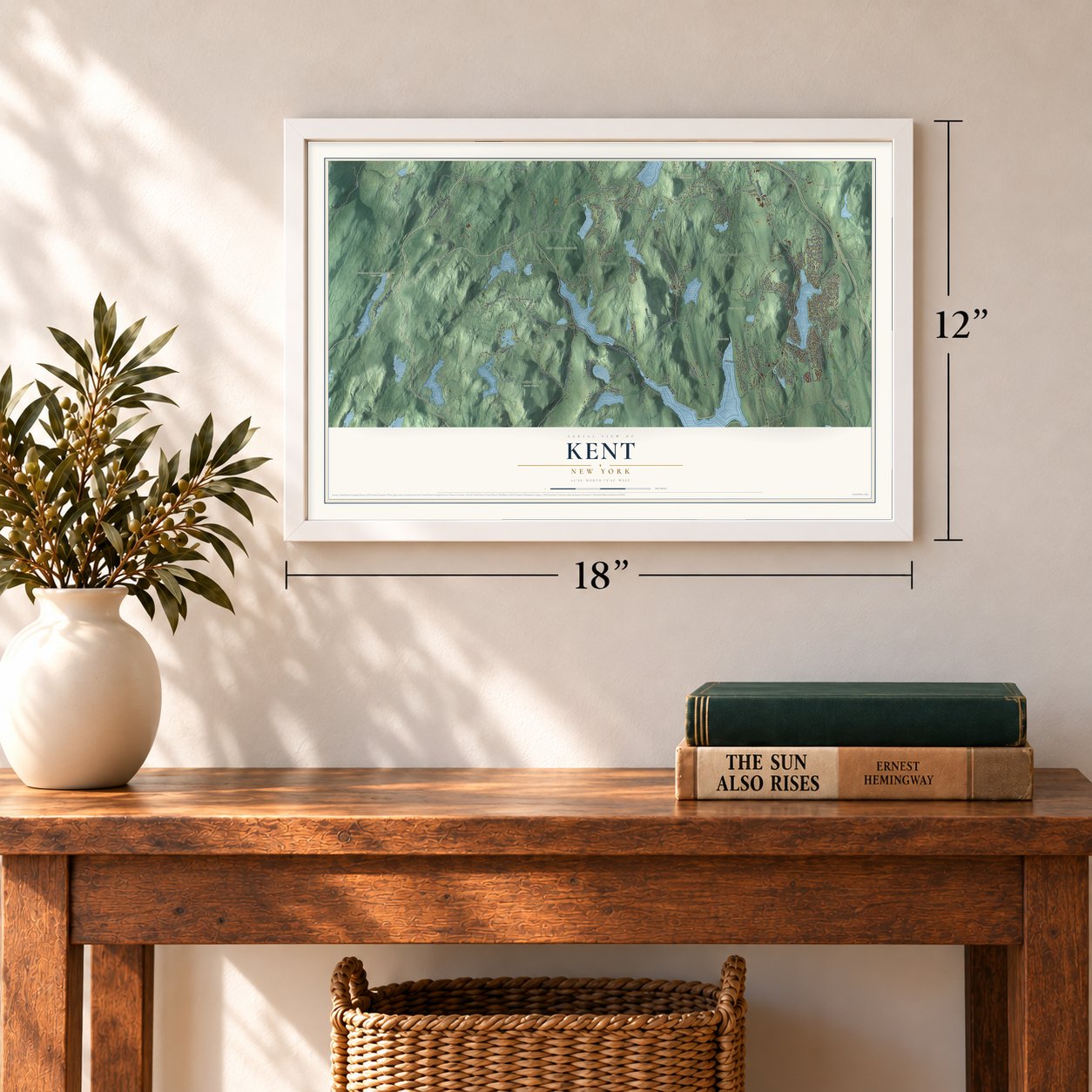
12" x 18" Archival Matte Print
A Map of Home. A Work of Art.
Bring a piece of Kent home. Whether it’s where you grew up, your current home, or simply a moment in your life, this Kent, New York map print brings those memories to your wall. Antique-inspired styling and modern geographic detail combine to create artwork that’s beautiful from across the room, with plenty to study and explore when you get up close.

Three ways to hang it
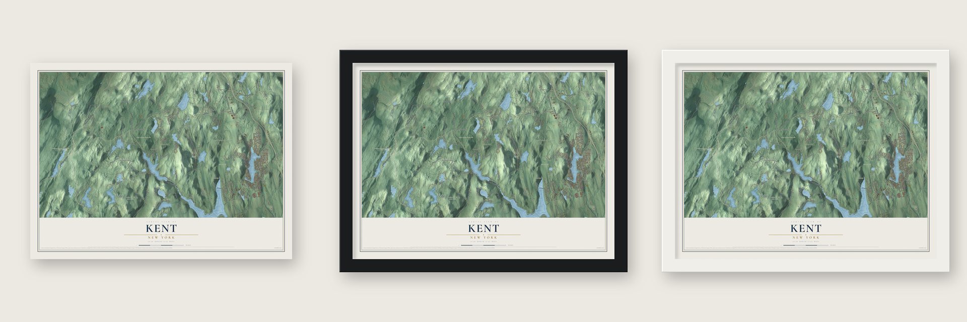
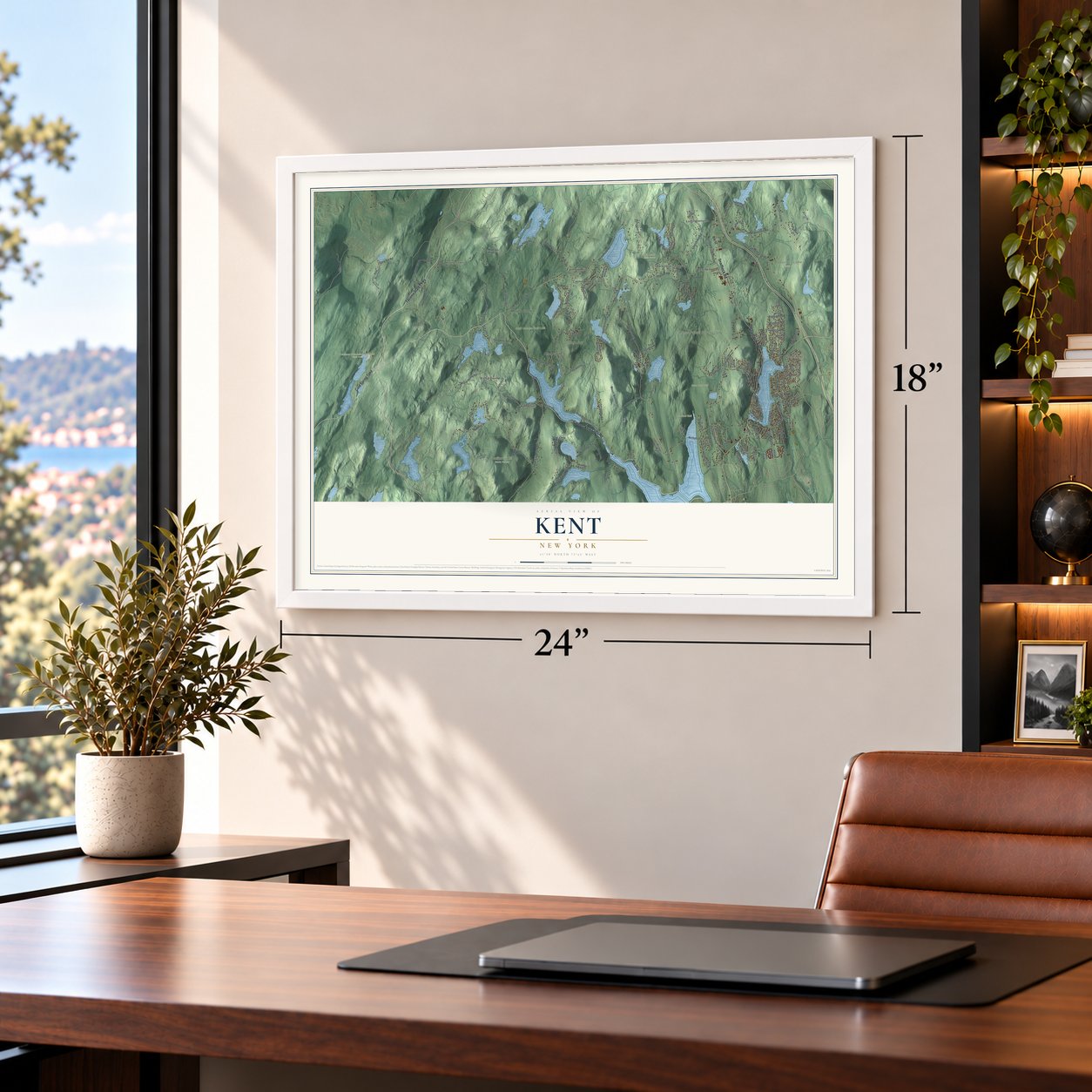
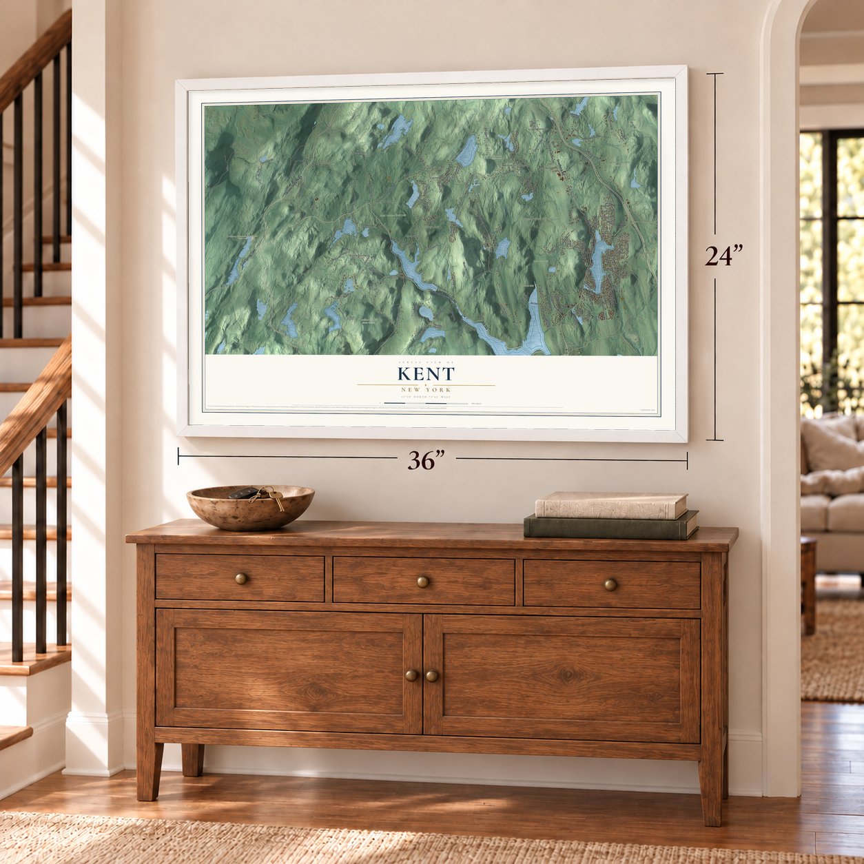
Unframed archival matte, a black wood frame or a white wood frame.
Up close
Real geography. Art worth displaying.
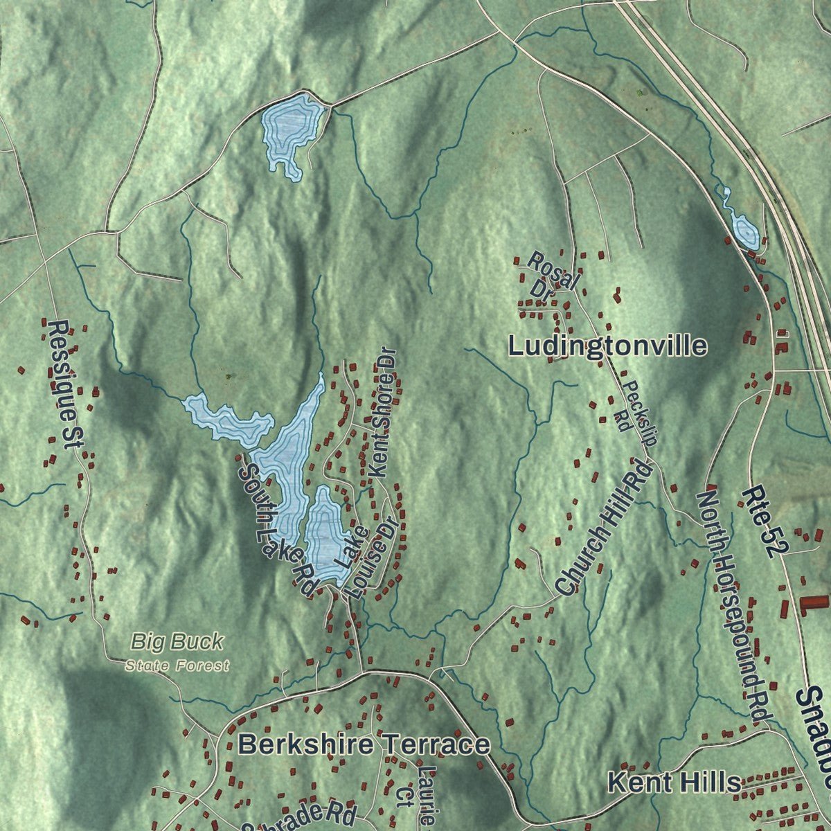
This map was created using accurate cartographic data and authoritative geographic sources, including the U.S. Geological Survey (USGS) and FEMA. The map brings together terrain, waterways, roads, and building detail. The majority of the streets are labeled, houses are accurately depicted, and the topography is derived from government sources. Combining local data with carefully composed color and shading leads to this beautifully detailed Kent artwork for your wall.
Rather than simply showing street outlines, we’ve included as many of the street names as we could reasonably fit on the map while keeping their names legible. Zoom in on the high resolution preview to see exactly what’s on the map. We truly set out to create a statement piece for anyone who loves Kent. So whether it’s for you, or a gift for someone you love, we hope this map of Kent brings back fond memories.
Explore the full map of Kent, New York and read about the local places it shows.

About Kent, New York
Town of Kent is a town in Putnam County, New York, United States. The population was 12,900 at the 2020 census. Kent was part of the Highland Patent of 1697 today known as the Philipse Patent), when it was still populated by the Wappinger tribe.
- 12,900 peopleThe population was 12,900 at the 2020 census.
- A 1697 milestoneKent was part of the Highland Patent of 1697 today known as the Philipse Patent), when it was still populated by the Wappinger tribe.
- A 1724 milestoneDaniel Nimham (1724 to 1778) was the last chief of the Wappingers and was the most prominent Native American of his time in the Hudson Valley.
- A 1751 milestoneUpon the 1751 death of Frederick Philipse II, second Lord of Philipsburg Manor and owner of the "Highland Patent", the Manor went to his son Frederick Philipse III and the Patent was.
- A 1752 milestoneFollowing the death of daughter Margaret in 1752, who died intestate, the Patent was then redivided among the three surviving heirs, son Philip, and daughters Susannah (wife of Beverley Robinson) and Mary.
Find your street
Names on the Kent map
Every name below is printed on this map. Look for your street, your school, the park where you played, or the pond down the road.
Places and landmarks20
- Hortontown
- Kent Corners
- Adams Unit
- Big Buck State Forest
- Boyd Corners North Unit
- California Hill State Forest
- Camp Joy
- Clarence Fahnestock Memorial State Park
- Dean Pond Unit
- Horse Pound Brook Unit
- Wonder Lake State Park
- Allen Corners
Show all 20 places
- Berkshire Terrace
- Carmel Park Estates
- Farmers Mills
- Kent Cliffs
- Kent Hills
- Ludingtonville
- Meads Corners
- Richardsville
Streets and roads168
- Carmel-Kent Cliffs Road
- Taconic State Parkway
- Cold Spring Turnpike
- Snadbeck Avenue
- Snadbeck Road
- Route 301
- Farmers Mills Road
- Livingston Road
- Crompton Drive
- Cole Shears Court
- Long Hill Road
- Towners Road
- Gipsy Trail Road
- Golf Ridge Road
- Sagamore Road
- Horsepound Road
- Ludingtonville Road
- Ninham Road
- Richardsville Road
- East Boyds Road
- Nimham Road
- Peekskill Hollow Road
- Nichols Street
- Pudding Street
- Old Forge Drive
- Hortontown Road
- Miller Hill Road
- Mooney Hill Road
- Towers Road
- Gordon Road
Show all 168 streets
- Tibet Drive
- Ressique Street
- Bowen Road
- Clearpool Road
- White Pond Road
- Sagamore Drive
- Black Pond Road
- Church Hill Road
- Dean Road
- Barrett Circle West
- South Knapp Court
- Putnam Drive
- Schrade Road
- North Horsepound Road
- Hortontown Hill Road
- Whangtown Road
- Barrett Hill Road
- Terry Hill Road
- Crossroad Court
- Mount Nimham Court
- Cottage Road
- Dixon Road
- Tompkins Road
- Kittredge Drive
- Hilltop Court
- Dykeman Road
- Deer Hill Court
- Vernon Drive
- Lincoln Drive
- Coles Mills Road
- Drew Road
- Salem Road
- Lhasa Court
- South Lake Road
- Dingley Road
- Bryant Trail
- Robin Drive
- Leeside Drive
- Joseph Court
- Ludington Court
- Rosedale Road
- Warwick Road
- Hillside Road
- Ontario Road
- Pine Trail
- Minello Drive
- Sol Drive
- Route 52
- Lakeshore Drive East
- Brewster Drive
- Smalley Corners Road
- Waywayanda Court
- Seven Hills Lake Drive
- Lake Shore Drive West
- Kent Shore Drive
- Denton Lake Road
- Palmer Trail
- Kentview Drive
- Long Mountain Court
- Montrose Drive
- Mungers Road
- Clarkson Road
- Ponderosa Road
- Hill and Dale Road
- Miller Hill Woods Court
- Little Fill Court
- Knapp Road
- Birch Point Court
- Mount Ninham Court
- Gatehouse Court
- Dutchess Lake Court
- Whang Hollow Road
- Lt Michael Neuner Court
- Kentwood Drive
- Park Road
- Chief Nimham Drive
- Union Road
- China Court
- Bowen Court
- Knollcrest Road
- Stonegate Court
- Sabrina Court
- Barrett Circle Court
- Willow Trail Court
- Millpond Lane
- Craft Road
- William Street
- Grey Oaks Court
- Laurie Court
- Quaker Road
- Lake Louise Drive
- Fireside Court
- Cliff Court
- Darryl Lane
- Lorne Court
- Rosal Drive
- Bryant Road
- Beach Court
- Longfellow Drive
- Lakeside Camp Road
- North Knapp Court
- Summit Lane
- Peckslip Road
- California Hill Road
- Rambler Road
- Lacrosse Road
- Brook Trail
- White Pond Colony Road
- Old Route 301
- Holland Drive
- Gypsy Trail Road
- Adams Court
- Placid Drive
- West Lakeshore Drive
- Long Mountain Road
- Pine Pond Road
- Princeton Road
- Champlain Drive
- Noonan Drive
- Maynard Road
- Larchmont Road
- Branch Court
- Greenridge Court
- Sterling Road
- Shenandoah Court
- Byram Road
- East Hook Road
- Michael Court
- Smokey Hollow Court
- Lucille Road
- Kashmir Court
- Forge Road
- Pioneer Lane
- Meads Court
- Loggers Court
- Sybil Court
- Iris Court
- Anna Court
Names are listed as they appear on the printed map. Zoom into the product photos to find them.
The art of mapping a place
How This Map Was Made
Real places. Remarkable detail. Discover the layers that turn geographic data into a map of home.

The view from above
Aerial imagery reveals the character of the land: woodland, open fields, and the patterns of a place.

The shape of the land
Elevation data brings hills, valleys, and subtle changes in the landscape into view.

The details of home
Roads, waterways, and building footprints come together to make the map feel unmistakably local.

Geography becomes art
Considered color, shading, and typography bring the layers together in a map made for your wall.


Process illustrated with Mendon, Massachusetts. Aerial imagery: USDA NAIP. Terrain: USGS 3D Elevation Program. Map details and finished artwork: KNOWOL.
The Details
About This Print
Choose an archival matte print, or a black or white Ayous wood frame. The archival matte print is unframed.
Select your size and finish above to see the matching product image and price.
Materials & Craftsmanship
A contemporary map with the character of a classic atlas, printed on archival matte paper. Optional frames are made from Ayous wood.
Your printed map does not include the watermark shown in the full-map preview.
Shipping & Delivery
Free shipping within the United States. Every print is made to order in the USA.
Buying a gift? Add a note in your cart and we'll include it. We never put prices in the package.
Prints ship within 2 to 3 business days. Allow 7 to 10 days total from ordering for delivery. Timing may vary during holidays or periods of high order volume.
Read our shipping policy.
Returns and damaged prints
Each print is made to order. Change-of-mind refunds are not available after production.
If your print arrives damaged, misprinted or incorrect, contact support@knowol.com within 30 days of receiving it. Include your order number, photos and a description of the issue.
Read our full refund and replacement policy. For questions about your order, email support@knowol.com.
Find your town
Looking for another city?
Find a map of home in our New York collection.
Nearby
Maps of towns near Kent
Know someone from one of these towns? Their map makes a great gift.